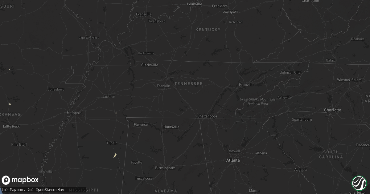
Hail Map in Tennessee on June 26, 2024
Get this storm
June 26 map
$229
one time, instant access
Download today. No call, no setup
Keep the $229
Bought the map and want the full workflow? Apply the entire $229 to a subscription within 7 days. None of it is wasted.
Every map, not just this one
This buys you this map. Subscription and you get every map we run, in the markets you choose from a few cities to whole states to nationwide. Plus real-time alerts the moment a storm fires.
Contact data
Name, contact info, occupancy, even credit band for addresses in the footprint. You go from where it hit to who to call.
Become the source they trust
Unlimited branding weather history reports on demand. You already have the documented answer ready for the property owner, and you are the one who showed up with it.
Property data and RoofTrace estimates
Pull up any address you have got, its value and the exact code rules for that jurisdiction, straight from One Click Code. Then RoofTrace estimates the squares, pitch, and roof value, priced the way you price.
Storm reports in Tennessee
Tennessee
| Date | Description |
|---|---|
| 06/26/20245:32 PM CDT | Facebook photo of a tree down on a house on denny road. |
| 06/26/20245:27 PM CDT | Multiple reports of trees down in springfield. Time estimated via radar. |
| 06/26/20245:19 PM CDT | Tree down in the 4100 block of lahr road in springfield. Time estimated. |
| 06/26/20245:16 PM CDT | Powerlines downed on west division street near pascal drive... Forcing the closure of w division street. Time estimated via radar. |
| 06/26/20245:13 PM CDT | Facebook report of tree snapped on garland drive. |
| 06/26/20245:11 PM CDT | Facebook video of a tree snapped on luree lane. |
| 06/26/20245:11 PM CDT | Tree reported down in watertown on highway 70. Time estimated from radar. |
| 06/26/20245:08 PM CDT | Tspotter report of a tree and powerline down at andrew jackson and weber drive in hermitage. Power outages reported. Time estimated via radar. |
| 06/26/20245:03 PM CDT | Downed trees reported near donelson pike and i-40. Time estimated. |
| 06/26/20245:01 PM CDT | Downburst reported at bna along hangar lane with road signs reported pulled from the ground. Time estimated based on time of peak winds measured by asos. |
| 06/26/20245:01 PM CDT | Corrects previous tstm wnd dmg report from 4 n antioch. Downburst reported at bna along hangar lane. These strong winds knocked over temporary construction signs along |
| 06/26/20244:58 PM CDT | Tspotter report of a large tree branch downed at a residence near shelby park in east nashville. Time estimated via radar. |
| 06/26/20244:55 PM CDT | Large tree down on sim springs road in wheel. |
| 06/26/20244:52 PM CDT | Social media report of a downed tree in crieve hall. Time estimated via radar. |
| 06/26/20244:47 PM CDT | Tspotter report of multiple snapped tree branches along s royal oaks blvd between riverside drive and center point place in franklin. Time estimated via radar. |
| 06/26/20244:45 PM CDT | Large tree down in yard of home on clovercroft road at dante ranch lane. |
| 06/26/20244:42 PM CDT | Tspotter report of large tree split on green hill blvd at concord rd. |
| 06/26/20244:37 PM CDT | Tspotter report of a snapped tree limb near downtown franklin. Time estimated from radar. |
| 06/26/20244:35 PM CDT | Many reports of trees down across franklin with some blocking roadways. |
| 06/26/20244:31 PM CDT | Tspotter report of a downed powerline on broad street and medical center parkway. Time estimated by radar. |
| 06/26/20244:25 PM CDT | A frail looking tree was knocked down on smokey circle. Time estimated by radar. |
| 06/26/20244:20 PM CDT | Tree down on pipkin hills dr. |
| 06/25/20248:15 PM CDT | Delayed report. Facebook photos of an awning blown off gas station in jamestown. |
| 06/25/20247:07 PM CDT | Tree reported down on brotherton mountain road at east wall avenue in algood. Time estimated. |
| 06/25/20247:07 PM CDT | Tree reported down on e broad street in cookeville. Time estimated. |
| 06/25/20247:00 PM CDT | Powerline down across the road on west spring street at scott avenue in cookeville. Time estimated. |
All States Impacted by Hail Map on June 26, 2024
- Iowa
- Texas
- Wisconsin
- Arizona
- Kansas
- Oklahoma
- Tennessee
- Arkansas
- Missouri
- Ohio
- Louisiana
- Pennsylvania
- Kentucky
- Georgia
- Mississippi
- South Carolina
- Florida
- Alabama
- Oregon
- West Virginia
- Idaho
- New Mexico
- Nevada
- North Carolina
- Washington
- Colorado
- Virginia
- Maryland
- Utah
- New Jersey
- New York
- Wyoming
- Connecticut
- Massachusetts
- Rhode Island
- Montana
Cities Impacted by Hail Map on June 26, 2024
- Parnell, IA
- Iowa City, IA
- Coralville, IA
- Wellman, IA
- Kalona, IA
- Oxford, IA
- Williamsburg, IA
- West Branch, IA
- Riverside, IA
- Hills, IA
- West Liberty, IA
- Lone Tree, IA
- Amarillo, TX
- Panhandle, TX
- Claude, TX
- Evansville, WI
- Janesville, WI
- Douglas, AZ
- Bisbee, AZ
- Elk City, KS
- Independence, KS
- Havana, KS
- Sedan, KS
- Cedar Vale, KS
- Winfield, KS
- Courtland, KS
- Belleville, KS
- Republic, KS
- Norway, KS
- Scandia, KS
- Cuba, KS
- Munden, KS
- Ramona, OK
- Ochelata, OK
- Barnsdall, OK
- Selmer, TN
- Inola, OK
- Skiatook, OK
- Owasso, OK
- Catoosa, OK
- Tulsa, OK
- Sperry, OK
- Mountain Home, AR
- Jenks, OK
- Broken Arrow, OK
- Bixby, OK
- Glenpool, OK
- Mounds, OK
- Muskogee, OK
- Caney, KS
- Beggs, OK
- Okmulgee, OK
- Haskell, OK
- Porter, OK
- Oktaha, OK
- Checotah, OK
- Council Hill, OK
- Koshkonong, MO
- London, AR
- Taft, OK
- Boynton, OK
- Henryetta, OK
- Morris, OK
- Eufaula, OK
- Hanna, OK
- Stigler, OK
- Russellville, AR
- Coweta, OK
- Redbird, OK
- Warner, OK
- Porum, OK
- Mcalester, OK
- Canadian, OK
- Indianola, OK
- Crowder, OK
- Mccurtain, OK
- Quinton, OK
- Kinta, OK
- Whitefield, OK
- Webbers Falls, OK
- Braggs, OK
- Wilburton, OK
- Hartshorne, OK
- Krebs, OK
- Red Oak, OK
- Portageville, MO
- Haileyville, OK
- Cameron, OK
- Poteau, OK
- Howe, OK
- Hartford, AR
- Heavener, OK
- Damascus, AR
- Bee Branch, AR
- Quitman, AR
- Talihina, OK
- Waldron, AR
- Honobia, OK
- Nashoba, OK
- Smithville, OK
- Eagletown, OK
- Broken Bow, OK
- Idabel, OK
- Holland, OH
- Toledo, OH
- Clayton, OK
- Detroit, TX
- Pittsburg, OK
- Bethel, OK
- Wister, OK
- Spencerville, OK
- Daisy, OK
- Valliant, OK
- Clarksville, TX
- De Kalb, TX
- Garvin, OK
- Rufe, OK
- Fort Towson, OK
- Albion, OK
- Ringold, OK
- Rattan, OK
- Tuskahoma, OK
- Snow, OK
- Haworth, OK
- Blanco, OK
- Sawyer, OK
- Bagwell, TX
- Finley, OK
- Wright City, OK
- Avery, TX
- Hugo, OK
- Whitesboro, OK
- Maumee, OH
- Ashtabula, OH
- Austinburg, OH
- Hooks, TX
- Jefferson, OH
- New Boston, TX
- Foreman, AR
- Annona, TX
- Maud, TX
- Simms, TX
- Talco, TX
- Marietta, TX
- Naples, TX
- Omaha, TX
- Linden, TX
- Bivins, TX
- Douglassville, TX
- Atlanta, TX
- Texarkana, TX
- Rodessa, LA
- Queen City, TX
- Vivian, LA
- Oil City, LA
- Jefferson, TX
- Bloomburg, TX
- Doddridge, AR
- Lone Star, TX
- Avinger, TX
- Cookville, TX
- Hughes Springs, TX
- Daingerfield, TX
- Pittsburg, TX
- Mount Pleasant, TX
- Diana, TX
- Karnack, TX
- Mooringsport, LA
- Beckville, TX
- Marshall, TX
- Waskom, TX
- Tatum, TX
- Ore City, TX
- Hallsville, TX
- Harleton, TX
- Conneaut, OH
- Kingsville, OH
- Pierpont, OH
- Spartansburg, PA
- Union City, PA
- Spring Creek, PA
- Eastlake, OH
- Grand Valley, PA
- Warren, PA
- Albion, PA
- Springboro, PA
- Tiona, PA
- Clarendon, PA
- Kane, PA
- Irvine, KY
- Ravenna, KY
- Dixie, GA
- Quitman, GA
- Lewis Run, PA
- Sheffield, PA
- Irvine, PA
- Youngsville, PA
- Boston, GA
- Austin, PA
- Coudersport, PA
- Nash, TX
- Ashdown, AR
- Ida, LA
- Texarkana, AR
- Hosston, LA
- Bradley, AR
- Belcher, LA
- Fouke, AR
- Gilliam, LA
- Heflin, LA
- Sibley, LA
- Greenwood, LA
- Blanchard, LA
- Doyline, LA
- Princeton, LA
- Bethany, LA
- Ringgold, LA
- Haughton, LA
- Barksdale Afb, LA
- Elm Grove, LA
- Bossier City, LA
- Shreveport, LA
- De Berry, TX
- Minden, LA
- Benton, LA
- Plain Dealing, LA
- Cotton Valley, LA
- Keithville, LA
- Carthage, TX
- Longview, TX
- Stonewall, LA
- Henderson, TX
- Logansport, LA
- Garrison, TX
- Keatchie, LA
- Gary, TX
- Timpson, TX
- Frierson, LA
- Long Branch, TX
- Gloster, LA
- Tenaha, TX
- Grand Cane, LA
- Winthrop, AR
- Aberdeen, MS
- Varnville, SC
- Barwick, GA
- Ogden, AR
- Alleene, AR
- Wilton, AR
- Garland City, AR
- Lewisville, AR
- Taylor, AR
- Hope, AR
- Magnolia, AR
- Buckner, AR
- Sarepta, LA
- Springhill, LA
- De Queen, AR
- Fulton, AR
- Waldo, AR
- Horatio, AR
- Stamps, AR
- Rosston, AR
- Mount Holly, AR
- Athens, LA
- Willisville, AR
- Emerson, AR
- Gibsland, LA
- McNeil, AR
- Stephens, AR
- Junction City, AR
- Dubberly, LA
- El Dorado, AR
- Homer, LA
- Shongaloo, LA
- Haynesville, LA
- Lisbon, LA
- Summerfield, LA
- Bernice, LA
- Mount Enterprise, TX
- Cushing, TX
- Gladewater, TX
- Reklaw, TX
- Kilgore, TX
- Overton, TX
- Gilmer, TX
- Jacksonville, TX
- Troup, TX
- Laneville, TX
- White Oak, TX
- Price, TX
- Big Sandy, TX
- Selman City, TX
- Arp, TX
- Winona, TX
- Tyler, TX
- Galeton, PA
- Smethport, PA
- Crosby, PA
- Port Allegany, PA
- Pavo, GA
- Green Cove Springs, FL
- Greenville, FL
- Moultrie, GA
- Madison, FL
- Thomaston, AL
- Joaquin, TX
- Douglass, TX
- Center, TX
- Nacogdoches, TX
- Mansfield, LA
- Ashland, LA
- Simsboro, LA
- Lillie, LA
- Jamestown, LA
- Dubach, LA
- Grambling, LA
- Bienville, LA
- Jonesboro, LA
- Arcadia, LA
- Ruston, LA
- Quitman, LA
- Coushatta, LA
- Hall Summit, LA
- Castor, LA
- Choudrant, LA
- Saline, LA
- Eros, LA
- Chatham, LA
- Sumter, SC
- Marion Junction, AL
- Live Oak, FL
- Valdosta, GA
- Early Branch, SC
- Moody Afb, GA
- Hastings, FL
- Manning, SC
- York, AL
- Livingston, AL
- Catherine, AL
- Shinglehouse, PA
- Roulette, PA
- Smoaks, SC
- Emelle, AL
- Batesville, MS
- Jennings, FL
- Jasper, FL
- Gaines, PA
- Tuscaloosa, AL
- Coker, AL
- Buhl, AL
- Northport, AL
- Nyssa, OR
- Lynchburg, SC
- Mayesville, SC
- Lake Park, GA
- Ray City, GA
- Lakeland, GA
- Calhoun, LA
- Columbia, LA
- Downsville, LA
- Grayson, LA
- West Monroe, LA
- Farmerville, LA
- Dodson, LA
- Goldonna, LA
- Pollok, TX
- Converse, LA
- Lufkin, TX
- San Augustine, TX
- Chireno, TX
- Shelbyville, TX
- Pelican, LA
- Rusk, TX
- Cuba, AL
- Raleigh, MS
- Saint Albans, WV
- Nitro, WV
- Charleston, WV
- Willacoochee, GA
- Branchville, SC
- Parma, ID
- Stockton, GA
- Du Pont, GA
- Statenville, GA
- Homerville, GA
- Florence, SC
- Cope, SC
- Bowman, SC
- Mosquero, NM
- New Plymouth, ID
- Caldwell, ID
- Fruitland, ID
- Monroeville, AL
- Reevesville, SC
- Macon, MS
- Jacksonville, FL
- Luray, SC
- Alapaha, GA
- Ambrose, GA
- Cloutierville, LA
- Huntington, TX
- Olla, LA
- Many, LA
- Robeline, LA
- Etoile, TX
- Winnfield, LA
- Bronson, TX
- Melrose, LA
- Montgomery, LA
- Milam, TX
- Marthaville, LA
- Natchez, LA
- Belmont, LA
- Pleasant Hill, LA
- Sikes, LA
- Pollock, LA
- Zwolle, LA
- Tullos, LA
- Hemphill, TX
- Noble, LA
- Campti, LA
- Natchitoches, LA
- Colfax, LA
- Atlanta, LA
- Dry Prong, LA
- Provencal, LA
- Georgetown, LA
- Trout, LA
- Diboll, TX
- Corrigan, TX
- Fisher, LA
- Pineland, TX
- Florien, LA
- Broaddus, TX
- Zavalla, TX
- Lena, LA
- Hornbeck, LA
- Leesville, LA
- Anacoco, LA
- Jasper, TX
- Brookeland, TX
- Chester, TX
- Burkeville, TX
- Mora, LA
- Wiergate, TX
- Flatwoods, LA
- Newton, TX
- Colmesneil, TX
- Woodville, TX
- Moscow, TX
- Livingston, TX
- Evans, LA
- Kirbyville, TX
- Brookwood, AL
- Adger, AL
- Holly Hill, SC
- Santee, SC
- White Oak, GA
- Society Hill, SC
- Darlington, SC
- Nahunta, GA
- Emmett, ID
- Peterman, AL
- Thomasville, AL
- Brantley, AL
- Hortense, GA
- Pearson, GA
- Evergreen, AL
- Repton, AL
- Castleberry, AL
- De Kalb, MS
- Douglas, GA
- Waynesville, GA
- Elba, AL
- Wellsboro, PA
- Scooba, MS
- Pine Hill, AL
- Sweet, ID
- Morris, PA
- Bruneau, ID
- Deridder, LA
- Screven, GA
- Shuqualak, MS
- Scranton, SC
- Lake City, SC
- Greenville, AL
- Milton, PA
- Williamsport, PA
- Coward, SC
- Effingham, SC
- Dillon, SC
- Summerton, SC
- Jersey Shore, PA
- Linden, PA
- Cogan Station, PA
- Blenheim, SC
- Kissimmee, FL
- Latta, SC
- Wallback, WV
- Procious, WV
- Blossburg, PA
- Maysel, WV
- Brookville, PA
- Reynoldsville, PA
- Falls Creek, PA
- Brockway, PA
- Brockport, PA
- Weedville, PA
- Byrnedale, PA
- Penfield, PA
- Kersey, PA
- Dalhart, TX
- Stratford, TX
- Yulee, FL
- Hilliard, FL
- Leivasy, WV
- Quinwood, WV
- Mount Nebo, WV
- Bloomsburg, PA
- Danville, PA
- Covington, PA
- Mainesburg, PA
- Troy, PA
- Canton, PA
- Clay, WV
- Pamplico, SC
- Bob White, WV
- Bim, WV
- Banks, ID
- Horseshoe Bend, ID
- Newton, WV
- Ivydale, WV
- McEwen, TN
- Mansfield, PA
- Colorado City, AZ
- Hamer, SC
- Garden Valley, ID
- Sierra Blanca, TX
- Baker, NV
- Van, WV
- Patagonia, AZ
- Erin, TN
- Rowland, NC
- Maxton, NC
- Georgiana, AL
- Ely, NV
- Orangeville, PA
- Berwick, PA
- Marion, SC
- Blue River, KY
- Prestonsburg, KY
- Dry Creek, LA
- Duck, WV
- Oxbow, OR
- Mansfield, WA
- Imnaha, OR
- Connell, WA
- Lind, WA
- Dayton, WA
- Odessa, WA
- Indian Valley, ID
- Cascade, ID
- Twisp, WA
- Waitsburg, WA
- Soap Lake, WA
- Council, ID
- Pateros, WA
- Prescott, WA
- Joseph, OR
- Brewster, WA
- Ritzville, WA
- Coulee City, WA
- Carlton, WA
- Methow, WA
- Bridgeport, WA
- Wilson Creek, WA
- Mesa, ID
- Washtucna, WA
- Pasco, WA
- Enterprise, OR
- Wallowa, OR
- Marlin, WA
- Waterville, WA
- Kim, CO
- Lowman, ID
- McKee, KY
- Warsaw, VA
- Hughesville, PA
- Muncy, PA
- King Hill, ID
- Aylett, VA
- Las Animas, CO
- Nescopeck, PA
- Ville Platte, LA
- Mifflinville, PA
- Williams, AZ
- Wapwallopen, PA
- Hagerman, ID
- Bliss, ID
- Twin Falls, ID
- Oakley, ID
- Hansen, ID
- Bomont, WV
- Liberty, PA
- Roaring Branch, PA
- Walkerton, VA
- King William, VA
- Saint Stephens Church, VA
- Brewton, AL
- Letohatchee, AL
- Lexington Park, MD
- Patuxent River, MD
- Parker, ID
- Chester, ID
- Saint Anthony, ID
- Rexburg, ID
- Ashton, ID
- Newdale, ID
- Mountain Top, PA
- Drums, PA
- Holden, WV
- Garrison, UT
- Wendell, ID
- Folkston, GA
- Kingsland, GA
- Brunswick, GA
- Gooding, ID
- Pie Town, NM
- Waverly, GA
- Scotland, MD
- Boise, ID
- Chapmanville, WV
- Pecks Mill, WV
- Dingess, WV
- Cuervo, NM
- Summersville, WV
- Vanleer, TN
- Fort Hancock, TX
- Freeland, PA
- Malta, ID
- Grand View, ID
- Eldorado, OK
- Cyclone, PA
- Felt, OK
- Toddville, MD
- Mount Jewett, PA
- Wilcox, PA
- Pinon, NM
- Allentown, PA
- Quanah, TX
- Childress, TX
- Tyaskin, MD
- Vienna, MD
- Bivalve, MD
- Quantico, MD
- Nanticoke, MD
- Grove Hill, AL
- Crisfield, MD
- Oakdale, PA
- Imperial, PA
- Easton, PA
- Phillipsburg, NJ
- Clovis, NM
- Caddo, OK
- Laurel, MS
- Upper Black Eddy, PA
- Ottsville, PA
- Jerome, ID
- Walters, OK
- Grandfield, OK
- Chattanooga, OK
- Loveland, OK
- Texhoma, OK
- Goodwell, OK
- North Versailles, PA
- Wilmerding, PA
- Trafford, PA
- Monroeville, PA
- Irwin, PA
- Eden, MD
- Salisbury, MD
- Hebron, MD
- Fruitland, MD
- Lafayette, NJ
- Hamburg, NJ
- Sussex, NJ
- Westtown, NY
- Goshen, NY
- Vernon, NJ
- Greenwood Lake, NY
- Florida, NY
- Hewitt, NJ
- Glenwood, NJ
- Pine Island, NY
- Warwick, NY
- Franklin, NJ
- Highland Lakes, NJ
- New Hampton, NY
- Johnson, NY
- Unionville, NY
- Slate Hill, NY
- Middletown, NY
- Augusta, NJ
- Branchville, NJ
- Chester, NY
- Campbell Hall, NY
- Monroe, NY
- Durant, OK
- Eureka, NV
- Hereford, TX
- Happy, TX
- Hollis, OK
- Spring Creek, NV
- Ruby Valley, NV
- Dexter, NM
- Hagerman, NM
- Mead, OK
- Cheyenne, WY
- Fe Warren Afb, WY
- Spanish Fork, UT
- Heber City, UT
- Santaquin, UT
- Fairview, UT
- Sunray, TX
- Gruver, TX
- Guymon, OK
- Sutton, WV
- Lenox, AL
- Pritchett, CO
- Devol, OK
- Milford, UT
- Greensburg, PA
- Campo, CO
- Milburn, OK
- Kenefic, OK
- Calera, OK
- Elizabeth, NJ
- Staten Island, NY
- Elizabethport, NJ
- Fillmore, UT
- Mangum, OK
- Willow, OK
- Woodbine, GA
- Cartwright, OK
- Colbert, OK
- Kingston, OK
- Frederick, OK
- Davidson, OK
- Lake Arthur, NM
- Orefield, PA
- Vinson, OK
- Flatwoods, WV
- Ireland, WV
- Pottsboro, TX
- Denison, TX
- Harrold, TX
- Electra, TX
- Sherman, TX
- Whitesboro, TX
- Dodson, TX
- Wingdale, NY
- Lagrangeville, NY
- Dover Plains, NY
- Poughquag, NY
- Idaho City, ID
- Santa Rosa, NM
- East Point, KY
- Altus, OK
- Blair, OK
- Sadler, TX
- Collinsville, TX
- Inwood, WV
- Kearneysville, WV
- Martinsburg, WV
- Shepherdstown, WV
- Harpers Ferry, WV
- Shenandoah Junction, WV
- Ranson, WV
- Charles Town, WV
- Sharpsburg, MD
- Keedysville, MD
- Knoxville, MD
- Morris, CT
- Gordonville, TX
- Lebanon, OK
- Litchfield, CT
- Madill, OK
- Left Hand, WV
- Elk City, ID
- Hart, TX
- Torrington, CT
- Goshen, CT
- Headrick, OK
- Clothier, WV
- Gainesville, TX
- Tulia, TX
- Saint Landry, LA
- Wilson, OK
- Bantam, CT
- Lone Grove, OK
- Ardmore, OK
- Pembroke, NC
- Ringling, OK
- Deal Island, MD
- Austin, NV
- Fishing Creek, MD
- Crapo, MD
- Washingtonville, NY
- Rock Tavern, NY
- Maybrook, NY
- Montgomery, NY
- Blooming Grove, NY
- Highland Mills, NY
- Walden, NY
- Cornwall, NY
- Newburgh, NY
- New Windsor, NY
- Mountainville, NY
- Salisbury Mills, NY
- Terryville, CT
- New Britain, CT
- Bristol, CT
- New Hartford, CT
- Canton, CT
- Killingworth, CT
- Burlington, CT
- Harwinton, CT
- Winsted, CT
- Berlin, CT
- Avon, CT
- Southington, CT
- Middlefield, CT
- West Simsbury, CT
- Riverton, CT
- Rockfall, CT
- Higganum, CT
- Simsbury, CT
- Unionville, CT
- East Berlin, CT
- Barkhamsted, CT
- Pine Meadow, CT
- Plainville, CT
- Colebrook, CT
- Meriden, CT
- Middletown, CT
- Farmington, CT
- Durham, CT
- Newington, CT
- West Hartland, CT
- Rocky Hill, CT
- Weatogue, CT
- West Granby, CT
- Bloomfield, CT
- Wethersfield, CT
- Cromwell, CT
- West Hartford, CT
- Granby, CT
- East Hartland, CT
- North Granby, CT
- Springfield, MA
- Enfield, CT
- South Glastonbury, CT
- Suffield, CT
- Tariffville, CT
- Southwick, MA
- Windsor, CT
- South Windsor, CT
- East Granby, CT
- East Windsor, CT
- Manchester, CT
- East Hartford, CT
- Feeding Hills, MA
- Portland, CT
- West Suffield, CT
- Broad Brook, CT
- Agawam, MA
- Windsor Locks, CT
- Hartford, CT
- Longmeadow, MA
- Glastonbury, CT
- Stafford Springs, CT
- Bozrah, CT
- Middle Haddam, CT
- Quaker Hill, CT
- North Windham, CT
- Willimantic, CT
- Ashford, CT
- Montville, CT
- Windham, CT
- West Kingston, RI
- Shannock, RI
- Westerly, RI
- Voluntown, CT
- Taftville, CT
- Coventry, CT
- Kenyon, RI
- Baltic, CT
- Yantic, CT
- Colchester, CT
- East Hampton, CT
- Hampton, CT
- Hampden, MA
- Hope Valley, RI
- Cobalt, CT
- Somers, CT
- Canterbury, CT
- Wyoming, RI
- Salem, CT
- Wakefield, RI
- Rockville, RI
- Andover, CT
- Bradford, RI
- Norwich, CT
- Amston, CT
- Waterford, CT
- Lebanon, CT
- Bolton, CT
- Tolland, CT
- Uncasville, CT
- Exeter, RI
- Groton, CT
- Gales Ferry, CT
- Columbia, CT
- Mystic, CT
- Gilman, CT
- Marlborough, CT
- Vernon Rockville, CT
- Ledyard, CT
- East Longmeadow, MA
- Old Lyme, CT
- Mashantucket, CT
- Charlestown, RI
- Pawcatuck, CT
- Wood River Junction, RI
- Hopkinton, RI
- Chaplin, CT
- Willington, CT
- Ellington, CT
- Haddam, CT
- Storrs Mansfield, CT
- South Windham, CT
- North Stonington, CT
- Preston, CT
- Jewett City, CT
- Plainfield, CT
- Scotland, CT
- Hebron, CT
- East Haddam, CT
- Ashaway, RI
- North Franklin, CT
- Moodus, CT
- Carolina, RI
- Stonington, CT
- Mansfield Center, CT
- East Lyme, CT
- Oakdale, CT
- Chester, CT
- Beacon Falls, CT
- Plymouth, CT
- Milldale, CT
- Oakville, CT
- Watertown, CT
- Wallingford, CT
- Naugatuck, CT
- Oxford, CT
- Northfield, CT
- Guilford, CT
- Bethany, CT
- Marion, CT
- Waterbury, CT
- Prospect, CT
- Madison, CT
- North Haven, CT
- Thomaston, CT
- Hamden, CT
- Plantsville, CT
- Cheshire, CT
- Wolcott, CT
- Middlebury, CT
- Seymour, CT
- Bridgewater, CT
- Washington, CT
- Woodbury, CT
- New Preston Marble Dale, CT
- Roxbury, CT
- Brookfield, CT
- New Milford, CT
- Sandy Hook, CT
- Cornwall Bridge, CT
- Bethlehem, CT
- Washington Depot, CT
- Lakeside, CT
- Southbury, CT
- Newtown, CT
- Monson, MA
- Douglas, MA
- Sutton, MA
- Millbury, MA
- Brooklyn, CT
- Sterling, CT
- Chepachet, RI
- Holland, MA
- Coventry, RI
- Wilbraham, MA
- Eastford, CT
- Clayville, RI
- Woodstock, CT
- Fiskdale, MA
- Auburn, MA
- Moosup, CT
- Quinebaug, CT
- Central Village, CT
- Brimfield, MA
- Oxford, MA
- Dudley, MA
- Dayville, CT
- North Grosvenordale, CT
- Charlton, MA
- Wales, MA
- Southbridge, MA
- Pascoag, RI
- Pomfret, CT
- Woodstock Valley, CT
- Thompson, CT
- Foster, RI
- West Greenwich, RI
- Putnam, CT
- North Oxford, MA
- Pomfret Center, CT
- Webster, MA
- East Killingly, CT
- Sturbridge, MA
- Danielson, CT
- Greene, RI
- North Scituate, RI
- Northbridge, MA
- Whitinsville, MA
- Mapleville, RI
- Harrisville, RI
- Oakland, RI
- Glendale, RI
- Hope, RI
- Uxbridge, MA
- North Smithfield, RI
- Slatersville, RI
- Greenville, RI
- Smithfield, RI
- East Greenwich, RI
- Johnston, RI
- West Warwick, RI
- Forestdale, RI
- Cranston, RI
- Woonsocket, RI
- Warwick, RI
- Lincoln, RI
- North Providence, RI
- Providence, RI
- Manville, RI
- New Smyrna Beach, FL
- Osteen, FL
- Darby, MT
- Clarendon, TX
- Shamrock, TX
- Riverton, NJ
- Maple Shade, NJ
- Moorestown, NJ
- Willingboro, NJ
- Beverly, NJ
- Burlington, NJ
- Riverside, NJ
- Croydon, PA
- Silverton, TX
- Nocona, TX
- Rancocas, NJ
- Mount Laurel, NJ
- Mount Holly, NJ
- Almo, ID
- Pampa, TX
- Delta, UT
- Groom, TX
- Princess Anne, MD
- Geneva, FL
- Mclean, TX
- Thackerville, OK
- Winfield, WV
- Columbus, NJ
- Hainesport, NJ
- Bordentown, NJ
- Miami, TX
- Jackson, AL
- Crescent Valley, NV
- Wellington, TX
- Boise City, OK
- Higgins, TX
- Howell, NJ
- Jackson, NJ
- Lakewood, NJ
- Texhoma, TX
- Corona, NY
- Forest Hills, NY
- Rego Park, NY
- Elmhurst, NY
- South Kent, CT
- Kent, CT
- Pennsauken, NJ
- Merchantville, NJ
- Cherry Hill, NJ
- Lipscomb, TX
- Woodside, NY
- Maspeth, NY
- Harts, WV
- Varney, KY
- Hewett, WV
- Logan, WV
- Lewisville, OH
- Duke, OK
- Follett, TX
- Lockney, TX
- Sandy Hook, KY
- Blaine, KY
- Webbville, KY
- Shattuck, OK
- Wheeler, TX
- Chillicothe, TX
- Attleboro, MA
- Cumberland, RI
- Central Falls, RI
- Pawtucket, RI
- East Providence, RI
- Rumford, RI
- Albion, RI
- Altha, FL
- Gould, OK
- Grand Ridge, FL
- Blountstown, FL
- Marianna, FL
- Jeannette, PA
- Export, PA
- Delmont, PA
- Harrison City, PA
- Claridge, PA
- North Attleboro, MA


