Our hail maps creation process
Gain a deeper understanding of how we deliver industry-standard hail maps to meet your specific needs
Collecting accurate data
HailTrace starts the hail maps creation process by collecting data from various sources, including weather radars, satellites, and ground observations. Our team uses advanced technology and algorithms to process the data and convert it into usable information. With all that combined, our meteorologists are able to identify areas that are at risk of hail storms and severe weather events.Combining data to create maps
After all the data has been gathered, we begin the process of creating hail maps. These maps are later being used to provide a visual representation of the areas that were affected by the hail storm, as well as the size and intensity of the hail. HailTrace uses specialized mapping software that combined with a meteorologist team, creates maps that are updated in real-time to reflect changing weather conditions.Providing valuable insights
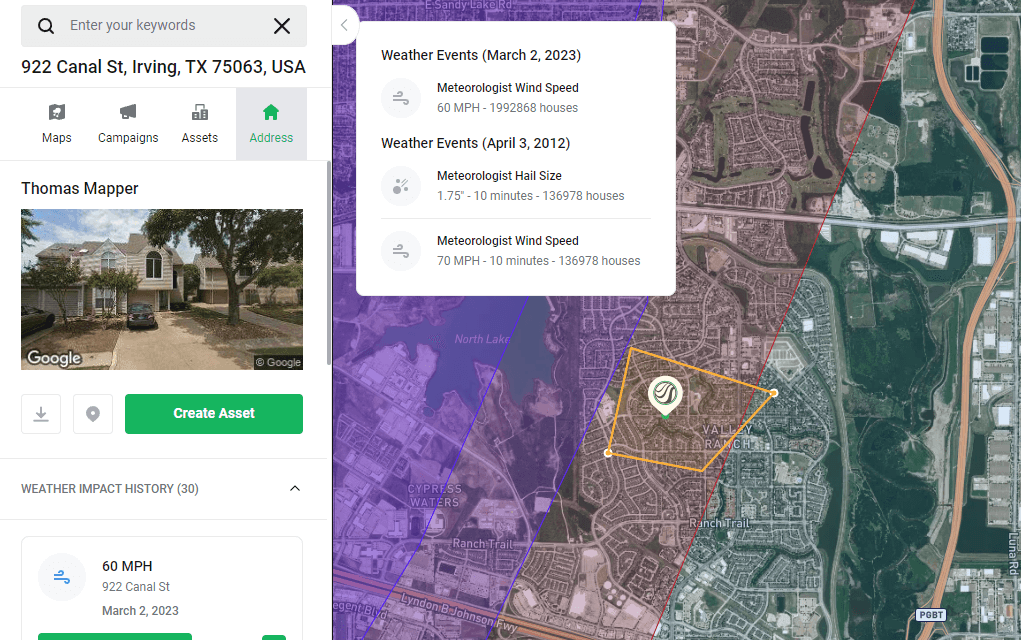
After creating a map, we continue on supporting it throughout the entire weather event and adding more information to it. Our software makes it easy for you to navigate the hail map and see data, including the size and intensity of hailstorms, which areas are most affected, and the potential damage caused by hail. We also give you the option to generate weather history reports on locations affected by the event.Start making data-driven decisions now
Our software leverages Cole Information and OneClick Code data to help you get to your potential leads faster by including important property and contact details on hail maps.
Whether you are in the office or out in the field, HailTrace data is always available to you in our browser and mobile applications.

Use our interactive hail maps
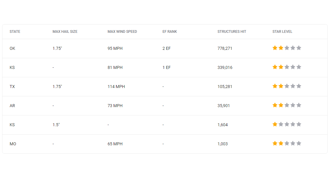
Every hail map created by HailTrace includes accurate data that consists of the estimated number of affected structures, a list of NOAA reports, and impacted regions split by states, cities and zipcodes.
Reduce the time spent looking for opportunities and start now by using maps created by meteorologists.
