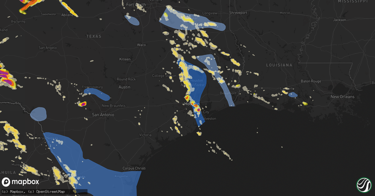
Hail Map on May 28, 2024
Get this storm
May 28 map
$229
one time, instant access
Download today. No call, no setup
Keep the $229
Bought the map and want the full workflow? Apply the entire $229 to a subscription within 7 days. None of it is wasted.
Every map, not just this one
This buys you this map. Subscription and you get every map we run, in the markets you choose from a few cities to whole states to nationwide. Plus real-time alerts the moment a storm fires.
Contact data
Name, contact info, occupancy, even credit band for addresses in the footprint. You go from where it hit to who to call.
Become the source they trust
Unlimited branding weather history reports on demand. You already have the documented answer ready for the property owner, and you are the one who showed up with it.
Property data and RoofTrace estimates
Pull up any address you have got, its value and the exact code rules for that jurisdiction, straight from One Click Code. Then RoofTrace estimates the squares, pitch, and roof value, priced the way you price.
States Impacted by Hail Map on May 28, 2024
Storm reports
Colorado
| Date | Description |
|---|---|
| 05/28/20246:39 PM CDT | Picture on facebook of hail compared to an actual quarter.... Hail was larger than the quarter. |
| 05/28/20246:24 PM CDT | Asos station klaa lamar airport. |
| 05/28/20246:23 PM CDT | Largest hail was the size of a quarter. Time estimated by radar. |
| 05/28/20246:16 PM CDT | Lots of pea size hail... A few of the largest stones were size of a quarter. |
| 05/28/20246:13 PM CDT | A local report indicates 1.00 inch wind near Eads |
| 05/28/20245:55 PM CDT | A local report indicates 1.00 inch wind near 13 ESE Higbee |
| 05/28/20245:55 PM CDT | Country road 14 north of hwy 50. |
| 05/28/20245:38 PM CDT | Quarter size hail... With bigger stones estimated at 1.5 inches. |
| 05/28/20245:33 PM CDT | A local report indicates 1.50 inch wind near 2 W Las Animas |
| 05/28/20242:54 PM CDT | Awos station ktad trinidad airport. |
| 05/27/202411:45 PM CDT | Report from mping: quarter |
| 05/27/202411:28 PM CDT | A local report indicates 1.75 inch wind near Johnstown |
| 05/27/202411:15 PM CDT | A local report indicates 1.50 inch wind near 2 W Johnstown |
| 05/27/202411:15 PM CDT | A local report indicates 1.75 inch wind near 2 W Johnstown |
| 05/27/202411:15 PM CDT | A local report indicates 1.75 inch wind near 2 W Johnstown |
| 05/27/202411:10 PM CDT | A local report indicates 1.25 inch wind near 1 NE Garden City |
| 05/27/202411:02 PM CDT | Report from mping: quarter |
| 05/27/202410:59 PM CDT | A local report indicates 1.00 inch wind near 1 N Garden City |
| 05/27/202410:47 PM CDT | A local report indicates 1.00 inch wind near 2 NNW Garden City |
| 05/27/202410:45 PM CDT | A local report indicates 1.00 inch wind near 1 N Garden City |
| 05/27/202410:45 PM CDT | A local report indicates 2.00 inch wind near 1 E Garden City |
| 05/27/20249:20 PM CDT | A local report indicates 1.50 inch wind near 4 SE Woodrow |
| 05/27/20248:00 PM CDT | Facebook report of a 2 mile swath of hail that was 6 inches deep and that flattened the wheat... Time estimated by radar. |
| 05/27/20247:05 PM CDT | [landspout] landspout at hwy 287 and county road p southeast of eads. Dust swirl on the ground. Lasted about 1 minute. |
| 05/27/20247:00 PM CDT | Hailed for approximately 30 minutes. Reported with pictures from social media. |
| 05/27/20247:00 PM CDT | Report and video on x of hail falling in flagler... Estimated nickel to quarter size hail. |
Louisiana
| Date | Description |
|---|---|
| 05/28/20243:53 PM CDT | Roof of a trailer home ripped off. |
| 05/28/20243:42 PM CDT | Tree fell on a house. |
| 05/28/20242:53 PM CDT | Awos station kara 4 sse cade. |
| 05/28/20241:53 PM CDT | Report from mping: quarter |
Idaho
| Date | Description |
|---|---|
| 05/28/20243:40 PM CDT | Mesonet station lpfi1 lodgepole. |
| 05/27/20247:43 PM CDT | A strong outflow boundary from a thunderstorm damaged several powerlines around the boise metropolitan area and garden valley. Around 2...000-3...000 people were estima |
Oklahoma
| Date | Description |
|---|---|
| 05/28/20241:00 PM CDT | A local report indicates 1.00 inch wind near Alfalfa |
| 05/28/202410:39 AM CDT | A local report indicates 1.00 inch wind near Mutual |
| 05/28/202410:25 AM CDT | A local report indicates 1.00 inch wind near 3 ENE Fargo |
| 05/28/202410:00 AM CDT | Relayed images. Radar estimated time. |
| 05/28/202410:00 AM CDT | Report from mping: golf ball |
| 05/28/20249:55 AM CDT | A local report indicates 1.00 inch wind near 6 SSW Fargo |
| 05/28/20249:50 AM CDT | Report from mping: quarter |
| 05/28/20249:15 AM CDT | A local report indicates 1.00 inch wind near 3 SE Fort Supply |
| 05/27/20247:18 PM CDT | A local report indicates 59 MPH wind near 1 WSW Guymon |
Texas
| Date | Description |
|---|---|
| 05/28/20246:57 PM CDT | Report from mping: hen egg |
| 05/28/20246:53 PM CDT | Asos station kdrt del rio intl airport. |
| 05/28/20246:45 PM CDT | Report from mping: quarter |
| 05/28/20246:44 PM CDT | A local report indicates 2.00 inch wind near 1 NNW Levelland |
| 05/28/20246:40 PM CDT | A local report indicates 1.75 inch wind near 4 NE Lake J.b. Thomas |
| 05/28/20246:39 PM CDT | A local report indicates 3.00 inch wind near 3 WNW Levelland |
| 05/28/20246:33 PM CDT | Report from mping: baseball+ |
| 05/28/20246:28 PM CDT | Report from mping: quarter |
| 05/28/20246:25 PM CDT | A local report indicates 5.00 inch wind near 7 NE Whiteface |
| 05/28/20246:20 PM CDT | Report from mping: quarter |
| 05/28/20246:18 PM CDT | A local report indicates 2.00 inch wind near 10 S Texline |
| 05/28/20246:14 PM CDT | A local report indicates 4.50 inch wind near 6 SSE Pep |
| 05/28/20246:09 PM CDT | Report from mping: quarter |
| 05/28/20246:06 PM CDT | A local report indicates 1.75 inch wind near 1 WNW Tahoka |
| 05/28/20246:05 PM CDT | Report from mping: tea cup |
| 05/28/20246:03 PM CDT | Report from mping: baseball+ |
| 05/28/20246:02 PM CDT | Report from mping: quarter |
| 05/28/20245:56 PM CDT | Report from mping: baseball |
| 05/28/20245:51 PM CDT | A local report indicates 1.00 inch wind near Anton |
| 05/28/20245:45 PM CDT | Corrects previous hail report from 10 s texline. Timed based on radar. |
| 05/28/20245:38 PM CDT | A local report indicates 1.75 inch wind near Dalhart |
| 05/28/20245:37 PM CDT | A local report indicates 2.00 inch wind near 1 NW Dalhart |
| 05/28/20245:35 PM CDT | A local report indicates 2.75 inch wind near 4 S Texline |
| 05/28/20245:30 PM CDT | A local report indicates 1.50 inch wind near 1 WNW Dalhart |
| 05/28/20245:27 PM CDT | A local report indicates 1.00 inch wind near Texline |
| 05/28/20245:26 PM CDT | A local report indicates 1.25 inch wind near 6 WSW New Home |
| 05/28/20245:25 PM CDT | A local report indicates 1.75 inch wind near 4 N Whitharral |
| 05/28/20245:16 PM CDT | Hail broke out windows of a well work truck. |
| 05/28/20245:12 PM CDT | Report from mping: golf ball |
| 05/28/20245:10 PM CDT | A local report indicates 2.75 inch wind near 4 E Meadow |
| 05/28/20244:57 PM CDT | A local report indicates 3.00 inch wind near 4 ESE Pep |
| 05/28/20244:56 PM CDT | Report from mping: hen egg |
| 05/28/20244:50 PM CDT | A local report indicates 1.75 inch wind near Hartley |
| 05/28/20244:45 PM CDT | A local report indicates 2.00 inch wind near Channing |
| 05/28/20244:44 PM CDT | A local report indicates 1.50 inch wind near Channing |
| 05/28/20244:43 PM CDT | A local report indicates 1.75 inch wind near 4 SSW Timbercreek Canyo |
| 05/28/20244:35 PM CDT | Wind gust associated with downburst from anvil ahead of the storm. Peak wind gust lasted for several minutes. |
| 05/28/20244:24 PM CDT | Quarter-sized hail was observed in the medical center area of clear lake. |
| 05/28/20244:23 PM CDT | A local report indicates 1.75 inch wind near Pep |
| 05/28/20244:17 PM CDT | House was hit with dime to quarter size hail... But the worst part of the storm stayed just west of their location. |
| 05/28/20244:07 PM CDT | Report from mping: golf ball |
| 05/28/20244:06 PM CDT | A local report indicates 2.00 inch wind near 1 S Enochs |
| 05/28/20244:03 PM CDT | A local report indicates 1.25 inch wind near 3 S Sundown |
| 05/28/20243:58 PM CDT | Report from mping: half dollar |
| 05/28/20243:45 PM CDT | A local report indicates 1.00 inch wind near 1 S Mccamey |
| 05/28/20243:39 PM CDT | A local report indicates 1.50 inch wind near 1 WSW Friona |
| 05/28/20243:30 PM CDT | A local report indicates 1.00 inch wind near 1 NNW Hereford |
| 05/28/20243:26 PM CDT | A local report indicates 2.00 inch wind near 6 W Hereford |
| 05/28/20243:05 PM CDT | The kgls |
| 05/28/20242:59 PM CDT | At intersection of 2487 and 1154. Video shared on social media. |
| 05/28/20242:57 PM CDT | Video shared via social media. |
| 05/28/20242:40 PM CDT | Corrects time from previous report. At intersection of 2487 and 1154. Video shared on social media. |
| 05/28/20242:38 PM CDT | Report from mping: 1-inch tree limbs broken; shingles blown off. |
| 05/28/20242:36 PM CDT | Buoy station port2 port arthur... Tx. |
| 05/28/20242:30 PM CDT | Report from mping: quarter |
| 05/28/20242:28 PM CDT | Golf ball-sized hail was observed in clear lake. Additionally... Strong thunderstorm winds resulted in damage to tree limbs. |
| 05/28/20242:25 PM CDT | Up to ten minutes of hail ranging from pea to quarter size at southwest cotton growers. Began around 225 pm and ended at 235 pm. |
| 05/28/20242:23 PM CDT | Corrects previous hail report from 2 nne friendswood. Quarter-sized hail was observed in friendswood. Several trees were also downed in the area of tall ships dr. |
| 05/28/20242:23 PM CDT | Quarter-sized hail was observed in friendswood. |
| 05/28/20242:23 PM CDT | Asos station kbpt southeast texas regional airport. |
| 05/28/20242:19 PM CDT | Public reports a measured 73 mph wind gust on a personal ambient weather station. |
| 05/28/20242:15 PM CDT | The klvj |
| 05/28/20242:15 PM CDT | Corrects previous hail report from 1 nw webster. Quarter-sized hail was observed in the medical center area of clear lake. |
| 05/28/20242:13 PM CDT | Report from mping: 3-inch tree limbs broken; power poles broken. |
| 05/28/20241:55 PM CDT | A trained spotter reported quarter-sized hail at the intersection of hwy 3 and clear lake city blvd as a line of severe storms moved through the area. |
| 05/28/20241:53 PM CDT | Public submitted photo of half dollar size hail near deweyville. |
| 05/28/20241:53 PM CDT | Asos station khou houston hobby. |
| 05/28/20241:45 PM CDT | Strong thunderstorm winds resulted in scattered window damage to several skyscrapers in downtown houston. |
| 05/28/20241:45 PM CDT | Kountze fire reports powerlines and a tree across a house on holland cemetery rd. |
| 05/28/20241:45 PM CDT | Kountze fire department reports roof collapse at a car wash near dollar general in kountze. |
| 05/28/20241:44 PM CDT | Report from mping: quarter |
| 05/28/20241:23 PM CDT | Report from mping: ping pong ball |
| 05/28/20241:23 PM CDT | Large trees were downed in the indian shores neighborhood in crosby... Near lake houston. |
| 05/28/20241:19 PM CDT | The kiah |
| 05/28/202412:51 PM CDT | *** 1 fatal *** corrects previous tstm wnd dmg report from 6 nw the woodlands. Strong thunderstorm winds resulted in the collapse of a home under construction with work |
| 05/28/202412:45 PM CDT | Several trees down in the town of lufkin as well as diboll and etoile. |
| 05/28/202412:43 PM CDT | Large tree fell on a public pathway at ellen trout zoo... Which caused closure of the zoo for remainder of the day. |
| 05/28/202412:42 PM CDT | A trained spotter in livingston reported quarter-sized hail... As well as tree and power line damage in livingston near hwy 190. Time estimated based on radar. |
| 05/28/202412:39 PM CDT | Measured at lufkin angelina county airport asos. |
| 05/28/202412:32 PM CDT | *** 1 fatal *** strong thunderstorm winds resulted in the collapse of a home under construction with workers inside. One worker was killed after being trapped under the |
| 05/28/202412:27 PM CDT | Report from mping: 3-inch tree limbs broken; power poles broken. |
| 05/28/202412:27 PM CDT | Ham radio operator measured a wind gust of 58 mph in coldspring along the sw side of lake livingston. |
| 05/28/202412:23 PM CDT | Report from mping: trees uprooted or snapped; roof blown off. |
| 05/28/202412:15 PM CDT | Tree down on state highway 7 at state highway 103 west. |
| 05/28/202412:11 PM CDT | Measured gust of 58 knots |
| 05/28/202412:07 PM CDT | Kfdm mesonet measured 59 mph gust. |
| 05/28/202411:53 AM CDT | Asos station kbmq burnet muni arpt-kate craddock fld; associated with outflow from thunderstorm. |
| 05/28/202411:52 AM CDT | Large tree across state highway 87... Just north of fire station in six mile community. |
| 05/28/202411:48 AM CDT | Two large trees across fm road 2343... One before and one after rice field road. |
| 05/28/202411:43 AM CDT | Large tree down near the intersection of fm 1428 and hwy 21 in madison county. |
| 05/28/202411:43 AM CDT | Ham radio operator reported widespread tree damage across houston county. Time estimated based on radar. |
| 05/28/202411:36 AM CDT | Vehicle struck a tree... Which had fallen across highway 83... Just east of hemphill. |
| 05/28/202411:01 AM CDT | Public reported a measured wind gust of 86 mph at 5:39 am. |
| 05/28/202410:43 AM CDT | Trees down on fm road 699. |
| 05/28/202410:30 AM CDT | Trees down on fm road 2026. |
| 05/28/202410:30 AM CDT | Trees down on fm road 138. |
| 05/28/202410:26 AM CDT | A local report indicates 1.00 inch wind near Streetman |
| 05/28/202410:05 AM CDT | Trees down across the city of carthage and throughout the county. |
| 05/28/20249:55 AM CDT | Correction....measured at texas water development board mesonet site at lake murvaul. |
| 05/28/20249:20 AM CDT | Multiple trees down in and around the city of henderson. |
| 05/28/20249:15 AM CDT | Measured at texas water development board mesonet site at lake striker. |
| 05/28/20249:05 AM CDT | Multiple trees down on fm road 13 near the price community. |
| 05/28/20249:04 AM CDT | Multiple trees down on ward and sunset streets in overton. |
| 05/28/20249:00 AM CDT | Report of downed trees between whitehouse and arp via skywarn spotter. |
| 05/28/20249:00 AM CDT | Large broken tree limbs fell onto parked truck. |
| 05/28/20248:55 AM CDT | Kcpt measured a 66 mph wind gust. |
| 05/28/20248:53 AM CDT | Wind gust of 58 mph reported at ktyr. |
| 05/28/20248:51 AM CDT | Corrects previous tstm wnd dmg report from 1 sse midlothian. Delayed report. Social media report of downed branches and split trees in downtown midlothian. Fence damage |
| 05/28/20248:36 AM CDT | Smith county fire department reported tree down near intersection of fm road 346 at county road 122. |
| 05/28/20248:25 AM CDT | Widespread downed trees in hideaway community. |
| 05/28/20248:24 AM CDT | Skywarn spotter reports one inch hail in noonday. Picture of hail measurement sent in. |
| 05/28/20248:20 AM CDT | Report of tree damage in and around the town of jamestown in nw smith county. |
| 05/28/20248:09 AM CDT | Commercial warehouse along airport road has collapsed roof. |
| 05/28/20248:04 AM CDT | Spotter reported estimated wind gust of 70 mph 3 miles e of murchison. |
| 05/28/20248:00 AM CDT | The front of an uninhabited store was torn off in grand saline. |
| 05/28/20247:45 AM CDT | Trees were knocked down on houses and vehicles west of van near fm 16 and cr 4414. Widespread trees knocked down were reported across the county. Some trees fell on hom |
| 05/28/20247:44 AM CDT | Spotter reported estimated wind gust of 60 mph in eustace. |
| 05/28/20247:40 AM CDT | Trained spotter reports trees around 18 inches in diameter uprooted along hwy 64 beginning in downtown ben wheeler |
| 05/28/20247:35 AM CDT | Large trees uprooted near griffith ave in terrell. |
| 05/28/20247:30 AM CDT | Widespread trees down... Including on homes and vehicles... Was reported across henderson county. |
| 05/28/20247:19 AM CDT | Estimated 70 mph winds in mabank. |
| 05/28/20247:17 AM CDT | Large trees branches down in rockwall. Power outages reported throughout the county. |
| 05/28/20247:10 AM CDT | Amateur radio reported quarter size hail 3 miles north of kemp. Also estimated 60 mph wind gust. |
| 05/28/20247:09 AM CDT | Overturned 18 wheeler. |
| 05/28/20247:09 AM CDT | Overturned 18 wheeler in palmer. |
| 05/28/20247:05 AM CDT | Fire dept reported major damage to the north forney high school. |
| 05/28/20247:04 AM CDT | Overturned 18 wheelers. |
| 05/28/20247:00 AM CDT | Part of the roof was torn off a house in cr 103 between kaufman and abner. |
| 05/28/20243:52 AM CDT | Fluvanna mesonet measured a 50kt gust at 3:52am. |
| 05/28/20242:56 AM CDT | Measured by the texas tech mesonet. Severe wind gusts occurred between 2:53 am and 3:02 am. |
| 05/28/20242:50 AM CDT | Three transmission lines down near substation. Time estimated by radar. |
| 05/28/20242:17 AM CDT | Measured by the west texas mesonet. A wind gust of 58 mph also occurred at 2:18 am. |
| 05/28/20242:06 AM CDT | A local report indicates 1.00 inch wind near 2 W Ropesville |
| 05/28/20241:30 AM CDT | *** 8 inj *** two mobile homes destroyed. Widespread wind damage throughout town. |
| 05/28/202412:54 AM CDT | Measured by the texas tech mesonet. A wind gust of 58 mph also occurred one minute later... At 12:55 am. |
| 05/28/202412:03 AM CDT | Severe gusts began at 12:01am and ended at 12:53am. Peak wind gust was 60 mph at 12:03am. |
| 05/27/202410:07 PM CDT | Social media report of a fence down in the santa rita subdivison of laredo. |
| 05/27/202410:00 PM CDT | Emergency manager reported a partial collapse of a home in the green ranch subdivision of laredo. |
| 05/27/20249:45 PM CDT | Awos station klrd reported at wind gust of 52 knots. |
| 05/27/20249:32 PM CDT | Social media picture of 2.5 inch hail. |
| 05/27/20249:05 PM CDT | 60-70 mph winds reported in anson. |
| 05/27/20248:09 PM CDT | A local report indicates 1.75 inch wind near 2 WNW Wilson |
| 05/27/20247:55 PM CDT | Awos station kdlf laughlin afb. |
| 05/27/20247:40 PM CDT | A local report indicates 1.00 inch wind near 3 E Wolfforth |
| 05/27/20247:37 PM CDT | Report from mping: quarter |
| 05/27/20247:35 PM CDT | A local report indicates 1.75 inch wind near 1 WSW Wolfforth |
| 05/27/20247:31 PM CDT | This gust was from decaying thunderstorms... Not so much a strong storm with a strong updraft. This gust is assumed to be from rain falling through a dry low level laye |
| 05/27/20247:23 PM CDT | Report from mping: half dollar |
| 05/27/20247:06 PM CDT | A local report indicates 1.50 inch wind near 3 S Smyer |
| 05/27/20247:03 PM CDT | Report from mping: baseball |
New Mexico
| Date | Description |
|---|---|
| 05/28/20246:45 PM CDT | A local report indicates 1.00 inch wind near 2 S Amistad |
| 05/28/20245:13 PM CDT | A local report indicates 60 MPH wind near 1 W Clayton |
| 05/28/20245:12 PM CDT | A local report indicates 1.00 inch wind near 1 W Clayton |
| 05/28/20245:12 PM CDT | Event ongoing at the time of the report. |
| 05/28/20245:00 PM CDT | Power lines down across u.s. Highway 56 near otto cemetery. Event type/cause of damage to be determined. |
| 05/28/20245:00 PM CDT | A local report indicates 1.75 inch wind near 12 SE Mount Dora |
| 05/28/20243:30 PM CDT | A local report indicates 1.00 inch wind near 12 N Grenville |
| 05/28/202412:16 AM CDT | Report forwarded from lubbock... Tx media outlet. |
| 05/27/202411:55 PM CDT | Forwarded report from amarillo... Tx media outlet. |
| 05/27/202411:30 PM CDT | Corrects previous hail report from portales. Report forwarded from lubbock... Tx media outlet. |
| 05/27/202411:20 PM CDT | A local report indicates 1.50 inch wind near 4 SW Clovis |
| 05/27/202410:05 PM CDT | Lots of quarter sized hail and wind gusts up to around 50 mph. |
| 05/27/20249:10 PM CDT | A local report indicates 1.00 inch wind near 10 ESE Tucumcari |
| 05/27/20248:10 PM CDT | A local report indicates 1.00 inch wind near Logan |
| 05/27/20247:45 PM CDT | A local report indicates 1.75 inch wind near 11 NW Ute Lake State Pa |
| 05/27/20247:10 PM CDT | A local report indicates 1.75 inch wind near 11 N Nara Visa |
North Carolina
| Date | Description |
|---|---|
| 05/28/20244:55 PM CDT | A local report indicates 1.00 inch wind near 1 N Arapahoe |
| 05/28/20241:46 PM CDT | One large tree limb and a few small limbs blown from tree. |
Kentucky
| Date | Description |
|---|---|
| 05/28/20249:21 AM CDT | Ef-1 tornado... 90 mph damage along a 5-mile track. |
Kansas
| Date | Description |
|---|---|
| 05/28/20244:35 PM CDT | A local report indicates 1.00 inch wind near 3 E Mullinville |
| 05/28/20244:30 PM CDT | A local report indicates 1.00 inch wind near Mullinville |
| 05/28/20244:27 PM CDT | A local report indicates 1.00 inch wind near Mullinville |
| 05/28/20243:56 PM CDT | A local report indicates 2.00 inch wind near 3 S Bellefont |
| 05/28/20243:50 PM CDT | A local report indicates 1.50 inch wind near Spearville |
| 05/28/20243:50 PM CDT | A local report indicates 1.75 inch wind near Spearville |
| 05/28/20243:14 PM CDT | A local report indicates 60 MPH wind near Jetmore |
| 05/28/20241:40 PM CDT | A local report indicates 1.00 inch wind near 1 NW Shields |
| 05/28/202412:40 PM CDT | Hail lasted for 15-20 minutes. Estimated time of report from radar. |
| 05/28/202412:11 PM CDT | Some hail may have been as large as golf ball in size. |
| 05/28/202411:20 AM CDT | A local report indicates 1.75 inch wind near Ashland |
| 05/28/202411:19 AM CDT | A local report indicates 2.50 inch wind near Ashland |
| 05/28/202411:19 AM CDT | A local report indicates 2.00 inch wind near Ashland |
| 05/28/202411:15 AM CDT | A local report indicates 2.50 inch wind near Ashland |
| 05/28/202410:15 AM CDT | A local report indicates 1.00 inch wind near 4 W Meade State Park |
| 05/27/20248:00 PM CDT | Quarters to half dollar size hail was reported. |
| 05/27/20247:45 PM CDT | Dimes to nickels mostly... With a few quarter size hailstones were reported. |
| 05/27/20247:23 PM CDT | Social media photo. |
Indiana
| Date | Description |
|---|---|
| 05/27/20248:57 PM CDT | Hail covering the ground... Some roads slippery. |
| 05/27/20248:20 PM CDT | Hail from penny to quarter size with visual evidence of the largest size stone. |
Florida
| Date | Description |
|---|---|
| 05/28/20245:36 PM CDT | Media relayed video of up to half-dollar sized hail. Time estimate via radar. Delayed report via social media. |
Montana
| Date | Description |
|---|---|
| 05/28/20246:44 PM CDT | Live powerline down over highway 93 due to thunderstorm winds. Hamilton fire on the scene. Sheriff is closing the highway both southbound and northbound until further n |
| 05/27/202411:02 PM CDT | Asos station khln helena airport. |
| 05/27/20247:34 PM CDT | Asos station khln helena airport. |
| 05/27/20247:23 PM CDT | Corrected for time. Asos station khln helena airport. |
Utah
| Date | Description |
|---|---|
| 05/28/20246:30 PM CDT | Wind gust of 58 mph reported at ucc42. |
| 05/28/20244:50 PM CDT | Mesonet station ut215 i-215 at i-80. |
| 05/27/20248:45 PM CDT | Mesonet station dpg07 english village. |
| 05/27/20248:25 PM CDT | Mesonet station dpg05 white sage. |
| 05/27/20248:16 PM CDT | Awos station kpvu provo municipal airport. |
| 05/27/20248:15 PM CDT | Mesonet station dpg13 durand road. |
| 05/27/20247:50 PM CDT | Mesonet station dpg02 callao gate. |
Cities Impacted by Hail Map on May 28, 2024
- Barnesville, PA
- Ennis, TX
- Chatfield, TX
- Kemp, TX
- Rice, TX
- Mabank, TX
- Terrell, TX
- Kaufman, TX
- Scurry, TX
- Elida, NM
- Sudan, TX
- Wildorado, TX
- Vega, TX
- Jacksboro, TX
- Olney, TX
- Loving, TX
- Canton, TX
- Wills Point, TX
- Corsicana, TX
- Kerens, TX
- Powell, TX
- Bryson, TX
- Jermyn, TX
- Graham, TX
- Athens, TX
- Trinidad, TX
- Eustace, TX
- Malakoff, TX
- Ben Wheeler, TX
- Van, TX
- Muleshoe, TX
- Lindale, TX
- Brownsboro, TX
- Murchison, TX
- Tyler, TX
- Frankston, TX
- Montalba, TX
- Palestine, TX
- Larue, TX
- Chandler, TX
- Emory, TX
- Newcastle, TX
- Newark, TX
- Azle, TX
- Boyd, TX
- Fort Worth, TX
- Flint, TX
- Bullard, TX
- Poolville, TX
- Weatherford, TX
- Jacksonville, TX
- Haltom City, TX
- Mineola, TX
- Troup, TX
- Whitehouse, TX
- Kennedale, TX
- Arlington, TX
- Granbury, TX
- Mansfield, TX
- Crowley, TX
- Arp, TX
- Winona, TX
- Overton, TX
- Price, TX
- Henderson, TX
- Kilgore, TX
- Selman City, TX
- Godley, TX
- Cleburne, TX
- Nemo, TX
- Rio Vista, TX
- Blum, TX
- Grand Prairie, TX
- Midlothian, TX
- Cedar Hill, TX
- Rusk, TX
- Grandview, TX
- Covington, TX
- Laneville, TX
- Itasca, TX
- Fort Supply, OK
- Reklaw, TX
- Follett, TX
- Alto, TX
- Shattuck, OK
- Cushing, TX
- Buffalo, OK
- Mooreland, OK
- Douglass, TX
- Woodward, OK
- Sharon, OK
- Fargo, OK
- Laverne, OK
- May, OK
- Gage, OK
- Cresson, TX
- Nacogdoches, TX
- Wells, TX
- Carthage, TX
- Tatum, TX
- Beckville, TX
- Gate, OK
- Long Branch, TX
- Mount Enterprise, TX
- Gary, TX
- Timpson, TX
- Pollok, TX
- Streetman, TX
- Richland, TX
- Forgan, OK
- Plains, KS
- Meade, KS
- Tenaha, TX
- Mutual, OK
- Arnett, OK
- Lufkin, TX
- Teague, TX
- Tennessee Colony, TX
- Huntington, TX
- Buffalo, TX
- Fairfield, TX
- Chireno, TX
- Vici, OK
- Camargo, OK
- Taloga, OK
- Englewood, KS
- Etoile, TX
- Broaddus, TX
- Oakwood, TX
- Ashland, KS
- San Augustine, TX
- Centerville, TX
- Elkhart, TX
- Colmesneil, TX
- Woodville, TX
- Bronson, TX
- Jewett, TX
- Bryan, TX
- Brookeland, TX
- Rhome, TX
- Normangee, TX
- Grapeland, TX
- Springtown, TX
- Madisonville, TX
- Putnam, OK
- Protection, KS
- Minneola, KS
- Crockett, TX
- Midway, TX
- Leona, TX
- Jasper, TX
- North Zulch, TX
- Iola, TX
- Many, LA
- Zwolle, LA
- Custer City, OK
- Coldwater, KS
- Lovelady, TX
- Huntsville, TX
- College Station, TX
- Grinnell, KS
- Oakley, KS
- Wiergate, TX
- Newton, TX
- Hoxie, KS
- Bedias, TX
- Anderson, TX
- Burkeville, TX
- Trinity, TX
- Florien, LA
- Richards, TX
- Pennington, TX
- Groveton, TX
- Arapaho, OK
- Navasota, TX
- Brenham, TX
- Montgomery, TX
- New Waverly, TX
- Coldspring, TX
- Willis, TX
- Conroe, TX
- Cleveland, TX
- Oakhurst, TX
- Pointblank, TX
- Weatherford, OK
- Robert Lee, TX
- Christoval, TX
- San Angelo, TX
- Kirbyville, TX
- Mertzon, TX
- Deridder, LA
- Sterling City, TX
- Eden, TX
- Eldorado, TX
- Gove, KS
- Hornbeck, LA
- Grainfield, KS
- Park, KS
- Bon Wier, TX
- Dry Creek, LA
- Onalaska, TX
- Washington, TX
- Livingston, TX
- Kountze, TX
- Chappell Hill, TX
- Houston, TX
- Cypress, TX
- Corrigan, TX
- Leesville, LA
- Shepherd, TX
- Goodrich, TX
- Apple Springs, TX
- Diboll, TX
- Spring, TX
- Hempstead, TX
- Tomball, TX
- Moscow, TX
- Magnolia, TX
- Moulton, TX
- Shiner, TX
- Chester, TX
- Warren, TX
- Splendora, TX
- Porter, TX
- Humble, TX
- New Caney, TX
- Kingwood, TX
- Dayton, TX
- Huffman, TX
- Silsbee, TX
- Flatonia, TX
- Fred, TX
- Merryville, LA
- Wilmington, NC
- Crosby, TX
- Quinter, KS
- Reedsville, WI
- South Houston, TX
- Singer, LA
- Buna, TX
- Schulenburg, TX
- Brookshire, TX
- Dighton, KS
- Healy, KS
- Channelview, TX
- Highlands, TX
- Deer Park, TX
- Galena Park, TX
- Pasadena, TX
- Carnegie, OK
- Hillister, TX
- Webster, TX
- Sulphur, LA
- Cordell, OK
- Manitowoc, WI
- Orange, TX
- Bell City, LA
- Lake Charles, LA
- Katy, TX
- Rosenberg, TX
- Call, TX
- Alvin, TX
- Pearland, TX
- Friendswood, TX
- La Porte, TX
- Beasley, TX
- Imperial, TX
- Needville, TX
- Vinton, LA
- Deweyville, TX
- League City, TX
- Dickinson, TX
- Santa Fe, TX
- Wharton, TX
- Utica, KS
- Rosharon, TX
- Grand Chenier, LA
- Missouri City, TX
- Fresno, TX
- Manvel, TX
- Beeler, KS
- Starks, LA
- Boling, TX
- Brownfield, TX
- Texas City, TX
- Ness City, KS
- New Iberia, LA
- Cuero, TX
- Gonzales, TX
- Seabrook, TX
- Youngsville, LA
- Lumberton, TX
- Vidor, TX
- Welsh, LA
- Crane, TX
- Ozona, TX
- Yoakum, TX
- Nederland, TX
- Sabine Pass, TX
- Beaumont, TX
- Port Neches, TX
- Port Arthur, TX
- Iowa, LA
- Jetmore, KS
- Levelland, TX
- Seagraves, TX
- Van Vleck, TX
- Pledger, TX
- Folsom, NM
- Grenville, NM
- Jeanerette, LA
- Cameron, LA
- Sweeny, TX
- Markham, TX
- Maurice, LA
- Bay City, TX
- Abbeville, LA
- Sundown, TX
- Kaplan, LA
- Farwell, TX
- Ganado, TX
- Lolita, TX
- Lafayette, LA
- Duson, LA
- Iraan, TX
- Gueydan, LA
- Fort Stockton, TX
- Amherst, TX
- McCamey, TX
- Earth, TX
- Saint Martinville, LA
- Broussard, LA
- Loreauville, LA
- Hereford, TX
- Friona, TX
- Tahoka, TX
- Freeport, TX
- Rayne, LA
- Blessing, TX
- Midfield, TX
- Galveston, TX
- Napoleonville, LA
- Wright, KS
- Spearville, KS
- Hanston, KS
- Midkiff, TX
- Yoder, CO
- Pierre Part, LA
- Bovina, TX
- Littlefield, TX
- Colorado Springs, CO
- Matagorda, TX
- Fort Pierce, FL
- Des Moines, NM
- Scott, LA
- Carolina Beach, NC
- Morton, TX
- Enochs, TX
- Kinsley, KS
- Calhan, CO
- Franklin, LA
- Port Saint Lucie, FL
- Offerle, KS
- Ford, KS
- Bucklin, KS
- Morgan City, LA
- Patterson, LA
- Adrian, TX
- Greensburg, KS
- Mullinville, KS
- Branson, CO
- Franklin, WI
- Meadow, TX
- Midland, TX
- Maple Hill, NC
- Breaux Bridge, LA
- Pep, TX
- Ropesville, TX
- Lubbock, TX
- Shallowater, TX
- Sheffield, TX
- Riverdale, IL
- Rush, CO
- New Bern, NC
- Garden City, TX
- Baytown, TX
- Dryden, TX
- Ordway, CO
- Kim, CO
- New Berlin, WI
- Palm City, FL
- Calumet City, IL
- Chicago, IL
- Dolton, IL
- Havelock, NC
- Haviland, KS
- Las Animas, CO
- Channing, TX
- Arapahoe, NC
- Grantsboro, NC
- Canyon, TX
- Ralls, TX
- Lorenzo, TX
- La Marque, TX
- Hitchcock, TX
- Liverpool, TX
- Amarillo, TX
- Clayton, NM
- Sedan, NM
- Hartley, TX
- Wilmore, KS
- Dumas, TX
- Dalhart, TX
- Lockney, TX
- Floydada, TX
- Texline, TX
- Karval, CO
- Eads, CO
- Wolfforth, TX
- Silverton, TX
- Baker City, OR
- Kemah, TX
- Hammond, IN
- Hasty, CO
- Indiantown, FL
- Stuart, FL
- West Palm Beach, FL
- Palm Beach Gardens, FL
- Anton, TX
- Matador, TX
- Roaring Springs, TX
- Sugar City, CO
- Abernathy, TX
- Burns, OR
- Maple, TX
- Loxahatchee, FL
- Kit Carson, CO
- Columbia, NC
- Vona, CO
- Happy, TX
- Stratton, CO
- Amistad, NM
- Drewsey, OR
- Comstock, TX
- Dickens, TX
- Paint Rock, TX
- Keyes, OK
- Texhoma, OK
- Flagler, CO
- Wheeler, TX
- Mobeetie, TX
- Oriental, NC
- Spur, TX
- Haswell, CO
- Richfield, KS
- Fairfield, NC
- Lamar, CO
- Nara Visa, NM
- Stafford, TX
- Cheyenne Wells, CO
- Post, TX
- Hugoton, KS
- Arapahoe, CO
- Gail, TX
- Elkhart, KS
- Arlington, CO
- Coahoma, TX
- Swanquarter, NC
- Kuna, ID
- Briscoe, TX
- Sonora, TX
- Rolla, KS
- Old Glory, TX
- Aspermont, TX
- Ira, TX
- Snyder, TX
- Big Spring, TX
- Odonnell, TX
- Ulysses, KS
- Fluvanna, TX
- Engelhard, NC
- Burlington, CO
- Bethune, CO
- Paducah, TX
- Stumpy Point, NC
- Del Rio, TX
- Brackettville, TX
- Laughlin Afb, TX
- Kirk, CO
- White Bird, ID
- Stratford, TX
- Smyer, TX
- Texhoma, TX
- Syracuse, KS
- Justiceburg, TX
- Wortham, TX
- Hooker, OK
- Hearne, TX
- Mosquero, NM
- Junction, TX
- Garden City, ID
- Boise, ID
- Guymon, OK
- Goodwell, OK
- Idalia, CO
- Idaho City, ID
- Granite, OK
- Rotan, TX
- Wilson, TX
- Horseshoe Bend, ID
- Cactus, TX
- Stinnett, TX
- Masterson, TX
- Sunray, TX
- Fritch, TX
- Carr, CO
- Nunn, CO
- Wallowa, OR
- Rocksprings, TX
- Slaton, TX
- Jupiter, FL
- Peru, IN
- Hardesty, OK
- Eagle Pass, TX
- Quemado, TX
- Carrizo Springs, TX
- El Indio, TX
- Laredo, TX
- Logan, NM
- Satanta, KS
- Fruitland, ID
- Parma, ID
- Nyssa, OR
- Garden City, KS
- San Jon, NM
- Hamlin, TX
- Woodrow, CO
- Lawton, OK
- New Plymouth, ID
- Payette, ID
- Hondo, TX
- Roosevelt, TX
- Walsh, CO
- Bard, NM
- Wray, CO
- Fort Morgan, CO
- Leakey, TX
- Bryant, IN
- San Saba, TX
- Medina, TX
- Saint Francis, KS
- Deer Trail, CO
- Richfield, UT
- Glenwood, UT
- Fillmore, UT
- Sigurd, UT
- Aurora, UT
- Holden, UT
- Salina, UT
- Oak City, UT
- Delta, UT
- Hinckley, UT
- Lynndyl, UT
- Wendover, UT
- Dugway, UT
- Stockton, UT
- Rush Valley, UT
- Vernon, UT
- Santaquin, UT
- Payson, UT
- Fairview, UT
- Spanish Fork, UT
- Fayette, UT
- Moroni, UT
- Levan, UT
- Mayfield, UT
- Mona, UT
- Centerfield, UT
- Redmond, UT
- Goshen, UT
- Orem, UT
- Eagle Mountain, UT
- Springville, UT
- Provo, UT
- Wales, UT
- Cedar Valley, UT
- Nephi, UT
- Manti, UT
- Sterling, UT
- Leamington, UT
- Mapleton, UT
- Gunnison, UT
- Salem, UT
- Axtell, UT
- Scipio, UT
- Fountain Green, UT
- Eureka, UT
- Spring City, UT
- Mount Pleasant, UT
- Ephraim, UT
- Tucumcari, NM
- Anson, TX
- Portland, IN
- Tarpley, TX
- Kendall, KS
- Panhandle, TX
- Stamford, TX
- Abilene, TX
- Hawley, TX
- Kerrville, TX
- Ingram, TX
- Hunt, TX
- Mountain Home, TX
- Somerville, TX
- Fort Recovery, OH
- Bandera, TX
- Grady, NM
- Ontario, OR
- Fredericksburg, TX
- Comfort, TX
- Akron, CO
- Lindon, CO
- Mcalister, NM
- Clyde, TX
- Albany, TX
- Zapata, TX
- San Ygnacio, TX
- Roma, TX
- Hebbronville, TX
- Crystal City, TX
- Asherton, TX
- Catarina, TX
- Cotulla, TX
- Big Wells, TX
- Encinal, TX
- Boerne, TX
- Blanco, TX
- Stonewall, TX
- Kendalia, TX
- Baird, TX
- Piqua, OH
- Melrose, NM
- Snyder, CO
- Quitaque, TX
- Eaton, CO
- Greeley, CO
- Gill, CO
- Broadview, NM
- Troy, OH
- Spring Branch, TX
- Canyon Lake, TX
- Fischer, TX
- San Marcos, TX
- Wimberley, TX
- Mirando City, TX
- Galeton, CO
- Briggsdale, CO
- Clovis, NM
- Windsor, CO
- Guerra, TX
- Oilton, TX
- Milliken, CO
- Johnstown, CO
- Evans, CO
- McClave, CO
- Cannon Afb, NM
- Concepcion, TX
- Bruni, TX
- Freer, TX
- Realitos, TX
- Falfurrias, TX
- Encino, TX
- Loveland, CO
- Fowlerton, TX
- Texico, NM
- Portales, NM
- La Salle, CO
- Ranger, TX
- De Leon, TX
- Desdemona, TX
- Linn, TX
- San Isidro, TX
- Delmita, TX
- Santa Elena, TX
- Rio Grande City, TX
- Kersey, CO
- Fort Collins, CO
- Berthoud, CO
- Platteville, CO
- Fort Lupton, CO
- Lone Wolf, OK
- Rogers, NM
- Whiteface, TX
- San Diego, TX
- Benavides, TX
- Sarita, TX
- Armstrong, TX
- Premont, TX
- Alice, TX
- Riviera, TX
- Kingsville, TX
- Bishop, TX
- Corpus Christi, TX
- Vancourt, TX
- Menard, TX