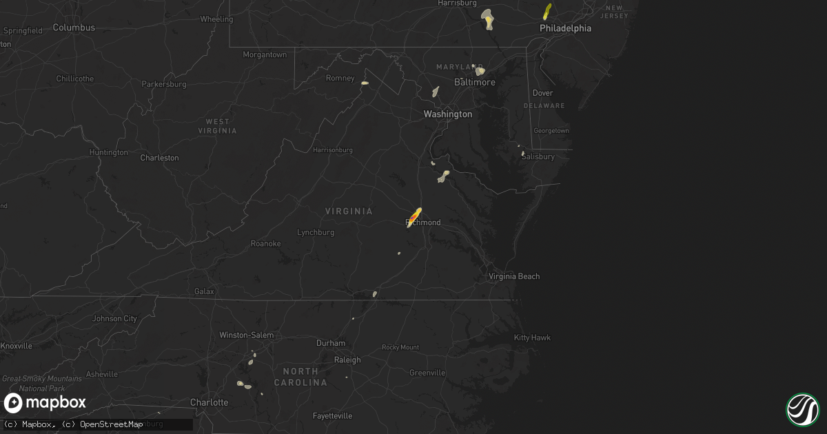
Hail Map on August 18, 2024
Get this storm
August 18 map
$229
one time, instant access
Download today. No call, no setup
Keep the $229
Bought the map and want the full workflow? Apply the entire $229 to a subscription within 7 days. None of it is wasted.
Every map, not just this one
This buys you this map. Subscription and you get every map we run, in the markets you choose from a few cities to whole states to nationwide. Plus real-time alerts the moment a storm fires.
Contact data
Name, contact info, occupancy, even credit band for addresses in the footprint. You go from where it hit to who to call.
Become the source they trust
Unlimited branding weather history reports on demand. You already have the documented answer ready for the property owner, and you are the one who showed up with it.
Property data and RoofTrace estimates
Pull up any address you have got, its value and the exact code rules for that jurisdiction, straight from One Click Code. Then RoofTrace estimates the squares, pitch, and roof value, priced the way you price.
States Impacted by Hail Map on August 18, 2024
Storm reports
Georgia
| Date | Description |
|---|---|
| 08/18/20246:50 PM CDT | Tree down on elaine drive and mary ann street. |
| 08/18/20246:30 PM CDT | Randolph county em reports trees down across the county. |
| 08/18/20246:30 PM CDT | Several trees down across northwest side of county per em. |
| 08/18/20246:29 PM CDT | Mesonet station ga347 i-75 at sr 7. |
| 08/18/20246:28 PM CDT | Trees and powerlines down in cuthbert and shellman. Power is out along blakely street south of cuthbert. |
| 08/18/20246:16 PM CDT | A tree was blown down on meeks road at meeks cemetery road. |
| 08/18/20246:15 PM CDT | Tree down along ga hwy 39 near rood creek. |
| 08/18/20246:12 PM CDT | Tree down along ga hwy 39 near florence marina. |
| 08/18/20246:10 PM CDT | A tree was downed on piney mount church road at snell bridge road. |
| 08/18/20246:10 PM CDT | A tree was downed on liberty grove church road near the intersection of pwa road. |
| 08/18/20246:10 PM CDT | A tree was downed on liberty grove church road near the intersection of pwa road. |
| 08/18/20246:03 PM CDT | A tree was blown down on cross cedar road at carlos snell road. |
| 08/18/20246:00 PM CDT | A tree was downed near the sweats portable buildings business on ga-57. |
| 08/18/20246:00 PM CDT | A tree was downed ga-57 at glover road. |
| 08/18/20245:46 PM CDT | A tree was downed onto power lines in the 1000 block of jordan mill rd. |
| 08/18/20245:46 PM CDT | A tree fell onto power lines in the 700 block of east mccarty street. |
| 08/18/20245:45 PM CDT | Corrects previous tstm wnd dmg report from 2 nne sandersville. A couple trees fell onto homes along n. Lake drive. |
| 08/18/20245:45 PM CDT | Several trees were downed along walden rd. |
| 08/18/20245:45 PM CDT | Tree downed in 200 block of frank rd. |
| 08/18/20245:45 PM CDT | A tree fell onto a home in the 100 block of n. Lake drive. |
| 08/18/20245:45 PM CDT | Corrects previous tstm wnd dmg report from 2 ne sandersville. Several trees were downed along walden rd. Four more trees downed on two homes and one shop along mayview |
| 08/18/20245:44 PM CDT | Tree down on a powerline at the intersection of murray farm road and flem smith road. |
| 08/18/20245:37 PM CDT | Tree down in 300 block of hill road. |
| 08/18/20245:35 PM CDT | Tree down on woodward rd and hwy 41. |
| 08/18/20245:28 PM CDT | A power pole and power lines were downed on waterfork rd. |
| 08/18/20245:25 PM CDT | Trees down along lexington drive... In the jonesboro community. |
| 08/18/20245:15 PM CDT | Trees down along huie drive... In the morrow community. |
| 08/18/20245:10 PM CDT | Trees down along pine gate drive. |
| 08/18/20245:10 PM CDT | A tree was downed on hayward-smith rd. |
| 08/18/20245:10 PM CDT | A tree fell onto power lines on main street. |
| 08/18/20245:10 PM CDT | A tree was downed on pine street in gordon. |
| 08/18/20245:09 PM CDT | A tree was downed in the 100 block of snyder rd ne. |
| 08/18/20245:07 PM CDT | A tree was downed in the 100 black of twin lakes rd se. |
| 08/18/20245:05 PM CDT | Em reports tree down on powerlines on kings hwy near dorsett shoals rd. |
| 08/18/20245:05 PM CDT | Trees down along silver dollar road... Between matthews road and liberty hill road. |
| 08/18/20245:05 PM CDT | A tree was downed in the 2200 block of irwinton rd. |
| 08/18/20245:04 PM CDT | A tree was downed onto power lines on s. Jefferson street at e. Screven street. |
| 08/18/20245:04 PM CDT | A tree fell onto a gas meter in the 100 block of park ave se... Causing gas to leak from the meter. |
| 08/18/20245:03 PM CDT | A local report indicates 58 MPH wind near Columbus Metropolitan A |
| 08/18/20245:03 PM CDT | A tree was downed onto a power line in the 100 block of forest hill road sw. |
| 08/18/20245:03 PM CDT | A tree fell onto a power line in the 100 block of allen memorial drive sw. |
| 08/18/20245:03 PM CDT | A tree was downed onto a power line on frank bone road sw at ivey drive sw. |
| 08/18/20245:03 PM CDT | A tree was downed on ivey dr. Sw at hillcrest dr. Sw. |
| 08/18/20244:56 PM CDT | A tree was reported down on power lines on garrett rd between warm springs rd and county line rd. |
| 08/18/20244:56 PM CDT | A large tree fell onto power lines along arrington drive. |
| 08/18/20244:55 PM CDT | Reported in the treasure lake area. |
| 08/18/20244:53 PM CDT | Estimated gust in the area of standing boy creek at lake oliver. |
| 08/18/20244:50 PM CDT | Trees down along high bluff trail near newnan road... Southeast of carrollton. |
| 08/18/20244:50 PM CDT | A large tree was reported down across whitesville road near biggers road. |
| 08/18/20244:50 PM CDT | A tree was reported down on whitesville road near twin chapel drive. |
| 08/18/20244:49 PM CDT | A tree was downed onto a power line in the 100 block of daisy trail nw. |
| 08/18/20244:47 PM CDT | A tree was downed in the 200 block of little rd nw. |
| 08/18/20244:44 PM CDT | A tree was reported down on bluegill road at southshore rd. |
| 08/18/20244:40 PM CDT | Trees down near intersection of lanier road and miller academy road. |
| 08/18/20244:40 PM CDT | Tree down along 4th street... East side of newnan. |
| 08/18/20244:39 PM CDT | A tree was reported down on highway 129 between highway 212 and the jones county line. |
| 08/18/20244:34 PM CDT | A tree was reported down along rabbit skip rd sw. |
| 08/18/20244:30 PM CDT | Tree on house in the 500 block of ishman ballard rd. |
| 08/18/20244:25 PM CDT | Tree down at felton mcmichael rd and huff rd. |
| 08/18/20244:20 PM CDT | Reported at exit 30 on i-185. |
| 08/18/20244:05 PM CDT | Multiple trees down along westpoint road... Near potts road. |
| 08/18/20244:05 PM CDT | Tree down at upper woolsey rd and little rd. |
| 08/18/20244:00 PM CDT | Multiple reports of trees down along westpoint road... Between gabbettville road and lambert road. |
| 08/18/20243:54 PM CDT | A tree reportedly fell onto an rv at holiday campground with no injuries. |
| 08/18/20243:51 PM CDT | Tree down at rodgers rd and airline rd. |
| 08/18/20243:50 PM CDT | Tree down at summerfield ln and summerfield dr. |
| 08/18/20243:50 PM CDT | Tree down at south ola rd and new hope rd. |
| 08/18/20243:50 PM CDT | Tree down at willow ln and hopewell pl. |
| 08/18/20243:48 PM CDT | Tree down on home near tunis drive and holloway rd. |
| 08/18/20243:45 PM CDT | A tree was reported down and blocking the right lane of highway 23 southbound at campground rd. |
| 08/18/20243:30 PM CDT | Tree down on brookwater dr. |
| 08/18/20243:20 PM CDT | Tree down on home along 3800 block of brookstone way. |
| 08/18/20243:18 PM CDT | Trees down along jeffrey drive in the woodcrest community. |
| 08/18/20243:15 PM CDT | Numerous trees down in and around the ellenwood community near linecrest rd. Several homes and cars damaged severely by falling trees. |
| 08/18/20243:15 PM CDT | Multiple trees down in ellenwood in the vicinity of club circle and simmons way... Lombard rd and ward rd. |
| 08/18/20243:15 PM CDT | Tree down on i285 wb just before i675. |
| 08/18/20243:10 PM CDT | Tree down in roadway along 1400 block of golf link drive. |
| 08/18/20243:10 PM CDT | Tree down blocking roadway along 2900 block of da vinci blvd. |
| 08/18/20242:47 PM CDT | A large tree limb was downed along montag circle. |
| 08/18/20242:45 PM CDT | A large tree was downed onto power lines on piedmont avenue ne near 8th street ne. |
| 08/18/20242:42 PM CDT | A large tree fell onto an unoccupied vehicle on holly street nw at north avenue nw. |
| 08/18/20242:38 PM CDT | A large tree fell across buckner road. |
| 08/18/20241:29 AM CDT | A few trees were blown down in grady county. |
| 08/17/202410:05 PM CDT | Trees down in grady county. |
| 08/17/20249:51 PM CDT | The weatherflow site on the south end of tybee island measured a 65 mph wind gust. |
| 08/17/20249:25 PM CDT | Several large tree limbs down and blowing around in cairo. |
| 08/17/20249:15 PM CDT | Tree down in thomasville. |
| 08/17/20249:06 PM CDT | The nos tide gauge at fort pulaski measured a 64 mph wind gust. |
| 08/17/20248:57 PM CDT | Tree down in ochlocknee. |
| 08/17/20248:15 PM CDT | Several calls about trees down in mitchell county. |
| 08/17/20247:57 PM CDT | Tree repo |
| 08/17/20247:57 PM CDT | Tree reported down on south wynn road at shaw road. Time estimated from radar. |
| 08/17/20247:57 PM CDT | A pecan tree limb was blown down onto highway 112. |
| 08/17/20247:45 PM CDT | Tree reported down on clito road at franklin road. Time estimated from radar. |
| 08/17/20247:45 PM CDT | Tree reported down on clito road at franklin road. Time estimated from radar. ( |
| 08/17/20247:45 PM CDT | Tree reported down on jarrell pond road near stoney pond road. Time estimated from radar. |
| 08/17/20247:44 PM CDT | Tree down along ferguson road. |
| 08/17/20247:38 PM CDT | Tree reported down on statesboro highway at dover road. Time estimated from radar. |
| 08/17/20247:26 PM CDT | Tree down along tarrytown road. |
| 08/17/20247:26 PM CDT | Two to three trees down along hilton memory road and old kibbee rd north near the train tracks. |
| 08/17/20247:24 PM CDT | Tree down along warnock pond road northeast of tarrytown. |
| 08/17/20247:19 PM CDT | Tree down along bell line road. |
| 08/17/20247:19 PM CDT | Two to four trees down along wilson woodard road and roddy hwy. |
Mississippi
| Date | Description |
|---|---|
| 08/18/20246:58 PM CDT | Local law enforcement reported a powerline down near w main st east of duncan ms along with a few downed trees. |
| 08/18/20241:41 AM CDT | Measured by personal weather station. Tree damage also reported in the area. |
| 08/17/202411:37 PM CDT | Utility pole snapped near cr 14 at cr 31. |
| 08/17/202411:37 PM CDT | Large tree downed on ms highway 528 near oak bowery. |
| 08/17/202411:29 PM CDT | Trees and powerlines downed at the intersection of cr 29 and cr 293. |
| 08/17/202410:07 PM CDT | Tree downed around the 220 block of morgantown road. Time estimated based on radar. |
| 08/17/20249:45 PM CDT | Corrects previous tstm wnd dmg report from 2 ne russum. Trees |
| 08/17/20249:45 PM CDT | Corrects previous tstm wnd dmg report from 2 ne russum. Trees down along old gordon annex. |
| 08/17/20249:40 PM CDT | Trees down along hwy 18 near the claiborne/copiah county line. |
| 08/17/20249:33 PM CDT | Tree downed and laying across the road near the 3200 block of marion dunbar street. Time estimated based on radar. |
| 08/17/20249:26 PM CDT | Trees downed between the intersection of cedar hill rd and gus green rd. |
| 08/17/20249:20 PM CDT | Downed trees between the intersection of robinson springs rd and coker dr. |
| 08/17/20249:20 PM CDT | Down trees between the intersection of robinson springs road and deer haven drive. |
| 08/17/20249:19 PM CDT | Trees and powerlines downed on old port gibson road and bill strong road. Time estimated based on radar. |
| 08/17/20249:10 PM CDT | Trees downed onto powerline along redbone rd. |
| 08/17/20249:10 PM CDT | A tree fell on a house along nailor rd near poole rd. |
| 08/17/20249:05 PM CDT | Tree downed on halls ferry rd near greerbriar. |
| 08/17/20249:05 PM CDT | Tree down along ms highway 27 between gibson rd and warriors trail. |
| 08/17/20249:00 PM CDT | Tree and power lines downed along culkin rd. |
| 08/17/20248:55 PM CDT | Multiple trees downed... Blocking oak ridge rd. |
| 08/17/20248:45 PM CDT | Tree down across ms highway 465 near eagle lake. Report via social media. |
| 08/17/20248:45 PM CDT | Widespread downed trees along the eagle lake community. |
| 08/17/20248:45 PM CDT | Trees down along old gordon annex. |
| 08/17/20248:30 PM CDT | Downed powerlines on coker road. Time estimated based on radar. |
| 08/17/20248:23 PM CDT | Trees down on moon lake rd. Time estimated based on radar. |
| 08/17/20248:15 PM CDT | Majority of anguilla without power due to downed powerlines. |
| 08/17/20248:05 PM CDT | Tree downed on church st. Time estimated based on radar. |
| 08/17/20247:58 PM CDT | Law enforcement reported multiple trees and powerlines down across sunflower county. |
| 08/17/20247:57 PM CDT | Tree downed on edna st. Time estimated based on radar. |
| 08/17/20247:51 PM CDT | Recorded by private weather station near schlater. |
| 08/17/20247:45 PM CDT | Two trees fell on vehicles and one tree fell on a house in moorhead. |
| 08/17/20247:40 PM CDT | City of greenville reports several downed trees and powerlines across the city... Including along hwy 1... Witchtree... Tampa at us 82... Omega... And goodrich at willi |
| 08/17/20247:40 PM CDT | Tree downed across cypress ln. |
| 08/17/20247:40 PM CDT | Tree downed across broadway st. |
| 08/17/20247:37 PM CDT | City of greenville reports downed trees and possible building damage at the glh airport. |
| 08/17/20247:00 PM CDT | A tree was snapped and a chicken coop was damaged in rosedale. |
Louisiana
| Date | Description |
|---|---|
| 08/18/20242:30 AM CDT | Public submitted a photo of a large branch split from a tree on babineaux rd. |
| 08/18/20241:38 AM CDT | Photo from the public of a tree split about half way up the trunk. |
| 08/17/202411:00 PM CDT | Two trees down near farmerville. |
| 08/17/202410:55 PM CDT | Tree down sw of marion louisiana. |
| 08/17/20248:27 PM CDT | Downed trees along hwy 580 and hwy 65 n. |
North Carolina
| Date | Description |
|---|---|
| 08/18/20246:50 PM CDT | Tree reported down in eastern freemont. |
| 08/18/20246:24 PM CDT | Trees down along mount shepard road. |
| 08/18/20246:21 PM CDT | Trees down near the intersection of tabernacle church rd and snyder county rd. |
| 08/18/20246:11 PM CDT | Tree down in kenly... Nc. |
| 08/18/20246:06 PM CDT | Numerous trees down. |
| 08/18/20246:05 PM CDT | Trees down near the intersection of fuller mill rd and reddy foxx ln. |
| 08/18/20245:57 PM CDT | Tree down near mile marker 90 on i-95. |
| 08/18/20245:49 PM CDT | Tree down on mt ulla hwy at eddie wayne dr. Time estimated. |
| 08/18/20245:49 PM CDT | Tree down on statesville hwy between rinehardt rd and grayland rd. |
| 08/18/20245:43 PM CDT | Trees down along i-95 near brogden road. |
| 08/18/20245:34 PM CDT | Tree fell on a power line and caught fire along hwy 52 in the far ne corner of the county. |
| 08/18/20245:31 PM CDT | Tree down near the intersection of cleveland rd and wellons rd. |
| 08/18/20245:30 PM CDT | Tree on a house near hwy 150 and lake norman near doolie community. Time estimated from radar. |
| 08/18/20245:29 PM CDT | Two trees blocking grassy creek rd caused the road to be shut down. Time estimated based on radar. |
| 08/18/20245:29 PM CDT | Extensive damage to docks and trees down around troutman. Downed trees also noted by electric utility south of troutman. |
| 08/18/20245:28 PM CDT | Several large trees down and several structures damaged by fallen trees on tennessee circle. Boat houses with roofs blown off. |
| 08/18/20245:16 PM CDT | 1 tree down on a house at 250 neill farm rd. |
| 08/18/20245:15 PM CDT | 1 tree on a house at 231 tennessee circle. |
| 08/18/20245:12 PM CDT | Large tree down and damage to residents grill. |
| 08/18/20245:07 PM CDT | Considerable tree damage with numerous trees down all along i-40 from nc-42 to nc-210. Co-located with an area of over 3...000 power outages. |
| 08/18/20245:00 PM CDT | Trees down in clemmons. |
| 08/18/20244:38 PM CDT | Tree down on shady grove church road. Time estimated from radar. |
| 08/18/20244:30 PM CDT | Several trees down along hwy 127 between fellowship church rd and lake hickory. |
| 08/18/20244:30 PM CDT | Tree down on speas ferry road. Time estimated from radar. |
| 08/18/20244:20 PM CDT | Reports on social media and the local fire department indicated that a large tree had block both lanes of traffic near the intersection of murray road and shoaley road. |
| 08/18/20244:12 PM CDT | Trees down on warren bridge rd near the wilkes co border. |
| 08/18/20244:07 PM CDT | Power outage was caused by fallen trees damaging equipment. |
| 08/18/20244:00 PM CDT | Trees down near intersection of wilkesboro hwy and sandburg rd. Time estimated. |
| 08/18/20243:45 PM CDT | Two trees down in happy valley area. Time estimated. |
| 08/17/20248:52 PM CDT | Weather station at sunset beach fishing pier recorded a 65 mph gust. |
| 08/17/20248:15 PM CDT | Large pine tree uprooted. |
| 08/17/20247:49 PM CDT | Tree down near the intersection of us-64 and pea ridge rd. |
| 08/17/20247:43 PM CDT | Tree down near millbrook dr and barton row. |
| 08/17/20247:05 PM CDT | Tree down near eureka. |
Arkansas
| Date | Description |
|---|---|
| 08/18/20246:53 PM CDT | Tree limbs blown down. |
| 08/18/20246:52 PM CDT | Trees blown down. |
| 08/18/20246:45 PM CDT | Several trees blown down in the garrett bridge area. |
| 08/18/20246:37 PM CDT | Some trees blown over. |
| 08/18/20246:30 PM CDT | Report from mping: quarter |
| 08/18/20246:30 PM CDT | Report from mping: 1-inch tree limbs broken; shingles blown off. |
| 08/18/20246:26 PM CDT | Several trees down. |
| 08/18/20246:25 PM CDT | Numerous reports of trees down in fayetteville from both the public and storm spotters... With photos relayed via x. Time estimated from gusts in both springdale and at |
| 08/18/20246:25 PM CDT | Downed trees and damage to street signs in west fayetteville. Estimated winds of 65 mph. Photos relayed via x. |
| 08/18/20246:25 PM CDT | 50 knot gust measured at fayetteville drake field. |
| 08/18/20246:23 PM CDT | Report from mping: quarter |
| 08/18/20246:23 PM CDT | Photo of hail relayed via x by storm spotter. Time estimated via radar. |
| 08/18/20246:22 PM CDT | 51 knot gust measured at springdale municipal airport. |
| 08/18/20246:19 PM CDT | A local report indicates 1.00 inch wind near 1 SE Hooker |
| 08/18/20246:10 PM CDT | A local report indicates 1.00 inch wind near 1 SSE Hooker |
| 08/18/20246:06 PM CDT | Tree limbs blown down. |
| 08/18/20246:02 PM CDT | 56 knot gust measured at northwest arkansas national airport. |
| 08/18/20245:17 PM CDT | Tree limbs blown down. |
| 08/18/20244:56 PM CDT | A local report indicates 1.00 inch wind near Cabot |
| 08/18/20244:46 PM CDT | This report was supposed to be for lonoke county austin... Therefore not valid. Corrects previous hail report from austin in conway co. |
| 08/18/20244:46 PM CDT | A local report indicates 1.00 inch wind near Austin |
| 08/18/20244:37 PM CDT | Tree branch snapped in half. |
| 08/18/20244:35 PM CDT | A local report indicates 1.25 inch wind near 3 SW El Paso |
| 08/18/20244:18 PM CDT | A local report indicates 1.50 inch wind near Ward |
| 08/18/20244:18 PM CDT | A local report indicates 2.00 inch wind near Ward |
| 08/18/20244:15 PM CDT | Oak trees snapped at the trunks. |
| 08/17/202410:10 PM CDT | Multiple trees down in the area. A few buildings experienced roof damage. |
| 08/17/20249:20 PM CDT | Tree limbs blown down. |
| 08/17/20249:15 PM CDT | This is a delayed report. Extensive damage occurred to several large docks. |
| 08/17/20249:10 PM CDT | Many trees down near reynolds road in bryant... Ar. |
| 08/17/20249:07 PM CDT | Tree blown onto a house. |
| 08/17/20249:02 PM CDT | Trees and powerlines blown down near the intersection of hwy 5 and mcgee road. |
| 08/17/20248:59 PM CDT | Multiple trees and power lines blown down across garland county. |
| 08/17/20248:50 PM CDT | Corrects previous hail report from 1 ene story. Estimated golf ball size hail. |
| 08/17/20248:35 PM CDT | Tree limbs blown down. |
| 08/17/20248:35 PM CDT | Tree limbs blown down. |
| 08/17/20248:30 PM CDT | 3-4 in tree branches snapped. |
| 08/17/20248:29 PM CDT | Tree limbs blown down. |
| 08/17/20248:18 PM CDT | Tree limbs blown down. |
| 08/17/20248:17 PM CDT | Tree limbs blown down. |
| 08/17/20248:15 PM CDT | Numerous trees blown down. |
| 08/17/20248:14 PM CDT | Trees blown down around centerville. Some damage to some structures as well. |
| 08/17/20248:09 PM CDT | Trees blown down. |
| 08/17/20248:04 PM CDT | Trees blown down in dover. |
| 08/17/20247:58 PM CDT | Tree limbs blown down. |
| 08/17/20247:55 PM CDT | Trees blown over. |
| 08/17/20247:51 PM CDT | Trees blown over. |
| 08/17/20247:50 PM CDT | Trees blown down. |
| 08/17/20247:48 PM CDT | A local report indicates 1.00 inch wind near Dover |
| 08/17/20247:46 PM CDT | Trees downed on n main street near hwy 65. Time estimated based on radar. |
| 08/17/20247:41 PM CDT | Power lines blown down onto rogers street. |
| 08/17/20247:40 PM CDT | Power lines down in lavaca. Time estimated via radar. |
| 08/17/20247:40 PM CDT | Tree down across shaver road. Location and time estimated. |
| 08/17/20247:40 PM CDT | Law enforcement reported a roof blown off of a business on main st near hamburg ar. |
| 08/17/20247:37 PM CDT | Tree limbs blown down. |
| 08/17/20247:35 PM CDT | Several trees down. |
| 08/17/20247:34 PM CDT | Tree downed on storage shed on south lakeshore drive and powerline downed on north lakeshore drive. Time estimated based on radar. |
| 08/17/20247:33 PM CDT | Tree limbs blown down. |
| 08/17/20247:30 PM CDT | Power lines blown down in dyer. Relayed by county emergency management. Time estimated via radar. |
| 08/17/20247:25 PM CDT | Numerous trees down. Relayed by county emergency management. Time estimated via radar. |
| 08/17/20247:24 PM CDT | A local report indicates 60 MPH wind near 2 E Baxter |
| 08/17/20247:19 PM CDT | Numerous trees down. |
| 08/17/20247:09 PM CDT | Tree limbs blown down. |
| 08/17/20247:06 PM CDT | Numerous trees down. |
| 08/17/20247:02 PM CDT | Mesonet/davis wx station measured 62 mph near mcgehee. |
| 08/17/20247:01 PM CDT | Numerous trees down. |
Florida
| Date | Description |
|---|---|
| 08/18/20241:48 AM CDT | Continued reports of trees and power lines down in jackson county. |
| 08/18/20241:36 AM CDT | I tree down on hubbard st. |
| 08/18/20241:36 AM CDT | 1 power line down on plateau avenue. |
| 08/18/20241:35 AM CDT | 1 tree down at myrtle avenue and 12th st. |
| 08/18/20241:10 AM CDT | Report of a tree down on a carport and power line in the bonifay area. |
| 08/17/202411:10 PM CDT | Numerous power outages in the blountstown area as storms with gusty winds moved through. |
| 08/17/202410:30 PM CDT | Trees down around mary brown road and st hebron road. |
| 08/17/202410:25 PM CDT | Several trees down across jackson county. |
| 08/17/202410:15 PM CDT | A strapped down mobile home was shifted off its blocks between marianna and cypress. |
| 08/17/202410:13 PM CDT | Photo of a tree down on old cottondale road on social media. |
| 08/17/202410:10 PM CDT | Several trees down across jackson county. |
South Carolina
| Date | Description |
|---|---|
| 08/18/20246:29 PM CDT | An 8 inch branch from a large oak tree split and fell near the intersection of calhoun and 14th street. |
| 08/18/20246:29 PM CDT | Several large tree limbs down blocking s 14th avenue near the intersection with e hudson st. Time estimated based on radar. |
| 08/18/20245:17 PM CDT | Lancaster county 911 reported multiple trees down on powerlines along flat creek rd. Time estimated by radar. |
| 08/18/20244:59 PM CDT | Lancaster county 911 reported 1 hail at the building. Time estimated by radar. |
| 08/18/20244:52 PM CDT | Lancas |
| 08/18/20244:52 PM CDT | Lancaster county dispatch reported trees down within the city limits. |
| 08/18/20243:49 PM CDT | Tree down on sardis rd. Time estimated. |
| 08/18/20243:25 PM CDT | A few trees down on the n and nw side of gaffney... Including gettys dr... Beltline rd... And littlejohn st. On beltline rd... One tree fell on an apartment after storm |
| 08/17/202411:33 PM CDT | Tree down partially blocking santee rd between strong rd and wee tee rd. Time estimated based on radar. |
| 08/17/202411:29 PM CDT | Em reported several trees down in the bonneau area. Time estimated from radar data. |
| 08/17/202410:40 PM CDT | Emergency manager reported 1 tree blocking roadway in 200 block of salem road... And a few large branches down on roadway in that area. |
| 08/17/20249:13 PM CDT | Bamberg county dispatch reported a tree down over erhardt near the intersection of tabernacle rd. Time estimated by radar. |
| 08/17/20247:08 PM CDT | Three trees and large limbs down near the intersection of us-508 and sc-22... South of aynor. Time estimated by radar. |
| 08/17/20247:06 PM CDT | Large limbs down across dog bluff road in aynor. Time estimated by radar. |
Kansas
| Date | Description |
|---|---|
| 08/18/20242:25 PM CDT | Personal weather station via weatherunderground measured 59 mph from weakening storms with outflow. |
| 08/18/202412:30 PM CDT | Delayed report from social media. Picture of a large part of a healthy tree down across road. Estimated speed around 60 mph. |
Idaho
| Date | Description |
|---|---|
| 08/18/20245:30 PM CDT | Strong winds also with tree branches down. |
| 08/17/20249:00 PM CDT | Itd rwis station itd95 - inl puzzle us-20/us-26. |
| 08/17/20248:50 PM CDT | Mesonet station sum - big southern butte. |
| 08/17/20247:41 PM CDT | Mesonet station svb1h. |
Oklahoma
| Date | Description |
|---|---|
| 08/18/20246:05 PM CDT | Mesonet station brec breckinridge. |
| 08/18/20245:50 PM CDT | Mesonet station brec breckinridge. |
| 08/18/20245:50 PM CDT | Power poles broken and tin wrapped around the median cables. Damage path described as about 1.5 miles wide. Time estimated from nearby mesonet. |
Oregon
| Date | Description |
|---|---|
| 08/18/20244:52 PM CDT | Few downed trees... Unknown time. |
Alabama
| Date | Description |
|---|---|
| 08/18/20246:32 PM CDT | A local report indicates 61 MPH wind near Craig Field Airport |
| 08/18/20246:27 PM CDT | A tree was blown down on company street. |
| 08/18/20246:21 PM CDT | Ten trees blown down on cr30. |
| 08/18/20246:20 PM CDT | Several trees were blown down on the west side of selma. |
| 08/18/20246:17 PM CDT | Trees were blown down near thomaston. |
| 08/18/20246:15 PM CDT | Several trees were blown down near lazy acres. |
| 08/18/20246:07 PM CDT | A tree was blown down on mill pond road. |
| 08/18/20246:04 PM CDT | Trees were blown down around dayton. |
| 08/18/20246:00 PM CDT | A few trees were blown down in far southern russell county. |
| 08/18/20245:59 PM CDT | Several trees and power lines down in the valley grande area. A silo was also damaged. |
| 08/18/20245:56 PM CDT | Multiple trees were blown down around uniontown. |
| 08/18/20245:55 PM CDT | Numerous trees down along county rd 54 making it impassable. |
| 08/18/20245:51 PM CDT | Trees were blown down around faunsdale. |
| 08/18/20245:49 PM CDT | Trees were blown down in northeast bullock county per fire dept. |
| 08/18/20245:46 PM CDT | Several trees were blown down from near greensboro to near gallion. |
| 08/18/20245:40 PM CDT | Multiple trees were blown down around hatchechubbee. |
| 08/18/20245:40 PM CDT | Minor roof damage reported to some structures in reeltown. |
| 08/18/20245:37 PM CDT | Multiple trees were blown down around hurtsboro. |
| 08/18/20245:35 PM CDT | Multiple trees were blown down around marion. |
| 08/18/20245:33 PM CDT | Several trees were blown down... At least one landed on a home. The higher concentration of damage occurred just west of greensboro. |
| 08/18/20245:33 PM CDT | Several trees were blown down... At least one landed on a home. The higher concentration of damage occurred just west of greensboro. |
| 08/18/20245:15 PM CDT | Multiple trees were blown down... Multiple homes were damaged... And a few vehicles were damaged along us 80. |
| 08/18/20245:12 PM CDT | A few trees were blown down around kowaliga. |
| 08/18/20245:07 PM CDT | A few trees were blown down around brent. |
| 08/18/20245:00 PM CDT | Multiple trees and some power lines were blown down near auburn university. |
| 08/18/20245:00 PM CDT | Multiple trees and some power lines were blown down near auburn and opelika. This includes lee road 395... Lee road 10... Lee road 70... Lee road 11... Lee road 45... C |
| 08/18/20244:57 PM CDT | Minor roof damage to building and at least quarter size hail. |
| 08/18/20244:55 PM CDT | A local report indicates 1.50 inch wind near 2 W Alexander City |
| 08/18/20244:47 PM CDT | Several trees were blown down around fosters. |
| 08/18/20244:45 PM CDT | A local report indicates 1.00 inch wind near Fosters |
| 08/18/20244:44 PM CDT | Corrects previous hail report from kellyton. |
| 08/18/20244:40 PM CDT | A tree and power lines were blown down into the roadway near moon branch road. |
| 08/18/20244:30 PM CDT | Several trees were blown down around romulus. |
| 08/18/20244:22 PM CDT | A local report indicates 1.75 inch wind near 1 ENE Alexander City |
| 08/18/20244:21 PM CDT | Estimated at least quarter size hail partially covering the ground. |
| 08/18/20244:21 PM CDT | A local report indicates 1.00 inch wind near 2 ESE Dadeville |
| 08/18/20244:21 PM CDT | Multiple trees were blown down around camp hill. |
| 08/18/20244:21 PM CDT | Estimated at least |
| 08/18/20244:15 PM CDT | Multiple trees were blown down around dadeville. |
| 08/18/20244:08 PM CDT | A local report indicates 1.00 inch wind near 3 SSW Hillabee Creek |
| 08/18/20244:05 PM CDT | Multiple trees were blown down around jacksons gap. |
| 08/18/20244:03 PM CDT | A local report indicates 1.00 inch wind near Hackneyville |
| 08/18/20244:03 PM CDT | A few trees were blown down around hackneyville. |
| 08/18/20243:59 PM CDT | Multiple trees were blown down around alexander city. |
| 08/18/20243:54 PM CDT | A local report indicates 1.00 inch wind near 2 WSW New Site |
| 08/18/20243:48 PM CDT | Estimated quarter size hail from video. |
| 08/18/20243:41 PM CDT | A tree was blown down on hagood road. |
| 08/18/20243:18 PM CDT | A tree was blown down on sr 22 and cr 16. |
| 08/18/20243:02 PM CDT | A tree was blown down and partially blocking the roadway... On cr 59 between cr 310 and cr 65. A few pine trees were snapped off in the same area. |
| 08/18/20242:57 PM CDT | 1 inch diameter hail fell in the clear creek harbor area. Hail lasted for several minutes with lots of tree debris. |
| 08/18/20241:09 AM CDT | Tree down on county road 70. |
| 08/17/20249:45 PM CDT | Trees down in the cottonwood area. |
| 08/17/20249:37 PM CDT | Social media report of a tree down on house in the madrid-cottonwood area. |
| 08/17/20249:25 PM CDT | Tree down in the hartford area. |
| 08/17/20249:23 PM CDT | About 60 to 65 mph winds at lewis road slocomb area. |
| 08/17/20249:21 PM CDT | Trees down in the bay springs area. |
| 08/17/20249:17 PM CDT | A transmission pole was broken in a field just east of n county road 9 and upton road. |
| 08/17/20249:14 PM CDT | A wire was down along with a broken three phase pole along cumbie road. |
| 08/17/20248:25 PM CDT | Tree down near the intersection of highway 125 and county road 102. |
| 08/17/20248:12 PM CDT | Multiple trees were blown down along us 29. |
| 08/17/20248:10 PM CDT | A tree was blown down onto a vehicle along sr 125. Unknown injuries. |
| 08/17/20247:56 PM CDT | A local report indicates 1.00 inch wind near Antioch |
| 08/17/20247:51 PM CDT | Multiple trees were blown down along us 29. |
| 08/17/20247:48 PM CDT | Trees down in the whatley community. |
| 08/17/20247:35 PM CDT | Trees down in several spots along cr35 |
| 08/17/20247:26 PM CDT | Trees down on powerlines in the fulton and dickinson communities. |
| 08/17/20247:17 PM CDT | Trees down on powerlines near the wilcox county line on highway 5. |
| 08/17/20247:11 PM CDT | Multiple trees were blown down. 112. |
| 08/17/20247:11 PM CDT | Multiple trees were blown down. |
| 08/17/20247:08 PM CDT | Trees were blown down along sr 30 in clayton. |
| 08/17/20247:07 PM CDT | Several trees were blown down around vineland. |
| 08/17/20247:00 PM CDT | Several trees were blown down near cr 12... Cr 85... And cr 4. |
New York
| Date | Description |
|---|---|
| 08/18/20242:09 PM CDT | Trees and wires down in cedarville. Time estimated from radar. |
Maryland
| Date | Description |
|---|---|
| 08/18/20246:59 PM CDT | Tops snapped out of multiple trees and a few trees downed in the area of kahlston rd. |
| 08/18/20246:59 PM CDT | Tops snapped out of multiple trees and a few trees downed in the area of kahlston rd. Metal sheathing blown down from beneath a covered shopping center walkway. |
| 08/18/20246:01 PM CDT | 14 inch tree down blocking road near gaither rd and forsythe rd. |
Pennsylvania
| Date | Description |
|---|---|
| 08/18/20245:10 PM CDT | Corrects previous tstm wnd dmg report from 2 sse millersburg. Trees down with smaller trees uprooted. |
| 08/18/20244:44 PM CDT | Tree and wires down completely blocking roadway on 300 block of owl hollow rd. |
| 08/18/20244:23 PM CDT | Tree fell on wires and also lots of branches down in the fox chase section. |
| 08/18/20243:15 PM CDT | Corrects previous non-tstm wnd dmg report from 1 sse smithfield twp. A few trees down. Time estimated from radar. |
| 08/18/20243:06 PM CDT | A local report indicates 1.00 inch wind near Skippack |
| 08/18/20242:41 PM CDT | A few trees down near mt bethel township. Time estimated from radar. |
| 08/18/20241:56 PM CDT | Trees down blocking portions of 4th street. |
| 08/18/20241:15 PM CDT | Trees down with smaller trees uprooted. |
| 08/18/20241:14 PM CDT | Corrects previous tstm wnd dmg report from 1 ssw millersburg. Trees down blocking portions of 4th street. |
| 08/17/20247:45 PM CDT | Multiple trees down at eckman rd and brenneman rd. |
| 08/17/20247:10 PM CDT | Tree into house on 700 block of catherine st. |
| 08/17/20247:10 PM CDT | Multiple trees down with some on homes along marietta avenue between us route 30 and little conestoga creek. |
New Jersey
| Date | Description |
|---|---|
| 08/18/20245:40 PM CDT | Low hanging wires over eagle rock road in roseland nj due to thunderstorm wind damage. |
| 08/18/20244:15 PM CDT | Tree down on 206. Time estimated from radar. |
| 08/18/20244:05 PM CDT | Downed tree at the intersection of butler rd and sunset lake rd. |
| 08/18/20243:48 PM CDT | A few trees down near hardwick township. Time estimated from radar. |
Virginia
| Date | Description |
|---|---|
| 08/18/20245:44 PM CDT | 911 call center reported a couple trees down in the smith point area of reedville. |
| 08/18/20245:00 PM CDT | 911 call center reported a tree down at providence united methodist church. |
| 08/18/20244:09 PM CDT | The 911 call center reported two trees down on loving union road. Time estimated from radar. |
| 08/18/20244:05 PM CDT | Report from mping: half dollar |
| 08/18/20244:05 PM CDT | A local report indicates 1.00 inch wind near 3 W Laurel |
| 08/18/20244:00 PM CDT | Report from mping: half dollar |
| 08/18/20243:55 PM CDT | I-64 and parham road. |
| 08/18/20243:53 PM CDT | A local report indicates 1.25 inch wind near 2 NE Tuckahoe |
| 08/18/20243:53 PM CDT | The henry county 911 center reported that a large tree was down near the intersection of meeks road and powell road... Very near the north carolina border southeast of |
| 08/18/20243:52 PM CDT | Trained spotter reported three solar pathway lights damaged from the hail with a fourth destroyed... Window screen damage to a home... And hail dents in vehicles includ |
| 08/18/20243:51 PM CDT | Public reports from social media show large hail estimated to be around two inches in diameter in the tuckahoe area. Time estimated from radar. |
| 08/18/20243:51 PM CDT | A local report indicates 1.50 inch wind near Tuckahoe |
| 08/18/20243:50 PM CDT | A tree fell onto an suv on parham road near aldi. No injuries were reported. |
| 08/18/20243:48 PM CDT | *** 1 fatal *** tree fell on a car and killed a man inside the car. Confirmed by broadcast media from henrico police and fire. |
| 08/18/20243:48 PM CDT | Minor structural damage to a home on gunby dr. |
| 08/18/20243:48 PM CDT | Tree downed on three chopt road at freeman high school. |
| 08/18/20243:45 PM CDT | Tree down across desota drive. Multiple trees down and significant tree damage in the general area. |
| 08/18/20243:45 PM CDT | Report from mping: half dollar |
| 08/18/20242:33 PM CDT | Several downed trees along route 218. |
| 08/18/20242:29 PM CDT | Tree blocking locust dale lane |
Montana
| Date | Description |
|---|---|
| 08/18/20246:45 PM CDT | 20 foot tall tree down along eastside hwy. |
| 08/17/20249:50 PM CDT | Public weather station. Location estimated. |
| 08/17/20248:59 PM CDT | Delayed report. Public reports quarter sized hail. Gusty winds also blew around items around the residence. |
| 08/17/20247:16 PM CDT | A local report indicates 72 MPH wind near 6 NW Missoula |
| 08/17/20247:15 PM CDT | Tree down across fleet street. Additional damage to tree branches in pleasant view neighborhood. |
| 08/17/20247:10 PM CDT | Trees on powerline... Power out. |
| 08/17/20247:10 PM CDT | Missoula county reports eastbound traffic closed at reserve st as well as westbound at paxon st for a tree in the road. |
Cities Impacted by Hail Map on August 18, 2024
- Chattanooga, TN
- Ooltewah, TN
- Ord, NE
- North Loup, NE
- Scotia, NE
- Greeley, NE
- Wolbach, NE
- Palmer, NE
- Belgrade, NE
- Fullerton, NE
- Ewing, NE
- Amelia, NE
- Burwell, NE
- Elgin, NE
- Petersburg, NE
- Ericson, NE
- Bartlett, NE
- Clearwater, NE
- Callaway, NE
- Spalding, NE
- Albion, NE
- Cedar Rapids, NE
- Primrose, NE
- Central City, NE
- Clarks, NE
- Kearney, NE
- Minden, NE
- Marquette, NE
- York, NE
- McCool Junction, NE
- Giltner, NE
- Holstein, NE
- Roseland, NE
- Bladen, NE
- Exeter, NE
- Fairmont, NE
- Ayr, NE
- Friend, NE
- Lawrence, NE
- Blue Hill, NE
- Superior, NE
- Guide Rock, NE
- Nelson, NE
- Belleville, KS
- Munden, KS
- Clyde, KS
- Clifton, KS
- Morganville, KS
- Clay Center, KS
- Gore, VA
- High View, WV
- Capon Bridge, WV
- Winchester, VA
- King George, VA
- Powder Springs, GA
- Marietta, GA
- Malvern, PA
- Paoli, PA
- Smyrna, GA
- Mableton, GA
- Harveyville, KS
- Burlingame, KS
- Auburn, KS
- Eskridge, KS
- Carbondale, KS
- Scranton, KS
- Osage City, KS
- Lyndon, KS
- Brodheadsville, PA
- Talladega, AL
- Cropwell, AL
- Wayne, PA
- Atlanta, GA
- Berwyn, PA
- Phoenixville, PA
- Pell City, AL
- Stroudsburg, PA
- King Of Prussia, PA
- Oaks, PA
- Collegeville, PA
- Norristown, PA
- Schwenksville, PA
- Harleysville, PA
- Skippack, PA
- Anniston, AL
- Alpine, AL
- Ellenwood, GA
- Decatur, GA
- Delaware Water Gap, PA
- East Stroudsburg, PA
- Vincent, AL
- Columbia, NJ
- Goodwater, AL
- Roanoke, AL
- Delta, UT
- Conley, GA
- Stockbridge, GA
- Wilsons, VA
- Benedict, NE
- Cragford, AL
- Wadley, AL
- Morrow, GA
- Jonesboro, GA
- Rex, GA
- Perkasie, PA
- Quakertown, PA
- Five Points, AL
- Millerville, AL
- Ashland, AL
- Pinson, AL
- Gaffney, SC
- Richmond, VA
- Midlothian, VA
- Morris, AL
- Heflin, AL
- Hector, AR
- Dover, AR
- Springfield, AR
- Remlap, AL
- Sylacauga, AL
- Berry, AL
- Northport, AL
- Covington, GA
- Gordo, AL
- Kimberly, AL
- Asbury, NJ
- Birmingham, AL
- Plumerville, AR
- El Paso, AR
- Russellville, AR
- Henrico, VA
- Greenbrier, AR
- Alexander City, AL
- Ranburne, AL
- Colonial Beach, VA
- Caret, VA
- Bowling Green, VA
- Hattieville, AR
- Lagrange, GA
- Lanett, AL
- Oxford, NC
- Mansfield, GA
- Daviston, AL
- Jacksons Gap, AL
- Dadeville, AL
- Glen Allen, VA
- Beebe, AR
- Tuscaloosa, AL
- Kellyton, AL
- Jerusalem, AR
- Duck Hill, MS
- Solgohachia, AR
- Hampton, NJ
- Glen Gardner, NJ
- Pittstown, NJ
- Clinton, NJ
- Conway, AR
- Elrod, AL
- Trussville, AL
- Ashland, VA
- Ward, AR
- West Point, GA
- Newnan, GA
- Whitesburg, GA
- Vilonia, AR
- Morrilton, AR
- Wooster, AR
- Damascus, AR
- Austin, AR
- Filer, ID
- Twin Falls, ID
- Brookwood, AL
- Waco, GA
- Buhl, AL
- Ralph, AL
- Catawba, SC
- Eatonton, GA
- Hustle, VA
- Port Royal, VA
- Winona, MS
- Carrollton, GA
- Cottondale, AL
- Lonoke, AR
- Carlisle, AR
- Cabot, AR
- Waverly, AL
- Camp Hill, AL
- Mount Bethel, PA
- Bangor, PA
- Sheridan, AR
- Eutaw, AL
- Brierfield, AL
- Centreville, AL
- Griffin, GA
- Boydton, VA
- Columbus, GA
- Fortson, GA
- Smiths Station, AL
- Phenix City, AL
- Show Low, AZ
- Lead, SD
- Hill City, SD
- Knoxville, AL
- Fosters, AL
- West Blocton, AL
- Milledgeville, GA
- Bracey, VA
- South Hill, VA
- Auburn, AL
- Hamilton, GA
- Lancaster, SC
- Randolph, AL
- Hazen, AR
- Bauxite, AR
- Cleveland, AR
- Enola, AR
- Mount Vernon, AR
- Cataula, GA
- Loretto, VA
- Jerome, ID
- Moundville, AL
- Midland, GA
- De Valls Bluff, AR
- Willow Spring, NC
- Center Ridge, AR
- Enid, OK
- White Hall, AR
- Lawley, AL
- Forest Park, GA
- Akron, AL
- Villa Rica, GA
- Winston, GA
- Douglasville, GA
- Shelton, WA
- Darby, MT
- Union Springs, AL
- Tuskegee, AL
- Medicine Lodge, KS
- Gibbonsville, ID
- Opelika, AL
- Mount Pleasant, NC
- Pine Bluff, AR
- Equality, AL
- Eclectic, AL
- Gold Hill, NC
- Fort Lawn, SC
- Gaithersburg, MD
- Atkins, AR
- Prattsville, AR
- Brent, AL
- Roe, AR
- Maplesville, AL
- Forsyth, GA
- Sawyerville, AL
- Weogufka, AL
- Carthage, AR
- Leola, AR
- Hazelton, ID
- Malvern, AR
- North Fork, ID
- Richfield, NC
- Jefferson, AR
- Marion, AL
- Hatchechubbee, AL
- Hurtsboro, AL
- Seale, AL
- Greensboro, AL
- Clarendon, AR
- Des Arc, AR
- Plantersville, AL
- Tallassee, AL
- Macon, GA
- Poyen, AR
- Pittsview, AL
- Bentonville, AR
- Harrison, GA
- Tennille, GA
- Watts, OK
- Centerton, AR
- Hiwasse, AR
- Gravette, AR
- Blackfoot, ID
- Lexington, NC
- Fort Valley, GA
- Roberta, GA
- Selma, AL
- New London, NC
- Germantown, MD
- Montgomery Village, MD
- Casscoe, AR
- Uniontown, AL
- Newbern, AL
- Shoup, ID
- Fairmont, OK
- McLeod, MT
- Holly Grove, AR
- Springdale, AR
- Fayetteville, AR
- Gallion, AL
- Wrightsville, GA
- Faunsdale, AL
- Pelsor, AR
- Albemarle, NC
- Star City, AR
- Biscoe, AR
- Thomasville, NC
- Rogers, AR
- Lowell, AR
- Gentry, AR
- Absarokee, MT
- Jackson, MT
- Donaldson, AR
- Cockeysville, MD
- Hindsville, AR
- Siloam Springs, AR
- Chinle, AZ
- Ganado, AZ
- Farmington, AR
- Prairie Grove, AR
- Yorktown, AR
- De Witt, AR
- Saint Charles, AR
- Tyler, AL
- Sardis, AL
- Marion Junction, AL
- Montello, NV
- Elkins, AR
- Wesley, AR
- Clinton, MT
- Philipsburg, MT
- West Fork, AR
- Winslow, AR
- Lincoln, AR
- Stevensville, MT
- Huntsville, AR
- Scranton, SC
- Bismarck, AR
- Crumrod, AR
- Pamplico, SC
- Witter, AR
- Montgomery, AL
- Dumas, AR
- Dry Branch, GA
- Wadley, GA
- Grouse Creek, UT
- Watson, AR
- Drummond, MT
- Arkadelphia, AR
- Lititz, PA
- Mount Joy, PA
- Landisville, PA
- Manheim, PA
- Columbia, PA
- Lancaster, PA
- Arlington, AL
- Thomaston, AL
- Combs, AR
- Alligator, MS
- Duncan, MS
- Rupert, ID
- Grady, AR
- Tillar, AR
- Pickens, AR
- Gould, AR
- Mellwood, AR
- Hagarville, AR
- Rockford, AL
- Magnolia, AL
- Pine Hill, AL
- Pike Road, AL
- Monticello, AR
- Mardela Springs, MD
- Pettigrew, AR
- Saint Paul, AR
- Sparkman, AR
- Windsor Mill, MD
- Parkville, MD
- Glen Arm, MD
- Towson, MD
- Tarrytown, GA
- Soperton, GA
- Choteau, MT
- Rosedale, MS
- Gunnison, MS
- Mountville, PA
- Nottingham, MD
- Glenwood, GA
- Rockledge, GA
- Lamar, AR
- Shelby, MS
- Thomasville, AL
- Elaine, AR
- Mound Bayou, MS
- Drew, MS
- Buhl, ID
- Clayton, AL
- Perry Hall, MD
- Midway, AL
- Baltimore, MD
- Merigold, MS
- Vienna, MD
- Wilmar, AR
- McGehee, AR
- Mount Judea, AR
- Gurdon, AR
- Beulah, MS
- Boyle, MS
- Cleveland, MS
- Fountain Hill, AR
- Greenbank, WA
- Augusta, MT
- Millersville, PA
- Washington Boro, PA
- East Petersburg, PA
- Hamburg, AR
- Coupeville, WA
- Rohwer, AR
- Benoit, MS
- Ozone, AR
- Roberts, ID
- Menan, ID
- Ruleville, MS
- Doddsville, MS
- Kingsville, MD
- Mount Vernon, GA
- Arkansas City, AR
- Lake Village, AR
- Greenville, MS
- Dermott, AR
- Missoula, MT
- Troy, AL
- Minter, AL
- Shaw, MS
- Leeds, AL
- Sterrett, AL
- Vandiver, AL
- Portland, AR
- Ramer, AL
- Grady, AL
- Brinkley, AR
- Moro, AR
- Conestoga, PA
- Deer, AR
- Rexburg, ID
- Clarksville, AR
- Indianola, MS
- Delaware, AR
- Knoxville, AR
- Scranton, AR
- New Blaine, AR
- London, AR
- Fairfield, MT
- Vidalia, GA
- Parkdale, AR
- Schlater, MS
- Eudora, AR
- Wilmot, AR
- Ailey, GA
- Sunflower, MS
- Pequea, PA
- Clarksdale, MS
- Minter City, MS
- Marvell, AR
- Johnsonville, SC
- Brundidge, AL
- Lake Providence, LA
- Oak Grove, LA
- Dardanelle, AR
- Greenwood, MS
- Lyons, GA
- Bellevue, ID
- Fairfield, ID
- Ketchum, ID
- Hailey, ID
- Sun Valley, ID
- Mackay, ID
- Philipp, MS
- Floweree, MT
- Great Falls, MT
- Ariton, AL
- Chidester, AR
- Geyser, MT
- Rosedale, MD
- Metter, GA
- Twin City, GA
- Whiteville, NC
- Clarkton, NC
- Jacksonville, GA
- Moorhead, MS
- Sidon, MS
- Carrollton, MS
- Itta Bena, MS
- Rover, AR
- Plainview, AR
- Ola, AR
- Rolling Fork, MS
- Mayersville, MS
- Bladenboro, NC
- Transylvania, LA
- North Little Rock, AR
- Scott, AR
- Jacksonville, AR
- Sherwood, AR
- Mountain Pine, AR
- Royal, AR
- Hot Springs National Park, AR
- Jessieville, AR
- Malad City, ID
- Paron, AR
- Evergreen, NC
- Carter, MT
- Dothan, AL
- Wickes, AR
- Stanton, AL
- Little Rock Air Force Base, AR
- Umpire, AR
- Grannis, AR
- Prattville, AL
- Billingsley, AL
- Autaugaville, AL
- Flora, MS
- Canton, MS
- Bentonia, MS
- Alexander, AR
- Arimo, ID
- Mccammon, ID
- Mount Ida, AR
- Story, AR
- Pelham, GA
- Cairo, GA
- Cottonwood, AL
- Ashford, AL
- Langley, AR
- Downey, ID
- Gillham, AR
- Bonnerdale, AR
- Amity, AR
- Pearcy, AR
- Glenwood, AR
- Fort Benning, GA
- Brady, MT
- Rocky Ford, CO
- Madison, MS
- De Queen, AR
- Highwood, MT
- Traskwood, AR
- Norman, AR
- Mabelvale, AR
- Redfield, AR
- Hensley, AR
- North Myrtle Beach, SC
- Calabash, NC
- Little River, SC
- Sunset Beach, NC
- Ocean Isle Beach, NC
- Shallotte, NC
- Arco, ID
- Carey, ID
- Moore, ID
- Atomic City, ID
- Montrose, AR
- Fort Benton, MT
- Dierks, AR
- Little Rock, AR
- Whigham, GA
- Ordway, CO
- Olar, SC
- Ledger, MT
- Geraldine, MT
- Cope, SC
- Branchville, SC
- Bamberg, SC
- Fordyce, AR
- Bearden, AR
- Ochlocknee, GA
- Meigs, GA
- Lumber City, GA
- Uvalda, GA
- Nashville, AR
- Sugar City, CO
- Loma, MT
- Murfreesboro, AR
- Benton, AR
- Delight, AR
- Savannah, GA
- Tybee Island, GA
- Newhope, AR
- Hermitage, AR
- Marianna, FL
- Grand Ridge, FL
- Slocomb, AL
- Prescott, AR
- Cascade, MT
- Simms, MT
- Fort Shaw, MT
- Vaughn, MT
- Sun River, MT
- Power, MT
- Magnolia, AR
- Crossett, AR
- Emerson, AR
- Coward, SC
- Thornton, AR
- Chester, MT
- Newton, AL
- Mount Gilead, NC
- Kershaw, SC
- Moncks Corner, SC
- Bonneau, SC
- Louin, MS
- Paulding, MS
- Bay Springs, MS
- Whitlash, MT
- Georgetown, SC
- Andrews, SC
- Heidelberg, MS
- Columbia, LA
- Monroe, LA
- West Monroe, LA
- Big Sandy, MT
- Andalusia, AL
- Florala, AL
- Blakely, GA
- Jakin, GA
- Brewton, AL
- Chester, AR
- Donalsonville, GA
- Colquitt, GA
- Proctor, OK
- Jersey, AR
- Kirby, AR
- Lonsdale, AR
- Grapevine, AR
- Sherrill, AR
- Altheimer, AR
- Stuttgart, AR
- Crocketts Bluff, AR
- Stilwell, OK
- Tahlequah, OK
- Natural Dam, AR
- Bunch, OK
- Brinson, GA
- Rudy, AR
- Mountainburg, AR
- Uniontown, AR
- Muldrow, OK
- Lucedale, MS
- Lavaca, AR
- Cedarville, AR
- Van Buren, AR
- Alma, AR
- Leakesville, MS
- Fort Smith, AR
- Sallisaw, OK
- Charleston, AR
- Ponce De Leon, FL
- Freeport, FL
- Roland, OK
- Wilmer, AL
- Greenwood, AR
- Barling, AR
- Doerun, GA
- Booneville, AR
- Vernon, FL
- Huntington, AR
- Mansfield, AR
- Hackett, AR
- Arkoma, OK
- Pocola, OK
- Spiro, OK
- Waldron, AR
- Hartford, AR
- Cameron, OK
- Santa Rosa Beach, FL
- Heavener, OK
- Howe, OK
- Poteau, OK
- Sims, AR
- Mena, AR
- Boles, AR
- Westville, OK
- Zortman, MT
- Kansas, OK
- Evansville, AR
- Canehill, AR
- Hays, MT
- Winnett, MT
- Summers, AR
- Malta, MT
- Dodson, MT