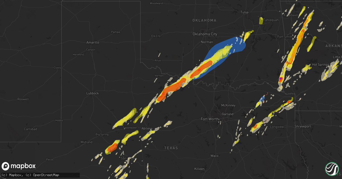
Hail Map on April 4, 2025
Get this storm
April 4 map
$229
one time, instant access
Download today. No call, no setup
Keep the $229
Bought the map and want the full workflow? Apply the entire $229 to a subscription within 7 days. None of it is wasted.
Every map, not just this one
This buys you this map. Subscription and you get every map we run, in the markets you choose from a few cities to whole states to nationwide. Plus real-time alerts the moment a storm fires.
Contact data
Name, contact info, occupancy, even credit band for addresses in the footprint. You go from where it hit to who to call.
Become the source they trust
Unlimited branding weather history reports on demand. You already have the documented answer ready for the property owner, and you are the one who showed up with it.
Property data and RoofTrace estimates
Pull up any address you have got, its value and the exact code rules for that jurisdiction, straight from One Click Code. Then RoofTrace estimates the squares, pitch, and roof value, priced the way you price.
States Impacted by Hail Map on April 4, 2025
Storm reports
Texas
| Date | Description |
|---|---|
| 04/04/20256:32 PM CDT | Ktbs-tv viewer reports golf ball size hail just east of maud community near wright patman lake. |
| 04/04/20255:34 PM CDT | Trees snapped... Overturned cars... And additional damage near the lakeview baptist assembly in lone star. |
| 04/04/20255:18 PM CDT | A local report indicates 1.00 inch wind near 3 N Bettie |
| 04/04/20255:05 PM CDT | Multiple trees down on fm road 2088... West of us highway 271... Between the union hill and bettie communities. Also... Some structure damage from trees. |
| 04/04/20255:05 PM CDT | Structural damage at union hill elementary. Possible tornado. |
| 04/04/20255:03 PM CDT | Carport lifted and damaged east end of barber rd in the bettie community. |
| 04/04/20255:00 PM CDT | Damage to bridge road surface on fm road 852 over lake gilmer. |
| 04/04/20254:55 PM CDT | Photo of destroyed residence in the kelsey community along state highway 154. |
| 04/04/20254:50 PM CDT | Horse loafing shed roof and walls damage and trees down on kelsey creek rd and cox trail... Just south of state hwy 154 in the kelsey community west of gilmer. |
| 04/04/20254:40 PM CDT | Pictures of damage at a manufacturing plant... Coincident with a tornadic debris signature. Time estimated by radar. |
| 04/04/20254:22 PM CDT | Damage reported at intersection of cr 1345 and cr 1360. |
| 04/04/20254:11 PM CDT | Dime to quarter size hail reported by amateur radio operator. |
| 04/04/20254:00 PM CDT | Report of confirmed tornado on ground near the talco community. |
| 04/04/20253:47 PM CDT | Report of a house destroyed on farm to market rd 909 from local sheriff. |
| 04/04/20253:28 PM CDT | Multiple trees down near fm 1255 and fm 773. |
| 04/04/20253:25 PM CDT | Reports of a tree on a house at fm 1255 and sh 110. Also a roof blown off of a house nearby. |
| 04/04/20253:22 PM CDT | Report of confirmed tornado and damage in rosalie community just east of bogata. |
| 04/04/20252:40 PM CDT | Report of down powerlines just east of eureka. |
| 04/04/20252:01 AM CDT | Report from mping: ping pong ball |
| 04/04/20251:50 AM CDT | Location and time are estimated. |
| 04/04/20251:48 AM CDT | Report from mping: quarter |
| 04/04/20251:48 AM CDT | A local report indicates 1.50 inch wind near 1 SW Wichita Falls |
| 04/04/20251:47 AM CDT | Report from mping: quarter |
| 04/04/20251:46 AM CDT | A local report indicates 1.00 inch wind near 2 N Lakeside City |
| 04/04/20251:45 AM CDT | Report from mping: golf ball |
| 04/04/20251:44 AM CDT | Report from mping: ping pong ball |
| 04/04/20251:43 AM CDT | A local report indicates 1.00 inch wind near 3 S Lakeside City |
| 04/04/20251:43 AM CDT | Spotter network report. |
| 04/04/20251:42 AM CDT | A local report indicates 1.00 inch wind near 3 NW Lakeside City |
| 04/04/20251:42 AM CDT | Report from mping: half dollar |
| 04/04/20251:38 AM CDT | A local report indicates 1.00 inch wind near 4 SSW Lakeside City |
| 04/04/20251:38 AM CDT | Lots of nickel-size hail with some quarter-size. |
| 04/04/20251:10 AM CDT | A local report indicates 1.00 inch wind near 4 S San Angelo |
| 04/04/202512:30 AM CDT | Report from mping half dollar. |
| 04/04/202512:05 AM CDT | A local report indicates 1.75 inch wind near 1 E Stamford |
| 04/03/202511:48 PM CDT | Report from mping: half dollar |
| 04/03/202511:45 PM CDT | A local report indicates 1.25 inch wind near Rotan |
| 04/03/202511:45 PM CDT | Reported hail damage to cars and broken tree limbs. |
| 04/03/202511:42 PM CDT | Hail anywhere from marble to quarter size. Also... Numerous dents on the hood of vehicle. Time estimated via radar. |
| 04/03/202511:34 PM CDT | The sterling county sheriff office reported golf ball size hail in sterling city. |
| 04/03/202511:01 PM CDT | Quarter to half dollar sized hail. |
Arkansas
| Date | Description |
|---|---|
| 04/04/20253:02 AM CDT | Spotter sees debris in osceola. |
| 04/04/20252:49 AM CDT | Photo from emergency manager showing large hail estimated to be about 2 inches in diameter. |
| 04/04/20252:45 AM CDT | Franklin county em reported half dollar size hail at ozark eoc. |
| 04/04/20252:45 AM CDT | A local report indicates 1.75 inch wind near 1 E Ozark |
| 04/04/20252:42 AM CDT | Report from mping. |
| 04/04/20252:36 AM CDT | A local report indicates 1.75 inch wind near 3 SE Meg |
| 04/04/20252:35 AM CDT | Timing estimated from radar. |
| 04/04/20252:21 AM CDT | A couple of power poles were knocked down on jett lane. |
| 04/04/20252:18 AM CDT | Reported train car blown off tracks at exit 7 off ar-555. Possible tornado. |
| 04/04/20252:00 AM CDT | A local report indicates 1.75 inch wind near Waldron |
| 04/04/20251:58 AM CDT | Damage occurred to a waldron school roof which led to ceiling damage and water infiltration. Uncertain whether it was caused by very large hail or damaging winds. |
| 04/04/20251:58 AM CDT | A local report indicates 1.50 inch wind near Waldron |
| 04/04/20251:51 AM CDT | Tree down on house on ar 163. Possible tornado. |
| 04/04/20251:50 AM CDT | Damage reported near the country club east of wynne. |
| 04/04/20251:50 AM CDT | A local report indicates 2.00 inch wind near Y City |
| 04/04/20251:46 AM CDT | A local report indicates 1.75 inch wind near Kingston |
| 04/04/20251:45 AM CDT | A local report indicates 63 MPH wind near 1 SW Colt |
| 04/04/20251:45 AM CDT | Home damaged on cr 741 near wynne. Possible tornado. |
| 04/04/20251:44 AM CDT | Damage reported on fitzgerald crossing south of wynne. Possible tornado. |
| 04/04/20251:40 AM CDT | Report from mping. |
| 04/04/20251:35 AM CDT | Report from mping. |
| 04/04/20251:35 AM CDT | Report from mping. |
| 04/04/20251:34 AM CDT | Report from mping. |
| 04/04/20251:32 AM CDT | Report from mping. |
| 04/04/20251:14 AM CDT | Timing estimated from radar. |
| 04/04/202512:48 AM CDT | Franklin county em reported quarter to half dollar size hail at ozark eoc. |
| 04/04/202512:34 AM CDT | Timing estimated from radar. |
| 04/04/202512:10 AM CDT | Trees and powerlines down in lonoke. |
| 04/03/202510:11 PM CDT | Report from mping: ping pong ball |
| 04/03/202510:01 PM CDT | A local report indicates 1.75 inch wind near Hatfield |
| 04/03/20258:03 PM CDT | Reports of trees down and other damage along highway 82 near garland. Time estimated by radar. Possible tornado. |
| 04/03/20258:00 PM CDT | Corrects previous tstm wnd dmg report from 3 ne garland. |
| 04/03/20258:00 PM CDT | Possible tornado damage near intersection of highway 196 and highway 134. Up to 7 power poles snapped. |
| 04/03/20257:19 PM CDT | Arkansas state police confirm damage on claxton loop in cushman. |
| 04/03/20257:12 PM CDT | Trees blown down at numerous locations across hot springs. |
Oklahoma
| Date | Description |
|---|---|
| 04/04/20253:35 PM CDT | Ems reports damage to trees and powerlines near the intersection of snows arena road and us highway 70. |
| 04/04/20257:24 AM CDT | A local report indicates 1.00 inch wind near Wagoner |
| 04/04/20257:07 AM CDT | A local report indicates 1.00 inch wind near 3 NW Muskogee |
| 04/04/20257:00 AM CDT | A local report indicates 1.00 inch wind near 3 NW Muskogee |
| 04/04/20254:58 AM CDT | Social media video driving through hail on i-40 near henryetta. |
| 04/04/20254:57 AM CDT | Quarter size hail reported at tiger mountain. |
| 04/04/20254:17 AM CDT | Holdenville mesonet site. |
| 04/04/20254:15 AM CDT | Time is estimated from radar. |
| 04/04/20254:05 AM CDT | Siding uplifted. Time estimated by radar. |
| 04/04/20253:57 AM CDT | Spotter network report. |
| 04/04/20253:55 AM CDT | Phone call report. |
| 04/04/20253:45 AM CDT | Byars |
| 04/04/20253:40 AM CDT | A local report indicates 1.00 inch wind near Stratford |
| 04/04/20253:40 AM CDT | A small radio tower collapsed onto a gas station awning. Relayed image. Time is estimated from radar. |
| 04/04/20253:40 AM CDT | Sulphur |
| 04/04/20253:35 AM CDT | Sulphur |
| 04/04/20253:30 AM CDT | Social media report. |
| 04/04/20253:30 AM CDT | Structure collapse with entrapment. Time is estimated from radar. |
| 04/04/20253:28 AM CDT | Time estimated from radar. |
| 04/04/20253:26 AM CDT | Home destroyed. Time estimated by radar. |
| 04/04/20253:25 AM CDT | Chain-link fence damage. Time estimated by radar. |
| 04/04/20253:24 AM CDT | A local report indicates 1.00 inch wind near 3 E Elmore City |
| 04/04/20253:12 AM CDT | Barn destroyed. Time estimated by radar. |
| 04/04/20253:05 AM CDT | Report from mping: ping pong ball |
| 04/04/20252:59 AM CDT | Substantial limb damage to a tree. Time estimated by radar. |
| 04/04/20252:55 AM CDT | Ringling |
| 04/04/20252:53 AM CDT | Roof removed from building in ringling. Social media report. |
| 04/04/20252:50 AM CDT | Ringling |
| 04/04/20252:49 AM CDT | Solar panels destroyed. Time estimated by radar. |
| 04/04/20252:47 AM CDT | Social media post shown from inside of car with windows destroyed. Time estimated by radar. |
| 04/04/20252:35 AM CDT | Mature 12-inch trunk broken off of tree. Time estimated by radar. |
| 04/04/20252:25 AM CDT | Phone call report. |
| 04/03/20259:23 PM CDT | Just north of the eagletown community. |
| 04/03/20259:20 PM CDT | Golf ball size hail reported in the middle of eagletown. |
Ohio
| Date | Description |
|---|---|
| 04/04/202510:57 AM CDT | Photo verified. |
| 04/04/202510:56 AM CDT | Photo verified. |
| 04/03/202511:00 PM CDT | Photo verified. |
| 04/03/202510:50 PM CDT | A local report indicates 1.00 inch wind near 2 NW Shawnee Hills |
| 04/03/202510:50 PM CDT | A local report indicates 1.00 inch wind near 3 E Spring Valley |
| 04/03/202510:40 PM CDT | A local report indicates 1.00 inch wind near 4 WNW Waynesville |
| 04/03/202510:35 PM CDT | A local report indicates 1.00 inch wind near 3 S Centerville |
| 04/03/202510:33 PM CDT | A local report indicates 1.00 inch wind near 3 SE Centerville |
Tennessee
| Date | Description |
|---|---|
| 04/04/20253:41 PM CDT | Report from mping: ping pong ball |
| 04/04/20255:22 AM CDT | Tree down on poplar grove road near the poplar grove cemetery. |
| 04/04/20255:19 AM CDT | Multiple trees down... Damaged home... And power outages near springville. Possibly associated with a tornado. |
| 04/04/20255:18 AM CDT | Tree down blocking roadway on pleasant hill road near springville. |
| 04/04/20255:18 AM CDT | Home damaged on pleasant hill road. Grain truck and shed/barn demolished next door. |
| 04/04/20255:18 AM CDT | Tree down on a powerline at highway 641 and big sandy river road. |
| 04/04/20253:56 AM CDT | House damaged on parks road near friendship. Possible tornado. |
| 04/04/20253:53 AM CDT | Lots of trees down on pugh road. Possible tornado. |
| 04/04/20253:52 AM CDT | Corrects previous tstm wnd dmg report from 2 s friendship. Shop damaged on east road. Possible tornado. |
| 04/04/20252:52 AM CDT | Shop damaged on east road. Possible tornado. |
Kentucky
| Date | Description |
|---|---|
| 04/04/20253:40 PM CDT | A local report indicates 2.75 inch wind near 6 WNW Hamlin |
| 04/04/20253:37 PM CDT | A local report indicates 2.00 inch wind near 4 NW Hamlin |
| 04/04/20253:35 PM CDT | Twitter picture compared to a wiffle ball. |
| 04/04/20253:30 PM CDT | Report with photo of estimated ping pong size hail. |
| 04/04/20253:29 PM CDT | Power outages reported as well. |
| 04/04/20252:35 PM CDT | Whitley county em reports localized straight line wind damage along mosley branch road headed towards knox county... Just to the ne of the intersection with 1064. Outbu |
| 04/04/20252:35 PM CDT | Delayed social media report |
| 04/04/20252:33 PM CDT | Trees down with a tree on vehicle. |
| 04/04/20252:33 PM CDT | Corrects previous tstm wnd dmg report from 4 n perkins. The whitley county em confirmed that they received a call about a tree on vehicle with entrapment. However... Th |
Missouri
| Date | Description |
|---|---|
| 04/03/20258:59 PM CDT | Report from mping: ping pong ball |
| 04/03/20258:56 PM CDT | Delayed report. Many downed trees... Fencing... Some power poles and damage to a home. Time estimated via radar. |
| 04/03/20257:54 PM CDT | Larger than quarter sized hail at high praire church on redtop rd near the buffalo and fair grove line. Lasted about 1 min. |
| 04/03/20257:52 PM CDT | Spotter confirms a tornado heading toward gordonville. |
| 04/03/20257:39 PM CDT | 1.25 inch hail. |
| 04/03/20257:37 PM CDT | Report from mping... Quarter 1.00 in. |
| 04/03/20257:35 PM CDT | Willard springfield area. Picture provided by media of 1.25 inch hail. |
| 04/03/20257:33 PM CDT | Quarter size hail. Lasted 5 minutes. |
| 04/03/20257:32 PM CDT | Quarter size hail. |
| 04/03/20257:23 PM CDT | Half dollar size hail. |
| 04/03/20257:22 PM CDT | 1 inch hail 1 ne of marionville hs. |
| 04/03/20257:18 PM CDT | Tornado reported on hwy 91. |
West Virginia
| Date | Description |
|---|---|
| 04/04/20256:50 AM CDT | One tree down along dog days road in chapmanville. |
Illinois
| Date | Description |
|---|---|
| 04/03/202510:55 PM CDT | A local report indicates 1.00 inch wind near 3 NNW Metropolis |
Cities Impacted by Hail Map on April 4, 2025
- Muskogee, OK
- Fort Gibson, OK
- Wagoner, OK
- Porter, OK
- Ozark, AR
- Mulberry, AR
- Pettigrew, AR
- Vernon, TX
- Parma, MO
- New Madrid, MO
- Matthews, MO
- Catron, MO
- Alton, MO
- Fremont, MO
- Essex, MO
- Van Buren, MO
- Springdale, AR
- Blair, OK
- Altus, OK
- Lone Wolf, OK
- Mangum, OK
- Oark, AR
- Powell, TX
- Mexia, TX
- Rockholds, KY
- Corbin, KY
- Kemp, TX
- Chatfield, TX
- Sulphur Springs, TX
- Williamsburg, KY
- Wortham, TX
- Richland, TX
- Woodbine, KY
- Greenville, TX
- Campbell, TX
- Cumby, TX
- Brashear, TX
- Dike, TX
- Summersville, MO
- Wills Point, TX
- Point, TX
- Corsicana, TX
- Kaufman, TX
- Mabank, TX
- Barbourville, KY
- Gray, KY
- Calico Rock, AR
- Norfork, AR
- Terrell, TX
- Hartshorn, MO
- Jadwin, MO
- Salem, MO
- Rice, TX
- Kerens, TX
- Sulphur Bluff, TX
- Deport, TX
- Bogata, TX
- Talco, TX
- Grand Saline, TX
- Fruitvale, TX
- Canton, TX
- Caulfield, MO
- Murray, KY
- Hazel, KY
- Edgewood, TX
- Trinidad, TX
- Bowling Green, KY
- Holly Springs, MS
- Farmington, KY
- Sedalia, KY
- Mayfield, KY
- Viola, AR
- Elizabeth, AR
- Puryear, TN
- Athens, TX
- Emory, TX
- Alba, TX
- Oakland, KY
- Smiths Grove, KY
- Lamar, MS
- Almo, KY
- Murchison, TX
- Cadiz, KY
- Sumner, TX
- Kenefic, OK
- Blossom, TX
- Bokchito, OK
- Bennington, OK
- Paris, TX
- Boswell, OK
- Detroit, TX
- Arthur City, TX
- Tishomingo, OK
- Mill Creek, OK
- Caddo, OK
- Powderly, TX
- Coleman, OK
- Clarksville, TX
- Milburn, OK
- Benton, KY
- Watts, OK
- Summers, AR
- Saltillo, TX
- Oneida, TN
- Park City, KY
- Rocky Hill, KY
- Ben Wheeler, TX
- Brownsboro, TX
- Colcord, OK
- Eustace, TX
- Van, TX
- Lindale, TX
- Tyler, TX
- Alvaton, KY
- Portland, TN
- Westmoreland, TN
- Bethpage, TN
- Chandler, TX
- Lowell, AR
- Siloam Springs, AR
- Winfield, TN
- Rogers, AR
- Cave Springs, AR
- Mount Vernon, TX
- Seligman, MO
- Adolphus, KY
- Scottsville, KY
- Dexter, KY
- Mineola, TX
- Cave City, KY
- Fountain Run, KY
- Austin, KY
- Hawkins, TX
- Mount Pleasant, TX
- Garfield, AR
- Horse Cave, KY
- Hardin, KY
- Hector, AR
- Glasgow, KY
- Etoile, KY
- Bunker, MO
- Annona, TX
- Witts Springs, AR
- Summer Shade, KY
- Eighty Eight, KY
- Winnsboro, TX
- Alpena, AR
- Avery, TX
- Big Sandy, TX
- Gilmer, TX
- Haworth, OK
- De Kalb, TX
- Pittsburg, TX
- Edmonton, KY
- Greensburg, KY
- Summersville, KY
- Campbellsville, KY
- Cecil, AR
- Charleston, AR
- Daingerfield, TX
- Pocahontas, AR
- Warm Springs, AR
- Foreman, AR
- De Queen, AR
- Ravenden Springs, AR
- Doniphan, MO
- Maynard, AR
- Hughes Springs, TX
- Omaha, TX
- Lone Star, TX
- Success, AR
- Naples, TX
- Oxly, MO
- Theodosia, MO
- Lockesburg, AR
- Clinton, AR
- Shirley, AR
- Winthrop, AR
- Mena, AR
- Fairdealing, MO
- Dierks, AR
- Gradyville, KY
- Fayetteville, AR
- Farmington, AR
- Bentonville, AR
- Ashdown, AR
- Alleene, AR
- Avinger, TX
- Thornfield, MO
- Noble, MO
- Ellington, MO
- Fox, AR
- Mountain View, AR
- Marietta, TX
- Douglassville, TX
- Wasola, MO
- Pelsor, AR
- Crofton, KY
- Dover, AR
- Hagarville, AR
- Newhope, AR
- Kirby, AR
- Glenwood, AR
- Langley, AR
- Harviell, MO
- Poplar Bluff, MO
- Prairie Grove, AR
- Linden, TX
- Caddo Gap, AR
- Bonnerdale, AR
- Norman, AR
- Melbourne, AR
- Amity, AR
- Des Arc, MO
- Nashville, AR
- Mineral Springs, AR
- Williamsville, MO
- Atlanta, TX
- Pineville, AR
- Maud, TX
- Ore City, TX
- Annapolis, MO
- Fredericktown, MO
- Mount Judea, AR
- Guion, AR
- Violet Hill, AR
- Franklin, AR
- Wappapello, MO
- Texarkana, TX
- Nash, TX
- Pleasant Grove, AR
- Batesville, AR
- Mount Pleasant, AR
- Horseshoe Bend, AR
- McGee, MO
- Aurora, MO
- Cassville, MO
- Purdy, MO
- Fifty Six, AR
- Verona, MO
- Puxico, MO
- Zalma, MO
- Marble Hill, MO
- Crane, MO
- Marionville, MO
- Murfreesboro, AR
- Sturdivant, MO
- Sage, AR
- Hardy, AR
- Cherokee Village, AR
- Ash Flat, AR
- Brownwood, MO
- Advance, MO
- Gipsy, MO
- Republic, MO
- Billings, MO
- Springfield, MO
- Bois D Arc, MO
- Couch, MO
- Gatewood, MO
- Queen City, TX
- Whitewater, MO
- Williford, AR
- Willard, MO
- Pleasant Hope, MO
- Fair Grove, MO
- Brighton, MO
- Greenville, MO
- Cape Girardeau, MO
- Jackson, MO
- Brazil, IN
- Brookline, MO
- Leopold, MO
- Bloomburg, TX
- Texarkana, AR
- Poland, IN
- Reelsville, IN
- Cloverdale, IN
- Fouke, AR
- Centerpoint, IN
- Bloomfield, MO
- Quincy, IN
- Martinsville, IN
- Flint, TX
- Garland City, AR
- Myrtle, MO
- Madison, IN
- Prim, AR
- Drasco, AR
- Deputy, IN
- Fillmore, IN
- Coatesville, IN
- Grandin, MO
- Glenallen, MO
- Oran, MO
- Burfordville, MO
- Naylor, MO
- Chaffee, MO
- Buffalo, MO
- Bullard, TX
- Hope, AR
- Elkland, MO
- Long Lane, MO
- Monrovia, IN
- Clayton, IN
- Stilesville, IN
- Mooresville, IN
- Fisk, MO
- Dupont, IN
- Broseley, MO
- Pomona, IL
- Alto Pass, IL
- Dudley, MO
- Whitehouse, TX
- Dexter, MO
- Anna, IL
- Carbondale, IL
- Makanda, IL
- Jonesboro, IL
- Wolf Lake, IL
- Winona, TX
- Tamms, IL
- Dongola, IL
- Cobden, IL
- Galena, MO
- Bell City, MO
- Idabel, OK
- Broken Bow, OK
- Horatio, AR
- Goreville, IL
- Buncombe, IL
- Ullin, IL
- Paris, TN
- Heavener, OK
- Howe, OK
- Eagletown, OK
- Gillham, AR
- Searcy, AR
- Sikeston, MO
- Watson, OK
- Gurdon, AR
- Vienna, IL
- Gladewater, TX
- Marion, IL
- Creal Springs, IL
- Stonefort, IL
- Cypress, IL
- Carrier Mills, IL
- Thompsonville, IL
- Galatia, IL
- Harrisburg, IL
- Raleigh, IL
- Wickes, AR
- Grannis, AR
- Cove, AR
- Equality, IL
- Eldorado, IL
- Broughton, IL
- Pittsburg, IL
- Judsonia, AR
- Ozark, IL
- Simpson, IL
- Pangburn, AR
- Bernie, MO
- Bertrand, MO
- East Prairie, MO
- Charleston, MO
- Ridgway, IL
- Norris City, IL
- Omaha, IL
- Junction, IL
- Donaldson, AR
- Arkadelphia, AR
- Bald Knob, AR
- Eddyville, IL
- Sabinal, TX
- Hatfield, AR
- Lebanon, OH
- Hamilton, OH
- Middletown, OH
- Monroe, OH
- New Haven, IL
- Shawneetown, IL
- Smithville, OK
- Malvern, AR
- Bradford, AR
- Cairo, IL
- Mountainburg, AR
- Boles, AR
- Morganfield, KY
- Mount Vernon, IN
- Waynesville, OH
- Franklin, OH
- Villa Ridge, IL
- Barlow, KY
- Traskwood, AR
- Oregonia, OH
- Mound City, IL
- Mounds, IL
- Olmsted, IL
- Springboro, OH
- Uniontown, KY
- Carmi, IL
- Waldron, AR
- Dayton, OH
- Bellbrook, OH
- Spring Valley, OH
- Winslow, AR
- Benton, AR
- Hodgen, OK
- Kevil, KY
- La Center, KY
- Grand Chain, IL
- Sparkman, AR
- Carthage, AR
- Leola, AR
- Xenia, OH
- Belknap, IL
- Parks, AR
- Evansville, IN
- La Pryor, TX
- Batesville, TX
- Wickliffe, KY
- Metropolis, IL
- Wilmington, OH
- Bauxite, AR
- Sheridan, AR
- Poyen, AR
- Prattsville, AR
- Karnak, IL
- Jamestown, OH
- Cedarville, OH
- Booneville, AR
- Mansfield, AR
- Big Lake, TX
- West Paducah, KY
- Golconda, IL
- Uvalde, TX
- Hindsville, AR
- Huntsville, AR
- Bryant, AR
- Alexander, AR
- Mabelvale, AR
- South Solon, OH
- South Charleston, OH
- Brookport, IL
- Ira, TX
- Colorado City, TX
- Wesley, AR
- Snyder, TX
- Knippa, TX
- Garden City, TX
- London, OH
- Paducah, KY
- Westbrook, TX
- Little Rock, AR
- Jeffersonville, OH
- Sterling City, TX
- Boaz, KY
- Hermleigh, TX
- Roscoe, TX
- Loraine, TX
- Smithland, KY
- Ledbetter, KY
- Burna, KY
- Tiline, KY
- Hampton, KY
- Salem, KY
- Mount Sterling, OH
- Anson, TX
- Merkel, TX
- Eureka Springs, AR
- Berryville, AR
- Roby, TX
- Rotan, TX
- Sweetwater, TX
- Yellow Springs, OH
- Springfield, OH
- Hawley, TX
- Hensley, AR
- Stamford, TX
- Leakey, TX
- Rio Frio, TX
- Concan, TX
- Utopia, TX
- Robert Lee, TX
- Hamlin, TX
- McCaulley, TX
- Sylvester, TX
- Scott, AR
- England, AR
- Ozona, TX
- Sabina, OH
- Carlsbad, TX
- Christoval, TX
- Rule, TX
- Haskell, TX
- Blackwell, TX
- Maryneal, TX
- Aspermont, TX
- San Angelo, TX
- Rocksprings, TX
- Mountain Home, TX
- Lonoke, AR
- Keo, AR
- Dryden, TX
- Brackettville, TX
- Junction, TX
- London, TX
- Del Rio, TX
- Weinert, TX
- Throckmorton, TX
- Carlisle, AR
- Hickory Plains, AR
- Des Arc, AR
- Branch, AR
- Ratcliff, AR
- Goodfellow Afb, TX
- Barnhart, TX
- Sonora, TX
- Menard, TX
- Eldorado, TX
- Camp Wood, TX
- Seymour, TX
- Goree, TX
- Nolan, TX
- Miles, TX
- Kirksey, KY
- Vandervoort, AR
- Hazen, AR
- Winters, TX
- Ovalo, TX
- Lawn, TX
- Tuscola, TX
- Barksdale, TX
- Vancourt, TX
- Wall, TX
- Eola, TX
- Mertzon, TX
- Altus, AR
- Clarksville, AR
- Griffithville, AR
- Abilene, TX
- Saint Paul, AR
- Vanderpool, TX
- Witter, AR
- Olney, TX
- Holliday, TX
- Clyde, TX
- Ballinger, TX
- Magazine, AR
- Rowena, TX
- Lavaca, AR
- Paris, AR
- Kingston, AR
- Ponca, AR
- Deer, AR
- Hunt, TX
- Medina, TX
- Electra, TX
- Comstock, TX
- Eden, TX
- Baird, TX
- Melvin, TX
- Brady, TX
- Green Forest, AR
- Talpa, TX
- Goldsboro, TX
- Compton, AR
- Wynne, AR
- Wichita Falls, TX
- Iowa Park, TX
- Ingram, TX
- Kerrville, TX
- Novice, TX
- Coleman, TX
- Sheppard Afb, TX
- Fredericksburg, TX
- Petrolia, TX
- Elkins, AR
- Combs, AR
- Paint Rock, TX
- Cisco, TX
- Moran, TX
- Harper, TX
- Newcastle, TX
- Henrietta, TX
- Colt, AR
- Palestine, AR
- Widener, AR
- Earle, AR
- Forrest City, AR
- Parkin, AR
- Cherry Valley, AR
- Crawfordsville, AR
- Tyronza, AR
- Turrell, AR
- Breckenridge, TX
- Byers, TX
- Randlett, OK
- Fort Smith, AR
- Gilmore, AR
- Ryan, OK
- Waurika, OK
- Grandfield, OK
- Burkburnett, TX
- Caddo, TX
- Ranger, TX
- Oden, AR
- Mount Ida, AR
- Hastings, OK
- Temple, OK
- Comanche, OK
- Doddridge, AR
- Marion, AR
- Memphis, TN
- Drummonds, TN
- Frenchmans Bayou, AR
- Ringling, OK
- Loco, OK
- Simms, TX
- Pencil Bluff, AR
- Sims, AR
- Duncan, OK
- Burgettstown, PA
- Healdton, OK
- Millington, TN
- Briggsville, AR
- Danville, AR
- Belleville, AR
- Springer, OK
- Graham, OK
- Ratliff City, OK
- Tussy, OK
- Wilson, OK
- Bluffton, AR
- Hartman, AR
- Subiaco, AR
- Scranton, AR
- New Boston, TX
- Osceola, AR
- Davis, OK
- Ardmore, OK
- Wynnewood, OK
- Foster, OK
- Hennepin, OK
- Elmore City, OK
- Willow City, TX
- Havana, AR
- Harrison, AR
- Henning, TN
- Ripley, TN
- Stratford, OK
- Sulphur, OK
- Pauls Valley, OK
- Dardanelle, AR
- Llano, TX
- New Concord, KY
- Gates, TN
- Delaware, AR
- Knoxville, AR
- Russellville, AR
- London, AR
- Ada, OK
- Wanette, OK
- Byars, OK
- Roff, OK
- Fitzhugh, OK
- Paoli, OK
- Lindsay, OK
- Maysville, OK
- Lexington, OK
- Wayne, OK
- Purcell, OK
- Asher, OK
- Friendship, TN
- Konawa, OK
- Macomb, OK
- Sasakwa, OK
- Cedar Hill, TX
- Holdenville, OK
- Wewoka, OK
- Maud, OK
- Allen, OK
- Atwood, OK
- Marlow, OK
- Dallas, TX
- Duncanville, TX
- Desoto, TX
- Calvin, OK
- Stuart, OK
- Bowlegs, OK
- Seminole, OK
- Wetumka, OK
- Okemah, OK
- Tecumseh, OK
- Earlsboro, OK
- Lamar, OK
- Dustin, OK
- Weleetka, OK
- Mcalester, OK
- Hanna, OK
- Milford, TX
- Atwood, TN
- Trezevant, TN
- Milan, TN
- Italy, TX
- Eufaula, OK
- Henryetta, OK
- Checotah, OK
- Council Hill, OK
- Okmulgee, OK
- Huntingdon, TN
- McKenzie, TN
- Bumpus Mills, TN
- Dover, TN
- Hopkinsville, KY
- Avoca, TX
- Lueders, TX