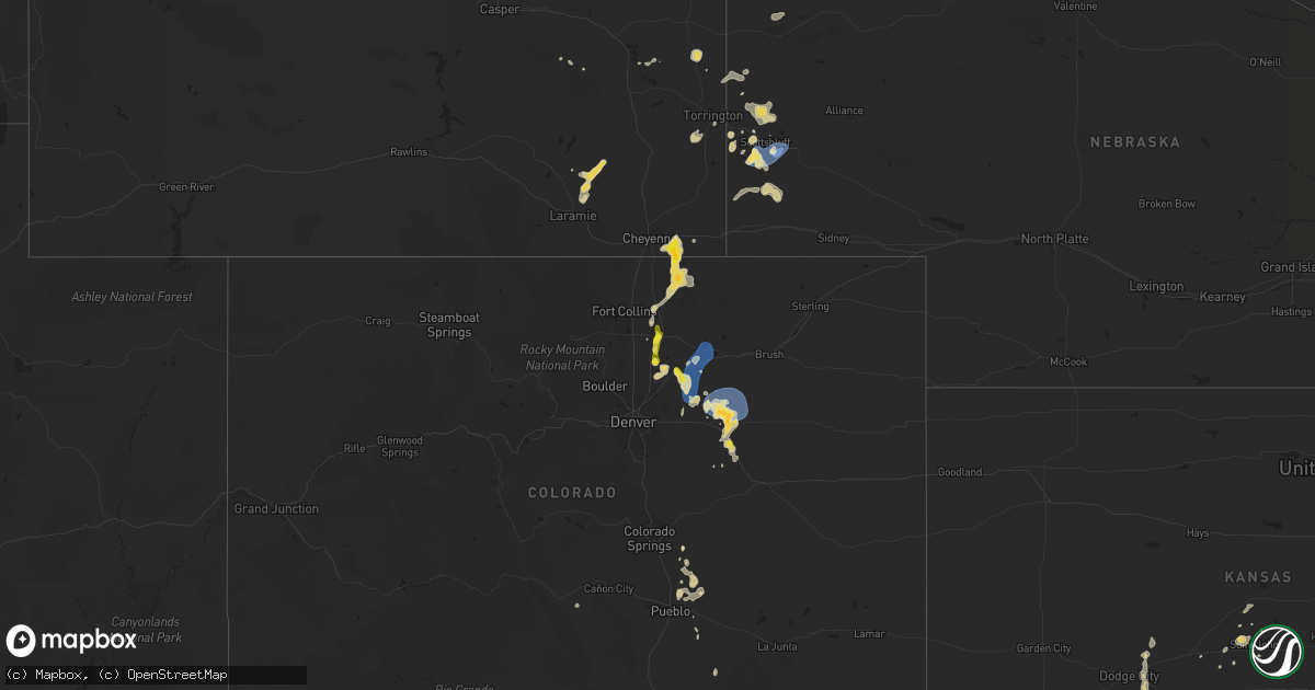
Hail Map on July 24, 2025
Get this storm
July 24 map
$229
one time, instant access
Download today. No call, no setup
Keep the $229
Bought the map and want the full workflow? Apply the entire $229 to a subscription within 7 days. None of it is wasted.
Every map, not just this one
This buys you this map. Subscription and you get every map we run, in the markets you choose from a few cities to whole states to nationwide. Plus real-time alerts the moment a storm fires.
Contact data
Name, contact info, occupancy, even credit band for addresses in the footprint. You go from where it hit to who to call.
Become the source they trust
Unlimited branding weather history reports on demand. You already have the documented answer ready for the property owner, and you are the one who showed up with it.
Property data and RoofTrace estimates
Pull up any address you have got, its value and the exact code rules for that jurisdiction, straight from One Click Code. Then RoofTrace estimates the squares, pitch, and roof value, priced the way you price.
States Impacted by Hail Map on July 24, 2025
Storm reports
Indiana
| Date | Description |
|---|---|
| 07/24/20256:17 PM CDT | Trees down in the area of sr120 and 700 e from thunderstorm outflow wind. |
| 07/24/20256:12 PM CDT | Outflow wind from thunderstorms downed an estimated 36 inch diameter tree. Tree did have a hollow spot on the inside. |
| 07/24/20256:06 PM CDT | Trees down around lake pleasant. Some smaller structures damaged as well. |
| 07/24/20253:34 PM CDT | Gyy awos. |
Nevada
| Date | Description |
|---|---|
| 07/24/20255:44 PM CDT | Mesonet station up973 3.9 sw gerlach |
Nebraska
| Date | Description |
|---|---|
| 07/24/20256:39 PM CDT | Spotter reports 75 mph wind gust with kestrel wind meter. |
| 07/24/20256:25 PM CDT | Spotter recorded 62 mph wind gust on personal weather station. Strong winds blew down their flag pole. Pea to half inch hail was also occuring at the time. |
Michigan
| Date | Description |
|---|---|
| 07/24/20255:41 PM CDT | Dispatch reports numerous trees and power lines down across the county. Hardest hit areas were lapeer... Attica... And north of imlay city. Dispatch received multiple r |
| 07/24/20255:24 PM CDT | Dispatch reports numerous trees and power lines down near millington. Photo on social media of large tree uprooted in millington as well. |
| 07/24/20254:58 PM CDT | Social media photos show large tree limb downed in clio. |
| 07/24/20254:55 PM CDT | Trees down on m-96 blocking traffic between galesburg and augusta. Time estimated from radar and power outage map. |
| 07/24/20254:55 PM CDT | Trees down on m-96 blocki |
| 07/24/20253:40 PM CDT | Dispatch reports multiple trees and power lines down in the harbor beach area. |
| 07/24/20252:55 PM CDT | Dispatch reports numerous trees and power lines down in the caseville area near the crossroads of conkey and sand rd. |
| 07/24/20252:10 PM CDT | Trained spotter reports large uprooted tree down on railroad crossing at cody estes rd. Two additional large limbs down on east mt forest rd and elevator rd. |
| 07/24/20251:40 PM CDT | Emergency manager reported multiple trees down blocking roads in moffatt twp on maple ridge rd near m-33. Also noted trees down across other parts of arenac and ogemaw |
| 07/24/20251:30 PM CDT | A few trees and power lines down. |
| 07/24/20251:28 PM CDT | Emergency manager reported tree on powerline which fell on a car. |
| 07/24/20251:20 PM CDT | Trees reported down. |
| 07/24/20251:18 PM CDT | Emergency manager reports trees down on powerlines northwest of gladwin. |
| 07/24/20251:18 PM CDT | Powerline and trees reported down. |
| 07/24/20251:01 PM CDT | Emergency manager relayed a report from the public of numerous trees down and a roof ripped off a silo. Delayed report... Time estimated via radar. |
| 07/24/202510:35 AM CDT | Numerous trees down on road with visible funnel reported. Potential tornado damage. Time estimated via radar. |
| 07/23/20257:38 PM CDT | Amateur radio reports 60 mph wind gust measured at gratiot ave and metro parkway. |
| 07/23/20257:38 PM CDT | Amateur radio reports 60 mph wind gust measured at gratiot ave and metro parkw |
| 07/23/20257:15 PM CDT | A large tree was blown down in royal oak. |
Texas
| Date | Description |
|---|---|
| 07/24/20256:33 PM CDT | A local report indicates 58 MPH wind near 2 SSW Muleshoe |
| 07/24/20254:12 PM CDT | A local report indicates 64 MPH wind near 13 W Toyavale |
| 07/23/202510:40 PM CDT | A local report indicates 68 MPH wind near 4 NNW Lake Tanglewood |
| 07/23/202510:11 PM CDT | A local report indicates 71 MPH wind near 10 SW Paducah |
| 07/23/202510:10 PM CDT | A local report indicates 69 MPH wind near 10 SW Paducah |
| 07/23/20257:29 PM CDT | Report from mping: ping pong ball |
| 07/23/20257:26 PM CDT | Photos received of straight line wind da |
| 07/23/20257:26 PM CDT | Photos received of straight line wind damage to outdoor awning. An outdoor wooden table was flipped and tree debris was noted in the area. Time estimated by radar. |
Oklahoma
| Date | Description |
|---|---|
| 07/23/20258:19 PM CDT | Report relayed by emergency management. |
| 07/23/20258:11 PM CDT | A local report indicates 60 MPH wind near Pond Creek |
| 07/23/20258:05 PM CDT | Powerlines blown down near the intersection of 16th street and keowee street. Time estimated from radar |
| 07/23/20258:05 PM CDT | Powerlines blown down near the intersection of 16th street and keowee street. Time estimated from radar. |
| 07/23/20258:00 PM CDT | Report relayed by emergency management. |
Colorado
| Date | Description |
|---|---|
| 07/24/20256:56 PM CDT | Pws-kcobyers14. |
| 07/24/20256:39 PM CDT | Pws-kcowiggi19. |
| 07/24/20256:26 PM CDT | Mesonet station co222 dearfield. |
| 07/24/20255:54 PM CDT | Weatherlink station wl-prospect valley2.52ne. |
| 07/24/20255:36 PM CDT | Report of penny to quarter size hail on the southwest side of keenesburg. Report via social media. |
| 07/24/20255:34 PM CDT | Mesonet station co038 i-76 keenesburg/hudson. |
| 07/24/20255:19 PM CDT | Report via spotternetwork. Time estimated by radar. |
| 07/24/20255:04 PM CDT | Report from mping: quarter |
| 07/24/20255:04 PM CDT | Report from mping: quarter |
| 07/24/20255:02 PM CDT | Report via social media. |
| 07/24/20254:57 PM CDT | Average size 0.5 inches... Lasted a duration of 12 minutes. |
Illinois
| Date | Description |
|---|---|
| 07/24/20255:54 PM CDT | Photo shared on social media showing a tree downed onto frontage road near manteno. Time estimated from radar. |
| 07/24/20254:00 PM CDT | Photo shared on social media showing a large tree limb downed onto a house in minooka. Another photo was shared showing a snapped tree elsewhere in minooka. Time estima |
| 07/24/20253:55 PM CDT | Photo shared on social media showing a snapped tree in channahon. Time estimated from radar. |
| 07/24/20253:33 PM CDT | Photo relayed of downed tree in romeoville on il-53 near bluff road that landed on a fence as well as the south bound lane of the road. Time estimated by radar. |
| 07/24/20253:26 PM CDT | Fence partially blown down and two fence posts snapped. |
| 07/24/20253:25 PM CDT | Multiple public reports of downed trees and large tree limbs on the northwest side of joliet. Time estimated from radar. |
| 07/24/20253:21 PM CDT | Multiple public reports of downed trees and large tree limbs in and near morris. Time estimated from radar. |
| 07/24/20253:12 PM CDT | Measured at a personal weather station. |
| 07/24/20253:10 PM CDT | Multiple public reports of downed trees and large tree limbs in plainfield. Time estimated from radar. |
| 07/24/20253:05 PM CDT | Photo shared on social media showing a tree downed onto a street in the lakeview community area of chicago. Time estimated from radar. |
| 07/24/20253:04 PM CDT | Tree down on house. |
| 07/24/20253:03 PM CDT | Photo shared on social media showing a large tree limb downed onto lawndale avenue near 31st street in the little village neighborhood of chicago. Time estimated from r |
| 07/24/20253:02 PM CDT | Measured at the midway asos. |
| 07/24/20253:01 PM CDT | Multiple public reports of downed trees on the north side of oak lawn. Time estimated from radar. |
| 07/24/20253:01 PM CDT | 2 inch diameter tree limbs also broken. |
| 07/24/20253:00 PM CDT | Tree downed onto a garage in burbank. |
| 07/24/20253:00 PM CDT | A local report indicates 72 MPH wind near 1 W Oak Lawn |
| 07/24/20253:00 PM CDT | A local report indicates 70 MPH wind near 3.0 SW Midway Airport |
| 07/24/20253:00 PM CDT | ( |
| 07/24/20253:00 PM CDT | *** 1 inj *** corrects previous report from 1 ene morgan park - chicago. Local broadcast media reports that a person suffered minor injuries after a large tree fell on |
| 07/24/20252:59 PM CDT | Power lines next to a bp gas station were downed... Causing two main gas lines to ignite. The resulting fire spread to a nearby tree before the gas lines eventually exp |
| 07/24/20252:59 PM CDT | Photo shared on social media showing a large tree limb downed in stickney. Time estimated from radar. |
| 07/24/20252:58 PM CDT | Photo shared on social media of tree downed onto wires in bridgeview. Time estimated from radar. |
| 07/24/20252:58 PM CDT | Corrects time of previous tstm wnd dmg report from 1 se riverside. Local broadcast media reports that a brick wall partially collapsed on a building near the intersecti |
| 07/24/20252:58 PM CDT | Multiple 12 inch diameter trees snapped. |
| 07/24/20252:56 PM CDT | Photo shared on social media showing a tree downed onto a road in brookfield. Time estimated from radar. |
| 07/24/20252:55 PM CDT | Multiple reports of large tree limbs downed in la grange. Time estimated from radar. |
| 07/24/20252:55 PM CDT | Tree blown down. Time estimated from radar. |
| 07/24/20252:55 PM CDT | Photo shared on social media showing a large tree limb downed onto a mobile home in justice... Caving its roof in by about a foot. Trees and power lines were downed els |
| 07/24/20252:54 PM CDT | Large tree branches downed. |
| 07/24/20252:54 PM CDT | Local broadcast media reports that a brick wall partially collapsed on a building near the intersection of ogden ave and powell ave in lyons. No injuries were reported. |
| 07/24/20252:54 PM CDT | One foot diameter tree limb down onto a power line. |
| 07/24/20252:52 PM CDT | Photo shared on social media of a large tree limb snapped in indian head park. Time estimated from radar. |
| 07/24/20252:52 PM CDT | Photos submitted of trees with large branches snapped. Time estimated by radar. |
| 07/24/20252:49 PM CDT | Photo shared on social media of approximately 3 inch diameter tree branches downed at route 83 and 63rd street. Time estimated from radar. |
| 07/24/20252:48 PM CDT | Photo shared of rotted tree downed onto street. Time estimated from radar. |
| 07/24/20252:48 PM CDT | Photo shared on social media showing a downed tree in westmont. Time estimated from radar. |
| 07/24/20252:46 PM CDT | Video received showing numerous tree branches of various sizes down near the intersection of short street and main street in lisle. |
| 07/24/20252:46 PM CDT | Photo shared of a large tree limb snapped. Time estimated from radar. |
| 07/24/20252:46 PM CDT | Based on an nws damage survey... A microburst with peak wind estimated near 80 mph started near lisle high school at the intersection of ohio court and short streets... |
| 07/24/20252:45 PM CDT | 12 inch diameter tree limb downed at oldfield road and lemont road. |
| 07/24/20252:45 PM CDT | Wires down and tree down in the road. |
| 07/24/20252:44 PM CDT | Power lines and large tree branches downed in woodridge. Damage to gutters and siding reported as well. |
| 07/24/20252:44 PM CDT | Corrects and combines previous tstm wnd dmg reports from 2 sse bolingbrook. A large... Rotting tree was snapped a few feet up at the white fence farm restaurant... Land |
| 07/24/20252:44 PM CDT | Tree branch greater than 6 inches in diameter downed in a front yard on north pinecrest road. Time estimated from radar. |
| 07/24/20252:44 PM CDT | Large tree downed at the white fence farm restaurant. Time estimated from radar. |
| 07/24/20252:44 PM CDT | Estimated 65 mph wind gusts. Numerous 3 to 6 inch diameter tree limbs down. |
| 07/24/20252:43 PM CDT | Power poles snapped. |
| 07/24/20252:38 PM CDT | Trees and wires down near naper blvd and collingwood drive. |
| 07/24/20252:38 PM CDT | Numerous trees and wires down in the vicinity. Relayed via the city of naperville. |
| 07/24/20252:38 PM CDT | Photo showed a large oak tree down in front yard. |
| 07/24/20252:37 PM CDT | Multiple public reports of downed trees and large tree limbs on the south side of naperville. Time estimated from radar. |
| 07/24/20252:35 PM CDT | Updates previous tstm wnd dmg report from 1 s yorkville. Multiple public reports of downed trees on the south side of yorkville. Time estimated from radar. |
| 07/24/20252:35 PM CDT | Tree downed on the south side of yorkville. Time estimated from radar. |
| 07/24/20252:28 PM CDT | Tree downed onto a house. Time estimated from radar. |
| 07/24/20252:28 PM CDT | Multiple reports of trees and wires downed across aurora. |
| 07/24/20252:28 PM CDT | Multiple trees downed on the east side of north aurora. Time estimated from radar. |
| 07/24/20252:26 PM CDT | A local report indicates 60 MPH wind near 2 WSW Montgomery |
| 07/24/20252:26 PM CDT | Photo shared of a downed large tree limb that crushed the hood of a sedan. Time estimated from radar. |
| 07/24/20252:25 PM CDT | Numerous wires down. |
| 07/24/20252:24 PM CDT | Large tree branches and limbs downed in oswego. Time estimated from radar. |
| 07/24/20252:24 PM CDT | Videos show two downed trees in millbrook. Time estimated from radar. |
New Mexico
| Date | Description |
|---|---|
| 07/24/20254:49 PM CDT | Quarter sized hail reported. |
Kansas
| Date | Description |
|---|---|
| 07/23/20258:48 PM CDT | A local report indicates 1.00 inch wind near Newton |
| 07/23/20258:40 PM CDT | Courtesy of kwch. |
Louisiana
| Date | Description |
|---|---|
| 07/24/20256:16 PM CDT | Asos station klch lake charles. |
| 07/24/20256:12 PM CDT | Received photo of tree snapped about 8 feet off the ground. |
| 07/24/20256:08 PM CDT | Photos received via social media of thunderstorm damage at the jellystone rv park. Tree was snapped off approximately 5 feet up the trunk and fell onto an rv. Time esti |
Cities Impacted by Hail Map on July 24, 2025
- Elmira, MI
- Vanderbilt, MI
- Boyne Falls, MI
- Onaway, MI
- Millersburg, MI
- Rogers City, MI
- Afton, MI
- Johannesburg, MI
- Hawks, MI
- Presque Isle, MI
- Hillman, MI
- Lachine, MI
- Posen, MI
- Saint Helen, MI
- Roscommon, MI
- Prudenville, MI
- Harrison, MI
- Tererro, NM
- Gladwin, MI
- Hale, MI
- Laramie, WY
- Whittemore, MI
- Glennie, MI
- South Branch, MI
- Lupton, MI
- Long Lake, MI
- Bosler, WY
- Sandwich, IL
- Somonauk, IL
- Hinckley, IL
- Douglas, WY
- Wheatland, WY
- Naperville, IL
- Aurora, IL
- Sugar Grove, IL
- Newark, IL
- Sheridan, IL
- Plano, IL
- Big Rock, IL
- Montgomery, IL
- Bristol, IL
- Yorkville, IL
- North Aurora, IL
- Evanston, IL
- Serena, IL
- Oswego, IL
- Lombard, IL
- Glen Ellyn, IL
- Lisle, IL
- Wheaton, IL
- Batavia, IL
- Chicago, IL
- Moore Haven, FL
- Plainfield, IL
- Villa Park, IL
- Elmhurst, IL
- Oak Brook, IL
- Downers Grove, IL
- Hillside, IL
- Berkeley, IL
- Warrenville, IL
- Bellwood, IL
- Seneca, IL
- Minooka, IL
- Westchester, IL
- La Grange Park, IL
- Melrose Park, IL
- Broadview, IL
- Akron, MI
- Brookfield, IL
- Westmont, IL
- Hinsdale, IL
- Maywood, IL
- La Grange, IL
- Riverside, IL
- Western Springs, IL
- Stone Park, IL
- Clarendon Hills, IL
- Morris, IL
- Joliet, IL
- Hometown, IL
- Burbank, IL
- Berwyn, IL
- Blue Island, IL
- Summit Argo, IL
- Chicago Ridge, IL
- Riverdale, IL
- Cicero, IL
- Alsip, IL
- Evergreen Park, IL
- Bridgeview, IL
- Oak Lawn, IL
- Madison, KS
- Gridley, KS
- Labelle, FL
- Greenfield, IN
- Mooseheart, IL
- Romeoville, IL
- Lockport, IL
- Shorewood, IL
- Dearborn, MO
- Ottawa, IL
- Marseilles, IL
- Gower, MO
- Burlington, KS
- Channahon, IL
- Saint Johns, MI
- Agency, MO
- Glyndon, MN
- Andrews, TX
- Trimble, MO
- Plattsburg, MO
- Edgerton, KS
- Childress, TX
- Paola, KS
- Covert, MI
- Coloma, MI
- Grand Ridge, IL
- Hollis, OK
- Spring Hill, KS
- Abbeville, LA
- Bangor, MI
- South Haven, MI
- Grand Junction, MI
- Glendo, WY
- Yoder, WY
- Hamilton, MO
- Kingston, MO
- Cotopaxi, CO
- Cleveland, MO
- Bucyrus, KS
- Louisburg, KS
- Stilwell, KS
- Belton, MO
- Canyon, TX
- Claude, TX
- Peculiar, MO
- Streator, IL
- Hamilton, KS
- Matador, TX
- Cowgill, MO
- Polo, MO
- Gillette, WY
- Burlington, OK
- Pleasant Hill, MO
- Braymer, MO
- Marlette, MI
- Taiban, NM
- Platteville, CO
- La Salle, CO
- Gilcrest, CO
- Fort Lupton, CO
- Greeley, CO
- Evans, CO
- Ransom, IL
- Rutland, IL
- Mooreland, OK
- Jay Em, WY
- Torrington, WY
- Flushing, MI
- Montrose, MI
- Mount Morris, MI
- Clio, MI
- Virgil, KS
- Lawson, MO
- Freeman, MO
- Lamesa, TX
- Jet, OK
- Wakita, OK
- Helena, OK
- Dawn, MO
- Cherokee, OK
- Harrisonville, MO
- Dana, IL
- Waynoka, OK
- Lyman, NE
- Eureka, KS
- Cheyenne, WY
- Harrison, NE
- Hudson, CO
- Norborne, MO
- Douglass, KS
- Nash, OK
- Alva, OK
- Oxford, KS
- Carpenter, WY
- Keenesburg, CO
- Lathrop, MO
- Rock, KS
- Gallatin, MO
- Carmen, OK
- Shamrock, TX
- Cheyenne, OK
- Sharon, OK
- Canadian, TX
- Morrill, NE
- Utica, MO
- Mobeetie, TX
- Mooresville, MO
- Gould, OK
- Wheeler, TX
- Medford, OK
- Fargo, OK
- Woodward, OK
- Odessa, MO
- Mayview, MO
- Mitchell, NE
- Bennett, CO
- Ludlow, MO
- Lake Charles, LA
- Iowa, LA
- Sulphur, LA
- Hackberry, LA
- Cameron, LA
- Kersey, CO
- Wiggins, CO
- Roggen, CO
- Orchard, CO
- Rozet, WY
- Flomot, TX
- Quanah, TX
- Paducah, TX
- Scottsbluff, NE
- Happy, TX
- Ault, CO
- Nunn, CO
- Grover, CO
- Gering, NE
- Brighton, CO
- Kingsville, MO
- Holden, MO
- Fort Supply, OK
- Dacoma, OK
- Dimondale, MI
- Lansing, MI
- Mason, MI
- Holt, MI
- Strasburg, CO
- Pond Creek, OK
- Alliance, NE
- Burns, WY
- Bluff City, KS
- Caldwell, KS
- Waverly, MO
- Hale, MO
- Wellington, KS
- Quitaque, TX
- Turkey, TX
- Minatare, NE
- Harrisburg, NE
- Milliken, CO
- Deridder, LA
- Byers, CO
- Morton, TX
- Pierce, CO
- Lane, KS
- Osawatomie, KS
- Chester, OK
- Colorado Springs, CO
- Bayard, NE
- Melbeta, NE
- Clayton, NM
- Crawford, NE
- Goltry, OK
- Raymore, MO
- Eaton, CO
- Conchas Dam, NM
- Clarendon, TX
- Tatum, NM
- Charlotte, MI
- Deer Trail, CO
- Fort Morgan, CO
- Starks, LA
- Ringwood, OK
- Cleo Springs, OK
- Yreka, CA
- Sudan, TX
- Agate, CO
- Sweet Springs, MO
- Homosassa, FL
- Malta Bend, MO
- Tampa, FL
- Bonanza, OR
- Muleshoe, TX
- Amherst, TX
- Plainview, TX
- Lockney, TX
- Kress, TX
- Silverton, TX
- Higginsville, MO
- Kremlin, OK
- Humboldt, KS
- Chanute, KS
- Enid, OK
- El Dorado, KS
- Inglis, FL
- Dunnellon, FL
- Newton, KS
- La Cygne, KS
- Meno, OK
- Odessa, FL
- Crystal River, FL
- Elmer, MO
- Fort Jones, CA
- Booker, TX
- Hale Center, TX
- Avondale, CO
- Halstead, KS
- Walton, KS
- Minneola, KS
- Rushville, IL
- Sedgwick, KS
- Valley Center, KS
- Carrier, OK
- Bucklin, KS
- Hereford, TX
- Perryton, TX
- Miami, TX
- Timewell, IL
- Towanda, KS
- Benton, KS
- Summerfield, TX
- Roaring Springs, TX
- Dickens, TX
- Ford, KS
- Chillicothe, TX
- Laverne, OK
- Friona, TX
- Wright, KS
- Dodge City, KS
- Brandon, FL
- Amarillo, TX
- Spearville, KS
- Big Springs, NE
- Jetmore, KS
- Peabody, KS
- Atlanta, MO
- Amsterdam, MO
- Belpre, KS
- Marshall, MO
- Blackburn, MO
- Stinnett, TX
- Hanston, KS
- Mutual, OK
- Marathon, TX
- Hesston, KS
- Boone, CO
- Pampa, TX
- Adrian, MO
- St John, KS
- Haviland, KS
- Macksville, KS
- Larned, KS
- Crane, TX
- Great Bend, KS
- Augusta, KS
- Sayre, OK
- Garden City, TX
- Hudson, KS
- Groom, TX
- Piedmont, KS
- Leon, KS
- Spur, TX
- Atlanta, KS
- Snyder, TX
- Woodridge, IL
- Darien, IL
- Willowbrook, IL
- Bolingbrook, IL
- Milnesand, NM
- Lyons, IL
- Hines, IL
- Forest Park, IL
- Willow Springs, IL
- Justice, IL
- Hickory Hills, IL
- Worth, IL
- Palos Hills, IL
- Hammond, IN
- Lemont, IL
- Elmwood Park, IL
- River Grove, IL
- River Forest, IL
- Addison, IL
- Oak Park, IL
- Turpin, OK
- Fort Davis, TX
- Hunter, OK