Hail Map in West Monroe, LA on September 16, 2025
The weather event in West Monroe, LA on September 16, 2025 includes Wind and Hail maps. 16 states and 530 cities were impacted and suffered possible damage. The total estimated number of properties impacted is 1.
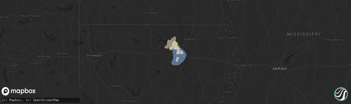
Wind
Hail
1
Estimated number of impacted properties by a 1.00" hail or larger0
Estimated number of impacted properties by a 1.75" hail or larger0
Estimated number of impacted properties by a 2.50" hail or largerStorm reports in West Monroe, LA
West Monroe, LA
| Date | Description |
|---|---|
| 09/16/20256:15 PM CDT | Trees and power lines down around whites ferry road area near pinecrest and wall williams road. Report via social media. |
| 09/16/20256:15 PM CDT | Corrects previous tstm wnd dmg report from 2 ene claiborne. Trees and power lines down around whites ferry road area near pinecrest and wall williams road. Report via s |
| 09/16/20256:10 PM CDT | Trees down on roads and power lines in the kiroli park area of west monroe. |
| 09/16/20256:07 PM CDT | Social media report of trees and power lines down on belmont drive. |
| 09/16/20256:05 PM CDT | Report of light pole down across constitution drive near red rood inn... Via social media. |
All States Impacted by Hail Map on September 16, 2025
All Cities Impacted by Hail Map on September 16, 2025
- Dallas, SD
- Platte, SD
- Chadron, NE
- Gregory, SD
- Hay Springs, NE
- Burke, SD
- Crawford, NE
- Whitney, NE
- Dexter, IA
- Redfield, IA
- Ellsworth, NE
- Bingham, NE
- Kosciusko, MS
- Sallis, MS
- Stuart, IA
- Britt, IA
- Vaughn, NM
- Woodburn, IA
- Lakeside, NE
- Kanawha, IA
- Garner, IA
- Magdalena, NM
- Ashby, NE
- Merriman, NE
- Castalian Springs, TN
- Hartsville, TN
- Lebanon, TN
- Fort Lauderdale, FL
- Hollywood, FL
- Miami, FL
- Miami Gardens, FL
- Hyannis, NE
- Goodell, IA
- Arthur, NE
- Lemoyne, NE
- Culbertson, NE
- Tallulah, LA
- Oshkosh, NE
- Roosevelt, UT
- McCook, NE
- Branson, MO
- Kilgore, NE
- Somers, IA
- Callender, IA
- Newellton, LA
- Osborne, KS
- Mason City, IA
- Indianola, MS
- Valentine, NE
- Louise, MS
- Silver City, MS
- Osceola, IA
- New Virginia, IA
- Mitchellville, IA
- Lu Verne, IA
- Livermore, IA
- Oberlin, LA
- Imperial, NE
- Benkelman, NE
- Hollister, MO
- Colfax, IA
- Joplin, MO
- Moorland, IA
- Downs, KS
- Coalmont, CO
- Damar, KS
- Cascilla, MS
- Bode, IA
- Alva, OK
- Portis, KS
- Ogallala, NE
- Keystone, NE
- Saint Joseph, LA
- Hoxie, KS
- Lamar, CO
- Champion, NE
- Bogue, KS
- Stockton, KS
- Van Buren, AR
- Gilbert, LA
- Clayton, LA
- Maywood, NE
- La Porte City, IA
- Evansdale, IA
- Waterloo, IA
- Lapoint, UT
- Fort Duchesne, UT
- Selden, KS
- Inverness, MS
- Rolling Fork, MS
- Cassville, MO
- Exeter, MO
- Estancia, NM
- Anguilla, MS
- Ocate, NM
- Wagon Mound, NM
- Natoma, KS
- Philadelphia, MS
- Doddsville, MS
- Boyle, MS
- Shaw, MS
- Springfield, CO
- Palisade, NE
- Enders, NE
- Clear Lake, IA
- Thornton, IA
- Lakin, KS
- Bradgate, IA
- Rockwell, IA
- Quapaw, OK
- Johnson, KS
- Sunflower, MS
- Goldfield, IA
- Myakka City, FL
- Washburn, MO
- Holcomb, MS
- Greenwood, MS
- Galena, KS
- Riverton, KS
- Lake Wales, FL
- Frostproof, FL
- Yazoo City, MS
- Vernal, UT
- Tridell, UT
- Venango, NE
- Grant, NE
- Burt, IA
- Lone Rock, IA
- Rockwell City, IA
- Lohrville, IA
- Alton, KS
- Waldo, KS
- Swaledale, IA
- McCune, KS
- Scammon, KS
- Norcatur, KS
- Wauneta, NE
- Rutland, IA
- Renwick, IA
- Apache, OK
- Freedom, OK
- Manson, IA
- Stratton, NE
- Miami, OK
- Fort Smith, AR
- Baxter Springs, KS
- Eureka Springs, AR
- Berryville, AR
- Fort Collins, CO
- Columbus, KS
- Paxton, NE
- Sutherland, NE
- Corwith, IA
- Ottosen, IA
- Creston, IA
- Redfield, KS
- Uniontown, KS
- Powell, MO
- Afton, IA
- Bradenton, FL
- Wilsonville, NE
- Ulysses, KS
- Picher, OK
- Treece, KS
- Las Vegas, NM
- Anton Chico, NM
- Hardy, IA
- Algona, IA
- West Bend, IA
- Cedar Falls, IA
- Cameron, MO
- Trenton, NE
- Wilder, TN
- Holly Bluff, MS
- Gilmore City, IA
- Kingston, AR
- Rockford, IA
- Windsor, CO
- Mooreland, OK
- Hudson, IA
- Huntsville, AR
- Rolfe, IA
- Osage, IA
- Sheffield, IA
- Lathrop, MO
- Bearden, AR
- Ackerman, MS
- West Mineral, KS
- Nora Springs, IA
- Dougherty, IA
- Hepler, KS
- Camden, AR
- Crawford, TN
- Leland, MS
- Oberlin, KS
- Marble Rock, IA
- Alexander, IA
- Pocahontas, IA
- Rudd, IA
- Whittemore, IA
- Tryon, NE
- Paradise, KS
- Wood Lake, NE
- Floyd, IA
- Orchard, IA
- Crumrod, AR
- Lamar, MO
- Algodones, NM
- Crane, MO
- Mallard, IA
- Eaton, CO
- Ault, CO
- Johnstown, NE
- Springview, NE
- Sparks, NE
- Indianola, NE
- Hampton, IA
- Fonda, IA
- Curlew, IA
- Liberal, MO
- Aredale, IA
- Marionville, MO
- Placitas, NM
- Fairland, OK
- Bartlett, KS
- Chetopa, KS
- Havelock, IA
- Billings, MO
- Buckingham, IA
- Strasburg, CO
- Bennett, CO
- Oswego, KS
- Mellwood, AR
- Conway, AR
- Laurens, IA
- Jonesville, LA
- Ainsworth, NE
- Long Pine, NE
- Ackley, IA
- Julesburg, CO
- Jolley, IA
- Girard, KS
- Bastrop, LA
- Walnut, KS
- Byers, CO
- Geneva, IA
- Dumont, IA
- Kiowa, CO
- Hugo, CO
- Dover, AR
- Rexford, KS
- Woodston, KS
- Witter, AR
- Colby, KS
- Morton, MS
- Emmetsburg, IA
- Hamburg, AR
- Pelahatchie, MS
- Hayes Center, NE
- Charles City, IA
- Wesley, AR
- Bates City, MO
- Sac City, IA
- Lytton, IA
- Russellville, AR
- London, AR
- Deer Trail, CO
- Monterey, LA
- Big Springs, NE
- Lake, MS
- Forest, MS
- Lexington, NE
- Pettigrew, AR
- Saint Paul, AR
- Shawnee, KS
- Greene, IA
- Allison, IA
- Bristow, IA
- Baskin, LA
- Rayville, LA
- Delhi, LA
- Atwood, KS
- Nashua, IA
- Haigler, NE
- Mission, KS
- Babbitt, MN
- Elkins, AR
- Liberal, KS
- Ely, MN
- Hershey, NE
- North Platte, NE
- Orrick, MO
- Willard, MO
- Republic, MO
- Kansas City, KS
- Pulaski, MS
- Clarksville, IA
- Early, IA
- Parks, NE
- Bois D Arc, MO
- Ash Grove, MO
- Wray, CO
- Kansas City, MO
- Palmer, IA
- Greenwood, AR
- Springfield, MO
- Holyoke, CO
- Amherst, CO
- Pottsville, AR
- Kismet, KS
- Plainfield, IA
- Waverly, IA
- Monroe, LA
- Downsville, LA
- West Monroe, LA
- Max, NE
- Fort Morgan, CO
- Woodrow, CO
- Stapleton, NE
- Shell Rock, IA
- Isabella, MN
- Lawrence, MS
- Gibbon, NE
- Shelton, NE
- Farmerville, LA
- Kaplan, LA
- Sterlington, LA
- Spencer, IA
- Hill City, KS
- Stanley, NM
- Mount Vernon, AR
- Lawson, MO
- Oak Grove, LA
- Pioneer, LA
- Eddyville, NE
- Ludell, KS
- Herndon, KS
- Nemaha, IA
- Acme, LA
- Pomeroy, IA
- Glade, KS
- Arnold, NE
- Akron, CO
- Lindon, CO
- Sumner, NE
- McDonald, KS
- Deridder, LA
- Pitkin, LA
- Lenora, KS
- Fort Dodge, IA
- Knierim, IA
- Saint Francis, KS
- Anselmo, NE
- Overton, NE
- Excelsior Springs, MO
- Rayville, MO
- Idalia, CO
- El Dorado, AR
- Merna, NE
- Marion, LA
- Cherokee, IA
- Broken Bow, NE
- Wahoo, NE
- Mason City, NE
- Oconto, NE
- Stephens, AR
- Ithaca, NE
- Fleming, CO
- Hardesty, OK
- Mountain Lake, MN
- Clare, IA
- Winnsboro, LA
- Ansley, NE
- Waverly, NE
- Crook, CO
- Logan, IA
- Missouri Valley, IA
- Aurelia, IA
- Bird City, KS
- Ceresco, NE
- Ashland, NE
- Saint Martinville, LA
- McNeil, AR
- Bingham Lake, MN
- Sedgwick, CO
- Duncombe, IA
- Otho, IA
- Lehigh, IA
- Burnside, IA
- Dayton, IA
- Choudrant, LA
- Ruston, LA
- Blair, NE
- Arcadia, NE
- Kennard, NE
- Arlington, NE
- Goodland, KS
- Burlington, CO
- Kanorado, KS
- Sheldon, IA
- Ashton, IA
- Sanborn, IA
- Bunkie, LA
- Westerville, NE
- Farnhamville, IA
- Barnum, IA
- Ord, NE
- Herman, NE
- Fremont, NE
- Independence, MO
- Fayetteville, AR
- Comstock, NE
- Loup City, NE
- North Loup, NE
- Scotia, NE
- Greenfield, IA
- Marcus, IA
- Valley, NE
- Magnolia, AR
- Hartsel, CO
- Greeley, NE
- Elyria, NE
- Melvin, IA
- Sleepy Eye, MN
- Remsen, IA
- Dunlap, IA
- Winterset, IA
- Menlo, IA
- Modale, IA
- Mondamin, IA
- Elm Creek, NE
- Miller, NE
- Macksburg, IA
- Stratford, IA
- Scribner, NE
- Hartley, IA
- Pilot Mound, IA
- Nickerson, NE
- Yutan, NE
- Colon, NE
- Dow City, IA
- Wolbach, NE
- Schuyler, NE
- Panora, IA
- Minden, NE
- Lynch, NE
- Eros, LA
- Ulysses, NE
- Leigh, NE
- Clarkson, NE
- Edson, KS
- Brewster, KS
- Arion, IA
- Rising City, NE
- Hooper, NE
- Holstein, IA
- David City, NE
- Levant, KS
- Rogers, NE
- Adel, IA
- Denison, IA
- Schleswig, IA
- Howells, NE
- Minburn, IA
- Quimby, IA
- Washta, IA
- Kenesaw, NE
- Columbus, NE
- Ida Grove, IA
- Battle Creek, IA
- Bellwood, NE
- Bruno, NE
- Wood River, NE
- Danbury, NE
- Heartwell, NE
- Perry, IA
- Brainard, NE
- Valparaiso, NE
- Dwight, NE
- Glidden, IA
- West Point, NE
- Dodge, NE
- Wisner, NE
- Juniata, NE
- Roseland, NE
- Holstein, NE
- Orient, IA
- Grand Junction, IA
- Weston, NE
- Bladen, NE
- Anthon, IA
- Ogden, IA
- Dresden, KS
- Tekamah, NE
- Jennings, KS
- Linden, IA
- Guthrie Center, IA
- Leawood, KS
- Sergeant Bluff, IA
- Casey, IA
- Ellis, KS
- Ogallah, KS
- Plainville, KS
- Woodbine, IA
- Linwood, NE
- Catharine, KS
- Victoria, KS
- Hays, KS
- Defiance, IA
- Calhoun, LA
- Lucas, KS
- Bennington, NE
- Washington, NE
- Luray, KS
- Sylvan Grove, KS
- Kimball, SD
- Baileyville, KS
- Greenwood, NE
- Pawnee City, NE
- Madison, SD
- Ramona, SD
- Bruce, SD
- Volga, SD
- Brookings, SD
- Mead, NE
- Star Prairie, WI
- Clayton, NM
- Clayton, WI
- Osceola, WI
- Sioux Falls, SD


