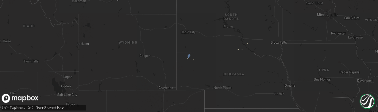
Hail Map on September 16, 2025
The weather event on September 16, 2025 includes Wind and Hail maps. 16 states and 530 cities were impacted and suffered possible damage. The total estimated number of properties impacted is 46,736.
Want more than just the map?
Turn this storm into a full workflow.
- Owner + property data so you know who to knock
- OnDemand branded weather history reports to win the "did we even have hail?" argument
- RoofTrace estimate so reps stop guessing numbers at the door
Bought this map? Upgrade within 7 days and we'll credit the $230. (10-15 min setup call)
Wind
Hail
46,736
Estimated number of impacted properties by a 1.00" hail or larger7,473
Estimated number of impacted properties by a 1.75" hail or larger4,977
Estimated number of impacted properties by a 2.50" hail or largerStates Impacted by Hail Map on September 16, 2025
Storm reports
Florida
| Date | Description |
|---|---|
| 09/16/20252:06 PM CDT | Broward county sheriffs office reports all lanes of sr-848 at sw 35th ave are closed due to downed powerline in hollywood in relation to a strong thunderstorm that move |
| 09/16/20252:00 PM CDT | Miramar police reports a fallen tree is obstructing a lane at the intersection of pembroke road and 62nd ave... In relation to a strong thunderstorm that moved over the |
| 09/16/20251:45 PM CDT | Asos station khwo pembroke pines reported a wind gust of 52 kts/60 mph associated with a strong thunderstorm. Station elevation is 7 ft. |
South Dakota
| Date | Description |
|---|---|
| 09/15/20257:35 PM CDT | Report from mping: quarter |
Iowa
| Date | Description |
|---|---|
| 09/16/20256:59 PM CDT | Delayed report. Several small branches down. Bark stripped off trees just before 7p. |
| 09/16/20256:20 PM CDT | Quarter sized hail reported on the east side of charles city. |
| 09/16/20256:05 PM CDT | Report from mping: quarter |
| 09/16/20256:05 PM CDT | Report provided via social media. |
| 09/16/20255:25 PM CDT | Delayed report. Pictures of hail up to half-dollar sized. |
| 09/16/20255:19 PM CDT | Most hail was quarter to ping pong ball sized. |
| 09/16/20254:25 PM CDT | Reported from the public library. |
| 09/16/20254:00 PM CDT | Delayed report via social media. |
| 09/16/20253:45 PM CDT | Sheets of dime to quarter size hail. |
| 09/16/20253:37 PM CDT | A local report indicates 1.00 inch wind near 1 SW Evansdale |
| 09/15/20259:42 PM CDT | Hail mostly pea to dime... But several stones from quarter up to golf ball size. |
| 09/15/20258:25 PM CDT | A local report indicates 1.25 inch wind near 4 SW Melvin |
| 09/15/20258:25 PM CDT | Wind gust measured by the waterloo asos. Time from metar. |
| 09/15/20258:25 PM CDT | (fs |
| 09/15/20257:59 PM CDT | Trained spotter reported nickel to quarter sized hail in fort dodge. |
| 09/15/20257:35 PM CDT | Peak gust of 58 mph reported by the fort dodge awos. Time taken from metar. |
Tennessee
| Date | Description |
|---|---|
| 09/16/20252:53 PM CDT | Tspotter report shows large branches down on bell rd near nashville shores. |
| 09/16/20252:51 PM CDT | Tree snapped in half near john hagar and south new hope. Time estimated by radar. |
Mississippi
| Date | Description |
|---|---|
| 09/16/20255:35 PM CDT | Penny to quarter size. |
| 09/16/20255:30 PM CDT | A local report indicates 1.50 inch wind near 2 NNE Homewood |
| 09/16/20254:13 PM CDT | A tree and a power pole down along hargrave road and us 61 n. |
Louisiana
| Date | Description |
|---|---|
| 09/16/20256:48 PM CDT | Penny to quarter size hail reported in the crossroads community. |
| 09/16/20256:20 PM CDT | Report of quarter hail on social media in the rocky branch community. |
| 09/16/20256:20 PM CDT | A tree fell on a house. |
| 09/16/20256:15 PM CDT | Corrects previous tstm wnd dmg report from 2 ene claiborne. Trees and power lines down around whites ferry road area near pinecrest and wall williams road. Report via s |
| 09/16/20256:15 PM CDT | Trees and power lines down around whites ferry road area near pinecrest and wall williams road. Report via social media. |
| 09/16/20256:15 PM CDT | Several trees down on roads in and around the rocky branch community. This includes...john haye rd... Rocky branch rd... Roan rd... And chapman rd. Also... A tree fell |
| 09/16/20256:10 PM CDT | Trees down on roads and power lines in the kiroli park area of west monroe. |
| 09/16/20256:07 PM CDT | Social media report of trees and power lines down on belmont drive. |
| 09/16/20256:05 PM CDT | Report of light pole down across constitution drive near red rood inn... Via social media. |
| 09/16/20255:50 PM CDT | Trees down on road and power lines on park avenue and loop road in northern sections of the city of monroe. |
| 09/16/20255:41 PM CDT | Measured at |
| 09/16/20255:40 PM CDT | Reported along la hwy 583. |
| 09/16/20255:40 PM CDT | A few trees down on finks hideaway road in north monroe... Near the intersection with old sterlington road and just east of fire station. |
| 09/16/20255:38 PM CDT | Corrects previous tstm wnd gst report from 3 e monroe. Measured at |
| 09/16/20255:25 PM CDT | Report of downed utility pole and power lines across stubbs vinson road near us highway 80 via social media. |
| 09/16/20254:07 PM CDT | A couple of trees were blown down on rock road. |
| 09/15/20257:20 PM CDT | Social media post of tree down in the yard of a residence in the choudrant/sibley area in eastern lincoln parish. |
New Mexico
| Date | Description |
|---|---|
| 09/16/20254:00 PM CDT | Asos station klvs las vegas muni airport. Likely caused by a wet microburst. |
Missouri
| Date | Description |
|---|---|
| 09/16/20256:46 PM CDT | Social media report of mostly pea to nickel size hail with a few stones up to quarter size between independence and blue springs. Time and location estimated from radar |
| 09/16/20256:35 PM CDT | 635 pm spotter reported quarter size hail... 40mph gusts... 1.5 miles east of ash grove. |
| 09/16/20256:27 PM CDT | Report from mping... Quarter... 1.00 in. |
| 09/16/20256:20 PM CDT | Several large tree limbs down. |
| 09/16/20256:20 PM CDT | Several large tree limbs down. |
| 09/16/20256:18 PM CDT | Power poles snapped and s |
| 09/16/20256:18 PM CDT | Power poles snapped and some structural damage. |
| 09/16/20256:10 PM CDT | A social media picture showed hail to the size of quarters in willard with a storm around 610pm. |
| 09/16/20256:05 PM CDT | Social media report of a large tree down on a property in rural ray county. Another report of up to quarter size hail north of orrick. Time and location estimated based |
| 09/16/20255:29 PM CDT | Report from mping... Quarter... 1.00 in. |
| 09/16/20255:24 PM CDT | Kshb-tv viewer shares photo of shed roof damage south of bates city. Stronger storm with subtle downburst divergence signature noted. Time estimated from radar. |
| 09/16/20253:32 PM CDT | A local report indicates 1.25 inch wind near 3 E I-44 Near Mile Mar |
| 09/16/20252:45 PM CDT | A few large trees down. |
| 09/15/20257:00 PM CDT | Kshb-tv viewer showed picture of 1 inch hail near parkville. |
Arkansas
| Date | Description |
|---|---|
| 09/16/20256:55 PM CDT | Sheriff office reports trees down on gladys street in magnolia. |
| 09/16/20256:17 PM CDT | A local report indicates 1.00 inch wind near 3 SE Durham |
| 09/15/20257:00 PM CDT | Sheriff office reports trees down across the west side of magnolia on west north street...south heights street...and pecan street. |
| 09/15/20257:00 PM CDT | Some trees were damaged and some metal sheeting panels were blown off a metal shop building. Time is estimated from radar. |
Utah
| Date | Description |
|---|---|
| 09/16/20253:22 PM CDT | A local report indicates 1.00 inch wind near 9 ESE Whiterocks |
Kansas
| Date | Description |
|---|---|
| 09/16/20256:56 PM CDT | Photo of 1 3/4 inch hail currently falling in atwood. |
| 09/16/20256:50 PM CDT | Ongoing quarter sized hail as of 6 pm mdt. |
| 09/16/20256:22 PM CDT | Tree uprooted... Tree may not have been in good health. |
| 09/16/20256:12 PM CDT | Social media picture of quarter size hail. |
| 09/16/20256:10 PM CDT | Social media photo of hail up to half dollar size on knox street. Time estimated from radar. |
| 09/16/20256:09 PM CDT | Several reports of downed tree limbs and hail up to quarter size on 53rd street. Time estimated from radar. |
| 09/16/20256:08 PM CDT | A local report indicates 1.75 inch wind near 2 W Merriam |
| 09/16/20256:07 PM CDT | Report from mping: quarter |
| 09/16/20256:05 PM CDT | A local report indicates 1.00 inch wind near 1 NW Merriam |
| 09/16/20256:00 PM CDT | Report from mping: quarter |
| 09/16/20254:00 PM CDT | Mostly had pea size hail. |
| 09/16/20254:00 PM CDT | Report from mping... Ping pong ball 1.50 in. |
| 09/16/20254:00 PM CDT | Report from mping... Quarter... 1.00 in. |
| 09/15/202511:21 PM CDT | A local report indicates 62 MPH wind near 2 E Shallow Water |
| 09/15/202510:15 PM CDT | Awos station koin oberlin. |
| 09/15/20258:34 PM CDT | Ksyf at the st. Francis airport reported the wind gust. |
| 09/15/20258:34 PM CDT | 1 inch hail reported. Accumulating hail also reported with heavy rain. |
| 09/15/20258:25 PM CDT | Weather underground site kkssaint20 reported the wind gust. |
| 09/15/20257:44 PM CDT | Ksyf airport. |
| 09/15/20257:39 PM CDT | A local report indicates 1.50 inch wind near 5 WNW Herndon |
| 09/15/20257:14 PM CDT | A local report indicates 1.50 inch wind near Atwood |
| 09/15/20257:11 PM CDT | Lasted 8 minutes. |
| 09/15/20257:10 PM CDT | Trained spotter reports a lot of 1-1.25 inch hail... Enough to cover the ground. |
| 09/15/20257:10 PM CDT | Corrects previous hail report from 2 nne ludell. Trained spotter reports a lot of 1-1.50 inch hail... Enough to cover the ground. |
Nebraska
| Date | Description |
|---|---|
| 09/16/20256:45 PM CDT | Photo sent via facebook. |
| 09/16/20256:13 PM CDT | Report from mping: quarter |
| 09/16/20255:47 PM CDT | Kmck asos reported the wind gust. |
| 09/16/20255:43 PM CDT | Measured 3.15 inches; picture received of windshield caving in and small side window broken on vehicle. |
| 09/16/20255:42 PM CDT | Measured 3.4 inch hail picked up at 6 pm mt. |
| 09/16/20255:42 PM CDT | 3.5 inch hail... Unsure of when picture was sent. |
| 09/16/20255:18 PM CDT | Still falling. |
| 09/16/20255:17 PM CDT | Report from mping: hen egg |
| 09/16/20255:14 PM CDT | A local report indicates 60 MPH wind near 8 W Ainsworth |
| 09/16/20255:07 PM CDT | A local report indicates 60 MPH wind near Valentine |
| 09/16/20255:04 PM CDT | Report from mping: quarter |
| 09/16/20254:55 PM CDT | Report from mping: hen egg+ |
| 09/16/20254:54 PM CDT | Caller also reports torrential rainfall. |
| 09/16/20254:53 PM CDT | Half dollar size hail relayed from local media j |
| 09/16/20254:53 PM CDT | Half dollar size hail relayed from local media just east of roscoe on i-80.. |
| 09/16/20254:52 PM CDT | Asos station kvtn valentine airport. |
| 09/16/20254:51 PM CDT | Rep |
| 09/16/20254:51 PM CDT | Report of golf ball sized hail in mccook. |
| 09/16/20254:38 PM CDT | Photo of an estimated 3.1 inch hail stone 2 miles northwest of mccook. |
| 09/16/20254:27 PM CDT | A local report indicates 1.00 inch wind near Roscoe |
| 09/16/20254:15 PM CDT | Public report of 2 inch hail in mccook at the fair grounds. |
| 09/16/20254:14 PM CDT | Relayed report of damaged roof due to ping pong to golf ball sized hail. |
| 09/16/20254:12 PM CDT | A local report indicates 1.50 inch wind near Enders |
| 09/16/20254:08 PM CDT | Trained spotter report of 3 inch hail. |
| 09/16/20254:05 PM CDT | A local report indicates 1.00 inch wind near 10 SSW Grant |
| 09/16/20254:03 PM CDT | Report via social media of golf ball sized hail in mccook. |
| 09/16/20253:56 PM CDT | A local report indicates 1.50 inch wind near Ogallala |
| 09/16/20253:50 PM CDT | Tennis ball size hail falling again. |
| 09/16/20253:50 PM CDT | Corrects previous hail report from 5 w mccook. Tennis ball size hail falling again. |
| 09/16/20253:40 PM CDT | Trained spotter reports 1 inch hail 4 sw of mccook. |
| 09/16/20253:00 PM CDT | Corrects previous hail report from 5 w mccook. Tennis ball size hail in perry. |
| 09/16/20252:54 PM CDT | Ongoing quarter sized hail with accumulation on roads. |
| 09/16/202510:47 AM CDT | Asos station kcdr chadron airport - cdr. |
| 09/16/20254:30 AM CDT | Delayed report. 2 foot diameter tree down... Stop sign blown over... Outdoor awning thrown over fence... And various other smaller branches down within an approximately |
| 09/15/202510:37 PM CDT | A gust of this magnitude appeared to be very isolated in nature... With most nearby unofficial stations reporting lower values. Hastings pd is not aware of any wind dam |
| 09/15/202510:37 PM CDT | A gust of this magnitude appeared to be very isolated in nature... With most nearby unoffici |
| 09/15/20259:00 PM CDT | A local report indicates 59 MPH wind near Ord Airport |
| 09/15/20258:25 PM CDT | Gusts estimated to be around 60 mph. Accompanied by pea to dime size hail. |
| 09/15/20257:59 PM CDT | Report from mping: quarter |
| 09/15/20257:51 PM CDT | Picture of numerous hail stones with the largest being golf ball size. |
| 09/15/20257:51 PM CDT | Picture of numerous hail stones with the largest bein |
| 09/15/20257:42 PM CDT | Asos station kbbw broken bow airport. |
| 09/15/20257:36 PM CDT | Asos station kbbw broken bow airport. |
| 09/15/20257:30 PM CDT | A local report indicates 1.00 inch wind near Stratton |
| 09/15/20257:30 PM CDT | Delayed report of about 1.5 inch hail about 15-20 miles north of atwood. |
Minnesota
| Date | Description |
|---|---|
| 09/16/20255:39 PM CDT | Public picture of quarter to ping pong ball sized hail near babbitt relayed by broadcast media. Time estimated from radar. |
Colorado
| Date | Description |
|---|---|
| 09/16/20256:42 PM CDT | Penny to quarter sized hail ongoing. |
| 09/16/20255:59 PM CDT | Private weather statio |
| 09/16/20255:59 PM CDT | Private weather station. |
| 09/16/20255:11 PM CDT | Reported landspout tornado slowly moving north near cr 47 and l; lasted five to six minutes. |
| 09/16/20254:22 PM CDT | [landspout] photo of landspout near cheyenne wells. |
| 09/16/20253:02 PM CDT | Mesonet station co101 082w023 basalt-holland hills. |
| 09/15/20257:05 PM CDT | Nickel and quarter sized hail. |
Wyoming
| Date | Description |
|---|---|
| 09/16/20255:00 PM CDT | Downed power lines with power loss in laramie and univ of wyo. |
Cities Impacted by Hail Map on September 16, 2025
- Dallas, SD
- Platte, SD
- Chadron, NE
- Gregory, SD
- Hay Springs, NE
- Burke, SD
- Crawford, NE
- Whitney, NE
- Dexter, IA
- Redfield, IA
- Ellsworth, NE
- Bingham, NE
- Kosciusko, MS
- Sallis, MS
- Stuart, IA
- Britt, IA
- Vaughn, NM
- Woodburn, IA
- Lakeside, NE
- Kanawha, IA
- Garner, IA
- Magdalena, NM
- Ashby, NE
- Merriman, NE
- Castalian Springs, TN
- Hartsville, TN
- Lebanon, TN
- Fort Lauderdale, FL
- Hollywood, FL
- Miami, FL
- Miami Gardens, FL
- Hyannis, NE
- Goodell, IA
- Arthur, NE
- Lemoyne, NE
- Culbertson, NE
- Tallulah, LA
- Oshkosh, NE
- Roosevelt, UT
- McCook, NE
- Branson, MO
- Kilgore, NE
- Somers, IA
- Callender, IA
- Newellton, LA
- Osborne, KS
- Mason City, IA
- Indianola, MS
- Valentine, NE
- Louise, MS
- Silver City, MS
- Osceola, IA
- New Virginia, IA
- Mitchellville, IA
- Lu Verne, IA
- Livermore, IA
- Oberlin, LA
- Imperial, NE
- Benkelman, NE
- Hollister, MO
- Colfax, IA
- Joplin, MO
- Moorland, IA
- Downs, KS
- Coalmont, CO
- Damar, KS
- Cascilla, MS
- Bode, IA
- Alva, OK
- Portis, KS
- Ogallala, NE
- Keystone, NE
- Saint Joseph, LA
- Hoxie, KS
- Lamar, CO
- Champion, NE
- Bogue, KS
- Stockton, KS
- Van Buren, AR
- Gilbert, LA
- Clayton, LA
- Maywood, NE
- La Porte City, IA
- Evansdale, IA
- Waterloo, IA
- Lapoint, UT
- Fort Duchesne, UT
- Selden, KS
- Inverness, MS
- Rolling Fork, MS
- Cassville, MO
- Exeter, MO
- Estancia, NM
- Anguilla, MS
- Ocate, NM
- Wagon Mound, NM
- Natoma, KS
- Philadelphia, MS
- Doddsville, MS
- Boyle, MS
- Shaw, MS
- Springfield, CO
- Palisade, NE
- Enders, NE
- Clear Lake, IA
- Thornton, IA
- Lakin, KS
- Bradgate, IA
- Rockwell, IA
- Quapaw, OK
- Johnson, KS
- Sunflower, MS
- Goldfield, IA
- Myakka City, FL
- Washburn, MO
- Holcomb, MS
- Greenwood, MS
- Galena, KS
- Riverton, KS
- Lake Wales, FL
- Frostproof, FL
- Yazoo City, MS
- Vernal, UT
- Tridell, UT
- Venango, NE
- Grant, NE
- Burt, IA
- Lone Rock, IA
- Rockwell City, IA
- Lohrville, IA
- Alton, KS
- Waldo, KS
- Swaledale, IA
- McCune, KS
- Scammon, KS
- Norcatur, KS
- Wauneta, NE
- Rutland, IA
- Renwick, IA
- Apache, OK
- Freedom, OK
- Manson, IA
- Stratton, NE
- Miami, OK
- Fort Smith, AR
- Baxter Springs, KS
- Eureka Springs, AR
- Berryville, AR
- Fort Collins, CO
- Columbus, KS
- Paxton, NE
- Sutherland, NE
- Corwith, IA
- Ottosen, IA
- Creston, IA
- Redfield, KS
- Uniontown, KS
- Powell, MO
- Afton, IA
- Bradenton, FL
- Wilsonville, NE
- Ulysses, KS
- Picher, OK
- Treece, KS
- Las Vegas, NM
- Anton Chico, NM
- Hardy, IA
- Algona, IA
- West Bend, IA
- Cedar Falls, IA
- Cameron, MO
- Trenton, NE
- Wilder, TN
- Holly Bluff, MS
- Gilmore City, IA
- Kingston, AR
- Rockford, IA
- Windsor, CO
- Mooreland, OK
- Hudson, IA
- Huntsville, AR
- Rolfe, IA
- Osage, IA
- Sheffield, IA
- Lathrop, MO
- Bearden, AR
- Ackerman, MS
- West Mineral, KS
- Nora Springs, IA
- Dougherty, IA
- Hepler, KS
- Camden, AR
- Crawford, TN
- Leland, MS
- Oberlin, KS
- Marble Rock, IA
- Alexander, IA
- Pocahontas, IA
- Rudd, IA
- Whittemore, IA
- Tryon, NE
- Paradise, KS
- Wood Lake, NE
- Floyd, IA
- Orchard, IA
- Crumrod, AR
- Lamar, MO
- Algodones, NM
- Crane, MO
- Mallard, IA
- Eaton, CO
- Ault, CO
- Johnstown, NE
- Springview, NE
- Sparks, NE
- Indianola, NE
- Hampton, IA
- Fonda, IA
- Curlew, IA
- Liberal, MO
- Aredale, IA
- Marionville, MO
- Placitas, NM
- Fairland, OK
- Bartlett, KS
- Chetopa, KS
- Havelock, IA
- Billings, MO
- Buckingham, IA
- Strasburg, CO
- Bennett, CO
- Oswego, KS
- Mellwood, AR
- Conway, AR
- Laurens, IA
- Jonesville, LA
- Ainsworth, NE
- Long Pine, NE
- Ackley, IA
- Julesburg, CO
- Jolley, IA
- Girard, KS
- Bastrop, LA
- Walnut, KS
- Byers, CO
- Geneva, IA
- Dumont, IA
- Kiowa, CO
- Hugo, CO
- Dover, AR
- Rexford, KS
- Woodston, KS
- Witter, AR
- Colby, KS
- Morton, MS
- Emmetsburg, IA
- Hamburg, AR
- Pelahatchie, MS
- Hayes Center, NE
- Charles City, IA
- Wesley, AR
- Bates City, MO
- Sac City, IA
- Lytton, IA
- Russellville, AR
- London, AR
- Deer Trail, CO
- Monterey, LA
- Big Springs, NE
- Lake, MS
- Forest, MS
- Lexington, NE
- Pettigrew, AR
- Saint Paul, AR
- Shawnee, KS
- Greene, IA
- Allison, IA
- Bristow, IA
- Baskin, LA
- Rayville, LA
- Delhi, LA
- Atwood, KS
- Nashua, IA
- Haigler, NE
- Mission, KS
- Babbitt, MN
- Elkins, AR
- Liberal, KS
- Ely, MN
- Hershey, NE
- North Platte, NE
- Orrick, MO
- Willard, MO
- Republic, MO
- Kansas City, KS
- Pulaski, MS
- Clarksville, IA
- Early, IA
- Parks, NE
- Bois D Arc, MO
- Ash Grove, MO
- Wray, CO
- Kansas City, MO
- Palmer, IA
- Greenwood, AR
- Springfield, MO
- Holyoke, CO
- Amherst, CO
- Pottsville, AR
- Kismet, KS
- Plainfield, IA
- Waverly, IA
- Monroe, LA
- Downsville, LA
- West Monroe, LA
- Max, NE
- Fort Morgan, CO
- Woodrow, CO
- Stapleton, NE
- Shell Rock, IA
- Isabella, MN
- Lawrence, MS
- Gibbon, NE
- Shelton, NE
- Farmerville, LA
- Kaplan, LA
- Sterlington, LA
- Spencer, IA
- Hill City, KS
- Stanley, NM
- Mount Vernon, AR
- Lawson, MO
- Oak Grove, LA
- Pioneer, LA
- Eddyville, NE
- Ludell, KS
- Herndon, KS
- Nemaha, IA
- Acme, LA
- Pomeroy, IA
- Glade, KS
- Arnold, NE
- Akron, CO
- Lindon, CO
- Sumner, NE
- McDonald, KS
- Deridder, LA
- Pitkin, LA
- Lenora, KS
- Fort Dodge, IA
- Knierim, IA
- Saint Francis, KS
- Anselmo, NE
- Overton, NE
- Excelsior Springs, MO
- Rayville, MO
- Idalia, CO
- El Dorado, AR
- Merna, NE
- Marion, LA
- Cherokee, IA
- Broken Bow, NE
- Wahoo, NE
- Mason City, NE
- Oconto, NE
- Stephens, AR
- Ithaca, NE
- Fleming, CO
- Hardesty, OK
- Mountain Lake, MN
- Clare, IA
- Winnsboro, LA
- Ansley, NE
- Waverly, NE
- Crook, CO
- Logan, IA
- Missouri Valley, IA
- Aurelia, IA
- Bird City, KS
- Ceresco, NE
- Ashland, NE
- Saint Martinville, LA
- McNeil, AR
- Bingham Lake, MN
- Sedgwick, CO
- Duncombe, IA
- Otho, IA
- Lehigh, IA
- Burnside, IA
- Dayton, IA
- Choudrant, LA
- Ruston, LA
- Blair, NE
- Arcadia, NE
- Kennard, NE
- Arlington, NE
- Goodland, KS
- Burlington, CO
- Kanorado, KS
- Sheldon, IA
- Ashton, IA
- Sanborn, IA
- Bunkie, LA
- Westerville, NE
- Farnhamville, IA
- Barnum, IA
- Ord, NE
- Herman, NE
- Fremont, NE
- Independence, MO
- Fayetteville, AR
- Comstock, NE
- Loup City, NE
- North Loup, NE
- Scotia, NE
- Greenfield, IA
- Marcus, IA
- Valley, NE
- Magnolia, AR
- Hartsel, CO
- Greeley, NE
- Elyria, NE
- Melvin, IA
- Sleepy Eye, MN
- Remsen, IA
- Dunlap, IA
- Winterset, IA
- Menlo, IA
- Modale, IA
- Mondamin, IA
- Elm Creek, NE
- Miller, NE
- Macksburg, IA
- Stratford, IA
- Scribner, NE
- Hartley, IA
- Pilot Mound, IA
- Nickerson, NE
- Yutan, NE
- Colon, NE
- Dow City, IA
- Wolbach, NE
- Schuyler, NE
- Panora, IA
- Minden, NE
- Lynch, NE
- Eros, LA
- Ulysses, NE
- Leigh, NE
- Clarkson, NE
- Edson, KS
- Brewster, KS
- Arion, IA
- Rising City, NE
- Hooper, NE
- Holstein, IA
- David City, NE
- Levant, KS
- Rogers, NE
- Adel, IA
- Denison, IA
- Schleswig, IA
- Howells, NE
- Minburn, IA
- Quimby, IA
- Washta, IA
- Kenesaw, NE
- Columbus, NE
- Ida Grove, IA
- Battle Creek, IA
- Bellwood, NE
- Bruno, NE
- Wood River, NE
- Danbury, NE
- Heartwell, NE
- Perry, IA
- Brainard, NE
- Valparaiso, NE
- Dwight, NE
- Glidden, IA
- West Point, NE
- Dodge, NE
- Wisner, NE
- Juniata, NE
- Roseland, NE
- Holstein, NE
- Orient, IA
- Grand Junction, IA
- Weston, NE
- Bladen, NE
- Anthon, IA
- Ogden, IA
- Dresden, KS
- Tekamah, NE
- Jennings, KS
- Linden, IA
- Guthrie Center, IA
- Leawood, KS
- Sergeant Bluff, IA
- Casey, IA
- Ellis, KS
- Ogallah, KS
- Plainville, KS
- Woodbine, IA
- Linwood, NE
- Catharine, KS
- Victoria, KS
- Hays, KS
- Defiance, IA
- Calhoun, LA
- Lucas, KS
- Bennington, NE
- Washington, NE
- Luray, KS
- Sylvan Grove, KS
- Kimball, SD
- Baileyville, KS
- Greenwood, NE
- Pawnee City, NE
- Madison, SD
- Ramona, SD
- Bruce, SD
- Volga, SD
- Brookings, SD
- Mead, NE
- Star Prairie, WI
- Clayton, NM
- Clayton, WI
- Osceola, WI
- Sioux Falls, SD