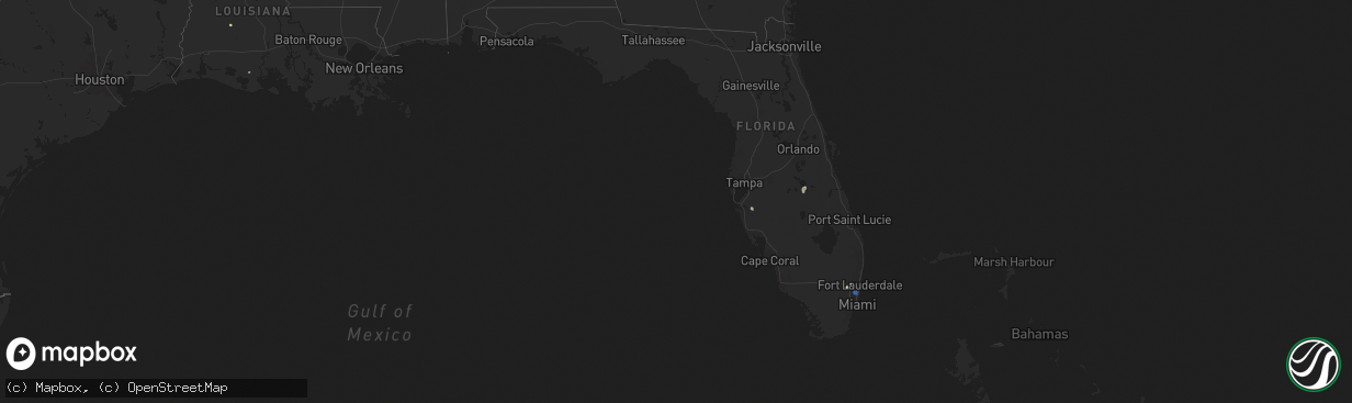
Hail Map in Florida on September 16, 2025
The weather event in Florida on September 16, 2025 includes Wind and Hail maps. 16 states and 530 cities were impacted and suffered possible damage. The total estimated number of properties impacted is 0.
Want more than just the map?
Turn this storm into a full workflow.
- Owner + property data so you know who to knock
- OnDemand branded weather history reports to win the "did we even have hail?" argument
- RoofTrace estimate so reps stop guessing numbers at the door
Bought this map? Upgrade within 7 days and we'll credit the $230. (10-15 min setup call)
Wind
Hail
0
Estimated number of impacted properties by a 1.00" hail or larger0
Estimated number of impacted properties by a 1.75" hail or larger0
Estimated number of impacted properties by a 2.50" hail or largerStorm reports in Florida
Florida
| Date | Description |
|---|---|
| 09/16/20252:06 PM CDT | Broward county sheriffs office reports all lanes of sr-848 at sw 35th ave are closed due to downed powerline in hollywood in relation to a strong thunderstorm that move |
| 09/16/20252:00 PM CDT | Miramar police reports a fallen tree is obstructing a lane at the intersection of pembroke road and 62nd ave... In relation to a strong thunderstorm that moved over the |
| 09/16/20251:45 PM CDT | Asos station khwo pembroke pines reported a wind gust of 52 kts/60 mph associated with a strong thunderstorm. Station elevation is 7 ft. |
All States Impacted by Hail Map on September 16, 2025
Cities Impacted by Hail Map on September 16, 2025
- Dallas, SD
- Platte, SD
- Chadron, NE
- Gregory, SD
- Hay Springs, NE
- Burke, SD
- Crawford, NE
- Whitney, NE
- Dexter, IA
- Redfield, IA
- Ellsworth, NE
- Bingham, NE
- Kosciusko, MS
- Sallis, MS
- Stuart, IA
- Britt, IA
- Vaughn, NM
- Woodburn, IA
- Lakeside, NE
- Kanawha, IA
- Garner, IA
- Magdalena, NM
- Ashby, NE
- Merriman, NE
- Castalian Springs, TN
- Hartsville, TN
- Lebanon, TN
- Fort Lauderdale, FL
- Hollywood, FL
- Miami, FL
- Miami Gardens, FL
- Hyannis, NE
- Goodell, IA
- Arthur, NE
- Lemoyne, NE
- Culbertson, NE
- Tallulah, LA
- Oshkosh, NE
- Roosevelt, UT
- McCook, NE
- Branson, MO
- Kilgore, NE
- Somers, IA
- Callender, IA
- Newellton, LA
- Osborne, KS
- Mason City, IA
- Indianola, MS
- Valentine, NE
- Louise, MS
- Silver City, MS
- Osceola, IA
- New Virginia, IA
- Mitchellville, IA
- Lu Verne, IA
- Livermore, IA
- Oberlin, LA
- Imperial, NE
- Benkelman, NE
- Hollister, MO
- Colfax, IA
- Joplin, MO
- Moorland, IA
- Downs, KS
- Coalmont, CO
- Damar, KS
- Cascilla, MS
- Bode, IA
- Alva, OK
- Portis, KS
- Ogallala, NE
- Keystone, NE
- Saint Joseph, LA
- Hoxie, KS
- Lamar, CO
- Champion, NE
- Bogue, KS
- Stockton, KS
- Van Buren, AR
- Gilbert, LA
- Clayton, LA
- Maywood, NE
- La Porte City, IA
- Evansdale, IA
- Waterloo, IA
- Lapoint, UT
- Fort Duchesne, UT
- Selden, KS
- Inverness, MS
- Rolling Fork, MS
- Cassville, MO
- Exeter, MO
- Estancia, NM
- Anguilla, MS
- Ocate, NM
- Wagon Mound, NM
- Natoma, KS
- Philadelphia, MS
- Doddsville, MS
- Boyle, MS
- Shaw, MS
- Springfield, CO
- Palisade, NE
- Enders, NE
- Clear Lake, IA
- Thornton, IA
- Lakin, KS
- Bradgate, IA
- Rockwell, IA
- Quapaw, OK
- Johnson, KS
- Sunflower, MS
- Goldfield, IA
- Myakka City, FL
- Washburn, MO
- Holcomb, MS
- Greenwood, MS
- Galena, KS
- Riverton, KS
- Lake Wales, FL
- Frostproof, FL
- Yazoo City, MS
- Vernal, UT
- Tridell, UT
- Venango, NE
- Grant, NE
- Burt, IA
- Lone Rock, IA
- Rockwell City, IA
- Lohrville, IA
- Alton, KS
- Waldo, KS
- Swaledale, IA
- McCune, KS
- Scammon, KS
- Norcatur, KS
- Wauneta, NE
- Rutland, IA
- Renwick, IA
- Apache, OK
- Freedom, OK
- Manson, IA
- Stratton, NE
- Miami, OK
- Fort Smith, AR
- Baxter Springs, KS
- Eureka Springs, AR
- Berryville, AR
- Fort Collins, CO
- Columbus, KS
- Paxton, NE
- Sutherland, NE
- Corwith, IA
- Ottosen, IA
- Creston, IA
- Redfield, KS
- Uniontown, KS
- Powell, MO
- Afton, IA
- Bradenton, FL
- Wilsonville, NE
- Ulysses, KS
- Picher, OK
- Treece, KS
- Las Vegas, NM
- Anton Chico, NM
- Hardy, IA
- Algona, IA
- West Bend, IA
- Cedar Falls, IA
- Cameron, MO
- Trenton, NE
- Wilder, TN
- Holly Bluff, MS
- Gilmore City, IA
- Kingston, AR
- Rockford, IA
- Windsor, CO
- Mooreland, OK
- Hudson, IA
- Huntsville, AR
- Rolfe, IA
- Osage, IA
- Sheffield, IA
- Lathrop, MO
- Bearden, AR
- Ackerman, MS
- West Mineral, KS
- Nora Springs, IA
- Dougherty, IA
- Hepler, KS
- Camden, AR
- Crawford, TN
- Leland, MS
- Oberlin, KS
- Marble Rock, IA
- Alexander, IA
- Pocahontas, IA
- Rudd, IA
- Whittemore, IA
- Tryon, NE
- Paradise, KS
- Wood Lake, NE
- Floyd, IA
- Orchard, IA
- Crumrod, AR
- Lamar, MO
- Algodones, NM
- Crane, MO
- Mallard, IA
- Eaton, CO
- Ault, CO
- Johnstown, NE
- Springview, NE
- Sparks, NE
- Indianola, NE
- Hampton, IA
- Fonda, IA
- Curlew, IA
- Liberal, MO
- Aredale, IA
- Marionville, MO
- Placitas, NM
- Fairland, OK
- Bartlett, KS
- Chetopa, KS
- Havelock, IA
- Billings, MO
- Buckingham, IA
- Strasburg, CO
- Bennett, CO
- Oswego, KS
- Mellwood, AR
- Conway, AR
- Laurens, IA
- Jonesville, LA
- Ainsworth, NE
- Long Pine, NE
- Ackley, IA
- Julesburg, CO
- Jolley, IA
- Girard, KS
- Bastrop, LA
- Walnut, KS
- Byers, CO
- Geneva, IA
- Dumont, IA
- Kiowa, CO
- Hugo, CO
- Dover, AR
- Rexford, KS
- Woodston, KS
- Witter, AR
- Colby, KS
- Morton, MS
- Emmetsburg, IA
- Hamburg, AR
- Pelahatchie, MS
- Hayes Center, NE
- Charles City, IA
- Wesley, AR
- Bates City, MO
- Sac City, IA
- Lytton, IA
- Russellville, AR
- London, AR
- Deer Trail, CO
- Monterey, LA
- Big Springs, NE
- Lake, MS
- Forest, MS
- Lexington, NE
- Pettigrew, AR
- Saint Paul, AR
- Shawnee, KS
- Greene, IA
- Allison, IA
- Bristow, IA
- Baskin, LA
- Rayville, LA
- Delhi, LA
- Atwood, KS
- Nashua, IA
- Haigler, NE
- Mission, KS
- Babbitt, MN
- Elkins, AR
- Liberal, KS
- Ely, MN
- Hershey, NE
- North Platte, NE
- Orrick, MO
- Willard, MO
- Republic, MO
- Kansas City, KS
- Pulaski, MS
- Clarksville, IA
- Early, IA
- Parks, NE
- Bois D Arc, MO
- Ash Grove, MO
- Wray, CO
- Kansas City, MO
- Palmer, IA
- Greenwood, AR
- Springfield, MO
- Holyoke, CO
- Amherst, CO
- Pottsville, AR
- Kismet, KS
- Plainfield, IA
- Waverly, IA
- Monroe, LA
- Downsville, LA
- West Monroe, LA
- Max, NE
- Fort Morgan, CO
- Woodrow, CO
- Stapleton, NE
- Shell Rock, IA
- Isabella, MN
- Lawrence, MS
- Gibbon, NE
- Shelton, NE
- Farmerville, LA
- Kaplan, LA
- Sterlington, LA
- Spencer, IA
- Hill City, KS
- Stanley, NM
- Mount Vernon, AR
- Lawson, MO
- Oak Grove, LA
- Pioneer, LA
- Eddyville, NE
- Ludell, KS
- Herndon, KS
- Nemaha, IA
- Acme, LA
- Pomeroy, IA
- Glade, KS
- Arnold, NE
- Akron, CO
- Lindon, CO
- Sumner, NE
- McDonald, KS
- Deridder, LA
- Pitkin, LA
- Lenora, KS
- Fort Dodge, IA
- Knierim, IA
- Saint Francis, KS
- Anselmo, NE
- Overton, NE
- Excelsior Springs, MO
- Rayville, MO
- Idalia, CO
- El Dorado, AR
- Merna, NE
- Marion, LA
- Cherokee, IA
- Broken Bow, NE
- Wahoo, NE
- Mason City, NE
- Oconto, NE
- Stephens, AR
- Ithaca, NE
- Fleming, CO
- Hardesty, OK
- Mountain Lake, MN
- Clare, IA
- Winnsboro, LA
- Ansley, NE
- Waverly, NE
- Crook, CO
- Logan, IA
- Missouri Valley, IA
- Aurelia, IA
- Bird City, KS
- Ceresco, NE
- Ashland, NE
- Saint Martinville, LA
- McNeil, AR
- Bingham Lake, MN
- Sedgwick, CO
- Duncombe, IA
- Otho, IA
- Lehigh, IA
- Burnside, IA
- Dayton, IA
- Choudrant, LA
- Ruston, LA
- Blair, NE
- Arcadia, NE
- Kennard, NE
- Arlington, NE
- Goodland, KS
- Burlington, CO
- Kanorado, KS
- Sheldon, IA
- Ashton, IA
- Sanborn, IA
- Bunkie, LA
- Westerville, NE
- Farnhamville, IA
- Barnum, IA
- Ord, NE
- Herman, NE
- Fremont, NE
- Independence, MO
- Fayetteville, AR
- Comstock, NE
- Loup City, NE
- North Loup, NE
- Scotia, NE
- Greenfield, IA
- Marcus, IA
- Valley, NE
- Magnolia, AR
- Hartsel, CO
- Greeley, NE
- Elyria, NE
- Melvin, IA
- Sleepy Eye, MN
- Remsen, IA
- Dunlap, IA
- Winterset, IA
- Menlo, IA
- Modale, IA
- Mondamin, IA
- Elm Creek, NE
- Miller, NE
- Macksburg, IA
- Stratford, IA
- Scribner, NE
- Hartley, IA
- Pilot Mound, IA
- Nickerson, NE
- Yutan, NE
- Colon, NE
- Dow City, IA
- Wolbach, NE
- Schuyler, NE
- Panora, IA
- Minden, NE
- Lynch, NE
- Eros, LA
- Ulysses, NE
- Leigh, NE
- Clarkson, NE
- Edson, KS
- Brewster, KS
- Arion, IA
- Rising City, NE
- Hooper, NE
- Holstein, IA
- David City, NE
- Levant, KS
- Rogers, NE
- Adel, IA
- Denison, IA
- Schleswig, IA
- Howells, NE
- Minburn, IA
- Quimby, IA
- Washta, IA
- Kenesaw, NE
- Columbus, NE
- Ida Grove, IA
- Battle Creek, IA
- Bellwood, NE
- Bruno, NE
- Wood River, NE
- Danbury, NE
- Heartwell, NE
- Perry, IA
- Brainard, NE
- Valparaiso, NE
- Dwight, NE
- Glidden, IA
- West Point, NE
- Dodge, NE
- Wisner, NE
- Juniata, NE
- Roseland, NE
- Holstein, NE
- Orient, IA
- Grand Junction, IA
- Weston, NE
- Bladen, NE
- Anthon, IA
- Ogden, IA
- Dresden, KS
- Tekamah, NE
- Jennings, KS
- Linden, IA
- Guthrie Center, IA
- Leawood, KS
- Sergeant Bluff, IA
- Casey, IA
- Ellis, KS
- Ogallah, KS
- Plainville, KS
- Woodbine, IA
- Linwood, NE
- Catharine, KS
- Victoria, KS
- Hays, KS
- Defiance, IA
- Calhoun, LA
- Lucas, KS
- Bennington, NE
- Washington, NE
- Luray, KS
- Sylvan Grove, KS
- Kimball, SD
- Baileyville, KS
- Greenwood, NE
- Pawnee City, NE
- Madison, SD
- Ramona, SD
- Bruce, SD
- Volga, SD
- Brookings, SD
- Mead, NE
- Star Prairie, WI
- Clayton, NM
- Clayton, WI
- Osceola, WI
- Sioux Falls, SD


