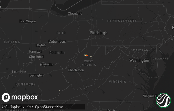
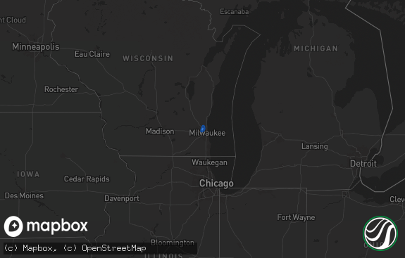
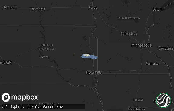
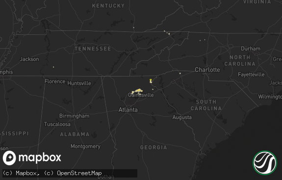
Hail Map in Delaware on August 1, 2019
The weather event in Delaware on August 1, 2019 includes Hail and Wind maps. 25 states and 601 cities were impacted and suffered possible damage. The total estimated number of properties impacted is 3,096.

Hail
Wind
3,096
Estimated number of impacted properties by a 1.00" hail or larger0
Estimated number of impacted properties by a 1.75" hail or larger0
Estimated number of impacted properties by a 2.50" hail or largerStorm reports in Delaware
Delaware
| Date | Description |
|---|---|
| 08/01/20194:53 PM CDT | Wind gusts between 50 and 60 mph estimated in laurel. |
| 08/01/20194:53 PM CDT | Tree and large limbs reported down near laurel. |
| 08/01/20194:50 PM CDT | Section of a tree snapped off and fell onto power lines. A large tree was also uprooted. Time estimated from radar. |
| 08/01/20194:45 PM CDT | Tree down onto power lines in blades. Time estimated from radar. |
| 08/01/20194:44 PM CDT | Quarter size hail reported in seaford. |
| 08/01/20194:40 PM CDT | Trees reported down in bridgeville. |
| 08/01/20194:02 PM CDT | Trees and wires reported down in felton. Time estimated from radar. |
| 08/01/20193:58 PM CDT | Tree limbs down at the intersection of sandtown road and burnite mill road. Time estimated from radar. |
| 08/01/20193:05 PM CDT | Quarter size hail reported in harrington. |
| 08/01/201912:44 AM CDT | At 544 PM EDT, a severe thunderstorm was located over Laurel, or 13 miles north of Salisbury, moving south at 25 mph. HAZARD...60 mph wind gusts and quarter size hail. SOURCE...Radar indicated. IMPACT...Minor damage to vehicles is possible. Expect wind damage to trees and powerlines. This severe thunderstorm will be near, Sharptown around 550 PM EDT. Delmar around 605 PM EDT. Hebron around 610 PM EDT. Parsonsburg around 615 PM EDT. Salisbury around 620 PM EDT. Fruitland and Salisbury University around 625 PM EDT.Other locations impacted by this severe thunderstorm includeGalestown, Catchpenny, Mardela Springs, Trinity, Salisbury-Wicomico,Chesapeake Heights, Melson, Shad Point, Allen and Lakewood. |
| 07/31/201911:56 PM CDT | At 455 PM EDT, a severe thunderstorm was located over Sandtown, or 13 miles southwest of Dover, moving south at 20 mph. Another severe thunderstorm was moving into northwestern Sussex County from the north. HAZARD...60 mph wind gusts and quarter size hail. SOURCE...Radar indicated. IMPACT...Minor damage to vehicles is possible. Wind damage to roofs, siding, trees, and power lines is possible. Locations impacted include... Dover, Milford, Denton, Harrington, Camden, Bridgeville, Greensboro, Oakland, Ridgely, Ellendale, Goldsboro, Woodside, Viola, Smithville, Jumptown, Hazlettville, Agner, Sandtown, Andrewsville and Harmony. |
| 07/31/201911:06 PM CDT | At 405 PM EDT, severe thunderstorms were located along a line extending from near Green Spring to near Delaney Corner to Sudlersville, moving southeast at 10 mph. HAZARD...60 mph wind gusts and quarter size hail. SOURCE...Radar indicated. IMPACT...Minor damage to vehicles is possible. Wind damage to roofs, siding, trees, and power lines is possible. Locations impacted include... Dover, Middletown, Smyrna, Camden, Clayton, Cheswold, Millington, Sudlersville, Goldsboro, Woodside, Hartly, Rising Sun-Lebanon, Hazlettville, Delaney Corner, Dover Base Housing, Crumpton, Dover Speedway, Sandtown, Green Spring and Rising Sun. |
| 07/31/201911:00 PM CDT | At 359 PM EDT, a severe thunderstorm was located over Harrington, or 15 miles south of Dover, moving southeast at 10 mph. HAZARD...60 mph wind gusts and quarter size hail. SOURCE...Radar indicated. IMPACT...Minor damage to vehicles is possible. Wind damage to roofs, siding, trees, and power lines is possible. Locations impacted include... Milford, Harrington, Viola, Andrewsville, Felton, Greenwood, Frederica, Houston, Farmington, Woodside East and Riverview. |
| 07/31/20197:45 PM CDT | Tree down onto power lines in blades. Time estimated from radar. |
All States Impacted by Hail Map on August 1, 2019
Cities Impacted by Hail Map on August 1, 2019
- Orangeburg, SC
- El Dorado, KS
- Forsyth, MT
- Akron, CO
- Sudlersville, MD
- Millington, MD
- Dallas, NC
- Gastonia, NC
- Bay Minette, AL
- Atlanta, GA
- Holly, CO
- Blacksburg, SC
- Inkom, ID
- Staunton, VA
- Marion, SC
- Mullins, SC
- Dillon, SC
- Fork, SC
- Brush, CO
- Waverly, AL
- Blackville, SC
- Denmark, SC
- Intercourse, PA
- Paradise, PA
- Kinzers, PA
- Ronks, PA
- Gordonville, PA
- Bird In Hand, PA
- Simpson, KS
- Beloit, KS
- Glasco, KS
- Waynesboro, GA
- Tampa, KS
- Brooklyn, MD
- Springerville, AZ
- Cuba, AL
- Lauderdale, MS
- Beulah, ND
- Stoneham, CO
- Atwood, CO
- Sterling, CO
- Merino, CO
- Seaford, DE
- Harrington, DE
- Georgetown, DE
- Laurel, DE
- Bridgeville, DE
- Greenwood, DE
- Mandaree, ND
- Killdeer, ND
- Hinton, WV
- Daniels, WV
- Shady Spring, WV
- Courtenay, ND
- Durham, KS
- Bremen, GA
- Buchanan, GA
- Roundup, MT
- Douglass, KS
- Severna Park, MD
- Crownsville, MD
- Millersville, MD
- Garrison, KY
- Olive Hill, KY
- Salem, AL
- Clermont, FL
- Grover, CO
- Carpenter, WY
- Pine Bluffs, WY
- Haswell, CO
- Eads, CO
- Fort Benning, GA
- Cusseta, GA
- Salem, VA
- Roanoke, VA
- Statesville, NC
- Kimball, NE
- Dix, NE
- Limon, CO
- Ramah, CO
- Matheson, CO
- Hugo, CO
- Lafayette, AL
- Jackson, OH
- Stuarts Draft, VA
- Mooresboro, NC
- Spotsylvania, VA
- Leon, KS
- Augusta, KS
- Peach Bottom, PA
- Kirkwood, PA
- Nottingham, PA
- Oxford, PA
- Quarryville, PA
- New Castle, VA
- Karval, CO
- Agate, CO
- Raleigh, NC
- Dothan, AL
- Headland, AL
- Hughesville, MD
- Charlotte Hall, MD
- Mechanicsville, MD
- Alliance, NE
- Cohagen, MT
- Pisgah, AL
- Henagar, AL
- Jewell, KS
- Formoso, KS
- Courtland, KS
- Jamestown, KS
- Norway, KS
- Carrollton, GA
- Roopville, GA
- Franklin, GA
- Troutman, NC
- Whitmire, SC
- Lexington, VA
- Garrison, ND
- Arkansas City, KS
- Winfield, KS
- Hemingford, NE
- Ider, AL
- Greensboro, NC
- Jamestown, NC
- Dazey, ND
- Otis, CO
- Curtis Bay, MD
- Pasadena, MD
- Halethorpe, MD
- Baltimore, MD
- Glen Burnie, MD
- Harrison, NE
- Stevens, PA
- Reinholds, PA
- Denver, PA
- Christiana, PA
- Smoketown, PA
- Terre Hill, PA
- Adamstown, PA
- East Earl, PA
- Mohnton, PA
- Ephrata, PA
- Leola, PA
- New Holland, PA
- Forest Hill, MD
- Bel Air, MD
- Arnegard, ND
- Craigsville, VA
- Greenville, VA
- Middlebrook, VA
- Swoope, VA
- Charlottesville, VA
- Axton, VA
- Ridgeway, VA
- Cascade, VA
- Boones Mill, VA
- Fayetteville, TN
- Kelso, TN
- Watford City, ND
- Vass, NC
- New Salem, ND
- Woodville, AL
- Scottsboro, AL
- Gaffney, SC
- Hope, KS
- Whiteford, MD
- Delta, PA
- Webster Springs, WV
- Mulberry, TN
- Winnsboro, SC
- Sanborn, ND
- Esbon, KS
- Havelock, NC
- Lynchburg, VA
- Evington, VA
- Taylors, SC
- Greenville, SC
- Travelers Rest, SC
- Ranburne, AL
- Heflin, AL
- Five Points, AL
- Towanda, KS
- Forest, VA
- Bighorn, MT
- Resaca, GA
- Hamer, SC
- Brockton, MT
- Waldorf, MD
- Brandywine, MD
- Bryantown, MD
- Aquasco, MD
- Florala, AL
- Andalusia, AL
- Angela, MT
- Sparta, NC
- Georgetown, GA
- Fort Gaines, GA
- Morris, GA
- Goshen, VA
- Ray, OH
- Londonderry, OH
- Chillicothe, OH
- Walstonburg, NC
- Farmville, NC
- Fountain, NC
- Stantonsburg, NC
- Rainelle, WV
- Millboro, VA
- Hillrose, CO
- Rowland, NC
- Derby, KS
- Lumberton, NC
- Lehigh, KS
- Rose Hill, KS
- Syracuse, KS
- Lexington, NC
- Thomasville, NC
- Pettibone, ND
- Fort Morgan, CO
- Henderson, MD
- Hartly, DE
- Houston, DE
- Marydel, DE
- Camden Wyoming, DE
- Marydel, MD
- Goldsboro, MD
- Barclay, MD
- Ellendale, DE
- Greensboro, MD
- Felton, DE
- Chesnee, SC
- Anderson, SC
- Malta, ID
- Hereford, CO
- Delmar, MD
- Delmar, DE
- Amherst, VA
- Madison Heights, VA
- Monroe, VA
- Rappahannock Academy, VA
- King George, VA
- Solomon, KS
- Wing, ND
- Bent Mountain, VA
- Newport, VA
- Copper Hill, VA
- Cartwright, ND
- Williston, ND
- Fairview, MT
- Armuchee, GA
- Calhoun, GA
- Sugar Valley, GA
- Roanoke, AL
- Blackfoot, ID
- Eden, NC
- Sugar Grove, WV
- Bainville, MT
- Prosperity, SC
- Pomaria, SC
- Alexander, ND
- Mankato, KS
- Troy, VA
- Raphine, VA
- Coolville, OH
- Guysville, OH
- Hysham, MT
- Sanders, MT
- Wyndmere, ND
- Newark, DE
- Mill Creek, WV
- Atlanta, KS
- Charlotte, NC
- Millen, GA
- Perkins, GA
- Columbus, ND
- Bidwell, OH
- Gallipolis, OH
- Forkland, AL
- Hazen, ND
- Ririe, ID
- Dunn Center, ND
- Marietta, GA
- Keene, ND
- Lewistown, MT
- Briggsdale, CO
- Yanceyville, NC
- Marion, KS
- Hillsboro, KS
- Waverly, OH
- Rockford, AL
- Delphos, KS
- Minneapolis, KS
- Dalton, GA
- Chatsworth, GA
- Zap, ND
- Shelby, NC
- Cherryville, NC
- Huntersville, NC
- Dallas, GA
- White Sulphur Springs, WV
- Roggen, CO
- Lebanon, KS
- Lanett, AL
- Kit Carson, CO
- Peterman, AL
- Monroeville, AL
- Homestead, MT
- Louisville, TN
- Knoxville, TN
- Newberry, SC
- Blair, SC
- Norway, SC
- McDavid, FL
- Beaver, OH
- Tarboro, NC
- Rocky Mount, NC
- Rockmart, GA
- Street, MD
- Honoraville, AL
- Greenville, AL
- Ash, NC
- Snyder, CO
- Louisa, VA
- Gordonsville, VA
- Goode, VA
- Burns, KS
- Potwin, KS
- Boligee, AL
- Minatare, NE
- Benedict, ND
- Crossville, TN
- Unionville, VA
- Orange, VA
- Oxford, KS
- Udall, KS
- Belle Plaine, KS
- Nichols, SC
- Athens, OH
- Stewart, OH
- Cutler, OH
- Little Hocking, OH
- Padroni, CO
- Halliday, ND
- Pinetta, FL
- Madison, FL
- Lincolnville, KS
- West End, NC
- Verona, VA
- Nashville, GA
- Harman, WV
- Lakemont, GA
- Musselshell, MT
- Aiken, SC
- Ridge Spring, SC
- Scenic, SD
- Massey, MD
- Clayton, DE
- Galena, MD
- Townsend, DE
- Lancaster, SC
- Jennings, FL
- Lake Park, GA
- Philip, SD
- Wytheville, VA
- Latta, SC
- Salina, KS
- Harrisburg, NE
- Rougemont, NC
- Bahama, NC
- Hillsborough, NC
- Virginia City, MT
- Century, FL
- Bayard, NE
- Milton, NC
- Ringgold, VA
- Darlington, MD
- Lyerly, GA
- New Raymer, CO
- Woodland, AL
- Waco, GA
- Show Low, AZ
- Lakeside, AZ
- Pinetop, AZ
- Shade, OH
- Tappahannock, VA
- Garner, NC
- Annapolis, MD
- Gap, PA
- Reading, PA
- Lancaster, PA
- Alton, VA
- Mobile, AL
- Lucedale, MS
- Wilmer, AL
- Brookwood, AL
- Middleport, OH
- Bristol, TN
- Bluff City, TN
- Kingsport, TN
- Byers, CO
- Boiling Springs, SC
- Rockbridge Baths, VA
- Covington, VA
- Newkirk, OK
- Kings Mountain, NC
- Lower Peach Tree, AL
- Semmes, AL
- Culbertson, MT
- Valley Center, KS
- Lambert, MT
- Fredericksburg, VA
- Stone Mountain, GA
- Pine Lake, GA
- Ellerbe, NC
- Blountsville, AL
- Clayton, GA
- West Columbia, WV
- Burgaw, NC
- Rocky Point, NC
- Vinton, VA
- Fishersville, VA
- Rosebud, MT
- Midland City, AL
- Callaway, VA
- Severn, MD
- Riva, MD
- Gambrills, MD
- Davidsonville, MD
- Decatur, AL
- Clarkrange, TN
- Auburn, AL
- Opelika, AL
- Ramona, KS
- Lima, MT
- Owings, MD
- Tracys Landing, MD
- Friendship, MD
- Sunderland, MD
- Dunkirk, MD
- Huntingtown, MD
- Lothian, MD
- Buffalo, WV
- Quitman, MS
- Dexter, GA
- Dudley, GA
- Great Falls, SC
- Blackstock, SC
- Fairmount, GA
- Midway Park, NC
- Hubert, NC
- Jacksonville, NC
- Maysville, NC
- Camp Lejeune, NC
- Senoia, GA
- Madison, AL
- Locust Grove, VA
- Epping, ND
- Lake Toxaway, NC
- Maxton, NC
- Pocatello, ID
- West Grove, PA
- Cochranville, PA
- Rustburg, VA
- Pembroke, NC
- Fairmont, NC
- Collettsville, NC
- Blowing Rock, NC
- Steele, ND
- Tuttle, ND
- Inman, SC
- Conowingo, MD
- Peabody, KS
- Timmonsville, SC
- Wiggins, CO
- Oak Hill, OH
- Smoot, WV
- Alapaha, GA
- Hiwassee, VA
- Keenesburg, CO
- Bennett, CO
- Adger, AL
- Rosedale, MD
- Loris, SC
- Easley, SC
- Newton, KS
- Mount Gilead, NC
- Gering, NE
- Port Royal, VA
- Bowbells, ND
- Benton, KS
- Wichita, KS
- Andover, KS
- Golden Valley, ND
- Doe Hill, VA
- Stafford, VA
- Talladega, AL
- Winterville, NC
- Greenville, NC
- Atmore, AL
- Danville, VA
- Anton, CO
- Lindon, CO
- Whitewater, KS
- Florence, KS
- Piketon, OH
- Payson, AZ
- Forest Grove, MT
- High Point, NC
- Mount Holly, NC
- Currie, NC
- Buena Vista, GA
- Box Springs, GA
- Crossville, AL
- Albertville, AL
- Geraldine, AL
- Abilene, KS
- Jackson Springs, NC
- Mineral, VA
- Loretto, VA
- Groveland, FL
- Lenox, GA
- Glendive, MT
- Bridgeport, NE
- Kenmare, ND
- Gaylesville, AL
- Big Timber, MT
- Heath Springs, SC
- Atkinson, NC
- Toomsuba, MS
- Chester, GA
- Seneca, SC
- Townville, SC
- Hudson, NC
- Granite Falls, NC
- Coolidge, KS
- Vance, AL
- Otway, OH
- Peebles, OH
- Deer Trail, CO
- Dover, DE
- Nottingham, MD
- Duluth, GA
- Norcross, GA
- Rocky Face, GA
- Wall, SD
- New Town, ND
- Randall, KS
- Valley City, ND
- Sutherlin, VA
- Richey, MT
- Mulvane, KS
- Willis, VA
- Lilesville, NC
- Meridian, MS
- Fraziers Bottom, WV
- Fort Lawn, SC
- Minford, OH
- Fairfield, VA
- Sidney, NE
- Fleetwood, NC
- Campobello, SC
- Addison, AL
- Ovett, MS
- Citronelle, AL
- Angora, NE
- Roseland, VA
- Clay Center, KS
- Elm City, NC
- Robinson, ND
- Douglas, ND
- Warsaw, VA
- Tazewell, TN
- Barnard, KS
- Tescott, KS
- Evergreen, AL
- Taylorsville, NC
- Concord, VA
- Rogers, ND
- Scottsville, VA
- Max, ND
- Richmond, VA
- Hendersonville, NC
- Livingston, MT
- Parsonsburg, MD
- Salisbury, MD
- Selden, KS
- Chester, SC
- Needham, AL
- Lamont, FL
- Macclesfield, NC
- Pinetops, NC
- Groveoak, AL
- Fyffe, AL
- Bethel, DE
- Macon, GA
- Cadwell, GA
- Piedmont, AL
- Glade Valley, NC
- Wilson, NC
- Blountville, TN


