Hail Map on September 6, 2025
Get this storm
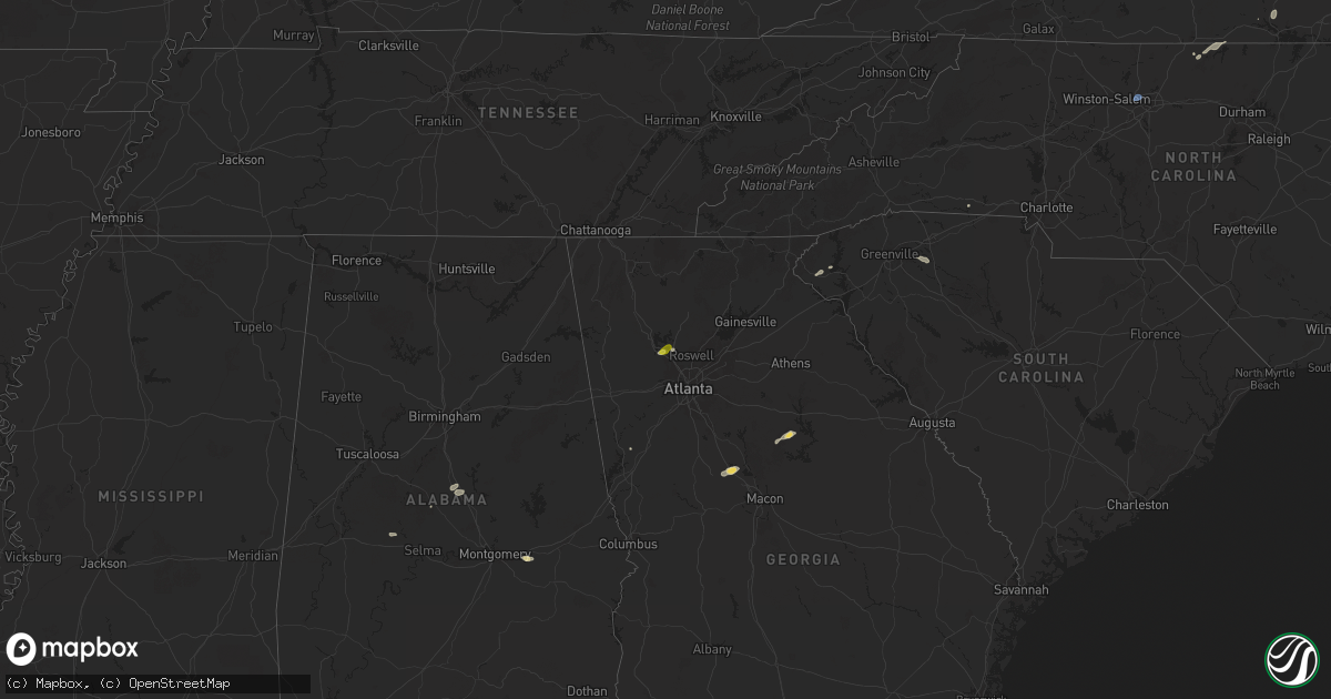
September 6 map
$229
one time, instant access
Download today. No call, no setup
Keep the $229
Bought the map and want the full workflow? Apply the entire $229 to a subscription within 7 days. None of it is wasted.
Every map, not just this one
This buys you this map. Subscription and you get every map we run, in the markets you choose from a few cities to whole states to nationwide. Plus real-time alerts the moment a storm fires.
Contact data
Name, contact info, occupancy, even credit band for addresses in the footprint. You go from where it hit to who to call.
Become the source they trust
Unlimited branding weather history reports on demand. You already have the documented answer ready for the property owner, and you are the one who showed up with it.
Property data and RoofTrace estimates
Pull up any address you have got, its value and the exact code rules for that jurisdiction, straight from One Click Code. Then RoofTrace estimates the squares, pitch, and roof value, priced the way you price.
States Impacted by Hail Map on September 6, 2025
Storm reports
Maine
| Date | Description |
|---|---|
| 09/06/20252:50 PM CDT | Bridgton fire reports a large pine tree and powerlines down blocking highland rd. Time estimated by radar. |
Virginia
| Date | Description |
|---|---|
| 09/06/20253:26 PM CDT | One tree down along alexadria pike and moorehead drive due to thunderstorm winds. |
| 09/06/20253:26 PM CDT | One tree down at the intersection lee street and ashby street due to thundersto |
| 09/06/20253:26 PM CDT | Several powerlines down due to thunderstorm winds along john e mann street. |
| 09/06/20253:26 PM CDT | One tree down at the intersection lee street and ashby street due to thunderstorm winds. |
| 09/06/20253:25 PM CDT | One tree down near eva walker park due to thunderstorm winds. |
| 09/06/20253:25 PM CDT | One tree down along walker drive due to thunderstorm winds. |
| 09/06/20253:06 PM CDT | Two trees reported down in amissville... Va. |
| 09/06/20252:45 PM CDT | Tree down on south terrys bridge road near the intersection with james d hagood highway. |
| 09/06/20252:37 PM CDT | Tree reported down on lee highway near shenandoah national park. |
| 09/06/20252:36 PM CDT | Tree down near the intersection of black walnut church road and clusters springs road. |
| 09/06/20252:31 PM CDT | Tree down on alton post office road... East of its intersection with emergency road. |
Alabama
| Date | Description |
|---|---|
| 09/06/20251:02 PM CDT | Several trees down near the intersection of cr45 and cr4 near hamburg in perry county. Law enforcement on scene with the road blocked. Time estimated by radar. |
Connecticut
| Date | Description |
|---|---|
| 09/06/20253:05 PM CDT | Power lines and tree down through a house |
| 09/06/20252:55 PM CDT | Eversource reports a power outage caused by tree damage on val court in wolcott. |
| 09/06/20252:40 PM CDT | Corrects previous tstm wnd dmg report from 1 nnw new britain. Power lines and tree down through a house |
| 09/06/20252:40 PM CDT | In burlington... Two trees were down blocking sand bank hill rd. |
| 09/06/20252:25 PM CDT | Eversource reports a power outage due to tree damage on mill hill road s. |
| 09/06/20252:18 PM CDT | Several trees uprooted and downed near schofield hill rd in washington depot. |
| 09/06/20252:18 PM CDT | Trees down along route 222... Hill road... In the town of harwinton. |
| 09/06/20252:15 PM CDT | Received report of tree down on wires from 911 call center near the intersection of 202 and 47. Time based on radar. |
| 09/06/20251:54 PM CDT | Social media report of hail estimated to be at least 1 inch in diameter. Time estimated from radar. |
| 09/06/20251:40 PM CDT | Several trees uprooted and downed near schofield hill rd in washington depot. |
| 09/06/20251:40 PM CDT | Received report of trees down on a building as well as in the roadway and on wires along route 202... South and near the town of new preston. From a broadcast media par |
| 09/06/20251:40 PM CDT | Corrects previous tstm wnd dmg report from 1 s new preston with correct time. Several trees uprooted and downed near schofield hill rd in washington depot. |
| 09/06/20251:30 PM CDT | Trees and wires down over roadway. Roadway closed. Time radar estimated. |
| 09/06/20251:30 PM CDT | Trees and wires down over roadway. Roadway |
| 09/06/20251:20 PM CDT | Social media and photo report of a tree town and a power line on fire at the intersection of route 112 and route 7 south of falls village. |
| 09/06/20251:00 PM CDT | Tree and wires down on wires. Tree is on fire and fire is threatening structure. |
| 09/06/202512:58 PM CDT | *** 1 inj *** tree fell on car injuring an occupant. Fire department dispatched. |
South Carolina
| Date | Description |
|---|---|
| 09/06/20256:13 PM CDT | Tree down in roadway on center rd. |
| 09/06/20255:58 PM CDT | Tree down at intersection of pineland rd and timberlake rd. |
| 09/06/20255:56 PM CDT | Tree down on ingle ave at duncan bypass. |
| 09/06/20255:56 PM CDT | Tree down at intersection of barnado rd and woodberry dr. |
| 09/06/20255:56 PM CDT | Tree d |
| 09/06/20255:55 PM CDT | Two trees down near intersection of pineland rd and kelly rd. |
| 09/06/20255:55 PM CDT | Two trees down near intersection o |
| 09/06/20255:55 PM CDT | Two trees down near intersection o |
| 09/06/20255:50 PM CDT | Tree down near intersection of toney rd and meansville rd. |
| 09/06/20255:36 PM CDT | Multiple trees down sw of jonesville... Sc. |
| 09/06/20255:23 PM CDT | Tree down at friendship church rd and wofford rd. Time estimated. |
| 09/06/20253:25 PM CDT | Facebook user reports trees down behind their house on six mile hwy north of central. Time estimated. |
| 09/06/20253:18 PM CDT | Large tree blocking roadway at intersection of lawrence bridge rd and alpine dr. |
| 09/06/20253:15 PM CDT | Large tree down near intersection of keowee school rd and old walhalla hwy. |
| 09/06/20253:13 PM CDT | Snapped power pole on hwy 183 at county line. |
Arizona
| Date | Description |
|---|---|
| 09/05/20258:45 PM CDT | Report of power poles down near san joaquin rd and neal ave. |
Massachusetts
| Date | Description |
|---|---|
| 09/06/20254:55 PM CDT | In sharon... A large tree was down across a driveway. Relayed by amateur radio. |
| 09/06/20254:20 PM CDT | Tree/wires down on a car. Relayed by amateur radio. Time estimated from radar. |
| 09/06/20254:15 PM CDT | Tree down... Partially on a house... Another tree down on a vehicle on congress street. Time estimated from radar. |
| 09/06/20253:58 PM CDT | A local report indicates 59 MPH wind near Bedford AP |
| 09/06/20253:55 PM CDT | Trees/wires down. Relayed by amateur radio. |
| 09/06/20253:52 PM CDT | Tree down on a house on appletree lane in bedford. Time estimated by radar. |
| 09/06/20253:50 PM CDT | Tree down across highland st. |
| 09/06/20253:45 PM CDT | Tree down partially blocking martin street. Relayed by amateur radio. Time estimated from radar. |
| 09/06/20253:40 PM CDT | Multiple trees down on oxbow rd. Relayed by amateur radio. Time estimated from radar. |
| 09/06/20253:38 PM CDT | Trees downed on chandler st in worcester. Time e |
| 09/06/20253:38 PM CDT | Trees downed on chandler st in worcester. Time estimated by radar. |
| 09/06/20253:30 PM CDT | In charlton... A tree was down on yeoman rd. Relayed by amateur radio. |
| 09/06/20253:20 PM CDT | Downed tree limbs on route 62 in stow. |
| 09/06/20253:20 PM CDT | Several reports of trees/wires down across town. Relayed by amateur radio. Time estimated from radar. |
| 09/06/20253:15 PM CDT | Numerous trees and wires down and roads blocked. Time estimated from radar. |
| 09/06/20253:11 PM CDT | Trees downed on ruthven ave. |
| 09/06/20253:11 PM CDT | Large tree on powerlines on beverly rd in worcester. Time estimated by radar. |
| 09/06/20253:11 PM CDT | Corrects previous tstm wnd dmg report from 1 s worcester for time. Trees downed on chandler st in worcester. Time estimated by radar. |
| 09/06/20253:10 PM CDT | Tree down with partial road blockage |
| 09/06/20253:10 PM CDT | Large tree down on bailey rd making it impassable. |
| 09/06/20253:10 PM CDT | Large tree down on bailey rd making it im |
| 09/06/20253:06 PM CDT | Tree down on a house |
| 09/06/20253:05 PM CDT | Trees down on bailey rd. Time estimated from radar. |
| 09/06/20252:50 PM CDT | Tree... Power pole and wires down on hastings rd. Time estimated from radar. Relayed by amateur radio. |
| 09/06/20252:30 PM CDT | Reports of several trees down across town... Including washington street... Crescent st and old west brookfield rd. Time estimated from radar. |
| 09/06/20252:30 PM CDT | Multiple tree branches down along rt 19 near the mass pike. Relayed by amateur radio. |
| 09/06/20252:30 PM CDT | Several trees and power lines down |
| 09/06/20252:30 PM CDT | Tree down on a car on nelson street |
| 09/06/20252:30 PM CDT | Tree down on a car on nelson street (relayed |
| 09/06/20252:25 PM CDT | A local report indicates 1.00 inch wind near 4 NW Ashburnham |
| 09/06/20252:15 PM CDT | Trees and powerlines down along norcross hill road and highland avenue. Relayed by amateur radio. |
| 09/06/20252:10 PM CDT | Public report relayed via amateur radio. |
| 09/06/20252:10 PM CDT | A local report indicates 64 MPH wind near Granby |
| 09/06/20252:05 PM CDT | In southwick... A large tree and wires were down. |
| 09/06/20252:05 PM CDT | Several large trees down on i-91 |
| 09/06/20252:00 PM CDT | In south deerfield... A tree and wires were down on river rd. Relayed by amateur radio. |
| 09/06/20251:57 PM CDT | Route 10 closed due to downed trees |
| 09/06/20251:57 PM CDT | Multiple large trees down on power lines near clark street in southampton |
| 09/06/20251:56 PM CDT | A local report indicates 64 MPH wind near Westfield-Barnes AP |
| 09/06/20251:55 PM CDT | In northfield... A tree and wires were down on lucky clapp rd. Relayed by amateur radio. |
| 09/06/20251:55 PM CDT | Tree down on house |
| 09/06/20251:50 PM CDT | Video confirmation of wires down and on fire |
| 09/06/20251:45 PM CDT | In colrain... A tree and power lines were down on van nuys rd. Relayed by amateur radio. |
| 09/06/20251:35 PM CDT | Tree down over roadway. |
| 09/06/20251:35 PM CDT | In blandford... There were trees down near town hall and a roof damaged at the blandford fairgrounds agricultural building. |
| 09/06/20251:28 PM CDT | Tree down on wires. |
| 09/06/20251:26 PM CDT | Multiple trees down in sheffield. |
| 09/06/20251:25 PM CDT | Numerous trees down on tolland road... Reservoir road and pine road in otis. |
| 09/06/20251:25 PM CDT | Numerous trees down. |
| 09/06/20251:25 PM CDT | Trees and wires down block entrance to tolland state forest. |
| 09/06/20251:07 PM CDT | Report from mping: ping pong ball |
| 09/06/20251:07 PM CDT | Report from mping of ping pong ball size hail... 1.50 inches. |
| 09/06/20251:06 PM CDT | Multiple trees down along old stockbridge rd. |
| 09/06/20251:04 PM CDT | Tree down over roadway. |
| 09/06/20251:04 PM CDT | Corrects previous tstm wnd dmg report from 4 e sheffield. Tree down on wires. |
| 09/06/20251:04 PM CDT | Corrects previous tstm wnd dmg report from 4 ene sheffield. Tree down over roadway. |
| 09/06/20251:04 PM CDT | Multiple trees down in sheffield. |
| 09/06/20251:04 PM CDT | Tree down on wires. |
| 09/06/20251:04 PM CDT | Corrects previous tstm wnd dmg report from sheffield. Multiple trees down in sheffield. |
New Jersey
| Date | Description |
|---|---|
| 09/06/20253:10 PM CDT | Weatherflow station in seaside park gusted to 51 knots |
| 09/06/20252:05 PM CDT | Social media report of snapped trees and branches in the olde forge section of shamong. Time estimated by radar. |
| 09/06/20252:00 PM CDT | Large tree felled via x. Time est. From radar. |
| 09/06/20251:52 PM CDT | Large tree fell... Knocking down power poles. Picture relayed on social media. Time estimated from radar. |
| 09/06/20251:46 PM CDT | Tree down blocking road at south middlebash rd near blackwells mills rd. Time estimated from radar. |
| 09/06/20251:44 PM CDT | Several trees down at amwell rd and elizabeth ave. Time estimated from radar. |
| 09/06/20251:34 PM CDT | Numerous trees and wires down. Time estimated from radar. |
| 09/06/20251:34 PM CDT | Trees and wires down. Time estimated from radar. |
| 09/06/20251:21 PM CDT | Trees and wires down. Time estimated from radar. |
New York
| Date | Description |
|---|---|
| 09/06/20252:26 PM CDT | Mesonet station xbay bayville. |
| 09/06/20252:10 PM CDT | Tree down on androvette street. |
| 09/06/20252:10 PM CDT | Downed tree blocking storer avenue near carlin street. |
| 09/06/20252:06 PM CDT | Trees and wires down on a vehicle on hardscrabble road and reed road. |
| 09/06/20251:15 PM CDT | Tree and wires down across the road |
| 09/06/20251:15 PM CDT | Tree and wires down across the roadway. |
| 09/06/20251:06 PM CDT | Tree down over the roadway near intersection of county road 7 and hall hill rd. |
| 09/06/202512:54 PM CDT | Multiple trees down per 911 dispatch near state route 82 and wiltsie bridge rd in town on ancram. |
| 09/06/202512:46 PM CDT | Tree through roof of house. Ancram fire dept dispatched and enroute to location. |
| 09/06/202512:45 PM CDT | Large tree branch blocking the road near over mtn rd and east ancram rd. |
| 09/06/202512:45 PM CDT | Twitter/ report: large tree branch blocking the road near over mtn rd and east ancram rd. |
| 09/06/202512:44 PM CDT | Tree and wires down across the roadway. |
| 09/06/202512:39 PM CDT | Tree down over the roadway near intersection of county road 7 and hall hill rd. |
| 09/06/202512:38 PM CDT | Social media report and photo of a few trees down on county route 7 just west of elsohn road near gallatin. |
| 09/06/202512:37 PM CDT | Tree down in a yard along route 11 north of barnett road. |
| 09/06/202512:37 PM CDT | A tree was down on power lines with another power pole snapped on route 11 just north of barnett road in gallatin. |
| 09/06/202512:37 PM CDT | Social media report of a tree down on route 11 just north of route 7 southwest of ancram. |
| 09/06/202512:20 PM CDT | A tree was downed on u.s. Route 9 at amherst road in red hook. |
Maryland
| Date | Description |
|---|---|
| 09/06/20252:33 PM CDT | One tree down due to thunderstorm winds along rock springs road. |
| 09/06/20252:07 PM CDT | One tree down on powerlines due to thunderstorm winds along the 400 block of shucks road. |
| 09/06/20252:03 PM CDT | A local report indicates 1.50 inch wind near 2 S Bel Air |
| 09/06/20251:59 PM CDT | One tree down on powerlines due to thunderstorm winds at the intersection of west heather road and wakefield drive. (l |
| 09/06/20251:59 PM CDT | One tree down on powerlines due to thunderstorm winds at the intersection of west heather road and wakefield drive. |
| 09/06/20251:58 PM CDT | A local report indicates 1.00 inch wind near 2 SSE Bel Air |
Florida
| Date | Description |
|---|---|
| 09/06/20256:00 PM CDT | Marion county dispatch reported a tree was blown down into power lines in the juniper court area. |
| 09/06/20256:00 PM CDT | Marion county dispatch reported a tree was blown down into power lines in the juniper court area. |
| 09/06/20256:00 PM CDT | Wires were blown dow |
| 09/06/20256:00 PM CDT | Wires were blown down near the intersection of highway 316 and nw 145th avenue. |
| 09/06/20256:00 PM CDT | Wires were blown down ne |
| 09/06/20256:00 PM CDT | Marion county dispatch reported a tree was blown down into po |
District of Columbia
| Date | Description |
|---|---|
| 09/06/20254:00 PM CDT | A local report indicates 60 MPH wind near Reagan National Arpt |
North Carolina
| Date | Description |
|---|---|
| 09/06/20252:30 PM CDT | Tree fell on a house on windward circle. |
| 09/06/20252:25 PM CDT | Tree fell on car. No injuries. Time estimated. |
| 09/06/20252:17 PM CDT | Tree fell on powerline near new prospect rd and carson rd. Time estimated from radar. |
| 09/06/20252:09 PM CDT | A tree was down on kerrs chapel road in caswell county north carolina. |
| 09/06/20252:03 PM CDT | Power outage due to fallen trees per duke energy website. |
| 09/06/20251:57 PM CDT | Tree down on fraternity church rd. |
| 09/06/20251:51 PM CDT | Tree was reported down on camp springs road in caswell county north carolina. |
| 09/06/20251:47 PM CDT | A tree was reported down by the 911 call center at stadler road in caswell county north carolina. |
| 09/06/20251:42 PM CDT | A tree was reported down at the intersection of nc 150 and nc87 in rockingham county north carolina. |
| 09/06/20251:30 PM CDT | Powerline knocked off house on powell rd. |
| 09/06/20251:26 PM CDT | Trees and power lines down in mocksville... Nc. |
| 09/06/20251:16 PM CDT | Power outage reported by duke energy caused by fallen trees or limbs damaging equipment. |
| 09/06/20251:12 PM CDT | Tree down on bearhollow rd. |
| 09/06/202512:53 PM CDT | Asos station reported peak gust of 61 mph at 1:53 pm. |
New Hampshire
| Date | Description |
|---|---|
| 09/06/20253:55 PM CDT | Social media photo of a toppled large tree partially blocking vespa lane. |
| 09/06/20253:20 PM CDT | Quarter-sized hail fell for 5-6 min. Time estimated by radar. |
| 09/06/20253:20 PM CDT | Quarter-sized hail |
| 09/06/20253:17 PM CDT | Two mature trees down. Time estimated from radar. |
| 09/06/20253:15 PM CDT | Tree down on nh-3 in litchfield. Time estimated by radar. |
| 09/06/20253:12 PM CDT | Large oak tree down on a house. Several other large trees are also down in the area. Time estimated from radar. |
| 09/06/20253:10 PM CDT | Off-duty firefighter reports a large tree downed partially blocking epping st. Time estimated by radar. |
| 09/06/20253:09 PM CDT | Corrects previous tstm wnd dmg report from 3 n nashua. Social media photo of a toppled large tree partially blocking vespa lane. Time estimated from radar. |
| 09/06/20253:05 PM CDT | Barrington fire reporting a tree down on a house on small rd. Time estimated by radar. |
| 09/06/20253:05 PM CDT | Trees and large branches downed across the south side of milford. Time estimated by radar. |
| 09/06/20253:05 PM CDT | Delayed report...large trees down on eastern shore of ayers lake. Time estimated by radar. |
| 09/06/20253:05 PM CDT | Corrects previous tstm wnd dmg report from 2 n barrington. Trees down in the area including barrington fire reporting a tree down on a house on small rd. Time estimated |
| 09/06/20252:52 PM CDT | Corrects previous hail report from 4 se manchester. Hail as big as 1.5 inches fell southeast of manchester. Hail began at 3:52pm and lasted for up to 10 mins. Cracked a |
| 09/06/20252:42 PM CDT | Hail as big as 1.5 inches fell southeast of manchester. Hail began at 3:42pm and lasted for up to 10 mins. Cracked a windshield. Observed shredded leaves and branches a |
| 09/06/20252:40 PM CDT | Measured quarter-sized hail which lasted for 8 minutes. Hail accumulated in areas of lawn. Leaves and a few branches knocked down. Time estimated by radar. |
| 09/06/20252:40 PM CDT | Merrimack fire reported a tree down on a house on kinsman ln. No injuries. Time estimated by radar. |
| 09/06/20252:40 PM CDT | Allenstown fire reports a tree down onto wires and house on deerfield rd. No injuries. Time estimated by radar. |
| 09/06/20252:35 PM CDT | Reports of downed trees and wires on west side of henniker. Time estimated by radar. |
| 09/06/20252:25 PM CDT | Large tree down on a car in hooksett. Time estimated by radar. |
| 09/06/20252:25 PM CDT | Hail observed in a food store parking lot. Most stones were quarter-sized. Time estimated by radar. |
| 09/06/20252:20 PM CDT | Observed numerous trees downed in the town of fitzwilliam. Time estimated by radar. |
| 09/06/20252:15 PM CDT | Numerous trees down in richmond--observed at least 10. Largest trees were about 16 inches in diameter. Time estimated by radar. |
| 09/06/20252:05 PM CDT | Hail as large as ping pong balls fell for almost 10 mins. Time estimated by radar. |
| 09/06/20251:40 PM CDT | Three trees down on north ashland road in plymouth. Largest was about 10 inches. Time estimated by radar. |
| 09/06/20251:40 PM CDT | Off-duty firefighter reported a tree down on wires along nh-175. Time estimated by radar. |
Georgia
| Date | Description |
|---|---|
| 09/06/20251:34 PM CDT | Report from mping: quarter |
| 09/06/20251:25 PM CDT | Several reports of dime to quarter sized hail along hwy 92 from acworth to west of woodstock. |
Cities Impacted by Hail Map on September 6, 2025
- Grant, OK
- Hugo, OK
- South Hutchinson, KS
- Rhinebeck, NY
- Red Hook, NY
- Stanfordville, NY
- Pine Plains, NY
- Ancramdale, NY
- Ancram, NY
- Millerton, NY
- Copake, NY
- Copake Falls, NY
- Marion, AL
- Lakeville, CT
- Salisbury, CT
- South Egremont, MA
- Sheffield, MA
- Great Barrington, MA
- Canaan, CT
- Ashley Falls, MA
- East Canaan, CT
- Southfield, MA
- Mill River, MA
- Norfolk, CT
- Falls Village, CT
- Sandisfield, MA
- Monterey, MA
- Kennesaw, GA
- Acworth, GA
- New Hope, PA
- Lambertville, NJ
- Stockton, NJ
- Ringoes, NJ
- Otis, MA
- Colebrook, CT
- East Otis, MA
- Granville, MA
- Blandford, MA
- Greensboro, NC
- Riverton, CT
- West Hartland, CT
- East Hartland, CT
- Comstock, TX
- Pawling, NY
- Poughquag, NY
- Wingdale, NY
- Dover Plains, NY
- Hopewell, NJ
- Flemington, NJ
- Hillsborough, NJ
- Woodstock, GA
- North Granby, CT
- Russell, MA
- Westfield, MA
- Southwick, MA
- Somerset, NJ
- South Kent, CT
- Belle Mead, NJ
- Skillman, NJ
- New Milford, CT
- Gaylordsville, CT
- Kent, CT
- Marietta, GA
- New Preston Marble Dale, CT
- Sherman, CT
- Feeding Hills, MA
- West Springfield, MA
- Southampton, MA
- Holyoke, MA
- Easthampton, MA
- Huntington, MA
- Agawam, MA
- Springfield, MA
- Chicopee, MA
- Scotch Plains, NJ
- Cornwall Bridge, CT
- Bernardston, MA
- Gill, MA
- Northfield, MA
- King William, VA
- Aylett, VA
- Blanch, NC
- Milton, NC
- Upper Falls, MD
- Joppa, MD
- Kingsville, MD
- Plainfield, NJ
- Bantam, CT
- Washington Depot, CT
- Piscataway, NJ
- Dunellen, NJ
- White Marsh, MD
- Abingdon, MD
- Bel Air, MD
- Edgewood, MD
- Middle River, MD
- New Brunswick, NJ
- Yanceyville, NC
- Brookfield, CT
- Bridgewater, CT
- Warwick, MA
- Edison, NJ
- Del Rio, TX
- Manquin, VA
- Semora, NC
- Alton, VA
- Litchfield, CT
- Morris, CT
- Fords, NJ
- Metuchen, NJ
- Iselin, NJ
- Woodbridge, NJ
- Perth Amboy, NJ
- Avenel, NJ
- Sewaren, NJ
- Highland Park, NJ
- Port Reading, NJ
- Fallston, MD
- Churchville, MD
- Aberdeen, MD
- Darlington, MD
- Havre De Grace, MD
- Street, MD
- South Hadley, MA
- Wilbraham, MA
- Indian Orchard, MA
- Monson, MA
- Ludlow, MA
- Longmeadow, MA
- Palmer, MA
- Three Rivers, MA
- Belchertown, MA
- Bondsville, MA
- Granby, MA
- Thorndike, MA
- Hogansville, GA
- Roxbury, CT
- Jemison, AL
- Thorsby, AL
- Winchendon, MA
- Colora, MD
- Conowingo, MD
- Carteret, NJ
- Winchester, NH
- Hinsdale, NH
- Fitzwilliam, NH
- Troy, NH
- Fiskdale, MA
- West Warren, MA
- Ware, MA
- Warren, MA
- Brimfield, MA
- West Brookfield, MA
- Brookfield, MA
- Sturbridge, MA
- East Brookfield, MA
- Gilbertville, MA
- North Brookfield, MA
- New Braintree, MA
- Rising Sun, MD
- Peach Bottom, PA
- Nottingham, PA
- Athol, MA
- Baldwinville, MA
- Templeton, MA
- Gardner, MA
- Ashburnham, MA
- Rindge, NH
- New Ipswich, NH
- Ashby, MA
- Gilmanton Iron Works, NH
- Center Barnstead, NH
- Alton, NH
- Gilmanton, NH
- Hooksett, NH
- Candia, NH
- Suncook, NH
- Epsom, NH
- Deerfield, NH
- Northwood, NH
- Nottingham, NH
- Royalston, MA
- Greenfield, MA
- Westfield, NJ
- Millers Falls, MA
- Wendell, MA
- Montague, MA
- Shelby, NC
- Chatsworth, NJ
- Turners Falls, MA
- Orange, MA
- Clanton, AL
- Merrimack, NH
- Bedford, NH
- Skipwith, VA
- Red Oak, VA
- Westminster, SC
- Manchester, NH
- Londonderry, NH
- Auburn, NH
- Charlton, MA
- Spencer, MA
- Rochdale, MA
- Leicester, MA
- Oakham, MA
- Paxton, MA
- Alton Bay, NH
- Strafford, NH
- Barrington, NH
- Rochester, NH
- Raymond, NH
- Chester, NH
- Holden, MA
- Cornish, ME
- West Baldwin, ME
- Walhalla, SC
- Chase City, VA
- Woodville, VA
- Washington, VA
- Litchfield, NH
- Wylliesburg, VA
- Sperryville, VA
- Parsonsfield, ME
- Limington, ME
- Seneca, SC
- West Union, SC
- East Baldwin, ME
- Castleton, VA
- Amissville, VA
- Oxford, PA
- Cherry Valley, MA
- Worcester, MA
- Boylston, MA
- Shrewsbury, MA
- West Boylston, MA
- Northborough, MA
- Marlborough, MA
- Stow, MA
- Hudson, MA
- Berlin, MA
- Bolton, MA
- Jefferson, MA
- Clinton, MA
- Pecos, NM
- Chestertown, MD
- Worton, MD
- Warrenton, VA
- Marshall, VA
- Jeffersonton, VA
- Brackettville, TX
- Goffstown, NH
- Millington, MD
- Kennedyville, MD
- Juliette, GA
- Barnesville, GA
- Arlington, VA
- Alexandria, VA
- Washington, DC
- Naval Anacost Annex, DC
- Oxon Hill, MD
- Suitland, MD
- Temple Hills, MD
- Fort Washington, MD
- Clinton, MD
- Sudbury, MA
- Maynard, MA
- Shorter, AL
- Cecil, AL
- Pike Road, AL
- Derry, NH
- Windham, NH
- Amherst, NH
- Forsyth, GA
- Church Hill, MD
- Centreville, MD
- Charles City, VA
- Sudlersville, MD
- Lanexa, VA
- Eatonton, GA
- Townsend, DE
- Massey, MD
- Galena, MD
- Clayton, DE
- Mayer, AZ
- Barclay, MD
- Estancia, NM
- Henderson, NV
- Pylesville, MD
- Marydel, MD
- Hartly, DE
- Smyrna, DE
- Ingleside, MD
- Perry Hall, MD
- Moore, SC
- Woodruff, SC
- Nogales, AZ
- Vaughn, NM
- Murphy, ID
- Grand View, ID
- Bend, OR
- Sisters, OR
- Thoreau, NM
- Green Valley, AZ
- Amado, AZ
- Maupin, OR
- Grants, NM
- Casa Blanca, NM
- Cubero, NM
- Tucson, AZ
- Roma, TX
- Veguita, NM
- Belen, NM
- Socorro, NM
- Peralta, NM
- Bosque Farms, NM
- Los Lunas, NM
- Lincoln, MA
- Concord, MA
- Hanscom Afb, MA
- Bedford, MA
- Acton, MA
- Lexington, MA
- Burlington, MA
- Woburn, MA
- Winchester, MA
- Reading, MA
- Wilmington, MA
- Billerica, MA
- Southbury, CT