Hail Map on June 30, 2025
Get this storm
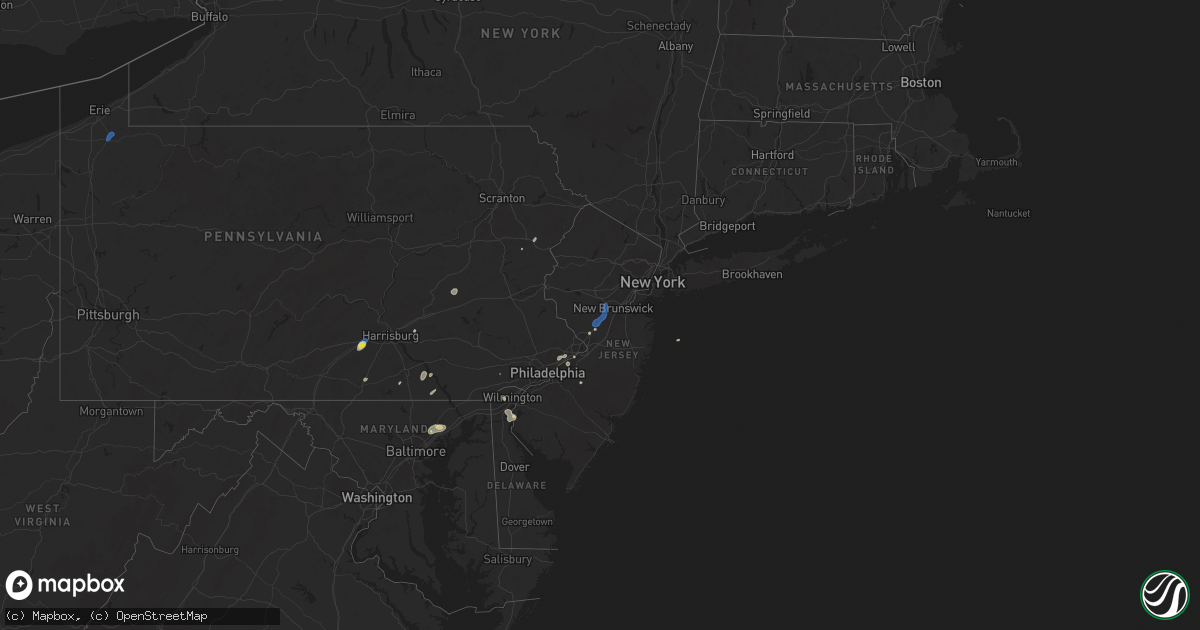
June 30 map
$229
one time, instant access
Download today. No call, no setup
Keep the $229
Bought the map and want the full workflow? Apply the entire $229 to a subscription within 7 days. None of it is wasted.
Every map, not just this one
This buys you this map. Subscription and you get every map we run, in the markets you choose from a few cities to whole states to nationwide. Plus real-time alerts the moment a storm fires.
Contact data
Name, contact info, occupancy, even credit band for addresses in the footprint. You go from where it hit to who to call.
Become the source they trust
Unlimited branding weather history reports on demand. You already have the documented answer ready for the property owner, and you are the one who showed up with it.
Property data and RoofTrace estimates
Pull up any address you have got, its value and the exact code rules for that jurisdiction, straight from One Click Code. Then RoofTrace estimates the squares, pitch, and roof value, priced the way you price.
States Impacted by Hail Map on June 30, 2025
Storm reports
Texas
| Date | Description |
|---|---|
| 06/30/20253:44 PM CDT | Multiple large tree limbs down... Along with roof damage to a building. |
Arkansas
| Date | Description |
|---|---|
| 06/29/202511:03 PM CDT | A local report indicates 60 MPH wind near 1 WSW Gibson |
Mississippi
| Date | Description |
|---|---|
| 06/30/20252:17 PM CDT | Fence down at henrys bar and grill and unknown damage to storage building at atlas auto. |
Utah
| Date | Description |
|---|---|
| 06/30/20256:30 PM CDT | Thunderstorm wind gusts damaged the main camp. Three staked port a potties were blown over. Shower unit canopy was blown over... Several tents rolled away including one |
| 06/30/20255:49 PM CDT | Asos station kmlf milford municipal airport. |
| 06/29/202511:20 PM CDT | Mesonet station dpg24 w of wildcat. |
| 06/29/202511:10 PM CDT | Mesonet station dpg15 salt flats. |
| 06/29/20258:40 PM CDT | Mesonet station utr20 ut-20. |
Missouri
| Date | Description |
|---|---|
| 06/30/20253:02 PM CDT | Delayed report. Downed tree and wires near douglas street. Time estimated from radar. |
| 06/30/202511:00 AM CDT | Mping report of tree limbs down in the fayette area. Power outages were reported in the area as well. Time estimated from radar. |
| 06/30/202511:00 AM CDT | Private weather station reported a 60-mph gust in the wake of thunderstorms moving through about 15-30 minutes prior. Weather station also reported a small pressure dro |
Delaware
| Date | Description |
|---|---|
| 06/30/20252:30 PM CDT | Tree snapped in half. Time estimated from radar. |
| 06/30/202512:32 PM CDT | Multiple trees and wires down. Time estimated from radar. |
| 06/30/202512:31 PM CDT | Pictures of several branches down and a few large trees down. Time estimated from radar. |
| 06/30/202512:30 PM CDT | Corrects time of previous tstm wnd dmg report from elsmere. Tree into a house. Time estimated from radar. |
| 06/30/202512:30 PM CDT | Multiple trees and wires down on kirkwood highway. Time estimated from radar. |
| 06/30/202512:16 PM CDT | Report of large tree branches down along omar road west of pyle center road... Including some down on power lines. Several videos via social media support that this dam |
| 06/29/20258:27 PM CDT | Report of a tree fallen onto a house near the intersection of catalpa ave and s maryland ave in wilmington. |
| 06/29/20258:16 PM CDT | *** 1 fatal... 1 inj *** updates previous tstm wnd dmg report from 1 wnw west park. Tree down onto a vehicle with a trapped occupant near lancaster pike and hedgerow pl |
Wisconsin
| Date | Description |
|---|---|
| 06/30/20253:42 PM CDT | Fire department provided photos of multiple trees snapped from 8th street east to townline road along ripley street in cornell. Suspected microburst. Time estimated via |
Pennsylvania
| Date | Description |
|---|---|
| 06/30/20255:36 PM CDT | Tree down blocking charleston road near the intersection of catlin hollow road. |
| 06/30/20254:27 PM CDT | Tree down on perry hwy. Time estimated via radar. |
| 06/30/20254:26 PM CDT | Tree down on roadway. |
| 06/30/20254:16 PM CDT | Trees and wires down at the intersection of paradise valley road and route 715. Time estimated from radar. |
| 06/30/20254:12 PM CDT | Trees and wires down at the intersection of carlton road and paradise valley road. Time estimated from radar. |
| 06/30/20254:02 PM CDT | Tree on a house on courtyard drive slightly north of carlisle. |
| 06/30/20254:01 PM CDT | Multiple tree and wires down in carlisle. |
| 06/30/20252:16 PM CDT | Trees down along woodhaven avenue in northeast philadelphia. Time estimated from radar. |
| 06/30/20252:15 PM CDT | Reports of a tree down. |
| 06/30/20252:14 PM CDT | Multiple trees down in pottsville... With a report of a tree falling on a car on the 800 block of fairmount avenue. No injuries reported. |
| 06/30/20252:14 PM CDT | Multiple trees down in the area of weigand blvd. |
| 06/30/202512:02 AM CDT | Tree down on us-30 eastbound at kinzer rd. |
| 06/29/202511:31 PM CDT | Trees down on lancaster pike... Caus |
| 06/29/202511:31 PM CDT | Trees down on lancaster pike... Causing it to be closed for a short time. |
| 06/29/202511:00 PM CDT | Picture of tree down lying across wissinger rd in bechtelsville. Time estimated. |
| 06/29/202510:35 PM CDT | Trees on wires at the intersection of mcfarland drive and penningdon drive. |
New Jersey
| Date | Description |
|---|---|
| 06/30/20254:11 PM CDT | Multiple trees down. Time estimated from radar. |
| 06/30/20254:06 PM CDT | Multiple trees down. Time estimated from radar. |
| 06/30/20253:59 PM CDT | Trees and wires down. Time estimated from radar. |
| 06/30/20253:55 PM CDT | Trees and wires down at the intersection of raritan ave and ashland road. Time estimated from radar. |
| 06/30/20253:54 PM CDT | Multiple trees down. Time estimated from radar. |
| 06/30/20253:25 PM CDT | Trees and wires down at the intersection of schalks crossing road and research way. Time estimated from radar. |
| 06/30/20253:25 PM CDT | Trees and wires down at the intersection of schalks crossing road and wyndhurst drive. Time estimated from radar. |
| 06/30/20253:23 PM CDT | Multiple trees uprooted and large tree branches snapped. Time estimated from radar. |
| 06/30/20253:23 PM CDT | Multiple trees down at intersection of schalks crossing road and scudders mill road. Time estimated from radar. |
| 06/30/20253:15 PM CDT | Multiple reports of trees and wires down. Time estimated from radar. |
| 06/30/20253:04 PM CDT | Multiple reports of trees and wires down. Time estimated from radar. |
| 06/30/20253:04 PM CDT | Multiple reports of trees and wires down. Time estimated from radar. |
| 06/30/20253:04 PM CDT | Multiple reports of trees and wires down. Time estimated from radar. |
New Mexico
| Date | Description |
|---|---|
| 06/30/20253:40 PM CDT | Mesonet station wsm43 little burro |
| 06/29/20257:50 PM CDT | Reported at deming municipal airport at 642 pm. |
Maryland
| Date | Description |
|---|---|
| 06/30/20256:28 PM CDT | Tree down near the 400 block of sunny view road. |
| 06/30/20255:45 PM CDT | Three calls for trees down near freeland towards the state line. |
| 06/30/20255:12 PM CDT | Several reports of trees down on the northeast side of fallston towards bel air. |
| 06/30/20254:11 PM CDT | Large tree down at the intersection of bel air rd. And new cut rd. |
| 06/30/20254:11 PM CDT | Large |
| 06/30/20254:07 PM CDT | Several trees and wires down in the city of kingsville. |
| 06/29/20257:17 PM CDT | Tree down and siding ripped off home near the 700 block of ruddy ct. |
Alabama
| Date | Description |
|---|---|
| 06/29/20257:30 PM CDT | Large tree blocking alabama highway 116. |
| 06/29/20257:30 PM CDT | Large tree down between church street and alabama h |
| 06/29/20257:30 PM CDT | Large tree down between church str |
| 06/29/20257:30 PM CDT | Large tree down between church street and alabama highway 39. |
Oklahoma
| Date | Description |
|---|---|
| 06/30/20255:11 PM CDT | Personal weather station. |
Arizona
| Date | Description |
|---|---|
| 06/30/20256:14 PM CDT | Wind gust recorded at safford airport. |
| 06/29/20258:50 PM CDT | Delayed report. 6 inch diameter tree branch downed from thunderstorm outflow winds. Time estimated from radar. |
Oregon
| Date | Description |
|---|---|
| 06/29/20259:25 PM CDT | 1 inch diameter limbs broken off and 1.63 inches of rain reported with a thunderstorm on monday evening. Station elevation: 4500 ft. |
Michigan
| Date | Description |
|---|---|
| 06/30/20256:30 PM CDT | Branches up to 2 inches in diameter downed. Time estimated by radar. |
| 06/30/20254:10 PM CDT | Tree blocking southside rd half mile north of m-94. Time approximated by reporter. |
| 06/29/20258:00 PM CDT | From facebook message... The damage is as follows across the town: pine tree broke off at base approximately 2 to 3 ft in diameter. Another 1 to 2 ft diameter tree spli |
Minnesota
| Date | Description |
|---|---|
| 06/30/20256:57 PM CDT | Cottonwood tree down over road. |
West Virginia
| Date | Description |
|---|---|
| 06/30/20251:52 PM CDT | Tree down on 500 block of middle ridge road. |
Cities Impacted by Hail Map on June 30, 2025
- Lyman, NE
- Harrisburg, NE
- Hawk Springs, WY
- Lagrange, WY
- Morrill, NE
- Scottsbluff, NE
- Torrington, WY
- Gering, NE
- Yoder, WY
- Mitchell, NE
- Brookfield, WI
- Elm Grove, WI
- Milwaukee, WI
- Butler, WI
- Menomonee Falls, WI
- Mequon, WI
- Saint Helen, MI
- Ordway, CO
- Corona, NM
- Lincoln, MI
- Laingsburg, MI
- Owosso, MI
- Santa Fe, NM
- West Chester, PA
- Stanley, NM
- Hershey, PA
- Palmyra, PA
- Durand, MI
- Crystal Falls, MI
- Medford, NJ
- Hudson, WI
- New Richmond, WI
- Schuylkill Haven, PA
- Moriarty, NM
- Philadelphia, PA
- Cressona, PA
- Auburn, PA
- Pottsville, PA
- Socorro, NM
- Moorestown, NJ
- Riverside, NJ
- Ackerly, TX
- Lamesa, TX
- Woodville, WI
- Wilson, WI
- Fort Davis, TX
- Belleville, AR
- Seminole, TX
- Willingboro, NJ
- Beverly, NJ
- Andrews, TX
- Polo, MO
- Lamy, NM
- Tijeras, NM
- Albuquerque, NM
- Burlington, NJ
- Bensalem, PA
- Wilmington, DE
- Baldwin, WI
- Glenwood City, WI
- Downing, WI
- Bristol, PA
- Westcliffe, CO
- Everglades City, FL
- Spring Valley, WI
- Trenton, NJ
- Lawrence Township, NJ
- Plainsboro, NJ
- Princeton, NJ
- Monmouth Junction, NJ
- Kingston, NJ
- Kendall Park, NJ
- Clines Corners, NM
- Estancia, NM
- Pennsville, NJ
- Tecumseh, NE
- Johnson, NE
- Willard, NM
- Princeton Junction, NJ
- Middletown, DE
- Salem, NJ
- New Castle, DE
- Delaware City, DE
- Franklin Park, NJ
- North Brunswick, NJ
- Somerset, NJ
- Mountainair, NM
- Clinton, AR
- Bee Branch, AR
- Holloman Air Force Base, NM
- Alamogordo, NM
- Hermleigh, TX
- Tularosa, NM
- Snyder, TX
- Glenwood, NM
- Torreon, NM
- Kingsville, MD
- Datil, NM
- Ribera, NM
- Ira, TX
- Carlisle, PA
- Balmorhea, TX
- Jefferson, CO
- Fairplay, CO
- Asher, OK
- Wanette, OK
- Vermont, IL
- Waterford, PA
- Lindsay, OK
- Byars, OK
- Bailey, CO
- Kermit, TX
- Red Lion, PA
- Windsor, PA
- Felton, PA
- Rule, TX
- Plainville, IL
- Liberty, IL
- Effort, PA
- Henryville, PA
- East Stroudsburg, PA
- Tannersville, PA
- Lawton, OK
- Geronimo, OK
- Lake George, CO
- Sedalia, CO
- Ada, OK
- Payson, IL
- Pauls Valley, OK
- Silver City, NM
- Wanatah, IN
- Hanna, IN
- Bruce Crossing, MI
- Mule Creek, NM
- Paoli, OK
- Munday, TX
- Magdalena, NM
- Fittstown, OK
- Fitzhugh, OK
- Fisk, MO
- Atoka, TN
- Millington, TN
- Cubero, NM
- Glen Arm, MD
- Prudenville, MI
- Brighton, TN
- Kiowa, OK
- Pittsburg, OK
- Wrightsville, PA
- Lacombe, LA
- Stonewall, OK
- Maysville, OK
- Stratford, OK
- Haskell, TX
- Poplar Bluff, MO
- Weinert, TX
- Dudley, MO
- Safford, AZ
- Blanco, OK
- Fork, MD
- Hydes, MD
- Seven Valleys, PA
- Baldwin, MD
- Fallston, MD
- Aspermont, TX
- Grandfield, OK
- Roosevelt, OK
- Coalgate, OK
- Seymour, TX
- Morenci, AZ
- Clifton, AZ
- Indiahoma, OK
- Wardville, OK
- Rush Springs, OK
- Joppa, MD
- Zenia, CA
- Hollister, OK
- Elgin, OK
- Fort Sill, OK
- Deming, NM
- Hurley, NM
- Woodland Park, CO
- Davidson, OK
- Cache, OK
- Abingdon, MD
- Bel Air, MD
- Loveland, OK
- Electra, TX
- Harrold, TX
- Walters, OK
- Atoka, OK
- Faxon, OK
- Wynnewood, OK
- Aliceville, AL
- Sylvester, GA
- Bonnerdale, AR
- Honobia, OK
- Marlow, OK
- Boligee, AL
- Edgewood, MD
- Upper Falls, MD
- Perry Hall, MD
- Kendall, WI
- Colorado Springs, CO
- Duncan, OK
- Florissant, CO
- Wilton, WI
- Guffey, CO
- Crowell, TX
- Bethel, OK
- Tomah, WI
- Fort Klamath, OR
- Vernon, TX
- Opelousas, LA
- Forks Of Salmon, CA
- Elroy, WI
- Gettysburg, PA
- New Oxford, PA
- Larkspur, CO
- Cass City, MI
- Port Barre, LA
- Washington, LA
- Healdton, OK
- Havana, AR
- Usaf Academy, CO
- Graham, OK
- Tupelo, OK
- Wapanucka, OK
- Lockney, TX
- Airville, PA
- Fawn Grove, PA
- Wilson, OK
- Gagetown, MI
- Lone Grove, OK
- Arlington, TN
- Saylorsburg, PA
- Montoursville, PA
- Williamsport, PA
- Cogan Station, PA
- Conestoga, PA
- Bartonsville, PA
- Hockessin, DE
- Franklin, MO
- Glasgow, MO
- Fayette, MO
- Armstrong, MO
- Clark, MO
- Rocheport, MO
- New Franklin, MO
- Harrisburg, MO
- Higbee, MO
- Sturgeon, MO
- Columbia, MO
- North Little Rock, AR
- Mayflower, AR
- Maumelle, AR
- Sherwood, AR
- Jacksonville, AR
- Carrizozo, NM
- Truth Or Consequences, NM