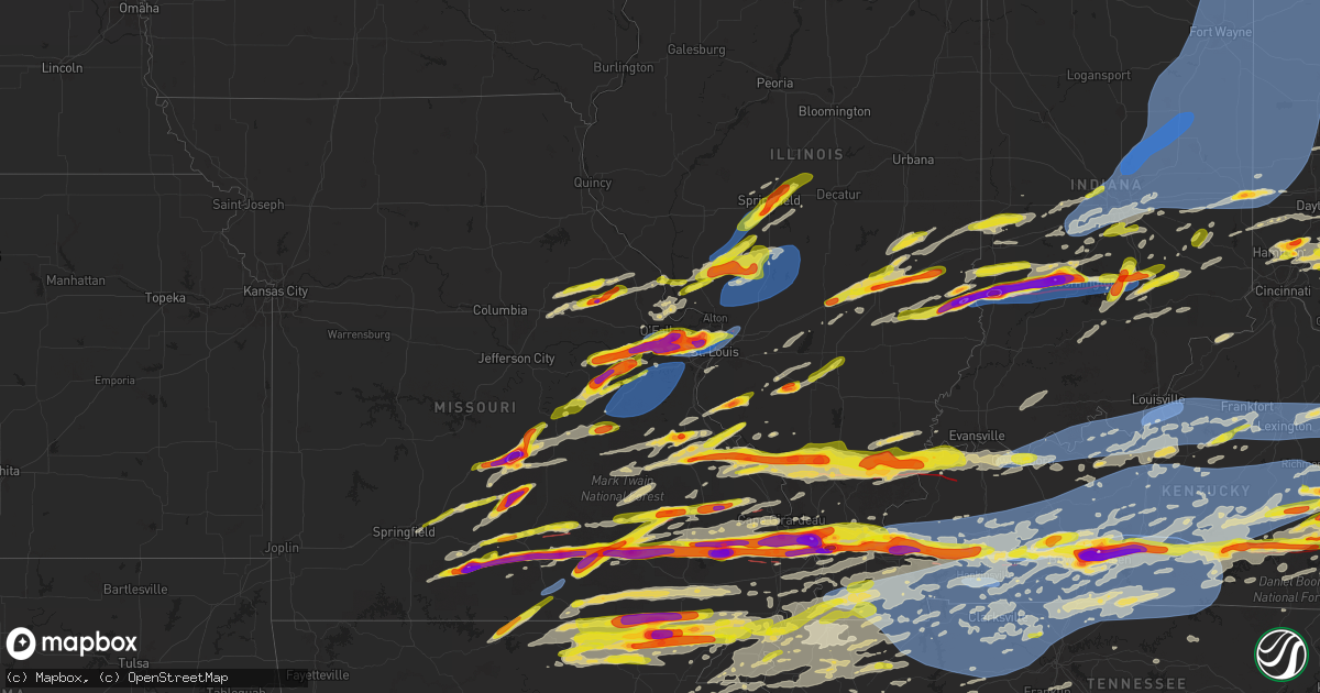
Hail Map on May 16, 2025
Get this storm
May 16 map
$229
one time, instant access
Download today. No call, no setup
Keep the $229
Bought the map and want the full workflow? Apply the entire $229 to a subscription within 7 days. None of it is wasted.
Every map, not just this one
This buys you this map. Subscription and you get every map we run, in the markets you choose from a few cities to whole states to nationwide. Plus real-time alerts the moment a storm fires.
Contact data
Name, contact info, occupancy, even credit band for addresses in the footprint. You go from where it hit to who to call.
Become the source they trust
Unlimited branding weather history reports on demand. You already have the documented answer ready for the property owner, and you are the one who showed up with it.
Property data and RoofTrace estimates
Pull up any address you have got, its value and the exact code rules for that jurisdiction, straight from One Click Code. Then RoofTrace estimates the squares, pitch, and roof value, priced the way you price.
States Impacted by Hail Map on May 16, 2025
Storm reports
Illinois
| Date | Description |
|---|---|
| 05/16/20256:51 PM CDT | A local report indicates 1.00 inch wind near Rockford Airport |
| 05/16/20256:19 PM CDT | Reported tornado on the ground. |
| 05/16/20256:16 PM CDT | A local report indicates 1.50 inch wind near 3 S Greenup |
| 05/16/20256:13 PM CDT | Report from mping: quarter |
| 05/16/20256:12 PM CDT | A local report indicates 1.75 inch wind near Cambria |
| 05/16/20256:10 PM CDT | A local report indicates 1.75 inch wind near 3 SSW Jewett |
| 05/16/20256:07 PM CDT | Report from mping: ping pong ball |
| 05/16/20256:01 PM CDT | Report from mping: quarter |
| 05/16/20255:59 PM CDT | A local report indicates 1.00 inch wind near Cambria |
| 05/16/20255:57 PM CDT | A local report indicates 1.75 inch wind near 4 NW Murphysboro |
| 05/16/20255:49 PM CDT | Broadcast media relayed viewer report of quarter sized hail in sigel. |
| 05/16/20255:49 PM CDT | Broadcast media relayed viewer report of golf ball sized hail in effingham. |
| 05/16/20255:33 PM CDT | A local report indicates 1.25 inch wind near 1 N Coles County Airpor |
| 05/16/20255:24 PM CDT | Private weather station kilmilfo14 reported 63 mph gust near milford. |
| 05/16/20255:16 PM CDT | Private weather station reported 59 mph gust near cissna park. |
| 05/16/20255:13 PM CDT | Emergency manager reports tree in roadway near melvin street and 15th street in gibson city. |
| 05/16/20255:10 PM CDT | Power lines downed on east patton street in paxton. Time estimated. |
| 05/16/20255:09 PM CDT | A local report indicates 1.00 inch wind near Robinson |
| 05/16/20255:05 PM CDT | A local report indicates 2.75 inch wind near 2 W Robinson Municipal |
| 05/16/20255:00 PM CDT | A local report indicates 2.75 inch wind near Robinson |
| 05/16/20255:00 PM CDT | A local report indicates 3.00 inch wind near Robinson |
| 05/16/20255:00 PM CDT | A local report indicates 2.00 inch wind near 1 NNE Robinson |
| 05/16/20254:57 PM CDT | A power line was blown down at lakewood manor. |
| 05/16/20254:57 PM CDT | Power lines were blown down at route 40 and 900th street. |
| 05/16/20254:53 PM CDT | Power lines were blown down across lake sara road. |
| 05/16/20254:48 PM CDT | A power line was blown down at route 40 and 500th street. |
| 05/16/20254:46 PM CDT | Delayed report. |
| 05/16/20254:46 PM CDT | Tree branches were blown across route 40 southwest of altamont. |
| 05/16/20254:43 PM CDT | Report from mping: quarter |
| 05/16/20254:34 PM CDT | A local report indicates 1.25 inch wind near Mound City |
| 05/16/20254:15 PM CDT | Multiple trees were blown down near lake decatur. |
| 05/16/20254:15 PM CDT | A flag pole was snapped. |
| 05/16/20254:15 PM CDT | Numerous tree branches and power lines were blown down across decatur. |
| 05/16/20254:14 PM CDT | *** 1 inj *** a tree fell onto a house on bayview drive. One person sustained a head injury. |
| 05/16/20254:12 PM CDT | Tornado reported on the ground. |
| 05/16/20254:02 PM CDT | A car lot roof was partially blown off and multiple trees were blown down. |
| 05/16/20253:52 PM CDT | Report from mping: quarter |
| 05/16/20253:49 PM CDT | Several large tree limbs were blown down. |
| 05/16/20253:35 PM CDT | Public report of 2 inch hail 4w nashville. |
| 05/16/20253:35 PM CDT | Pictures received on x. Time estimated. |
| 05/16/20253:20 PM CDT | Near camp butler national cemetery. |
| 05/16/20253:17 PM CDT | A local report indicates 1.75 inch wind near 2 ENE Southern View |
| 05/16/20253:17 PM CDT | Time estimated by radar. |
| 05/16/20253:17 PM CDT | Multiple power poles down. |
| 05/16/20253:17 PM CDT | Tree damage throughout town. |
| 05/16/20253:16 PM CDT | Power poles were broken and power lines were blown down in the harvard park neighborhood. |
| 05/16/20253:15 PM CDT | Pictures received on x of a few small trees uprooted. Time estimated. |
| 05/16/20253:14 PM CDT | Trees down near route 16 and route 127. Time estimated by radar. |
| 05/16/20253:05 PM CDT | Received a picture of a large tree down. Time estimated. |
| 05/16/20253:05 PM CDT | Numerous tree limbs down with structural damage to several homes along emert avenue and johnson road in granite city. |
| 05/16/20253:02 PM CDT | Tree down. Power pole and transformer taken down by tree. |
| 05/16/20253:01 PM CDT | Report from mping: quarter |
| 05/16/20253:00 PM CDT | Pictures received on x. Time estimated. |
| 05/16/20252:59 PM CDT | Ham radio operator relayed reports of a tree down across summerfield road and lilac road. |
| 05/16/20252:58 PM CDT | A local report indicates 1.50 inch wind near Red Bud |
| 05/16/20252:58 PM CDT | Corrects previous hail report from red bud. |
| 05/16/20252:57 PM CDT | Report from mping: quarter |
| 05/16/20252:57 PM CDT | Report from mping: quarter |
| 05/16/20252:55 PM CDT | 12 inch tree limbs down. Estimated wind speeds of 70 mph. Time estimated by radar. |
| 05/16/20252:55 PM CDT | Report from mping: half dollar |
| 05/16/20252:55 PM CDT | A large branch snapped from a large healthy tree. |
| 05/16/20252:54 PM CDT | Ham radio operator report near pontoon road and maryville road in granite city. |
| 05/16/20252:52 PM CDT | 15-inch tree down at the roots with quarter-size hail. |
| 05/16/20252:51 PM CDT | Damage in the area including trees and a snapped flag pole. |
| 05/16/20252:43 PM CDT | Several calls received over northern st. Clair county for trees and power lines down. Time estimated by radar. |
| 05/16/20252:41 PM CDT | Numerous large trees snapped. |
| 05/16/20252:40 PM CDT | Trees and powerlines down. Time estimated by radar. |
| 05/16/20253:28 AM CDT | A brick outbuilding had its roof taken off and walls collapsed by thunderstorm winds. Report via email. |
| 05/15/20257:13 PM CDT | A local report indicates 2.75 inch wind near Mounds |
| 05/15/20257:05 PM CDT | Report from mping: half dollar |
| 05/15/20257:04 PM CDT | A local report indicates 2.75 inch wind near 3 N Mounds |
| 05/15/20257:00 PM CDT | A local report indicates 1.00 inch wind near Cherry Valley |
New York
| Date | Description |
|---|---|
| 05/16/20256:14 PM CDT | Tree down on wires as per county dispatch feed. |
| 05/16/20253:10 PM CDT | Tree down on high tension lines and blocking the road near the intersection of eddy/north star and farrand roads. |
| 05/16/20253:08 PM CDT | Tree down on wires on eddy road. |
| 05/16/20256:58 AM CDT | Trees and wires down on shaw rd. |
| 05/16/20256:58 AM CDT | Trees and wires down |
Pennsylvania
| Date | Description |
|---|---|
| 05/16/20255:30 PM CDT | Tree down on wires on state route 285 near south canal road. Time estimated via radar. |
| 05/16/20255:21 PM CDT | Dispatch scanner reported a tree down on burns road near east lake road. Time estimated via radar. |
| 05/16/20255:04 PM CDT | Trees and wires down on a house on kittatinny sreet. |
| 05/16/20254:52 PM CDT | Trees and wires down on steigerwalt hollow road. |
| 05/16/20254:44 PM CDT | Numerous reports of trees down in wires around arch rock. |
| 05/16/20254:42 PM CDT | Trees down on wires. |
| 05/16/20254:36 PM CDT | Trees and power poles down along grim hollow road. |
| 05/16/20254:30 PM CDT | Trees and wires down across jacobs mill road. |
| 05/16/20254:10 PM CDT | Quarter size hail near new bloomfield. |
| 05/16/20253:52 PM CDT | Trees down across baltimore pike at white road. |
| 05/16/20252:58 PM CDT | Trees down on wires. |
| 05/16/20252:48 PM CDT | Tree down on pennsylvania avenue. |
| 05/16/20252:30 PM CDT | A local report indicates 1.25 inch wind near 2 WSW Mcalevys Fort |
| 05/16/20251:58 PM CDT | Trees down on wires northwest of warriors mark. |
| 05/16/20251:55 PM CDT | Tree down across roadway near laurel lane. |
| 05/16/202511:06 AM CDT | Tree onto car. Time estimated from radar. |
| 05/16/202511:06 AM CDT | Wires down. Time estimated from radar. |
| 05/16/202511:06 AM CDT | Telephone pole into a roof. Time estimated from radar. |
| 05/16/202511:05 AM CDT | Several large trees down in the andorra part of philadelphia. Time estimated from radar. |
| 05/16/202510:45 AM CDT | Small and large tree branches down. Time estimated from radar. |
| 05/16/202510:38 AM CDT | Downed tree in wires on central av / cedar hollow rd northbound at central av. There is a traffic disruption. |
| 05/16/20259:55 AM CDT | *** 1 inj *** tree down on house in exeter township. Report of at least 1 injury. Time estimated from radar. |
| 05/16/20259:54 AM CDT | Trees and wires down. Time estimated from radar. |
| 05/16/20259:50 AM CDT | Wires down - wires down on an unoccupied car. Time estimated from radar. |
| 05/16/20259:48 AM CDT | Wires down along centre street and franklin street. Time estimated from radar. |
| 05/16/202512:20 AM CDT | Trees down on mcclellandtown road. |
| 05/16/202512:07 AM CDT | Tree down on power lines in canonsburg. Picture provided. |
| 05/16/202512:01 AM CDT | Trees down in the franklin township region. |
| 05/15/202511:56 PM CDT | Trees down in richhill township area. |
| 05/15/202511:45 PM CDT | Trees down in the aleppo area. |
Maryland
| Date | Description |
|---|---|
| 05/16/20256:00 PM CDT | Picture of hail received via social media in hurlock md. |
| 05/16/20255:55 PM CDT | Wind damage in the galestown area of dorchester county. Time estimated from radar. |
| 05/16/20255:55 PM CDT | Trees and wires down. Time estimated from radar. |
| 05/16/20255:50 PM CDT | Trees and powerlines down throughout easton... With two trees on homes. Time estimated from radar. |
| 05/16/20255:49 PM CDT | Report from mping: quarter |
| 05/16/20255:47 PM CDT | A local report indicates 60 MPH wind near 2 W Tanyard |
| 05/16/20255:45 PM CDT | Report from mping: quarter |
| 05/16/20255:45 PM CDT | Pictured shared via social media. |
| 05/16/20255:40 PM CDT | Picture of a snapped tree sent via social media. Time estimated from radar. |
| 05/16/20255:40 PM CDT | 1.5 inch hail reported. Time estimated from radar. |
| 05/16/20255:33 PM CDT | A local report indicates 72 MPH wind near 10 ENE Plum Point |
| 05/16/20255:22 PM CDT | Ndbc sensor |
| 05/16/20255:18 PM CDT | Tree down on the road across susquehanna river road. Time estimated from radar. |
| 05/16/20255:14 PM CDT | A local report indicates 58 MPH wind near 5 ESE Bay Ridge |
| 05/16/20255:14 PM CDT | A local report indicates 74 MPH wind near Patuxent River NAS |
| 05/16/20255:10 PM CDT | Several trees and power lines downed near 2900th block of main street in edgewater. |
| 05/16/20255:10 PM CDT | Report sent on social media of 1 inch hail. |
| 05/16/20255:10 PM CDT | Trees snapped near the 2100 block of broening highway. |
| 05/16/20255:08 PM CDT | Tree blew down into the roadway on eb md-260 chesapeake beach road. Time estimated by radar. |
| 05/16/20255:06 PM CDT | Roofs blown off a couple row houses... Trees downed... And other minor structural damage on fairway in old dundalk next to yorkway along with yorkway and sellers point |
| 05/16/20255:05 PM CDT | Several trees downed in piney point area. |
| 05/16/20255:03 PM CDT | Tree blew down into the roadway on sb md-260 w. Chesapeake beach road. Time based on radar. |
| 05/16/20255:01 PM CDT | Reports of trees down in the joppa area. |
| 05/16/20255:01 PM CDT | Tree downed onto power lines at intersection of soaper ave and magothy beach rd in pasadena. |
| 05/16/20255:01 PM CDT | Nws storm survey can confirm a tornado touched down around federal hill in baltimore city and tracked east before lifting in dundalk. The tornado was given a preliminar |
| 05/16/20255:00 PM CDT | Significant tree... Power line... And damage to buildings along merritt blvd and meadow lane. |
| 05/16/20255:00 PM CDT | Reports of trees down in the bel air area. |
| 05/16/20255:00 PM CDT | Large tree and several power lines downed along ferry landing road in dunkirk. |
| 05/16/20254:57 PM CDT | Reports of trees down in the fallston area. |
| 05/16/20254:55 PM CDT | Tree blew down into the roadway on md-725 marlboro pike at us-301 crain highway. Time estimated by radar. |
| 05/16/20254:53 PM CDT | Tree blew down into the roadway on md-382 croom road at molly berry road. Time estimated by radar. |
| 05/16/20254:53 PM CDT | Damage to building along boston street and s clinton st |
| 05/16/20254:52 PM CDT | Tree blew down into the roadway on nb us-29 colesville rd at eb md-193 university blvd. Time estimated by radar. |
| 05/16/20254:52 PM CDT | Metal roof on gym partially removed. |
| 05/16/20254:52 PM CDT | Reports of trees down in the jarrettsville |
| 05/16/20254:51 PM CDT | Nws storm survey can confirm a tornado touched down around federal hill in baltimore city and tracked east before lifting in dundalk. The tornado was given a preliminar |
| 05/16/20254:51 PM CDT | Tree blew down into the roadway on wb md-202 largo road at dunloring drive. Time estimated from radar. |
| 05/16/20254:50 PM CDT | Tree blew down into the roadway on us-301 crain highway at md-382 croom road. Time based on radar. |
| 05/16/20254:48 PM CDT | Tree blew down into the roadway on sb 1-95 at exit 47a/sb i-195. Time estimated from radar. |
| 05/16/20254:48 PM CDT | Siding partially removed off an apartment building near the 140 block of nunnery lane. |
| 05/16/20254:47 PM CDT | A local report indicates 63 MPH wind near Andrews AFB |
| 05/16/20254:45 PM CDT | A local report indicates 58 MPH wind near 2 SE Clinton |
| 05/16/20254:44 PM CDT | Mdot sensor gust to 62 mph. |
| 05/16/20254:43 PM CDT | Two trees down at spotter location. |
| 05/16/20254:41 PM CDT | Uprooted tree in the springlake community |
| 05/16/20254:40 PM CDT | Large tree downed on oak drive in catonsville. |
| 05/16/20254:39 PM CDT | Reports of multiple trees down on nunnery lane. |
| 05/16/20254:38 PM CDT | Trees blew down on md-210 indian head highway at palmer road. |
| 05/16/20254:38 PM CDT | Multiple trees down on shawan road in cockeysville... Md. Time estimated by radar. |
| 05/16/20254:38 PM CDT | Tree blew down into the roadway on sb i-83 past belfast road |
| 05/16/20254:36 PM CDT | A pair of trees down in the kendall ridge neighborhood |
| 05/16/20254:35 PM CDT | Trees blew down into the roadway on md-25 falls road at shawan road/tufton avenue. |
| 05/16/20254:34 PM CDT | Carroll county em reports numerous trees downed in the hampstead area. |
| 05/16/20254:34 PM CDT | A local report indicates 1.00 inch wind near 2 N Reisterstown |
| 05/16/20254:31 PM CDT | Several trees downed on harpers farm road. |
| 05/16/20254:30 PM CDT | Tree branches downed onto power lines along 4400 block of edgebrook road. |
| 05/16/20254:29 PM CDT | 1 foot diameter tree down. |
| 05/16/20254:29 PM CDT | Trees blew down into the roadway on southbound md-650 new hampshire avenue at stonegate drive. |
| 05/16/20254:28 PM CDT | A local report indicates 2.50 inch wind near 4 SSE Hampstead |
| 05/16/20254:27 PM CDT | Montgomery county em reports tree onto a house at 19000 block of new hampshire ave. |
| 05/16/20254:27 PM CDT | Trees blew down into the roadway on eastbound md-927 montrose road at i-270 washington national pike. |
| 05/16/20254:25 PM CDT | Trees blew down onto wires on redland road near mill run drive blocking the entire roadway. |
| 05/16/20254:24 PM CDT | Trees blew down into the roadway on eastbound md-117 clopper road at i-270 washington national pike. |
| 05/16/20254:22 PM CDT | Montgomery county em reports several trees downed in the flower hills area. A tree fell onto a house near intersection of cochrane ct and cochrane way |
| 05/16/20254:22 PM CDT | Trees blew down into the roadway on eastbound md-117 clopper road at game preserve road blocking the right side of the roadway. |
| 05/16/20254:21 PM CDT | Around a dozen trees downed in the deerwood area. |
| 05/16/20254:21 PM CDT | Numerous reports of downed trees in derwood |
| 05/16/20254:20 PM CDT | Wires and tree branches down near the 14000 block of darnestown road |
| 05/16/20254:19 PM CDT | Multiple reports of power lines down in new windsor... Md. |
| 05/16/20254:18 PM CDT | Tree blew down on md-28 darnestown road blocking all lanes near seneca creek. Time estimated by radar. |
| 05/16/20254:16 PM CDT | Tree branches onto wires along the 14000 block of darnestown road. |
| 05/16/20254:16 PM CDT | Carroll county em reports several trees downed from south of westminster to winfield. |
| 05/16/20254:12 PM CDT | A local report indicates 1.00 inch wind near 4 ENE Westminster |
| 05/16/20254:11 PM CDT | A local report indicates 1.50 inch wind near 1 NNE Westminster |
| 05/16/20254:02 PM CDT | Trees blew down into the roadway on md-75 green valley road at jones road. |
| 05/16/20253:58 PM CDT | Trees reported down on ridge ave. In mt. Airy. |
| 05/16/20253:58 PM CDT | Several reports of trees down along the us-15 corridor from emmittsburg south through thurmont. |
| 05/16/20253:57 PM CDT | Several trees reported down along the us-15 corridor from utica to frederick. |
| 05/16/20253:57 PM CDT | Several trees reported down along the us-15 corridor from utica to frederick. |
| 05/16/20253:46 PM CDT | Power lines reported down in silver spring... One of which was a snapped power pole. |
| 05/16/20253:44 PM CDT | A couple of trees reported down in kensington. |
| 05/16/20253:36 PM CDT | Trees down on wires. |
| 05/16/20252:59 PM CDT | Multiple trees down around little orleans. |
| 05/16/20252:51 PM CDT | Numerous trees down around flintstone. |
| 05/16/20252:37 PM CDT | Tree down near the 800 block of shades lane. |
| 05/16/20252:05 PM CDT | Tree down on wires. |
New Jersey
| Date | Description |
|---|---|
| 05/16/20251:00 PM CDT | Hail up to the size of golf ball. Time estimated from radar. |
| 05/16/202512:45 PM CDT | Wires down on gravel hole road and holly glen lane. Wires sparking. Time estimated from radar. |
| 05/16/202511:58 AM CDT | Numerous trees down cains mill rd section of collings lakes. Time estimated from radar. |
| 05/16/202511:56 AM CDT | Trees and wires down on edgewood road. Tornado possible. |
| 05/16/202511:56 AM CDT | Numerous trees and wires down across collings lakes... At least one into a house with major damage. Possible tornado. Time estimated from radar. |
| 05/16/202511:52 AM CDT | Trees and wires down along route 54 near hammonton. Time estimated from radar. |
| 05/16/202511:52 AM CDT | An ef-0 tornado occurred near collings lakes new jersey. The first damage was noted along malaga road where large branches were downed and some metal roof sheeting was |
| 05/16/202511:50 AM CDT | Tress down along cains mill road. Time estimated from radar. |
| 05/16/202511:41 AM CDT | Trees and wires down throughout the area. Time estimated from radar. |
| 05/16/202511:38 AM CDT | Trees and powerlines down. Time estimated from radar. |
| 05/16/202511:36 AM CDT | Report of a heavily damaged shed around the bridgeton area. Possible tornado. |
South Carolina
| Date | Description |
|---|---|
| 05/16/20255:30 AM CDT | A local report indicates 1.00 inch wind near Campobello |
| 05/16/20255:20 AM CDT | Cocorahs observer reported quarter size hail just sse of gowen |
| 05/16/20255:20 AM CDT | Cocorahs observer reported quarter size hail just sse of gowensville. |
Alabama
| Date | Description |
|---|---|
| 05/16/20256:55 AM CDT | Photo of quarter sized hail just north of |
| 05/16/20256:55 AM CDT | Photo of quarter sized |
| 05/16/20256:55 AM CDT | Photo of quarter sized hail just north of clanton relayed through social media. |
| 05/16/20256:37 AM CDT | Corrects previous tstm wnd dmg report from 1 ene wedowee. Trees down ac |
| 05/16/20256:37 AM CDT | Corrects previous tstm wnd dmg |
| 05/16/20256:37 AM CDT | Corrects previous tstm wnd dmg report from 1 |
| 05/16/20256:37 AM CDT | Corrects previous tstm wnd dmg report from 1 ene wedow |
| 05/16/20256:37 AM CDT | Corrects previous tstm wnd d |
| 05/16/20256:37 AM CDT | Corrects previous tstm wnd dmg report from 1 ene wedowee. Trees down across portion of alabama highway 48 east of |
| 05/16/20256:37 AM CDT | Corrects previous tstm wnd dmg report from 1 ene wedowee. Trees down across portion of alabama highway 48 east of wedowee resulted a 2- |
| 05/16/20256:37 AM CDT | Corrects previous tstm wnd dmg report from 1 ene wedowee. Trees down across portion of alabama highway 48 east of wedowee resulted a |
| 05/16/20256:37 AM CDT | Corrects previous tstm wnd dmg report from 1 ene wedowee. Trees down across portion of |
| 05/16/20256:37 AM CDT | Corrects previous tstm wnd dmg report from 1 ene wedowee. Trees down across portion of alabama highway 48 east of we |
| 05/16/20256:37 AM CDT | Corrects previous tstm wnd dmg report from 1 ene wedowee. Trees down across portion of alabama highway 48 east |
| 05/16/20256:37 AM CDT | Corrects previous tstm wnd dmg report from 1 ene wedowee. Trees down across portion of alabama hi |
| 05/16/20256:37 AM CDT | Corrects previous tstm wnd dmg report from 1 ene wedowee. Trees down across portion of alabama highway 48 east of wedowee resulted a 2-vehicle accident. |
| 05/16/20256:35 AM CDT | Randolph co |
| 05/16/20256:35 AM CDT | Randolph county ema reports several trees down across the county and reports that the mayor of wedowee says power is out in |
| 05/16/20256:35 AM CDT | Randolph county ema reports several tree |
| 05/16/20256:35 AM CDT | Randolph county ema reports several trees down across the county and reports that the mayor of wedowee says power is out in the town. |
| 05/16/20256:35 AM CDT | Randolph county ema reports several trees down across the |
| 05/16/20256:34 AM CDT | Trees down blocking a portion of u.s. Highway 48 near wedowee. |
| 05/16/20256:34 AM CDT | Trees down blocking portions of county road 32. |
| 05/16/20256:34 AM CDT | Trees |
| 05/16/20255:54 AM CDT | Tree down blocking a portion of kentuck road. |
| 05/16/20255:46 AM CDT | Tree down blocking chadtain road. |
| 05/16/20255:46 AM CDT | Tree down blocking chadtain road. |
| 05/16/20255:40 AM CDT | Trees down blocking a portion of stemley road. |
| 05/16/20255:35 AM CDT | Tree down blocking a portion of renfroe road. |
| 05/16/20255:35 AM CDT | Tree down blocking a portion of willingham road. |
| 05/16/20255:35 AM CDT | Fire department dispatched to a report of trees down along u.s. Highway 70 near five oaks road. |
| 05/16/20255:16 AM CDT | Public phone call reported to shelby county 911 that a tree fell onto power lines along ro |
| 05/16/20255:16 AM CDT | Public phone call reported to shelby county 911 that a tree fell onto power lines along roy drive in helena. |
| 05/16/20255:16 AM CDT | St. Clair county ema reports a tree fell on a house along sunrise drive... No injuries. A couple of trees and power lines were reported down in the moody area as well. |
| 05/16/20255:08 AM CDT | Several photos submitted to local broadcast media from residents of the trussville area documenting downed trees... Some of which have impacted houses... Structures and |
| 05/16/20255:08 AM CDT | Trained spotter replayed a report from trussville pd of a tree down near the intersection of trussville-clay road and happy hollow road. |
| 05/16/20255:06 AM CDT | Mountain brook fire department dispatched to a report of a large tree down blocking oakdale drive with possible power lines down in this area as well. |
| 05/16/20255:05 AM CDT | Fire department dispatched to assist with a tree down report near the intersection of montreat circle and montreat lane in vestavia hills. |
| 05/16/20255:05 AM CDT | Trained spotter relayed report from mountain brook pd that trees are down near the intersection of mountain brook parkway and cahaba road. |
| 05/16/20255:02 AM CDT | Trained spotter replayed a report that hoover fd is responding to a tree down along shades crest road. |
| 05/16/20254:59 AM CDT | Trained spotter relayed reports from glenwood fd of a snapped power pole with downed lines at the 3200 block of castleheights road. |
| 05/16/20254:53 AM CDT | Trained spotter relayed report of fultondale and glenwood fd mutual aid response to trees down near new castle road and mulberry drive. |
| 05/16/20254:49 AM CDT | Trained spotter relayed report that sylvan springs fd is responding to a large tree down near the intersection of beech circle and pine circle. |
| 05/16/20254:48 AM CDT | Trained spotter relayed reports of forestdale fd responding toa a tree down along cedar crest drive. |
| 05/16/20254:48 AM CDT | Trained spotter reported that concord fd is responding to a tree down near the intersection of rock creek road and victory lane. |
| 05/16/20254:48 AM CDT | Public report from fire department of a tree down across highway 269 near rock creek road. Also... Adamsville fire department responding to a tree down on highway 78 ne |
| 05/16/20254:15 AM CDT | Tree down at the intersection of cr 747 and cr 730. Time estimated based on radar. |
| 05/16/20254:05 AM CDT | Multiple trees in the roadway blocking spirit life church. Time estimated based on radar. |
| 05/16/20253:37 AM CDT | Trees down across portion of alabama highway 48 east of wedowee resulted a 2-vehicle accident. |
| 05/16/20253:11 AM CDT | Tree down at bethel cemetery road and county line road. Time estimated based on radar. |
| 05/16/20252:34 AM CDT | Numerous trees were reported down across the county. Damage was most prevalent in the red bay and to its east near and just south of highway 24. |
Tennessee
| Date | Description |
|---|---|
| 05/16/20259:26 AM CDT | Tree down across van dyke road at routon lane. |
| 05/16/20259:23 AM CDT | Trees down at palestine road and herrondale east road. |
| 05/16/20258:30 AM CDT | A local report indicates 1.00 inch wind near Ridgely |
| 05/16/20257:32 AM CDT | Reported quarter size hail in tiptonville... Tn. |
| 05/16/20252:30 AM CDT | Trees down. |
| 05/16/20252:25 AM CDT | Numerous trees down. |
| 05/16/20252:15 AM CDT | Trees down. |
| 05/16/20252:13 AM CDT | Several trees down. |
| 05/16/20252:09 AM CDT | Trees down across the area. |
| 05/16/20252:06 AM CDT | Several trees down. |
| 05/16/20251:59 AM CDT | Quarter size hail in kodak. |
| 05/16/20251:52 AM CDT | Widespread trees down. |
| 05/16/20251:48 AM CDT | Trees down. |
| 05/16/20251:40 AM CDT | Several trees down. |
| 05/16/20251:33 AM CDT | Several trees down. |
| 05/16/20251:20 AM CDT | Several trees down. |
| 05/16/20251:12 AM CDT | Widespread trees down. |
| 05/16/202512:48 AM CDT | High wind with trees down. |
| 05/16/202512:28 AM CDT | Trees down. |
| 05/15/202511:12 PM CDT | Report of quarter size hail in mckenzie. |
| 05/15/202511:00 PM CDT | Facebook report of three trees down on mt vernon rd. Time estimated based on radar. |
| 05/15/202510:57 PM CDT | Facebook report of a tree down on south tunnel rd. |
| 05/15/202510:53 PM CDT | Several trees down on shades bridge road. Time is radar estimated. |
| 05/15/202510:51 PM CDT | Report of trees down along shades bridge road. |
| 05/15/202510:48 PM CDT | Report from mping: quarter |
| 05/15/202510:46 PM CDT | Report from mping: half dollar |
| 05/15/202510:27 PM CDT | Several trees down across robertson county. |
| 05/15/202510:11 PM CDT | Tree down on highway 149 in cumberland city. Time estimated based on radar. |
| 05/15/202510:10 PM CDT | Multiple reports of trees and powerlines down across the county. 1 home with a tree on it. Time estimated by radar. |
| 05/15/20259:58 PM CDT | Tree down on highway 49 at overlook rd. Time estimated based on radar. |
| 05/15/20259:52 PM CDT | Report of trees down near fairgrounds road and hummingbird lane in paris. |
| 05/15/20259:48 PM CDT | Tree down through powerlines on brown street in paris. |
| 05/15/20259:45 PM CDT | Tree down near old paris murray road and chapel hill road. |
| 05/15/20259:36 PM CDT | Tree down on shady grove road. |
Michigan
| Date | Description |
|---|---|
| 05/16/20254:35 PM CDT | Pine tree about 1 foot in diameter snapped above the base. Time estimated by radar. |
| 05/16/20253:00 PM CDT | Large branch about 10 inches in diameter broke from a tree in the yard. |
| 05/16/202510:16 AM CDT | Severe tree damage at the intersection of burgess drive and maple street. Many trees/limbs down. |
| 05/15/20259:11 PM CDT | Mdot rwis near coopersville. |
| 05/15/20257:50 PM CDT | Spotter is at m-20 and m-66 in remus. |
| 05/15/20257:45 PM CDT | Report from mping: quarter |
| 05/15/20257:25 PM CDT | M-20 at 120th st. |
| 05/15/20257:21 PM CDT | Many trees down in a small region at the corner of red arrow highway |
| 05/15/20257:15 PM CDT | North state st at west ave by the airport. |
| 05/15/20257:01 PM CDT | Report from mping: ping pong ball |
District of Columbia
| Date | Description |
|---|---|
| 05/16/20254:38 PM CDT | A local report indicates 69 MPH wind near Reagan National Arpt |
Virginia
| Date | Description |
|---|---|
| 05/16/20256:20 PM CDT | Downed power pole. Time estimated. |
| 05/16/20256:20 PM CDT | Tree down near churchland bridge in portsmouth. Time estimated. |
| 05/16/20256:20 PM CDT | Trees down in the vicinity of tyre neck rd and norfolk rd in portsmouth... Causing power outages. Time estimated. |
| 05/16/20256:19 PM CDT | Tree fell on an apartment building and partially collapsed the building. Time estimated. |
| 05/16/20256:04 PM CDT | Report of wires down. Time estimated. |
| 05/16/20256:02 PM CDT | Report of wires down. Time estimated. |
| 05/16/20256:02 PM CDT | Report of wires down. Time estimated. |
| 05/16/20256:00 PM CDT | Report of wires down. Time estimated. |
| 05/16/20256:00 PM CDT | Tree down in suffolk near the intersection of us-460 and and us-58. Time estimated. |
| 05/16/20255:59 PM CDT | Report of wires down. Time estimated. |
| 05/16/20255:59 PM CDT | Report of wires down. Time estimated. |
| 05/16/20255:53 PM CDT | Reports of wires down. Time estimated. |
| 05/16/20255:42 PM CDT | Multiple trees down in ivor. Time estimated. |
| 05/16/20255:36 PM CDT | Several trees down in quinby. Time estimated. |
| 05/16/20255:35 PM CDT | Trees and powerlines down. |
| 05/16/20255:30 PM CDT | Picture from the wavy-tv facebook page of a large tree downed into a home in exmore. Time estimated. |
| 05/16/20255:30 PM CDT | Tree down on sylvan rd in waverly. |
| 05/16/20255:30 PM CDT | Multiple trees down along va 35 in sussex county. |
| 05/16/20255:20 PM CDT | Tree down on walkers mill rd. Time estimated. |
| 05/16/20255:15 PM CDT | Tree down on little mill rd near stony creek. Time estimated. |
| 05/16/20255:02 PM CDT | Tree knocked down on us-1 in the vicinity of old stage rd. Time estimated from radar. |
| 05/16/20255:02 PM CDT | Tree knocked down near the intersection of mckenney hwy and cherry hill rd. Time estimated from radar. |
| 05/16/20254:50 PM CDT | Multiple trees down blocking the south bound lanes on i-85. Time estimated. |
| 05/16/20254:45 PM CDT | Many trees down across the county... Particularly for southern portions of the county near boydton and clarksville. Time estimated. |
| 05/16/20254:36 PM CDT | Several trees down in the vicinity of poorhouse rd. |
| 05/16/20254:34 PM CDT | *** 1 fatal *** tree fell on vehicle killing female occupant. Time approximated by radar wind observation. |
| 05/16/20254:34 PM CDT | *** 1 fatal *** tree fell on vehicle killing occupant. Time approximated by radar wind observation. |
| 05/16/20254:33 PM CDT | Trees blew down on southbound george washington memorial parkway at va-629 vernon view drive blocking the entire roadway. |
| 05/16/20254:33 PM CDT | Tree down in the vicinity of oral oaks rd. Time estimated. |
| 05/16/20254:33 PM CDT | Numerous large trees down near the intersection of george washington memorial pkwy and morningside ln. One tree fell onto a vehicle. |
| 05/16/20254:30 PM CDT | A local report indicates 1.25 inch wind near Bailey's Crossroads |
| 05/16/20254:29 PM CDT | Several trees down with multiple power outages reports in the city of alexandria. |
| 05/16/20254:27 PM CDT | Large tree down near intersection of cluster springs road and old cluster springs road. |
| 05/16/20254:25 PM CDT | Tree down blocking the road on rehoboth rd. |
| 05/16/20254:25 PM CDT | Public report of multiple trees snapped near the intersection of franconia road and beulah street. |
| 05/16/20254:23 PM CDT | Trees down in the vicinity of lunenburg county rd. Time estimated. |
| 05/16/20254:23 PM CDT | Several trees down in the vicinity of courthouse rd. Time estimated. |
| 05/16/20254:22 PM CDT | A few trees were downed along philpott road. Time estimated from radar. |
| 05/16/20254:21 PM CDT | Trees blew down into the roadway on eastbound va-620 braddock road in the vicinity of va-733 glen park road. |
| 05/16/20254:19 PM CDT | Tree blew down on pohick road at gambrill road/gambrill court. Time estimated from radar. |
| 05/16/20254:18 PM CDT | Tree down blocking the road on fort mitchell drive. |
| 05/16/20254:15 PM CDT | Numerous reports of trees down along hampton rd. |
| 05/16/20254:15 PM CDT | Multiple trees down on shadow lane near hampton road |
| 05/16/20254:10 PM CDT | Tree down along kerns mill road... Near its intersection with kerns church road. |
| 05/16/20254:08 PM CDT | Tree down on hummingbird road near oak level road. |
| 05/16/20254:08 PM CDT | Several large branches were broken off... And the tin roof of a barn was blown off. In addition... A few trees were downed along nearby sunny side lane. Time estimated |
| 05/16/20254:05 PM CDT | Tree down on ringgold church road partially blocking roadway. Time estimated from radar. |
| 05/16/20254:05 PM CDT | A large tree and power lines were downed onto a house. Time estimated from radar. |
| 05/16/20254:03 PM CDT | Tree down partially blocking mitchell road near eggleston falls road. |
| 05/16/20254:03 PM CDT | A few trees down in the vicinity of old richmond road... North of danville. Time estimated from radar. |
| 05/16/20253:53 PM CDT | Several trees snapped and uprooted on hughesville rd. Just south of lincoln. |
| 05/16/20253:46 PM CDT | Trees blew down into the roadway on northbound va-704 harmony church road in the vicinity of va-707 digges valley road. |
| 05/16/20253:46 PM CDT | A couple trees down along tight squeeze road. Time estimated from radar. |
| 05/16/20253:45 PM CDT | A local report indicates 1.00 inch wind near 3 N Martinsville Airpor |
| 05/16/20253:30 PM CDT | Three trees down along telegraph road. Time estimated from radar. |
| 05/16/20253:25 PM CDT | A local report indicates 1.00 inch wind near 3 NNE Sheppards |
| 05/16/20253:22 PM CDT | Tree down onto roadway near the intersection of summerville rd and pyletown road. |
| 05/16/20253:22 PM CDT | Tree down onto roadway near the intersection of longmarsh rd and crums church road. |
| 05/16/20253:14 PM CDT | Hail up to the size of quarters fell. The time was estimated from radar. |
| 05/16/20253:06 PM CDT | Tree down near the intersection of cedar hill rd. And welltown rd. |
| 05/16/20252:59 PM CDT | Tree down near the intersection of owl ln. And carpers pk. |
| 05/16/20252:58 PM CDT | Several trees down around zion church road & fishers road. |
| 05/16/20252:57 PM CDT | A local report indicates 1.00 inch wind near Rocky Mount |
| 05/16/20252:55 PM CDT | Large tree knocked down along jared square ne in leesburg. |
| 05/16/20252:49 PM CDT | Thunderstorm winds blew down multiple trees along the 700 block of west chilhowie street. |
| 05/16/20252:22 PM CDT | A local report indicates 1.00 inch wind near 2 SSE Walton |
| 05/16/20252:11 PM CDT | 55 knot gust measured on rsois unit. |
| 05/16/20252:09 PM CDT | Several trees down. |
| 05/16/20251:54 PM CDT | Buchanan county 911 center reports tree down around the 80 block of slate creek rd. Time estimated via radar. |
| 05/16/20251:49 PM CDT | Thunderstorm winds blew down one tree along the 800 block of wilderness road. |
| 05/16/20251:45 PM CDT | Trees down. |
| 05/16/20251:44 PM CDT | Thunderstorm winds blew down one tree near the intersection of wilderness road and kimberling road. |
| 05/16/20251:43 PM CDT | Thunderstorm winds blew down one tree along the 3800 block of east blue grass trail. |
| 05/16/20251:41 PM CDT | Social media post reported several trees down across route 42 in bland county. |
| 05/16/20251:29 PM CDT | Trees down. |
| 05/16/20251:29 PM CDT | T |
| 05/16/20251:25 PM CDT | Thunderstorm winds blew down one tree on niday drive. |
| 05/16/20251:03 PM CDT | A couple trees downed by thunderstorm winds on mill creek road near boxwood lane. Time estimated from radar. |
| 05/16/202512:36 PM CDT | Buchanan county 911 center reports a tree down on lovers gap rd just past southern gap road. Time estimated by radar. |
| 05/16/202511:56 AM CDT | Tree down on kid mill rd in vansant. Time estimated via radar. |
| 05/16/20255:11 AM CDT | Two trees down... One at welcome ln and dickenson hwy... The other at kiwanis park rd and splashdam rd. |
| 05/16/20253:50 AM CDT | Tree down on huntington trail road... Between oak hill road and mountain run road... And blocking both lanes. |
| 05/16/20253:48 AM CDT | Large tree down across payneton road... Completely blocking the road. |
| 05/16/20253:31 AM CDT | Tree down on dyers store road. |
| 05/16/20253:23 AM CDT | Multiple trees down on ramsey memorial road in penhook. |
| 05/16/20252:46 AM CDT | Tree down across the road near the intersection of bethlehem road and green level road. |
| 05/16/20252:08 AM CDT | Tree down blocking both lanes of n main street. |
| 05/16/20252:07 AM CDT | Tree down blocking highland road and berkley drive. |
| 05/16/20252:07 AM CDT | Tree down and blocking entire road on south iron street. |
| 05/16/20252:06 AM CDT | Tree down on power line near intersection of w lee street and n sheffey street. |
| 05/16/20252:04 AM CDT | Several trees down. |
| 05/16/20251:55 AM CDT | Power lines down near intersection of valley and long hollow road. |
| 05/16/20251:52 AM CDT | Tree down blocking one side of cleghorn valley road. |
| 05/16/20251:52 AM CDT | Large tree down along crusenberry road. |
| 05/16/20251:51 AM CDT | Trees down blocking part of worthy blvd and mckee street. |
| 05/16/20251:50 AM CDT | Trees down blocking part of worthy blvd and ridgeview road. |
| 05/16/20251:50 AM CDT | Widespread trees down. |
| 05/16/20251:49 AM CDT | Tree down near intersection of madison street and palmer avenue. |
| 05/16/20251:31 AM CDT | Several trees down. |
| 05/16/20251:22 AM CDT | Several trees down. |
| 05/16/20251:20 AM CDT | Trees down. |
| 05/16/20251:18 AM CDT | Dickenson county 911 center reports a tree down blocking one lane on dickenson hwy at welcome ln near haysi... Va. Time estimated via radar. |
| 05/16/20251:17 AM CDT | Dickenson county 911 center reports a tree down blocking both lanes of kiwanis park rd at the intersection of splashdam rd near haysi... Va. Time estimated via radar. |
| 05/16/20251:13 AM CDT | Trees down. |
| 05/16/202512:55 AM CDT | Several trees down. |
| 05/16/202512:50 AM CDT | Dickenson county 911 reports a tree down on mcclure ave in clintwood... Va. Road will be shutdown for most of the day. Time estimated by radar. |
| 05/16/202512:50 AM CDT | Corrects previous tstm wnd dmg report from haysi. Two trees down... One at welcome ln and dickenson hwy... The other at kiwanis park rd and splashdam rd. Corrected time |
| 05/16/202512:24 AM CDT | Trees blew down in the 3000 block of strait creek road. |
| 05/15/202510:14 PM CDT | Report of wires down. Time estimated. |
North Carolina
| Date | Description |
|---|---|
| 05/16/20256:50 PM CDT | 51 knot gust at kecg. |
| 05/16/20256:40 PM CDT | Tree down near intersection of acorn hill rd and us 158. |
| 05/16/20256:30 PM CDT | Tree and powerline down in the road. Time estimated. |
| 05/16/20256:30 PM CDT | Trees down near intersection of white oak rd and us 158. Time estimated. |
| 05/16/20256:25 PM CDT | Tree down near intersection of main st and nc 137. Time estimated. |
| 05/16/20256:15 PM CDT | Trees and powerlines down. Time estimated. |
| 05/16/20256:15 PM CDT | Trees and powerlines down near vaughntown rd and benthal bridge rd. Time estimated. |
| 05/16/20255:33 PM CDT | Trees down on willow dr. |
| 05/16/20255:30 PM CDT | Trees down along gaston rd. |
| 05/16/20255:28 PM CDT | An estimated 50-75 trees down near henrico in northampton nc. Powerlines also down. Time estimated. |
| 05/16/20255:25 PM CDT | Trees uprooted and snapped... Trees on houses... And powerlines down. |
| 05/16/20255:15 PM CDT | Trees and power lines down across town. |
| 05/16/20255:14 PM CDT | Trees down at enterprise rd and pearl harbor rd. |
| 05/16/20254:55 PM CDT | Tree on power lines along 1600 block of glenn ave. |
| 05/16/20254:50 PM CDT | Tree down along 3400 block of us-158 bypass. |
| 05/16/20254:47 PM CDT | Tree down on power lines along 1700 block of morgan rd. |
| 05/16/20254:47 PM CDT | Trees down along huntboro rd. |
| 05/16/20254:42 PM CDT | Corrects previous non-tstm wnd dmg report from stovall. One tree was blown down near the intersection of highway 15n and school st. In stovall. Time estimated by radar. |
| 05/16/20254:40 PM CDT | One tree was blown down near the intersection of rueben hart rd. And grassy creek virgilina rd. Time estimated by radar. |
| 05/16/20254:00 PM CDT | Tree down blocking powell road near morehead avenue. Time estimated from radar. |
| 05/16/20255:20 AM CDT | Trees d |
| 05/16/20255:20 AM CDT | Trees down on tennessee circle and fern hill road. |
| 05/16/20254:15 AM CDT | Large tree limbs/branches down |
| 05/16/20254:06 AM CDT | Trees down on east houstonville road. |
| 05/16/20254:01 AM CDT | Tree on house. |
| 05/16/20254:00 AM CDT | A local report indicates 1.00 inch wind near 2 E Webster |
| 05/16/20253:15 AM CDT | Multiple trees on roadway. |
| 05/16/20253:10 AM CDT | Utility company reported several trees blown down on power lines and causing outages near east wonder road. |
| 05/16/20253:05 AM CDT | 911 call center reports multiple trees down on powerlines and blocking roadways in spruce pine. |
| 05/16/20253:05 AM CDT | Utility company reported several trees blown down on power lines and causing outages northeast of almond. |
| 05/16/20253:00 AM CDT | A local report indicates 1.00 inch wind near Burnsville |
| 05/16/20252:56 AM CDT | Utility company reported trees blown down on power lines with outages in the micaville community. |
| 05/16/20252:55 AM CDT | 911 call center reports multiple trees down on powerlines and blocking roadways in bakersville. |
Arkansas
| Date | Description |
|---|---|
| 05/16/20256:53 PM CDT | A local report indicates 1.75 inch wind near 3 NW Success |
| 05/16/20251:45 PM CDT | A local report indicates 1.00 inch wind near 2 SW Fawn Park |
| 05/16/20251:33 PM CDT | A local report indicates 1.75 inch wind near Clinton |
| 05/16/202511:58 AM CDT | Report from mping: quarter |
| 05/16/202511:51 AM CDT | A local report indicates 1.25 inch wind near 1 E Lamar |
| 05/16/202511:51 AM CDT | Corrects report of 1 mi e of lamar. |
| 05/16/20258:41 AM CDT | Report of power poles down. |
| 05/16/20258:41 AM CDT | Report of several power poles down south of lake city... Ar. |
| 05/16/20258:28 AM CDT | Reported an entire wooden fence blown down and a large tree uprooted behind a home. |
| 05/16/20258:22 AM CDT | Blytheville asos 5 minute observation recorded a 60 mph wind gust. |
| 05/16/20258:22 AM CDT | Corrects previous tstm wnd gst report from 2 ese gosnell. Blytheville asos 5 minute observation recorded a 60 mph wind gust. |
| 05/16/20258:21 AM CDT | Tree down on sandusky lane. |
| 05/16/20258:05 AM CDT | Uprooted tree at manila housing authority. Time radar estimated. |
| 05/16/20257:52 AM CDT | Reported a medal out building pieces wrapped around tree with lofted debris in field behind it. Several tree limbs also snapped. Possible tornado. |
| 05/15/202511:26 PM CDT | Powerlines blown down. Time based on radar estimates. |
| 05/15/202511:12 PM CDT | Several trees blown down. |
| 05/15/20259:54 PM CDT | A local report indicates 1.00 inch wind near 1 E Lake Cortez |
| 05/15/20259:43 PM CDT | A local report indicates 2.00 inch wind near 2 SW Lake Desoto |
| 05/15/20259:41 PM CDT | A local report indicates 1.00 inch wind near 1 NE Morgan |
| 05/15/20258:07 PM CDT | A local report indicates 2.00 inch wind near 1 N Pitman |
| 05/15/20257:55 PM CDT | A local report indicates 1.75 inch wind near Mcdougal |
| 05/15/20257:55 PM CDT | A local report indicates 1.50 inch wind near 1 NW Pocahontas |
| 05/15/20257:52 PM CDT | Measured golfball sized hail at pocahontas high school. |
| 05/15/20257:51 PM CDT | A local report indicates 1.00 inch wind near 3 NW Pocahontas |
| 05/15/20257:45 PM CDT | Verified with a picture on social media. |
| 05/15/20257:28 PM CDT | Law enforcement measured golfball sized hail in danville. |
| 05/15/20257:27 PM CDT | Report of half dollar size hail in corning. |
| 05/15/20257:25 PM CDT | Report of golf ball size hail in sw corning near basil street. |
| 05/15/20257:19 PM CDT | Report from mping: half dollar |
| 05/15/20257:18 PM CDT | A local report indicates 2.50 inch wind near Datto |
| 05/15/20257:09 PM CDT | A local report indicates 1.00 inch wind near Highland |
Texas
| Date | Description |
|---|---|
| 05/16/20256:50 PM CDT | A local report indicates 1.75 inch wind near 2 SSW Crowley |
| 05/16/20256:49 PM CDT | Photo of quarter to half dollar hail. |
| 05/16/20256:49 PM CDT | A local report indicates 1.20 inch wind near Briaroaks |
| 05/16/20256:45 PM CDT | Facebook video showed golfball to baseball size hail near joshua. |
| 05/16/20256:30 PM CDT | Facebook photo showed spiky hail of at least 2 inches in diameter. |
| 05/16/20256:27 PM CDT | Multiple reports of quarter to half dollar hail. |
| 05/16/20256:25 PM CDT | Delayed report of quarter hail from social media. |
| 05/16/20256:16 PM CDT | Delayed report of 2 to 2.5 inch hail reported in godley. Time estimated. |
| 05/16/20256:11 PM CDT | 1 to 1.25 hail. |
| 05/16/20256:06 PM CDT | Report from mping: ping pong ball |
| 05/16/20256:01 PM CDT | Quarter hail 1 mile n of 377. |
| 05/15/202510:41 PM CDT | Terrell fire vfd reports an 18 wheeler was overturned on i-20. |
| 05/15/202510:37 PM CDT | 1 inch hail measured in terrell. |
| 05/15/202510:30 PM CDT | Roof damage to a home and carport displaced. Time estimated from radar. |
| 05/15/202510:21 PM CDT | Report from mping: quarter |
| 05/15/202510:17 PM CDT | Facebook photo showed golfball size hail in crandall. |
| 05/15/20259:30 PM CDT | A local report indicates 1.75 inch wind near 3 S Alvarado |
| 05/15/20259:30 PM CDT | Report from mping: hen egg |
| 05/15/20259:28 PM CDT | Report from mping: tennis ball |
| 05/15/20259:20 PM CDT | Hail up to quarter size estimated from photo received from public. Time estimated using radar. |
| 05/15/20259:15 PM CDT | Facebook report via tyler media said large trees were blown down on the westbound lanes of hwy 31 with tops of other trees also blown out. |
| 05/15/20259:04 PM CDT | Report from mping. |
| 05/15/20259:04 PM CDT | Report from mping. |
| 05/15/20259:02 PM CDT | Report from mping. |
| 05/15/20259:00 PM CDT | Report from mping. |
| 05/15/20258:59 PM CDT | Storm spotter reported 1 in hail. |
| 05/15/20258:55 PM CDT | Near plain elementary school. Time estimated via radar. |
| 05/15/20258:55 PM CDT | Report from mping. |
| 05/15/20258:54 PM CDT | Hen egg to tennis ball size hail measured with ruler. Time estimated using radar. |
| 05/15/20258:54 PM CDT | Public photo with ruler in the deerbrooke neighborhood. Time estimated via radar. |
| 05/15/20258:53 PM CDT | Hail photographed alongside ruler. |
| 05/15/20258:52 PM CDT | Located near north creek ranch in leander. |
| 05/15/20258:52 PM CDT | Photo provided with ruler in the carneros ranch neighborhood. Time estimated via radar. Hail duration was very brief. |
| 05/15/20258:52 PM CDT | Photo with ruler received from media. Time and location estimated using radar. |
| 05/15/20258:48 PM CDT | Storm spotter reported quarter size hail beneath water tower. |
| 05/15/20258:47 PM CDT | Cocorahs report of hail from pea size to golf ball size for 18 minutes. Shredded leaves and dents in cars reported. |
| 05/15/20258:41 PM CDT | Report from mping. |
| 05/15/20258:36 PM CDT | Report from mping. |
| 05/15/20258:33 PM CDT | Report from mping. |
| 05/15/20258:33 PM CDT | Quarter to ping pong ball size hail reported south of kemp. |
| 05/15/20258:28 PM CDT | Quarter hail reported between kopperl and lakeside village. |
| 05/15/20258:26 PM CDT | Photo of measured 2.76 inch hail. |
| 05/15/20258:24 PM CDT | Person called in report. Estimated at 1 inch. |
| 05/15/20258:23 PM CDT | Photo of 2.11 inch hail measured. |
| 05/15/20258:20 PM CDT | Asos station kbmq burnet muni arpt-kate craddock fld. |
| 05/15/20258:15 PM CDT | Report from mping. |
| 05/15/20258:11 PM CDT | Between burnet and marble falls on highway 281. Time estimated via radar. |
| 05/15/20258:07 PM CDT | 1.25 inch hail measured. |
| 05/15/20258:00 PM CDT | Photo of quarter hail in n ennis. |
| 05/15/20258:00 PM CDT | A local report indicates 2.00 inch wind near 1 S Garrett |
| 05/15/20257:58 PM CDT | A local report indicates 1.00 inch wind near Cranfills Gap |
| 05/15/20257:38 PM CDT | Nickel to quarter size hail. |
| 05/15/20257:32 PM CDT | Hail ranging from nickel to quarter size; time estimated via radar. |
| 05/15/20257:20 PM CDT | Delayed report... Photo on social media... Time estimated from radar. |
| 05/15/20257:20 PM CDT | Photo received from public. Time estimated via radar. |
| 05/15/20257:19 PM CDT | Quarter size hail and est wind 30-45 mph reported. |
| 05/15/20257:18 PM CDT | Quarter to ping pong ball size hail reported. |
| 05/15/20257:15 PM CDT | Photo of quarter hail on social media. |
| 05/15/20257:00 PM CDT | Considerable wind damage around the fm 917 and fm 2738 area near lillian. Several trees blown down... Sheds damaged... And rv turned on its side. |
West Virginia
| Date | Description |
|---|---|
| 05/16/20253:24 PM CDT | Public reports large tree branches downed near va center in kearnysville. |
| 05/16/20253:24 PM CDT | A local report indicates 62 MPH wind near Martinsburg Arpt |
| 05/16/20253:17 PM CDT | Numerous trees down in martinsburg. |
| 05/16/20253:08 PM CDT | Tree down onto roadway near the intersection of apple harvest drive and tub run hollow road. |
| 05/16/20253:04 PM CDT | Tree down on sir johns run road. |
| 05/16/20252:55 PM CDT | Public reports four trees downed in vicinity of capon bridge. |
| 05/16/20252:46 PM CDT | Trees down between yellow spring and capon bridge. |
| 05/16/20252:37 PM CDT | Multiple trees down near wiley ford. |
| 05/16/20252:20 PM CDT | A local report indicates 60 MPH wind near 1 E Wiley Ford |
| 05/16/20252:05 PM CDT | Multiple trees reported down. |
| 05/16/20252:01 PM CDT | Tree down on rift-berwind rd near the railroad trussel by the va line. Time estimated via radar. |
| 05/16/20251:58 PM CDT | Tree reported down on marshall highway blocking the roadway. Time is estimated by radar. |
| 05/16/20251:57 PM CDT | Tree down on bucklick road. |
| 05/16/20251:54 PM CDT | Logan 911 center reports a tree down blocking the southbound lane on route 44 near the atv crossing south of logan. Time estimated via radar. |
| 05/16/20251:52 PM CDT | Tree down in bruceton mills. |
| 05/16/20251:44 PM CDT | Tree down on george washington highway. |
| 05/16/20251:42 PM CDT | Tree reported down near the intersection of country club road and turner road. Time is estimated by radar. |
| 05/16/20251:40 PM CDT | Tree down on stony run road. |
| 05/16/20251:40 PM CDT | Corrects previous tstm wnd dmg report from 2 sw reedsville. Tree down on stony run road. Tree fell on ambulance. |
| 05/16/20251:38 PM CDT | Tree reported down with live lines. Time is estimated by radar. |
| 05/16/20251:38 PM CDT | Two trees down on power lines. Trees are blocking burnt cabin road. |
| 05/16/20251:37 PM CDT | Tree fell on a house on bear mountain rd... In flemington... Wv near the elementary school. Time estimated via radar. |
| 05/16/20251:36 PM CDT | Tree down with cable lines on galloway junction rd near philippi. Time estimated via radar. |
| 05/16/20251:35 PM CDT | Three trees reported down... With beverly pike roadway blocked. |
| 05/16/20251:33 PM CDT | Tree down on church street. |
| 05/16/20251:20 PM CDT | Asos station kckb clarksburg airport. |
| 05/16/20251:18 PM CDT | Thunderstorm winds blew down one tree on the 400 block of ingleside road close to a water plant. |
| 05/16/20251:18 PM CDT | Raleigh county 911 reports a tree down in the 3500 block of coal river rd in dameron... Wv. Time estimated via radar. |
| 05/16/20251:16 PM CDT | Raleigh county 911 center reports a tree down in the 100 block of trump road in bolt... Wv. Time estimated via radar. |
| 05/16/20251:15 PM CDT | Tree down blocking 1 lane on route 10 at stone branch road. Time estimated via radar. |
| 05/16/20251:12 PM CDT | Thunderstorm winds blew down one tree on cherry street near the intersection with woodside drive. |
| 05/16/20251:02 PM CDT | Tree reported down blocking one lane of spencer bottom road. Time is estimated by radar. |
| 05/16/20251:00 PM CDT | Tree damage resulting in 52 customers without power. Time is estimated by radar. |
| 05/16/202512:56 PM CDT | Tree down on big jenny branch road near davy... Wv. Time estimated via radar. |
| 05/16/202512:55 PM CDT | Tree down on crawley creek road between canoe bridge rd and mills branch road near chapmanville... Wv. Tree is blocking half a lane. |
| 05/16/202512:46 PM CDT | Tree down on marshall highway near sunamco market in jolo. Time estimated via radar. |
| 05/16/202512:01 PM CDT | Mcdowell county 911 center reports a tree down 200 block of ostenaco rd. Power lines involved with sparks emitting from the lines. Time estimated via radar. |
| 05/16/202512:54 AM CDT | Trees blew down in the 2100 block of johnson run road. |
| 05/16/202512:48 AM CDT | Trees blew down on ridge road near burlington. |
| 05/16/202512:42 AM CDT | Trees blew down on rock creek drive in new creek. |
| 05/16/202512:37 AM CDT | Trees blew down on cr-21/6 big stony road in sugar grove. |
| 05/16/202512:34 AM CDT | Trees blew down along cr-2 emoryville road in elk garden. |
| 05/16/202512:32 AM CDT | Tree down on power lines... Blocking entire road on rockland road. |
| 05/16/202512:32 AM CDT | Tree down in the 2000 block of germany road and blocking the roadway. |
| 05/16/202512:31 AM CDT | Tree down at the intersection of laurel hill road and chestnut ridge road... And blocking the roadway. |
| 05/16/202512:28 AM CDT | Tree down and blocking the road in the 5000 block of raders valley road. |
| 05/16/202512:25 AM CDT | Tree down on spotts ridge road and blocking the roadway. |
| 05/16/202512:13 AM CDT | Tree down on sunlight road near the intersection with friars hill road. |
| 05/16/202512:05 AM CDT | Tree down on army camp rd in prince. Time estimated by radar. |
| 05/15/202511:50 PM CDT | Tree reported down covering one lane of roadway near the intersection of midland trail and turkey creek road. Time is estimated by radar. |
| 05/15/202511:48 PM CDT | Tree contact resulting in 10 customers without power. |
| 05/15/202511:40 PM CDT | Trees down on dragon highway. |
| 05/15/202511:37 PM CDT | Multiple trees down all along tallamansville rd. In tallamansville. Time estimated based on radar. |
| 05/15/202511:37 PM CDT | Trees down around fish creek. Picture provided. |
| 05/15/202511:37 PM CDT | Tree... Power pole and lines down on island ave. Time estimated based on radar. |
| 05/15/202511:35 PM CDT | Tree down across the road. |
| 05/15/202511:30 PM CDT | Tree damage resulting in over 200 customers without power. Time is estimated by radar. |
| 05/15/202511:22 PM CDT | Tree down. Time estimated by radar. |
| 05/15/202511:15 PM CDT | Tree down. Time estimated by radar. |
| 05/15/202511:03 PM CDT | Tree down. Time estimated by radar. |
| 05/15/202510:58 PM CDT | Tree down in ivydale. Time estimated by radar. |
| 05/15/202510:55 PM CDT | Tree down in madison. Time estimated by radar. |
| 05/15/202510:53 PM CDT | Tree down on lower mill creek and rt 52 in fort gay. Time estimated by radar. |
| 05/15/202510:46 PM CDT | Tree made contact with power lines in the area of little sycamore rd and lizemore rd. Time is estimated via radar. Approximately 6 customers are without power in the ar |
| 05/15/202510:45 PM CDT | Several trees down in crooked creek. Time estimated by radar. |
| 05/15/202510:42 PM CDT | Tree down on power lines blocking both lanes on the highway. Bowtie ln... Williamson. |
| 05/15/202510:42 PM CDT | Tree blocking entire road in elk creek. Traffic cannot get by. Time estimated by radar. |
| 05/15/202510:40 PM CDT | Tree fell and made contact with a power line on barren creek rd. There are currently 29 customers without power in the area. Time estimated via radar. |
| 05/15/202510:34 PM CDT | Tree blocking south bound lane on billy branch rd and route 152 in genoa. Time estimated by radar. |
| 05/15/202510:32 PM CDT | Tree damage resulting in over 700 customers without power. |
| 05/15/202510:26 PM CDT | Tree damage resulting in over 100 customers without power. |
| 05/15/202510:20 PM CDT | Tree down on one lane across teays valley rd. Time estimated by radar. |
| 05/15/202510:20 PM CDT | Tree down blocking one lane toward teays valley. Time estimated by radar. |
| 05/15/202510:15 PM CDT | Tree down on stuart cir and us 60 in hurricane. Time estimated by radar. |
| 05/15/202510:06 PM CDT | Tree damage resulting in over 600 customers without power. |
| 05/15/202510:00 PM CDT | Wayne county 911 center reports a tree down blocking one lane of route 52 at novamont dr. Time estimated by radar. |
| 05/15/20259:35 PM CDT | Tree down blocking one lane near the intersection of route 52 and novamont drive. |
Minnesota
| Date | Description |
|---|---|
| 05/16/20252:27 PM CDT | Large branches cracked off trees and east side of pump house lost most shingles. Time estimated by radar. |
Mississippi
| Date | Description |
|---|---|
| 05/16/20252:45 AM CDT | Trees and powerlines down in phillipp. |
| 05/16/20252:23 AM CDT | Tree down in amory. |
| 05/16/20252:05 AM CDT | Pictures sent over social media of a tree snapped at the base of its trunk. |
| 05/16/20252:05 AM CDT | Tree down on house. |
| 05/16/20252:02 AM CDT | Tree down in verona. |
| 05/16/20251:45 AM CDT | Partial loss of roof. |
| 05/16/20251:42 AM CDT | Tree uprooted. |
| 05/16/20251:42 AM CDT | Tree down on porch. |
| 05/16/20251:36 AM CDT | Trees down on antioch rd. |
| 05/16/20251:30 AM CDT | Tree down on cr 331. |
| 05/16/20251:25 AM CDT | A local report indicates 1.00 inch wind near 7 WSW Banner |
| 05/16/20251:23 AM CDT | Tree down on hwy 331. Time is radar estimated. |
| 05/16/20251:23 AM CDT | Multiple trees down near tula... At the intersection of cr 436...445...430. |
| 05/16/20251:20 AM CDT | Tree down on house in the 100 block of cr 479. |
| 05/16/20251:10 AM CDT | Tree down on cr 313 near hwy 6. Time is radar estimated. |
| 05/16/202512:51 AM CDT | Trees down on enid-teasdale road. |
Indiana
| Date | Description |
|---|---|
| 05/16/20256:58 PM CDT | Trees down. |
| 05/16/20256:57 PM CDT | Large branch down. |
| 05/16/20256:57 PM CDT | A local report indicates 65 MPH wind near 2 SW Ossian |
| 05/16/20256:56 PM CDT | Two foot diameter trees down on leesburg road... Near kromer rd. |
| 05/16/20256:56 PM CDT | Corrects previous tstm wnd dmg report from 4 e arcola. Six foot diameter... Rotten tree down on leesburg road... Near kromer rd. |
| 05/16/20256:56 PM CDT | Wind gust at the fort wayne international airport. |
| 05/16/20256:54 PM CDT | Snapped pear tree and another tree uprooted. |
| 05/16/20256:52 PM CDT | Picture shared on social media of a large tree broken tree branch. |
| 05/16/20256:51 PM CDT | Numerous reports of trees and power lines down across whitley county. Also a report of a field fire with location unknown. |
| 05/16/20256:50 PM CDT | Tree down blocking main street. |
| 05/16/20256:50 PM CDT | Trees down. |
| 05/16/20256:48 PM CDT | Mesonet station cw9663 huntington. |
| 05/16/20256:46 PM CDT | Reports of trees down in columbia city. |
| 05/16/20256:46 PM CDT | A local report indicates 68 MPH wind near 2 S Ligonier |
| 05/16/20256:46 PM CDT | Metal barn door removed. |
| 05/16/20256:45 PM CDT | Large tree uprooted at a residence. Time estimated. |
| 05/16/20256:45 PM CDT | Large diameter tree limbs down. Time estimated by radar. |
| 05/16/20256:42 PM CDT | A local report indicates 1.00 inch wind near 1 WNW Nashville |
| 05/16/20256:41 PM CDT | Reports of trees down. |
| 05/16/20256:38 PM CDT | A local report indicates a tornado near 1 SE Bloomington |
| 05/16/20256:35 PM CDT | Report from mping: quarter |
| 05/16/20256:35 PM CDT | The top part of a mature oak tree |
| 05/16/20256:35 PM CDT | A local report indicates 1.50 inch wind near 1 NW Whitehall |
| 05/16/20256:35 PM CDT | Nws employee reports tree branches down over southeast warsaw in kosciusko county indiana. Estimated winds around 50 mph. |
| 05/16/20256:34 PM CDT | Tree and power lines down near cr 300 e and old us 30. |
| 05/16/20256:33 PM CDT | A local report indicates 1.00 inch wind near Ellettsville |
| 05/16/20256:33 PM CDT | Multiple reports of trees down in andrews. |
| 05/16/20256:32 PM CDT | A local report indicates 80 MPH wind near 2 W Homecroft |
| 05/16/20256:32 PM CDT | Three foot plus diameter tree down across wheeling pike and 600 near matthews in. |
| 05/16/20256:30 PM CDT | A local report indicates a tornado near 6 SW Whitehall |
| 05/16/20256:30 PM CDT | Report from mping: golf ball |
| 05/16/20256:30 PM CDT | Reported debris. |
| 05/16/20256:30 PM CDT | Multiple reports of trees and powerlines down northern madison county. |
| 05/16/20256:30 PM CDT | Several trees down. |
| 05/16/20256:30 PM CDT | 100 trees down. |
| 05/16/20256:29 PM CDT | Tree down on s clay st at calhoon st. |
| 05/16/20256:29 PM CDT | Tree down across and blocking main street in center of jonesboro... In. Approx size of trunk 3+ft diameter. Top half broke out and is across the street. Relayed by amat |
| 05/16/20256:29 PM CDT | Reports of power lines down. |
| 05/16/20256:28 PM CDT | A local report indicates 1.75 inch wind near 1 S Ellettsville |
| 05/16/20256:26 PM CDT | Report from mping: golf ball |
| 05/16/20256:23 PM CDT | A local report indicates 83 MPH wind near 2 SW Frankton |
| 05/16/20256:21 PM CDT | A local report indicates 71 MPH wind near Frankton |
| 05/16/20256:20 PM CDT | Trained spotter reported a couple of trees down and several branches 2 to 3 inches in diameter downed by winds estimated to be 50- 60 mph west of rochester in fulton co |
| 05/16/20256:16 PM CDT | Kmqj - mount comfort airport metar obs. |
| 05/16/20256:15 PM CDT | Large trees down. |
| 05/16/20256:15 PM CDT | Report from mping: quarter |
| 05/16/20256:15 PM CDT | Collapse of barn structure. Time estimated. |
| 05/16/20256:12 PM CDT | Shredded leaves... Vehicle dents... Broken windows to house and vehicles. |
| 05/16/20256:10 PM CDT | Reports of multiple trees down.... Also reports of 0.75 inch hail. |
| 05/16/20256:08 PM CDT | Report from mping: quarter |
| 05/16/20256:07 PM CDT | 65-70 mph winds. |
| 05/16/20256:06 PM CDT | A local report indicates a tornado near 3 S Worthington |
| 05/16/20255:56 PM CDT | Trees down. |
| 05/16/20255:55 PM CDT | A local report indicates a tornado near 2 NW Switz City |
| 05/16/20255:55 PM CDT | Reported large strong tornado. |
| 05/16/20255:55 PM CDT | White county has several trees and poles down. Reports of damage to houses and buildings. Church in reynolds lost its steeple. Tree in front room of a house... Siding b |
| 05/16/20255:55 PM CDT | Pictures on social media of trees down in town. |
| 05/16/20255:52 PM CDT | Kind metar observation. |
| 05/16/20255:52 PM CDT | Corrects previous tstm wnd gst report from indianapolis int'l airport. Kind metar observation. |
| 05/16/20255:48 PM CDT | Large tree and power line down in roadway on 6000 block of cr e 90 s. |
| 05/16/20255:48 PM CDT | A local report indicates a tornado near 1 NW Linton |
| 05/16/20255:48 PM CDT | Power lines reported down in the 6700 block of west us 24. |
| 05/16/20255:47 PM CDT | *** 1 fatal... 1 inj *** corrects previous non-tstm wnd dmg report from 4 w linton. 33 year old female lost her life when tree fell on vehicle. Death may have been caus |
| 05/16/20255:46 PM CDT | Power poles leaning on w country road 300 s... Near s county road 125 w. |
| 05/16/20255:45 PM CDT | Tree onto house on clinton st... Near burlington ave. |
| 05/16/20255:45 PM CDT | Mesonet station fw1989 walton. |
| 05/16/20255:44 PM CDT | Trees fell onto 3 homes... With one reported seriously damaged. In addition... There were numerous trees downed... 15 power poles snapped... And other reports of roof a |
| 05/16/20255:43 PM CDT | Large tree down onto road along county road e 800 s. |
| 05/16/20255:40 PM CDT | Measured wind gust of 75 mph at benton central high school. Time estimated by radar. |
| 05/16/20255:40 PM CDT | Multiple reports of trees down in the area. |
| 05/16/20255:36 PM CDT | Updates previous tstm wnd dmg report from oxford. Benton county emergency management reports large limbs and power lines downed in and near oxford. |
| 05/16/20255:36 PM CDT | Benton county emergency management reports large limbs downed near oxford. |
| 05/16/20255:35 PM CDT | Trees down. |
| 05/16/20255:35 PM CDT | Golfball to baseball sized. |
| 05/16/20255:34 PM CDT | A local report indicates 1.75 inch wind near Sullivan |
| 05/16/20255:34 PM CDT | A local report indicates 4.00 inch wind near 2 ENE Sullivan |
| 05/16/20255:31 PM CDT | A local report indicates 1.75 inch wind near 1 S Sullivan |
| 05/16/20255:28 PM CDT | A local report indicates 1.00 inch wind near Sullivan |
| 05/16/20255:21 PM CDT | Corrects previous non-tstm wnd gst report from 5 nne ambia. 70 mph gust measured near dunnington. Wind gust occurred along the leading edge of a dust storm. |
| 05/16/20255:20 PM CDT | Emergency management reported 65 mph wind gust with leading edge of dust storm. |
| 05/16/20255:17 PM CDT | Powerlines down on taft road. |
| 05/15/20259:14 PM CDT | From social media. |
| 05/15/20259:09 PM CDT | A local report indicates 1.00 inch wind near Centerville |
| 05/15/20259:05 PM CDT | A local report indicates 1.00 inch wind near Centerville |
| 05/15/20258:16 PM CDT | Tree down on south club road and east state road 64. |
| 05/15/20258:16 PM CDT | Tree down at the intersection of meridian road and south 130 w. |
| 05/15/20258:13 PM CDT | Part of roof off a house... Multiple downed limbs. |
| 05/15/20257:50 PM CDT | A local report indicates a tornado near 2 SSW Stinesville |
| 05/15/20257:23 PM CDT | Tree damage. |
| 05/15/20257:16 PM CDT | A local report indicates 1.00 inch wind near 1 N New Salem |
| 05/15/20257:16 PM CDT | A local report indicates 1.25 inch wind near 1 SE Columbus |
| 05/15/20257:15 PM CDT | A couple of trees were downed between cedar grove and new trenton. Time estimated from radar. |
| 05/15/20257:12 PM CDT | Report from mping: quarter |
| 05/15/20257:10 PM CDT | A local report indicates 71 MPH wind near 3 N New Haven |
| 05/15/20257:09 PM CDT | Cone shaped tornado visible from south side of columbus. |
| 05/15/20257:07 PM CDT | Barn roof destroyed. Multiple large trees and other buildings were damaged. Report relayed via social media. |
| 05/15/20257:05 PM CDT | Damage to signs and fences blown down at baseball fields. |
| 05/15/20257:04 PM CDT | A local report indicates a tornado near 2 N Stone Head |
| 05/15/20257:00 PM CDT | Reports of multiple levelled homes in the bellsville pike area. |
Missouri
| Date | Description |
|---|---|
| 05/16/20256:46 PM CDT | Tornado on the ground crossed i 55 mile marker 77. |
| 05/16/20256:43 PM CDT | Mesonet station up918 1.4 w ash hill |
| 05/16/20256:40 PM CDT | Tornado on ground. |
| 05/16/20256:40 PM CDT | A local report indicates 1.75 inch wind near Kelso |
| 05/16/20255:45 PM CDT | A local report indicates 1.75 inch wind near Perryville |
| 05/16/20255:22 PM CDT | Report of quarter sized hail near lanton. Time estimated from radar. |
| 05/16/20255:15 PM CDT | A local report indicates 1.75 inch wind near 1 SW Saint John |
| 05/16/20255:00 PM CDT | Quarter-sized hail at st. Charles rock road and mckelvey road. |
| 05/16/20254:55 PM CDT | Report from mping: quarter |
| 05/16/20254:55 PM CDT | Report from mping: ping pong ball |
| 05/16/20254:55 PM CDT | Report from mping: quarter |
| 05/16/20254:53 PM CDT | Report near krei radio in farmington. |
| 05/16/20254:18 PM CDT | Structural damage to a home. |
| 05/16/20254:15 PM CDT | Quarter-inch hail fell at us 61 and market street in ste. Genevieve. |
| 05/16/20254:14 PM CDT | Report from mping: quarter |
| 05/16/20254:12 PM CDT | Debris spotted. |
| 05/16/20254:08 PM CDT | A local report indicates a tornado near 2 E Hay-Wood City |
| 05/16/20254:03 PM CDT | A local report indicates 1.00 inch wind near 4 SSW Valles Mill |
| 05/16/20254:00 PM CDT | Nws employee relayed a report from a family member. |
| 05/16/20253:56 PM CDT | A local report indicates 2.75 inch wind near 3 S Zalma |
| 05/16/20253:51 PM CDT | Corrects previous tornado report from 4 ssw bell city. |
| 05/16/20253:46 PM CDT | A local report indicates 1.50 inch wind near Puxico |
| 05/16/20253:42 PM CDT | A local report indicates 1.00 inch wind near 3 SW Patton |
| 05/16/20253:26 PM CDT | Officer reported golf ball size hail in annapolis. |
| 05/16/20253:20 PM CDT | A local report indicates 1.00 inch wind near Piedmont |
| 05/16/20253:20 PM CDT | A local report indicates 1.00 inch wind near Mill Spring |
| 05/16/20253:10 PM CDT | Tree tops broken off large trees. |
| 05/16/20252:57 PM CDT | Member of the public reported ping-pong size hail from a photo on kfvs. |
| 05/16/20252:55 PM CDT | Missouri state highway patrol reported a tornado on the ground near annapolis. Damage unknown at the time of report. Time of event estimated by radar. |
| 05/16/20252:54 PM CDT | Large tree down onto power lines. |
| 05/16/20252:54 PM CDT | Report from mping: ping pong ball |
| 05/16/20252:50 PM CDT | 4-foot diameter tree down at mcpherson avenue and taylor avenue. |
| 05/16/20252:50 PM CDT | Photo of quarter size hail on kfvs. |
| 05/16/20252:47 PM CDT | A local report indicates 1.00 inch wind near 1 N University City |
| 05/16/20252:46 PM CDT | Missouri dot reported tree debris littering i-70 at carrie. |
| 05/16/20252:46 PM CDT | Multiple trees down... Others broken off at the top... And cell phone tower damaged at courion industries. |
| 05/16/20252:46 PM CDT | Photo submitted via social media. |
| 05/16/20252:46 PM CDT | Photo submitted via email. |
| 05/16/20252:46 PM CDT | Photo submitted via email. Hail fell near clearview and hatherly in north city. |
| 05/16/20252:45 PM CDT | A local report indicates 1.00 inch wind near 2 W Overland |
| 05/16/20252:44 PM CDT | Report from mping: ping pong ball |
| 05/16/20252:44 PM CDT | Significant front porch damage to residence along plymouth avenue. |
| 05/16/20252:43 PM CDT | Northwest fire district relayed a report of large trees down off woodbourne drive just southwest of wydown boulevard and skinker. |
| 05/16/20252:43 PM CDT | Cell tower damaged. Several buildings damaged with broken windows. |
| 05/16/20252:43 PM CDT | Several trees down on pine ave. |
| 05/16/20252:43 PM CDT | Report from mping: ping pong ball |
| 05/16/20252:43 PM CDT | Several large trees down on maryland ave in west st. Louis. |
| 05/16/20252:43 PM CDT | Several trees down on west pine blvd. Power is out in the neighborhood. Courtesy of ksdk. Time estimated by radar. |
| 05/16/20252:42 PM CDT | 5655 pershing avenue in west st. Louis experienced considerable wind damage to the apartment building... Including windows blown out. |
| 05/16/20252:41 PM CDT | Numerous trees down across the area. |
| 05/16/20252:41 PM CDT | Significant damage to apartment complex. What looks like parts of the building are laying within the complexs interior courtyard. Balcony bars are bent and nearly falli |
| 05/16/20252:41 PM CDT | Report courtesy of kmov. Time estimated by radar. |
| 05/16/20252:40 PM CDT | At st. Marys hospital insulation and metal objects were blown and scattered throughout the area. Windows were blown out of the building and numerous large tree branches |
| 05/16/20252:40 PM CDT | Large trees and fences blown over on washington university campus. |
| 05/16/20252:38 PM CDT | Report from mping: quarter |
| 05/16/20252:37 PM CDT | Twisted power poles and trees down and twisted guttering. Damage path was narrow. |
| 05/16/20252:37 PM CDT | Hail in overland and charlack. |
| 05/16/20252:36 PM CDT | A local report indicates 2.50 inch wind near 2 WNW Van Buren |
| 05/16/20252:35 PM CDT | Reported measured gust. Time estimated. |
| 05/16/20252:35 PM CDT | Report from mping: quarter |
| 05/16/20252:35 PM CDT | A local report indicates 1.25 inch wind near 1 SE Overland |
| 05/16/20252:35 PM CDT | Time estimated. |
| 05/16/20252:34 PM CDT | Report from mping: half dollar |
| 05/16/20252:33 PM CDT | Report from mping: ping pong ball |
| 05/16/20252:33 PM CDT | Numerous trees and wire down in northern jefferson county around the high ridge and saline valley area. Time estimated by radar. |
| 05/16/20252:32 PM CDT | Report from mping: half dollar |
| 05/16/20252:30 PM CDT | Time estimated. |
| 05/16/20252:30 PM CDT | Report from mping: hen egg |
| 05/16/20252:29 PM CDT | A local report indicates 1.00 inch wind near 3 E Chesterfield |
| 05/16/20252:29 PM CDT | A local report indicates 1.00 inch wind near 2 E Chesterfield |
| 05/16/20252:27 PM CDT | Report from mping: golf ball |
| 05/16/20252:27 PM CDT | A local report indicates 1.50 inch wind near Saint Peters |
| 05/16/20252:27 PM CDT | Report from mping: golf ball |
| 05/16/20252:26 PM CDT | Report from mping: half dollar |
| 05/16/20252:26 PM CDT | Report from mping: hen egg |
| 05/16/20252:26 PM CDT | A local report indicates 2.00 inch wind near 2 E Chesterfield |
| 05/16/20252:25 PM CDT | Photo submitted via social media. |
| 05/16/20252:25 PM CDT | Report from mping: half dollar |
| 05/16/20252:25 PM CDT | Picture received on x. Time estimated from radar. |
| 05/16/20252:25 PM CDT | Report from mping: tennis ball |
| 05/16/20252:25 PM CDT | Report from mping: half dollar |
| 05/16/20252:25 PM CDT | A local report indicates 2.00 inch wind near Harvester |
| 05/16/20252:24 PM CDT | Report from mping: golf ball |
| 05/16/20252:24 PM CDT | City of chesterfield official submitted a photo of 2 inch hail. |
| 05/16/20252:24 PM CDT | Corrects previous hail report from 4 s weldon spring. |
| 05/16/20252:24 PM CDT | Photo submitted courtesy of spectrum news. |
| 05/16/20252:24 PM CDT | 60 mph estimat |
| 05/16/20252:24 PM CDT | A local report indicates 1.75 inch wind near 4 S Weldon Spring |
| 05/16/20252:24 PM CDT | 60 mph estimated winds as well. |
| 05/16/20252:24 PM CDT | A local report indicates 2.00 inch wind near 1 N Weldon Spring |
| 05/16/20252:24 PM CDT | A local report indicates 1.75 inch wind near 1 WNW Harvester |
| 05/16/20252:23 PM CDT | A local report indicates 1.25 inch wind near 2 SW Cottleville |
| 05/16/20252:23 PM CDT | Report from mping: golf ball |
| 05/16/20252:23 PM CDT | Report from mping... Quarter 1.00 in. |
| 05/16/20252:22 PM CDT | Report from mping: quarter |
| 05/16/20252:21 PM CDT | Report from mping: quarter |
| 05/16/20252:21 PM CDT | Report from mping: quarter |
| 05/16/20252:21 PM CDT | Report from mping: quarter |
| 05/16/20252:20 PM CDT | Time estimated. |
| 05/16/20252:20 PM CDT | Tree top down... Two trees uprooted. |
| 05/16/20252:20 PM CDT | Time estimated. |
| 05/16/20252:20 PM CDT | A local report indicates 2.00 inch wind near 1 S Harvester |
| 05/16/20252:20 PM CDT | Howell county eoc showed peak wind gusts at 67.6 mph during as the storms passed through west plains. |
| 05/16/20252:20 PM CDT | Report from mping: golf ball |
| 05/16/20252:19 PM CDT | Report from mping: golf ball |
| 05/16/20252:19 PM CDT | Corrects previous hail report from 3 nw wildwood. Report from mping: golf ball |
| 05/16/20252:18 PM CDT | Report from mping: quarter |
| 05/16/20252:18 PM CDT | A local report indicates 2.00 inch wind near 2 WSW Weldon Spring |
| 05/16/20252:18 PM CDT | Hail persisted for 10+ minutes. |
| 05/16/20252:18 PM CDT | Several power lines downed. |
| 05/16/20252:18 PM CDT | Report from mping: ping pong ball |
| 05/16/20252:15 PM CDT | 4 power poles snapped/down... Cutting off the entrance/exit to a neighborhood. Time estimated from radar. |
| 05/16/20252:15 PM CDT | Golf ball sized hail 3ene of our office specifically. |
| 05/16/20252:13 PM CDT | A local report indicates 2.00 inch wind near Defiance |
| 05/16/20252:12 PM CDT | A local report indicates 1.00 inch wind near South Fork |
| 05/16/20252:12 PM CDT | Report from mping: half dollar |
| 05/16/20252:10 PM CDT | 12 power poles down near highway n and money drive. |
| 05/16/20252:10 PM CDT | Power lines down near highway n between highway k and bryan road. |
| 05/16/20252:07 PM CDT | Time estimated. |
| 05/16/20252:07 PM CDT | Report from mping: golf ball |
| 05/16/20252:06 PM CDT | A local report indicates 1.00 inch wind near Washington |
| 05/16/20252:05 PM CDT | Washington school district official submitted a photo of half dollar size hail. Time estimated by radar. |
| 05/16/20252:05 PM CDT | A local report indicates 1.00 inch wind near Washington |
| 05/16/20252:05 PM CDT | Washington em reported 1-inch hail. |
| 05/16/20252:00 PM CDT | Report from mping: quarter |
| 05/16/20252:00 PM CDT | Time estimated. |
| 05/16/20251:53 PM CDT | Video sent in by local broadcast media. Courtesy of ksdk. Time estimated by radar. |
| 05/16/20251:52 PM CDT | A local report indicates 1.75 inch wind near Dutzow |
| 05/16/20251:51 PM CDT | A local report indicates 1.75 inch wind near Dutzow |
| 05/16/20251:50 PM CDT | Warren county em reported golf ball sized hail at marthasville. |
| 05/16/20251:48 PM CDT | Media relayed pic of lemon sized hail. |
| 05/16/20251:47 PM CDT | Report from mping: quarter |
| 05/16/20251:45 PM CDT | Emergency management relayed a photo of large hail. Time estimated by radar. |
| 05/16/20251:44 PM CDT | Report from mping: quarter |
| 05/16/20251:43 PM CDT | Report from mping: quarter |
| 05/16/20251:41 PM CDT | A local report indicates 1.00 inch wind near 2 ESE New Haven |
| 05/16/20251:38 PM CDT | A local report indicates 1.75 inch wind near 4 W Mountain View |
| 05/16/20251:37 PM CDT | A local report indicates 1.50 inch wind near 3 S New Haven |
| 05/16/20251:36 PM CDT | A local report indicates 1.75 inch wind near 2 W Mountain View |
| 05/16/20251:30 PM CDT | Report from mping... Quarter 1.00 in. |
| 05/16/20251:26 PM CDT | A local report indicates 1.75 inch wind near Willow Springs |
| 05/16/20251:25 PM CDT | Almost tennis ball size hail. |
| 05/16/20251:15 PM CDT | A local report indicates 1.50 inch wind near 3 E Saint Robert |
| 05/16/20251:15 PM CDT | A local report indicates 2.00 inch wind near Roby |
| 05/16/20251:12 PM CDT | Picture of 2.5 inch hail. |
| 05/16/20251:10 PM CDT | Report from mping ping pong ball 1.50 in. |
| 05/16/20251:10 PM CDT | Via social media picture. |
| 05/16/20251:10 PM CDT | Picture of 3 inch hail. |
| 05/16/20251:10 PM CDT | Report from mping... Golf ball 1.75 in. |
| 05/16/20251:09 PM CDT | Corrects previous hail report from saint robert. Via social media post and picture. Corrected size. |
| 05/16/20251:09 PM CDT | Via social media post and picture. |
| 05/16/20251:05 PM CDT | Report from mping... Baseball 3.25 in. |
| 05/16/20251:05 PM CDT | Mixture of hail sizes with the largest 2 inches. |
| 05/16/20251:00 PM CDT | Pictures sent. |
| 05/16/20251:00 PM CDT | Sizes range from penny to lime size if not bigger. Happened for 20 straight mins and lots of damage to vehicles. |
| 05/16/20251:00 PM CDT | Report from mping... Quarter 1.00 in. |
| 05/16/202512:50 PM CDT | A local report indicates 1.75 inch wind near 1 NW Ava |
| 05/16/202512:45 PM CDT | A local report indicates 1.00 inch wind near 2 WSW Squires |
| 05/16/202512:43 PM CDT | A local report indicates 1.75 inch wind near Ava |
| 05/16/202512:43 PM CDT | A local report indicates 1.00 inch wind near 2 NNW Ava |
| 05/16/202512:42 PM CDT | A local report indicates 1.75 inch wind near 3 NW Squires |
| 05/16/202512:42 PM CDT | A local report indicates 2.75 inch wind near Ava |
| 05/16/202512:30 PM CDT | Report from mping... Golf ball 1.75 in. |
| 05/16/202512:28 PM CDT | A local report indicates 1.00 inch wind near Marshfield |
| 05/16/20257:35 AM CDT | Time estimated on radar. |
| 05/15/20257:58 PM CDT | Report of half dollar size hail in campbell. |
| 05/15/20257:54 PM CDT | Picture of a damaged carport received on x. Time estimated. |
| 05/15/20257:42 PM CDT | Public report of trees and powerlines down in the clarkton area. Time estimated via radar. |
| 05/15/20257:18 PM CDT | 55 mph measured gust trees down. |
| 05/15/20257:01 PM CDT | Trees down. |
Kentucky
| Date | Description |
|---|---|
| 05/16/20256:55 PM CDT | Report from mping: half dollar |
| 05/16/20256:54 PM CDT | A local report indicates a tornado near 1 ENE Clifty |
| 05/16/20255:57 PM CDT | A local report indicates 2.00 inch wind near Smithland |
| 05/16/20255:44 PM CDT | A local report indicates 1.00 inch wind near Kuttawa |
| 05/16/20255:32 PM CDT | A local report indicates 2.00 inch wind near Calvert City |
| 05/16/20255:11 PM CDT | A local report indicates 1.75 inch wind near 1 N Paducah |
| 05/16/20255:09 PM CDT | 1 inch hail and power lines/power poles broke across the road at the ema office. |
| 05/16/20255:02 PM CDT | A local report indicates 1.25 inch wind near 2 SE Heath |
| 05/16/20254:58 PM CDT | Reports of windows busted out from hail. |
| 05/16/20254:55 PM CDT | Report from mping: ping pong ball |
| 05/16/20254:54 PM CDT | Report from mping: quarter |
| 05/16/20254:44 PM CDT | A local report indicates 2.75 inch wind near 1 S Barlow |
| 05/16/20251:33 PM CDT | Pike county dispatch reported a utility line knocked down onto a roof and a power pole blown over in the 3000 block of fedscreek road. Time of occurrence estimated from |
| 05/16/20251:22 PM CDT | Pike county dispatch reported a tree hanging over and partially blocking east shelbiana road in the 4000 block. Event occurrence time estimated from radar. |
| 05/16/20251:21 PM CDT | Pike county dispatch reported a tree blown down and blocking raccoon road in the 6500 block. Road was closed. Time of occurrence estimated from radar. |
| 05/16/20251:15 PM CDT | State police reported a tree blown down near the millstone community. |
| 05/16/20251:13 PM CDT | Pike county dispatch reported a tree blown down and partially blocking hurricane road in the 4400 block. Time of occurrence estimated from radar. |
| 05/16/20251:00 PM CDT | At least ten reports of trees down with power outages throughout the county and impacting most major thoroughfares... Including us highway 421 and ky highway 80. Radar |
| 05/16/202512:58 PM CDT | Power pole blown down... Leaving power lines on a residence and transformer on a driveway in the 2000 block of ky-463. Time of occurrence estimated from radar. |
| 05/16/202512:54 PM CDT | State police reported a tree knocked down onto ky-7 in the vicinity of cornettsville. Time of event occurrence estimated from radar. |
| 05/16/202512:50 PM CDT | County dispatch reported a tree bringing down power lines onto a residence in the 2600 block of big creek road. Time of occurrence estimated from radar. |
| 05/16/202512:29 PM CDT | Trees down in the big creek area and power line down on hal rogers parkway near mile marker 26. |
| 05/16/202512:26 PM CDT | In or near whick along ky 1110 trees and powerlines were reported to have been blown down. The event time is radar estimated. |
| 05/16/202512:26 PM CDT | Several trees reported down in the otter creek rd and goose creek rd areas. |
| 05/16/202512:23 PM CDT | Tree down on power line. Time estimated from radar. Possible that damage was caused by subsequent storm about 30 minutes later. |
| 05/16/202512:21 PM CDT | Trees down on east shelbiana road between petyon creek and greesy creek road. |
| 05/16/202512:20 PM CDT | Multiple trees down along bar creek rd. Time estimated from radar. |
| 05/16/202512:20 PM CDT | Trees down between the 400 and 500 block of lick branch road. |
| 05/16/202512:18 PM CDT | A couple of trees down in the sublimity springs subdivision. |
| 05/16/202512:16 PM CDT | Several trees down in the curry branch rd and ky highway 80 area. |
| 05/16/202512:12 PM CDT | Report via the pike county em. |
| 05/16/202512:09 PM CDT | Trees were reported to have been blown down near bush elementary school along ky 80 in eastern laurel county with a picture relayed by a ham radio operator. The event t |
| 05/16/202512:08 PM CDT | Tree down and blocking moores creek school road. Time estimated from radar. |
| 05/16/202512:08 PM CDT | A couple of trees down near the intersection of sasser school road and shields lane. |
| 05/16/202512:07 PM CDT | A spotter in southeast london noted that trees were downed along barrett road as the storms moved through. Time estimated by radar. |
| 05/16/202512:03 PM CDT | Roof peeled off a business onto multiple adjacent vehicles. Vehicles have sustained unspecified damage. |
| 05/16/202512:03 PM CDT | Multiple photos of large tree snapped and split three ways and blocking the intersection of whitley street and jody street in london. Power pole snapped and power lines |
| 05/16/202512:03 PM CDT | Photos of two hailstones with diameter greater than 2 inches. Largest stone appears to be 2.75 inches or larger. |
| 05/16/202512:01 PM CDT | Time of occurrence estimated from radar. |
| 05/16/202511:51 AM CDT | Couple of trees down blocking the road near the intersection of clay hill road and kettlehead road. |
| 05/16/202511:49 AM CDT | Several trees down blocking close road. |
| 05/16/202511:49 AM CDT | Tree down on road. |
| 05/16/202511:48 AM CDT | Trees and power lines down along ky highway 3106 and ky highway 1275 n between monticello and steubenville. Exact location estimated. |
| 05/16/202511:46 AM CDT | Tree blocking road near 200 old bronston school road. |
| 05/16/202511:15 AM CDT | Hail fell from 12:15 to 12:20 pm. Photo provided to the office. |
| 05/16/202511:02 AM CDT | Picture on social media showed approximately egg-size hail. Time of occurrence estimated from radar. |
| 05/16/202510:57 AM CDT | County dispatch reported a tree blown down and partially blocking ky-2030. |
| 05/16/202510:56 AM CDT | Two trees down blocking the road 1100 block of plum fork in maloneton... Ky. Time estimated via radar. |
| 05/16/202510:42 AM CDT | Picture on social media shows approximately quarter-sized hail near wabd. Time of occurrence estimated from radar. |
| 05/16/202510:30 AM CDT | A local report indicates 1.00 inch wind near 4 NW Lecta |
| 05/16/202510:25 AM CDT | Tree damage resulting in 95 customers without power. |
| 05/16/202510:20 AM CDT | Tree damage resulting in over 50 customers without power. |
| 05/16/202510:00 AM CDT | Photo via social media of 2.00 to 2.50-inch diameter hail. Time estimated from radar. |
| 05/16/20259:58 AM CDT | Photo shared via social media of multiple hail stones of at least 2 inch diameter. |
| 05/16/20259:58 AM CDT | Emergency manager reported golf ball-sized hail along noble branch. |
| 05/16/20259:54 AM CDT | Tree down on martins trail outside of mckinney. |
| 05/16/20259:53 AM CDT | Nickel to quarter-sized hail observed at the wendell h ford airport. |
| 05/16/20259:48 AM CDT | Two trees blown down along turkey road near the intersection with stepstone road. |
| 05/16/20259:48 AM CDT | Tree blown into the power lines near the intersection of rocky branch road and main street. Event time estimated from radar. |
| 05/16/20259:43 AM CDT | Tree down on the 400 block of sharp road. |
| 05/16/20259:20 AM CDT | Powerlines down on forecast ave. |
| 05/16/20259:20 AM CDT | Tree... Power pole and power lines down just north of north bypass and old lebanon rd. |
| 05/16/20259:10 AM CDT | Tree down over the 200 block of blue jay road. |
| 05/16/20259:09 AM CDT | Tree down over the 600 block of coral ridge road. |
| 05/16/20259:00 AM CDT | Hail up to approximately egg size was reported along ky-290 between annville and mckee. Event time estimated from radar. |
| 05/16/20258:51 AM CDT | Report from mping: half dollar |
| 05/16/20258:48 AM CDT | Report from mping: quarter |
| 05/16/20258:44 AM CDT | Social media photos of estimated 2 to 3 inch diameter hail from the tyner lake area of jackson county. |
| 05/16/20258:37 AM CDT | Local business reported quarter size hail with picture to verify. |
| 05/16/20258:29 AM CDT | 1 tree down and small hail. |
| 05/16/20258:21 AM CDT | Large tree fell across a road and onto a house. Structural damage to the roof and roof structure. Time estimated from radar. |
| 05/16/20258:20 AM CDT | Tree down on mercer rd near riverside. |
| 05/16/20258:08 AM CDT | A local report indicates 1.50 inch wind near 2 SSW South Hill |
| 05/16/20257:43 AM CDT | A local report indicates 1.00 inch wind near 3 SW Berea |
| 05/16/20257:08 AM CDT | A local report indicates 1.00 inch wind near 1 SSW Berea |
| 05/16/20257:00 AM CDT | Tree down on cartersville road near the county line. |
| 05/16/202512:24 AM CDT | County dispatch reported trees blown down in many parts of the county but did not provide specific details. Ky-160 and ky-1103 apparently stood out as highways which sa |
| 05/16/202512:07 AM CDT | Ky-7 closed by large tree blown down and blocking both lanes. Power lines were knock down. Event time estimated from radar. |
| 05/15/202511:55 PM CDT | Martin county dispatch reported over a dozen instances of trees blown down onto or along highways around the county. Some of the trees involved power and phone lines. T |
| 05/15/202511:31 PM CDT | Tree was blown down and blocked michigan avenue adjacent to the monticello wayne county park. Event time estimated from radar. |
| 05/15/202511:30 PM CDT | Tree was blown down onto a mobile home and involved electrical lines in the 500 block of south main street. Event time estimated from radar. |
| 05/15/202511:26 PM CDT | County dispatch reported multiple trees blown down along ky-92 west of monticello. Event time estimated from radar and kentucky mesonet station monticello 4 nw. |
| 05/15/202511:16 PM CDT | Multiple trees down over goodin road. |
| 05/15/202511:09 PM CDT | County dispatch reported that many individual trees blown down around the county... But provided no specific details. |
| 05/15/202511:07 PM CDT | Multiple trees down in columbia. |
| 05/15/202511:07 PM CDT | Millers creek fire rescue clear out over 50 trees blown down into the local roadways. |
| 05/15/202511:05 PM CDT | Multiple trees blown down in the vicinity of stanton. Event time estimated from radar. |
| 05/15/202511:05 PM CDT | A local report indicates 59 MPH wind near 3 W Burkesville |
| 05/15/202510:57 PM CDT | Picture on social media shows tree blown down onto stacy lane road. Event time estimated from radar. |
| 05/15/202510:55 PM CDT | A local report indicates 58 MPH wind near 4 NNW Berea |
| 05/15/202510:49 PM CDT | A tree blew down on hampton way. |
| 05/15/202510:47 PM CDT | Likely tornado damage shown at the london airport. |
| 05/15/202510:45 PM CDT | Tree down on broughtontown road. |
| 05/15/202510:43 PM CDT | Tree down on powerlines on the 2400 block of wallacetown road. |
| 05/15/202510:42 PM CDT | Tree down on the 700 block of clear fork road. |
| 05/15/202510:42 PM CDT | Tree down on a house and went through roof on the 100 block of spring valley drive. |
| 05/15/202510:40 PM CDT | County dispatch reported a tree blocking willoughby town road near the intersection of ky-213. Time of event occurrence estimated from radar. |
| 05/15/202510:40 PM CDT | Tree down over the 4100 block of preachersville road blocking two lanes. |
| 05/15/202510:36 PM CDT | Tree down on a home on the 100 block of york street. |
| 05/15/202510:36 PM CDT | Tree down over the 100 block of kelly ridge road. |
| 05/15/202510:36 PM CDT | Tree down over the 200 block of lexington road. |
| 05/15/202510:31 PM CDT | Tree down on powerlines on conner avenue. |
| 05/15/202510:30 PM CDT | A local report indicates 60 MPH wind near 2 SSE Hays |
| 05/15/202510:26 PM CDT | Tree down. Time estimated by radar. |
| 05/15/202510:25 PM CDT | Tree blown down and partially blocking rockcastle road near the intersection with abbs lane. Event time estimated from radar. |
| 05/15/202510:25 PM CDT | Tree down on normans camp road. |
| 05/15/202510:25 PM CDT | Corrects previous tstm wnd dmg report from 1 sse louisa. Tree damage resulting in 95 customers without power. |
| 05/15/202510:24 PM CDT | Tree down on powerlines on the 400 block of bailey pike. |
| 05/15/202510:20 PM CDT | Corrects previous tstm wnd dmg report from 7 se blaine. Tree damage resulting in over 50 customers without power. |
| 05/15/202510:19 PM CDT | A local report indicates 65 MPH wind near 1 WNW Woodburn |
| 05/15/202510:17 PM CDT | Large limb down behind a home in franklin. |
| 05/15/202510:17 PM CDT | Corrects previous tstm wnd gst report from 1 ese bowling green. |
| 05/15/202510:15 PM CDT | A local report indicates 75 MPH wind near 2 NW Plano |
| 05/15/202510:14 PM CDT | High winds and some broken tree tops. Power out. Time estimated from radar. |
| 05/15/202510:12 PM CDT | Tree damage resulting in 133 customers without power. Time is estimated by radar. |
| 05/15/202510:10 PM CDT | Picture of a tree that with an uprooting pulled up part of the black top in a parking lot and landed on a van. Time of damage unknown but likely with the second wave th |
| 05/15/202510:10 PM CDT | A local report indicates 63 MPH wind near 6 W Lexington |
| 05/15/202510:07 PM CDT | Multiple trees down in the gravel switch area. |
| 05/15/202510:07 PM CDT | 4 trees blown over and uprooted on london drive. |
| 05/15/202510:00 PM CDT | Large hardwood tree split. |
| 05/15/202510:00 PM CDT | Mesonet station 1578w logan aluminum. |
| 05/15/20259:59 PM CDT | Multiple trees down in the lebanon area. One tree went through a roof of a home. |
| 05/15/20259:58 PM CDT | Several trees down around olive hill. Time estimated by radar. |
| 05/15/20259:57 PM CDT | Trained spotter reported tornado in somerset. |
| 05/15/20259:55 PM CDT | Tds on radar. |
| 05/15/20259:55 PM CDT | A local report indicates 59 MPH wind near 3 ENE Loretto |
| 05/15/20259:51 PM CDT | Multiple trees down in the eastern part of the county. |
| 05/15/20259:51 PM CDT | Multiple trees down in the loretto area. |
| 05/15/20259:50 PM CDT | Mesonet station zion elkton ky 5 sw. |
| 05/15/20259:47 PM CDT | Power lines down blocking the road. |
| 05/15/20259:42 PM CDT | Tree reported blown down along ccc trail. Event time estimated from radar. |
| 05/15/20259:41 PM CDT | A local report indicates 1.00 inch wind near Oak Grove |
| 05/15/20259:38 PM CDT | Multiple trees down in windsor. |
| 05/15/20259:38 PM CDT | Pictures on social media show multiple trees blown down... Including onto residence and vehicles along fallen road. Minor wind damage was also sustained to siding and r |
| 05/15/20259:35 PM CDT | Multiple power poles snapped near bullitt east high school. |
| 05/15/20259:35 PM CDT | County dispatch reported up to golf ball-sized hail in morehead. |
| 05/15/20259:34 PM CDT | Large tree down on hwy 84. Time estimated from radar. |
| 05/15/20259:33 PM CDT | County dispatch reported at least a dozen instances of a trees blown down around the county... Including along wind cave road... Ky-89... And ledger fork road. Some of |
| 05/15/20259:33 PM CDT | Tree blown down along ky-191 at gap between trent and stillwater. Event time estimated from radar. |
| 05/15/20259:32 PM CDT | Report from mping: quarter |
| 05/15/20259:32 PM CDT | Report from mping: quarter |
| 05/15/20259:30 PM CDT | A local report indicates 59 MPH wind near 4 ENE Howe Valley |
| 05/15/20259:30 PM CDT | Spencer county mesonet. |
| 05/15/20259:30 PM CDT | Hardin county mesonet. |
| 05/15/20259:30 PM CDT | Lopsided hail measuring 2 inches in diameter. Time is approximate and based on radar. |
| 05/15/20259:30 PM CDT | A local report indicates 59 MPH wind near 2 W Wakefield |
| 05/15/20259:29 PM CDT | A tree was blown down along the east bound lane of the mountain parkway between pine ridge and campton. Event time estimated from radar. |
| 05/15/20259:29 PM CDT | Report from mping: quarter |
| 05/15/20259:27 PM CDT | Multiple trees down in the southeast part of the county. |
| 05/15/20259:25 PM CDT | Corrects previous tstm wnd dmg report from 1 ene mount washington. Multiple power poles snapped near bullitt east high school. |
| 05/15/20259:23 PM CDT | A local report indicates 1.75 inch wind near 1 WNW Russell Springs |
| 05/15/20259:23 PM CDT | Multiple trees and large limbs down in the elk creek area. |
| 05/15/20259:17 PM CDT | A few trees down and large limbs down at intersection of union hill rd and murray highway. |
| 05/15/20259:16 PM CDT | Measured from a home weather station and a hand held anemometer. |
| 05/15/20259:15 PM CDT | Tree down on the 2500 block of granger road. |
| 05/15/20259:15 PM CDT | Tree down over hubbard lane. |
| 05/15/20259:15 PM CDT | Tree down over the road near the 4200 block of cane run road. |
| 05/15/20259:14 PM CDT | Tree down on a home on the 2500 block of adrienne way. |
| 05/15/20259:12 PM CDT | Multiple trees down in morgantown. |
| 05/15/20259:12 PM CDT | Tree down over the 200 block of bardstown road. |
| 05/15/20259:10 PM CDT | Tree down over the 3500 block of preston highway. |
| 05/15/20259:10 PM CDT | Heavy metal fences blown down... Siding removed from mobile homes and some smaller trees down. Hand held anemometer measured 70 mph before blown out of hand. Brief pea |
| 05/15/20259:10 PM CDT | Tree down on the 2500 block of bells mill road. |
| 05/15/20259:09 PM CDT | Pictures from social media show multiple trees blown down on tipton ridge along ky-52. Event time estimated from radar. |
| 05/15/20259:09 PM CDT | Multiple trees down in fairplay. |
| 05/15/20259:09 PM CDT | Several trees down across the county. |
| 05/15/20259:08 PM CDT | Tree fell on house in the 5100 block of yew ln. |
| 05/15/20259:08 PM CDT | Tree down over the 200 block of east martin place. |
| 05/15/20259:06 PM CDT | Large tree down at the intersection of dave smith road and sunny lane. |
| 05/15/20259:06 PM CDT | Tree down over cupio lane. |
| 05/15/20259:06 PM CDT | A local report indicates 82 MPH wind near 1 NNE Louisville Int'l |
| 05/15/20259:03 PM CDT | Trained spotter called to report two trees were down near the intersection of majestic dr and cr-1446. Time estimated from radar. |
| 05/15/20259:00 PM CDT | Partial fence blown down at murray state university. Numerous large limbs down in the city of murray. |
| 05/15/20258:59 PM CDT | Large tree reportedly blown down on big perry road in the 2200 block. Event time estimated from radar. |
| 05/15/20258:58 PM CDT | 61 kt measured at murray aiport. |
| 05/15/20258:55 PM CDT | On hwy 80 at the graves/calloway county line. Power flashes seen. |
| 05/15/20258:50 PM CDT | Tree down over the intersection of new state road and highway 376. |
| 05/15/20258:49 PM CDT | Trees and power lines down in the city of mayfield. |
| 05/15/20258:47 PM CDT | Tree down over the intersection of rhodelia road and roy hardesty road. |
| 05/15/20258:46 PM CDT | Tree uprooted and hanging over the highway... Stuck in another tree... Along the 4800 block of goddard road. |
| 05/15/20258:46 PM CDT | Tree blown down and blocking rawlins road. Event time estimated from radar. |
| 05/15/20258:46 PM CDT | Trees blown down and blocking half of the highway in the 15400 block of morehead road. Event time estimated from radar. |
| 05/15/20258:46 PM CDT | Report from mping: quarter |
| 05/15/20258:43 PM CDT | Tree down along hawesville easton rd between lamastus and claud bolin hill. Time estimated from radar. |
| 05/15/20258:42 PM CDT | Tree on a house. |
| 05/15/20258:39 PM CDT | Tree down on the 7200 block of state route 69. |
| 05/15/20258:38 PM CDT | Large tree down on the 9200 block of state route 69. |
| 05/15/20258:35 PM CDT | A local report indicates a tornado near 6 SE Princeton |
| 05/15/20258:30 PM CDT | Mesonet station prnc princeton ky 2 se. |
| 05/15/20258:24 PM CDT | Tree down on a powerline on the 1000 block of state route 271 south. |
| 05/15/20258:24 PM CDT | Roof off building in downtown princeton. |
| 05/15/20258:17 PM CDT | A local report indicates 1.00 inch wind near Owensboro |
| 05/15/20258:12 PM CDT | Tree down at the intersection of old happy valley road and happy valley road. |
| 05/15/20257:54 PM CDT | Large tree down on road. 600 block of bethel ln. Time stamp on image shows it occurred with first storm that crossed the area that evening. Time estimated from radar. |
| 05/15/20257:54 PM CDT | Picture on x. |
| 05/15/20257:50 PM CDT | Average hail was golf ball size. Largest baseball. Minor leaf damage. Car dents. Hail lasted 10 minutes. Time estimated from radar. |
| 05/15/20257:49 PM CDT | A local report indicates 1.00 inch wind near Plum Springs |
| 05/15/20257:48 PM CDT | Picture on x. |
| 05/15/20257:48 PM CDT | Picture on x. |
| 05/15/20257:47 PM CDT | Report from mping: golf ball |
| 05/15/20257:46 PM CDT | Report from mping: hen egg |
| 05/15/20257:46 PM CDT | Report from mping: tennis ball |
| 05/15/20257:46 PM CDT | Report from mping: golf ball |
| 05/15/20257:46 PM CDT | A local report indicates 1.00 inch wind near 1 NNW Bowling Green |
| 05/15/20257:42 PM CDT | Power lines down and possible gas leak near us 60 morganfield. |
| 05/15/20257:42 PM CDT | Report from mping: quarter |
| 05/15/20257:42 PM CDT | Report from mping: quarter |
| 05/15/20257:42 PM CDT | Picture on twitter. |
| 05/15/20257:41 PM CDT | A local report indicates 1.50 inch wind near 2 N Bowling Green |
| 05/15/20257:40 PM CDT | Report from mping: half dollar |
| 05/15/20257:40 PM CDT | A local report indicates 1.25 inch wind near 1 NW Bowling Green |
| 05/15/20257:39 PM CDT | Picture on x. |
| 05/15/20257:36 PM CDT | A local report indicates 1.00 inch wind near Alton |
| 05/15/20257:34 PM CDT | A local report indicates a tornado near 1 W Morganfield |
| 05/15/20257:28 PM CDT | A local report indicates 1.00 inch wind near 1 NE Hadley |
| 05/15/20257:24 PM CDT | Reported on anderson rd. |
| 05/15/20257:06 PM CDT | Trees snapped power lines down. |
Ohio
| Date | Description |
|---|---|
| 05/16/202510:40 AM CDT | Portage county 911 dispatch reports a tree down on waterloo road. Time estimated via radar. |
| 05/15/202511:47 PM CDT | Trees down across the road. |
| 05/15/202511:25 PM CDT | Power outage affecting more than 20 customers reported along smith run road. |
| 05/15/202511:23 PM CDT | A number of trees down along state route 255. |
| 05/15/202511:11 PM CDT | Report of multiple trees down along oh 800 north of woodsville. Time estimated based on radar. |
| 05/15/202511:11 PM CDT | Trees down in lewisville. |
| 05/15/202511:05 PM CDT | Tree limbs down in harrietsville. Time estimated via radar. |
| 05/15/202511:04 PM CDT | Tree down at w. Franklin st. And madison st. Time reported corroborated with radar. |
| 05/15/202511:04 PM CDT | T |
| 05/15/202510:57 PM CDT | Tree down on myers st in nelsonville. Time estimated by radar. |
| 05/15/202510:53 PM CDT | Tree down. Time estimated by radar. |
| 05/15/202510:52 PM CDT | Trees down in caldwell. |
| 05/15/202510:52 PM CDT | Tree damage resulting in 114 customers without power. Time is estimated by radar. |
| 05/15/202510:52 PM CDT | Tree damage resulting in 140 customers without power. |
| 05/15/202510:50 PM CDT | Tree down. Time estimated by radar. |
| 05/15/202510:45 PM CDT | Portage county 911 dispatch reports a tree down interstate 76 near mile marker 40.5. Time estimated via radar. |
| 05/15/202510:45 PM CDT | Portage county 911 dispatch reports a large tree down on gower road at new milford with power line wrapped into tree. Time estimated via radar. |
| 05/15/202510:42 PM CDT | Portage county 911 dispatch reports a tree down on old forge road. Time estimated via radar. |
| 05/15/202510:40 PM CDT | Portage county 911 dispatch reports a tree down on summit street in kent. Time estimated via radar. |
| 05/15/202510:40 PM CDT | Tree damage resulting in over 260 customers without power. |
| 05/15/202510:37 PM CDT | Portage county 911 dispatch reports a tree down on the 1400 block trares road. Time estimated via radar. |
| 05/15/202510:37 PM CDT | Portage county 911 dispatch reports a tree down at us route 224 and congress lake road. |
| 05/15/202510:31 PM CDT | Tree down on buchtel rd in nelsonville. |
| 05/15/202510:30 PM CDT | Tree down. Time estimated by radar. |
| 05/15/202510:29 PM CDT | Asos station kakr akron fulton airport reported a 57 kt thunderstorm wind gust. |
| 05/15/202510:26 PM CDT | Tree down on power lines in st rt 78 in glouster. |
| 05/15/202510:26 PM CDT | Tree damage resulting in over 490 customers without power. |
| 05/15/202510:23 PM CDT | Tree down on power lines on forth st e in south point. |
| 05/15/202510:23 PM CDT | Tree down on power lines on burr oak blvd in nelsonville. |
| 05/15/202510:20 PM CDT | Report of a tree down along cherry run road nw. Time estimated based on radar. |
| 05/15/202510:20 PM CDT | Tree down at meyers street and canal street. Time estimated from radar. |
| 05/15/202510:18 PM CDT | Tree on powerlines and on fire with sparking. Time estimated from radar. |
| 05/15/202510:18 PM CDT | Tree down blocking entire roadway at w. Canal st. And meyers st. In nelsonville. Time estimated from radar. |
| 05/15/202510:17 PM CDT | Local dispatch scanner reported powerlines down on 7th street northwest. Time estimated via radar. |
| 05/15/202510:16 PM CDT | Tree damage resulting in 21 customers without power. |
| 05/15/202510:15 PM CDT | Local dispatch scanner reported state route 619 west of state street impassable due to trees down. Time estimated via radar. |
| 05/15/202510:15 PM CDT | Tree and power lines down on provens drive. Time estimated via radar. |
| 05/15/202510:15 PM CDT | Local dispatch scanner reported trees down on glennbrook road. |
| 05/15/202510:15 PM CDT | Medium to large tree branches down near intersection of rose circle drive and akron view drive. |
| 05/15/202510:15 PM CDT | Medium to larg |
| 05/15/202510:14 PM CDT | Tree reported down blocking both lanes of state route 595. Time is estimated by radar. |
| 05/15/202510:13 PM CDT | Tree reported down blocking township road 235 near the intersection with marietta road. Time is estimated by radar. |
| 05/15/202510:12 PM CDT | Large tree reported down blocking township road 213. Time is estimated by radar. |
| 05/15/202510:11 PM CDT | Local dispatch scanner reported a tree down on manchester road. Time estimated via radar. |
| 05/15/202510:07 PM CDT | Several trees downed in the logan area. Time estimated from radar. |
| 05/15/202510:05 PM CDT | 911 dispatch scanner reported a tree down on south academy street. Time estimated via radar. |
| 05/15/202510:04 PM CDT | Tree down. Time estimated from radar. |
| 05/15/202510:00 PM CDT | Tree down. Time estimated by radar. |
| 05/15/20259:58 PM CDT | Tree down on a house. From social media. |
| 05/15/20259:55 PM CDT | Picture and time from social media. |
| 05/15/20259:48 PM CDT | Tree down on the 800 block of bever street. Time estimated via radar. |
| 05/15/20259:47 PM CDT | Trees down on the south side of wooster including on the elm street extension and clinton and vanover. |
| 05/15/20259:45 PM CDT | From social media. |
| 05/15/20259:30 PM CDT | Huron county ema reports tree limbs... Power poles... And power lines down in the southeast portion of the county including around greenwich. Time estimated via radar. |
| 05/15/20259:24 PM CDT | Asos station kmfd mansfield. |
| 05/15/20259:20 PM CDT | A local report indicates 1.50 inch wind near Greenfield |
| 05/15/20259:18 PM CDT | Photo of hail... Size and time estimated in report. |
| 05/15/20259:18 PM CDT | County dispatch scanner reported multiple tree limbs and powerlines down on lenox avenue. Time estimated via radar. |
| 05/15/20259:16 PM CDT | Siding damage along a home and a garage from large hail. |
| 05/15/20259:15 PM CDT | From social media. |
| 05/15/20259:13 PM CDT | A local report indicates 2.00 inch wind near 6 NE Leesburg |
| 05/15/20259:07 PM CDT | From social media picture with ruler. Time estimated from radar. |
| 05/15/20259:06 PM CDT | A local report indicates 2.50 inch wind near 1 NNW Leesburg |
| 05/15/20259:05 PM CDT | A local report indicates 1.25 inch wind near 5 SSE Sabina |
| 05/15/20258:58 PM CDT | A local report indicates 1.25 inch wind near 3 SSE Sabina |
| 05/15/20258:56 PM CDT | Trees downed across the county. |
| 05/15/20258:52 PM CDT | Marion county 911 dispatch has numerous reports of trees and wires down across the city of marion. |
| 05/15/20258:52 PM CDT | Asos station kmnn marion. |
| 05/15/20258:48 PM CDT | A local report indicates 1.00 inch wind near 3 S Wilmington |
| 05/15/20258:46 PM CDT | A local report indicates 2.50 inch wind near 4 S Wilmington |
| 05/15/20258:45 PM CDT | A local report indicates 2.50 inch wind near 4 SSW Wilmington |
| 05/15/20258:44 PM CDT | Size estimated from social media picture. Time estimated from radar. |
| 05/15/20258:42 PM CDT | Size estimated from social media picture. Cowan lake area. |
| 05/15/20258:42 PM CDT | Trees and large branches downed. Roofing ductwork blown off. |
| 05/15/20258:40 PM CDT | Numerous tree branches were downed. |
| 05/15/20258:40 PM CDT | A tree was downed blocking the roadway. |
| 05/15/20258:35 PM CDT | Trees down. |
| 05/15/20258:34 PM CDT | Large tree down. |
| 05/15/20258:20 PM CDT | Tree limbs downed. |
| 05/15/20258:20 PM CDT | Multiple large trees were downed. |
| 05/15/20258:13 PM CDT | A large tree was downed. |
| 05/15/20258:11 PM CDT | Several large trees were downed on a property. |
| 05/15/20258:09 PM CDT | A local report indicates 1.00 inch wind near 2 W Monroe |
| 05/15/20258:05 PM CDT | A local report indicates 1.25 inch wind near 3 NE Fairfield |
| 05/15/20258:01 PM CDT | From social media. Size estimated. |
| 05/15/20258:00 PM CDT | From social media. |
| 05/15/20258:00 PM CDT | Large tree downed blocking the road on faulkner road. Time estimated from radar. |
| 05/15/20258:00 PM CDT | A local report indicates 1.00 inch wind near 2 SE Middletown |
| 05/15/20257:55 PM CDT | From social media. Between two and two and a half inches. |
| 05/15/20257:43 PM CDT | Power lines... Poles... And trees down in multiple locations. |
| 05/15/20257:43 PM CDT | Trees down on route 274. |
| 05/15/20257:37 PM CDT | Trees and power lines down. Lightning stuck a utility pole and caused a tree to catch fire. |
| 05/15/20257:35 PM CDT | A tree was downed and a gutter was blown of a house. Time estimated from radar. |
| 05/15/20257:31 PM CDT | Trees and a utility pole blown down. |
Wisconsin
| Date | Description |
|---|---|
| 05/16/20256:12 PM CDT | Winds knocked over part of a tall fence and caused the roof of a barn to collapse. |
| 05/16/20256:07 PM CDT | Trees down. The time of this report is an estimate based on radar. |
| 05/16/20256:00 PM CDT | Trees down. The time of this report is an estimate based on radar. |
| 05/16/20255:57 PM CDT | Snapped trees along ashland avenue near lambeau field. The time of this report is an estimate based on radar data. |
| 05/16/20255:54 PM CDT | A line of storms produced a gust of 50 knots at kgrb. |
| 05/16/20255:33 PM CDT | Trees and power lines down throughout county. The time of this report is an estimate based on radar data. |
| 05/16/20255:22 PM CDT | Strong winds knocked a tree onto a powerline and a trampoline was blown around. |
| 05/16/20255:19 PM CDT | Trees and power lines down. The time of this report is an estimate based on radar. |
| 05/16/20255:14 PM CDT | Trees and power lines down. The time of this report is an estimate based on radar. |
| 05/16/20255:11 PM CDT | Trees and power lines down. The time of this report is an estimate based on radar. |
| 05/16/20255:09 PM CDT | Corrects previous tstm wnd dmg report from 1 sse eureka. Trees and power lines down. The time of this report is an estimate based on radar. |
| 05/16/20254:35 PM CDT | Wisconet site mtlo. |
| 05/16/20253:45 PM CDT | . |
| 05/16/20253:43 PM CDT | Winds flipped over 4 outdoor structures and downed some power lines. Time estimated by radar. |
| 05/16/20253:40 PM CDT | Trees and branches down. |
| 05/16/20253:39 PM CDT | Mesonet site near i-94 and hwy 67 reported a 57 kt/66 mph wind gust. |
| 05/16/20253:20 PM CDT | Large tree down along blue spring lake. |
Delaware
| Date | Description |
|---|---|
| 05/16/20256:10 PM CDT | Numerous trees and wires down across the west side of laurel. Time estimated from radar. |
| 05/16/20256:05 PM CDT | Extensive tree damage including downed trees on rd 493. Time estimated from radar. |
| 05/16/20251:31 PM CDT | Report from mping: golf ball |
Cities Impacted by Hail Map on May 16, 2025
- Cash, AR
- Harned, KY
- Garfield, KY
- Newport, AR
- Vevay, IN
- Greenville, KY
- White Plains, KY
- Berea, KY
- Mount Vernon, KY
- Fairmount City, PA
- Mayport, PA
- Kennett, MO
- Hornersville, MO
- Princeton, KY
- Portageville, MO
- Hayti, MO
- McKee, KY
- Tiptonville, TN
- Bragg City, MO
- Custer, KY
- Irvington, KY
- Vine Grove, KY
- Warsaw, KY
- Ghent, KY
- Holcomb, MO
- Springfield, KY
- Willisburg, KY
- Gobler, MO
- Steele, MO
- Madisonville, KY
- Hickman, KY
- East Prairie, MO
- Eddyville, KY
- Cadiz, KY
- Union City, TN
- Jonesboro, AR
- Caruthersville, MO
- Arbyrd, MO
- Cerulean, KY
- Weiner, AR
- Harrisburg, AR
- Rineyville, KY
- Radcliff, KY
- Ridgely, TN
- Clinton, KY
- Crofton, KY
- Nortonville, KY
- Powderly, KY
- Central City, KY
- Paint Lick, KY
- Elizabethtown, KY
- West Point, KY
- Lebanon Junction, KY
- Lake City, AR
- Hornbeak, TN
- Hickory, KY
- Troy, TN
- Fulton, KY
- Fancy Farm, KY
- Mayfield, KY
- Rochester, KY
- Morgantown, KY
- Beechmont, KY
- Drakesboro, KY
- Beech Creek, KY
- Browder, KY
- Boston, KY
- Elkton, KY
- Hopkinsville, KY
- Belton, KY
- Lewisburg, KY
- Cecilia, KY
- Fort Knox, KY
- Bay, AR
- Monette, AR
- South Fulton, TN
- Water Valley, KY
- Wingo, KY
- Dunmor, KY
- Campbellsville, KY
- Black Oak, AR
- Benton, KY
- Shepherdsville, KY
- Leachville, AR
- Coxs Creek, KY
- Manila, AR
- Caraway, AR
- Bardstown, KY
- Obion, TN
- Thida, AR
- Bradford, AR
- Oil Trough, AR
- Tuckerman, AR
- Amagon, AR
- Fisher, AR
- Pleasant Plains, AR
- Trumann, AR
- Etowah, AR
- Sedalia, KY
- Bowling Green, KY
- Bloomfield, KY
- Clarkson, KY
- Columbia, KY
- Hazel, KY
- Murray, KY
- Farmington, KY
- Millwood, KY
- Trenton, KY
- Pembroke, KY
- Martin, TN
- Blytheville, AR
- Elk Horn, KY
- Chaplin, KY
- Rockfield, KY
- Jetson, KY
- Kirksey, KY
- Symsonia, KY
- Liberty, KY
- Hardin, KY
- Guthrie, KY
- Gilbertsville, KY
- Kuttawa, KY
- Almo, KY
- Beaver Dam, KY
- Eubank, KY
- Crab Orchard, KY
- Marston, MO
- Hustonville, KY
- Lawrenceburg, KY
- Bee Spring, KY
- Sweeden, KY
- Brownsville, KY
- Mount Eden, KY
- Oakland, KY
- Smiths Grove, KY
- Hodgenville, KY
- Dexter, KY
- Dresden, TN
- Palmersville, TN
- Dukedom, TN
- Finley, TN
- Roundhill, KY
- Livingston, KY
- Newbern, TN
- New Haven, KY
- Rives, TN
- Yosemite, KY
- Versailles, KY
- East Bernstadt, KY
- Russellville, KY
- Annville, KY
- Sharon, TN
- Bonnieville, KY
- Upton, KY
- Sonora, KY
- Munfordville, KY
- Magnolia, KY
- Park City, KY
- Rocky Hill, KY
- Cave City, KY
- Kings Mountain, KY
- Stanford, KY
- Middleburg, KY
- Waynesburg, KY
- Puryear, TN
- Cottage Grove, TN
- Tyner, KY
- Gracey, KY
- Herndon, KY
- Mount Sherman, KY
- Harrodsburg, KY
- Greensburg, KY
- Canmer, KY
- Summersville, KY
- New Concord, KY
- Salvisa, KY
- Buffalo, KY
- Paris, TN
- Sandgap, KY
- Orlando, KY
- Vincent, KY
- Booneville, KY
- Horse Cave, KY
- Hardyville, KY
- Sharon Grove, KY
- Buchanan, TN
- Lebanon, KY
- Sextons Creek, KY
- Buckhorn, KY
- Ricetown, KY
- Mistletoe, KY
- Jackson, KY
- Bradfordsville, KY
- Gravel Switch, KY
- Dover, TN
- Auburn, KY
- Manchester, KY
- Whick, KY
- Lost Creek, KY
- Clayhole, KY
- Rowdy, KY
- Woodburn, KY
- Big Sandy, TN
- Richmond, KY
- Dunnville, KY
- Clarksville, TN
- Woodlawn, TN
- Knifley, KY
- Leitchfield, KY
- Mammoth Cave, KY
- Olmstead, KY
- Allensville, KY
- Somerset, KY
- Oak Grove, KY
- Adams, TN
- Cedar Hill, TN
- Springfield, TN
- Glasgow, KY
- Hueysville, KY
- Adairville, KY
- Franklin, KY
- Alvaton, KY
- Brodhead, KY
- Edmonton, KY
- Scottsville, KY
- Portland, TN
- Orlinda, TN
- Leburn, KY
- Vest, KY
- Gunlock, KY
- Cross Plains, TN
- Beattyville, KY
- Vancleve, KY
- Austin, KY
- Lucas, KY
- Adolphus, KY
- Westmoreland, TN
- Center, KY
- Cottontown, TN
- Glens Fork, KY
- White House, TN
- Salem, NJ
- Rousseau, KY
- Summer Shade, KY
- Jenkins, KY
- Neon, KY
- McRoberts, KY
- Jackhorn, KY
- Lafayette, TN
- Oneida, KY
- Gays Creek, KY
- Fountain Run, KY
- Salyersville, KY
- Windsor, KY
- Virgie, KY
- Robinson Creek, KY
- Knob Lick, KY
- Mount Hermon, KY
- Bethpage, TN
- Tompkinsville, KY
- Holland, KY
- Etoile, KY
- Shiloh, NJ
- Bridgeton, NJ
- Gamaliel, KY
- Bulan, KY
- Russell Springs, KY
- Burkesville, KY
- Garrett, KY
- Jamestown, KY
- Hazard, KY
- Ashcamp, KY
- Emmalena, KY
- Chavies, KY
- Ary, KY
- Mousie, KY
- Pikeville, KY
- Shelbiana, KY
- Wayland, KY
- Raven, KY
- Garner, KY
- Hi Hat, KY
- Dema, KY
- McDowell, KY
- Ozark, AR
- Altus, AR
- Lackey, KY
- Minnie, KY
- Printer, KY
- Grethel, KY
- Harold, KY
- Albany, KY
- Science Hill, KY
- Beaver, KY
- Rector, AR
- Marmaduke, AR
- Nancy, KY
- Kite, KY
- Langley, KY
- Wheelwright, KY
- Topmost, KY
- Bypro, KY
- Prestonsburg, KY
- Melvin, KY
- Drift, KY
- Bevinsville, KY
- Hindman, KY
- Pippa Passes, KY
- Clarksville, AR
- Coal Hill, AR
- Hartman, AR
- Teaberry, KY
- Elkhorn City, KY
- Regina, KY
- Belcher, KY
- Hellier, KY
- Millville, NJ
- Ferguson, KY
- London, KY
- Monticello, KY
- Weeksbury, KY
- Mouthcard, KY
- Lick Creek, KY
- Lamar, AR
- Hagarville, AR
- Springfield, MO
- Alpha, KY
- Burnside, KY
- Krypton, KY
- Shelby Gap, KY
- Strafford, MO
- Marshfield, MO
- Dover, AR
- Pelsor, AR
- Niangua, MO
- Parkers Lake, KY
- Grundy, VA
- Big Rock, VA
- Garrison, MO
- Taneyville, MO
- Corbin, KY
- Keavy, KY
- Whitley City, KY
- Breaks, VA
- Phyllis, KY
- Ava, MO
- Chadwick, MO
- Oldfield, MO
- Lebanon, MO
- Mansfield, MO
- Norwood, MO
- Macomb, MO
- Mountain Grove, MO
- Oakwood, VA
- Pilgrims Knob, VA
- Seymour, MO
- Lily, KY
- Sizerock, KY
- Hyden, KY
- Bear Branch, KY
- Vansant, VA
- Haysi, VA
- Jolo, WV
- Iaeger, WV
- Eastern, KY
- Big Creek, KY
- Hector, AR
- Squires, MO
- Richland, MO
- Grovespring, MO
- Falcon, MO
- Cabool, MO
- Drury, MO
- Vanzant, MO
- Laquey, MO
- Busy, KY
- Wooton, KY
- Georgetown, DE
- Bonnyman, KY
- Thousandsticks, KY
- Forsyth, MO
- Hartville, MO
- Jerusalem, AR
- Cub Run, KY
- Cape May Court House, NJ
- Gray, KY
- Cannon, KY
- Heidrick, KY
- Barbourville, KY
- Jewell Ridge, VA
- Whitewood, VA
- Raysal, WV
- Berwind, WV
- Raven, VA
- Woodbine, KY
- Bimble, KY
- Paynesville, WV
- War, WV
- Rockholds, KY
- Bandy, VA
- Combs, KY
- Squire, WV
- Smilax, KY
- Guston, KY
- Scotland, AR
- Fort Leonard Wood, MO
- Waynesville, MO
- Saint Robert, MO
- Graff, MO
- Plato, MO
- Huggins, MO
- Roby, MO
- Licking, MO
- Lynchburg, MO
- Delmont, NJ
- Woodbine, NJ
- Hinkle, KY
- Walker, KY
- Flat Lick, KY
- Girdler, KY
- Scalf, KY
- Stone Harbor, NJ
- Millsboro, DE
- Redfox, KY
- Whitesburg, KY
- Viper, KY
- Jeff, KY
- Mallie, KY
- Pine Top, KY
- Happy, KY
- Blackey, KY
- Cornettsville, KY
- Vicco, KY
- Clinton, AR
- Avalon, NJ
- Sassafras, KY
- Scuddy, KY
- Hallie, KY
- Willow Springs, MO
- Devils Elbow, MO
- Dixon, MO
- Sea Isle City, NJ
- Newburg, MO
- Elk Creek, MO
- Solo, MO
- Wildwood, NJ
- Jerome, MO
- Dagsboro, DE
- Rolla, MO
- Houston, MO
- Yukon, MO
- Summersville, MO
- Eunice, MO
- Hermann, MO
- Berger, MO
- Fallentimber, PA
- Rocky Gap, VA
- Bastian, VA
- Narrows, VA
- Ocean City, NJ
- Williamsburg, MO
- Kingdom City, MO
- Fulton, MO
- Auxvasse, MO
- Bledsoe, KY
- Baxter, KY
- Eolia, KY
- Martinsburg, MO
- Benton City, MO
- Wellsville, MO
- Montgomery City, MO
- Success, MO
- Bucyrus, MO
- Bluefield, VA
- Bluefield, WV
- Falls Mills, VA
- Leesburg, NJ
- Duke, MO
- Jeremiah, KY
- Partridge, KY
- Millstone, KY
- Mayking, KY
- Ermine, KY
- Roxana, KY
- Premium, KY
- Linefork, KY
- Isom, KY
- Thornton, KY
- Letcher, KY
- Shirley, AR
- Fairfield Bay, AR
- Mountain View, MO
- Middletown, MO
- Bellflower, MO
- Bland, VA
- Belle, MO
- Frankford, DE
- New Haven, MO
- Pound, VA
- Appalachia, VA
- Wise, VA
- Crocker, MO
- Owensville, MO
- Gerald, MO
- Gassville, AR
- Cotter, AR
- Marthasville, MO
- Bland, MO
- Eminence, MO
- Hartshorn, MO
- Washington, MO
- Rosebud, MO
- Birch Tree, MO
- Leslie, MO
- Beaufort, MO
- Union, MO
- Leasburg, MO
- Cuba, MO
- Steelville, MO
- Mountain Home, AR
- Eolia, MO
- Augusta, MO
- Warriors Mark, PA
- Castlewood, VA
- Dante, VA
- Nora, VA
- Saint Paul, VA
- Coeburn, VA
- Gamaliel, AR
- Silex, MO
- Bowling Green, MO
- Henderson, AR
- Staffordsville, VA
- Pearisburg, VA
- Truxton, MO
- High Hill, MO
- Tyrone, PA
- Saint James, MO
- Selbyville, DE
- Milton, DE
- Lewes, DE
- Defiance, MO
- Foristell, MO
- Clarkridge, AR
- Caulfield, MO
- Bakersfield, MO
- Gepp, AR
- Moody, MO
- Wentzville, MO
- Winona, MO
- O'Fallon, MO
- Saint Charles, MO
- West Plains, MO
- Denmark, WI
- Mineral Point, MO
- Potosi, MO
- Spruce Creek, PA
- Pennsylvania Furnace, PA
- Varney, KY
- Tigerton, WI
- Wittenberg, WI
- Troy, MO
- Elsberry, MO
- Port Matilda, PA
- Chesterfield, MO
- Bishopville, MD
- Fedscreek, KY
- Kimper, KY
- Steele, KY
- Pulaski, VA
- Dublin, VA
- Radford, VA
- State College, PA
- Hurley, VA
- Mohawk, WV
- Cleveland, VA
- Bradleyville, MO
- Tazewell, VA
- Tannersville, VA
- Ozone, AR
- Phelps, KY
- Raccoon, KY
- Lebanon, VA
- Bays, KY
- Clarksville, MO
- Bourbon, MO
- Christiansburg, VA
- Pilot, VA
- Riner, VA
- Floyd, VA
- Check, VA
- Blacksburg, VA
- Van Buren, MO
- Fremont, MO
- Belspring, VA
- Newport, VA
- Eggleston, VA
- Pembroke, VA
- Parrott, VA
- Elliston, VA
- Shawsville, VA
- Saint Peters, MO
- Wildwood, MO
- Batchtown, IL
- Hamburg, IL
- Hardin, IL
- Ballwin, MO
- Saint Louis, MO
- Maryland Heights, MO
- Earth City, MO
- Ellington, MO
- Brussels, IL
- Golden Eagle, IL
- Petersburg, PA
- Luxemburg, WI
- Saltville, VA
- Ceres, VA
- Huntingdon, PA
- Ocean City, MD
- Bonne Terre, MO
- Old Monroe, MO
- Moscow Mills, MO
- Bowler, WI
- Winfield, MO
- Foley, MO
- Dora, MO
- Harpers Ferry, WV
- Round Hill, VA
- Broadford, VA
- Saint Albans, MO
- Labadie, MO
- Sullivan, MO
- Bridgeton, MO
- Saint Ann, MO
- Hazelwood, MO
- Florissant, MO
- Fieldon, IL
- Kane, IL
- Jerseyville, IL
- Belleville, PA
- Rockbridge, IL
- Redford, MO
- Purcellville, VA
- Copper Hill, VA
- Greenfield, IL
- Carrollton, IL
- Chesterfield, IL
- Ellsinore, MO
- Chilhowie, VA
- Meadowview, VA
- Marion, VA
- Glade Spring, VA
- Edgar Springs, MO
- Pomona, MO
- Callaway, VA
- Oldtown, MD
- Bloomsdale, MO
- Prairie Du Rocher, IL
- Festus, MO
- Fults, IL
- Lewistown, PA
- Piedmont, MO
- Mill Spring, MO
- Lesterville, MO
- Venice, IL
- Granite City, IL
- Madison, IL
- Vulcan, MO
- Annapolis, MO
- Des Arc, MO
- Lovejoy, IL
- East Saint Louis, IL
- Red Bud, IL
- McVeytown, PA
- Rocky Mount, VA
- Grafton, IL
- Mountain, WI
- Ellenburg Depot, NY
- Altona, NY
- Mooers Forks, NY
- Fidelity, IL
- Medora, IL
- Wytheville, VA
- Hettick, IL
- Palmyra, IL
- Flintstone, MD
- Little Orleans, MD
- Boones Mill, VA
- Waterloo, IL
- Waterford, VA
- Leesburg, VA
- Williamsville, MO
- Greenville, MO
- Villa Ridge, MO
- Wiley Ford, WV
- Cumberland, MD
- Frostburg, MD
- Lonaconing, MD
- Ridgeley, WV
- Rawlings, MD
- Great Cacapon, WV
- Waverly, IL
- Virden, IL
- Edwardsville, IL
- Collinsville, IL
- Glen Carbon, IL
- Loami, IL
- Chatham, IL
- Auburn, IL
- New Berlin, IL
- Springfield, IL
- New Athens, IL
- Lenzburg, IL
- Marissa, IL
- Rochester, IL
- Riverton, IL
- Dickerson, MD
- Laurel, DE
- Max Meadows, VA
- Ivanhoe, VA
- Austinville, VA
- Baldwin, IL
- Carlinville, IL
- Wappapello, MO
- Carlyle, IL
- Fredericktown, MO
- Appomattox, VA
- Irvine, KY
- Shipman, IL
- Granville, PA
- Glade Hill, VA
- Pacific, MO
- Salem, MO
- Girard, IL
- Gillespie, IL
- Litchfield, IL
- McGee, MO
- Nilwood, IL
- Waggoner, IL
- Raymond, IL
- Marquand, MO
- Dawson, IL
- Sherman, IL
- Williamsville, IL
- Buffalo, IL
- Mifflin, PA
- Farmersville, IL
- Silva, MO
- Patterson, MO
- Port Royal, PA
- Nashville, IL
- Poolesville, MD
- Martinsville, VA
- Keyesport, IL
- Greenville, IL
- Cadet, MO
- Dodgeville, WI
- Mineral Point, WI
- Cantrall, IL
- Lovettsville, VA
- Centerville, MO
- Bunker, MO
- Farmville, VA
- Coulterville, IL
- Oakdale, IL
- Germantown, MD
- Potomac, MD
- Clarksburg, MD
- Kiel, WI
- Newton, WI
- Valders, WI
- Gretna, VA
- Cherryville, MO
- Davisville, MO
- Okawville, IL
- Millville, WV
- Charles Town, WV
- Manitowoc, WI
- Reedsville, WI
- Advance, MO
- Zalma, MO
- Sturdivant, MO
- Lowndes, MO
- Gipsy, MO
- Puxico, MO
- Brownwood, MO
- Millerstown, PA
- Ickesburg, PA
- Bloomfield, MO
- Patton, MO
- Martinsburg, WV
- Hedgesville, WV
- Gerrardstown, WV
- Inwood, WV
- Kearneysville, WV
- Shepherdstown, WV
- Sharpsburg, MD
- Shenandoah Junction, WV
- Pleasant Plains, IL
- Barneveld, WI
- Callands, VA
- Axton, VA
- Black, MO
- Modesto, IL
- Ranson, WV
- Gaithersburg, MD
- Rockville, MD
- Park Hills, MO
- Collinsville, VA
- Fieldale, VA
- Addieville, IL
- Marble Hill, MO
- Berryville, VA
- Ridgeway, WI
- Pawnee, IL
- Damascus, MD
- Patrick Springs, VA
- Stuart, VA
- Columbia, IL
- Harvel, IL
- Morrisonville, IL
- Mount Pulaski, IL
- Bluemont, VA
- Elkhart, IL
- Middleburg, VA
- Hamilton, VA
- Oran, MO
- Bell City, MO
- Benton, MO
- Palmyra, WI
- Whitewater, WI
- Fort Atkinson, WI
- Jefferson, WI
- Helenville, WI
- Sullivan, WI
- Dousman, WI
- Oconomowoc, WI
- Delafield, WI
- Nashotah, WI
- Okauchee, WI
- Hartland, WI
- Rubicon, WI
- Hartford, WI
- Colgate, WI
- Slinger, WI
- Hubertus, WI
- Richfield, WI
- Newport, PA
- Myersville, MD
- Frederick, MD
- Middletown, MD
- Jefferson, MD
- Richview, IL
- Glenallen, MO
- East Carondelet, IL
- Chatham, VA
- Shobonier, IL
- Mechanicsburg, IL
- Edinburg, IL
- Dry Fork, VA
- Blairs, VA
- Frenchville, PA
- Burfordville, MO
- Nathalie, VA
- Upperville, VA
- Belgrade, MO
- De Soto, MO
- Blackwell, MO
- Divernon, IL
- Bassett, VA
- Critz, VA
- Westminster, MD
- Taneytown, MD
- Dupo, IL
- Littlestown, PA
- Paeonian Springs, VA
- Bethesda, MD
- Knoxville, MD
- Tuscarora, MD
- Point Of Rocks, MD
- Adamstown, MD
- Brunswick, MD
- Rohrersville, MD
- Burkittsville, MD
- Phenix, VA
- Brookneal, VA
- Farmington, MO
- Valles Mines, MO
- French Village, MO
- Sainte Genevieve, MO
- Modoc, IL
- Ellis Grove, IL
- Clearfield, PA
- Sikeston, MO
- Charleston, MO
- Scott City, MO
- Mounds, IL
- Cairo, IL
- Miller City, IL
- Millersville, MO
- New Bloomfield, PA
- Jackson, MO
- Whitewater, MO
- Mount Auburn, IL
- Ingraham, IL
- Newton, IL
- Finksburg, MD
- Breese, IL
- Aviston, IL
- Keeling, VA
- Wheeler, IL
- Red Oak, VA
- Hanover, PA
- Skipwith, VA
- Scottsburg, VA
- Bowie, MD
- Hampstead, MD
- Irondale, MO
- Bixby, MO
- Belleview, MO
- Boss, MO
- Annandale, VA
- Danville, VA
- Ringgold, VA
- Glenarm, IL
- Centralia, IL
- Walnut Hill, IL
- Gettysburg, PA
- Boyds, MD
- Chase City, VA
- Clover, VA
- Saxe, VA
- Drakes Branch, VA
- Randolph, VA
- Vernon Hill, VA
- Beallsville, MD
- Union Bridge, MD
- New Windsor, MD
- Percy, IL
- Shermans Dale, PA
- Duncannon, PA
- Upperco, MD
- Kell, IL
- Salem, IL
- Hoyleton, IL
- Irvington, IL
- Walkersville, MD
- Thurmont, MD
- Farina, IL
- Mason, IL
- Louisville, IL
- Dieterich, IL
- Keymar, MD
- Woodsboro, MD
- Sutherlin, VA
- South Boston, VA
- Mount Airy, MD
- Fairfax Station, VA
- Evansville, IL
- Oak Ridge, MO
- Mifflintown, PA
- Biglerville, PA
- Aspers, PA
- Barlow, KY
- Ijamsville, MD
- Java, VA
- Upper Marlboro, MD
- Harwood, MD
- Edgewater, MD
- Davidsonville, MD
- Villa Ridge, IL
- Tamms, IL
- Perryville, MO
- Barnesville, MD
- Steeleville, IL
- Chester, IL
- Halifax, VA
- West Bend, WI
- Jackson, WI
- Saukville, WI
- Mound City, IL
- West Liberty, IL
- Willow Hill, IL
- Sainte Marie, IL
- Oblong, IL
- Elkhart Lake, WI
- New Holstein, WI
- Manchester, MD
- Caledonia, MO
- Bismarck, MO
- Sparks Glencoe, MD
- Reisterstown, MD
- Cockeysville, MD
- Boydton, VA
- Alexandria, VA
- Fort Belvoir, VA
- Lorton, VA
- Springfield, VA
- Fort Washington, MD
- Kenbridge, VA
- Victoria, VA
- Henry, VA
- La Center, KY
- Annapolis, MD
- Wickliffe, KY
- Buffalo Junction, VA
- Kevil, KY
- Stevensville, MD
- Fort Myer, VA
- Falls Church, VA
- Arlington, VA
- Clinton, MD
- Brandywine, MD
- Accokeek, MD
- Oxon Hill, MD
- Washington, DC
- Naval Anacost Annex, DC
- Temple Hills, MD
- Andrews Air Force Base, MD
- Cheltenham, MD
- District Heights, MD
- Capitol Heights, MD
- Suitland, MD
- Ashburn, VA
- Sterling, VA
- Derwood, MD
- Washington Grove, MD
- Montgomery Village, MD
- Fulton, MD
- Brookeville, MD
- Sandy Spring, MD
- Ashton, MD
- Highland, MD
- Olney, MD
- Spencer, VA
- Laurel, MD
- Annapolis Junction, MD
- Jessup, MD
- Brinklow, MD
- Savage, MD
- Clarksville, MD
- Columbia, MD
- Elkridge, MD
- Severn, MD
- Glen Burnie, MD
- Harmans, MD
- Hanover, MD
- Ellicott City, MD
- Baltimore, MD
- Catonsville, MD
- Halethorpe, MD
- Dundalk, MD
- Hyattsville, MD
- Mount Rainier, MD
- Bladensburg, MD
- Brentwood, MD
- Robinson, IL
- Saint Michaels, MD
- Claiborne, MD
- Mcdaniel, MD
- Doe Run, MO
- Baskerville, VA
- South Hill, VA
- Sumner, IL
- Parkton, MD
- Paducah, KY
- West Paducah, KY
- Stoy, IL
- Wittman, MD
- Greenbelt, MD
- Riva, MD
- Lanham, MD
- Mason, TX
- Chevy Chase, MD
- Kensington, MD
- Takoma Park, MD
- Burke, VA
- Fairfax, VA
- Silver Spring, MD
- Mechanicsville, MD
- Chaptico, MD
- Hughesville, MD
- Charlotte Hall, MD
- Clifton, VA
- Woodbridge, VA
- Sparta, IL
- La Crosse, VA
- Brodnax, VA
- Montello, WI
- Neshkoro, WI
- Princeton, WI
- Redgranite, WI
- Berlin, WI
- Omro, WI
- Green Lake, WI
- Winneconne, WI
- Brookport, IL
- Metropolis, IL
- Keysville, VA
- Lunenburg, VA
- Dundas, VA
- Alberta, VA
- Dolphin, VA
- Warfield, VA
- Rawlings, VA
- Blackstone, VA
- Lawrenceville, VA
- McKenney, VA
- Freeman, VA
- Jarratt, VA
- Stony Creek, VA
- Hutsonville, IL
- Palestine, IL
- Merom, IN
- Sullivan, IN
- Saint Mary, MO
- Koshkonong, MO
- Dayton, MD
- Linthicum Heights, MD
- Pasadena, MD
- Curtis Bay, MD
- Gambrills, MD
- Millersville, MD
- Fort George G Meade, MD
- Odenton, MD
- Leonardtown, MD
- Kinsman, OH
- Llano, TX
- Castell, TX
- Owings, MD
- Saint Leonard, MD
- Lusby, MD
- Sparrows Point, MD
- Ledbetter, KY
- Easton, MD
- Saint Clair, MO
- Benedict, MD
- Prince Frederick, MD
- Aquasco, MD
- Fairbanks, IN
- Annapolis, IL
- Spencerville, MD
- Burtonsville, MD
- Loveville, MD
- Bracey, VA
- Warrenton, NC
- Hollywood, MD
- Clements, MD
- Dunkirk, MD
- Lothian, MD
- Edgewood, MD
- Montross, VA
- Hague, VA
- Fort Howard, MD
- Callaway, MD
- Port Republic, MD
- California, MD
- Severna Park, MD
- Beltsville, MD
- Crownsville, MD
- Arnold, MD
- Gibson Island, MD
- Gwynn Oak, MD
- Thayer, MO
- Brooklyn, MD
- Essex, MD
- Alton, MO
- Church Creek, MD
- Fishing Creek, MD
- Golconda, IL
- Smithland, KY
- Burna, KY
- Calvert City, KY
- Tiline, KY
- Grand Rivers, KY
- Friendship, MD
- Tracys Landing, MD
- Deale, MD
- West River, MD
- Galesville, MD
- Shady Side, MD
- Churchton, MD
- Monkton, MD
- Phoenix, MD
- Federalsburg, MD
- Preston, MD
- Aberdeen Proving Ground, MD
- Landisburg, PA
- Neenah, WI
- Patuxent River, MD
- Lexington Park, MD
- Exmore, VA
- Jamestown, PA
- Brownstown, IL
- Vandalia, IL
- West York, IL
- Couch, MO
- Littleton, NC
- Ebony, VA
- Macon, NC
- Huntingtown, MD
- Sunderland, MD
- Saint Peter, IL
- Great Mills, MD
- Henrico, NC
- Gasburg, VA
- White Plains, VA
- Valley Lee, MD
- Dowell, MD
- Broomes Island, MD
- Park Hall, MD
- Solomons, MD
- Rock Hall, MD
- Trilla, IL
- Mattoon, IL
- Chesapeake Beach, MD
- Franktown, VA
- Salem, AR
- Machipongo, VA
- Birdsnest, VA
- East Alton, IL
- Alton, VA
- Rockwood, IL
- Dugger, IN
- Shelburn, IN
- Jasonville, IN
- Linton, IN
- Carlisle, IN
- Appleton, WI
- Kaukauna, WI
- Greenville, WI
- Oneida, WI
- Green Bay, WI
- Larsen, WI
- Hortonville, WI
- Oshkosh, WI
- Black Creek, WI
- Seymour, WI
- De Pere, WI
- Fremont, WI
- Shiocton, WI
- Pulaski, WI
- Little Chute, WI
- Butte Des Morts, WI
- Menasha, WI
- Ripon, WI
- Clayton, IN
- Stilesville, IN
- Clubb, MO
- Crapo, MD
- Toddville, MD
- Wingate, MD
- Worthington, IN
- Granbury, TX
- Roanoke Rapids, NC
- Gaston, NC
- Charleston, IL
- Lerna, IL
- Jacob, IL
- Altamont, IL
- Saint Elmo, IL
- Beecher City, IL
- Trappe, MD
- Watson, IL
- Effingham, IL
- Frohna, MO
- Marion, KY
- Coal City, IN
- Coatesville, IN
- Cloverdale, IN
- Fillmore, IN
- Greencastle, IN
- Camp, AR
- Shumway, IL
- Tilghman, MD
- Neavitt, MD
- Bozman, MD
- Royal Oak, MD
- Farmersburg, IN
- Lewis, IN
- Pimento, IN
- Hurlock, MD
- Fredonia, KY
- Ava, IL
- Gorham, IL
- Murphysboro, IL
- Clay City, IN
- Bloomfield, IN
- Switz City, IN
- Sherwood, MD
- Queenstown, MD
- Teutopolis, IL
- Ashmore, IL
- Cordova, MD
- Cherokee, TX
- Montrose, IL
- San Saba, TX
- Danville, IN
- Amo, IN
- Plainfield, IN
- Avon, IN
- Indianapolis, IN
- Mooresville, IN
- Camby, IN
- Monrovia, IN
- Martinsville, IN
- Quincy, IN
- Greenwood, IN
- West Newton, IN
- Beech Grove, IN
- Dawson Springs, KY
- Mammoth Spring, AR
- Denton, MD
- Toledo, IL
- Neoga, IL
- Hebron, MD
- Oxford, MD
- Sobieski, WI
- Suamico, WI
- Little Suamico, WI
- Oconto, WI
- Abrams, WI
- Vienna, MD
- Cambridge, MD
- Doniphan, MO
- Cresson, TX
- Quantico, MD
- Tyaskin, MD
- Tow, TX
- Sigel, IL
- New Franken, WI
- Westover, MD
- Viola, AR
- Bexar, AR
- Jewett, IL
- Rhodesdale, MD
- De Soto, IL
- Elkville, IL
- Carterville, IL
- Hurst, IL
- Cambria, IL
- Herrin, IL
- Carbondale, IL
- Mardela Springs, MD
- Paris, IL
- Jonesboro, IL
- Cobden, IL
- Alto Pass, IL
- Leopold, MO
- Pinckneyville, IL
- Godley, TX
- Ravenden, AR
- Raleigh, IL
- Broughton, IL
- Freedom, IN
- Lodi, MO
- Seymour, IN
- Columbus, IN
- Grandin, MO
- Sharptown, MD
- Fort Worth, TX
- Buchanan Dam, TX
- Bargersville, IN
- Royalton, IL
- Marion, IL
- Energy, IL
- Mitchell, IN
- Bedford, IN
- Hardinsburg, KY
- Galatia, IL
- Eldorado, IL
- East New Market, MD
- Linkwood, MD
- Salisbury, MD
- Seaford, DE
- Delmar, DE
- Parsonsburg, MD
- Bethel, DE
- Delmar, MD
- Haltom City, TX
- Campbell Hill, IL
- Edgewood, IL
- Spencer, IN
- Solsberry, IN
- Valley Spring, TX
- Franklin, IN
- Whiteland, IN
- Joshua, TX
- Needham, IN
- New Palestine, IN
- Greenfield, IN
- Mccordsville, IN
- Fortville, IN
- Charlottesville, IN
- Maxwell, IN
- Pendleton, IN
- Makanda, IL
- Burnet, TX
- Crowley, TX
- Gosport, IN
- Bloomington, IN
- Ellettsville, IN
- Lometa, TX
- Bend, TX
- Lampasas, TX
- Greenup, IL
- Martinsville, IL
- Casey, IL
- Warm Springs, AR
- Pocahontas, AR
- Myrtle, MO
- Norman, IN
- Kansas, IL
- Fairdealing, MO
- Harviell, MO
- Poplar Bluff, MO
- Norris City, IL
- Medora, IN
- Vallonia, IN
- Brownstown, IN
- Elizabethtown, IN
- Heltonville, IN
- Westport, IN
- Hartsville, IN
- Johnston City, IL
- Farrar, MO
- Ekron, KY
- Clinton, IN
- West Terre Haute, IN
- Freeman Spur, IL
- West Frankfort, IL
- Pittsburg, IL
- Universal, IN
- Vermilion, IL
- Burleson, TX
- Creal Springs, IL
- Chaffee, MO
- Ravenden Springs, AR
- Hardy, AR
- Glencoe, AR
- Cape Girardeau, MO
- Saint Charles, KY
- Hidalgo, IL
- Westfield, IL
- Rosedale, IN
- Rockville, IN
- Chestertown, MD
- Peshtigo, WI
- Marinette, WI
- Casco, WI
- Brussels, WI
- Sturgeon Bay, WI
- Forestville, WI
- Worton, MD
- Nashville, IN
- Freetown, IN
- Centreville, MD
- Nineveh, IN
- Barclay, MD
- Church Hill, MD
- Sudlersville, MD
- Grammer, IN
- Greensburg, IN
- Gatewood, MO
- Edinburgh, IN
- Maynard, AR
- Ingleside, MD
- Marydel, MD
- Henderson, MD
- Hartly, DE
- Marydel, DE
- Goldsboro, MD
- Camden Wyoming, DE
- Felton, DE
- Ellendale, DE
- Fairland, IN
- Boggstown, IN
- New Goshen, IN
- Terre Haute, IN
- Carmi, IL
- Williford, AR
- Pomona, IL
- Broseley, MO
- Thompsonville, IL
- Harrisburg, IL
- Carrier Mills, IL
- Wolf Lake, IL
- Grand Tower, IL
- North Vernon, IN
- Paragon, IN
- Trenton, IL
- Avenue, MD
- Fisk, MO
- Thebes, IL
- Carmel, IN
- Cicero, IN
- Westfield, IN
- Noblesville, IN
- Fishers, IN
- Ridge, MD
- Drayden, MD
- Saint Inigoes, MD
- Dameron, MD
- Arcadia, IN
- Anderson, IN
- Elwood, IN
- Atlanta, IN
- Zionsville, IN
- Brownsburg, IN
- Pittsboro, IN
- Crocheron, MD
- Nanticoke, MD
- Wilkinson, IN
- Ingalls, IN
- Frankton, IN
- Lapel, IN
- Evant, TX
- Goldthwaite, TX
- Sheridan, IN
- Tipton, IN
- Madison, MD
- Woolford, MD
- Bivalve, MD
- Taylors Island, MD
- Swayzee, IN
- Fairmount, IN
- Alexandria, IN
- Jonesboro, IN
- Sweetser, IN
- La Fontaine, IN
- Summitville, IN
- Converse, IN
- Marion, IN
- Markleville, IN
- Daleville, IN
- Fowlerton, IN
- Gaston, IN
- Upland, IN
- Van Buren, IN
- Andrews, IN
- Huntington, IN
- Warren, IN
- Lagro, IN
- Gas City, IN
- Wabash, IN
- Yorktown, IN
- Middletown, IN
- Roanoke, IN
- Muncie, IN
- Montpelier, IN
- Zanesville, IN
- Matthews, IN
- Markle, IN
- Hartford City, IN
- Ossian, IN
- Liberty Center, IN
- Bluffton, IN
- Yoder, IN
- Uniondale, IN
- Ridgeville, IN
- Williamsburg, IN
- Lynn, IN
- Lewisville, IN
- Connersville, IN
- Economy, IN
- Cambridge City, IN
- Dunkirk, IN
- Webster, IN
- Parker City, IN
- Knightstown, IN
- Losantville, IN
- Richmond, IN
- Redkey, IN
- Farmland, IN
- New Castle, IN
- Albany, IN
- Shirley, IN
- Hagerstown, IN
- Petroleum, IN
- Selma, IN
- Straughn, IN
- Greens Fork, IN
- Fountain City, IN
- Eaton, IN
- Bryant, IN
- Kennard, IN
- Winchester, IN
- Boston, IN
- Spiceland, IN
- Mooreland, IN
- Centerville, IN
- Springport, IN
- Pennville, IN
- Modoc, IN
- Keystone, IN
- Milton, IN
- Poneto, IN
- Portland, IN
- Rushville, IN
- Mays, IN
- Carthage, IN
- Falmouth, IN
- Alvarado, TX
- Lillian, TX
- Mansfield, TX
- White Cloud, MI
- Big Rapids, MI
- Success, AR
- Naylor, MO
- Guys Mills, PA
- Meadville, PA
- Rockford, IL
- Equality, IL
- Dudley, MO
- Arlington, TX
- Cherokee Village, AR
- Bridgeton, IN
- Carbon, IN
- Junction, IL
- Dexter, MO
- Bernie, MO
- Olive Branch, IL
- Muldraugh, KY
- Cleburne, TX
- Branch, MI
- McClure, IL
- Clermont, KY
- West Union, IL
- Oxly, MO
- Pulaski, IL
- Venus, TX
- Midlothian, TX
- Herod, IL
- Paris, MI
- Shawneetown, IL
- Sturgis, KY
- Morganfield, KY
- Lyons, IN
- Howard City, MI
- Churubusco, IN
- Columbia City, IN
- Fort Wayne, IN
- Coral, MI
- Laotto, IN
- Albion, IN
- Huntertown, IN
- Kendallville, IN
- Arcola, IN
- Avilla, IN
- Craigville, IN
- Geneva, IN
- Berne, IN
- Decatur, IN
- Leo, IN
- Ashley, IN
- Garrett, IN
- Monroeville, IN
- Waterloo, IN
- Hoagland, IN
- Pleasant Lake, IN
- New Haven, IN
- Saratoga, IN
- Grabill, IN
- Auburn, IN
- Hudson, IN
- Union City, IN
- Angola, IN
- Monroe, IN
- Corunna, IN
- Brazil, IN
- Milroy, IN
- Morley, MI
- Butlerville, IN
- Dupont, IN
- Grand Prairie, TX
- Ash Flat, AR
- Horseshoe Bend, AR
- Louisville, KY
- Stonefort, IL
- Neelyville, MO
- Olmsted, IL
- Ridgway, IL
- Taylorsville, KY
- Bainbridge, IN
- Shelbyville, IN
- Irons, MI
- Corning, AR
- Waddy, KY
- New Haven, IL
- Reed City, MI
- Grand Chain, IL
- Newaygo, MI
- Batesville, IN
- Dallas, TX
- Ullin, IL
- Karnak, IL
- Celina, OH
- Palestine, OH
- Wren, OH
- Saint Joe, IN
- Bradford, OH
- Ohio City, OH
- Arcanum, OH
- Coldwater, OH
- Ansonia, OH
- Convoy, OH
- Versailles, OH
- Hollansburg, OH
- New Weston, OH
- Saint Henry, OH
- West Manchester, OH
- Rossburg, OH
- Fort Recovery, OH
- Woodburn, IN
- Eldorado, OH
- New Paris, OH
- Salamonia, IN
- Greenville, OH
- New Madison, OH
- Spencerville, IN
- Rockford, OH
- Eaton, OH
- Union City, OH
- Willshire, OH
- Harlan, IN
- Burkettsville, OH
- Lewisburg, OH
- Saint Marys, OH
- Paulding, OH
- Wapakoneta, OH
- Osgood, OH
- Gettysburg, OH
- Scott, OH
- Latty, OH
- Lima, OH
- Houston, OH
- Spencerville, OH
- Sidney, OH
- Middle Point, OH
- New Knoxville, OH
- Hicksville, OH
- Haviland, OH
- Fort Jennings, OH
- Russia, OH
- Buckland, OH
- Botkins, OH
- Montezuma, OH
- Van Wert, OH
- Maria Stein, OH
- Delphos, OH
- Venedocia, OH
- Payne, OH
- Fort Loramie, OH
- Grover Hill, OH
- Butler, IN
- Chickasaw, OH
- New Bremen, OH
- Mendon, OH
- Covington, OH
- Minster, OH
- Yorkshire, OH
- Anna, OH
- Antwerp, OH
- Piqua, OH
- Pleasant Hill, OH
- Troy, OH
- Ludlow Falls, OH
- Laura, OH
- Pitsburg, OH
- West Milton, OH
- Verona, OH
- Brookville, OH
- Elizabeth City, NC
- Camden, NC
- South Mills, NC
- Shiloh, NC
- Shawboro, NC
- Coinjock, NC
- Poplar Branch, NC
- Aydlett, NC
- Grandy, NC
- Corolla, NC
- Jarvisburg, NC
- Kitty Hawk, NC
- Kill Devil Hills, NC
- Powells Point, NC
- Hope, IN
- Waxahachie, TX
- Hamilton, TX
- Jonesboro, TX
- Blanchard, MI
- Lakeview, MI
- Remus, MI
- Mecosta, MI
- Stanwood, MI
- Glenwood, IN
- Chase, MI
- Cory, IN
- Laurel, IN
- Bluffton, TX
- Flat Rock, IN
- Hurst, TX
- Frankfort, KY
- Fairdale, KY
- Essex, MO
- Wellston, MI
- Datto, AR
- Biggers, AR
- Cadillac, MI
- Qulin, MO
- Pierson, MI
- Waverly, KY
- Mount Vernon, IN
- Eddyville, IL
- Uniontown, KY
- Mount Washington, KY
- Brethren, MI
- Edgemont, AR
- Bedford, TX
- Euless, TX
- Oldenburg, IN
- Millstadt, IL
- Cleveland, AR
- Danville, AR
- Mountain View, AR
- Gays, IL
- Cecil, OH
- Hamilton, IN
- Mark Center, OH
- Cloverdale, OH
- Edgerton, OH
- Montgomery, MI
- Ottoville, OH
- Oakwood, OH
- Sherwood, OH
- Camden, MI
- Fremont, IN
- Melrose, OH
- Bryan, OH
- Montpelier, OH
- Defiance, OH
- Edon, OH
- Ney, OH
- Pioneer, OH
- Continental, OH
- West Unity, OH
- Cherry Valley, IL
- Columbus Grove, OH
- Stryker, OH
- Ottawa, OH
- Archbold, OH
- Evansport, OH
- Fayette, OH
- Waldron, MI
- Gomer, OH
- Alvordton, OH
- Hamler, OH
- Malinta, OH
- Napoleon, OH
- Ridgeville Corners, OH
- Liberty Center, OH
- Holgate, OH
- New Bavaria, OH
- Deshler, OH
- Wauseon, OH
- Miller City, OH
- Kalida, OH
- Cairo, OH
- Leipsic, OH
- Vaughnsville, OH
- Belvidere, IL
- Belknap, IL
- Ennis, TX
- Palmer, TX
- Kaleva, MI
- Chippewa Lake, MI
- Rodney, MI
- Ola, AR
- Franklin, AR
- Walkerville, MI
- Bertrand, MO
- Harrietta, MI
- Campbell, MO
- Knobel, AR
- Parma, MO
- Center Ridge, AR
- Henderson, KY
- Shelbyville, KY
- Hesperia, MI
- Corydon, KY
- Drasco, AR
- Midway, KY
- Kingsland, TX
- Dardanelle, AR
- Russellville, AR
- Pollard, AR
- Weidman, MI
- Lake, MI
- Barryton, MI
- Trenton, OH
- Hamilton, OH
- Middletown, OH
- Franklin, OH
- Monroe, OH
- Vichy, MO
- Evart, MI
- Dongola, IL
- Harvey, AR
- Bluffton, AR
- Gravelly, AR
- Mesick, MI
- Pittsville, VA
- Baldwin, MI
- Robards, KY
- Imboden, AR
- Evening Shade, AR
- Piggott, AR
- North Salem, IN
- Bardwell, KY
- Stillman Valley, IL
- Reed, KY
- Owensboro, KY
- Spottsville, KY
- Evansville, IN
- Ferris, TX
- Stinesville, IN
- Cunningham, KY
- Melber, KY
- Plainview, AR
- Hico, TX
- Salem, KY
- Grantsburg, IL
- Rockport, IN
- Peach Orchard, AR
- Cranfills Gap, TX
- Providence, KY
- Earlington, KY
- Hersey, MI
- Malden, MO
- Arlington, KY
- Marble Falls, TX
- Clifton, TX
- Meridian, TX
- Farwell, MI
- Tennyson, IN
- Dale, IN
- Gentryville, IN
- Fairfield, OH
- Casa, AR
- New Madrid, MO
- Briggsville, AR
- Rover, AR
- Bertram, TX
- Poughkeepsie, AR
- Fountaintown, IN
- Bee Branch, AR
- Damascus, AR
- Marcella, AR
- Locust Grove, AR
- West Chester, OH
- Black Rock, AR
- Clare, MI
- Morgan, TX
- Harrison, MI
- Muskegon, MI
- Whitehall, MI
- Oregonia, OH
- Lebanon, OH
- Nebo, KY
- Mason, OH
- South Lebanon, OH
- Morrow, OH
- Maineville, OH
- Kings Mills, OH
- Huntingburg, IN
- Holland, IN
- Paris, KY
- Boaz, KY
- Liberty Hill, TX
- Philpot, KY
- Maceo, KY
- Waynesville, OH
- Belleville, AR
- Perryville, AR
- Leander, TX
- Cedar Hill, TX
- Chatfield, TX
- Lexington, KY
- Camden, OH
- Kopperl, TX
- Rice, TX
- Powell, TX
- Greenway, AR
- Walnut Ridge, AR
- Rockford, MI
- North Middletown, KY
- Desha, AR
- Batesville, AR
- Graham, KY
- Bitely, MI
- Clarksville, OH
- Catron, MO
- Brohman, MI
- Matthews, MO
- Gideon, MO
- Wilmington, OH
- Clarkton, MO
- Parks, AR
- Comstock Park, MI
- Blanchester, OH
- Midland, OH
- Martinsville, OH
- Hawesville, KY
- Lewisport, KY
- Calhoun, KY
- Reynolds Station, KY
- Fordsville, KY
- Gradyville, KY
- Kemp, TX
- Kerens, TX
- New Vienna, OH
- Sabina, OH
- Leesburg, OH
- Huntsville, OH
- Belle Center, OH
- Bellefontaine, OH
- Kenton, OH
- Rushsylvania, OH
- Ridgeway, OH
- La Rue, OH
- Zanesfield, OH
- Harpster, OH
- Forest, OH
- West Mansfield, OH
- Mount Victory, OH
- New Bloomington, OH
- Morral, OH
- Upper Sandusky, OH
- Bucyrus, OH
- Nevada, OH
- Marion, OH
- Sunbury, OH
- Cardington, OH
- Caledonia, OH
- Richwood, OH
- Ostrander, OH
- Marysville, OH
- Raymond, OH
- Waldo, OH
- Radnor, OH
- Green Camp, OH
- Prospect, OH
- Broadway, OH
- Delaware, OH
- Magnetic Springs, OH
- East Liberty, OH
- Ashley, OH
- Beaverton, MI
- Hardinsburg, IN
- Saint Anthony, IN
- Marengo, IN
- Schnellville, IN
- Branchville, IN
- Sulphur, IN
- Milltown, IN
- Fredericksburg, IN
- Grantsburg, IN
- Payneville, KY
- Dubois, IN
- Depauw, IN
- Battletown, KY
- Palmyra, IN
- French Lick, IN
- Brandenburg, KY
- Leavenworth, IN
- Saint Croix, IN
- Mauckport, IN
- English, IN
- Jasper, IN
- Central, IN
- Ramsey, IN
- Taswell, IN
- Leopold, IN
- Celestine, IN
- Eckerty, IN
- Corydon, IN
- Birdseye, IN
- Paoli, IN
- Gladwin, MI
- Rome, IN
- Saint Meinrad, IN
- Stephensport, KY
- Ferdinand, IN
- Rhodelia, KY
- Cloverport, KY
- Tell City, IN
- Cannelton, IN
- Evanston, IN
- Derby, IN
- Bristow, IN
- Union Star, KY
- Washington Court House, OH
- Trafalgar, IN
- Morgantown, IN
- Whitesville, KY
- Mount Sterling, KY
- Carlisle, KY
- Sharpsburg, KY
- Breeding, KY
- Saint Francis, AR
- Gibson, MO
- Blum, TX
- Lilbourn, MO
- Webster, KY
- Pinconning, MI
- Cincinnati, OH
- Loveland, OH
- Lafe, AR
- Delaplaine, AR
- Paragould, AR
- Boles, AR
- Rhodes, MI
- Vienna, IL
- Laconia, IN
- Elizabeth, IN
- Brooks, KY
- Cedar Park, TX
- Round Rock, TX
- Georgetown, TX
- Trinidad, TX
- Mabank, TX
- Hampton, KY
- Twining, MI
- Sterling, MI
- Prescott, MI
- Whittemore, MI
- Sacramento, KY
- Mortons Gap, KY
- Bremen, KY
- Centertown, KY
- Rockport, KY
- Cromwell, KY
- Bumpus Mills, TN
- Malakoff, TX
- Goshen, OH
- Morristown, IN
- Falls Of Rough, KY
- Bentley, MI
- Standish, MI
- Rio Vista, TX
- Waco, KY
- New Holland, OH
- Arlington, IN
- Sandy Hook, KY
- Grandview, TX
- Bowling Green, IN
- Mena, AR
- Bloomingburg, OH
- Owingsville, KY
- O'Kean, AR
- Wardell, MO
- Greenfield, OH
- Frankfort, OH
- New Albany, IN
- New Middletown, IN
- Lanesville, IN
- Lynchburg, OH
- Athens, TX
- Clarksburg, OH
- Williamsport, OH
- Circleville, OH
- Mount Sterling, OH
- Ashville, OH
- Big Clifty, KY
- Eastview, KY
- Horse Branch, KY
- Caneyville, KY
- Hudson, KY
- Olaton, KY
- Rosine, KY
- McDaniels, KY
- Hartford, KY
- McHenry, KY
- Canal Winchester, OH
- Groveport, OH
- Carroll, OH
- South Salem, OH
- Chillicothe, OH
- Amanda, OH
- Glendale, KY
- White Mills, KY
- Big Rock, TN
- Paris, AR
- Magazine, AR
- New Blaine, AR
- Pottsville, AR
- Havana, AR
- Subiaco, AR
- Knoxville, AR
- Scranton, AR
- London, AR
- Delaware, AR
- Jessieville, AR
- Mountain Pine, AR
- Mount Ida, AR
- Royal, AR
- Sand Lake, MI
- Covington, TX
- Hillsboro, KY
- Salt Lick, KY
- Morehead, KY
- Jeffersonville, OH
- Sims, AR
- Westview, KY
- Story, AR
- Pleasant Plain, OH
- Omer, MI
- West Branch, MI
- Alger, MI
- Beech Grove, AR
- Fulton, OH
- Galion, OH
- Mansfield, OH
- Bellville, OH
- Chesterville, OH
- Lucas, OH
- Fredericktown, OH
- Marengo, OH
- Mount Gilead, OH
- Edison, OH
- Butler, OH
- Perrysville, OH
- Sparta, OH
- Gambier, OH
- Howard, OH
- Mount Vernon, OH
- Glenmont, OH
- Centerburg, OH
- Loudonville, OH
- Danville, OH
- Brinkhaven, OH
- Galena, OH
- Utica, OH
- West Liberty, OH
- Stoutsville, OH
- Lancaster, OH
- Baltimore, OH
- Kingston, OH
- Tarlton, OH
- Pleasantville, OH
- Fisherville, KY
- Finchville, KY
- Simpsonville, KY
- Fairfield, KY
- Fort Campbell, KY
- Indian Mound, TN
- La Fayette, KY
- Hot Springs Village, AR
- Lonsdale, AR
- Springville, TN
- Clearfield, KY
- Maypearl, TX
- Oden, AR
- Roland, AR
- Hillsboro, OH
- Bagdad, KY
- Olive Hill, KY
- Maryville, IL
- Benton, AR
- Paron, AR
- Catlettsburg, KY
- Kenova, WV
- Jamestown, OH
- Grayson, KY
- Denton, KY
- Louisa, KY
- Norman, AR
- Red Oak, TX
- Kempner, TX
- Burnham, PA
- Yeagertown, PA
- Laurelville, OH
- Allensville, PA
- Mill Creek, PA
- Six Lakes, MI
- Pencil Bluff, AR
- Trimble, TN
- Hot Springs National Park, AR
- North Little Rock, AR
- Maumelle, AR
- Ashland, OH
- Crestline, OH
- Shelby, OH
- Purmela, TX
- Hale, MI
- Campton, KY
- Sherwood, AR
- Brookville, IN
- Rockbridge, OH
- Logan, OH
- Adelphi, OH
- Briggs, TX
- Prichard, WV
- Shipshewana, IN
- Tennessee Ridge, TN
- England, AR
- Lonoke, AR
- Carlisle, AR
- Lancaster, TX
- Killeen, TX
- Loretto, KY
- Stewart, TN
- West Alexandria, OH
- Scurry, TX
- Kenton, TN
- Montalba, TX
- Palestine, TX
- Larue, TX
- Bremen, OH
- Rushville, OH
- Roseville, OH
- Sugar Grove, OH
- Mount Perry, OH
- Junction City, OH
- Zanesville, OH
- Somerset, OH
- New Lexington, OH
- Thornville, OH
- White Cottage, OH
- Glenford, OH
- Blue Rock, OH
- New Straitsville, OH
- Crooksville, OH
- New Plymouth, OH
- Union Furnace, OH
- Millfield, OH
- Trimble, OH
- Philo, OH
- Mcconnelsville, OH
- Athens, OH
- Jacksonville, OH
- South Bloomingville, OH
- McArthur, OH
- Stockport, OH
- Shawnee, OH
- Amesville, OH
- Chesterhill, OH
- The Plains, OH
- Creola, OH
- Nelsonville, OH
- New Marshfield, OH
- Duncan Falls, OH
- Chandlersville, OH
- Chauncey, OH
- Haydenville, OH
- Murray City, OH
- Corning, OH
- Buchtel, OH
- Londonderry, OH
- Glouster, OH
- New Concord, OH
- Malta, OH
- Pearcy, AR
- Crandall, TX
- Seagoville, TX
- Terrell, TX
- Forney, TX
- Belmont, MI
- Stuttgart, AR
- Hazen, AR
- Rosebush, MI
- Bonnerdale, AR
- Liberty, IN
- Cumberland Furnace, TN
- Cumberland City, TN
- Palmyra, TN
- Cooter, MO
- Dyersburg, TN
- Frenchburg, KY
- Ezel, KY
- Jeffersonville, KY
- Georgetown, KY
- Wellington, KY
- Stamping Ground, KY
- Winchester, KY
- Means, KY
- Nicholasville, KY
- Olympia, KY
- Isonville, KY
- Hope, KY
- Denniston, KY
- Webbville, KY
- Elkfork, KY
- West Liberty, KY
- Staffordsville, KY
- Oil Springs, KY
- Blaine, KY
- Flatgap, KY
- Martha, KY
- Keaton, KY
- Mize, KY
- Hazel Green, KY
- Sitka, KY
- Canal Fulton, OH
- Clinton, OH
- Orrville, OH
- North Lawrence, OH
- Rittman, OH
- Wadsworth, OH
- Marshallville, OH
- Massillon, OH
- Doylestown, OH
- Munroe Falls, OH
- Cuyahoga Falls, OH
- Tallmadge, OH
- Barberton, OH
- Uniontown, OH
- Kent, OH
- Stow, OH
- Akron, OH
- Middlebranch, OH
- Atwater, OH
- Lakemore, OH
- Canton, OH
- Louisville, OH
- Hartville, OH
- North Canton, OH
- Mogadore, OH
- Ravenna, OH
- Dalton, OH
- Sterling, OH
- Alliance, OH
- Seville, OH
- Rootstown, OH
- Limaville, OH
- Deerfield, OH
- Lake Milton, OH
- Diamond, OH
- Newton Falls, OH
- North Benton, OH
- Sarahsville, OH
- Beverly, OH
- Summerfield, OH
- Pleasant City, OH
- Quaker City, OH
- Caldwell, OH
- Lewisville, OH
- Cumberland, OH
- Senecaville, OH
- Woodsfield, OH
- Dexter City, OH
- Belle Valley, OH
- Lowell, OH
- Cutler, OH
- Byesville, OH
- Waterford, OH
- Cambridge, OH
- Macksburg, OH
- Graysville, OH
- Lower Salem, OH
- Coal Run, OH
- Vincent, OH
- Pleasant View, TN
- Ashland City, TN
- Lake Saint Louis, MO
- Alexander, AR
- Bradford, TN
- Atwood, TN
- Greenfield, TN
- McKenzie, TN
- West College Corner, IN
- College Corner, OH
- Germantown, OH
- Farmersville, OH
- Kiahsville, WV
- Ranger, WV
- Roe, AR
- Clarendon, AR
- Holly Grove, AR
- De Valls Bluff, AR
- Rutherford, TN
- Dyer, TN
- Dayton, OH
- Wayne, WV
- Cunningham, TN
- Southside, TN
- Huntington, WV
- Scott, AR
- Little Rock, AR
- Chapmansboro, TN
- Mabelvale, AR
- Bryant, AR
- Bauxite, AR
- Sidney, KY
- Miamisburg, OH
- Greenbrier, TN
- Mansfield, TN
- Erin, TN
- Waverly, TN
- Charlotte, TN
- Vanleer, TN
- Dickson, TN
- Burns, TN
- Eva, TN
- McEwen, TN
- Kingston Springs, TN
- Nashville, TN
- Pegram, TN
- Fairview, TN
- White Bluff, TN
- Gallatin, TN
- Hendersonville, TN
- Goodlettsville, TN
- Joelton, TN
- Madison, TN
- Whites Creek, TN
- Old Hickory, TN
- Eighty Eight, KY
- New Hope, KY
- Lenox, TN
- Gleason, TN
- Traskwood, AR
- Malvern, AR
- Marvell, AR
- Harts, WV
- Belfry, KY
- Forest Hills, KY
- Huntingdon, TN
- Hollow Rock, TN
- Henry, TN
- Twin Lake, MI
- Montague, MI
- Holton, MI
- Rothbury, MI
- Shelby, MI
- Hart, MI
- Luther, MI
- Wabbaseka, AR
- Prattsville, AR
- Sheridan, AR
- Poyen, AR
- Humphrey, AR
- Hensley, AR
- Waldron, AR
- Ulm, AR
- Casscoe, AR
- McCarr, KY
- Hardy, KY
- Huddy, KY
- Canada, KY
- Altheimer, AR
- Kimberly, WI
- Wrightstown, WI
- Combined Locks, WI
- Greenleaf, WI
- Brillion, WI
- Maribel, WI
- Eagle, WI
- Bruceton, TN
- Poplar Grove, AR
- Almyra, AR
- De Witt, AR
- Gillett, AR
- Ethel, AR
- Elaine, AR
- Saint Charles, AR
- Saint Francis, KY
- Mannsville, KY
- Raywick, KY
- Lexa, AR
- West Helena, AR
- Rush, KY
- Lebanon, TN
- Cameron, WV
- Crocketts Bluff, AR
- Beaumont, KY
- Reader, WV
- Porters Falls, WV
- Hartsville, TN
- Red Boiling Springs, TN
- Moss, TN
- Celina, TN
- Hestand, KY
- Whitleyville, TN
- Allons, TN
- Hilham, TN
- Byrdstown, TN
- Trenton, TN
- Ferrum, VA
- Long Island, VA
- Nunnelly, TN
- Coahoma, MS
- Helena, AR
- Dundee, MS
- Dillwyn, VA
- Friendship, TN
- Halls, TN
- Eagle Pass, TX
- Bethelridge, KY
- Danville, KY
- Lancaster, KY
- Parksville, KY
- Junction City, KY
- Perryville, KY
- Mackville, KY
- Saint Catharine, KY
- Westport, TN
- Cookeville, TN
- Livingston, TN
- Sledge, MS
- Friars Point, MS
- Buffalo Valley, TN
- Warbranch, KY
- Mozelle, KY
- Conover, OH
- Quincy, OH
- Baxter, TN
- Hurricane Mills, TN
- Crumrod, AR
- Lake Lynn, PA
- Bruceton Mills, WV
- Roark, KY
- Dilliner, PA
- Littcarr, KY
- Mellwood, AR
- Crenshaw, MS
- Marks, MS
- Clarksdale, MS
- Holladay, TN
- Hillsboro, MO
- Richwoods, MO
- Grubville, MO
- Luebbering, MO
- Dittmer, MO
- Robertsville, MO
- Cedar Hill, MO
- Lonedell, MO
- Fenton, MO
- Eureka, MO
- High Ridge, MO
- Catawissa, MO
- House Springs, MO
- Gray Summit, MO
- Valley Park, MO
- Brentwood, TN
- Nolensville, TN
- Franklin, TN
- Antioch, TN
- Batesville, MS
- Thompsons Station, TN
- Yeaddiss, KY
- Gould, AR
- Grady, AR
- Essie, KY
- Rison, AR
- Primm Springs, TN
- Lyon, MS
- Sardis, MS
- Lambert, MS
- Como, MS
- McAndrews, KY
- Ransom, KY
- Stone, KY
- Pinsonfork, KY
- Alligator, MS
- Centerville, TN
- Lyles, TN
- De Graff, OH
- Yuma, TN
- Mechanicsburg, OH
- Cable, OH
- Urbana, OH
- Dumas, AR
- Buena Vista, TN
- College Grove, TN
- Arrington, TN
- Enid, MS
- Pope, MS
- Courtland, MS
- Tichnor, AR
- Watson, AR
- Cedar Grove, TN
- Vance, MS
- Oxford, MS
- Water Valley, MS
- Oakland, MS
- Taylor, MS
- Peace Valley, MO
- Pine Bluff, AR
- White Hall, AR
- Milan, TN
- Gunnison, MS
- Rosedale, MS
- Paris, MS
- Mount Pleasant, TN
- Columbia, TN
- Coffeeville, MS
- University, MS
- Knoxville, TN
- Bruce, MS
- Banner, MS
- Mound Bayou, MS
- Merigold, MS
- Stewardson, IL
- Kodak, TN
- New Market, TN
- Dandridge, TN
- Sevierville, TN
- Strawberry Plains, TN
- Rohwer, AR
- Beulah, MS
- Cleveland, MS
- Honaker, VA
- Yorktown, AR
- Star City, AR
- Drew, MS
- White Pine, TN
- Seymour, TN
- Jefferson City, TN
- Ruleville, MS
- Englewood, TN
- Athens, TN
- Charleston, MS
- Alton, IL
- Bunker Hill, IL
- Staunton, IL
- Brighton, IL
- Piasa, IL
- Dorsey, IL
- Wilsonville, IL
- Benld, IL
- Sawyerville, IL
- Mount Olive, IL
- Hillsboro, IL
- Taylor Springs, IL
- Walshville, IL
- Worden, IL
- Bethalto, IL
- Butler, IL
- Irving, IL
- Norlina, NC
- Newport, TN
- Clintwood, VA
- Etowah, TN
- Penhook, VA
- Tutwiler, MS
- Minter City, MS
- Tillatoba, MS
- Union Hall, VA
- Nokomis, IL
- Palmer, IL
- Witt, IL
- North Tazewell, VA
- Clinchco, VA
- Branchland, WV
- Clarksville, VA
- Vergennes, IL
- Zeigler, IL
- Mulkeytown, IL
- Orient, IL
- Benton, IL
- Omaha, IL
- Wildersville, TN
- Vanceburg, KY
- Tellico Plains, TN
- Madisonville, TN
- Wallingford, KY
- Glendora, MS
- Nettleton, MS
- Okolona, MS
- Aberdeen, MS
- Vonore, TN
- Cascilla, MS
- Vardaman, MS
- Amory, MS
- Holcomb, MS
- Grenada, MS
- Robbinsville, NC
- Decatur, TN
- Pittsville, MD
- Texarkana, AR
- Burnsville, NC
- Calhoun, TN
- Winfield, TN
- Bryson City, NC
- Calhoun City, MS
- Woodland, MS
- Mantee, MS
- Weatherford, TX
- Aledo, TX
- Philipp, MS
- Eupora, MS
- Greenwood Springs, MS
- Hamilton, MS
- Duck Hill, MS
- Tallassee, TN
- Sulligent, AL
- Maben, MS
- Gore Springs, MS
- Whittier, NC
- Greenwood, MS
- Mathiston, MS
- Whaleyville, MD
- Big Creek, MS
- Sandy Level, VA
- Sylva, NC
- Cullowhee, NC
- Lexington, TN
- Jasper, AL
- Nauvoo, AL
- Cullman, AL
- Vinemont, AL
- Bethany Beach, DE
- Fenwick Island, DE
- Camden, TN
- Macedonia, IL
- Stephens, AR
- Only, TN
- Stewart, MS
- Arley, AL
- Charlotte Court House, VA
- Fayette, AL
- Ackerman, MS
- Kennedy, AL
- Millport, AL
- Bankston, AL
- Berry, AL
- Sturgis, MS
- Starkville, MS
- Bremen, AL
- Kilmichael, MS
- Oakman, AL
- Parrish, AL
- Quinton, AL
- Doddsville, MS
- Crawford, MS
- Weir, MS
- Columbus, MS
- Brooksville, MS
- Macon, MS
- Carrollton, AL
- Birmingham, AL
- Marietta, SC
- Travelers Rest, SC
- Aliceville, AL
- Landrum, SC
- Worcester, VT
- Montpelier, VT
- Moody, AL
- Trussville, AL
- Sterrett, AL
- Vandiver, AL
- Pell City, AL
- Odenville, AL
- Cropwell, AL
- Vincent, AL
- Bartelso, IL
- Hoffman, IL
- Woodstock, AL
- Vance, AL
- West Blocton, AL
- Montevallo, AL
- Brierfield, AL
- Centreville, AL
- Ashland, AL
- Lineville, AL
- Randolph, AL
- Wedowee, AL
- Calera, AL
- Jemison, AL
- Lawley, AL
- Maplesville, AL
- Clanton, AL
- Thorsby, AL
- Woodland, AL
- Roanoke, AL
- Cleveland, SC
- Hendersonville, NC
- Springboro, OH
- Carrollton, MS
- Coila, MS
- Winona, MS
- Williamstown, NJ