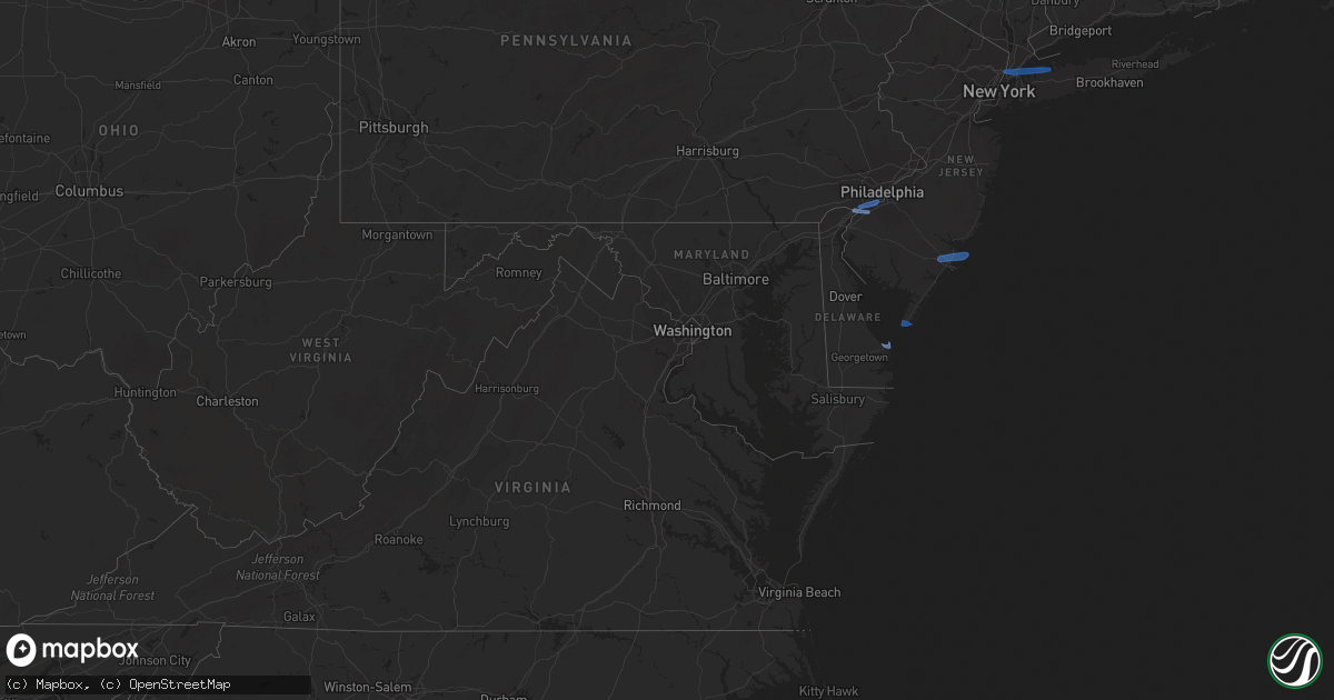
Hail Map in Delaware on April 21, 2020
Get this storm
April 21 map
$229
one time, instant access
Download today. No call, no setup
Keep the $229
Bought the map and want the full workflow? Apply the entire $229 to a subscription within 7 days. None of it is wasted.
Every map, not just this one
This buys you this map. Subscription and you get every map we run, in the markets you choose from a few cities to whole states to nationwide. Plus real-time alerts the moment a storm fires.
Contact data
Name, contact info, occupancy, even credit band for addresses in the footprint. You go from where it hit to who to call.
Become the source they trust
Unlimited branding weather history reports on demand. You already have the documented answer ready for the property owner, and you are the one who showed up with it.
Property data and RoofTrace estimates
Pull up any address you have got, its value and the exact code rules for that jurisdiction, straight from One Click Code. Then RoofTrace estimates the squares, pitch, and roof value, priced the way you price.
Storm reports in Delaware
Delaware
| Date | Description |
|---|---|
| 04/21/20202:30 PM CDT | A local report indicates 65 MPH wind near 1 ENE LEWES |
| 04/21/20201:50 PM CDT | Damaged utility pole from strong winds. Time estimated from radar. |
| 04/21/20201:08 PM CDT | A couple of reports of tree limbs and wires down in the area. Time estimated from radar. |
| 04/21/202012:54 PM CDT | A couple of reports of downed wires. Time estimated from radar. |
| 04/20/202010:46 PM CDT | At 345 PM EDT, severe thunderstorms were located along a line extending from near Gumboro to near Fruitland, moving east at 50 mph. HAZARD...60 mph wind gusts. SOURCE...Radar indicated. IMPACT...Expect damage to trees and powerlines. Severe thunderstorms will be near, Ocean Pines around 400 PM EDT. Newark around 405 PM EDT. Berlin and Cape Isle Of Wight around 415 PM EDT. Ocean City around 420 PM EDT.Other locations impacted by these severe thunderstorms includeBishop, Ocean City Municipality, Salisbury-Wicomico, Bishopville,Ironshire, Willards, Lakewood, West Ocean City, Longridge andChesapeake Heights.People at Peninsula Regional Medical Center, and Perdue Stadiumshould seek safe shelter immediately! |
| 04/20/20209:35 PM CDT | At 235 PM EDT, severe thunderstorms were located along a line extending from Easton to near Taylors Island, moving east at 45 mph. HAZARD...60 mph wind gusts. SOURCE...Radar indicated. IMPACT...Expect damage to trees and powerlines. Severe thunderstorms will be near, University Of Maryland Center For Environmental Studies around 255 PM EDT. Cambridge around 300 PM EDT. Vienna around 315 PM EDT.Other locations impacted by these severe thunderstorms includeGalestown, Wetipquin, Brookview, Eldorado, Hudson, Church Creek,Lloyds, Mardela Springs, Taylors Island and Woolford.People at Dorchester General Hospital should seek safe shelterimmediately! |
| 04/20/20209:24 PM CDT | At 223 PM EDT, severe thunderstorms were located along a line extending from near Medford to Williamstown to 6 miles northeast of Green Spring, moving east at 55 mph. HAZARD...60 mph wind gusts. SOURCE...Radar indicated. IMPACT...Damage to roofs, siding, trees, and power lines is possible. Locations impacted include... Vineland, Atlantic City, Millville, Bridgeton, Ocean City, Cape May, Cumberland, Evesham, Voorhees, Pleasantville, Glassboro, Lindenwold, Hammonton, Somers Point, Ventnor City, Brigantine, Northfield, Absecon, Clayton and Berlin.This includes the following highways... Atlantic City Expressway between mile markers 0 and 43. Garden State Parkway between mile markers 0 and 64. |
| 04/20/20208:04 PM CDT | At 103 PM EDT, severe thunderstorms were located along a line extending from Pleasant Valley to near Green Lane to near Parkesburg, moving east at 40 mph. HAZARD...60 mph wind gusts. SOURCE...Radar indicated. IMPACT...Damage to roofs, siding, trees, and power lines is possible. Locations impacted include... Philadelphia, West Chester, Norristown, Pottstown, Phoenixville, Lansdale, West Norriton, East Norriton, Coatesville, Westtown, Quakertown, Perkasie, Doylestown, Byram, Downingtown, Conshohocken, Hatboro, Souderton, Bedminster and Washington.This includes the following highways... Interstate 78 in New Jersey between mile markers 0 and 27. Interstate 476 in Pennsylvania between mile markers 9 and 19. Pennsylvania Turnpike between exits 312 and 343. Northeast Extension between exits A20 and A31. Interstate 76 in Pennsylvania between mile markers 327 and 336. |
All States Impacted by Hail Map on April 21, 2020
Cities Impacted by Hail Map on April 21, 2020
- Atoka, OK
- Minco, OK
- Chickasha, OK
- Tuttle, OK
- Amber, OK
- Pocasset, OK
- Elk City, OK
- Canute, OK
- Cement, OK
- Randlett, OK
- Mountain View, OK
- Gotebo, OK
- Spearman, TX
- Duncan, OK
- Sayre, OK
- Wilton, AR
- Ashdown, AR
- Goree, TX
- Weinert, TX
- Munday, TX
- Rule, TX
- O'Brien, TX
- Knox City, TX
- Old Glory, TX
- Rochester, TX
- Comanche, OK
- Canadian, TX
- Briscoe, TX
- Reydon, OK
- Durham, OK
- Fletcher, OK
- Elgin, OK
- Apache, OK
- Rush Springs, OK
- Marlow, OK
- Gillham, AR
- De Queen, AR
- Eagletown, OK
- Nashville, AR
- Mineral Springs, AR
- Pampa, TX
- Alva, OK
- Dacoma, OK
- Enid, OK
- Lane, OK
- Mooreland, OK
- Lawton, OK
- Seymour, TX
- Electra, TX
- Iowa Park, TX
- Hobart, OK
- Waynoka, OK
- Chester, OK
- Madill, OK
- Miami, TX
- Lone Grove, OK
- Ardmore, OK
- Coldwater, KS
- Freedom, OK
- Marshall, OK
- Douglas, OK
- Davis, OK
- Springer, OK
- Sulphur, OK
- Tishomingo, OK
- Mill Creek, OK
- Caney, OK
- Caddo, OK
- Helena, OK
- Gage, OK
- Channing, TX
- Masterson, TX
- Hennepin, OK
- Foster, OK
- Healdton, OK
- Sentinel, OK
- Mannsville, OK
- Carter, OK
- Lone Wolf, OK
- Graham, OK
- Loco, OK
- Bennington, OK
- Fort Sill, OK
- Carnegie, OK
- Roosevelt, OK
- Wapanucka, OK
- Ratliff City, OK
- Kenefic, OK
- Wilson, OK
- Medicine Park, OK
- Boswell, OK
- Coleman, OK
- Elmore City, OK
- Antlers, OK
- Milburn, OK
- Haskell, TX
- Stamford, TX
- Throckmorton, TX
- Aspermont, TX
- Woodward, OK
- Pawnee, OK
- Morrison, OK
- Hooker, OK
- Fort Towson, OK
- Perryton, TX
- Stinnett, TX
- Washington, OK
- Lockesburg, AR
- Borger, TX
- Hugo, OK
- Crescent, OK
- Perry, OK
- Orlando, OK
- Guthrie, OK
- Stillwater, OK
- Mulhall, OK
- Arnett, OK
- Cherokee, OK
- Carmen, OK
- Dill City, OK
- Foss, OK
- Liberal, KS
- Turpin, OK
- Hugoton, KS
- Kismet, KS
- Wheeler, TX
- Sweetwater, OK
- Devol, OK
- Burkburnett, TX
- Fargo, OK
- Sharon, OK
- Shattuck, OK
- Higgins, TX
- Idabel, OK
- Hamlin, TX
- Skellytown, TX
- Blanchard, OK
- Dougherty, OK
- Durant, OK
- Erick, OK
- Ringling, OK
- Englewood, KS
- Grandfield, OK
- Dumas, TX
- Cheyenne, OK
- Binger, OK
- Tussy, OK
- Walters, OK
- Gracemont, OK
- Bessie, OK
- Cordell, OK
- Corn, OK
- Cyril, OK
- Soper, OK
- Anadarko, OK
- Crawford, OK
- Hydro, OK
- Butler, OK
- Wynnewood, OK
- Hinton, OK
- Lookeba, OK
- Colony, OK
- Temple, OK
- Buffalo, OK
- Sunray, TX
- Fritch, TX
- Protection, KS
- Pond Creek, OK
- Garber, OK
- Drummond, OK
- Waukomis, OK
- Carrier, OK
- Ames, OK
- Lahoma, OK
- Kremlin, OK
- Nash, OK
- Fairmont, OK
- Meno, OK
- Morse, TX
- Vega, TX
- Vici, OK
- Glencoe, OK
- Coalgate, OK
- Fort Cobb, OK
- Haworth, OK
- Covington, OK
- Horatio, AR
- Hennessey, OK
- Lucien, OK
- Beaver, OK
- Ashland, KS
- Rosston, OK
- Red Rock, OK
- Billings, OK
- Marietta, OK
- Bokchito, OK
- Plains, KS
- Dover, OK
- Hunter, OK
- Ringwood, OK
- Tupelo, OK
- Follett, TX
- Jennings, LA
- Medford, OK
- Leedey, OK
- Fort Supply, OK
- Mutual, OK
- Branch, LA
- Goltry, OK
- Jet, OK
- Centrahoma, OK
- Booker, TX
- Meade, KS
- Clarksville, TX
- McCaskill, AR
- Welsh, LA
- Bridgeport, NJ
- Swedesboro, NJ
- Claymont, DE
- Marcus Hook, PA
- Chester, PA
- Gibbstown, NJ
- Paulsboro, NJ
- Essington, PA
- Crum Lynne, PA
- Philadelphia, PA
- Ridley Park, PA
- Lewes, DE
- Absecon, NJ
- Egg Harbor Township, NJ
- Cape May Point, NJ
- Cape May, NJ
- Mill Neck, NY
- New York, NY
- Port Washington, NY
- Englewood Cliffs, NJ
- Fort Lee, NJ
- Glen Head, NY
- Locust Valley, NY
- Sea Cliff, NY
- Bronx, NY
- Glen Cove, NY
- Oyster Bay, NY
- El Reno, OK
- Hammon, OK


