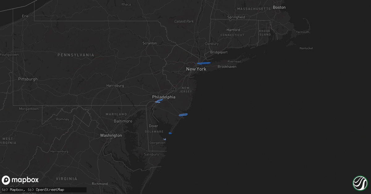
Hail Map in New Jersey on April 21, 2020
Get this storm
April 21 map
$229
one time, instant access
Download today. No call, no setup
Keep the $229
Bought the map and want the full workflow? Apply the entire $229 to a subscription within 7 days. None of it is wasted.
Every map, not just this one
This buys you this map. Subscription and you get every map we run, in the markets you choose from a few cities to whole states to nationwide. Plus real-time alerts the moment a storm fires.
Contact data
Name, contact info, occupancy, even credit band for addresses in the footprint. You go from where it hit to who to call.
Become the source they trust
Unlimited branding weather history reports on demand. You already have the documented answer ready for the property owner, and you are the one who showed up with it.
Property data and RoofTrace estimates
Pull up any address you have got, its value and the exact code rules for that jurisdiction, straight from One Click Code. Then RoofTrace estimates the squares, pitch, and roof value, priced the way you price.
Storm reports in New Jersey
New Jersey
| Date | Description |
|---|---|
| 04/21/20202:35 PM CDT | Several reports of downed power lines. Time estimated from radar. |
| 04/21/20202:30 PM CDT | Several reports of structural damage in little egg harbor. Time estimated from radar. |
| 04/21/20202:29 PM CDT | Beach haven mesonet measures 58 mph wind gust. |
| 04/21/20202:27 PM CDT | A local report indicates 69 MPH wind near 1 ENE CAPE MAY POINT |
| 04/21/20202:26 PM CDT | Several reports of power lines down in the area. Time estimated from radar. |
| 04/21/20202:25 PM CDT | Tree down... Transformers blown. |
| 04/21/20202:21 PM CDT | Kacy measures 60 mph wind gust. |
| 04/21/20202:18 PM CDT | Corrects previous tstm wnd gst report from atlantic city international airport |
| 04/21/20202:08 PM CDT | Several reports of power lines and tree limbs down in the toms river area. Time estimated from radar. |
| 04/21/20202:08 PM CDT | Several reports of downed trees and wires. Time estimated from radar. |
| 04/21/20202:04 PM CDT | Several reports of trees and wires down near and west of manasquan. Time estimated from radar. |
| 04/21/20202:04 PM CDT | Downed utility pole on state highway 35 south of lakewood road. Time estimated from radar. |
| 04/21/20202:04 PM CDT | Tree down on standish dr. In bellcrest area of toms river. Time estimated from radar. |
| 04/21/20202:03 PM CDT | Multiple trees uprooted in toms river near vaughn ave and n tunesbrook dr. Time estimated from radar. |
| 04/21/20202:00 PM CDT | Hooper ave & cedar bridge ave are closed due to wires down. |
| 04/21/20202:00 PM CDT | Trees and wires into homes near brick nj... Time estimated from radar. |
| 04/21/20201:58 PM CDT | Damage to trailers and sheds at sea girt training center... Time estimated from radar. |
| 04/21/20201:56 PM CDT | Downed trees and wires. Time estimated from radar. |
| 04/21/20201:51 PM CDT | Downed wires on nj70 in cherry hill. |
| 04/21/20201:50 PM CDT | Several reports of tree limbs and power lines down. |
| 04/21/20201:48 PM CDT | Downed utility pole on business state highway 33 near west main street. Time estimated from radar. |
| 04/21/20201:40 PM CDT | Several reports of tree limbs and power lines down in the browns mills area. Time estimated from radar. |
| 04/21/20201:38 PM CDT | Downed tree and wires. Time estimated from radar. |
| 04/21/20201:36 PM CDT | Several reports of trees and power lines down between pemberton and browns mills. Time estimated from radar. |
| 04/21/20201:35 PM CDT | Trees down in medford... Nj. Time estimated from radar. |
| 04/21/20201:31 PM CDT | Nj 511 reports a tree down on the garden state parkway southbound... South of exit 149. |
| 04/21/20201:30 PM CDT | Several tree limbs downed. |
| 04/21/20201:25 PM CDT | Dozens of reports of power lines and trees down in a swath from brooklawn to haddonfield. |
| 04/21/20201:24 PM CDT | 1-inch tree limbs broken and shingles blown off. |
| 04/21/20201:23 PM CDT | Downed tree on wires near neptune lane. |
| 04/21/20201:21 PM CDT | Several photos of trees down in the area. Time estimated from radar. |
| 04/21/20201:20 PM CDT | Downed tree on interstate 295 southbound ramp from haddonfield berlin road. Time estimated from radar. |
| 04/21/20201:20 PM CDT | Reports of power lines down. |
| 04/21/20201:20 PM CDT | Downed tree on wires near neptune lane. Time estimated from radar. |
| 04/21/20201:20 PM CDT | Tree down on house. |
| 04/21/20201:20 PM CDT | Large tree uprooted and fell on suv on laurel avenu. |
| 04/21/20201:16 PM CDT | Downed wires from strong winds. Time estimated from radar. |
| 04/21/20201:16 PM CDT | Downed pole and wires on state highway 41 near clements bridge road. |
| 04/21/20201:15 PM CDT | Multiple trees down in haddon heights... Nj. Time estimated from radar. |
| 04/21/20201:14 PM CDT | Mping report of trees uprooted at this location. Time estimated from radar. |
| 04/21/20201:13 PM CDT | Nj 511 reports a tree down on the garden state parkway southbound... South of exit 149. |
| 04/21/20201:10 PM CDT | A swath of wind damage was reported from brooklawn to east of haddonfield. Numerous power outages in the area... With several trees and power lines downed. Time estimat |
| 04/21/20201:07 PM CDT | Trained spotter reports trees and power lines down in brooklawn... Nj. |
| 04/21/20201:02 PM CDT | Several trees down near quakerbridge mall. Time estimated from radar. |
| 04/21/20201:00 PM CDT | Nj mesonet site reported 66 mph wind gust. |
| 04/20/20209:55 PM CDT | At 255 PM EDT, severe thunderstorms were located along a line extending from near Highlands to Pleasant Plains to Chatsworth, moving east at 55 mph. HAZARD...60 mph wind gusts. SOURCE...Radar indicated. IMPACT...Damage to roofs, siding, trees, and power lines is possible. Locations impacted include... Toms River, Long Branch, Asbury Park, Lakewood, Howell, Barnegat, Tinton Falls, Red Bank, Beachwood, Manasquan, Highlands, Point Pleasant Beach, Seaside Heights, Lakehurst, Farmingdale, Surf City, Mantoloking, Allenwood, Elberon and Navesink.This includes the following highways... Garden State Parkway between mile markers 61 and 111. Interstate 195 in New Jersey between mile markers 28 and 34. |
| 04/20/20209:46 PM CDT | At 246 PM EDT, severe thunderstorms were located along a line extending from near Greenwich to near Andrewsville to near University Of Maryland Center For Environmental Studies, moving east at 40 mph. HAZARD...60 mph wind gusts and penny size hail. SOURCE...Radar indicated. IMPACT...Damage to roofs, siding, trees, and power lines is possible. Locations impacted include... Dover, Georgetown, Smyrna, Milford, Seaford, Denton, Millsboro, Laurel, Harrington, Camden, Lewes, Federalsburg, Milton, Selbyville, Bridgeville, Greensboro, Delmar, Cheswold, Trappe and Dagsboro. |
| 04/20/20209:40 PM CDT | At 239 PM EDT, severe thunderstorms were located along a line extending from 6 miles east of Yorktown Heights to Cardinal Spellman Hs, moving east at 45 mph. HAZARD...60 mph wind gusts. SOURCE...Radar indicated. IMPACT...Expect damage to trees and power lines. Severe thunderstorms will be near... Bedford around 245 PM EDT. Port Chester and Rye around 250 PM EDT. New Canaan and Georgetown around 255 PM EDT. Wilton and Redding around 300 PM EDT. Westport and Weston around 305 PM EDT. Fairfield and Trumbull around 310 PM EDT. |
| 04/20/20209:12 PM CDT | At 211 PM EDT, severe thunderstorms were located along a line extending from near Ridgewood to Rocky Hill, moving east at 35 mph. HAZARD...60 mph wind gusts. SOURCE...Radar indicated. IMPACT...Expect damage to trees and power lines. Severe thunderstorms will be near... Paterson and Wayne around 215 PM EDT. Paramus around 220 PM EDT. Hackensack and Oradell around 225 PM EDT. Bergenfield and Englewood around 230 PM EDT. Fort Lee and Riverdale around 235 PM EDT. Yonkers and East Tremont around 240 PM EDT. New Rochelle and Bronxville around 245 PM EDT. Throgs Neck Bridge and City Island around 250 PM EDT. |
| 04/20/20209:04 PM CDT | At 204 PM EDT, severe thunderstorms were located along a line extending from near Aberdeen Proving Ground to near Kent Point, moving east at 50 mph. HAZARD...60 mph wind gusts and penny size hail. SOURCE...Radar indicated. IMPACT...Damage to roofs, siding, trees, and power lines is possible. Locations impacted include... Dover, Middletown, Easton, Centerville, Talbot, Smyrna, Milford, Chestertown, Denton, Centreville, Harrington, Camden, Clayton, Bridgeville, Greensboro, Oakland, Ridgely, Cheswold, Rock Hall and St. Michaels.People attending Covid-19 Drive through testing should seek safeshelter immediately! |
| 04/20/20208:56 PM CDT | At 154 PM EDT, severe thunderstorms were located along a line extending from near Pompton Lakes to near Skillman, moving east at 35 mph. HAZARD...60 mph wind gusts and quarter size hail. SOURCE...Radar indicated. IMPACT...Minor hail damage to vehicles is possible. Expect wind damage to trees and power lines.PRECAUTIONARY/PREPAREDNESS ACTIONS...For your protection move to an interior room on the lowest floor of abuilding.Large hail and damaging winds and continuous cloud to groundlightning is occurring with these storms. Move indoors immediately.Lightning is one of nature's leading killers. Remember, if you canhear thunder, you are close enough to be struck by lightning. |
All States Impacted by Hail Map on April 21, 2020
Cities Impacted by Hail Map on April 21, 2020
- Atoka, OK
- Minco, OK
- Chickasha, OK
- Tuttle, OK
- Amber, OK
- Pocasset, OK
- Elk City, OK
- Canute, OK
- Cement, OK
- Randlett, OK
- Mountain View, OK
- Gotebo, OK
- Spearman, TX
- Duncan, OK
- Sayre, OK
- Wilton, AR
- Ashdown, AR
- Goree, TX
- Weinert, TX
- Munday, TX
- Rule, TX
- O'Brien, TX
- Knox City, TX
- Old Glory, TX
- Rochester, TX
- Comanche, OK
- Canadian, TX
- Briscoe, TX
- Reydon, OK
- Durham, OK
- Fletcher, OK
- Elgin, OK
- Apache, OK
- Rush Springs, OK
- Marlow, OK
- Gillham, AR
- De Queen, AR
- Eagletown, OK
- Nashville, AR
- Mineral Springs, AR
- Pampa, TX
- Alva, OK
- Dacoma, OK
- Enid, OK
- Lane, OK
- Mooreland, OK
- Lawton, OK
- Seymour, TX
- Electra, TX
- Iowa Park, TX
- Hobart, OK
- Waynoka, OK
- Chester, OK
- Madill, OK
- Miami, TX
- Lone Grove, OK
- Ardmore, OK
- Coldwater, KS
- Freedom, OK
- Marshall, OK
- Douglas, OK
- Davis, OK
- Springer, OK
- Sulphur, OK
- Tishomingo, OK
- Mill Creek, OK
- Caney, OK
- Caddo, OK
- Helena, OK
- Gage, OK
- Channing, TX
- Masterson, TX
- Hennepin, OK
- Foster, OK
- Healdton, OK
- Sentinel, OK
- Mannsville, OK
- Carter, OK
- Lone Wolf, OK
- Graham, OK
- Loco, OK
- Bennington, OK
- Fort Sill, OK
- Carnegie, OK
- Roosevelt, OK
- Wapanucka, OK
- Ratliff City, OK
- Kenefic, OK
- Wilson, OK
- Medicine Park, OK
- Boswell, OK
- Coleman, OK
- Elmore City, OK
- Antlers, OK
- Milburn, OK
- Haskell, TX
- Stamford, TX
- Throckmorton, TX
- Aspermont, TX
- Woodward, OK
- Pawnee, OK
- Morrison, OK
- Hooker, OK
- Fort Towson, OK
- Perryton, TX
- Stinnett, TX
- Washington, OK
- Lockesburg, AR
- Borger, TX
- Hugo, OK
- Crescent, OK
- Perry, OK
- Orlando, OK
- Guthrie, OK
- Stillwater, OK
- Mulhall, OK
- Arnett, OK
- Cherokee, OK
- Carmen, OK
- Dill City, OK
- Foss, OK
- Liberal, KS
- Turpin, OK
- Hugoton, KS
- Kismet, KS
- Wheeler, TX
- Sweetwater, OK
- Devol, OK
- Burkburnett, TX
- Fargo, OK
- Sharon, OK
- Shattuck, OK
- Higgins, TX
- Idabel, OK
- Hamlin, TX
- Skellytown, TX
- Blanchard, OK
- Dougherty, OK
- Durant, OK
- Erick, OK
- Ringling, OK
- Englewood, KS
- Grandfield, OK
- Dumas, TX
- Cheyenne, OK
- Binger, OK
- Tussy, OK
- Walters, OK
- Gracemont, OK
- Bessie, OK
- Cordell, OK
- Corn, OK
- Cyril, OK
- Soper, OK
- Anadarko, OK
- Crawford, OK
- Hydro, OK
- Butler, OK
- Wynnewood, OK
- Hinton, OK
- Lookeba, OK
- Colony, OK
- Temple, OK
- Buffalo, OK
- Sunray, TX
- Fritch, TX
- Protection, KS
- Pond Creek, OK
- Garber, OK
- Drummond, OK
- Waukomis, OK
- Carrier, OK
- Ames, OK
- Lahoma, OK
- Kremlin, OK
- Nash, OK
- Fairmont, OK
- Meno, OK
- Morse, TX
- Vega, TX
- Vici, OK
- Glencoe, OK
- Coalgate, OK
- Fort Cobb, OK
- Haworth, OK
- Covington, OK
- Horatio, AR
- Hennessey, OK
- Lucien, OK
- Beaver, OK
- Ashland, KS
- Rosston, OK
- Red Rock, OK
- Billings, OK
- Marietta, OK
- Bokchito, OK
- Plains, KS
- Dover, OK
- Hunter, OK
- Ringwood, OK
- Tupelo, OK
- Follett, TX
- Jennings, LA
- Medford, OK
- Leedey, OK
- Fort Supply, OK
- Mutual, OK
- Branch, LA
- Goltry, OK
- Jet, OK
- Centrahoma, OK
- Booker, TX
- Meade, KS
- Clarksville, TX
- McCaskill, AR
- Welsh, LA
- Bridgeport, NJ
- Swedesboro, NJ
- Claymont, DE
- Marcus Hook, PA
- Chester, PA
- Gibbstown, NJ
- Paulsboro, NJ
- Essington, PA
- Crum Lynne, PA
- Philadelphia, PA
- Ridley Park, PA
- Lewes, DE
- Absecon, NJ
- Egg Harbor Township, NJ
- Cape May Point, NJ
- Cape May, NJ
- Mill Neck, NY
- New York, NY
- Port Washington, NY
- Englewood Cliffs, NJ
- Fort Lee, NJ
- Glen Head, NY
- Locust Valley, NY
- Sea Cliff, NY
- Bronx, NY
- Glen Cove, NY
- Oyster Bay, NY
- El Reno, OK
- Hammon, OK


