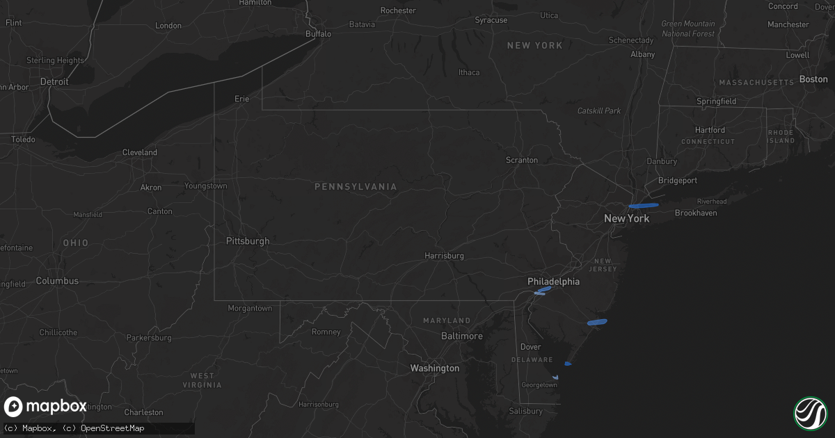
Hail Map in Pennsylvania on April 21, 2020
Get this storm
April 21 map
$229
one time, instant access
Download today. No call, no setup
Keep the $229
Bought the map and want the full workflow? Apply the entire $229 to a subscription within 7 days. None of it is wasted.
Every map, not just this one
This buys you this map. Subscription and you get every map we run, in the markets you choose from a few cities to whole states to nationwide. Plus real-time alerts the moment a storm fires.
Contact data
Name, contact info, occupancy, even credit band for addresses in the footprint. You go from where it hit to who to call.
Become the source they trust
Unlimited branding weather history reports on demand. You already have the documented answer ready for the property owner, and you are the one who showed up with it.
Property data and RoofTrace estimates
Pull up any address you have got, its value and the exact code rules for that jurisdiction, straight from One Click Code. Then RoofTrace estimates the squares, pitch, and roof value, priced the way you price.
Storm reports in Pennsylvania
Pennsylvania
| Date | Description |
|---|---|
| 04/21/20201:07 PM CDT | 59 mph wind gust measured at kphl. |
| 04/21/20201:07 PM CDT | 59 mph wind gust measured at kphl. This corrects a previous lsr. |
| 04/21/20201:05 PM CDT | 61 mph measured wind gust at kphl itws. |
| 04/21/20201:05 PM CDT | Phl itws measured 61 mph at 2:05 pm. |
| 04/21/202012:58 PM CDT | Downed wires near kemble park. Time estimated from radar. |
| 04/21/202012:26 PM CDT | Downed trees and wires. Time estimated from radar. |
| 04/21/202012:18 PM CDT | Downed tree near the intersection of reeceville road and swinehart road. Time estimated from radar. |
| 04/21/202012:15 PM CDT | Downed tree near the intersection of reeceville road and swinehart road. Time estimated from radar. |
| 04/21/202012:04 PM CDT | 1 inch tree limbs broken and shingles blown off of roof. Report from mping. |
| 04/20/20208:59 PM CDT | At 154 PM EDT, severe thunderstorms were located along a line extending from near Monsey to Belle Mead to Kensington, moving east at 40 mph. HAZARD...60 mph wind gusts. SOURCE...Radar indicated. IMPACT...Damage to roofs, siding, trees, and power lines is possible. Locations impacted include... Philadelphia, Toms River, Trenton, Camden, New Brunswick, Perth Amboy, Long Branch, Morristown, Asbury Park, Somerville, Sandy Hook, Somerset, Edison, Lakewood, Middletown, Old Bridge, Bensalem, Jackson, Howell and East Brunswick.People attending Covid-19 Drive through testing should seek safeshelter immediately!This includes the following highways... Garden State Parkway between mile markers 63 and 134. Interstate 195 in New Jersey between mile markers 0 and 34. Interstate 287 in New Jersey between mile markers 0 and 20, andbetween mile markers 25 and 53. Interstate 295 in New Jersey between mile markers 35 and 76. Interstate 78 in New Jersey between mile markers 32 and 42. Interstate 80 in New Jersey between mile markers 42 and 47. Interstate 95 in Pennsylvania between mile markers 22 and 40. New Jersey Turnpike between exits 4 and 13. Pennsylvania Turnpike between exits 351 and 353. Interstate 76 in Pennsylvania between mile markers 339 and 342. |
| 04/20/20208:28 PM CDT | At 127 PM EDT, severe thunderstorms were located along a line extending from Wharton to near Washington Crossing to Lima, moving east at 40 mph. HAZARD...60 mph wind gusts. SOURCE...Radar indicated. IMPACT...Damage to roofs, siding, trees, and power lines is possible. Locations impacted include... Philadelphia, Trenton, Camden, New Brunswick, Morristown, Somerville, Somerset, Bensalem, East Brunswick, Bridgewater, South Brunswick, Mount Laurel, North Brunswick, Ewing, Willingboro, Dover, Madison, Hopatcong, Middlesex and Princeton.People attending Covid-19 Drive through testing should seek safeshelter immediately!This includes the following highways... Interstate 195 in New Jersey between mile markers 0 and 7. Interstate 287 in New Jersey between mile markers 3 and 47. Interstate 295 in New Jersey between mile markers 35 and 76. Interstate 78 in New Jersey between mile markers 22 and 42. Interstate 80 in New Jersey between mile markers 29 and 48. Interstate 95 in Pennsylvania between mile markers 22 and 40. New Jersey Turnpike between exits 4 and 8, and between exits 9 and10. Pennsylvania Turnpike between exits 339 and 353. Interstate 76 in Pennsylvania between mile markers 332 and 342. |
All States Impacted by Hail Map on April 21, 2020
Cities Impacted by Hail Map on April 21, 2020
- Atoka, OK
- Minco, OK
- Chickasha, OK
- Tuttle, OK
- Amber, OK
- Pocasset, OK
- Elk City, OK
- Canute, OK
- Cement, OK
- Randlett, OK
- Mountain View, OK
- Gotebo, OK
- Spearman, TX
- Duncan, OK
- Sayre, OK
- Wilton, AR
- Ashdown, AR
- Goree, TX
- Weinert, TX
- Munday, TX
- Rule, TX
- O'Brien, TX
- Knox City, TX
- Old Glory, TX
- Rochester, TX
- Comanche, OK
- Canadian, TX
- Briscoe, TX
- Reydon, OK
- Durham, OK
- Fletcher, OK
- Elgin, OK
- Apache, OK
- Rush Springs, OK
- Marlow, OK
- Gillham, AR
- De Queen, AR
- Eagletown, OK
- Nashville, AR
- Mineral Springs, AR
- Pampa, TX
- Alva, OK
- Dacoma, OK
- Enid, OK
- Lane, OK
- Mooreland, OK
- Lawton, OK
- Seymour, TX
- Electra, TX
- Iowa Park, TX
- Hobart, OK
- Waynoka, OK
- Chester, OK
- Madill, OK
- Miami, TX
- Lone Grove, OK
- Ardmore, OK
- Coldwater, KS
- Freedom, OK
- Marshall, OK
- Douglas, OK
- Davis, OK
- Springer, OK
- Sulphur, OK
- Tishomingo, OK
- Mill Creek, OK
- Caney, OK
- Caddo, OK
- Helena, OK
- Gage, OK
- Channing, TX
- Masterson, TX
- Hennepin, OK
- Foster, OK
- Healdton, OK
- Sentinel, OK
- Mannsville, OK
- Carter, OK
- Lone Wolf, OK
- Graham, OK
- Loco, OK
- Bennington, OK
- Fort Sill, OK
- Carnegie, OK
- Roosevelt, OK
- Wapanucka, OK
- Ratliff City, OK
- Kenefic, OK
- Wilson, OK
- Medicine Park, OK
- Boswell, OK
- Coleman, OK
- Elmore City, OK
- Antlers, OK
- Milburn, OK
- Haskell, TX
- Stamford, TX
- Throckmorton, TX
- Aspermont, TX
- Woodward, OK
- Pawnee, OK
- Morrison, OK
- Hooker, OK
- Fort Towson, OK
- Perryton, TX
- Stinnett, TX
- Washington, OK
- Lockesburg, AR
- Borger, TX
- Hugo, OK
- Crescent, OK
- Perry, OK
- Orlando, OK
- Guthrie, OK
- Stillwater, OK
- Mulhall, OK
- Arnett, OK
- Cherokee, OK
- Carmen, OK
- Dill City, OK
- Foss, OK
- Liberal, KS
- Turpin, OK
- Hugoton, KS
- Kismet, KS
- Wheeler, TX
- Sweetwater, OK
- Devol, OK
- Burkburnett, TX
- Fargo, OK
- Sharon, OK
- Shattuck, OK
- Higgins, TX
- Idabel, OK
- Hamlin, TX
- Skellytown, TX
- Blanchard, OK
- Dougherty, OK
- Durant, OK
- Erick, OK
- Ringling, OK
- Englewood, KS
- Grandfield, OK
- Dumas, TX
- Cheyenne, OK
- Binger, OK
- Tussy, OK
- Walters, OK
- Gracemont, OK
- Bessie, OK
- Cordell, OK
- Corn, OK
- Cyril, OK
- Soper, OK
- Anadarko, OK
- Crawford, OK
- Hydro, OK
- Butler, OK
- Wynnewood, OK
- Hinton, OK
- Lookeba, OK
- Colony, OK
- Temple, OK
- Buffalo, OK
- Sunray, TX
- Fritch, TX
- Protection, KS
- Pond Creek, OK
- Garber, OK
- Drummond, OK
- Waukomis, OK
- Carrier, OK
- Ames, OK
- Lahoma, OK
- Kremlin, OK
- Nash, OK
- Fairmont, OK
- Meno, OK
- Morse, TX
- Vega, TX
- Vici, OK
- Glencoe, OK
- Coalgate, OK
- Fort Cobb, OK
- Haworth, OK
- Covington, OK
- Horatio, AR
- Hennessey, OK
- Lucien, OK
- Beaver, OK
- Ashland, KS
- Rosston, OK
- Red Rock, OK
- Billings, OK
- Marietta, OK
- Bokchito, OK
- Plains, KS
- Dover, OK
- Hunter, OK
- Ringwood, OK
- Tupelo, OK
- Follett, TX
- Jennings, LA
- Medford, OK
- Leedey, OK
- Fort Supply, OK
- Mutual, OK
- Branch, LA
- Goltry, OK
- Jet, OK
- Centrahoma, OK
- Booker, TX
- Meade, KS
- Clarksville, TX
- McCaskill, AR
- Welsh, LA
- Bridgeport, NJ
- Swedesboro, NJ
- Claymont, DE
- Marcus Hook, PA
- Chester, PA
- Gibbstown, NJ
- Paulsboro, NJ
- Essington, PA
- Crum Lynne, PA
- Philadelphia, PA
- Ridley Park, PA
- Lewes, DE
- Absecon, NJ
- Egg Harbor Township, NJ
- Cape May Point, NJ
- Cape May, NJ
- Mill Neck, NY
- New York, NY
- Port Washington, NY
- Englewood Cliffs, NJ
- Fort Lee, NJ
- Glen Head, NY
- Locust Valley, NY
- Sea Cliff, NY
- Bronx, NY
- Glen Cove, NY
- Oyster Bay, NY
- El Reno, OK
- Hammon, OK


