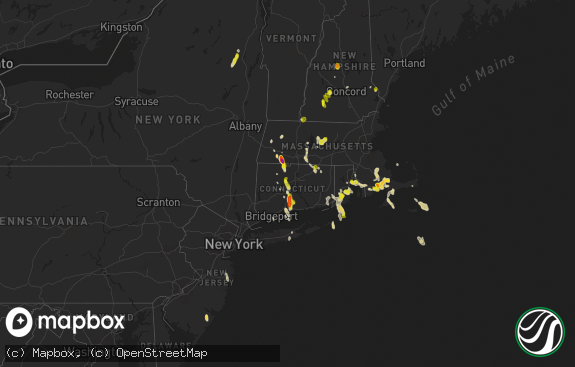
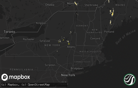
Hail Map in Vermont on October 7, 2020
The weather event in Vermont on October 7, 2020 includes Wind map. 5 states and 419 cities were impacted and suffered possible damage. The total estimated number of properties impacted is 0.

Wind
0
Estimated number of impacted properties by a 1.00" hail or larger0
Estimated number of impacted properties by a 1.75" hail or larger0
Estimated number of impacted properties by a 2.50" hail or largerStorm reports in Vermont
Vermont
| Date | Description |
|---|---|
| 10/07/20203:56 PM CDT | Tree down on lavigne rd |
| 10/07/20203:15 PM CDT | Widepsread downed trees and power lines |
| 10/07/20203:10 PM CDT | Trees and wires down on route 7 between jackson cross road and center sreet |
| 10/07/20203:10 PM CDT | Trees down |
| 10/06/202011:50 PM CDT | At 450 PM EDT, severe thunderstorms were located along a line extending from near Northfield to near Sunderland to near Williamsburg, moving east at 50 mph. HAZARD...60 mph wind gusts. SOURCE...Radar indicated. IMPACT...Expect damage to trees and power lines. Locations impacted include... Worcester, Leominster, Fitchburg, Amherst, Shrewsbury, Northampton, Orange, Deerfield, Gardner, South Hadley, Holden, Belchertown, Northborough, Clinton, Palmer, Spencer, Athol, Pepperell, Leicester and Groton. |
All States Impacted by Hail Map on October 7, 2020
Cities Impacted by Hail Map on October 7, 2020
- Syracuse, NY
- La Fayette, NY
- Homer, NY
- Preble, NY
- Locke, NY
- Canastota, NY
- Westford, NY
- East Worcester, NY
- Stamford, NY
- Richfield Springs, NY
- Maryland, NY
- Summit, NY
- Richmondville, NY
- Worcester, NY
- Schenevus, NY
- Davenport, NY
- Warnerville, NY
- Roseboom, NY
- West Fulton, NY
- Cooperstown, NY
- Middleburgh, NY
- Burlington Flats, NY
- West Winfield, NY
- Fly Creek, NY
- Charlotteville, NY
- Milford, NY
- Cherry Valley, NY
- Ilion, NY
- Fultonham, NY
- Jefferson, NY
- Hartwick, NY
- Glendale, RI
- Pembroke, MA
- North Bennington, VT
- Bedford, MA
- East Wareham, MA
- Watertown, MA
- Clifton Park, NY
- Providence, RI
- Douglas, MA
- Dudley, MA
- Wellesley, MA
- Ballston Lake, NY
- Turners Falls, MA
- Hudson, MA
- North Easton, MA
- New Salem, MA
- Barre, MA
- Chelmsford, MA
- Wrentham, MA
- Avon, MA
- Bolton, MA
- Wendell Depot, MA
- Rowe, MA
- Orange, MA
- Holliston, MA
- East Boston, MA
- Charlemont, MA
- South Dennis, MA
- North Adams, MA
- Shelburne Falls, MA
- Harvard, MA
- Newtonville, MA
- Mattapan, MA
- Rehoboth, MA
- Sharon, MA
- Leicester, MA
- Cohasset, MA
- Waban, MA
- Charlestown, MA
- Petersburg, NY
- Slatersville, RI
- Onset, MA
- Goshen, MA
- Bridgewater, MA
- Marlborough, MA
- Cherry Valley, MA
- Sagamore Beach, MA
- East Sandwich, MA
- Fayville, MA
- Westwood, MA
- North Weymouth, MA
- Melrose, NY
- Palmer, MA
- Haydenville, MA
- West Barnstable, MA
- Medway, MA
- Cumberland, RI
- Clinton, MA
- North Chatham, MA
- North Providence, RI
- Waltham, MA
- Newton, MA
- Stillwater, NY
- Conway, MA
- Paxton, MA
- Delanson, NY
- Northfield, MA
- Hubbardston, MA
- Webster, MA
- Norwood, MA
- Mapleville, RI
- Malden, MA
- Watervliet, NY
- Valley Falls, NY
- Rexford, NY
- Hanover, MA
- Bondsville, MA
- Milton, MA
- Bernardston, MA
- Baldwinville, MA
- Canton, MA
- Manville, RI
- Wynantskill, NY
- Norfolk, MA
- Wellesley Hills, MA
- Southbridge, MA
- Savoy, MA
- Seekonk, MA
- Stoughton, MA
- Boylston, MA
- Duxbury, MA
- Esperance, NY
- Bennington, VT
- Natick, MA
- Dennis, MA
- Fiskdale, MA
- Jamaica Plain, MA
- Hinsdale, NH
- Middleboro, MA
- Hatfield, MA
- Duanesburg, NY
- Newton Highlands, MA
- North Oxford, MA
- East Brookfield, MA
- Schaghticoke, NY
- Provincetown, MA
- Westborough, MA
- Albany, NY
- Alplaus, NY
- Worcester, MA
- Needham, MA
- Roslindale, MA
- Cambridge, MA
- Hoosick Falls, NY
- Herkimer, NY
- Sherborn, MA
- Millbury, MA
- Whitinsville, MA
- Pattersonville, NY
- Woburn, MA
- Greenfield, MA
- Cohoes, NY
- Wayland, MA
- Scituate, MA
- Wellfleet, MA
- Cropseyville, NY
- Winchester, NH
- Belchertown, MA
- Latham, NY
- Bellingham, MA
- Saint Johnsville, NY
- Maynard, MA
- Brewster, MA
- Holbrook, MA
- Roxbury Crossing, MA
- Oakham, MA
- Berkley, MA
- Hardwick, MA
- Grafton, MA
- Taunton, MA
- Rensselaer, NY
- Jefferson, MA
- Braintree, MA
- East Taunton, MA
- Dedham, MA
- Princeton, MA
- Johnstown, NY
- Northampton, MA
- Guilderland, NY
- West Roxbury, MA
- Newton Upper Falls, MA
- Johnston, RI
- Athol, MA
- Holden, MA
- South Hadley, MA
- Riverside, RI
- Stamford, VT
- West Boylston, MA
- Palatine Bridge, NY
- Billerica, MA
- Sagamore, MA
- Boston, MA
- Chepachet, RI
- Sterling, MA
- Lancaster, MA
- Humarock, MA
- Quincy, MA
- Whitman, MA
- Northborough, MA
- Medfield, MA
- Slingerlands, NY
- Petersham, MA
- Gilbertville, MA
- Fultonville, NY
- Warwick, MA
- Uxbridge, MA
- Rochdale, MA
- North Dighton, MA
- Kingston, MA
- Granby, MA
- Fort Plain, NY
- Hopkinton, MA
- Rotterdam Junction, NY
- Hingham, MA
- Norwell, MA
- South Easton, MA
- Orleans, MA
- Central Falls, RI
- Brookline, MA
- Cummington, MA
- Mechanicville, NY
- Carlisle, MA
- Shrewsbury, MA
- Plainville, MA
- Eagle Bridge, NY
- New Braintree, MA
- Fort Hunter, NY
- Mansfield, MA
- Hopedale, MA
- Harrisville, RI
- Milford, MA
- Newton Lower Falls, MA
- Mohawk, NY
- Norton, MA
- Nelliston, NY
- Vernon, VT
- South Boston, MA
- Waterford, NY
- Hadley, MA
- Montague, MA
- Royalston, MA
- Forestdale, RI
- Dorchester Center, MA
- Canajoharie, NY
- Southborough, MA
- East Bridgewater, MA
- Tribes Hill, NY
- Newton Center, MA
- Auburndale, MA
- West Newton, MA
- Smithfield, RI
- Millville, MA
- Gardner, MA
- Allston, MA
- Medford, MA
- Troy, NY
- Sandwich, MA
- Lexington, MA
- Foxboro, MA
- Wareham, MA
- North Brookfield, MA
- Attleboro, MA
- Williamstown, MA
- Deerfield, MA
- Chelsea, MA
- Blackstone, MA
- Brockton, MA
- Acton, MA
- Ware, MA
- Buskirk, NY
- Adams, MA
- Chestnut Hill, MA
- Rockland, MA
- Monroe Bridge, MA
- Dorchester, MA
- Roxbury, MA
- Boxborough, MA
- Wendell, MA
- Leeds, MA
- Winthrop, MA
- Whitingham, VT
- Schenectady, NY
- Fitchburg, MA
- Marshfield, MA
- Woonsocket, RI
- Abington, MA
- North Hatfield, MA
- South Barre, MA
- Belmont, MA
- Franklin, MA
- Round Lake, NY
- Berlin, NY
- Wilmington, VT
- West Bridgewater, MA
- Raynham, MA
- Leominster, MA
- Buckland, MA
- Everett, MA
- Jacksonville, VT
- Templeton, MA
- Florence, MA
- Lincoln, RI
- South Grafton, MA
- Lunenburg, MA
- Hanson, MA
- Upton, MA
- Carver, MA
- Leverett, MA
- Gill, MA
- Ashland, MA
- North Grafton, MA
- Sudbury, MA
- South Deerfield, MA
- Pawtucket, RI
- Amherst, MA
- Millers Falls, MA
- Hull, MA
- Arlington, MA
- Westminster, MA
- Albion, RI
- Harwich, MA
- Burlington, MA
- Lincoln, MA
- Stow, MA
- Brookfield, MA
- North Pownal, VT
- Rumford, RI
- Altamont, NY
- Spencer, MA
- Weymouth, MA
- Chatham, MA
- Marion, MA
- Hanscom Afb, MA
- North Truro, MA
- Revere, MA
- Colrain, MA
- Sprakers, NY
- Walpole, MA
- Eastham, MA
- East Walpole, MA
- West Halifax, VT
- South Walpole, MA
- Fort Johnson, NY
- Delmar, NY
- Attleboro Falls, MA
- Plymouth, MA
- Concord, MA
- Winchendon, MA
- Auburn, MA
- East Weymouth, MA
- Warren, MA
- Westford, MA
- Ashfield, MA
- Oxford, MA
- North Attleboro, MA
- West Warren, MA
- Sutton, MA
- Oakland, RI
- Mendon, MA
- Williamsburg, MA
- Sunderland, MA
- Shutesbury, MA
- Halifax, MA
- Plainfield, MA
- Brimfield, MA
- Berlin, MA
- South Weymouth, MA
- North Billerica, MA
- North Smithfield, RI
- Lakeville, MA
- Needham Heights, MA
- Pascoag, RI
- Rochester, MA
- Truro, MA
- Chesterfield, MA
- Burnt Hills, NY
- Dover, MA
- Pownal, VT
- Readsboro, VT
- Brighton, MA
- Little Falls, NY
- Framingham, MA
- Northbridge, MA
- Drury, MA
- Amsterdam, NY
- Lake Pleasant, MA
- Hyde Park, MA
- East Providence, RI
- Winchester, MA
- West Wareham, MA
- Brattleboro, VT
- West Brookfield, MA
- Somerville, MA
- Buzzards Bay, MA
- Weston, MA
- Erving, MA
- Johnsonville, NY
- Heath, MA
- West Hatfield, MA
- Rutland, MA
- Millis, MA
- Randolph, MA
- Littleton, MA
- Yarmouth Port, MA
- Fonda, NY
- Charlton, MA
- Sturbridge, MA
- Plympton, MA
- Cincinnatus, NY
- McDonough, NY
- Oxford, NY
- East Longmeadow, MA
- West Springfield, MA
- Westfield, MA
- Feeding Hills, MA
- Longmeadow, MA
- Springfield, MA
- Agawam, MA


