Hail Map on August 6, 2025
Get this storm
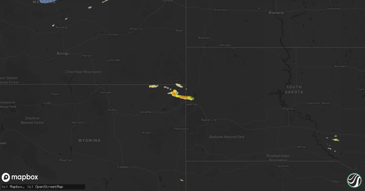
August 6 map
$229
one time, instant access
Download today. No call, no setup
Keep the $229
Bought the map and want the full workflow? Apply the entire $229 to a subscription within 7 days. None of it is wasted.
Every map, not just this one
This buys you this map. Subscription and you get every map we run, in the markets you choose from a few cities to whole states to nationwide. Plus real-time alerts the moment a storm fires.
Contact data
Name, contact info, occupancy, even credit band for addresses in the footprint. You go from where it hit to who to call.
Become the source they trust
Unlimited branding weather history reports on demand. You already have the documented answer ready for the property owner, and you are the one who showed up with it.
Property data and RoofTrace estimates
Pull up any address you have got, its value and the exact code rules for that jurisdiction, straight from One Click Code. Then RoofTrace estimates the squares, pitch, and roof value, priced the way you price.
States Impacted by Hail Map on August 6, 2025
Storm reports
Florida
| Date | Description |
|---|---|
| 08/06/20254:00 PM CDT | Trees on powerlines; wires down in fleming island. Time estimated from radar data. |
| 08/06/20254:00 PM CDT | Trees down in the 5200 block of river park villas drive. Time estimated from radar data. |
New York
| Date | Description |
|---|---|
| 08/06/20253:22 PM CDT | Tree down on us rt 11 and upton rd. |
South Dakota
| Date | Description |
|---|---|
| 08/06/202511:20 AM CDT | Hail up to quarter in size. Time estimated by radar. |
| 08/05/20258:22 PM CDT | Very gusty winds from all directions... But less than 60 mph. Very heavy rainfall. |
Nebraska
| Date | Description |
|---|---|
| 08/06/20258:05 AM CDT | Gust recorded by a personal weather station. |
Wyoming
| Date | Description |
|---|---|
| 08/05/20257:50 PM CDT | Just a few quarter sized hail stones... Mostly smaller. |
| 08/05/20257:30 PM CDT | A local report indicates 1.50 inch wind near 4 N Alva |
Louisiana
| Date | Description |
|---|---|
| 08/06/20253:25 PM CDT | Public reported trees down near sams club and rooms 2 go in covington. |
Montana
| Date | Description |
|---|---|
| 08/06/20256:17 AM CDT | King coulee... Mt |
| 08/06/20255:43 AM CDT | South sawmill creek... Mt |
| 08/06/20254:31 AM CDT | Awos station k1om oscar. |
| 08/06/20254:11 AM CDT | Awos station k1nm novemeber. |
| 08/06/20254:10 AM CDT | Mt mesonet station forestgrove n. Peak gust in the last 5 minutes. |
Cities Impacted by Hail Map on August 6, 2025
- Rushmore, MN
- Alstead, NH
- Morse Bluff, NE
- Cedar Bluffs, NE
- Omaha, NE
- Waterloo, NE
- Valley, NE
- Prague, NE
- Wahoo, NE
- Malmo, NE
- Mead, NE
- Colon, NE
- Council Bluffs, IA
- Carter Lake, IA
- La Vista, NE
- Platte, SD
- Pacific Junction, IA
- Glenwood, IA
- Bellevue, NE
- Gretna, NE
- Papillion, NE
- Plattsmouth, NE
- Springfield, NE
- Staplehurst, NE
- Malvern, IA
- Offutt Afb, NE
- Tabor, IA
- Thurman, IA
- Sidney, IA
- Percival, IA
- Hamburg, IA
- White Lake, SD
- Stickney, SD
- Overbrook, KS
- Kincaid, KS
- Colony, KS
- Byron, NY
- Saint Johns, FL
- Mulberry, FL
- Lakeland, FL
- Myakka City, FL
- Ona, FL
- Putnam Station, NY
- Orwell, VT
- Fair Haven, VT
- Sandy Hook, KY
- Olive Hill, KY
- Weston, WY
- Moorcroft, WY
- Hulett, WY
- Alzada, MT
- Greensburg, LA
- Torrington, WY
- Alva, WY
- Aladdin, WY
- Geddes, SD
- Limon, CO
- Kimball, SD
- Genoa, CO
- Beulah, WY
- Belle Fourche, SD
- Sundance, WY
- Seaton, IL
- Joy, IL
- Saint Onge, SD
- Spearfish, SD
- Keithsburg, IL
- Monmouth, IL
- Monroe, IA
- Colfax, IA
- Prairie City, IA
- Pella, IA
- Otley, IA
- Newton, IA
- Collins, IA
- Rhodes, IA
- Reasnor, IA
- Harvey, IA
- Bussey, IA
- Knoxville, IA
- Tracy, IA
- Lovilia, IA
- Melrose, IA
- Colo, IA
- Baxter, IA
- Melbourne, IA
- Leighton, IA
- State Center, IA
- Sully, IA
- Hilger, MT
- Lewistown, MT
- Roy, MT
- Grass Range, MT
- Albia, IA
- Oskaloosa, IA
- Laurel, IA
- Lynnville, IA
- Killduff, IA
- Kellogg, IA
- Moravia, IA
- Plano, IA
- Promise City, IA
- Beacon, IA
- Winnett, MT
- New Sharon, IA
- Searsboro, IA
- Mystic, IA
- Guthrie Center, IA
- Centerville, IA
- Adair, IA
- Exira, IA
- Chariton, IA
- Russell, IA
- Grinnell, IA
- Sand Springs, MT
- Casey, IA
- Stuart, IA
- Panora, IA
- Dexter, IA
- Redfield, IA
- Udell, IA
- Earlham, IA
- Cohagen, MT
- Zortman, MT
- Brusett, MT
- Adel, IA
- De Soto, IA
- Yale, IA
- Norwalk, IA
- Prole, IA
- Moulton, IA
- Seymour, IA
- Jordan, MT
- Indianola, IA
- Van Meter, IA
- Winterset, IA
- New Virginia, IA
- Williamson, IA
- Lacona, IA
- Lucas, IA
- Waukee, IA
- Derby, IA
- Osceola, IA
- Patterson, IA
- Cumming, IA
- Corydon, IA
- Linden, IA
- Minburn, IA
- Millerton, IA
- Perry, IA
- Truro, IA
- Saint Charles, IA
- Pleasantville, IA
- Humeston, IA
- Woodburn, IA
- Weldon, IA
- Dawson, IA
- Fort Peck, MT
- Circle, MT
- Garden Grove, IA
- Brockway, MT
- Allerton, IA
- Terry, MT
- Dallas Center, IA
- Melcher Dallas, IA