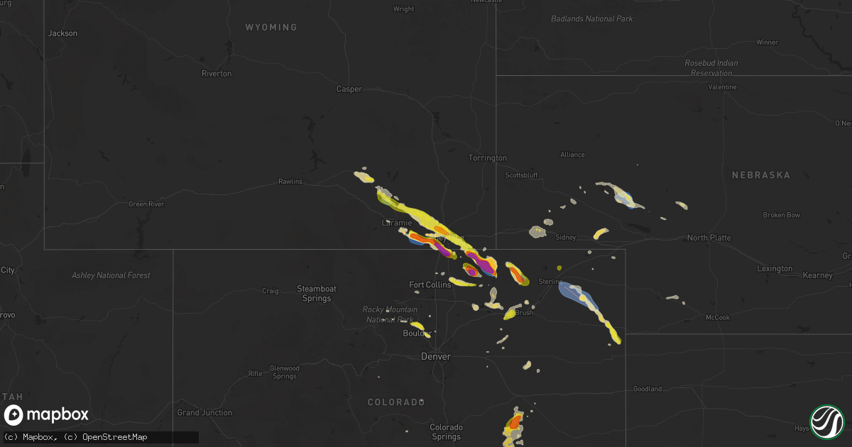
Hail Map on July 11, 2025
Get this storm
July 11 map
$229
one time, instant access
Download today. No call, no setup
Keep the $229
Bought the map and want the full workflow? Apply the entire $229 to a subscription within 7 days. None of it is wasted.
Every map, not just this one
This buys you this map. Subscription and you get every map we run, in the markets you choose from a few cities to whole states to nationwide. Plus real-time alerts the moment a storm fires.
Contact data
Name, contact info, occupancy, even credit band for addresses in the footprint. You go from where it hit to who to call.
Become the source they trust
Unlimited branding weather history reports on demand. You already have the documented answer ready for the property owner, and you are the one who showed up with it.
Property data and RoofTrace estimates
Pull up any address you have got, its value and the exact code rules for that jurisdiction, straight from One Click Code. Then RoofTrace estimates the squares, pitch, and roof value, priced the way you price.
States Impacted by Hail Map on July 11, 2025
Storm reports
Maryland
| Date | Description |
|---|---|
| 07/11/20256:14 PM CDT | Tree down on liskey road. |
Iowa
| Date | Description |
|---|---|
| 07/11/20256:45 PM CDT | As storm and winds moved in... Top of tree knocked over. Time of the event estimated using radar. |
| 07/11/20256:45 PM CDT | As storm and winds moved in... Top |
| 07/11/20256:39 PM CDT | Reported goose creek out of its banks on west 61st street. Report of basements flooding in the area. |
| 07/11/20256:39 PM CDT | Reported goose creek out of its banks on w |
| 07/11/20256:31 PM CDT | A local report indicates 60 MPH wind near Le Claire |
| 07/11/20255:55 PM CDT | Delayed report. 12 inch diameter tree down. |
| 07/11/20255:50 PM CDT | Occurring right now. |
| 07/11/20255:35 PM CDT | Several trees down in leclaire time estimated using radar. |
| 07/11/20255:32 PM CDT | Several large tree limbs down at 3200 n harrison. |
| 07/11/20255:26 PM CDT | From asos. |
| 07/11/20255:07 PM CDT | Delayed report. Large tree branch down... With several smaller tree limbs broken as well. Time estimated from radar. |
| 07/11/20255:04 PM CDT | A local report indicates 60 MPH wind near 2 E Dubuque |
| 07/11/20254:58 PM CDT | A local report indicates 59 MPH wind near Dubuque Regional Arpt |
| 07/11/20254:56 PM CDT | Several outbuildings destroyed along d55 between la motte and hwy 52. Power poles leaning as well along road. Time estimated from radar. |
| 07/11/20254:56 PM CDT | Large tree snapped near base. Time estimated from radar. |
| 07/11/20254:56 PM CDT | Damage to swing set. |
| 07/11/20254:50 PM CDT | Several 4 to 6 inch tree limbs down in maquoketa. Time of the event was estimated using radar. |
| 07/11/20254:46 PM CDT | Numerous trees down with main road in town blocked. Delayed report. |
| 07/11/20254:35 PM CDT | Possible gusts to 90 mph. |
| 07/11/20254:17 PM CDT | Photos and video relayed on x of a large tree uprooted at a farmstead along with a blown down shed. Time estimated by radar. |
| 07/11/20254:13 PM CDT | A local report indicates 64 MPH wind near 1 E Marion |
| 07/11/20254:12 PM CDT | Nws cooperative observer relayed damage photos of a large tree that was split near the base. Time estimated by radar. |
| 07/11/20254:00 PM CDT | 3 trees blown down within the city limits. |
| 07/11/20254:00 PM CDT | Very large tree snapped off 10 feet above the ground blocking the road. |
| 07/11/20253:58 PM CDT | Semi blown over on i-380. Also widespread reports of trees down across the northern part of the county. |
| 07/11/20253:58 PM CDT | Widespread reports across the northern part of the county of trees down. |
| 07/11/20253:56 PM CDT | Half inch tree limbs coming down. |
| 07/11/20253:54 PM CDT | Estimated wind gusts of 60 to 70 mph. Na damage reported. |
| 07/11/20253:52 PM CDT | Brief tornado touchdown. |
| 07/11/20253:46 PM CDT | Some trees snapped. A mobile home damaged. Time estimated. |
| 07/11/20253:45 PM CDT | Top half of a very large tree down. |
| 07/11/20253:44 PM CDT | Half of a maple tree down in the city. |
| 07/11/20253:42 PM CDT | Power out with damage to trees and a gazebo. Tree branches down. |
| 07/11/20253:39 PM CDT | A local report indicates 70 MPH wind near Newhall |
| 07/11/20253:31 PM CDT | From pws. |
| 07/11/20253:25 PM CDT | Photo of tree snapped near the base. Time estimated by radar. |
| 07/10/20259:25 PM CDT | A local report indicates 59 MPH wind near Webb |
| 07/10/20259:25 PM CDT | ( |
Georgia
| Date | Description |
|---|---|
| 07/11/20255:25 PM CDT | Trees down in the shoal creek area. |
| 07/11/20254:54 PM CDT | Emergency manager reported trees blocking half the roadway at the block of 7600 |
| 07/11/20254:54 PM CDT | Emergency manager reported trees blocking half the roadway at the block of 7600 central avenue. |
| 07/11/20254:34 PM CDT | Emergency manager reported one large tree down on ga-204 near montgomery cross road. |
| 07/11/20254:18 PM CDT | Tree down on the paved portion of jenk hill road. Exact location had to be estimated. Time estimated by radar. |
| 07/11/20254:09 PM CDT | Tree down at the 6100 block of rocky ford road. Time estimated by radar. |
| 07/11/20254:01 PM CDT | Emergency manager reported a tree blocking roadway at the 7900 block of abercorn street. |
New Hampshire
| Date | Description |
|---|---|
| 07/11/20254:38 PM CDT | Reported by weather spotter. Time estimated by radar. |
Illinois
| Date | Description |
|---|---|
| 07/11/20256:20 PM CDT | Trees and wires downed at the intersection of algonquin road and lakewood boulevard. Time estimated from radar. |
| 07/11/20255:34 PM CDT | Large trees down. |
| 07/11/20255:09 PM CDT | 1 to 2 inch tree limbs down. |
| 07/10/20259:15 PM CDT | Multiple reports of wires and trees down in quincy. |
| 07/10/20258:38 PM CDT | Power wires reported down on taylorville road approximately one mile north of the christian-montgomery county line. Time estimated by radar. |
| 07/10/20258:07 PM CDT | 2 inch diameter tree limbs down. |
| 07/10/20258:00 PM CDT | Reports of several trees and power lines down throughout the county. |
New Mexico
| Date | Description |
|---|---|
| 07/10/202510:45 PM CDT | Corrects previous non-tstm wnd gst report from 7 sw glenrio. Mesonet station 107 endee 2 sw. |
| 07/10/202510:40 PM CDT | Mesonet station 107 endee 2 sw. |
| 07/10/202510:40 PM CDT | Mesonet station 107 endee 2 sw. ( |
| 07/10/202510:07 PM CDT | Asos station ktcc tucumcari muni airport. |
| 07/10/202510:01 PM CDT | Mesonet station up363 logan 2.2 se |
| 07/10/202510:00 PM CDT | Trained spotter reports 60 mph wind gust from personal weather station. Lost power shortly after. |
| 07/10/20259:56 PM CDT | Corrected time of tstm wnd gst report from 2 s logan. Mesonet station up363 logan 2.2 se |
| 07/10/20259:55 PM CDT | Corrects previous non-tstm wnd gst report from 2 ese ute lake state park. Mesonet station lgan5 logan. |
| 07/10/20259:55 PM CDT | Corrected time of tstm wnd gst report from 2 e ute lake state park. Trained spotter reports 60 mph wind gust from personal weather station. Lost power shortly after. |
West Virginia
| Date | Description |
|---|---|
| 07/11/20254:15 PM CDT | Tree down in the 1600 block of ebert road. |
| 07/11/20253:44 PM CDT | Two reports of trees down in keyser. |
Alabama
| Date | Description |
|---|---|
| 07/11/20255:18 PM CDT | Report of a tree and powerline down on highway 72 in lauderdale county. Time estimated based on radar. |
| 07/11/20255:04 PM CDT | Report of a tree down on county road 6 in lauderdale county. Time estimated based on radar. |
| 07/11/20253:45 PM CDT | Reports of wind damage in the smiths station area involving large limbs... A few trees... And power poles/lines. Time of occurrence is a couple minutes either side of 3 |
| 07/11/20253:41 PM CDT | At the lee county farmers market...large sections of metal roofing and trusses blown around. Large tree branches down. |
| 07/11/20252:42 PM CDT | Photo of a large tree limb down on vehicle. Time estimated from radar. |
South Carolina
| Date | Description |
|---|---|
| 07/11/20256:32 PM CDT | Strong winds in combination with wet antecedent conditions uprooted a white oak tree |
| 07/11/20256:20 PM CDT | Tree down on roseville road. Time estimated based on radar. |
| 07/11/20256:02 PM CDT | Tree down at the traffic circle along orangeburg road and w butternut road. Time estimated by radar. |
| 07/11/20256:00 PM CDT | Tree down at the intersection of orangeburg road and old parsonage road. Time estimated by radar. |
| 07/11/20255:51 PM CDT | *** 1 inj *** emergency manager reported a tree on a vehicle near the 700 block of highway 61. It did cause an injury. |
| 07/11/20255:51 PM CDT | *** 1 inj *** emergency manager reported a tree on a vehicle near the 700 block of highway 61. It did cause an injury. |
| 07/11/20255:45 PM CDT | Tree down on i-26 wb near college park road. Time estimated by radar. |
| 07/11/20255:44 PM CDT | Tree down along ladson road near the intersection of lincolnville road. Time based on report. |
| 07/11/20255:35 PM CDT | Multiple trees down on parkland place road. |
| 07/11/20255:35 PM CDT | Multiple trees down on hillcrest farm rd. |
| 07/11/20255:27 PM CDT | Emergency manager reported tree down on i-26 near the 203 exit in the emergency lane. |
| 07/11/20255:16 PM CDT | Tall pine tree blown over along with numerous sticks and branches along boiling springs rd near sheallys pond heritage preserve. Time estimated by radar. |
| 07/11/20255:16 PM CDT | Tall pine tree blown over along with numerous sticks and branches along boiling springs rd near sheallys pond heritage preserve. Time estimated by radar. |
| 07/11/20255:15 PM CDT | Multiple reports of trees and power lines down across northeastern spartanburg county. |
| 07/11/20255:03 PM CDT | Lexington county em reported a couple of trees down near swansea blocking the roadway. Time estimated by radar. |
| 07/10/20257:07 PM CDT | Orangeburg dispatch reported a tree down near the intersection of bamberg rd and slab landing rd. Time estimated by radar. |
Massachusetts
| Date | Description |
|---|---|
| 07/11/20256:00 PM CDT | Corrects previous tstm wnd dmg report from 3 ese northampton. Tree down on i-91 southbound side near northampton. Time estimated from radar. Relayed by amateur radio. |
| 07/11/20255:56 PM CDT | A tree... Powerline wires and a utility pole were downed on sylvester rd in northampton. Time estiamted by radar. Relayed by amateur radio. |
| 07/11/20255:55 PM CDT | Corrects previous tstm wnd dmg report from 1 n northampton. Tree down near greeley ave in northampton. Relayed by amateur radio. |
| 07/11/20255:55 PM CDT | Multiple trees downed from burts pitt rd to ryan rd in northampton. Relayed by amateur radio. |
| 07/11/20255:30 PM CDT | Powerline wires downed on route 9 near williamsburg. Relayed by amateur radio. |
Colorado
| Date | Description |
|---|---|
| 07/11/20256:58 PM CDT | A local report indicates 2.00 inch wind near 5 SSE Grover |
| 07/11/20256:30 PM CDT | Time estimated. |
| 07/11/20256:20 PM CDT | A local report indicates 1.00 inch wind near 6 N Rockport |
| 07/11/20256:01 PM CDT | Location estimated... Lasted about 3 minutes. |
| 07/11/20256:01 PM CDT | [landspout] corrects previous tornado report from 3 se reiradon hill. Location estimated... Lasted about 3 minutes. |
| 07/10/20259:48 PM CDT | Report from mping: half dollar |
| 07/10/20259:48 PM CDT | Repor |
| 07/10/20259:03 PM CDT | Weatherlink site lazy_td_farm. |
| 07/10/20258:41 PM CDT | Weatherlink site osmus farm reports the gust. |
| 07/10/20258:38 PM CDT | Hail ranged from pea to quarter in size. Winds were 40+ mph. |
| 07/10/20258:16 PM CDT | Kcowray on weatherunderground reported the gust. |
| 07/10/20258:08 PM CDT | Facebook report and video of long duration of quarter to half dollar hail; estimated around 20 minutes. Video does show accumulating hail around a half inch deep but so |
| 07/10/20258:04 PM CDT | Report from mping: quarter |
| 07/10/20257:45 PM CDT | A local report indicates 1.25 inch wind near 9 W San Isabel |
| 07/10/20257:27 PM CDT | A local report indicates 1.00 inch wind near 1 NNW Louisville |
| 07/10/20257:27 PM CDT | Report from mping: quarter |
| 07/10/20257:15 PM CDT | A local report indicates 2.00 inch wind near 2 SE Grover |
Missouri
| Date | Description |
|---|---|
| 07/11/20256:48 PM CDT | A local report indicates 60 MPH wind near 1 ESE Excelsior Estates |
| 07/11/20256:45 PM CDT | Time confirmed from radar. |
| 07/11/20256:45 PM CDT | Tree limbs down. |
| 07/11/20256:41 PM CDT | Multiple social media reports of downed trees and limbs east of kearney and north of excelsior springs. Strong winds also reported in the orrick and wood heights areas. |
| 07/11/20256:38 PM CDT | Downed wires near 228th street. Time estimated from radar. |
| 07/11/20256:38 PM CDT | Social media report of limbs down east of kearney. Time and location estimated based on radar. |
| 07/11/20256:36 PM CDT | Social media report. Carport and vehicle damaged and multiple trees downed at a residence northeast of kearney. Time estimated from radar. |
| 07/11/20256:36 PM CDT | Downed wires near county line road. Time estimated from radar. |
| 07/11/20256:30 PM CDT | Social media report of downed limbs near route 92 and jesse james farm road. Time estimated from radar. |
| 07/11/20256:07 PM CDT | A pivot irrigation system was tipped over. Time estimated by radar. |
| 07/11/20254:51 PM CDT | Private weather sensor. |
| 07/11/20253:08 PM CDT | Downed tree limbs at a residence. Time and location estimated based on social media report and radar. |
| 07/10/202510:35 PM CDT | Private weather sensor. Winds appeared to be tied to a wake low upstream of strong to severe thunderstorms. |
| 07/10/202510:02 PM CDT | Multiple reports of wires down and power outages in sedalia. Time estimated from radar. |
| 07/10/20259:30 PM CDT | Tree down due to winds. Tree approximately 2.5 feet in diameter. |
| 07/10/20259:20 PM CDT | Social media reports of downed limbs from strong winds in the leeton area. Time estimated from radar. |
| 07/10/20259:01 PM CDT | Downed wires and power outages near 100th road. Time estimated from radar. |
| 07/10/20258:58 PM CDT | Downed wires near 1225th road. Time estimated from radar. |
| 07/10/20258:55 PM CDT | Downed tree limbs and wires near route e. Time estimated from radar. |
| 07/10/20258:52 PM CDT | Downed wires near 300th road. Time estimated from radar. |
| 07/10/20258:37 PM CDT | Downed wires near maple leaf lake conservation area. Time estimated from radar. |
| 07/10/20258:26 PM CDT | Downed wires near dillon road. Time estimated from radar. |
| 07/10/20258:26 PM CDT | Downed wires near route f. Time estimated from radar. |
| 07/10/20258:23 PM CDT | Multiple social media and utility reports of downed limbs and wires in the brookfield area. Time estimated from radar. |
| 07/10/20258:22 PM CDT | Several tree limbs... A road sign... And blown debris at a couple of residences were observed immediately south of a tornado track in strasburg. This damage appears to |
| 07/10/20258:21 PM CDT | Downed wires near route ww. Time estimated from radar. |
| 07/10/20258:21 PM CDT | A brief/weak tornado developed just west of strasburg at 821 pm cdt on july 11 with minor tree damage observed near state route 58. The tornado moved into the village o |
| 07/10/20258:21 PM CDT | Downed tree limbs and wires near missouri avenue. Time estimated from radar. |
| 07/10/20258:14 PM CDT | Downed wires and several power outages in the bates city area. Time based on dispatch report and confirmed from radar. |
| 07/10/20258:10 PM CDT | Downed tree limbs and wires near lone jack lees summit road. Time estimated from radar. |
| 07/10/20258:10 PM CDT | Time confirmed from radar. |
| 07/10/20258:09 PM CDT | Downed tree limbs and wires perdue road. Time estimated from radar. |
| 07/10/20258:06 PM CDT | Downed wires near hardsaw road. Time estimated from radar. |
| 07/10/20258:02 PM CDT | Downed wires near webb road. Time estimated from radar. |
| 07/10/20257:56 PM CDT | Downed tree limbs three inches in diameter on route h north of oak grove. Time estimated from radar. |
| 07/10/20257:53 PM CDT | Downed tree limbs and wires near pryor road. Time estimated from radar. |
| 07/10/20257:46 PM CDT | Downed tree limbs and wires near route bb. Time estimated from radar. |
| 07/10/20257:46 PM CDT | Mping report of tree limbs down on the south side of blue springs. Time confirmed from radar. |
| 07/10/20257:45 PM CDT | Private weather sensor. |
| 07/10/20257:45 PM CDT | Three inch branches down. |
| 07/10/20257:43 PM CDT | Multiple reports of tree limbs and wires down in the henrietta area. Time estimated from radar. |
| 07/10/20257:43 PM CDT | Downed wires near route t. Time estimated from radar. |
| 07/10/20257:40 PM CDT | Downed tree limbs on the road in richmond. Power is out in town. Time estimated from radar. |
| 07/10/20257:35 PM CDT | Social media report of trees down at a residence. Time estimated from radar. |
| 07/10/20257:35 PM CDT | Downed tree limbs and damage to the roof of a building. Time estimated from radar. |
| 07/10/20257:32 PM CDT | Social media report of minor damage and downed limbs at a property in buckner. Time estimated from radar. |
| 07/10/20257:29 PM CDT | Several large trees and limbs downed in the lake tapawingo area. Time estimated from radar. |
| 07/10/20257:29 PM CDT | Multiple social media reports of trees down... Including in the vicinity of 55th street. Time estimated from radar. |
| 07/10/20257:29 PM CDT | Mping report of tree limbs down near ashford court. Tmie estimated from radar. |
| 07/10/20257:16 PM CDT | Downed tree limbs and wires near lentz road. Time estimated from radar. |
| 07/10/20257:16 PM CDT | Several social media reports of trees and limbs down in independence. Time estimated from radar. |
| 07/10/20257:13 PM CDT | Social media report of a downed tree near route 291 and u.s. Highway 24. Time estimated from radar. |
| 07/10/20257:13 PM CDT | Social media report of a downed tree at a residence near highland avenue. Time estimated from radar. |
| 07/10/20257:13 PM CDT | Three inch tree branches down. |
| 07/10/20257:00 PM CDT | Downed wires near schack creek road. Time estimated from radar. |
Florida
| Date | Description |
|---|---|
| 07/11/20252:45 PM CDT | Hail of dime to quarter coin size reported around 3 miles south of la belle on sr 29. |
| 07/11/20252:30 PM CDT | A thunderstorm wind gust of 63 mph/55 knots was recorded at sfwmd site lz40 lake okeechobee center. Winds gusted between 50 and 62 mph between 3:15 pm and 4 pm. |
| 07/11/20251:22 PM CDT | Florida highway patrol reported a down tree on i-10 eb lamont near mm228. |
| 07/11/20251:15 PM CDT | Mping report of trees uprooted. |
| 07/11/20251:14 PM CDT | Mping report of power lines torn off power poles. |
| 07/11/202512:52 PM CDT | Leon county em reported a transformer down with a line on fire |
| 07/10/20257:42 PM CDT | Tree down on power lines on mathews road. |
| 07/10/20257:42 PM CDT | Tree down across the roadway at 1893 mathews road. |
Minnesota
| Date | Description |
|---|---|
| 07/11/20252:27 PM CDT | Report of a 5 to 6 foot section of a dock pulled out of the water and some smaller approximately 3 foot in diameter tree branches down from trees due to strong thunders |
North Carolina
| Date | Description |
|---|---|
| 07/11/20254:05 PM CDT | Tree down near plantation drive and coxe road. |
| 07/11/20254:00 PM CDT | Tree down near indian trail and whitesides road. |
| 07/11/20253:57 PM CDT | Tree downed across hudlow rd. |
| 07/11/20253:55 PM CDT | Tree down near rock road and oak springs road. |
| 07/11/20253:50 PM CDT | Several large trees down from summers road to burke memorial park road to ramblewoods drive. |
| 07/11/20253:50 PM CDT | Tree down near gilkey school road and us 221. |
| 07/11/20253:07 PM CDT | Tree down on little river road. |
| 07/11/20252:20 PM CDT | Two trees down blocking the roadway. |
Texas
| Date | Description |
|---|---|
| 07/11/202512:38 AM CDT | The mesonet station measured gusts 58 to 65 mph between 0034cdt and 0042cdt with the peak gust of 65 mph occurring at 0038cdt. |
| 07/11/202512:35 AM CDT | Mesonet measured gusts between 58 and 69 mph from 0034cdt and 0043cdt with the peak gust of |
| 07/11/202512:35 AM CDT | Mesonet measured gusts between 58 and 69 mph from 0034cdt and 0043cdt with the peak gust of 69 mph occurring at 0035cdt. |
| 07/11/202512:35 AM CDT | A local report indicates 69 MPH wind near 3 SE Pantex |
| 07/11/202512:25 AM CDT | Corrects previous tstm wnd gst report from 6 ne pantex. Mesonet caught a gust of 81 mph at 0028cdt with the first gust of 63 mph at 1225cdt. |
| 07/11/202512:22 AM CDT | A local report indicates 58 MPH wind near 6 ENE Amarillo |
| 07/11/202512:00 AM CDT | The hail with some up to the size of quarters lasted for maybe 5 minutes. |
| 07/10/202511:20 PM CDT | Two sem |
| 07/10/202511:20 PM CDT | Two semis blown over at the rest stop on highway 287 south of dumas. Report via facebook message. |
| 07/10/202511:13 PM CDT | A local report indicates 61 MPH wind near 3 SE Dumas |
| 07/10/202511:12 PM CDT | A local report indicates 71 MPH wind near 3 SE Dumas |
| 07/10/202511:08 PM CDT | Corrects previous non-tstm wnd gst report from 11 wnw bootleg. |
| 07/10/20258:45 PM CDT | Texas water development board station pgf fabens. |
Wisconsin
| Date | Description |
|---|---|
| 07/11/20256:36 PM CDT | A local report indicates 76 MPH wind near 1 S Evansville |
| 07/11/20256:31 PM CDT | Trees down and across roadway. Time estimated from radar. |
| 07/11/20256:26 PM CDT | A local report indicates 71 MPH wind near 1 S New Glarus |
| 07/11/20256:14 PM CDT | Widespread tree damage. |
| 07/11/20256:06 PM CDT | Time estimated from radar. |
| 07/11/20255:38 PM CDT | Widespread tree damage across the county. Corn damage in the elk grove area. Time estimated from radar. |
| 07/11/20255:26 PM CDT | Winds reported from home weather station. Trees down. |
| 07/11/20255:14 PM CDT | Quite a few trees down on power lines. |
| 07/11/20255:05 PM CDT | A local report indicates 65 MPH wind near Potosi |
| 07/11/20255:04 PM CDT | A local report indicates 60 MPH wind near 4 N Tennyson |
| 07/11/20255:00 PM CDT | Tree branch down on a garage in town. |
| 07/11/20253:55 PM CDT | Wisconet station reported 62 mph gust at 355 pm. |
| 07/10/20257:15 PM CDT | Minor tree damage. |
Wyoming
| Date | Description |
|---|---|
| 07/11/20256:00 PM CDT | Report from mping: quarter |
| 07/11/20255:40 PM CDT | Spotter drove through the area after the storm. Noted that snow plow was clearing away accumulated hail on us-287. Saw a few quarter size hailstones on the side of the |
| 07/11/20255:35 PM CDT | Public reports ping pong ball size hail. |
| 07/11/20255:10 PM CDT | Public report of accumulating dime size hail along interstate 80. Hail about 1 to 3 inches deep in some areas. A few estimated ping pong ball sized hailstones mixed in |
| 07/10/20258:40 PM CDT | Public reports quarter size hail. |
| 07/10/20258:31 PM CDT | Report from mping: quarter |
| 07/10/20258:21 PM CDT | Report from mping: quarter |
| 07/10/20258:20 PM CDT | A local report indicates 1.00 inch wind near 3 E Cheyenne |
| 07/10/20258:20 PM CDT | Report of quarter size hail. |
| 07/10/20258:18 PM CDT | A local report indicates 1.25 inch wind near 2 N Cheyenne |
| 07/10/20258:18 PM CDT | Report from mping: quarter |
| 07/10/20258:17 PM CDT | Report from mping: quarter |
| 07/10/20258:15 PM CDT | A local report indicates 1.50 inch wind near 4 NW Cheyenne |
| 07/10/20258:12 PM CDT | Report from mping: half dollar |
| 07/10/20258:10 PM CDT | Report from mping: half dollar |
| 07/10/20257:45 PM CDT | A local report indicates 1.00 inch wind near 1 N Federal |
Kansas
| Date | Description |
|---|---|
| 07/11/20256:59 PM CDT | A local report indicates 1.00 inch wind near 1 WSW Augusta |
| 07/11/20256:55 PM CDT | Emergency manager reported quarter size hail at stanta fe lake. |
| 07/11/20255:55 PM CDT | 2 foot diameter tree limb took down powerlines & power pole. |
| 07/11/20255:38 PM CDT | Kake storm spotter reported a few quarter size hail stones in south part of arkansas city. |
| 07/11/202512:25 AM CDT | A local report indicates 58 MPH wind near 1 S Coolidge |
| 07/11/202512:10 AM CDT | Delayed report. Four inch tree limb down. Spotter said from wind. Time estimated via radar. |
| 07/11/202512:10 AM CDT | Delayed report. Four inch tree limb down. Spotter said from wind. Time estimated via radar. |
| 07/10/20259:55 PM CDT | A local report indicates 60 MPH wind near 5 NW Buxton |
| 07/10/20259:45 PM CDT | A local report indicates 1.00 inch wind near 5 NW Buxton |
| 07/10/20259:06 PM CDT | Large tree was reported down blocking the southbound lane of national avenue in town. |
| 07/10/20258:48 PM CDT | The mesonet site 3nw of uniontown recorded a wind gust of 58mph. |
| 07/10/20258:39 PM CDT | Social media report. Time estimated from radar. |
| 07/10/20258:38 PM CDT | Multiple reports of downed limbs and wires in the pleasanton area. Time estimated from radar. |
| 07/10/20258:29 PM CDT | Multiple reports of wires down and power outages in eastern linn county. Time estimated from radar. |
| 07/10/20258:13 PM CDT | A local report indicates 1.00 inch wind near Belle Plaine |
| 07/10/20257:45 PM CDT | Social media report of multiple trees downed at a property southeast of paola. Minor property damage also occurred. Time estimated from radar. |
| 07/10/20257:23 PM CDT | Downed wires near 319th street. Time estimated from radar. |
| 07/10/20257:20 PM CDT | A local report indicates 1.75 inch wind near 1 SW Augusta |
| 07/10/20257:20 PM CDT | Courtesy of kake. |
| 07/10/20257:11 PM CDT | A local report indicates 1.25 inch wind near 1 S Augusta |
Virginia
| Date | Description |
|---|---|
| 07/11/20256:14 PM CDT | Tree down on liskey road. |
| 07/11/20256:06 PM CDT | Broadcast media relayed report of a tree down on main street in dayton. Time estimated from radar. |
| 07/11/20255:56 PM CDT | Tree down near texas roadhouse. |
Cities Impacted by Hail Map on July 11, 2025
- Cannon Ball, ND
- Linton, ND
- Walker, IA
- Center Point, IA
- Coggon, IA
- Winthrop, IA
- Breckenridge, MN
- Rothsay, MN
- Fergus Falls, MN
- Panora, IA
- Linden, IA
- Yale, IA
- Dawson, IA
- Perry, IA
- Ocala, FL
- Belleview, FL
- Bouton, IA
- Richville, MN
- Ottertail, MN
- Minburn, IA
- Woodward, IA
- Scottsboro, AL
- Menahga, MN
- Madrid, IA
- Park Rapids, MN
- Mauk, GA
- Knoxville, GA
- Lizella, GA
- Akeley, MN
- Walker, MN
- Dudley, GA
- Columbus, MS
- Crawford, MS
- Dexter, GA
- Hackensack, MN
- Cook, MN
- Naples, FL
- Saint Charles, IA
- Sebeka, MN
- Dublin, GA
- Angora, MN
- McRae Helena, GA
- Glenwood, MO
- Lancaster, MO
- Backus, MN
- South Bay, FL
- Belle Glade, FL
- Federal Dam, MN
- Orr, MN
- Side Lake, MN
- Toomsuba, MS
- Prole, IA
- Winterset, IA
- Norwalk, IA
- Immokalee, FL
- Estero, FL
- Fort Myers, FL
- Cochran, GA
- New Waverly, TX
- Downing, MO
- Lehigh Acres, FL
- Alva, FL
- Indianola, IA
- Remer, MN
- Labelle, FL
- Meridian, MS
- Huntsville, TX
- Trenton, MO
- Galt, MO
- Hawkinsville, GA
- Itta Bena, MS
- Schlater, MS
- Bloomfield, IA
- Alma, GA
- Mershon, GA
- Martensdale, IA
- Hibbing, MN
- Eastman, GA
- Nevis, MN
- Cohasset, MN
- Pillager, MN
- Bridgewater, IA
- Massena, IA
- Des Moines, IA
- Greenwood, MS
- Cumberland, IA
- Pulaski, IA
- Odum, GA
- Mitchellville, IA
- Brainerd, MN
- Deer River, MN
- Carlisle, IA
- Colfax, IA
- Felda, FL
- Milledgeville, GA
- Moore Haven, FL
- Clewiston, FL
- Prairie City, IA
- Runnells, IA
- Tama, IA
- Outing, MN
- Tarrytown, GA
- Soperton, GA
- Little Falls, MN
- Royalton, MN
- Grinnell, IA
- Fairfield, IA
- Milton, IA
- Nashwauk, MN
- Tupelo, MS
- Shannon, MS
- Cuba City, WI
- Platteville, WI
- Harris, MO
- Newtown, MO
- Monroe, IA
- Oakhurst, TX
- Newton, IA
- Cleveland, SC
- Cantril, IA
- Keosauqua, IA
- Sandersville, GA
- Aguilar, CO
- Pineview, GA
- Dubuque, IA
- Hazel Green, WI
- Belle Plaine, IA
- Otley, IA
- Collins, GA
- Cobbtown, GA
- Sidon, MS
- Vinton, IA
- Mount Auburn, IA
- Gatewood, MO
- Doniphan, MO
- Shaw, MS
- Cleveland, MS
- Kellogg, IA
- Rowley, IA
- Hartwick, IA
- Chelsea, IA
- Clearmont, MO
- Hopkins, MO
- Brighton, IA
- Urbana, IA
- Salem, AL
- Kieler, WI
- Belmont, WI
- Deerwood, MN
- Ironton, MN
- Jesup, GA
- Lynnville, IA
- Sully, IA
- Laramie, WY
- Brandon, IA
- Van Meter, IA
- Washington, IA
- Smiths Station, AL
- Potosi, WI
- Darlington, WI
- Mineral Point, WI
- Garrison, IA
- Shellsburg, IA
- Atkins, IA
- Van Horne, IA
- Newhall, IA
- Cedar Rapids, IA
- Watkins, IA
- Walford, IA
- Palo, IA
- Fairfax, IA
- Norway, IA
- Ely, IA
- Swisher, IA
- Mount Vernon, IA
- Lisbon, IA
- Hiawatha, IA
- Robins, IA
- Marion, IA
- Mechanicsville, IA
- Anamosa, IA
- Toddville, IA
- Alburnett, IA
- Springville, IA
- Martelle, IA
- Central City, IA
- Prairieburg, IA
- Ryan, IA
- Hopkinton, IA
- Morley, IA
- Monticello, IA
- Olin, IA
- Langworthy, IA
- Avon, MN
- Letts, IA
- Blairstown, IA
- Metter, GA
- Claxton, GA
- Searsboro, IA
- Emily, MN
- Crosby, MN
- Stockport, IA
- Masonville, IA
- Columbus Junction, IA
- Register, GA
- Shullsburg, WI
- Blanchardville, WI
- Wyoming, IA
- Center Junction, IA
- Worthington, IA
- Cascade, IA
- Farley, IA
- Delhi, IA
- Onslow, IA
- Monmouth, IA
- Maquoketa, IA
- Bernard, IA
- Baldwin, IA
- Epworth, IA
- Peosta, IA
- Argyle, WI
- Montezuma, IA
- Bigfork, MN
- Bovey, MN
- Pleasantville, IA
- West Liberty, IA
- West Branch, IA
- Conesville, IA
- Patterson, IA
- Earlville, IA
- Dyersville, IA
- New Vienna, IA
- Colesburg, IA
- Greeley, IA
- Swan River, MN
- Pella, IA
- Manchester, IA
- Edgewood, IA
- Oxford, MS
- Warba, MN
- Grand Rapids, MN
- Swan, IA
- Walsenburg, CO
- Pleasant Hill, IA
- Cumming, IA
- Garfield, GA
- Statesboro, GA
- Portal, GA
- New Sharon, IA
- Marengo, IA
- Quasqueton, IA
- Zwingle, IA
- Durango, IA
- La Motte, IA
- Sherrill, IA
- Buford, WY
- Rocky Ford, GA
- Kellerton, IA
- Chappell, NE
- Salem, IA
- Hillsboro, IA
- Mount Pleasant, IA
- Hamilton, IA
- Lovilia, IA
- Melrose, IA
- Bussey, IA
- Rutherfordton, NC
- Guttenberg, IA
- Luxemburg, IA
- Hollandale, WI
- New Glarus, WI
- Monticello, WI
- Andrew, IA
- Bellevue, IA
- East Dubuque, IL
- Spragueville, IA
- Atalissa, IA
- Tipton, IA
- Sylvania, GA
- Oshkosh, NE
- Jacksonville, FL
- Trinidad, CO
- Holy Cross, IA
- Lost Nation, IA
- Grand Mound, IA
- Calamus, IA
- Wheatland, IA
- Hendersonville, NC
- Marietta, SC
- Reasnor, IA
- Oskaloosa, IA
- Leighton, IA
- Muscatine, IA
- Independence, IA
- Saint Johns, FL
- Saint Augustine, FL
- Delmar, IA
- Tie Siding, WY
- Granite Canon, WY
- Cheyenne, WY
- Mount Horeb, WI
- Wilton, IA
- Moscow, IA
- Blue Grass, IA
- Durant, IA
- Stockton, IA
- Walcott, IA
- Davenport, IA
- Eldridge, IA
- Rock Island, IL
- Corydon, IA
- Braman, OK
- New London, IA
- Weston, CO
- North Buena Vista, IA
- Hephzibah, GA
- Knoxville, IA
- Jamaica, IA
- Newkirk, OK
- Dundee, IA
- Sigourney, IA
- Moline, IL
- Bettendorf, IA
- Galena, IL
- Hanover, IL
- Stockton, IL
- Elizabeth, IL
- Savanna, IL
- Benton, WI
- Scales Mound, IL
- Dickeyville, WI
- Apple River, IL
- South English, IA
- Harper, IA
- Webster, IA
- Roseville, IL
- Augusta, GA
- Hanna, WY
- Arkansas City, KS
- Wayland, IA
- Blockton, IA
- Yarmouth, IA
- Mount Union, IA
- Cassville, WI
- Chariton, IA
- Pueblo, CO
- Mountain Iron, MN
- Iron, MN
- Lavonia, GA
- East Prairie, MO
- Carthage, IL
- Kabetogama, MN
- Lockridge, IA
- Morning Sun, IA
- Greenwood, SC
- Medicine Bow, WY
- Weare, NH
- Francestown, NH
- Milan, IL
- Silvis, IL
- Hampton, IL
- Pleasant Valley, IA
- Carbon Cliff, IL
- East Moline, IL
- Le Claire, IA
- Colona, IL
- Port Byron, IL
- Rapids City, IL
- Hillsdale, IL
- Miles, IA
- Mount Carroll, IL
- Pearl City, IL
- Gratiot, WI
- Warren, IL
- Kent, IL
- Nora, IL
- Winslow, IL
- Lena, IL
- Monroe, WI
- Freeport, IL
- Browntown, WI
- McConnell, IL
- South Wayne, WI
- Dakota, IL
- Orangeville, IL
- Woodford, WI
- Lexington, SC
- Princeton, IA
- Maynard, AR
- Danville, IA
- West Point, IA
- Canon, GA
- Hartwell, GA
- Bowersville, GA
- Rock River, WY
- Vaughn, NM
- Earlham, IA
- Union Mills, NC
- Arcadia, FL
- Carr, CO
- Raton, NM
- Nunn, CO
- Coal Valley, IL
- Geneseo, IL
- Juda, WI
- Cedarville, IL
- Brodhead, WI
- Davis, IL
- Rock City, IL
- Albany, WI
- Orfordville, WI
- Cimarron, NM
- Maxwell, NM
- Las Vegas, NM
- Springer, NM
- Evans, GA
- Mediapolis, IA
- Weed, NM
- Bonaparte, IA
- Hodges, SC
- Donalds, SC
- Grover, CO
- Monmouth, IL
- Lakemont, GA
- Bosler, WY
- Arbela, MO
- Winfield, IA
- Russell, IA
- Millerton, IA
- Byers, CO
- Allerton, IA
- Durand, IL
- Rockton, IL
- Beloit, WI
- Evansville, WI
- Janesville, WI
- Footville, WI
- Brooklyn, WI
- Belleville, WI
- Edgerton, WI
- Springfield, CO
- Waverly, TN
- McEwen, TN
- Hurricane Mills, TN
- Ocate, NM
- Mount Sterling, IA
- Luray, MO
- Baskin, LA
- Plattsburg, MO
- Stewartsville, MO
- Donnellson, IA
- Farmington, IA
- Sperry, IA
- Burlington, IA
- Augusta, KS
- Andover, KS
- Fleming, CO
- Afton, IA
- Littlefork, MN
- Delhi, LA
- Epps, LA
- Cordova, IL
- Illinois City, IL
- Afton, WI
- Milton, WI
- Avalon, WI
- Whitewater, WI
- Fort Atkinson, WI
- Oakville, IA
- Wapello, IA
- Prophetstown, IL
- Tampico, IL
- Deer Grove, IL
- Rock Falls, IL
- Beulah, CO
- Harmon, IL
- Longmont, CO
- Boulder, CO
- Gray Court, SC
- Summerville, SC
- Abbeville, SC
- Due West, SC
- Memphis, MO
- Cameron, MO
- Guadalupita, NM
- Shannon City, IA
- Des Moines, NM
- Grenville, NM
- Niwot, CO
- Fort Morgan, CO
- Log Lane Village, CO
- Fowler, CO
- Model, CO
- Lafayette, CO
- Pattonsburg, MO
- Pierce, CO
- Gilman City, MO
- Spickard, MO
- Ware Shoals, SC
- New Boston, IL
- Keithsburg, IL
- Coffey, MO
- Briggsdale, CO
- Louisville, CO
- Erie, CO
- Las Animas, CO
- Dixon, IL
- Franklin Grove, IL
- Oregon, IL
- Chana, IL
- Ashton, IL
- Seaton, IL
- Oquawka, IL
- Elkhorn, WI
- Delavan, WI
- Eagle, WI
- Palmyra, WI
- Jefferson, WI
- Helenville, WI
- Sullivan, WI
- Dousman, WI
- Oconomowoc, WI
- Westcliffe, CO
- Lanark, IL
- Milledgeville, IL
- Venus, FL
- Kahoka, MO
- Deland, FL
- Wood River, IL
- Edwardsville, IL
- Bethalto, IL
- Laurens, SC
- Rose Hill, KS
- Tiger, GA
- Wetmore, CO
- Delafield, WI
- Nashotah, WI
- La Junta, CO
- Lake Helen, FL
- Helena, OK
- Julesburg, CO
- Haxtun, CO
- Otis, CO
- Yuma, CO
- Arnett, OK
- Boone, CO
- Waterloo, SC
- Avondale, CO
- Ault, CO
- Calhoun Falls, SC
- Excelsior Springs, MO
- Rayville, MO
- Lawson, MO
- Higgins, TX
- Sedgwick, CO
- Wellington, CO
- Leon, KS
- Blackville, SC
- Polo, MO
- Pritchett, CO
- Belle Plaine, KS
- New Raymer, CO
- Stoneham, CO
- Fe Warren Afb, WY
- Goltry, OK
- Mineral Bluff, GA
- Douglass, KS
- Garnett, KS
- Princeton, MO
- Richland, IA
- Kearney, MO
- Kim, CO
- Merino, CO
- Oak Grove, MO
- Grain Valley, MO
- Lone Jack, MO
- Wray, CO
- Bates City, MO
- Odessa, MO
- Murray, IA
- Joy, IL
- Neeses, SC
- Norway, SC
- Independence, MO
- Milan, MO
- Coatsville, MO
- Grand River, IA
- Smithfield, IL
- Humphreys, MO
- Dix, NE
- Ottawa, KS
- Melvern, KS
- Wayland, MO
- Lees Summit, MO
- Kansas City, MO
- Fountain Inn, SC
- Carpenter, WY
- Galeton, CO
- Paola, KS
- Osawatomie, KS
- McCormick, SC
- Denmark, SC
- Argyle, IA
- Peru, IA
- Truro, IA
- Laredo, MO
- Greenwood, MO
- Lamoni, IA
- Lorimor, IA
- Thayer, IA
- Ward, CO
- Udall, KS
- Blue Springs, MO
- Buckner, MO
- Mer Rouge, LA
- Deming, NM
- Toronto, KS
- Chillicothe, MO
- Chula, MO
- Walnut, IL
- Conway Springs, KS
- Wyaconda, MO
- Rutledge, MO
- Bamberg, SC
- Cope, SC
- Anniston, AL
- Abingdon, IL
- Avon, IL
- Berwick, IL
- Wheeling, MO
- Folsom, NM
- Holt, MO
- Trementina, NM
- Wagon Mound, NM
- Lewellen, NE
- Arthur, NE
- Iola, KS
- La Harpe, KS
- Moran, KS
- Bronson, KS
- Redfield, KS
- Fort Scott, KS
- Uniontown, KS
- Rush, CO
- Ramah, CO
- Hugo, CO
- Vega, TX
- Limon, CO
- Matheson, CO
- Table Grove, IL
- Ipava, IL
- Wyoming, IL
- Eaton, CO
- Gentry, MO
- Williamsburg, KS
- Genoa, CO
- Wellsville, KS
- Clint, TX
- Fabens, TX
- San Elizario, TX
- El Paso, TX
- Tornillo, TX
- Sugar City, CO
- Farmerville, LA
- Johnston, SC
- Sondheimer, LA
- Lyons, CO
- Speer, IL
- Edelstein, IL
- Eckley, CO
- Bradford, IL
- Putnam, IL
- Piedmont, KS
- Gridley, KS
- Burlington, KS
- Jamestown, SC
- Waverly, KS
- Fort Madison, IA
- Winnsboro, LA
- Howard, KS
- Orchard, CO
- Mosquero, NM
- Logan, NM
- Nara Visa, NM
- Conchas Dam, NM
- Weldona, CO
- Wiggins, CO
- Le Roy, KS
- Kingsville, MO
- Pleasant Hill, MO
- Gorin, MO
- Baring, MO
- Sparland, IL
- Sterrett, AL
- Harpersville, AL
- Westphalia, KS
- Westminster, SC
- Wellington, KS
- Ordway, CO
- Sunray, TX
- Fall River, KS
- Longton, KS
- Fredonia, KS
- Arlington, CO
- Woodrow, CO
- Clearwater, NE
- Elgin, NE
- Richmond, KS
- Lane, KS
- Milton, KS
- Yates Center, KS
- Solano, NM
- Tiskilwa, IL
- Montrose, IA
- Henry, IL
- Eureka, KS
- Kersey, CO
- Otterville, MO
- Florence, MO
- Smithton, MO
- Sedalia, MO
- Tilden, NE
- Virgil, KS
- Paw Paw, IL
- Plainview, NE
- Cameron, IL
- Raritan, IL
- Albany, MO
- Broomfield, CO
- Brunswick, NE
- Ellston, IA
- Webb, IA
- Dalhart, TX
- Stratford, TX
- San Jon, NM
- Bard, NM
- Tucumcari, NM
- Eads, CO
- Haswell, CO
- Severy, KS
- Potter, NE
- Media, IL
- Colony, KS
- Neosho Falls, KS
- Greeley, KS
- Neal, KS
- Galesburg, IL
- Welda, KS
- Karval, CO
- Syracuse, MO
- Tipton, MO
- Fortuna, MO
- Sheldon, MO
- Lamar, MO
- Jerico Springs, MO
- Dumas, TX
- Fontana, KS
- Taylor Ridge, IL
- Harrisonburg, VA
- Gilson, IL
- Centerville, KS
- Parker, KS
- Saint Augustine, IL
- Cross, SC
- La Harpe, IL
- Knoxville, IL
- Wiley, CO
- Golden City, MO
- Arcola, MO
- Lockwood, MO
- Palisade, MN
- Dahlonega, GA
- Aitkin, MN
- Broadwater, NE
- Rock, KS
- Piqua, KS
- Greenfield, MO
- Bunceton, MO
- Hartley, TX
- Channing, TX
- Kincaid, KS
- Dayton, VA
- Baldwin City, KS
- Union Springs, AL
- Mount Olive, IL
- Benld, IL
- Lakefield, MN
- Spirit Lake, IA
- La Plata, MO
- Grady, NM
- Broadview, NM
- Mcalister, NM
- Amarillo, TX
- Snyder, CO
- Buffalo, KS
- Benedict, KS
- Chanute, KS
- Humboldt, KS
- Ohatchee, AL
- Oxford Junction, IA
- Amistad, NM
- Alpha, MN
- Masterson, TX
- Everton, MO
- Burlington, OK
- Elsmore, KS
- Sierra Blanca, TX
- Humeston, IA
- Hereford, TX
- Adrian, TX
- Texico, NM
- Friona, TX
- Clovis, NM
- Melrose, NM
- Altoona, KS
- Boise City, OK
- Saint Joseph, MO
- La Belle, MO
- Sibley, IL
- Leon, IA
- Derby, IA
- Edina, MO
- Keyes, OK
- Knox City, MO
- Novelty, MO
- Keokuk, IA
- Elk Falls, KS
- Grand Blanc, MI
- Bayard, NE
- Hurdland, MO
- Daytona Beach, FL
- Panhandle, TX
- Moro, IL
- Nauvoo, IL
- Elk City, KS
- Holly, CO
- Stinnett, TX
- Bridgeport, NE
- Mountville, SC
- Claude, TX
- Macy, NE
- Long Grove, IA
- Donahue, IA
- De Witt, IA
- Smithshire, IL
- Ashby, NE
- Olney Springs, CO
- Crowley, CO
- East Alton, IL
- Alton, IL
- Lemoyne, NE
- Deltona, FL
- Tryon, NE
- Sutherland, NE
- Alva, OK
- Osteen, FL
- Saint Louis, MO
- Atkinson, IL
- Annawan, IL
- Texhoma, OK
- Paxton, NE
- Wayside, TX
- Groom, TX
- Hartington, NE
- Canyon, TX
- McClave, CO
- Princeville, IL
- Queen City, MO
- Laurel Hill, FL
- Elgin, IL
- Iliff, CO
- Sterling, CO
- Pollock, MO
- Newkirk, NM
- Hillrose, CO
- Sheridan Lake, CO
- Damascus, GA
- Sloan, IA
- Bogue, KS
- Winnebago, NE
- Hubbard, NE
- Homer, NE
- Perryville, MO
- East Troy, WI
- Syracuse, KS
- Meadville, MO
- Cuervo, NM
- Jackson, MN
- Dawn, MO
- Garita, NM
- Roxana, IL
- Minneola, KS
- Sedan, NM
- Laverne, OK
- Milford, IA
- Estherville, IA
- Dunnell, MN
- Dodge City, KS
- Johnson, KS
- Sawyerville, IL
- Linneus, MO
- Paullina, IA
- Ford, KS
- Ulysses, KS
- Lakin, KS
- Atlanta, MO
- Satanta, KS
- Palisade, NE
- Wauneta, NE
- Forgan, OK
- Fritch, TX
- Spearville, KS
- Bucklin, KS
- Gate, OK
- Vershire, VT
- Rosston, OK
- Floyd, NM
- Elida, NM
- Goodwell, OK
- Buffalo, OK
- Tulsa, OK
- Loganton, PA
- Dimmitt, TX
- Cimarron, KS
- Ensign, KS