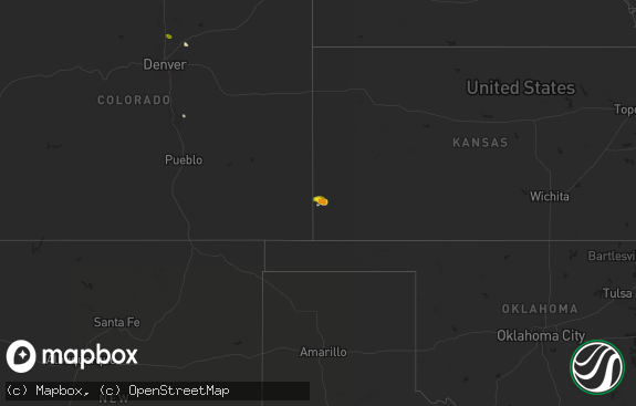
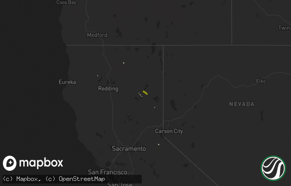
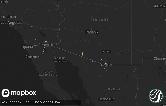
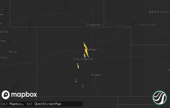
Hail Map in Nevada on August 10, 2022
The weather event in Nevada on August 10, 2022 includes Hail and Wind maps. 21 states and 286 cities were impacted and suffered possible damage. The total estimated number of properties impacted is 105.

Hail
Wind
105
Estimated number of impacted properties by a 1.00" hail or larger0
Estimated number of impacted properties by a 1.75" hail or larger0
Estimated number of impacted properties by a 2.50" hail or largerStorm reports in Nevada
Nevada
| Date | Description |
|---|---|
| 08/10/20225:15 PM CDT | Kane springs raws site measured a gust of 58 mph. Time estimated using radar. |
| 08/10/20224:13 AM CDT | At 912 PM PDT, a severe thunderstorm was located 12 miles southeast of New Pass Summit, moving northeast at 15 mph. HAZARD...60 mph wind gusts and half dollar size hail. SOURCE...Radar indicated. IMPACT...Hail damage to vehicles is expected. Expect wind damage to roofs, siding, and trees. Locations impacted include... Austin, Railroad Pass, and US-50 Highway |
| 08/10/20222:14 AM CDT | At 713 PM PDT, a severe thunderstorm was located near Stillwater, or 13 miles east of Fallon, moving northeast at 20 mph. HAZARD...60 mph wind gusts, half dollar size hail, and torrential rainfall. SOURCE...Radar indicated. IMPACT...Hail damage to vehicles is expected. Expect wind damage to roofs, siding, fencing and trees. Roadways may become impassable due to flooding. Locations impacted include... Stillwater. |
| 08/10/20221:41 AM CDT | At 640 PM PDT, a severe thunderstorm was located 7 miles southeast of Fallon, moving northeast at 15 mph. HAZARD...60 mph wind gusts and quarter size hail. SOURCE...Radar indicated. IMPACT...Hail damage to vehicles is expected. Expect wind damage to roofs, siding, fencing and trees. Locations impacted include... Stillwater, Junction U.S 50 And NV 116 (Stuart Rd), Fallon Station and Junction U.S 95 And NV 120 (Pasture Rd). |
| 08/10/202212:46 AM CDT | At 546 PM PDT, a severe thunderstorm was located 18 miles north of New Pass Summit, moving north at 5 mph. HAZARD...60 mph wind gusts and half dollar size hail. SOURCE...Radar indicated. IMPACT...Hail damage to vehicles is expected. Expect wind damage to roofs, siding, and trees. This severe thunderstorm will remain over mainly rural areas of central Lander County. |
| 08/09/202210:52 PM CDT | At 352 PM PDT, a severe thunderstorm was located 30 miles west of Grass Valley, moving north at 15 mph. HAZARD...60 mph wind gusts and half dollar size hail. SOURCE...Radar indicated. IMPACT...Hail damage to vehicles is expected. Expect wind damage to roofs, siding, and trees. Locations impacted include... Antelope Valley. |
| 08/09/202210:15 PM CDT | 61 mph wind gust was measured at arl sord site a06aa. |
| 08/09/202210:14 PM CDT | At 313 PM PDT, a severe thunderstorm was located 17 miles south of Battle Mountain, moving north at 15 mph. HAZARD...60 mph wind gusts and quarter size hail. SOURCE...Radar indicated. IMPACT...Hail damage to vehicles is expected. Expect wind damage to roofs, siding, and trees. Locations impacted include... Phoenix Mine. |
| 08/09/20229:15 PM CDT | 60 mph wind gust measured at arl sord site a27aa. |
| 08/09/20229:04 PM CDT | At 203 PM PDT, a severe thunderstorm was located 19 miles southwest of Pine Valley, moving east at 15 mph. HAZARD...60 mph wind gusts and quarter size hail. SOURCE...Radar indicated. IMPACT...Hail damage to vehicles is expected. Expect wind damage to roofs, siding, and trees. This severe thunderstorm will remain over mainly rural areas of central Eureka County. |
| 08/09/20228:15 PM CDT | Gust of 58 mph was measured at arl so |
| 08/09/20228:15 PM CDT | Gust of 58 mph was measured at arl sord site a01ab. |
All States Impacted by Hail Map on August 10, 2022
Cities Impacted by Hail Map on August 10, 2022
- Kents Store, VA
- Hyattsville, MD
- Riverdale, MD
- Greenbelt, MD
- Mount Rainier, MD
- College Park, MD
- Brentwood, MD
- Bladensburg, MD
- Beltsville, MD
- Goochland, VA
- Fallon, NV
- Savage, MD
- Laurel, MD
- Jessup, MD
- Boones Mill, VA
- Bainbridge Island, WA
- Drewryville, VA
- Capron, VA
- Columbia, VA
- Bremo Bluff, VA
- La Plata, MD
- Bryantown, MD
- Waldorf, MD
- Port Tobacco, MD
- Welcome, MD
- Accokeek, MD
- Holly Springs, NC
- Warfield, VA
- Freeman, VA
- Suffolk, VA
- La Grande, OR
- Oxon Hill, MD
- Marana, AZ
- Lanexa, VA
- Blum, TX
- Diamond, OR
- Princeton, OR
- Denton, NC
- Richfield, NC
- New London, NC
- Weston, OR
- Walla Walla, WA
- Sandston, VA
- Plymouth, NC
- Trinity, NC
- Raleigh, NC
- Garner, NC
- Elkwood, VA
- Brandy Station, VA
- Stevensburg, VA
- Culpeper, VA
- Virginia Beach, VA
- Gordonsville, VA
- Louisa, VA
- Cache, OK
- Indiahoma, OK
- Fillmore, UT
- New Canton, VA
- Arvonia, VA
- Battle Mountain, NV
- South Hill, VA
- Stuarts Draft, VA
- Palmyra, VA
- Gloucester, VA
- North, VA
- Dutton, VA
- Athena, OR
- Milton Freewater, OR
- Golconda, NV
- Courtland, VA
- Mattaponi, VA
- Little Plymouth, VA
- Newport News, VA
- Fort Eustis, VA
- Clayton, AL
- Eufaula, AL
- Charles City, VA
- Henrico, VA
- Chester, VA
- Providence Forge, VA
- Morgan, TX
- Elizabethton, TN
- Suitland, MD
- Charlotte, NC
- Midland, NC
- Matthews, NC
- Indian Head, MD
- West Point, VA
- Barhamsville, VA
- Fairfax, SC
- Ulmer, SC
- Covington, VA
- Naco, AZ
- Bisbee, AZ
- Littleton, NC
- Halifax, NC
- Garysburg, NC
- Enfield, NC
- Jackson, NC
- Minden, LA
- Texarkana, TX
- Marion, NC
- Conway, NC
- Woodland, NC
- Sedona, AZ
- Sanger, TX
- McKenney, VA
- Quinton, VA
- New Kent, VA
- Pilot Point, TX
- Glen Rose, TX
- Quantico, VA
- Triangle, VA
- Dumfries, VA
- Woodbridge, VA
- King And Queen Court House, VA
- Pulaski, VA
- Clayton, NC
- Wendell, NC
- Dayton, WA
- Waitsburg, WA
- Riverside, OR
- Chesapeake, VA
- Yorktown, VA
- Richmond, VA
- Aubrey, TX
- Cusick, WA
- Ione, WA
- Bonners Ferry, ID
- Asheboro, NC
- Seagoville, TX
- Columbia, NC
- Brunson, SC
- Deming, NM
- Robinson Creek, KY
- Pikeville, KY
- Harold, KY
- Austin, NV
- Kearneysville, WV
- Shacklefords, VA
- Sumerduck, VA
- Remington, VA
- Nellysford, VA
- Touchet, WA
- Church View, VA
- Saluda, VA
- Altus, OK
- Pomeroy, WA
- Vienna, VA
- Scottsville, VA
- Moneta, VA
- Huddleston, VA
- Alexandria, VA
- Alapaha, GA
- Powhatan, VA
- Chesterfield, VA
- Petersburg, VA
- Seaford, VA
- Lake Creek, TX
- Cooper, TX
- Wadesboro, NC
- Mount Pleasant, NC
- Blackville, SC
- Olar, SC
- Falls Church, VA
- Clifton Forge, VA
- Gates, NC
- Corapeake, NC
- Valley View, TX
- Catlett, VA
- Midland, VA
- Washington, DC
- Montpelier, VA
- Cochran, GA
- Eastman, GA
- Gorman, TX
- Eastland, TX
- Cypress, TX
- Nash, TX
- Graford, TX
- Jacksboro, TX
- Perrin, TX
- La Crosse, VA
- El Campo, TX
- Dayton, TX
- Spring, TX
- Houston, TX
- Kaufman, TX
- Cuero, TX
- Meyersville, TX
- Clyo, GA
- Waxahachie, TX
- Mabank, TX
- Stockdale, TX
- Pelham, NC
- Kemp, TX
- Brookesmith, TX
- Rockbridge Baths, VA
- Mount Dora, FL
- Zellwood, FL
- Apopka, FL
- Scurry, TX
- Durham, NC
- Oakton, VA
- Herndon, VA
- Fairfax, VA
- Reston, VA
- Forreston, TX
- Zuni, VA
- Franklin, VA
- Wakefield, VA
- Sedley, VA
- Ivor, VA
- Knightdale, NC
- Lexington, VA
- Raphine, VA
- Fairfield, VA
- Creswell, NC
- Roper, NC
- Era, TX
- Gainesville, TX
- Hull, TX
- Liberty, TX
- Brookshire, TX
- Healdton, OK
- Carrollton, VA
- Thomasville, GA
- Pavo, GA
- Louise, TX
- Saratoga, TX
- Prosper, TX
- Huffman, TX
- Katy, TX
- Edgewood, TX
- Wills Point, TX
- Yoakum, TX
- Brandywine, MD
- Parksley, VA
- Mckinney, TX
- Poca, WV
- Charleston, WV
- Concord, NC
- Fairfield, TX
- Willacoochee, GA
- Ruffin, NC
- Yanceyville, NC
- Stanfield, NC
- Globe, AZ
- Harrisburg, NC
- Sour Lake, TX
- Kountze, TX
- Dinwiddie, VA
- Carson, VA
- Lakeview, TX
- Temple, OK
- Rich Square, NC
- Sophia, NC
- High Point, NC
- Randleman, NC
- Hallettsville, TX
- Humble, TX
- Albemarle, NC
- Mount Lemmon, AZ
- Moultrie, GA
- Springfield, GA
- Celina, TX
- Greeneville, TN
- Dequincy, LA
- Albany, GA
- Sealy, TX
- Pendleton, OR
- Hockley, TX
- Americus, GA
- Leslie, GA
- Sorrento, FL
- Memphis, TX
- Santa Anna, TX
- Catawba, SC
- Ray City, GA
- Moody Afb, GA
- Lakeland, GA
- Naylor, GA
- Valdosta, GA
- Bowie, MD
- Fort George G Meade, MD
- Odenton, MD


