Hail Map in North Carolina on August 10, 2022
Get this storm
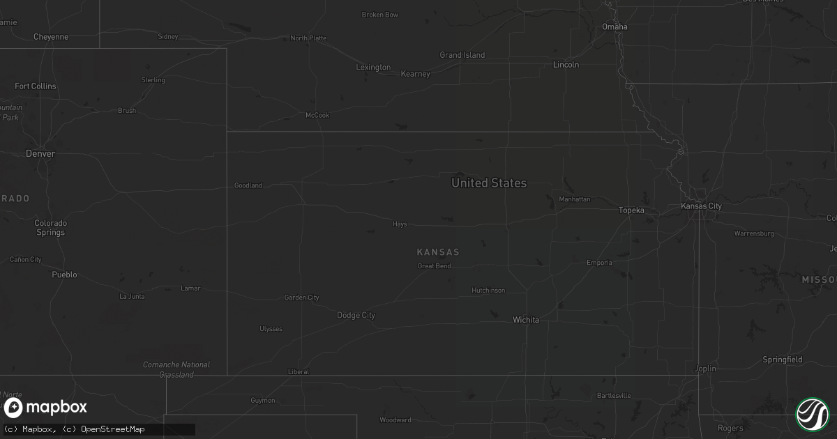
August 10 map
$229
one time, instant access
Download today. No call, no setup
Keep the $229
Bought the map and want the full workflow? Apply the entire $229 to a subscription within 7 days. None of it is wasted.
Every map, not just this one
This buys you this map. Subscription and you get every map we run, in the markets you choose from a few cities to whole states to nationwide. Plus real-time alerts the moment a storm fires.
Contact data
Name, contact info, occupancy, even credit band for addresses in the footprint. You go from where it hit to who to call.
Become the source they trust
Unlimited branding weather history reports on demand. You already have the documented answer ready for the property owner, and you are the one who showed up with it.
Property data and RoofTrace estimates
Pull up any address you have got, its value and the exact code rules for that jurisdiction, straight from One Click Code. Then RoofTrace estimates the squares, pitch, and roof value, priced the way you price.
Storm reports in North Carolina
North Carolina
| Date | Description |
|---|---|
| 08/10/20226:04 PM CDT | Several trees down around the city of halifax. All of halifax... Nc is without power. Time estimated by radar. |
| 08/10/20225:33 PM CDT | Public report of a tree down on a residence near rustic wood lane and hickory nut court. |
| 08/10/20225:28 PM CDT | Power outage due to trees damaging equipment. Time estimated by radar. |
| 08/10/20224:40 PM CDT | Report of down trees from mping. Time estimated by radar. |
| 08/10/20224:35 PM CDT | Corrects previous tstm wnd dmg report from 8 e gordontown. Report of down trees from mping. Time estimated by radar. |
| 08/10/20224:17 PM CDT | Tree fell and landed on a car. No injuries were reported. Time estimated by radar. |
| 08/10/20223:43 PM CDT | Reports of trees down near the city of locust... Nc. |
| 08/10/20223:15 PM CDT | One tree down near the intersection of blackwell road and foster road. |
| 08/10/20221:00 PM CDT | Trees down on the northbound lanes of us-421 in the purlear area. |
| 08/10/20221:58 AM CDT | At 657 PM EDT, a severe thunderstorm was located near Halifax, moving northeast at 20 mph. HAZARD...60 mph wind gusts. SOURCE...Radar indicated. IMPACT...Expect damage to roofs, siding, and trees. Locations impacted include... Roanoke Rapids, Halifax, Enfield, Weldon and South Weldon. |
| 08/10/20221:53 AM CDT | At 652 PM EDT, a severe thunderstorm was located near Fuquay-Varina, or 8 miles southwest of Cary, moving northeast at 20 mph. HAZARD...60 mph wind gusts. SOURCE...Radar indicated. IMPACT...Expect damage to roofs, siding, and trees. Locations impacted include... Raleigh, Cary, Garner, Fuquay-Varina, Apex, Holly Springs, Lake Wheeler, New Hill, Lake Benson and Shearon Harris Reservoir. |
| 08/10/20221:09 AM CDT | At 609 PM EDT, a severe thunderstorm was located 7 miles east of High Point, moving northeast at 25 mph. HAZARD...60 mph wind gusts. SOURCE...Radar indicated. IMPACT...Expect damage to roofs, siding, and trees. Locations impacted include... Greensboro, High Point, Asheboro, Randleman, Archdale, Trinity, Pleasant Garden, Jamestown, Liberty and Ramseur. |
| 08/10/202212:14 AM CDT | At 513 PM EDT, a severe thunderstorm was located over Garner, or near Raleigh, moving northeast at 15 mph. HAZARD...60 mph wind gusts. SOURCE...Radar indicated. IMPACT...Expect damage to roofs, siding, and trees. Locations impacted include... Raleigh, Garner, Knightdale, Wendell and Lake Benson. |
| 08/10/202212:06 AM CDT | At 506 PM EDT, a severe thunderstorm was located near Badin Lake, moving northeast at 15 mph. HAZARD...60 mph wind gusts. SOURCE...Radar indicated. IMPACT...Expect damage to roofs, siding, and trees. Locations impacted include... Badin Lake, Badin, Denton, Eldorado, Fish Tales Marina, Whip-O-Will Campground, Newsom, Pinehaven Marina, Ulah and High Rock Boat Dock Marina. |
| 08/09/202211:41 PM CDT | At 440 PM EDT, severe thunderstorms were located along a line extending from near Mt Pleasant to Midland, moving northeast at 15 mph. HAZARD...60 mph wind gusts. SOURCE...Radar indicated. IMPACT...Expect damage to roofs, siding, and trees. Locations impacted include... Albemarle, Badin Lake, Plyler, Fairview In Union County, Locust, Badin, Oakboro, Stanfield, Richfield and New London. |
| 08/09/202211:38 PM CDT | At 438 PM EDT, severe thunderstorms were located along a line extending from 11 miles northwest of Albemarle to 10 miles southeast of Downtown Concord, moving east at 15 mph. HAZARD...60 mph wind gusts and quarter size hail. SOURCE...Radar indicated. IMPACT...Minor hail damage to vehicles is expected. Expect wind damage to trees and power lines. Locations impacted include... Mt Pleasant, Midland and Gold Hill. |
| 08/09/202211:10 PM CDT | At 410 PM EDT, a severe thunderstorm was located 10 miles east of Uptown Charlotte, or over Mint Hill, moving east at 10 mph. HAZARD...60 mph wind gusts and quarter size hail. SOURCE...Radar indicated. IMPACT...Minor hail damage to vehicles is expected. Expect wind damage to trees and power lines. Locations impacted include... South Charlotte, East Charlotte, Matthews, Mint Hill, Harrisburg, Freedom Park, Reedy Creek Park, The Plaza, Midland and The Arboretum. |
| 08/09/202210:54 PM CDT | At 354 PM EDT, severe thunderstorms were located along a line extending from Providence to Yanceyville to near Quick, moving southeast at 15 mph. HAZARD...60 mph wind gusts and quarter size hail. SOURCE...Radar indicated. IMPACT...Hail damage to vehicles is expected. Expect wind damage to roofs, siding, and trees. Locations impacted include... Yanceyville... Bethel... Providence... Jericho... Prospect Hill... Camp Springs... and Milton. |
| 08/09/202210:28 PM CDT | At 328 PM EDT, a severe thunderstorm was located 12 miles southeast of Morganton, or 4 miles east of South Mountains State Park, moving northeast at 15 mph. HAZARD...60 mph wind gusts and quarter size hail. SOURCE...Radar indicated. IMPACT...Minor hail damage to vehicles is expected. Expect wind damage to trees and power lines. Locations impacted include... Icard, Hildebran, Casar, South Mountains State Park, Pleasant Grove, Cooksville, Propst, Vale, Mountain View and Belwood. |
| 08/09/20228:47 PM CDT | At 147 PM EDT, severe thunderstorms were located along a line extending from Wilbar to Maple Springs to near Darby, moving east at 10 mph. HAZARD...60 mph wind gusts and quarter size hail. SOURCE...Radar indicated. IMPACT...Hail damage to vehicles is expected. Expect wind damage to roofs, siding, and trees. Locations impacted include... North Wilkesboro... Wilkesboro... Traphill... Boomer... Wilbar... Mc Grady... and Darby. |
All States Impacted by Hail Map on August 10, 2022
Cities Impacted by Hail Map on August 10, 2022
- Kents Store, VA
- Hyattsville, MD
- Riverdale, MD
- Greenbelt, MD
- Mount Rainier, MD
- College Park, MD
- Brentwood, MD
- Bladensburg, MD
- Beltsville, MD
- Goochland, VA
- Fallon, NV
- Savage, MD
- Laurel, MD
- Jessup, MD
- Boones Mill, VA
- Bainbridge Island, WA
- Drewryville, VA
- Capron, VA
- Columbia, VA
- Bremo Bluff, VA
- La Plata, MD
- Bryantown, MD
- Waldorf, MD
- Port Tobacco, MD
- Welcome, MD
- Accokeek, MD
- Holly Springs, NC
- Warfield, VA
- Freeman, VA
- Suffolk, VA
- La Grande, OR
- Oxon Hill, MD
- Marana, AZ
- Lanexa, VA
- Blum, TX
- Diamond, OR
- Princeton, OR
- Denton, NC
- Richfield, NC
- New London, NC
- Weston, OR
- Walla Walla, WA
- Sandston, VA
- Plymouth, NC
- Trinity, NC
- Raleigh, NC
- Garner, NC
- Elkwood, VA
- Brandy Station, VA
- Stevensburg, VA
- Culpeper, VA
- Virginia Beach, VA
- Gordonsville, VA
- Louisa, VA
- Cache, OK
- Indiahoma, OK
- Fillmore, UT
- New Canton, VA
- Arvonia, VA
- Battle Mountain, NV
- South Hill, VA
- Stuarts Draft, VA
- Palmyra, VA
- Gloucester, VA
- North, VA
- Dutton, VA
- Athena, OR
- Milton Freewater, OR
- Golconda, NV
- Courtland, VA
- Mattaponi, VA
- Little Plymouth, VA
- Newport News, VA
- Fort Eustis, VA
- Clayton, AL
- Eufaula, AL
- Charles City, VA
- Henrico, VA
- Chester, VA
- Providence Forge, VA
- Morgan, TX
- Elizabethton, TN
- Suitland, MD
- Charlotte, NC
- Midland, NC
- Matthews, NC
- Indian Head, MD
- West Point, VA
- Barhamsville, VA
- Fairfax, SC
- Ulmer, SC
- Covington, VA
- Naco, AZ
- Bisbee, AZ
- Littleton, NC
- Halifax, NC
- Garysburg, NC
- Enfield, NC
- Jackson, NC
- Minden, LA
- Texarkana, TX
- Marion, NC
- Conway, NC
- Woodland, NC
- Sedona, AZ
- Sanger, TX
- McKenney, VA
- Quinton, VA
- New Kent, VA
- Pilot Point, TX
- Glen Rose, TX
- Quantico, VA
- Triangle, VA
- Dumfries, VA
- Woodbridge, VA
- King And Queen Court House, VA
- Pulaski, VA
- Clayton, NC
- Wendell, NC
- Dayton, WA
- Waitsburg, WA
- Riverside, OR
- Chesapeake, VA
- Yorktown, VA
- Richmond, VA
- Aubrey, TX
- Cusick, WA
- Ione, WA
- Bonners Ferry, ID
- Asheboro, NC
- Seagoville, TX
- Columbia, NC
- Brunson, SC
- Deming, NM
- Robinson Creek, KY
- Pikeville, KY
- Harold, KY
- Austin, NV
- Kearneysville, WV
- Shacklefords, VA
- Sumerduck, VA
- Remington, VA
- Nellysford, VA
- Touchet, WA
- Church View, VA
- Saluda, VA
- Altus, OK
- Pomeroy, WA
- Vienna, VA
- Scottsville, VA
- Moneta, VA
- Huddleston, VA
- Alexandria, VA
- Alapaha, GA
- Powhatan, VA
- Chesterfield, VA
- Petersburg, VA
- Seaford, VA
- Lake Creek, TX
- Cooper, TX
- Wadesboro, NC
- Mount Pleasant, NC
- Blackville, SC
- Olar, SC
- Falls Church, VA
- Clifton Forge, VA
- Gates, NC
- Corapeake, NC
- Valley View, TX
- Catlett, VA
- Midland, VA
- Washington, DC
- Montpelier, VA
- Cochran, GA
- Eastman, GA
- Gorman, TX
- Eastland, TX
- Cypress, TX
- Nash, TX
- Graford, TX
- Jacksboro, TX
- Perrin, TX
- La Crosse, VA
- El Campo, TX
- Dayton, TX
- Spring, TX
- Houston, TX
- Kaufman, TX
- Cuero, TX
- Meyersville, TX
- Clyo, GA
- Waxahachie, TX
- Mabank, TX
- Stockdale, TX
- Pelham, NC
- Kemp, TX
- Brookesmith, TX
- Rockbridge Baths, VA
- Mount Dora, FL
- Zellwood, FL
- Apopka, FL
- Scurry, TX
- Durham, NC
- Oakton, VA
- Herndon, VA
- Fairfax, VA
- Reston, VA
- Forreston, TX
- Zuni, VA
- Franklin, VA
- Wakefield, VA
- Sedley, VA
- Ivor, VA
- Knightdale, NC
- Lexington, VA
- Raphine, VA
- Fairfield, VA
- Creswell, NC
- Roper, NC
- Era, TX
- Gainesville, TX
- Hull, TX
- Liberty, TX
- Brookshire, TX
- Healdton, OK
- Carrollton, VA
- Thomasville, GA
- Pavo, GA
- Louise, TX
- Saratoga, TX
- Prosper, TX
- Huffman, TX
- Katy, TX
- Edgewood, TX
- Wills Point, TX
- Yoakum, TX
- Brandywine, MD
- Parksley, VA
- Mckinney, TX
- Poca, WV
- Charleston, WV
- Concord, NC
- Fairfield, TX
- Willacoochee, GA
- Ruffin, NC
- Yanceyville, NC
- Stanfield, NC
- Globe, AZ
- Harrisburg, NC
- Sour Lake, TX
- Kountze, TX
- Dinwiddie, VA
- Carson, VA
- Lakeview, TX
- Temple, OK
- Rich Square, NC
- Sophia, NC
- High Point, NC
- Randleman, NC
- Hallettsville, TX
- Humble, TX
- Albemarle, NC
- Mount Lemmon, AZ
- Moultrie, GA
- Springfield, GA
- Celina, TX
- Greeneville, TN
- Dequincy, LA
- Albany, GA
- Sealy, TX
- Pendleton, OR
- Hockley, TX
- Americus, GA
- Leslie, GA
- Sorrento, FL
- Memphis, TX
- Santa Anna, TX
- Catawba, SC
- Ray City, GA
- Moody Afb, GA
- Lakeland, GA
- Naylor, GA
- Valdosta, GA
- Bowie, MD
- Fort George G Meade, MD
- Odenton, MD


