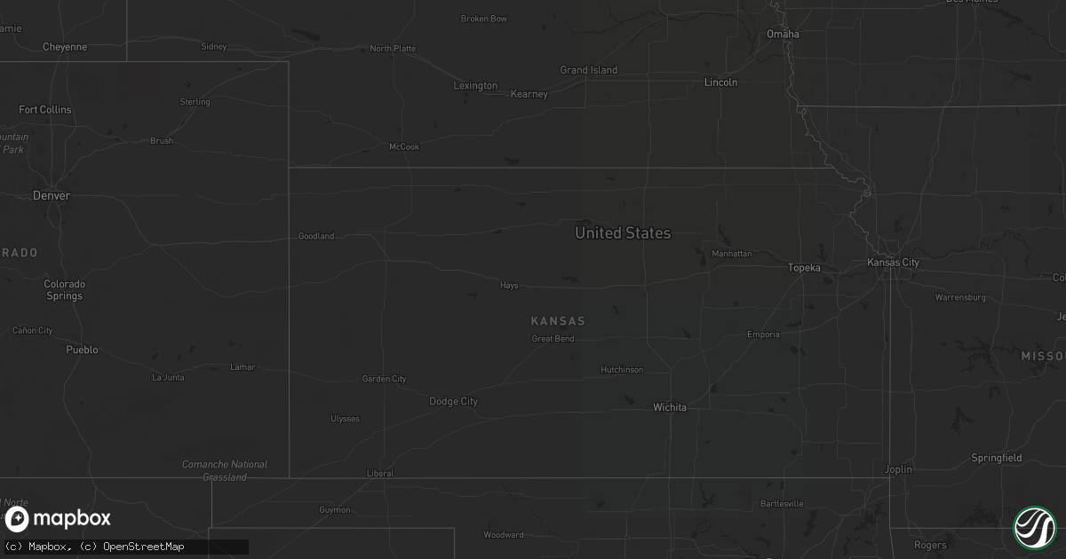
Hail Map in Georgia on August 10, 2022
Get this storm
August 10 map
$229
one time, instant access
Download today. No call, no setup
Keep the $229
Bought the map and want the full workflow? Apply the entire $229 to a subscription within 7 days. None of it is wasted.
Every map, not just this one
This buys you this map. Subscription and you get every map we run, in the markets you choose from a few cities to whole states to nationwide. Plus real-time alerts the moment a storm fires.
Contact data
Name, contact info, occupancy, even credit band for addresses in the footprint. You go from where it hit to who to call.
Become the source they trust
Unlimited branding weather history reports on demand. You already have the documented answer ready for the property owner, and you are the one who showed up with it.
Property data and RoofTrace estimates
Pull up any address you have got, its value and the exact code rules for that jurisdiction, straight from One Click Code. Then RoofTrace estimates the squares, pitch, and roof value, priced the way you price.
Storm reports in Georgia
Georgia
| Date | Description |
|---|---|
| 08/10/20226:48 PM CDT | Metal roof was lifted and flipped off a mobile home. Time estimated from radar. |
| 08/10/20226:48 PM CDT | Emergency manager reported multiple trees down on power lines and a large tree down across noel c conaway road... Likely due to thunderstorm outflow. Time estimated via |
| 08/10/20226:45 PM CDT | Social media report of trees down... Power lines down... And some damage to roofs. Time estimated from radar data. |
| 08/10/20225:30 PM CDT | Tree down near intersection of robert lee road and peach street. |
| 08/10/20225:30 PM CDT | Wire down near intersection of james pond rd and highway 32 w. |
| 08/10/20225:20 PM CDT | Tree down near the 100 block of lexington street. |
| 08/10/20225:10 PM CDT | Tree down near the intersection of west whitney ave and harding st. |
| 08/10/20225:10 PM CDT | Structural damage to church in downtown albany. Attributed to straight line winds based on review of photos from local media... Radar analysis... And discussions with e |
| 08/10/20224:30 PM CDT | 466 kierce road... Tree fell on power line. |
| 08/10/20224:26 PM CDT | Scattered trees down. |
| 08/10/20224:08 PM CDT | Several trees and power lines down across the county. |
| 08/10/20224:00 PM CDT | Delayed report. Tree down near the intersection of new forest highway and strawberry rd. |
| 08/10/20223:40 PM CDT | Several trees and power lines down across the county. |
| 08/10/20223:30 PM CDT | Delayed report. Multiple trees down along north main st. |
| 08/10/20223:14 PM CDT | Tree down with power line on boyette road... Lanier county georgia. |
| 08/10/20223:14 PM CDT | Tree down with power line on boyette road... Lanier county ge |
| 08/10/20223:10 PM CDT | Several power lines reported down in albany. |
| 08/10/20223:10 PM CDT | Tree down on powerlines along macon rd near intersection of s dixon dr. |
| 08/10/20222:51 PM CDT | Emergency manager reported at toney brothers road and ga-33 near new elm... That there are several pecan trees down and 2 road signs were knocked down. |
| 08/10/202212:59 AM CDT | At 558 PM EDT, a severe thunderstorm was located over Dubois, or 8 miles southeast of Cochran, moving north at 20 mph. HAZARD...60 mph wind gusts and quarter size hail. SOURCE...Radar indicated. IMPACT...Hail damage to vehicles is expected. Expect wind damage to roofs, siding, and trees. Locations impacted include... Cochran, Chester, Dubois, Royal, Coley Station, Gresston, Empire, Yonkers, Roddy, Baileys Park and Rowland. |
| 08/10/202212:58 AM CDT | At 558 PM EDT, severe thunderstorms were located along a line extending from near Edison to near Putney, moving northeast at 25 mph. HAZARD...60 mph wind gusts. SOURCE...Radar indicated. IMPACT...Expect damage to roofs, siding, and trees. Locations impacted include... Dawson, Leesburg, Cuthbert, Albany, Shellman, Smithville, Sasser, Bronwood, Parrott, Chokee, Stocks, Forrester, Carnegie, Palmyra, Randolph Co A/p, Clarks Mill, Dawson Municipal A/P, Chambliss, Olivers Mill and Neyami. |
| 08/10/202212:44 AM CDT | At 544 PM EDT, a severe thunderstorm was located over Chauncey, or 9 miles southeast of Eastman, moving northeast at 25 mph. HAZARD...60 mph wind gusts and quarter size hail. SOURCE...Radar indicated. IMPACT...Hail damage to vehicles is expected. Expect wind damage to roofs, siding, and trees. Locations impacted include... Eastman, Milan, Cadwell, Chauncey, Jay Bird Springs, Five Points, Plainfield, Cedar Grove and Godwinsville. |
| 08/10/202212:39 AM CDT | At 539 PM EDT, severe thunderstorms were located along a line extending from near Arlington to 6 miles northeast of Pelham, moving northeast at 20 mph. HAZARD...60 mph wind gusts. SOURCE...Radar indicated. IMPACT...Expect damage to roofs, siding, and trees. Locations impacted include... Morgan, Albany, Putney, Edison, Arlington, Leary, East Albany, Marine Corps Logistics Base, Turner City, Walker, Radium Springs, Parksville, Lockett Crossing, South Albany, Southwest Ga Regional A/P, Holt, Acree, Williamsburg, Moye and Pecan City. |
| 08/10/202212:12 AM CDT | At 512 PM EDT, severe thunderstorms were located along a line extending from 6 miles northwest of Whigham to near Thomasville, moving northeast at 35 mph. HAZARD...60 mph wind gusts. SOURCE...Radar indicated. IMPACT...Expect damage to roofs, siding, and trees. Locations impacted include... Pelham, Camilla, Moultrie, Baconton, Doerun, Riverside, Schley, Funston, Sale City, Bridgeboro, Minton, Flint, Anderson City, Cotton, Lester, Sigsbee, Pritchetts, Moultrie Municipal A/P, Poplar Arbor Church and Branchville. |
| 08/09/202211:56 PM CDT | At 456 PM EDT, a severe thunderstorm was located near West Bainbridge, or near Bainbridge, moving north at 20 mph. HAZARD...60 mph wind gusts. SOURCE...Radar indicated. IMPACT...Expect damage to roofs, siding, and trees. Locations impacted include... Colquitt, Newton, Arlington, Douglasville, Damascus, Babcock, Iveys Mill, Boykin, Mimsville, Branchville, Hentown, Bellview, Rowena, Milford, Hopeful, Red Store Crossroads, Crestview, Hoggard Mill, Hawkinstown and Harmony Church Rd/hwy 45. |
| 08/09/202211:46 PM CDT | At 446 PM EDT, severe thunderstorms were located along a line extending from 6 miles south of Ambrose to near Homerville, moving northeast at 20 mph. HAZARD...60 mph wind gusts and nickel size hail. SOURCE...Radar indicated. IMPACT...Expect damage to roofs, siding, and trees. Locations impacted include... Homerville, Pearson, Willacoochee, Ambrose, Argyle, Du Pont, Cogdell and Axson. |
| 08/09/202211:33 PM CDT | At 433 PM EDT, a severe thunderstorm was located near Bainbridge, moving north at 25 mph. HAZARD...60 mph wind gusts. SOURCE...Radar indicated. IMPACT...Expect damage to roofs, siding, and trees. Locations impacted include... Bainbridge, West Bainbridge, Attapulgus, Climax, Brinson, Hanover, Ausmac, Eldorendo, Decatur Co A/P, Steinham Store, Faceville, Fowlstown and Cyrene. |
| 08/09/202211:14 PM CDT | At 414 PM EDT, severe thunderstorms were located along a line extending from 6 miles north of Alapaha to near Moody Air Force Base, moving northeast at 15 mph. HAZARD...60 mph wind gusts. SOURCE...Radar indicated. IMPACT...Expect damage to roofs, siding, and trees. Locations impacted include... Lakeland, Nashville, Ray City, Alapaha, Moody Air Force Base, Meigs, Courthouse, Berrien Co A/P, Gladys, Glory, Hansell, Bannockburn, Weber and Teeterville. |
| 08/09/202210:59 PM CDT | At 359 PM EDT, a severe thunderstorm was located near East Albany, or near Albany, moving north at 15 mph. HAZARD...60 mph wind gusts. SOURCE...Radar indicated. IMPACT...Expect damage to roofs, siding, and trees. Locations impacted include... Leesburg, Albany, Putney, Smithville, East Albany, Marine Corps Logistics Base, Turner City, Warwick, Chokee, Stocks, Radium Springs, Forrester, Lockett Crossing, South Albany, Southwest Ga Regional A/P, Palmyra, Olivers Mill, Neyami, Williamsburg and Century. |
| 08/09/20227:19 PM CDT | Emergency manager reported a large tree down on power lines along stillwell rd and trees down on log landing road between stillwell rd and shadowbrook dr. Time estimate |
| 08/09/20227:11 PM CDT | Emergency manager reported multiple power lines down... Multiple trees on power lines... And a tree down on central ave all within the downtown guyton area. Time estima |
All States Impacted by Hail Map on August 10, 2022
Cities Impacted by Hail Map on August 10, 2022
- Kents Store, VA
- Hyattsville, MD
- Riverdale, MD
- Greenbelt, MD
- Mount Rainier, MD
- College Park, MD
- Brentwood, MD
- Bladensburg, MD
- Beltsville, MD
- Goochland, VA
- Fallon, NV
- Savage, MD
- Laurel, MD
- Jessup, MD
- Boones Mill, VA
- Bainbridge Island, WA
- Drewryville, VA
- Capron, VA
- Columbia, VA
- Bremo Bluff, VA
- La Plata, MD
- Bryantown, MD
- Waldorf, MD
- Port Tobacco, MD
- Welcome, MD
- Accokeek, MD
- Holly Springs, NC
- Warfield, VA
- Freeman, VA
- Suffolk, VA
- La Grande, OR
- Oxon Hill, MD
- Marana, AZ
- Lanexa, VA
- Blum, TX
- Diamond, OR
- Princeton, OR
- Denton, NC
- Richfield, NC
- New London, NC
- Weston, OR
- Walla Walla, WA
- Sandston, VA
- Plymouth, NC
- Trinity, NC
- Raleigh, NC
- Garner, NC
- Elkwood, VA
- Brandy Station, VA
- Stevensburg, VA
- Culpeper, VA
- Virginia Beach, VA
- Gordonsville, VA
- Louisa, VA
- Cache, OK
- Indiahoma, OK
- Fillmore, UT
- New Canton, VA
- Arvonia, VA
- Battle Mountain, NV
- South Hill, VA
- Stuarts Draft, VA
- Palmyra, VA
- Gloucester, VA
- North, VA
- Dutton, VA
- Athena, OR
- Milton Freewater, OR
- Golconda, NV
- Courtland, VA
- Mattaponi, VA
- Little Plymouth, VA
- Newport News, VA
- Fort Eustis, VA
- Clayton, AL
- Eufaula, AL
- Charles City, VA
- Henrico, VA
- Chester, VA
- Providence Forge, VA
- Morgan, TX
- Elizabethton, TN
- Suitland, MD
- Charlotte, NC
- Midland, NC
- Matthews, NC
- Indian Head, MD
- West Point, VA
- Barhamsville, VA
- Fairfax, SC
- Ulmer, SC
- Covington, VA
- Naco, AZ
- Bisbee, AZ
- Littleton, NC
- Halifax, NC
- Garysburg, NC
- Enfield, NC
- Jackson, NC
- Minden, LA
- Texarkana, TX
- Marion, NC
- Conway, NC
- Woodland, NC
- Sedona, AZ
- Sanger, TX
- McKenney, VA
- Quinton, VA
- New Kent, VA
- Pilot Point, TX
- Glen Rose, TX
- Quantico, VA
- Triangle, VA
- Dumfries, VA
- Woodbridge, VA
- King And Queen Court House, VA
- Pulaski, VA
- Clayton, NC
- Wendell, NC
- Dayton, WA
- Waitsburg, WA
- Riverside, OR
- Chesapeake, VA
- Yorktown, VA
- Richmond, VA
- Aubrey, TX
- Cusick, WA
- Ione, WA
- Bonners Ferry, ID
- Asheboro, NC
- Seagoville, TX
- Columbia, NC
- Brunson, SC
- Deming, NM
- Robinson Creek, KY
- Pikeville, KY
- Harold, KY
- Austin, NV
- Kearneysville, WV
- Shacklefords, VA
- Sumerduck, VA
- Remington, VA
- Nellysford, VA
- Touchet, WA
- Church View, VA
- Saluda, VA
- Altus, OK
- Pomeroy, WA
- Vienna, VA
- Scottsville, VA
- Moneta, VA
- Huddleston, VA
- Alexandria, VA
- Alapaha, GA
- Powhatan, VA
- Chesterfield, VA
- Petersburg, VA
- Seaford, VA
- Lake Creek, TX
- Cooper, TX
- Wadesboro, NC
- Mount Pleasant, NC
- Blackville, SC
- Olar, SC
- Falls Church, VA
- Clifton Forge, VA
- Gates, NC
- Corapeake, NC
- Valley View, TX
- Catlett, VA
- Midland, VA
- Washington, DC
- Montpelier, VA
- Cochran, GA
- Eastman, GA
- Gorman, TX
- Eastland, TX
- Cypress, TX
- Nash, TX
- Graford, TX
- Jacksboro, TX
- Perrin, TX
- La Crosse, VA
- El Campo, TX
- Dayton, TX
- Spring, TX
- Houston, TX
- Kaufman, TX
- Cuero, TX
- Meyersville, TX
- Clyo, GA
- Waxahachie, TX
- Mabank, TX
- Stockdale, TX
- Pelham, NC
- Kemp, TX
- Brookesmith, TX
- Rockbridge Baths, VA
- Mount Dora, FL
- Zellwood, FL
- Apopka, FL
- Scurry, TX
- Durham, NC
- Oakton, VA
- Herndon, VA
- Fairfax, VA
- Reston, VA
- Forreston, TX
- Zuni, VA
- Franklin, VA
- Wakefield, VA
- Sedley, VA
- Ivor, VA
- Knightdale, NC
- Lexington, VA
- Raphine, VA
- Fairfield, VA
- Creswell, NC
- Roper, NC
- Era, TX
- Gainesville, TX
- Hull, TX
- Liberty, TX
- Brookshire, TX
- Healdton, OK
- Carrollton, VA
- Thomasville, GA
- Pavo, GA
- Louise, TX
- Saratoga, TX
- Prosper, TX
- Huffman, TX
- Katy, TX
- Edgewood, TX
- Wills Point, TX
- Yoakum, TX
- Brandywine, MD
- Parksley, VA
- Mckinney, TX
- Poca, WV
- Charleston, WV
- Concord, NC
- Fairfield, TX
- Willacoochee, GA
- Ruffin, NC
- Yanceyville, NC
- Stanfield, NC
- Globe, AZ
- Harrisburg, NC
- Sour Lake, TX
- Kountze, TX
- Dinwiddie, VA
- Carson, VA
- Lakeview, TX
- Temple, OK
- Rich Square, NC
- Sophia, NC
- High Point, NC
- Randleman, NC
- Hallettsville, TX
- Humble, TX
- Albemarle, NC
- Mount Lemmon, AZ
- Moultrie, GA
- Springfield, GA
- Celina, TX
- Greeneville, TN
- Dequincy, LA
- Albany, GA
- Sealy, TX
- Pendleton, OR
- Hockley, TX
- Americus, GA
- Leslie, GA
- Sorrento, FL
- Memphis, TX
- Santa Anna, TX
- Catawba, SC
- Ray City, GA
- Moody Afb, GA
- Lakeland, GA
- Naylor, GA
- Valdosta, GA
- Bowie, MD
- Fort George G Meade, MD
- Odenton, MD


