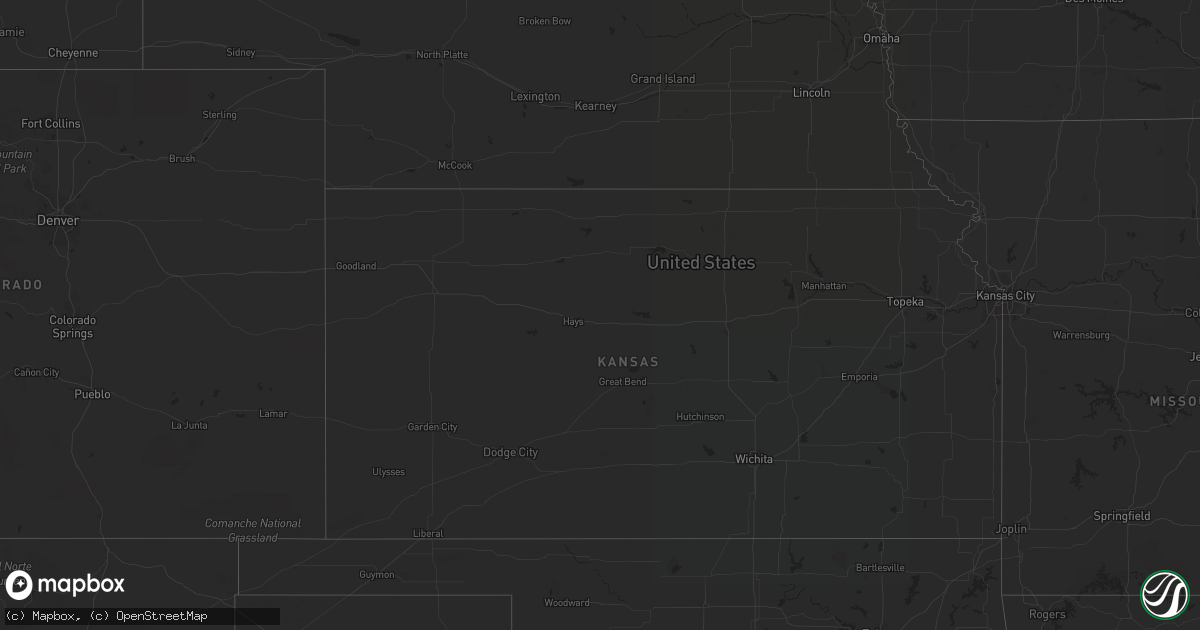
Hail Map in Oregon on August 10, 2022
Get this storm
August 10 map
$229
one time, instant access
Download today. No call, no setup
Keep the $229
Bought the map and want the full workflow? Apply the entire $229 to a subscription within 7 days. None of it is wasted.
Every map, not just this one
This buys you this map. Subscription and you get every map we run, in the markets you choose from a few cities to whole states to nationwide. Plus real-time alerts the moment a storm fires.
Contact data
Name, contact info, occupancy, even credit band for addresses in the footprint. You go from where it hit to who to call.
Become the source they trust
Unlimited branding weather history reports on demand. You already have the documented answer ready for the property owner, and you are the one who showed up with it.
Property data and RoofTrace estimates
Pull up any address you have got, its value and the exact code rules for that jurisdiction, straight from One Click Code. Then RoofTrace estimates the squares, pitch, and roof value, priced the way you price.
Storm reports in Oregon
Oregon
| Date | Description |
|---|---|
| 08/10/20223:45 PM CDT | Mesonet station rtfo3 red butte. |
| 08/10/20227:53 AM CDT | At 1252 PM PDT, a severe thunderstorm was located near Barton Lake, or 40 miles southeast of Burns, moving northeast at 30 mph. HAZARD...60 mph wind gusts and quarter size hail. SOURCE...Radar indicated. IMPACT...Hail damage to vehicles is expected. Expect wind damage to roofs, siding, and trees. Locations impacted include... New Princeton, Crane, Circle Bar, Malheur Cave, Riddle Mountain, Barton Lake, Venator and eastern Malheur Lake. |
| 08/10/20222:26 AM CDT | At 726 PM MDT, a severe thunderstorm was located near Freezeout Mountain, or 34 miles southwest of Parma, moving northeast at 20 mph. HAZARD...60 mph wind gusts and quarter size hail. SOURCE...Radar indicated. IMPACT...Hail damage to vehicles is expected. Expect wind damage to roofs, siding, and trees. This severe thunderstorm will be near... Freezeout Mountain around 740 PM MDT. Twin Springs Campground around 750 PM MDT. Owyhee Dam and northern Owyhee Reservoir around 810 PM MDT. |
| 08/10/20221:44 AM CDT | At 644 PM MDT, a severe thunderstorm was located near Monument Peak, or 51 miles west of Parma, moving north at 30 mph. HAZARD...60 mph wind gusts and quarter size hail. SOURCE...Radar indicated. IMPACT...Hail damage to vehicles is expected. Expect wind damage to roofs, siding, and trees. This severe thunderstorm will be near... Monument Peak around 650 PM MDT. Jonesboro around 710 PM MDT. Westfall Butte around 730 PM MDT. |
| 08/10/20221:43 AM CDT | At 642 PM MDT, a severe thunderstorm was located near Copeland Butte, or 41 miles north of Rome, moving northeast at 40 mph. HAZARD...60 mph wind gusts and quarter size hail. SOURCE...Radar indicated. IMPACT...Hail damage to vehicles is expected. Expect wind damage to roofs, siding, and trees. This severe thunderstorm will be near... Freezeout Mountain around 700 PM MDT. Twin Springs Campground around 710 PM MDT. Owyhee Dam and northern Owyhee Reservoir around 720 PM MDT. Shell Rock Butte and Double Mountain around 730 PM MDT. |
| 08/09/202211:20 PM CDT | Winds estimated at 90 mph. A downburst occurred from a severe thunderstorm that affected several parked... Unoccupied mobile homes. One of the mobile homes was picked u |
| 08/09/202211:20 PM CDT | Winds estimated 90 mph. A downburst occured from a severe thunderstorm that affected several parked... Unoccupied mobile homes. One of the mobile homes was picked up an |
| 08/09/202211:10 PM CDT | At 409 PM MDT, a severe thunderstorm was located near Shell Rock Butte, or 14 miles west of Parma, moving northeast at 30 mph. HAZARD...60 mph wind gusts and quarter size hail. SOURCE...Radar indicated. IMPACT...Hail damage to vehicles is expected. Expect wind damage to roofs, siding, and trees. This severe thunderstorm will be near... Vale, Keeney Pass and Owyhee around 420 PM MDT. Nyssa around 430 PM MDT. Ontario and Fruitland around 450 PM MDT. Payette and New Plymouth around 500 PM MDT. |
| 08/09/202210:32 PM CDT | At 331 PM MDT, a severe thunderstorm was located near Harper, or 30 miles west of Parma, moving northeast at 30 mph. HAZARD...60 mph wind gusts and half dollar size hail. SOURCE...Radar indicated. IMPACT...Hail damage to vehicles is expected. Expect wind damage to roofs, siding, and trees. This severe thunderstorm will be near... Vines Hill, Little Valley, Double Mountain and Shell Rock Butte around 350 PM MDT. Vale, Nyssa, Keeney Pass and Bully Creek Reservoir around 410 PM MDT. |
| 08/09/202210:07 PM CDT | At 307 PM MDT, a severe thunderstorm was located over Rufino Butte, or 40 miles west of Parma, moving northeast at 20 mph. HAZARD...60 mph wind gusts and quarter size hail. SOURCE...Radar indicated. IMPACT...Hail damage to vehicles is expected. Expect wind damage to roofs, siding, and trees. This severe thunderstorm will be near... Freezeout Mountain around 320 PM MDT. Harper and Little Valley around 340 PM MDT. |
| 08/09/20229:59 PM CDT | At 259 PM MDT, a severe thunderstorm was located near Scott Reservoir, or 8 miles south of Rome, moving northeast at 20 mph. HAZARD...60 mph wind gusts and quarter size hail. SOURCE...Radar indicated. IMPACT...Hail damage to vehicles is expected. Expect wind damage to roofs, siding, and trees. This severe thunderstorm will be near... Crooked Creek State Park around 310 PM MDT. Scott Reservoir around 320 PM MDT. Rome and Round Mountain around 330 PM MDT. Arock and Owyhee Butte around 340 PM MDT. |
| 08/09/20229:30 PM CDT | At 229 PM MDT, a severe thunderstorm was located near Monumental Rock, or 48 miles north of Rome, moving northeast at 25 mph. HAZARD...60 mph wind gusts and quarter size hail. SOURCE...Radar indicated. IMPACT...Hail damage to vehicles is expected. Expect wind damage to roofs, siding, and trees. Locations impacted include... Juntura, Monumental Rock, Mosquito Mountain, Rufino Butte, Jonesboro, Red Butte and Monument Peak. |
| 08/09/20229:27 PM CDT | At 227 PM PDT, a severe thunderstorm was located near Summerville, or 14 miles north of La Grande, moving northeast at 25 mph. HAZARD...60 mph wind gusts and quarter size hail. SOURCE...Radar indicated. IMPACT...Hail damage to vehicles is expected. Expect wind damage to roofs, siding, and trees. Locations impacted include... Elgin, Summerville and Spout Springs. |
| 08/09/20229:15 PM CDT | Winds estimated at 60 to 70 mph. Thunderstorm hit northern milton-freewater... Oregon. Storm survey revealed areas of isolated downed trees or tree branches. One tree s |
| 08/09/20229:15 PM CDT | Winds estimated at 60 to 70 mph. One thunderstorm hit portions of northern milton-freewater... Oregon. A storm survey revealed areas of isolated downed trees or tree br |
| 08/09/20228:39 PM CDT | At 138 PM PDT, a severe thunderstorm was located near Kamela, or 11 miles south of Meacham, moving northeast at 20 mph. HAZARD...60 mph wind gusts and quarter size hail. SOURCE...Radar indicated. IMPACT...Hail damage to vehicles is expected. Expect wind damage to roofs, siding, and trees. Locations impacted include... Meacham, Hilgard, Kamela and southeastern Umatilla Reservation. |
| 08/09/20228:17 PM CDT | At 116 PM PDT, a severe thunderstorm was located near Granite, or 29 miles southwest of North Powder, moving north at 15 mph. HAZARD...60 mph wind gusts and quarter size hail. SOURCE...Radar indicated. IMPACT...Hail damage to vehicles is expected. Expect wind damage to roofs, siding, and trees. Locations impacted include... Granite. |
All States Impacted by Hail Map on August 10, 2022
Cities Impacted by Hail Map on August 10, 2022
- Kents Store, VA
- Hyattsville, MD
- Riverdale, MD
- Greenbelt, MD
- Mount Rainier, MD
- College Park, MD
- Brentwood, MD
- Bladensburg, MD
- Beltsville, MD
- Goochland, VA
- Fallon, NV
- Savage, MD
- Laurel, MD
- Jessup, MD
- Boones Mill, VA
- Bainbridge Island, WA
- Drewryville, VA
- Capron, VA
- Columbia, VA
- Bremo Bluff, VA
- La Plata, MD
- Bryantown, MD
- Waldorf, MD
- Port Tobacco, MD
- Welcome, MD
- Accokeek, MD
- Holly Springs, NC
- Warfield, VA
- Freeman, VA
- Suffolk, VA
- La Grande, OR
- Oxon Hill, MD
- Marana, AZ
- Lanexa, VA
- Blum, TX
- Diamond, OR
- Princeton, OR
- Denton, NC
- Richfield, NC
- New London, NC
- Weston, OR
- Walla Walla, WA
- Sandston, VA
- Plymouth, NC
- Trinity, NC
- Raleigh, NC
- Garner, NC
- Elkwood, VA
- Brandy Station, VA
- Stevensburg, VA
- Culpeper, VA
- Virginia Beach, VA
- Gordonsville, VA
- Louisa, VA
- Cache, OK
- Indiahoma, OK
- Fillmore, UT
- New Canton, VA
- Arvonia, VA
- Battle Mountain, NV
- South Hill, VA
- Stuarts Draft, VA
- Palmyra, VA
- Gloucester, VA
- North, VA
- Dutton, VA
- Athena, OR
- Milton Freewater, OR
- Golconda, NV
- Courtland, VA
- Mattaponi, VA
- Little Plymouth, VA
- Newport News, VA
- Fort Eustis, VA
- Clayton, AL
- Eufaula, AL
- Charles City, VA
- Henrico, VA
- Chester, VA
- Providence Forge, VA
- Morgan, TX
- Elizabethton, TN
- Suitland, MD
- Charlotte, NC
- Midland, NC
- Matthews, NC
- Indian Head, MD
- West Point, VA
- Barhamsville, VA
- Fairfax, SC
- Ulmer, SC
- Covington, VA
- Naco, AZ
- Bisbee, AZ
- Littleton, NC
- Halifax, NC
- Garysburg, NC
- Enfield, NC
- Jackson, NC
- Minden, LA
- Texarkana, TX
- Marion, NC
- Conway, NC
- Woodland, NC
- Sedona, AZ
- Sanger, TX
- McKenney, VA
- Quinton, VA
- New Kent, VA
- Pilot Point, TX
- Glen Rose, TX
- Quantico, VA
- Triangle, VA
- Dumfries, VA
- Woodbridge, VA
- King And Queen Court House, VA
- Pulaski, VA
- Clayton, NC
- Wendell, NC
- Dayton, WA
- Waitsburg, WA
- Riverside, OR
- Chesapeake, VA
- Yorktown, VA
- Richmond, VA
- Aubrey, TX
- Cusick, WA
- Ione, WA
- Bonners Ferry, ID
- Asheboro, NC
- Seagoville, TX
- Columbia, NC
- Brunson, SC
- Deming, NM
- Robinson Creek, KY
- Pikeville, KY
- Harold, KY
- Austin, NV
- Kearneysville, WV
- Shacklefords, VA
- Sumerduck, VA
- Remington, VA
- Nellysford, VA
- Touchet, WA
- Church View, VA
- Saluda, VA
- Altus, OK
- Pomeroy, WA
- Vienna, VA
- Scottsville, VA
- Moneta, VA
- Huddleston, VA
- Alexandria, VA
- Alapaha, GA
- Powhatan, VA
- Chesterfield, VA
- Petersburg, VA
- Seaford, VA
- Lake Creek, TX
- Cooper, TX
- Wadesboro, NC
- Mount Pleasant, NC
- Blackville, SC
- Olar, SC
- Falls Church, VA
- Clifton Forge, VA
- Gates, NC
- Corapeake, NC
- Valley View, TX
- Catlett, VA
- Midland, VA
- Washington, DC
- Montpelier, VA
- Cochran, GA
- Eastman, GA
- Gorman, TX
- Eastland, TX
- Cypress, TX
- Nash, TX
- Graford, TX
- Jacksboro, TX
- Perrin, TX
- La Crosse, VA
- El Campo, TX
- Dayton, TX
- Spring, TX
- Houston, TX
- Kaufman, TX
- Cuero, TX
- Meyersville, TX
- Clyo, GA
- Waxahachie, TX
- Mabank, TX
- Stockdale, TX
- Pelham, NC
- Kemp, TX
- Brookesmith, TX
- Rockbridge Baths, VA
- Mount Dora, FL
- Zellwood, FL
- Apopka, FL
- Scurry, TX
- Durham, NC
- Oakton, VA
- Herndon, VA
- Fairfax, VA
- Reston, VA
- Forreston, TX
- Zuni, VA
- Franklin, VA
- Wakefield, VA
- Sedley, VA
- Ivor, VA
- Knightdale, NC
- Lexington, VA
- Raphine, VA
- Fairfield, VA
- Creswell, NC
- Roper, NC
- Era, TX
- Gainesville, TX
- Hull, TX
- Liberty, TX
- Brookshire, TX
- Healdton, OK
- Carrollton, VA
- Thomasville, GA
- Pavo, GA
- Louise, TX
- Saratoga, TX
- Prosper, TX
- Huffman, TX
- Katy, TX
- Edgewood, TX
- Wills Point, TX
- Yoakum, TX
- Brandywine, MD
- Parksley, VA
- Mckinney, TX
- Poca, WV
- Charleston, WV
- Concord, NC
- Fairfield, TX
- Willacoochee, GA
- Ruffin, NC
- Yanceyville, NC
- Stanfield, NC
- Globe, AZ
- Harrisburg, NC
- Sour Lake, TX
- Kountze, TX
- Dinwiddie, VA
- Carson, VA
- Lakeview, TX
- Temple, OK
- Rich Square, NC
- Sophia, NC
- High Point, NC
- Randleman, NC
- Hallettsville, TX
- Humble, TX
- Albemarle, NC
- Mount Lemmon, AZ
- Moultrie, GA
- Springfield, GA
- Celina, TX
- Greeneville, TN
- Dequincy, LA
- Albany, GA
- Sealy, TX
- Pendleton, OR
- Hockley, TX
- Americus, GA
- Leslie, GA
- Sorrento, FL
- Memphis, TX
- Santa Anna, TX
- Catawba, SC
- Ray City, GA
- Moody Afb, GA
- Lakeland, GA
- Naylor, GA
- Valdosta, GA
- Bowie, MD
- Fort George G Meade, MD
- Odenton, MD


