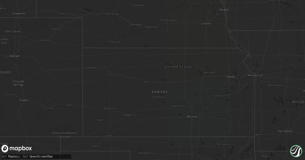
Hail Map in Virginia on August 10, 2022
Get this storm
August 10 map
$229
one time, instant access
Download today. No call, no setup
Keep the $229
Bought the map and want the full workflow? Apply the entire $229 to a subscription within 7 days. None of it is wasted.
Every map, not just this one
This buys you this map. Subscription and you get every map we run, in the markets you choose from a few cities to whole states to nationwide. Plus real-time alerts the moment a storm fires.
Contact data
Name, contact info, occupancy, even credit band for addresses in the footprint. You go from where it hit to who to call.
Become the source they trust
Unlimited branding weather history reports on demand. You already have the documented answer ready for the property owner, and you are the one who showed up with it.
Property data and RoofTrace estimates
Pull up any address you have got, its value and the exact code rules for that jurisdiction, straight from One Click Code. Then RoofTrace estimates the squares, pitch, and roof value, priced the way you price.
Storm reports in Virginia
Virginia
| Date | Description |
|---|---|
| 08/10/20226:45 PM CDT | Large tree branches down in yard. Time estimated from radar. |
| 08/10/20226:15 PM CDT | Nearly 300 power outages likely caused by storm west of ruthville in charles city county. Time estimated from radar. |
| 08/10/20225:26 PM CDT | A couple trees down on boydton plank road. Time estimated. |
| 08/10/20225:25 PM CDT | A few trees down. Time estimated from radar. |
| 08/10/20225:05 PM CDT | A local report indicates 0 MPH wind near 3 ENE ALBERTA |
| 08/10/20225:05 PM CDT | Around 500 power outages just northeast of alberta. Time estimated. |
| 08/10/20225:00 PM CDT | Tree down on rote 703 in dinwiddie county. Time estimated. |
| 08/10/20225:00 PM CDT | Several reports of downed trees in the saltville area. |
| 08/10/20224:57 PM CDT | Trees down on james madison parkway near chesnut hill. |
| 08/10/20224:55 PM CDT | Tree down on i-64 at mm 165. Time estimated. |
| 08/10/20224:48 PM CDT | Trees down in whites corner. |
| 08/10/20224:20 PM CDT | Tree down. Time estimated from radar. |
| 08/10/20224:15 PM CDT | Tree down at maximilian ct and valley ridge dr |
| 08/10/20224:15 PM CDT | Trees blew down near triangle on us-1 jefferson davis highway... Cabin road... And locust shade drive. |
| 08/10/20224:12 PM CDT | Trees blew down near the intersection of waterway drive and avon drive. Trees blew down near the intersection of va-610 delaney road and minnieville road. |
| 08/10/20224:05 PM CDT | Trees down near triangle on jefferson davis highway... Cabin road... And locust shade drive. |
| 08/10/20224:00 PM CDT | Numerous power outages likely caused by storm in southeast portions of louisa county. Time estimated. |
| 08/10/20223:52 PM CDT | Trees down on waterway drive. |
| 08/10/20223:40 PM CDT | Tree down near intersection of waterway dr and avon dr. |
| 08/10/20223:40 PM CDT | Tree down near intersection of delaney rd and minnieville rd |
| 08/10/20223:40 PM CDT | Trees blew down on va-738/va-309 old dominion drive near va-123 dolley madison boulevard. |
| 08/10/20223:30 PM CDT | Trees blew down near oakton. A tree blew down on honda road. A tree blew down near the intersection of maximilian court and valley ridge drive. |
| 08/10/20223:23 PM CDT | Tree down on honda road. |
| 08/10/20222:53 PM CDT | Large tree down at 775 gateway dr se |
| 08/10/20222:35 PM CDT | Tree down near intersection of peyton hill rd and indian ridge rd |
| 08/10/20222:30 PM CDT | Nearly 200 power outages just north of ware neck. Time estimated. |
| 08/10/20222:05 PM CDT | Trees blew down in the 500 block va-979 mount hermon road. |
| 08/10/20222:04 PM CDT | Tree down at 500 block mt. Hermon rd |
| 08/10/20221:55 PM CDT | Nearly 500 power outages likely caused by storm near glenns. Time estimated. |
| 08/10/20221:54 PM CDT | Few trees down near intersection of parkersburg turnpike and miss phillips rd |
| 08/10/20221:37 PM CDT | Several trees down along little calf pasture highway |
| 08/10/20221:30 PM CDT | Over 200 power outages wnw of charles city likely due to storm. Time estimated from radar. |
| 08/10/20221:26 PM CDT | Power line down along firehouse road just north of willis. |
| 08/10/20221:26 PM CDT | Thunderstorm winds blew three wrist-size diameter limbs and a number of other twigs down off trees along indian valley road between parker lane and horse ridge road. Ti |
| 08/10/202212:54 PM CDT | Tree down along shawsville pike blocking part of the road. |
| 08/10/202212:29 PM CDT | Thunderstorm winds blew down one tree on greenlevel road. |
| 08/10/20223:34 AM CDT | At 833 PM EDT, a severe thunderstorm was located over Fairfield, or near Rockbridge Baths, moving east at 30 mph. HAZARD...60 mph wind gusts and quarter size hail. SOURCE...Radar indicated. IMPACT...Hail damage to vehicles is expected. Expect wind damage to roofs, siding, and trees. Locations impacted include... Brownsburg... Vesuvius... and Fairfield. |
| 08/10/20222:27 AM CDT | At 726 PM EDT, a severe thunderstorm was located near Seaboard, or near Garysburg, moving northeast at 25 mph. HAZARD...60 mph wind gusts. SOURCE...Radar indicated. IMPACT...Expect damage to trees and powerlines. This severe thunderstorm will be near... Seaboard around 735 PM EDT. Boykins around 810 PM EDT.Other locations impacted by this severe thunderstorm include MudCastle, Milwaukee, Pendleton, Bryants Corner, Jackson, BoonesCrossroads, Pleasant Grove, Severn, Margarettsville and Creeksville. |
| 08/10/20222:22 AM CDT | At 722 PM EDT, a severe thunderstorm was located near Low Moor, or near Covington, and is nearly stationary. HAZARD...60 mph wind gusts and quarter size hail. SOURCE...Radar indicated. IMPACT...Hail damage to vehicles is expected. Expect wind damage to roofs, siding, and trees. Locations impacted include... Covington... Clifton Forge... Eagle Rock... Iron Gate... Low Moor... Glen Wilton... and Gala. |
| 08/10/20222:09 AM CDT | At 708 PM EDT, a severe thunderstorm was located over Courtland, moving east at 15 mph. HAZARD...60 mph wind gusts. SOURCE...Radar indicated. IMPACT...Expect damage to trees and powerlines. This severe thunderstorm will be near... Franklin around 720 PM EDT. Hunterdale around 725 PM EDT. Sedley around 730 PM EDT. Carrsville around 755 PM EDT.Other locations impacted by this severe thunderstorm includeVicksville, Handsom, Berlin, Worrell, Dory, Lees Mill, Walters,Sebrell, Burdette and Drewryville. |
| 08/10/20221:50 AM CDT | At 649 PM EDT, severe thunderstorms were located along a line extending from 6 miles southwest of Bottoms Bridge to near Jordans Point to Hopewell, moving east at 15 mph. HAZARD...60 mph wind gusts and quarter size hail. SOURCE...Radar indicated. IMPACT...Minor damage to vehicles is possible. Expect wind damage to trees and powerlines. Severe thunderstorms will be near... Jordans Point around 715 PM EDT. Roxbury around 725 PM EDT. Charles City, Adkins Store, Garysville, Ruthville, Providence Forge and Burrowsville around 730 PM EDT.Other locations impacted by these severe thunderstorms includeWrights Corner, Taylors Corner, Wayside, Birchett Estate,Mountcastle, Elko, Jordan Point Country Club, Glendale, Meadowvilleand Sandybottom. |
| 08/10/20221:17 AM CDT | At 617 PM EDT, severe thunderstorms were located along a line extending from near Sutherland to near Dinwiddie to Purdy, moving northeast at 30 mph. HAZARD...60 mph wind gusts. SOURCE...Radar indicated. IMPACT...Expect damage to trees and powerlines. Severe thunderstorms will be near... Sutherland and Carson around 620 PM EDT. Matoaca around 635 PM EDT. Virginia State University and Ettrick around 640 PM EDT. Petersburg, Colonial Heights, Disputanta, Chester, Prince George and Stony Creek around 645 PM EDT. Hopewell, Fort Lee and Sussex around 650 PM EDT. Garysville, Homeville and Jordans Point around 700 PM EDT.Other locations impacted by these severe thunderstorms includeBirchett Estate, Addison, Booker, Ammon, Lumberton, Jordan PointCountry Club, Petersburg National Battlefield, Church Road, RichardBland College and Meadowville. |
| 08/10/20221:03 AM CDT | At 602 PM EDT, severe thunderstorms were located along a line extending from near Wyndham to near Sabot to near Chula, moving east to southeast at 15 mph. HAZARD...60 mph wind gusts. SOURCE...Radar indicated. IMPACT...Expect damage to trees and powerlines. Severe thunderstorms will be near... Wyndham and Manakin around 610 PM EDT. Tuckahoe around 615 PM EDT. Moseley around 625 PM EDT. Laurel around 635 PM EDT. Glen Allen around 640 PM EDT. Richmond, University Of Richmond, Bon Air, Virginia Union University, Downtown Richmond, Virginia Commonwealth University, Mechanicsville, Lakeside, East Highland Park and Chesterfield Court House around 645 PM EDT.Other locations impacted by these severe thunderstorms includeCrozier, Pilkinton, Johnsons Springs, Pocahontas State Park,Skinquarter, Solomons Store, Beach, Chamberlayne, Fine Creek Millsand Roslyn Hills. |
| 08/10/20221:01 AM CDT | At 601 PM EDT, a severe thunderstorm was located near Purdy, moving east at 10 mph. HAZARD...60 mph wind gusts. SOURCE...Radar indicated. IMPACT...Expect damage to trees and powerlines. This severe thunderstorm will be near... Purdy around 625 PM EDT.Other locations impacted by this severe thunderstorm include CenterStar, Callaville, Cherry Hill, Rawlings, Dolphin, Rocky Run, FieldsCrossroads, Warfield, Wharfs Store and Darvills. |
| 08/10/202212:42 AM CDT | At 541 PM EDT, a severe thunderstorm was located near Carson, or near Dinwiddie, moving east at 10 mph. HAZARD...60 mph wind gusts. SOURCE...Radar indicated. IMPACT...Expect damage to trees and powerlines. This severe thunderstorm will be near... Carson around 610 PM EDT.Other locations impacted by this severe thunderstorm include Burgess,Templeton and Reams. |
| 08/10/202212:33 AM CDT | At 533 PM EDT, severe thunderstorms were located along a line extending from Gum Spring to near Goochland to 7 miles northeast of Trenholm, moving east at 10 mph. HAZARD...60 mph wind gusts and penny size hail. SOURCE...Radar indicated. IMPACT...Expect damage to trees and powerlines. Severe thunderstorms will be near... Goochland around 545 PM EDT. Powhatan, Oilville and Sabot around 615 PM EDT.Other locations impacted by these severe thunderstorms includeGoodwins Store, Flat Rock, Crozier, Sandy Hook, Rock Castle,Jefferson, Vontay, Maidens, Provost and Three Square. |
| 08/10/202212:15 AM CDT | At 515 PM EDT, a severe thunderstorm was located near Sedley, or 8 miles north of Franklin, moving southeast at 15 mph. HAZARD...60 mph wind gusts and penny size hail. SOURCE...Radar indicated. IMPACT...Expect damage to trees and powerlines. This severe thunderstorm will be near... Zuni around 525 PM EDT. Carrsville around 540 PM EDT. Windsor around 545 PM EDT. Holland around 555 PM EDT.Other locations impacted by this severe thunderstorm includeVicksville, Collosse, Berlin, Walters, Boaz, Burdette and Indika. |
| 08/09/202211:51 PM CDT | At 451 PM EDT, severe thunderstorms were located along a line extending from 8 miles southwest of Spotsylvania to near Montpelier to Gum Spring, moving east at 25 mph. HAZARD...60 mph wind gusts and penny size hail. SOURCE...Radar indicated. IMPACT...Expect damage to trees and powerlines. Severe thunderstorms will be near... Ladysmith around 515 PM EDT. Montpelier around 520 PM EDT. Ashland and Randolph Macon College around 525 PM EDT. Bowling Green, Milford, Kings Dominion, Dawn, Wyndham and Fort A.p. Hill around 530 PM EDT.Other locations impacted by these severe thunderstorms includeChilesburg, Golansville, Guinea, Vontay, Gum Tree, Elmont, Penola,Gilman, Nancy Wrights Corner and Cedar Fork. |
| 08/09/202211:22 PM CDT | At 421 PM EDT, a severe thunderstorm was located near Culpeper, and is nearly stationary. HAZARD...60 mph wind gusts. SOURCE...Radar indicated. IMPACT...Damaging winds will cause some trees and large branches to fall. This could injure those outdoors, as well as damage homes and vehicles. Roadways may become blocked by downed trees. Localized power outages are possible. Unsecured light objects may become projectiles. Locations impacted include... Culpeper, Winston, Lignum, Catalpa, Elkwood, Stevensburg, Mitchells, Brandy Station and Alanthus. |
| 08/09/202210:48 PM CDT | At 348 PM EDT, a severe thunderstorm was located over Denbigh, or over Newport News, moving north at 5 mph. In addition, a strong thunderstorm over Williamsburg was moving southeast at 15 mph. HAZARD...60 mph wind gusts and penny size hail. SOURCE...Radar indicated. IMPACT...Expect damage to trees and powerlines. Locations impacted include... Newport News, Hampton, Williamsburg, College Of William And Mary, Christopher Newport University, Queens Lake, Patrick Henry Field, Virginia Institute For Marine Sciences, Seaford, Gloucester Point, Busch Gardens, York Terrace, Lee Hall, Denbigh, Carver Gardens, Tabb, Grove, Kings Point, Beaconsdale and Fort Eustis. |
| 08/09/202210:18 PM CDT | At 318 PM EDT, severe thunderstorms were located along a line extending from near Hartfield to near Gloucester Courthouse, moving southeast at 10 mph. HAZARD...60 mph wind gusts and quarter size hail. SOURCE...Radar indicated. IMPACT...Minor damage to vehicles is possible. Expect wind damage to trees and powerlines. Severe thunderstorms will be near... Hartfield around 325 PM EDT. Gloucester Courthouse around 340 PM EDT. Blakes around 350 PM EDT. Mathews, Hayes, Gwynn and Mobjack around 400 PM EDT.Other locations impacted by these severe thunderstorms include Ruff,Beulah, Moon, Laban, Glass, Naxera, Harmony Village, Grafton, Harcumand Cash. |
| 08/09/202210:07 PM CDT | At 307 PM EDT, severe thunderstorms were located along a line extending from near Brownsburg to Rockbridge Baths to near Nimrod Hall, moving southeast at 20 mph. HAZARD...60 mph wind gusts and quarter size hail. SOURCE...Radar indicated. IMPACT...Hail damage to vehicles is expected. Expect wind damage to roofs, siding, and trees. Locations impacted include... Rockbridge Baths... Cornwall... Fairfield... Brownsburg... and Vesuvius. |
| 08/09/20229:50 PM CDT | At 250 PM EDT, a severe thunderstorm was located near Straightstone, or near Mt Airy, moving east at 20 mph. HAZARD...60 mph wind gusts. SOURCE...Radar indicated. IMPACT...Expect damage to roofs, siding, and trees. Locations impacted include... Altavista... Hurt... Brookneal... Mt Airy... Nathalie... Cody... and Leda. |
| 08/09/20229:44 PM CDT | At 244 PM EDT, a severe thunderstorm was located near Shacklefords, or near West Point, and is drifting east to southeast at 5 mph. HAZARD...60 mph wind gusts and quarter size hail. SOURCE...Radar indicated. IMPACT...Minor damage to vehicles is possible. Expect wind damage to trees and powerlines. This severe thunderstorm will be near... Urbanna, Glenns and Saluda around 330 PM EDT.Other locations impacted by this severe thunderstorm include Warner,Pampa, Mascot, Remlik, Healys, Adner, Gressit, Clancie, Cooper andVelma. |
| 08/09/20229:42 PM CDT | At 241 PM EDT, a severe thunderstorm was located over Massanutten, or 9 miles southeast of Harrisonburg, moving northeast at 5 mph. HAZARD...Localized 60 mph wind gusts. SOURCE...Radar indicated. IMPACT...Damaging winds will cause some trees and large branches to fall. This could injure those outdoors, as well as damage homes and vehicles. Roadways may become blocked by downed trees. Localized power outages are possible. Unsecured light objects may become projectiles. Locations impacted include... Shenandoah, Massanutten, Elkton, Rocky Bar, Penn Laird, Swift Run, Mcgaheysville and Montevideo. |
| 08/09/20229:25 PM CDT | At 225 PM EDT, a severe thunderstorm was located near Indian Valley, and is nearly stationary. HAZARD...60 mph wind gusts and quarter size hail. SOURCE...Radar indicated. IMPACT...Hail damage to vehicles is expected. Expect wind damage to roofs, siding, and trees. Locations impacted include... Floyd... Indian Valley... Willis... Alum Ridge... Copper Valley... and Rocky Knob Summit. |
| 08/09/20229:05 PM CDT | At 205 PM EDT, a severe thunderstorm was located over Jamaica, or 8 miles east of King And Queen Court House, and is nearly stationary. HAZARD...60 mph wind gusts. SOURCE...Radar indicated. IMPACT...Expect damage to trees and powerlines. This severe thunderstorm will be near... Jamaica around 225 PM EDT. Church View and Little Plymouth around 245 PM EDT.Other locations impacted by this severe thunderstorm includeLaneview, Nesting, Mollusk, Bowlers Wharf, Ino, Dragonville,Montague, Warner, Mascot and Velma. |
| 08/09/20229:03 PM CDT | At 203 PM EDT, a severe thunderstorm was located over Roxbury, and is nearly stationary. HAZARD...60 mph wind gusts and quarter size hail. SOURCE...Radar indicated. IMPACT...Minor damage to vehicles is possible. Expect wind damage to trees and powerlines. This severe thunderstorm will be near... Roxbury, Talleysville, Adkins Store and Providence Forge around 245 PM EDT.Other locations impacted by this severe thunderstorm include WrightsCorner, Quinton, Colonial Downs, Browns Corner, Sandybottom,Mountcastle, Barnetts, Elko, Roaches Corner and New Kent Airport. |
| 08/09/20229:02 PM CDT | At 202 PM EDT, severe thunderstorms were located along a line extending from near Peaks Of Otter Recreation Area to near Smith Mountain Lake State Park to Leatherwood, moving northeast at 20 mph. HAZARD...60 mph wind gusts and quarter size hail. SOURCE...Radar indicated. IMPACT...Hail damage to vehicles is expected. Expect wind damage to roofs, siding, and trees. Locations impacted include... Bedford... Altavista... Hurt... Chatham... Gretna... Glasgow... and Huddleston. |
| 08/09/20229:00 PM CDT | At 200 PM EDT, a severe thunderstorm was located near Parksley, or 18 miles northeast of Exmore, and is nearly stationary. HAZARD...60 mph wind gusts. SOURCE...Radar indicated. IMPACT...Expect damage to trees and powerlines. Locations impacted include... Accomac. |
| 08/09/20228:36 PM CDT | At 135 PM EDT, a severe thunderstorm was located near Sontag, or near Sydnorsville, moving east at 25 mph. HAZARD...60 mph wind gusts and quarter size hail. SOURCE...Radar indicated. IMPACT...Hail damage to vehicles is expected. Expect wind damage to roofs, siding, and trees. Locations impacted include... Gretna... Penhook... Sago... Climax... Pittsville... Sontag... and Southern Smith Mountain Lake. |
| 08/09/20228:27 PM CDT | At 126 PM EDT, a severe thunderstorm was located over Wirtz, or near Boones Mill, moving east at 10 mph. HAZARD...60 mph wind gusts and half dollar size hail. SOURCE...Radar indicated. IMPACT...Hail damage to vehicles is expected. Expect wind damage to roofs, siding, and trees. Locations impacted include... Rocky Mount... Boones Mill... Burnt Chimney... Western Smith Mountain Lake... Sontag... Westlake Corner... and Wirtz. |
| 08/09/20228:01 PM CDT | At 101 PM EDT, a severe thunderstorm was located over Wintergreen, or 11 miles south of Waynesboro, and is nearly stationary. HAZARD...60 mph wind gusts and quarter size hail. SOURCE...Radar indicated. IMPACT...Damaging winds will cause some trees and large branches to fall. This could injure those outdoors, as well as damage homes and vehicles. Roadways may become blocked by downed trees. Localized power outages are possible. Unsecured light objects may become projectiles. Locations impacted include... Wintergreen, Nellysford, Greenfield and Faber. |
All States Impacted by Hail Map on August 10, 2022
Cities Impacted by Hail Map on August 10, 2022
- Kents Store, VA
- Hyattsville, MD
- Riverdale, MD
- Greenbelt, MD
- Mount Rainier, MD
- College Park, MD
- Brentwood, MD
- Bladensburg, MD
- Beltsville, MD
- Goochland, VA
- Fallon, NV
- Savage, MD
- Laurel, MD
- Jessup, MD
- Boones Mill, VA
- Bainbridge Island, WA
- Drewryville, VA
- Capron, VA
- Columbia, VA
- Bremo Bluff, VA
- La Plata, MD
- Bryantown, MD
- Waldorf, MD
- Port Tobacco, MD
- Welcome, MD
- Accokeek, MD
- Holly Springs, NC
- Warfield, VA
- Freeman, VA
- Suffolk, VA
- La Grande, OR
- Oxon Hill, MD
- Marana, AZ
- Lanexa, VA
- Blum, TX
- Diamond, OR
- Princeton, OR
- Denton, NC
- Richfield, NC
- New London, NC
- Weston, OR
- Walla Walla, WA
- Sandston, VA
- Plymouth, NC
- Trinity, NC
- Raleigh, NC
- Garner, NC
- Elkwood, VA
- Brandy Station, VA
- Stevensburg, VA
- Culpeper, VA
- Virginia Beach, VA
- Gordonsville, VA
- Louisa, VA
- Cache, OK
- Indiahoma, OK
- Fillmore, UT
- New Canton, VA
- Arvonia, VA
- Battle Mountain, NV
- South Hill, VA
- Stuarts Draft, VA
- Palmyra, VA
- Gloucester, VA
- North, VA
- Dutton, VA
- Athena, OR
- Milton Freewater, OR
- Golconda, NV
- Courtland, VA
- Mattaponi, VA
- Little Plymouth, VA
- Newport News, VA
- Fort Eustis, VA
- Clayton, AL
- Eufaula, AL
- Charles City, VA
- Henrico, VA
- Chester, VA
- Providence Forge, VA
- Morgan, TX
- Elizabethton, TN
- Suitland, MD
- Charlotte, NC
- Midland, NC
- Matthews, NC
- Indian Head, MD
- West Point, VA
- Barhamsville, VA
- Fairfax, SC
- Ulmer, SC
- Covington, VA
- Naco, AZ
- Bisbee, AZ
- Littleton, NC
- Halifax, NC
- Garysburg, NC
- Enfield, NC
- Jackson, NC
- Minden, LA
- Texarkana, TX
- Marion, NC
- Conway, NC
- Woodland, NC
- Sedona, AZ
- Sanger, TX
- McKenney, VA
- Quinton, VA
- New Kent, VA
- Pilot Point, TX
- Glen Rose, TX
- Quantico, VA
- Triangle, VA
- Dumfries, VA
- Woodbridge, VA
- King And Queen Court House, VA
- Pulaski, VA
- Clayton, NC
- Wendell, NC
- Dayton, WA
- Waitsburg, WA
- Riverside, OR
- Chesapeake, VA
- Yorktown, VA
- Richmond, VA
- Aubrey, TX
- Cusick, WA
- Ione, WA
- Bonners Ferry, ID
- Asheboro, NC
- Seagoville, TX
- Columbia, NC
- Brunson, SC
- Deming, NM
- Robinson Creek, KY
- Pikeville, KY
- Harold, KY
- Austin, NV
- Kearneysville, WV
- Shacklefords, VA
- Sumerduck, VA
- Remington, VA
- Nellysford, VA
- Touchet, WA
- Church View, VA
- Saluda, VA
- Altus, OK
- Pomeroy, WA
- Vienna, VA
- Scottsville, VA
- Moneta, VA
- Huddleston, VA
- Alexandria, VA
- Alapaha, GA
- Powhatan, VA
- Chesterfield, VA
- Petersburg, VA
- Seaford, VA
- Lake Creek, TX
- Cooper, TX
- Wadesboro, NC
- Mount Pleasant, NC
- Blackville, SC
- Olar, SC
- Falls Church, VA
- Clifton Forge, VA
- Gates, NC
- Corapeake, NC
- Valley View, TX
- Catlett, VA
- Midland, VA
- Washington, DC
- Montpelier, VA
- Cochran, GA
- Eastman, GA
- Gorman, TX
- Eastland, TX
- Cypress, TX
- Nash, TX
- Graford, TX
- Jacksboro, TX
- Perrin, TX
- La Crosse, VA
- El Campo, TX
- Dayton, TX
- Spring, TX
- Houston, TX
- Kaufman, TX
- Cuero, TX
- Meyersville, TX
- Clyo, GA
- Waxahachie, TX
- Mabank, TX
- Stockdale, TX
- Pelham, NC
- Kemp, TX
- Brookesmith, TX
- Rockbridge Baths, VA
- Mount Dora, FL
- Zellwood, FL
- Apopka, FL
- Scurry, TX
- Durham, NC
- Oakton, VA
- Herndon, VA
- Fairfax, VA
- Reston, VA
- Forreston, TX
- Zuni, VA
- Franklin, VA
- Wakefield, VA
- Sedley, VA
- Ivor, VA
- Knightdale, NC
- Lexington, VA
- Raphine, VA
- Fairfield, VA
- Creswell, NC
- Roper, NC
- Era, TX
- Gainesville, TX
- Hull, TX
- Liberty, TX
- Brookshire, TX
- Healdton, OK
- Carrollton, VA
- Thomasville, GA
- Pavo, GA
- Louise, TX
- Saratoga, TX
- Prosper, TX
- Huffman, TX
- Katy, TX
- Edgewood, TX
- Wills Point, TX
- Yoakum, TX
- Brandywine, MD
- Parksley, VA
- Mckinney, TX
- Poca, WV
- Charleston, WV
- Concord, NC
- Fairfield, TX
- Willacoochee, GA
- Ruffin, NC
- Yanceyville, NC
- Stanfield, NC
- Globe, AZ
- Harrisburg, NC
- Sour Lake, TX
- Kountze, TX
- Dinwiddie, VA
- Carson, VA
- Lakeview, TX
- Temple, OK
- Rich Square, NC
- Sophia, NC
- High Point, NC
- Randleman, NC
- Hallettsville, TX
- Humble, TX
- Albemarle, NC
- Mount Lemmon, AZ
- Moultrie, GA
- Springfield, GA
- Celina, TX
- Greeneville, TN
- Dequincy, LA
- Albany, GA
- Sealy, TX
- Pendleton, OR
- Hockley, TX
- Americus, GA
- Leslie, GA
- Sorrento, FL
- Memphis, TX
- Santa Anna, TX
- Catawba, SC
- Ray City, GA
- Moody Afb, GA
- Lakeland, GA
- Naylor, GA
- Valdosta, GA
- Bowie, MD
- Fort George G Meade, MD
- Odenton, MD


