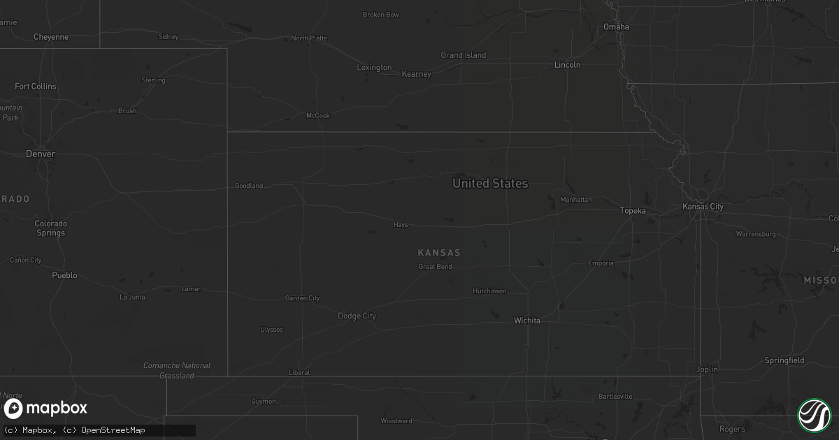
Hail Map in Maryland on August 10, 2022
Get this storm
August 10 map
$229
one time, instant access
Download today. No call, no setup
Keep the $229
Bought the map and want the full workflow? Apply the entire $229 to a subscription within 7 days. None of it is wasted.
Every map, not just this one
This buys you this map. Subscription and you get every map we run, in the markets you choose from a few cities to whole states to nationwide. Plus real-time alerts the moment a storm fires.
Contact data
Name, contact info, occupancy, even credit band for addresses in the footprint. You go from where it hit to who to call.
Become the source they trust
Unlimited branding weather history reports on demand. You already have the documented answer ready for the property owner, and you are the one who showed up with it.
Property data and RoofTrace estimates
Pull up any address you have got, its value and the exact code rules for that jurisdiction, straight from One Click Code. Then RoofTrace estimates the squares, pitch, and roof value, priced the way you price.
Storm reports in Maryland
Maryland
| Date | Description |
|---|---|
| 08/10/20225:44 PM CDT | Tree down near intersection of drayden rd and cherryfield rd |
| 08/10/20224:55 PM CDT | Tree down on central ave near rolling road. |
| 08/10/20224:52 PM CDT | At least six trees blew down on/near defense highway near the intersection of huntwood drive. |
| 08/10/20224:43 PM CDT | Trees down on md-424 near md-450. |
| 08/10/20224:38 PM CDT | At least 4 trees blew down on the south side of glen burnie. |
| 08/10/20224:14 PM CDT | Several trees blew down on md-564 at woodstream drive. |
| 08/10/20224:10 PM CDT | Trees blew down on md-564 at woodstream drive. |
| 08/10/20224:05 PM CDT | A large tree and large tree limbs blew down in university park. |
| 08/10/20223:46 PM CDT | Tree down on i-495 inner loop before us-29/coolesville road. |
| 08/10/20223:09 PM CDT | Several trees down on billingsley road near leonardtown road. Wires down as well. |
| 08/10/20221:14 AM CDT | At 614 PM EDT, severe thunderstorms were located along a line extending from near Dunkirk to Golden Beach, moving east at 15 mph. HAZARD...60 mph wind gusts. SOURCE...Radar indicated. IMPACT...Damaging winds will cause some trees and large branches to fall. This could injure those outdoors, as well as damage homes and vehicles. Roadways may become blocked by downed trees. Localized power outages are possible. Unsecured light objects may become projectiles. Locations impacted include... Waldorf, Shady Side, Chesapeake Beach, Deale, Prince Frederick, Sheridan Point, Hallowing Point, Breezy Point, Rosaryville, Marlton, Golden Beach, Dunkirk, Saint Leonard, Saint Charles, Brandywine, Huntingtown, Hughesville, Owings, Baden and Long Beach. |
| 08/10/202212:45 AM CDT | At 545 PM EDT, severe thunderstorms were located along a line extending from 6 miles southeast of Waldorf to near King George, moving southeast at 10 mph. HAZARD...60 mph wind gusts. SOURCE...Radar indicated. IMPACT...Damaging winds will cause some trees and large branches to fall. This could injure those outdoors, as well as damage homes and vehicles. Roadways may become blocked by downed trees. Localized power outages are possible. Unsecured light objects may become projectiles. Locations impacted include... Waldorf, La Plata, King George, Dahlgren, Fairview Beach, Nanjemoy Creek, Popes Creek, Saint Clements Bay, Port Tobacco River, Wicomico River, Saint Charles, Wicomico, Hughesville, Mechanicsville, Charlotte Hall, Cobb Island, Bryantown, Rock Point, Port Tobacco Village and Bushwood. |
| 08/10/202212:04 AM CDT | At 504 PM EDT, a severe thunderstorm was located over Goddard, or near Greenbelt, moving east at 20 mph. HAZARD...60 mph wind gusts. SOURCE...Radar indicated. IMPACT...Damaging winds will cause some trees and large branches to fall. This could injure those outdoors, as well as damage homes and vehicles. Roadways may become blocked by downed trees. Localized power outages are possible. Unsecured light objects may become projectiles. Locations impacted include... Bowie, Severn, Annapolis, College Park, Crofton, Greenbelt, Beltsville, Riviera Beach, Bladensburg, Mayo, Naval Academy, Severn River, University of Maryland, Gibson Island, Bodkin Point, Sillery Bay, Fedex Field, Magothy River, Dobbins Island and Pinehurst. |
| 08/09/202211:52 PM CDT | At 452 PM EDT, a severe thunderstorm was located over Dumfries, or near Quantico, and is nearly stationary. HAZARD...60 mph wind gusts. SOURCE...Radar indicated. IMPACT...Damaging winds will cause some trees and large branches to fall. This could injure those outdoors, as well as damage homes and vehicles. Roadways may become blocked by downed trees. Localized power outages are possible. Unsecured light objects may become projectiles. Locations impacted include... Dale City, Woodbridge, Quantico, Lake Ridge, Montclair, Triangle, Dumfries, Cherry Hill, Independent Hill, Bryans Road, Potomac Heights, Marbury, Ironsides, Rison, Nanjemoy and Pisgah. |
| 08/09/202211:12 PM CDT | At 411 PM EDT, a severe thunderstorm was located over Oakton, or near Fairfax, and is drifting east. HAZARD...Localized 60 mph wind gusts. SOURCE...Radar indicated. IMPACT...Damaging winds will cause some trees and large branches to fall. This could injure those outdoors, as well as damage homes and vehicles. Roadways may become blocked by downed trees. Localized power outages are possible. Unsecured light objects may become projectiles. Locations impacted include... Centreville, Reston, Annandale, South Riding, Herndon, Fairfax, Vienna, Lowes Island, Mantua, Pimmit Hills, American Legion Bridge, Potomac, Burke, Oakton, Sterling, Chantilly, Tysons Corner, Wolf Trap, Great Falls and Merrifield. |
| 08/09/202210:51 PM CDT | At 351 PM EDT, a severe thunderstorm was located near Waldorf, and is nearly stationary. HAZARD...60 mph wind gusts. SOURCE...Radar indicated. IMPACT...Damaging winds will cause some trees and large branches to fall. This could injure those outdoors, as well as damage homes and vehicles. Roadways may become blocked by downed trees. Localized power outages are possible. Unsecured light objects may become projectiles. Locations impacted include... Waldorf, Saint Charles, Hughesville and Bryantown. |
All States Impacted by Hail Map on August 10, 2022
Cities Impacted by Hail Map on August 10, 2022
- Kents Store, VA
- Hyattsville, MD
- Riverdale, MD
- Greenbelt, MD
- Mount Rainier, MD
- College Park, MD
- Brentwood, MD
- Bladensburg, MD
- Beltsville, MD
- Goochland, VA
- Fallon, NV
- Savage, MD
- Laurel, MD
- Jessup, MD
- Boones Mill, VA
- Bainbridge Island, WA
- Drewryville, VA
- Capron, VA
- Columbia, VA
- Bremo Bluff, VA
- La Plata, MD
- Bryantown, MD
- Waldorf, MD
- Port Tobacco, MD
- Welcome, MD
- Accokeek, MD
- Holly Springs, NC
- Warfield, VA
- Freeman, VA
- Suffolk, VA
- La Grande, OR
- Oxon Hill, MD
- Marana, AZ
- Lanexa, VA
- Blum, TX
- Diamond, OR
- Princeton, OR
- Denton, NC
- Richfield, NC
- New London, NC
- Weston, OR
- Walla Walla, WA
- Sandston, VA
- Plymouth, NC
- Trinity, NC
- Raleigh, NC
- Garner, NC
- Elkwood, VA
- Brandy Station, VA
- Stevensburg, VA
- Culpeper, VA
- Virginia Beach, VA
- Gordonsville, VA
- Louisa, VA
- Cache, OK
- Indiahoma, OK
- Fillmore, UT
- New Canton, VA
- Arvonia, VA
- Battle Mountain, NV
- South Hill, VA
- Stuarts Draft, VA
- Palmyra, VA
- Gloucester, VA
- North, VA
- Dutton, VA
- Athena, OR
- Milton Freewater, OR
- Golconda, NV
- Courtland, VA
- Mattaponi, VA
- Little Plymouth, VA
- Newport News, VA
- Fort Eustis, VA
- Clayton, AL
- Eufaula, AL
- Charles City, VA
- Henrico, VA
- Chester, VA
- Providence Forge, VA
- Morgan, TX
- Elizabethton, TN
- Suitland, MD
- Charlotte, NC
- Midland, NC
- Matthews, NC
- Indian Head, MD
- West Point, VA
- Barhamsville, VA
- Fairfax, SC
- Ulmer, SC
- Covington, VA
- Naco, AZ
- Bisbee, AZ
- Littleton, NC
- Halifax, NC
- Garysburg, NC
- Enfield, NC
- Jackson, NC
- Minden, LA
- Texarkana, TX
- Marion, NC
- Conway, NC
- Woodland, NC
- Sedona, AZ
- Sanger, TX
- McKenney, VA
- Quinton, VA
- New Kent, VA
- Pilot Point, TX
- Glen Rose, TX
- Quantico, VA
- Triangle, VA
- Dumfries, VA
- Woodbridge, VA
- King And Queen Court House, VA
- Pulaski, VA
- Clayton, NC
- Wendell, NC
- Dayton, WA
- Waitsburg, WA
- Riverside, OR
- Chesapeake, VA
- Yorktown, VA
- Richmond, VA
- Aubrey, TX
- Cusick, WA
- Ione, WA
- Bonners Ferry, ID
- Asheboro, NC
- Seagoville, TX
- Columbia, NC
- Brunson, SC
- Deming, NM
- Robinson Creek, KY
- Pikeville, KY
- Harold, KY
- Austin, NV
- Kearneysville, WV
- Shacklefords, VA
- Sumerduck, VA
- Remington, VA
- Nellysford, VA
- Touchet, WA
- Church View, VA
- Saluda, VA
- Altus, OK
- Pomeroy, WA
- Vienna, VA
- Scottsville, VA
- Moneta, VA
- Huddleston, VA
- Alexandria, VA
- Alapaha, GA
- Powhatan, VA
- Chesterfield, VA
- Petersburg, VA
- Seaford, VA
- Lake Creek, TX
- Cooper, TX
- Wadesboro, NC
- Mount Pleasant, NC
- Blackville, SC
- Olar, SC
- Falls Church, VA
- Clifton Forge, VA
- Gates, NC
- Corapeake, NC
- Valley View, TX
- Catlett, VA
- Midland, VA
- Washington, DC
- Montpelier, VA
- Cochran, GA
- Eastman, GA
- Gorman, TX
- Eastland, TX
- Cypress, TX
- Nash, TX
- Graford, TX
- Jacksboro, TX
- Perrin, TX
- La Crosse, VA
- El Campo, TX
- Dayton, TX
- Spring, TX
- Houston, TX
- Kaufman, TX
- Cuero, TX
- Meyersville, TX
- Clyo, GA
- Waxahachie, TX
- Mabank, TX
- Stockdale, TX
- Pelham, NC
- Kemp, TX
- Brookesmith, TX
- Rockbridge Baths, VA
- Mount Dora, FL
- Zellwood, FL
- Apopka, FL
- Scurry, TX
- Durham, NC
- Oakton, VA
- Herndon, VA
- Fairfax, VA
- Reston, VA
- Forreston, TX
- Zuni, VA
- Franklin, VA
- Wakefield, VA
- Sedley, VA
- Ivor, VA
- Knightdale, NC
- Lexington, VA
- Raphine, VA
- Fairfield, VA
- Creswell, NC
- Roper, NC
- Era, TX
- Gainesville, TX
- Hull, TX
- Liberty, TX
- Brookshire, TX
- Healdton, OK
- Carrollton, VA
- Thomasville, GA
- Pavo, GA
- Louise, TX
- Saratoga, TX
- Prosper, TX
- Huffman, TX
- Katy, TX
- Edgewood, TX
- Wills Point, TX
- Yoakum, TX
- Brandywine, MD
- Parksley, VA
- Mckinney, TX
- Poca, WV
- Charleston, WV
- Concord, NC
- Fairfield, TX
- Willacoochee, GA
- Ruffin, NC
- Yanceyville, NC
- Stanfield, NC
- Globe, AZ
- Harrisburg, NC
- Sour Lake, TX
- Kountze, TX
- Dinwiddie, VA
- Carson, VA
- Lakeview, TX
- Temple, OK
- Rich Square, NC
- Sophia, NC
- High Point, NC
- Randleman, NC
- Hallettsville, TX
- Humble, TX
- Albemarle, NC
- Mount Lemmon, AZ
- Moultrie, GA
- Springfield, GA
- Celina, TX
- Greeneville, TN
- Dequincy, LA
- Albany, GA
- Sealy, TX
- Pendleton, OR
- Hockley, TX
- Americus, GA
- Leslie, GA
- Sorrento, FL
- Memphis, TX
- Santa Anna, TX
- Catawba, SC
- Ray City, GA
- Moody Afb, GA
- Lakeland, GA
- Naylor, GA
- Valdosta, GA
- Bowie, MD
- Fort George G Meade, MD
- Odenton, MD


