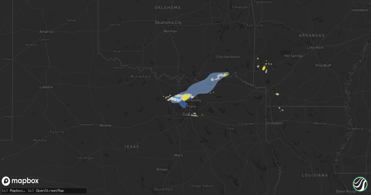
Hail Map on September 5, 2025
Get this storm
September 5 map
$229
one time, instant access
Download today. No call, no setup
Keep the $229
Bought the map and want the full workflow? Apply the entire $229 to a subscription within 7 days. None of it is wasted.
Every map, not just this one
This buys you this map. Subscription and you get every map we run, in the markets you choose from a few cities to whole states to nationwide. Plus real-time alerts the moment a storm fires.
Contact data
Name, contact info, occupancy, even credit band for addresses in the footprint. You go from where it hit to who to call.
Become the source they trust
Unlimited branding weather history reports on demand. You already have the documented answer ready for the property owner, and you are the one who showed up with it.
Property data and RoofTrace estimates
Pull up any address you have got, its value and the exact code rules for that jurisdiction, straight from One Click Code. Then RoofTrace estimates the squares, pitch, and roof value, priced the way you price.
States Impacted by Hail Map on September 5, 2025
Storm reports
West Virginia
| Date | Description |
|---|---|
| 09/05/20256:42 PM CDT | Local utility company reports power outages affecting 70-100 some customers in the myrtle and delbarton areas due to downed trees. Time estimated by radar. |
| 09/05/20256:40 PM CDT | Logan county 911 center reports a tree and a power line down in the 100 block area of gentry ave in logan... Wv. Time estimated by radar. |
| 09/05/20256:39 PM CDT | Logan county 911 reports a tree down in the 200 block of hanging rock hwy in logan. Tree is blocking one side of the road. Time estimated by radar. |
| 09/05/20256:34 PM CDT | Mingo county 911 reports a tree down involving power lines and a vehicle around the 800 block of day star rd near belo... Wv. Time is estimated by radar. |
| 09/05/20256:31 PM CDT | Mingo county 911 reports a tree down blocking the road in the 500 block of right fork laurel cr in laurel creek. Time estimated via radar. |
| 09/05/20256:30 PM CDT | Tree down blocking hensley big branch road near lenore... Wv. Time estimated by radar. |
| 09/05/20256:26 PM CDT | Portions of a downed tree fell onto a home in the lenore area heading towards laurel creek lake. Time estimated from radar. |
| 09/05/20256:23 PM CDT | Tree damage along route 152 resulted in over 100 local homes to be without power. |
| 09/05/20256:13 PM CDT | Over 500 homes in the shively area without power due to tree damage along main hart road. Time estimated from radar. |
| 09/04/20257:21 PM CDT | A downed tree was observed along pullman drive in coxs mills. Time estimated from radar. |
| 09/04/20257:00 PM CDT | Tree damage along conrad run road resulted in over 200 homes to be without power near the community of hazelgreen. Time estimated from radar. |
Tennessee
| Date | Description |
|---|---|
| 09/05/20256:57 PM CDT | Picture received of tennis ball size hail on social media from whitleyville. Time estimated from radar. |
| 09/05/20256:53 PM CDT | Tree down on a mobile home along taurus road. |
| 09/05/20256:48 PM CDT | Social media report of trees and powerlines down in several locations across jackson county. Time estimated from radar. |
| 09/05/20256:44 PM CDT | Picture of a barn with tin roofing peeled up. Time estimated by radar. In lafayette though exact location unknown. |
| 09/05/20256:44 PM CDT | Social media photos of hail up to quarter size near lafayette. Time estimated. |
| 09/05/20256:18 PM CDT | Tree fell on a car along the natchez trace parkway. |
| 09/05/20255:51 PM CDT | Social media photos of hail at least quarter size near duck river. Time estimated. |
| 09/05/20255:37 PM CDT | Tree down blocking roadway. Report originated with highway trooper. |
| 09/05/20255:24 PM CDT | Tree down on sanderson road. |
| 09/05/20255:20 PM CDT | Tree down on cypress creek road near drop anchor rv park. Entire road was blocked. |
| 09/04/20258:07 PM CDT | Trees and powerlines down on a home. T |
| 09/04/20258:07 PM CDT | Trees and powerlines down on a home. Time estimated from radar. |
| 09/04/20258:07 PM CDT | Trees and powerlines down on a home. Ti |
| 09/04/20258:07 PM CDT | Trees a |
| 09/04/20257:56 PM CDT | 56 mph wind gust reported via automated weather sensor. |
| 09/04/20257:15 PM CDT | Many trees down on west end of clay county. Time estimated from radar. |
| 09/04/20257:07 PM CDT | Pictures received on social media of large hail being held. Public reports golf ball size. |
Texas
| Date | Description |
|---|---|
| 09/05/20256:54 PM CDT | Tree fell through a fence and flagpole was blown down on coronado trail in frisco. |
| 09/05/20256:40 PM CDT | Denton enterprise airport recorded a 75 mph wind gust. Minor damage was reported to a hanger... And a number of small planes were damaged. |
| 09/05/20256:36 PM CDT | Corrects previous tstm wnd gst report from 4 w denton. Denton enterprise airport recorded a 75 mph wind gust at 636pm. Minor damage was reported to a hanger... And a nu |
| 09/05/20256:35 PM CDT | A home weather station in robson ranch recorded a 60 mph wind gust. |
| 09/05/20256:30 PM CDT | Facebook reports and photos showed widely scattered trees and large tree limbs were blown down across denton. |
| 09/05/20256:19 PM CDT | Denton enterprise airport recorded a 63 mph wind gust with strong winds behind the outflow boundary of a severe storm. |
| 09/05/20256:05 PM CDT | Delayed report. Damage to a outdoor metal building. Some of the walls collapsed and portions of the roof destroyed. |
| 09/04/202510:22 PM CDT | Report from mping: quarter |
| 09/04/202510:18 PM CDT | Report of a single tree down within the city limits of clarksville. |
| 09/04/202510:02 PM CDT | Wind gust of 60 mph measured at twu guinn hall. |
| 09/04/20259:53 PM CDT | Asos station kdto denton enterprise airport. |
| 09/04/20257:55 PM CDT | Several trees down and 8000 power outages across southern fannin county especially in the trenton and leonard areas. |
| 09/04/20257:55 PM CDT | Large oak trees were uprooted around leonard. Some fell on cars and homes. |
| 09/04/20257:43 PM CDT | Street signs... Tree limbs and trees were reported down across anna. An rv was also blown over on highway 75 on the anna/van alstyne line. |
| 09/04/20257:25 PM CDT | The roof of a horse barn collapsed along massey road to the east of gunter. This was reported via facebook. |
| 09/04/20257:24 PM CDT | Updates previous tstm wnd dmg report from gunter. Shingle and small limb damage in gunter reported via facebook. Local officials also reported larger tree limbs broken. |
| 09/04/20257:24 PM CDT | Shingle and small limb damage in gunter reported via facebook. |
| 09/04/20257:24 PM CDT | Updates previous tstm wnd dmg report from gunter. Shingle and small limb damage in gunter reported via facebook. Local officials also reported larger tree limbs broken. |
| 09/04/20257:24 PM CDT | Report from mping: half dollar |
| 09/04/20257:19 PM CDT | The roof covering and wood boards were partially torn off the side of a house in north preston lakes... North of celina. |
| 09/04/20257:13 PM CDT | Much of the western portion of the bethel baptist church on cr 128 was blown off. |
| 09/04/20257:05 PM CDT | Mesonet station twb73 mustang special utility district on fm 2931. |
| 09/04/20257:05 PM CDT | Report from mping: quarter |
| 09/04/20257:03 PM CDT | Lots of tree damage and broken tree damage in aubrey. |
| 09/04/20257:03 PM CDT | Report from mping: half dollar |
Kentucky
| Date | Description |
|---|---|
| 09/05/20256:35 PM CDT | Multiple pictures on social media of measured quarter-sized hail in shopville... Ky. Time estimated via radar. |
| 09/05/20256:30 PM CDT | Magoffin county dispatch reports a tree blocking south river road near owens cemetery and oakley creek. The tree was down on the stretch of river road that parallels th |
| 09/05/20256:05 PM CDT | Dispatch reported a tree down on a power line resulting in a power outage. |
| 09/05/20256:03 PM CDT | Martin county dispatch reported a downed tree blocking the road in the 6300 block of beauty road/ky-40. Time estimated via radar. |
| 09/05/20255:51 PM CDT | Lee county 911 relayed a report of a downed tree at mile marker 4 from the storms that occurred before 8pm last night. Time estimated via radar. |
| 09/05/20255:45 PM CDT | Wolfe county dispatch received a delayed report this morning of downed trees in a holler blocking blue balk road. Multiple storms moved through this area... But the str |
| 09/05/20255:40 PM CDT | Large tree down on salem rd... Mostly blocking the road. Off duty officer tried to move but was unable. |
| 09/05/20255:36 PM CDT | Martin county dispatch reports a downed tree blocking the road at the intersection of rock house road and lower wolf branch road. Time estimated via radar. Stronger-wor |
| 09/05/20255:18 PM CDT | Tree down on power line at the intersection of ky hwy 11 and ky highway 715. |
| 09/05/20255:12 PM CDT | Report of large tree down on orndorff mill rd. |
| 09/05/20255:04 PM CDT | Picture on social media of a large downed tree blocking ky-1092 between flatgap and drake fork road. Time estimated via radar. |
| 09/04/202510:30 PM CDT | Magoffin county dispatch received a delayed report earlier this morning of large tree branches downed and blocking lakeville road near the intersection with bear branch |
| 09/04/202510:08 PM CDT | Social media report of a downed tree at the vancleve park and ride immediately after the exit ramp from ky-15. Time estimated via radar. |
| 09/04/202510:07 PM CDT | Off-duty nws employee relayed a report of a down tree near the 6000 block of ky-1812. Time estimated from radar. |
| 09/04/202510:06 PM CDT | Social media report of downed trees one mile south of the wolfe/breathitt county line on ky-15. Report corroborated with a traffic slowdown on online gps software. Time |
| 09/04/202510:01 PM CDT | Social media report of a dumpster that was tossed/flipped from the wind at the bethany christian school. Time estimated via radar. |
| 09/04/202510:00 PM CDT | Resends previous tstm wnd dmg report from bethany due to iris error message. Social media report of a large tree down on a fence on bethany school lane in wolfe county. |
| 09/04/20259:50 PM CDT | Lee county 911 relayed a report of a downed tree in the 200 block of gilliam road. Time estimated via radar. |
| 09/04/20259:42 PM CDT | Lee county 911 relayed a report of downed trees along fairgrounds ridge road near the three forks regional jail. Time estimated via radar. |
| 09/04/20259:01 PM CDT | Video on social media of hail coming down near the intersection of walton road and nolan road. Largest stones appear to be quarter sized... With more widespread smaller |
| 09/04/20258:42 PM CDT | Magoffin county dispatch reports a downed tree blocking may branch road just off of highway 460. Time estimated via radar. |
| 09/04/20258:40 PM CDT | Ping pong size hail. |
| 09/04/20257:30 PM CDT | Report of trees down on three forks rd. And boone trail rd. |
Arkansas
| Date | Description |
|---|---|
| 09/05/202512:50 AM CDT | Report of trees down near hilltop drive on the north side of stamps. |
| 09/05/202512:48 AM CDT | Rep |
| 09/05/202512:48 AM CDT | Report of a powerline down on county road 27 north of stam |
| 09/05/202512:48 AM CDT | Report of a powerline down |
| 09/05/202512:48 AM CDT | Report of a powerline down on county road 27 north of stamps. |
| 09/04/202511:27 PM CDT | Corrects previous tstm wnd dmg report from 3 wnw dierks. Report of tree down on dierks lake road. |
| 09/04/202511:02 PM CDT | Corrects previous tstm wnd dmg report from 2 sse de queen. Report of trees down on east red bridge road just to the south of highway 41. |
| 09/04/202511:02 PM CDT | Corrects previous tstm wnd dmg report from 1 wnw de queen. Reports of trees down on johnson bridge road just off of highway 70 w. |
| 09/04/202511:02 PM CDT | Received several photos on our social media page of downed trees... With some on power lines and buildings... Across the town of gillham. |
| 09/04/202511:02 PM CDT | Corrects previous tstm wnd dmg report from 1 wnw de queen. Reports of trees down on johnson bridge road just off of highway 70 w. |
| 09/04/202511:00 PM CDT | Corrects previous tstm wnd dmg report from 1 s gillham. Report of tree down along highway 71 south of gillham. |
North Carolina
| Date | Description |
|---|---|
| 09/04/20258:18 PM CDT | Tree down blocking portion of key road near ararat road. |
Cities Impacted by Hail Map on September 5, 2025
- Holladay, TN
- Jackson, TN
- Waverly, TN
- Finger, TN
- Beech Bluff, TN
- Scotts Hill, TN
- Decaturville, TN
- Adamsville, TN
- Bethel Springs, TN
- Russellville, KY
- Adairville, KY
- Huron, TN
- Middleton, TN
- Reagan, TN
- Luray, TN
- Morris Chapel, TN
- Milledgeville, TN
- Enville, TN
- Lexington, TN
- Jacks Creek, TN
- Sardis, TN
- Olmstead, KY
- Linden, TN
- Allensville, KY
- Franklin, KY
- Parsons, TN
- Centerville, TN
- Paintsville, KY
- River, KY
- Scottsville, KY
- Lobelville, TN
- Duck River, TN
- Lyles, TN
- Primm Springs, TN
- Williamsport, TN
- Clifton, TN
- Belleville, WV
- Louisa, KY
- McKee, KY
- Inez, KY
- Waynesboro, TN
- Decatur, TX
- Washington, WV
- Mineral Wells, WV
- Rhome, TX
- Crum, WV
- Fort Gay, WV
- Dunlow, WV
- Tomahawk, KY
- Adolphus, KY
- Santa Fe, TN
- Harts, WV
- Krum, TX
- Ponder, TX
- Kermit, WV
- Warfield, KY
- Campton, KY
- Salyersville, KY
- Lovely, KY
- Searchlight, NV
- Portland, TN
- Lenore, WV
- Williamson, WV
- Dingess, WV
- Jackson, KY
- Vancleve, KY
- Somerset, KY
- Science Hill, KY
- Chapmanville, WV
- Mount Pleasant, TN
- Hampshire, TN
- Eubank, KY
- Westmoreland, TN
- Pioche, NV
- Columbia, TN
- Hagerhill, KY
- Justin, TX
- Sanger, TX
- Denton, TX
- Argyle, TX
- Aubrey, TX
- Lafayette, TN
- Caliente, NV
- Delbarton, WV
- Ulysses, KY
- Hartsville, TN
- Valley View, TX
- Pilot Point, TX
- Tutor Key, KY
- Castalian Springs, TN
- Gallatin, TN
- Pecks Mill, WV
- Logan, WV
- Royalton, KY
- Macfarlan, WV
- Harrisville, WV
- Smithville, WV
- Rousseau, KY
- East Point, KY
- Dixon Springs, TN
- Little Elm, TX
- Red Boiling Springs, TN
- Moss, TN
- Whitleyville, TN
- Prosper, TX
- Frisco, TX
- Celina, TX
- Tioga, TX
- Gunter, TX
- Mckinney, TX
- Bethpage, TN
- Rome, GA
- Taylorsville, GA
- Gunlock, KY
- Auxier, KY
- Pleasant Shade, TN
- Collinsville, TX
- Melissa, TX
- Howe, TX
- Celina, TN
- Gainesboro, TN
- Hilham, TN
- White Bluff, TN
- Ashland City, TN
- Richmond, KY
- Carthage, TN
- Only, TN
- David, KY
- Nashville, TN
- Kingston Springs, TN
- Pilgrim, KY
- Belfry, KY
- Beauty, KY
- Anna Maria, FL
- Hurricane Mills, TN
- Anna, TX
- Sherman, TX
- Van Alstyne, TX
- Allons, TN
- Monroe, TN
- Byrdstown, TN
- Livingston, TN
- Granville, TN
- McEwen, TN
- Joelton, TN
- Nunnelly, TN
- Hollow Rock, TN
- Huntingdon, TN
- Winchester, KY
- Pegram, TN
- Bays, KY
- Bradenton Beach, FL
- Prestonsburg, KY
- Hueysville, KY
- Langley, KY
- Lavalette, WV
- Huntington, WV
- Whites Creek, TN
- Goodlettsville, TN
- Matewan, WV
- Bruceton, TN
- Buena Vista, TN
- Denison, TX
- Whitewright, TX
- Bells, TX
- Tom Bean, TX
- Ravenna, TX
- Savoy, TX
- Hendrix, OK
- Bonham, TX
- Blue Ridge, TX
- Trenton, TX
- Ector, TX
- Yuma, TN
- Westport, TN
- Paint Lick, KY
- Camden, TN
- Jamestown, TN
- Berea, KY
- Lancaster, KY
- Ivanhoe, TX
- Randolph, TX
- Leonard, TX
- Ladonia, TX
- Dodd City, TX
- Wolfe City, TX
- Bailey, TX
- Waynesburg, KY
- Winfield, WV
- Poca, WV
- Red House, WV
- Irvine, KY
- New Johnsonville, TN
- Sugar Tree, TN
- White House, TN
- Hustonville, KY
- Middleburg, KY
- Wharncliffe, WV
- Gilbert, WV
- Waco, KY
- Bennington, OK
- Bokchito, OK
- Telephone, TX
- Sumner, TX
- Windom, TX
- Brookston, TX
- Honey Grove, TX
- Baxter, TN
- Silver Point, TN
- Big Springs, WV
- Kings Mountain, KY
- Auburn, WV
- Bloomington Springs, TN
- Baisden, WV
- Stanford, KY
- Mount Sterling, KY
- Owingsville, KY
- Hillsboro, KY
- Cookeville, TN
- Glenville, WV
- Coxs Mills, WV
- Buffalo Valley, TN
- Crab Orchard, KY
- Arthur City, TX
- Alvord, TX
- Brodhead, KY
- Sandgap, KY
- Ravenna, KY
- Thompsons Station, TN
- Van Lear, KY
- Boswell, OK
- Hugo, OK
- Boons Camp, KY
- Beattyville, KY
- Cooper, TX
- Powderly, TX
- Paris, TX
- Grant, OK
- Stanton, KY
- Rogers, KY
- Slade, KY
- Sparta, TN
- Vincent, KY
- Hendersonville, TN
- Fort Towson, OK
- Sawyer, OK
- Zoe, KY
- Hestand, KY
- Hohenwald, TN
- Spring Hill, TN
- Cove, AR
- Wickes, AR
- Bon Aqua, TN
- Gillham, AR
- Tyner, KY
- Wayne, WV
- De Queen, AR
- Booneville, KY
- Valliant, OK
- Lockesburg, AR
- Vandervoort, AR
- Grannis, AR
- Wildersville, TN
- Dierks, AR
- Clayhole, KY
- Lake Dallas, TX
- Lewisville, TX
- The Colony, TX
- Carrollton, TX
- Coppell, TX
- Grapevine, TX
- Flower Mound, TX
- Barboursville, WV
- Newhope, AR
- Langley, AR
- Dallas, TX
- Overton, NV
- Plano, TX
- Balch Springs, TX
- Nashville, AR
- Mesquite, TX
- Florence, AL
- Iron City, TN
- Sunnyvale, TX
- Forney, TX
- Terrell, TX
- Chauncey, WV
- Omar, WV
- Killen, AL
- Lewisville, AR
- Garland City, AR
- Lexington, AL
- Rogersville, AL
- Amargosa Valley, NV
- Willow Beach, AZ
- Oliver Springs, TN
- Indian Springs, NV
- Pahrump, NV
- Cotton Valley, LA
- Sarepta, LA
- Franklin, TN
- Plain Dealing, LA
- Oakfield, TN
- Medina, TN
- Eugene, OR
- Cottage Grove, OR
- Creswell, OR
- North Las Vegas, NV
- Las Vegas, NV
- Meadview, AZ
- Kingman, AZ
- Dickson, TN
- Summertown, TN
- Peach Springs, AZ
- Dolan Springs, AZ