Hail Map on May 5, 2026
Get this storm
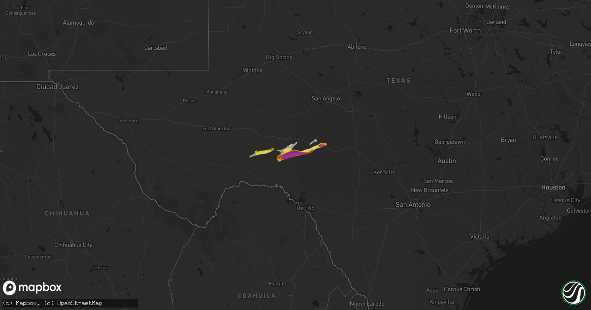
May 5 map
$229
one time, instant access
Download today. No call, no setup
Keep the $229
Bought the map and want the full workflow? Apply the entire $229 to a subscription within 7 days. None of it is wasted.
Every map, not just this one
This buys you this map. Subscription and you get every map we run, in the markets you choose from a few cities to whole states to nationwide. Plus real-time alerts the moment a storm fires.
Contact data
Name, contact info, occupancy, even credit band for addresses in the footprint. You go from where it hit to who to call.
Become the source they trust
Unlimited branding weather history reports on demand. You already have the documented answer ready for the property owner, and you are the one who showed up with it.
Property data and RoofTrace estimates
Pull up any address you have got, its value and the exact code rules for that jurisdiction, straight from One Click Code. Then RoofTrace estimates the squares, pitch, and roof value, priced the way you price.
Storm reports
New York
| Date | Description |
|---|---|
| 05/05/20262:41 PM CDT | Tree down across the roadway on guard rail. |
Kansas
| Date | Description |
|---|---|
| 05/05/20261:10 PM CDT | Delayed report: several large trees were uprooted and a few electric poles were snapped in waverly. Time estimated by radar. |
Texas
| Date | Description |
|---|---|
| 05/05/20266:55 AM CDT | A local report indicates 1.75 inch wind near 6 ENE Sonora |
Pennsylvania
| Date | Description |
|---|---|
| 05/04/20268:12 PM CDT | Report of a tree down fully covering the road. Time estimated based on radar. |
Utah
| Date | Description |
|---|---|
| 05/05/202612:20 AM CDT | Mesonet station utkno i-80 at mp 40 knolls. |
Arkansas
| Date | Description |
|---|---|
| 05/05/20263:02 AM CDT | A local report indicates 1.00 inch wind near 2 E Hot Springs |
| 05/05/20262:15 AM CDT | A tree was knocked down onto the railroad tracks at this location. Just before 8 am cdt a train collided with the downed tree. The train came to a stop which blocked tr |
Maine
| Date | Description |
|---|---|
| 05/05/20264:24 PM CDT | Delayed report: minor structural damage to houses in hanover with shingles blown off roofs and scattered tree damage. Time estimated from radar. |
| 05/05/20264:19 PM CDT | Corrects previous non-tstm wnd dmg report from 3 w presque isle. Large tree down partially blocking garland road in mapleton. |
Ohio
| Date | Description |
|---|---|
| 05/04/20267:31 PM CDT | Power pole and lines down at a residence on route 558. Time estimated from radar. |
New Hampshire
| Date | Description |
|---|---|
| 05/05/20263:45 PM CDT | Trees and utility wires down. |
| 05/05/20263:45 PM CDT | Trees and wires down on gould road. |
Cities Impacted by Hail Map on May 5, 2026
- Romance, AR
- Garden City, TX
- Crescent Valley, NV
- Honobia, OK
- Millington, TN
- Drummonds, TN
- Nashoba, OK
- Arlington, TN
- Atoka, TN
- Brighton, TN
- Smithville, OK
- Somerville, TN
- Mena, AR
- Lonsdale, AR
- Benton, AR
- Whiteville, TN
- Bryant, AR
- Alexander, AR
- Hot Springs National Park, AR
- Little Rock, AR
- Hatfield, AR
- Boles, AR
- Norman, AR
- Mabelvale, AR
- Bolivar, TN
- Bauxite, AR
- Malvern, AR
- Caddo Gap, AR
- Toone, TN
- Mount Ida, AR
- Bonnerdale, AR
- Glenwood, AR
- Royal, AR
- Langley, AR
- Story, AR
- Pearcy, AR
- Mountain Pine, AR
- Hot Springs Village, AR
- Hensley, AR
- Bismarck, AR
- Traskwood, AR
- Prattsville, AR
- Sheridan, AR
- Comstock, TX
- Ozona, TX
- Dryden, TX
- Sonora, TX