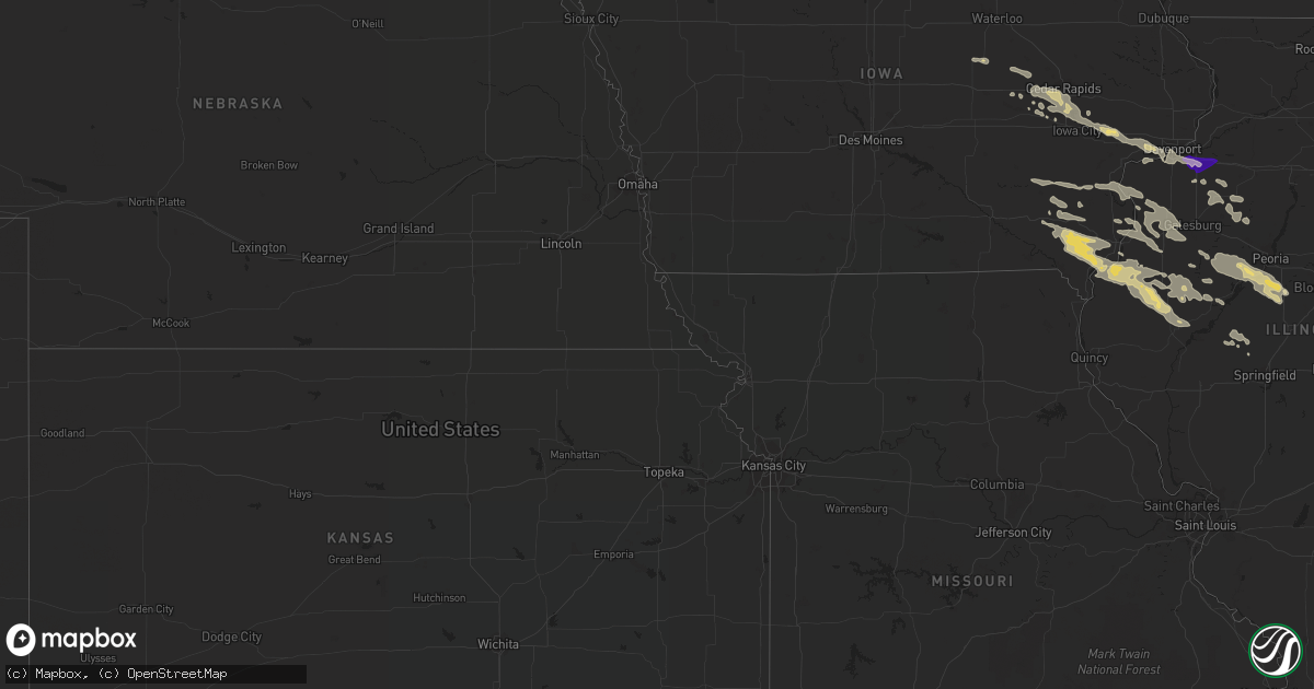
Hail Map in Illinois on July 31, 2022
Get this storm
July 31 map
$229
one time, instant access
Download today. No call, no setup
Keep the $229
Bought the map and want the full workflow? Apply the entire $229 to a subscription within 7 days. None of it is wasted.
Every map, not just this one
This buys you this map. Subscription and you get every map we run, in the markets you choose from a few cities to whole states to nationwide. Plus real-time alerts the moment a storm fires.
Contact data
Name, contact info, occupancy, even credit band for addresses in the footprint. You go from where it hit to who to call.
Become the source they trust
Unlimited branding weather history reports on demand. You already have the documented answer ready for the property owner, and you are the one who showed up with it.
Property data and RoofTrace estimates
Pull up any address you have got, its value and the exact code rules for that jurisdiction, straight from One Click Code. Then RoofTrace estimates the squares, pitch, and roof value, priced the way you price.
Storm reports in Illinois
Illinois
| Date | Description |
|---|---|
| 07/31/20226:30 AM CDT | 8 to 12 inch diameter branches down. Time estimated via radar. |
| 07/31/20226:26 AM CDT | Trees and powerlines down. Time estimated via radar. |
| 07/31/20226:25 AM CDT | Tree branches down. Time estimated via radar. |
| 07/31/20226:25 AM CDT | Large tree uprooted south of hindsboro. Time estimated via radar. |
| 07/31/20226:20 AM CDT | Trees down. Time estimated via radar. |
| 07/31/20226:15 AM CDT | Trees down. Time estimated by radar. |
| 07/31/20226:10 AM CDT | Tree down and corn blown over. Time estimated via radar. |
| 07/31/20226:00 AM CDT | Damage to roof of shed. Also reported minor home exterior damage to siding... Gutters. Time estimated via radar. |
| 07/31/20225:58 AM CDT | Eight power poles blown down. Time estimated via radar. |
| 07/31/20225:50 AM CDT | Trees down. Time estimated via radar. |
| 07/31/20225:46 AM CDT | A local report indicates 66 MPH wind near DECATUR AIRPORT |
| 07/31/20225:45 AM CDT | Social media photo shows tree branches down... One of which fell onto a chain link fence and damaged the fence. Time estimated by radar. |
| 07/31/20225:40 AM CDT | Tree branches down. Time estimated via radar. |
| 07/31/20225:40 AM CDT | Social media photo relayed by broadcast media shows large tree blown onto house... Causing structural damage. Time estimated via radar. |
| 07/31/20225:32 AM CDT | Three trees were blown down and a gazebo was tossed onto the roof of a house... Causing damage to the roof. |
| 07/31/20225:25 AM CDT | 50-60 mph blew down some 3 inch diameter limbs... Along with the hail knocking quite a few leaves off the trees in the area. |
| 07/31/20225:25 AM CDT | Mostly nickel to quarters... With a few larger stones. |
| 07/31/20225:10 AM CDT | Grain bin damaged. Time estimated via radar. |
| 07/31/20225:05 AM CDT | Large trees snapped at base. Largest tree was 24 inches in diameter. A large out building was also damaged. Time estimated via radar. |
| 07/31/20224:58 AM CDT | Power went out at that time. |
| 07/31/20224:55 AM CDT | Several tree limbs broken. Time estimate via radar. Report relayed by broadcast media. |
| 07/31/20222:08 AM CDT | A local report indicates 1.00 inch wind near 1 SW GREEN ROCK |
All States Impacted by Hail Map on July 31, 2022
Cities Impacted by Hail Map on July 31, 2022
- Deer Park, WI
- Clear Lake, WI
- Milltown, WI
- Luck, WI
- Winfield, IA
- Saint Paul, MN
- Lake Elmo, MN
- Alma, WI
- Waverly, IA
- Aitkin, MN
- Frederic, WI
- Sisters, OR
- Marengo, IA
- Watkins, IA
- Homestead, IA
- Oxford, IA
- Walnut Grove, MN
- Revere, MN
- Champaign, IL
- Ivesdale, IL
- Tolono, IL
- Webster, WI
- Shell Lake, WI
- Siren, WI
- Lewistown, IL
- Bushnell, IL
- Salem, IA
- New London, IA
- Hillsboro, IA
- Browning, IL
- West Burlington, IA
- Middletown, IA
- Farmington, IA
- Carthage, IL
- West Point, IA
- Rushville, IL
- Lomax, IL
- Table Grove, IL
- Littleton, IL
- Bardolph, IL
- Smithfield, IL
- Marietta, IL
- Colchester, IL
- Good Hope, IL
- Plymouth, IL
- Industry, IL
- Tennessee, IL
- Wever, IA
- Mount Pleasant, IA
- Fort Madison, IA
- Lockridge, IA
- La Harpe, IL
- Dallas City, IL
- Stockport, IA
- Danville, IA
- Blandinsville, IL
- Saint Paul, IA
- Adair, IL
- Astoria, IL
- Niota, IL
- Macomb, IL
- Nauvoo, IL
- Donnellson, IA
- Fairfield, IA
- Ipava, IL
- Sciota, IL
- Canistota, SD
- Salem, SD
- Braham, MN
- Pine City, MN
- Benson, NC
- Four Oaks, NC
- Nunda, SD
- Media, IL
- Biggsville, IL
- Roseville, IL
- Mediapolis, IA
- Smithshire, IL
- Oquawka, IL
- Gladstone, IL
- Kirkwood, IL
- Burlington, IA
- Norway, IA
- Amana, IA
- Decatur, IL
- Yucca, AZ
- Petersburg, IL
- Oakford, IL
- Pioche, NV
- Dover, MN
- Eyota, MN
- Plainview, MN
- Benson, AZ
- State Line, IN
- Bismarck, IL
- Potomac, IL
- Covington, IN
- Danville, IL
- Collison, IL
- Rossville, IL
- Oakville, IA
- Seaton, IL
- Wapello, IA
- Columbus Junction, IA
- New Boston, IL
- Muscatine, IA
- Joy, IL
- Lynn Center, IL
- Arthur, IL
- Arcola, IL
- Macon, IL
- Jacksonville, NC
- Hopedale, IL
- Tremont, IL
- Grantsburg, WI
- Elgin, MN
- Rochester, MN
- Millville, MN
- Saint Charles, MN
- Villa Grove, IL
- Newman, IL
- Brocton, IL
- Oakland, IL
- Hume, IL
- Murdock, IL
- Camargo, IL
- Wells, MN
- Alden, MN
- Rush City, MN
- Luzerne, IA
- Blairstown, IA
- Maquon, IL
- Peoria, IL
- Hanna City, IL
- Glasford, IL
- Norris, IL
- Farmington, IL
- Kingston Mines, IL
- Elmwood, IL
- Yates City, IL
- Fairview, IL
- Trivoli, IL
- Canton, IL
- Mapleton, IL
- Delavan, IL
- Green Valley, IL
- South Pekin, IL
- Pekin, IL
- Manito, IL
- Sahuarita, AZ
- Farmington, MN
- Northfield, MN
- Lakeville, MN
- Moweaqua, IL
- Montrose, SD
- Tuscola, IL
- Oldham, SD
- Arlington, SD
- Ramona, SD
- Speer, IL
- Princeville, IL
- Chandlerville, IL
- Penfield, IL
- Armstrong, IL
- Iowa City, IA
- Walcott, IA
- Atalissa, IA
- Taylor Ridge, IL
- Walford, IA
- Blue Grass, IA
- Stockton, IA
- Atkins, IA
- Newhall, IA
- Swisher, IA
- Durant, IA
- West Liberty, IA
- Moscow, IA
- Ely, IA
- Wilton, IA
- Solon, IA
- West Branch, IA
- Milan, IL
- North Liberty, IA
- Tipton, IA
- Fairfax, IA
- Cedar Rapids, IA
- Davenport, IA
- Pound, WI
- Mapleton, MN
- Danbury, WI
- Tower Hill, IL
- London Mills, IL
- Illinois City, IL
- Marshall, IL
- Paris, IL
- Orion, IL
- Rock Island, IL
- Geneseo, IL
- Moline, IL
- Coal Valley, IL
- Osco, IL
- Minnesota Lake, MN
- Brookings, SD
- Garrison, IA
- Van Horne, IA
- Vinton, IA
- Dysart, IA
- Dewitt, IL
- Clinton, IL
- Wapella, IL
- Cambridge, IL
- Woodhull, IL
- Altona, IL
- Galva, IL
- Oneida, IL
- Sidney, IL
- Philo, IL
- Broadlands, IL
- Longview, IL
- Allerton, IL
- Sidell, IL
- Westville, IL
- Metcalf, IL
- Chrisman, IL
- McLean, IL
- Heyworth, IL
- Waynesville, IL
- Clinton, IN
- Winfred, SD
- Bridgewater, SD
- Emery, SD
- Middle Amana, IA
- Kewanee, IL
- Susanville, CA
- Brighton, IA
- Keota, IA
- Ainsworth, IA
- Crawfordsville, IA
- Washington, IA
- Dennison, MN
- Cannon Falls, MN
- Amboy, MN
- Easton, MN
- Keithsburg, IL
- Cuba, IL
- Sperry, IA
- Victoria, IL
- Laura, IL
- La Fayette, IL
- Toulon, IL
- Madison, SD
- Avon, IL
- Ellisville, IL
- Wayland, IA
- Tucson, AZ
- Deer River, MN
- Vernon Center, MN
- Good Thunder, MN
- Sadorus, IL
- Bement, IL
- Pesotum, IL
- Rutland, SD
- Wentworth, SD
- Colman, SD
- Findlay, IL
- Sullivan, IL
- Windsor, IL
- Traer, IA
- Indianola, IL
- Canadian, TX
- Rosedale, IN
- Julesburg, CO
- Sells, AZ
- Vail, AZ
- Ajo, AZ
- Sidney, NE
- Salome, AZ
- Monticello, IL
- Kingman, IN
- Veedersburg, IN
- Perrysville, IN
- Kansas, IL
- Little York, IL
- Alexis, IL
- Aledo, IL
- Gerlaw, IL
- Cameron, IL
- Galesburg, IL
- Monmouth, IL
- Abingdon, IL
- Tumacacori, AZ
- Tubac, AZ
- Carman, IL
- Lodgepole, NE
- Argenta, IL
- Oreana, IL
- Maroa, IL
- Redmon, IL
- Higgins, TX
- Colona, IL


