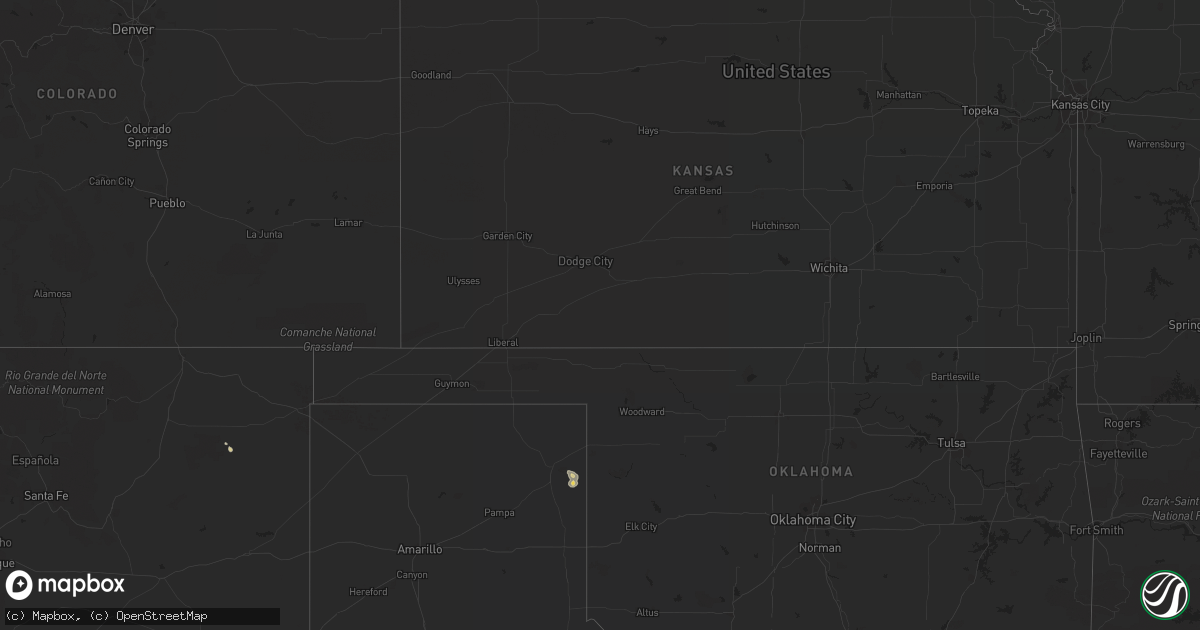
Hail Map on July 31, 2022
Get this storm
July 31 map
$229
one time, instant access
Download today. No call, no setup
Keep the $229
Bought the map and want the full workflow? Apply the entire $229 to a subscription within 7 days. None of it is wasted.
Every map, not just this one
This buys you this map. Subscription and you get every map we run, in the markets you choose from a few cities to whole states to nationwide. Plus real-time alerts the moment a storm fires.
Contact data
Name, contact info, occupancy, even credit band for addresses in the footprint. You go from where it hit to who to call.
Become the source they trust
Unlimited branding weather history reports on demand. You already have the documented answer ready for the property owner, and you are the one who showed up with it.
Property data and RoofTrace estimates
Pull up any address you have got, its value and the exact code rules for that jurisdiction, straight from One Click Code. Then RoofTrace estimates the squares, pitch, and roof value, priced the way you price.
States Impacted by Hail Map on July 31, 2022
Storm reports
Arizona
| Date | Description |
|---|---|
| 07/31/20226:47 PM CDT | Quarter size hail fell in the eagle crest ranch neighborhood. |
| 07/31/20227:54 AM CDT | At 1254 PM MST, a severe thunderstorm was located near Ajo, moving west at 25 mph. HAZARD...60 mph wind gusts and quarter size hail. SOURCE...Radar indicated. IMPACT...Hail damage to vehicles is expected. Expect wind damage to roofs, siding, and trees. Locations impacted include... Ajo. |
| 07/31/20221:36 AM CDT | At 635 PM MST, a cluster of strong to severe thunderstorms was located 7 miles east of Nogales International Airport, or 12 miles east of Nogales, moving northwest at 20 mph. HAZARD...60 mph wind gusts and nickel size hail. SOURCE...Radar indicated. IMPACT...Expect damage to roofs, siding, and trees. Locations impacted include... Nogales, Rio Rico, Patagonia, Nogales International Airport, Patagonia Lake State Park and Kino Springs. |
| 07/31/202212:58 AM CDT | At 557 PM MST, a severe thunderstorm was located near Tanque Verde, or near Davis-Monthan Air Force Base, moving northwest at 15 mph. HAZARD...60 mph wind gusts and quarter size hail. SOURCE...Radar indicated. IMPACT...Hail damage to vehicles is expected. Expect wind damage to roofs, siding, and trees. Locations impacted include... Tucson, Oro Valley, Marana, Davis-Monthan Air Force Base, Casas Adobes, Flowing Wells, Tanque Verde, Mount Lemmon/Summerhaven, Sabino Canyon Recreation Area, Catalina State Park, Catalina Foothills, Saguaro National Park East and Seven Falls. |
| 07/31/202212:21 AM CDT | At 521 PM MST, a cluster of severe thunderstorm was located near Davis-Monthan Air Force Base, moving northwest at 20 mph. HAZARD...60 mph wind gusts and quarter size hail. SOURCE...Radar indicated. IMPACT...Hail damage to vehicles is expected. Expect wind damage to roofs, siding, and trees. Locations impacted include... Tucson, Davis-Monthan Air Force Base, Casas Adobes, Flowing Wells, Tanque Verde, Vail, South Tucson, Sabino Canyon Recreation Area, Catalina Foothills, Tucson International Airport, Saguaro National Park East, Summit, Rita Ranch and Seven Falls. |
| 07/31/202212:18 AM CDT | At 517 PM MST, a severe thunderstorm was located over Nogales, moving northwest at 10 mph. HAZARD...60 mph wind gusts and quarter size hail. SOURCE...Radar indicated. IMPACT...Hail damage to vehicles is expected. Expect wind damage to roofs, siding, and trees. Locations impacted include... Nogales, Nogales International Airport, Patagonia Lake State Park, Kino Springs and Pena Blanca Lake. |
| 07/31/202212:06 AM CDT | At 505 PM MST, a severe thunderstorm was located over Pascua Pueblo Yaqui Reservation, or 12 miles southwest of Tucson, moving north at 20 mph. HAZARD...70 mph wind gusts and ping pong ball size hail. SOURCE...Radar indicated. IMPACT...People and animals outdoors will be injured. Expect hail damage to roofs, siding, windows, and vehicles. Expect considerable tree damage. Wind damage is also likely to mobile homes, roofs, and outbuildings. Locations impacted include... Tucson, Marana, Casas Adobes, Drexel Heights, Flowing Wells, Pascua Pueblo Yaqui Reservation, Saguaro National Park West, Valencia West, Tucson Estates, Picture Rocks, San Xavier Mission and Ryan AirField. |
| 07/30/202211:52 PM CDT | At 452 PM MST, a severe thunderstorm was located near Three Points, or 14 miles northwest of Sahuarita, moving northwest at 25 mph. HAZARD...60 mph wind gusts and quarter size hail. SOURCE...Radar indicated. IMPACT...Hail damage to vehicles is expected. Expect wind damage to roofs, siding, and trees. Locations impacted include... Three Points, Pascua Pueblo Yaqui Reservation, Valencia West, Tucson Estates, Saguaro National Park West, Picture Rocks, San Pedro and Ryan AirField. |
| 07/30/202211:37 PM CDT | At 436 PM MST, a severe thunderstorm was located near Vail, or 16 miles west of Benson, and is nearly stationary. HAZARD...60 mph wind gusts and quarter size hail. SOURCE...Radar indicated. IMPACT...Hail damage to vehicles is expected. Expect wind damage to roofs, siding, and trees. Locations impacted include... Vail and Saguaro National Park East. |
| 07/30/202210:46 PM CDT | At 346 PM MST, a severe thunderstorm was located over Patagonia Lake State Park, or 11 miles northeast of Nogales, moving west at 10 mph. HAZARD...60 mph wind gusts and quarter size hail. SOURCE...Radar indicated. IMPACT...Hail damage to vehicles is expected. Expect wind damage to roofs, siding, and trees. Locations impacted include... Patagonia and Patagonia Lake State Park. |
| 07/30/202210:31 PM CDT | At 331 PM MST, a severe thunderstorm was located near Tubac, moving northwest at 15 mph. HAZARD...60 mph wind gusts and quarter size hail. SOURCE...Radar indicated. IMPACT...Hail damage to vehicles is expected. Expect wind damage to roofs, siding, and trees. Locations impacted include... Green Valley, Tubac, Amado and Arivaca Junction. |
| 07/30/20227:20 PM CDT | Pictures submitted by public via social media of wind damage to a storage facility. |
Oklahoma
| Date | Description |
|---|---|
| 07/31/20225:03 AM CDT | At 1002 PM CDT, a severe thunderstorm was located near Lake Marvin, or 15 miles east of Canadian, moving east at 30 mph. HAZARD...70 mph wind gusts. SOURCE...Radar indicated. IMPACT...Expect some tree damage. Damage is likely to mobile homes, roofs, and outbuildings. Locations impacted include... Lake Marvin and Glazier. |
Indiana
| Date | Description |
|---|---|
| 07/31/20226:58 AM CDT | Tree down on a structure southwest bloomingdale. Time estimated via radar. |
| 07/31/20226:50 AM CDT | Trees down at residence. A few larger branches down on vehicles. Time estimated from radar. |
New Mexico
| Date | Description |
|---|---|
| 07/31/202212:51 AM CDT | At 550 PM MDT, a severe thunderstorm was located 14 miles south of Gladstone, or 23 miles north of Mosquero, moving southeast at 15 mph. HAZARD...60 mph wind gusts and quarter size hail. SOURCE...Radar indicated. IMPACT...Hail damage to vehicles is expected. Expect wind damage to roofs, siding, and trees. Locations impacted include... Bueyeros and Yates. |
California
| Date | Description |
|---|---|
| 07/31/20226:42 PM CDT | Trained weather spotter reported half dollar sized hail and very heavy rainfall. |
| 07/31/20223:14 PM CDT | Bicycle lake asos reported 61 mph winds from nearby thunderstorms. |
| 07/31/20224:49 AM CDT | At 948 AM PDT, a severe thunderstorm was located 7 miles southeast of Jean, moving north at 15 mph. HAZARD...60 mph wind gusts. SOURCE...Radar indicated. IMPACT...Expect damage to roofs, trees, or power lines. Patchy blowing dust may reduce visibility on area roadways. Locations impacted include... Primm, Jean and Goodsprings. This includes Interstate 15 in Nevada between mile markers 1 and 24. |
| 07/31/20221:01 AM CDT | At 558 PM PDT, a severe thunderstorm was located near Crater Lake Campground, or 19 miles north of Chester, moving west at 20 mph. HAZARD...Has had a report of quarter size hail. SOURCE...Radar indicated. IMPACT...Damage to vehicles is expected. Locations impacted include... Crater Lake Campground and Ca 44 At Shasta-Lassen Co Line. |
| 07/31/202212:19 AM CDT | At 518 PM PDT, a severe thunderstorm was located near Aspen Grove Campground, or 10 miles southwest of Eagle Lake, moving west at 10 mph. HAZARD...Quarter size hail. SOURCE...Radar indicated. IMPACT...Damage to vehicles is expected. Locations impacted include... Aspen Grove Campground, Crater Lake Campground, Christie Campground, Merrill Campground and Eagle Campground. |
| 07/30/202211:36 PM CDT | At 435 PM PDT, a severe thunderstorm was located near Eagle Lake, moving northwest at 20 mph. HAZARD...Quarter size hail. SOURCE...Radar indicated. IMPACT...Damage to vehicles is expected. Locations impacted include... Eagle Lake, Spaulding, Aspen Grove Campground, Christie Campground, Merrill Campground and Eagle Campground. |
North Dakota
| Date | Description |
|---|---|
| 07/30/20228:04 PM CDT | At 104 AM CDT, severe thunderstorms were located along a line extending from 7 miles northeast of Warwick to 7 miles northeast of Bordulac, moving east at 45 mph. HAZARD...60 mph wind gusts and penny size hail. SOURCE...Radar indicated. IMPACT...Expect damage to roofs, siding, and trees. Locations impacted include... New Rockford, Sheyenne, Binford, Tolna, Red Willow Lake, Pekin and Sutton. |
| 07/30/20228:04 PM CDT | At 102 AM CDT, a severe thunderstorm was located near Carrington, moving east at 45 mph. HAZARD...60 mph wind gusts and penny size hail. SOURCE...Radar indicated. IMPACT...Expect damage to roofs, siding, and trees. This severe thunderstorm will be near... Carrington around 105 AM CDT Bordulac around 115 AM CDT. Grace City around 125 AM CDT. Glenfield and Mchenry around 140 AM CDT.Other locations impacted by this severe thunderstorm include Juanita,Melville and Barlow. |
Illinois
| Date | Description |
|---|---|
| 07/31/20226:30 AM CDT | 8 to 12 inch diameter branches down. Time estimated via radar. |
| 07/31/20226:26 AM CDT | Trees and powerlines down. Time estimated via radar. |
| 07/31/20226:25 AM CDT | Tree branches down. Time estimated via radar. |
| 07/31/20226:25 AM CDT | Large tree uprooted south of hindsboro. Time estimated via radar. |
| 07/31/20226:20 AM CDT | Trees down. Time estimated via radar. |
| 07/31/20226:15 AM CDT | Trees down. Time estimated by radar. |
| 07/31/20226:10 AM CDT | Tree down and corn blown over. Time estimated via radar. |
| 07/31/20226:00 AM CDT | Damage to roof of shed. Also reported minor home exterior damage to siding... Gutters. Time estimated via radar. |
| 07/31/20225:58 AM CDT | Eight power poles blown down. Time estimated via radar. |
| 07/31/20225:50 AM CDT | Trees down. Time estimated via radar. |
| 07/31/20225:46 AM CDT | A local report indicates 66 MPH wind near DECATUR AIRPORT |
| 07/31/20225:45 AM CDT | Social media photo shows tree branches down... One of which fell onto a chain link fence and damaged the fence. Time estimated by radar. |
| 07/31/20225:40 AM CDT | Tree branches down. Time estimated via radar. |
| 07/31/20225:40 AM CDT | Social media photo relayed by broadcast media shows large tree blown onto house... Causing structural damage. Time estimated via radar. |
| 07/31/20225:32 AM CDT | Three trees were blown down and a gazebo was tossed onto the roof of a house... Causing damage to the roof. |
| 07/31/20225:25 AM CDT | Mostly nickel to quarters... With a few larger stones. |
| 07/31/20225:25 AM CDT | 50-60 mph blew down some 3 inch diameter limbs... Along with the hail knocking quite a few leaves off the trees in the area. |
| 07/31/20225:10 AM CDT | Grain bin damaged. Time estimated via radar. |
| 07/31/20225:05 AM CDT | Large trees snapped at base. Largest tree was 24 inches in diameter. A large out building was also damaged. Time estimated via radar. |
| 07/31/20224:58 AM CDT | Power went out at that time. |
| 07/31/20224:55 AM CDT | Several tree limbs broken. Time estimate via radar. Report relayed by broadcast media. |
| 07/31/20222:08 AM CDT | A local report indicates 1.00 inch wind near 1 SW GREEN ROCK |
Iowa
| Date | Description |
|---|---|
| 07/31/202212:45 AM CDT | Brief nickel to quarters... Time estimated from radar. Report via social media. |
Virginia
| Date | Description |
|---|---|
| 07/31/20226:42 PM CDT | Thunderstorm winds blew down multiple trees near the intersection of wolf trap road and north nichols ferry trail. |
| 07/31/20221:42 AM CDT | At 641 PM EDT, a severe thunderstorm was located near Ingram, moving east at 20 mph. HAZARD...60 mph wind gusts. SOURCE...Radar indicated. IMPACT...Expect damage to roofs, siding, and trees. Locations impacted include... South Boston... Halifax... Ingram... Clover... Scottsburg... Java... and Cluster Springs. |
| 07/30/20229:17 PM CDT | At 217 PM EDT, severe thunderstorms were located along a line extending from near Henderson to 6 miles east of Louisburg, moving northeast at 35 mph. HAZARD...60 mph wind gusts and quarter size hail. SOURCE...Radar indicated. IMPACT...Hail damage to vehicles is expected. Expect wind damage to roofs, siding, and trees. Locations impacted include... Henderson, Warrenton, Norlina, Littleton, Middleburg, Macon, Centerville, Medoc Mountain State Park, Aventon and Afton. |
| 07/30/20227:45 PM CDT | Trees downed and blocking road on eastbound side just off us-58 at intersection of wilkerson rd and puryears store rd. |
Wisconsin
| Date | Description |
|---|---|
| 07/31/20222:29 AM CDT | At 729 PM CDT, a severe thunderstorm was located over Siren, or 24 miles west of Spooner, moving east at 25 mph. HAZARD...Ping pong ball size hail and 60 mph wind gusts. SOURCE...Radar indicated. IMPACT...People and animals outdoors will be injured. Expect hail damage to roofs, siding, windows, and vehicles. Expect wind damage to roofs, siding, and trees. Locations impacted include... Hertel and Shell Lake. |
| 07/30/20229:19 PM CDT | Report from mping. 3-inch tree limbs broken. |
Nevada
| Date | Description |
|---|---|
| 07/31/20221:18 AM CDT | At 615 PM PDT, a severe thunderstorm was located 41 miles southwest of Blue Eagle Ranch, moving southeast at 10 mph. HAZARD...60 mph wind gusts and quarter size hail. SOURCE...Radar indicated. IMPACT...Hail damage to vehicles is expected. Expect wind damage to roofs, siding, and trees. This severe thunderstorm will be along portions NV375 just south of US Hwy 6. |
Minnesota
| Date | Description |
|---|---|
| 07/31/20223:42 AM CDT | At 842 PM CDT, a severe thunderstorm was located over Stanton, or 7 miles east of Northfield, moving east at 20 mph. HAZARD...60 mph wind gusts and quarter size hail. SOURCE...Radar indicated. IMPACT...Hail damage to vehicles is expected. Expect wind damage to roofs, siding, and trees. This severe thunderstorm will be near... Cannon Falls around 855 PM CDT. |
| 07/31/20223:03 AM CDT | At 803 PM CDT, a severe thunderstorm was located near Wells, or 17 miles west of Albert Lea, moving southeast at 35 mph. HAZARD...60 mph wind gusts and quarter size hail. SOURCE...Radar indicated. IMPACT...Hail damage to vehicles is expected. Expect wind damage to roofs, siding, and trees. This severe thunderstorm will be near... Alden around 815 PM CDT. Mansfield and Conger around 820 PM CDT.Other locations in the path of this severe thunderstorm includeAlbert Lea, Emmons and Twin Lakes. |
| 07/31/20222:28 AM CDT | At 728 PM CDT, a severe thunderstorm was located near Mapleton, or 20 miles south of Mankato, moving east at 30 mph. HAZARD...60 mph wind gusts and quarter size hail. SOURCE...Radar indicated. IMPACT...Hail damage to vehicles is expected. Expect wind damage to roofs, siding, and trees. This severe thunderstorm will be near... Minnesota Lake around 735 PM CDT.Other locations in the path of this severe thunderstorm includeFreeborn. |
Nebraska
| Date | Description |
|---|---|
| 07/31/20225:43 PM CDT | Asos station ksny sidney airport. |
| 07/30/20227:45 PM CDT | A local report indicates 62 MPH wind near HAYES CENTER |
North Carolina
| Date | Description |
|---|---|
| 07/31/20225:40 PM CDT | 911 center reports tree down at the intersection of stewart dr and harkers island rd. Time estimated by radar. |
| 07/31/20225:24 PM CDT | 911 call center reports tree down at the intersection of adams creek rd and hwy 101. Time estimated by radar. |
| 07/31/20225:20 PM CDT | Trees down along harmony hwy. |
| 07/31/20225:20 PM CDT | Tree downed along hunting creek rd. |
| 07/31/20225:12 PM CDT | 911 call center reports tree down at the intersection of brandywine blvd and hwy 24. Time estimated by radar. |
| 07/31/20224:37 PM CDT | Ham radio relayed reported of branches down at the intersection of piney green rd. And country club rd. Time based on radar. |
| 07/31/20224:31 PM CDT | Ham radio relayed report of 50-60 mph gusts at the intersection of hwy17 and western blvd. In jacksonville. Time based on radar. |
| 07/31/20224:23 PM CDT | Onslow county 911 reported trees down near the intersection of blue creek rd. And pony farm rd. Time based on radar. |
| 07/31/20224:11 PM CDT | Onslow county 911 reported large limbs down near the intersection of padgett rd. And haws run rd. Time based on radar. |
| 07/31/202212:29 PM CDT | Tree down near the intersection of ringwood road and heathsville road. Time estimated by radar. |
| 07/31/20221:06 AM CDT | At 605 PM EDT, severe thunderstorms were located along a line extending from near Havelock to near Newport to near Broad Creek, moving northeast at 40 mph. HAZARD...70 mph wind gusts and nickel size hail. SOURCE...Radar indicated. IMPACT...Expect considerable tree damage. Damage is likely to mobile homes, roofs, and outbuildings. Locations impacted include... New Bern, Havelock, Morehead City, Newport, Cedar Island, Harkers Island, South River, North River, Sealevel, Marshallberg, Davis, Smyrna, Merrimon, Straits, Atlantic, Pine Knoll Shores, Harlowe, Florence, Otway and Janeiro. |
| 07/31/202212:42 AM CDT | At 542 PM EDT, severe thunderstorms were located along a line extending from near Maysville to near Camp Lejeune Center, moving east at 25 mph. HAZARD...70 mph wind gusts and nickel size hail. SOURCE...Radar indicated. IMPACT...Expect considerable tree damage. Damage is likely to mobile homes, roofs, and outbuildings. Locations impacted include... Jacksonville, New Bern, Havelock, Morehead City, Newport, Pumpkin Center, Piney Green, Camp Lejeune Center, James City, Trent Woods, River Bend, Stella, Swansboro, Hubert, Cape Carteret, Maysville, Silverdale, Kellum, Midway Park and Belgrade. |
| 07/30/202211:59 PM CDT | At 459 PM EDT, severe thunderstorms were located along a line extending from 6 miles northeast of Murray Town to Edgecomb, moving northeast at 25 mph. HAZARD...60 mph wind gusts and quarter size hail. SOURCE...Radar indicated. IMPACT...Hail damage to vehicles is expected. Expect wind damage to roofs, siding, and trees. Locations impacted include... Jacksonville, Morehead City, North Topsail Beach, New River Station, Pumpkin Center, Piney Green, Half Moon, Camp Lejeune Center, Swansboro, Hubert, Richlands, Beulaville, Catherine Lake, Folkstone, Silverdale, Kellum, Cypress Creek, Midway Park, Verona and Dixon. |
| 07/30/202211:22 PM CDT | At 421 PM EDT, a severe thunderstorm was located over Barefoot Landing Area Of North Myrtle Beach, or near North Myrtle Beach Airport, moving southeast at 5 mph. HAZARD...60 mph wind gusts. SOURCE...Radar indicated. IMPACT...Expect wind damage to trees and power lines. Locations impacted include... Myrtle Beach, North Myrtle Beach, Little River, North Myrtle Beach Airport, Wampee, Hand, Nixonville, Barefoot Landing Area Of North Myrtle Beach, Briarcliffe Acres, Atlantic Beach, Sea Coast Medical Center and Grand Strand Regional Medical Center. |
| 07/30/202210:00 PM CDT | At 300 PM EDT, severe thunderstorms were located along a line extending from near Ebony to near Rocky Mount, moving northeast at 25 mph. HAZARD...60 mph wind gusts and quarter size hail. SOURCE...Radar indicated. IMPACT...Hail damage to vehicles is expected. Expect wind damage to roofs, siding, and trees. Locations impacted include... Rocky Mount, Roanoke Rapids, Halifax, Scotland Neck, Littleton, Enfield, Weldon, Whitakers, Leggett and Glenview. |
| 07/30/20228:28 PM CDT | At 128 PM EDT, a severe thunderstorm was located 11 miles southwest of Halifax, moving east at 10 mph. HAZARD...60 mph wind gusts and quarter size hail. SOURCE...Radar indicated. IMPACT...Hail damage to vehicles is expected. Expect wind damage to roofs, siding, and trees. Locations impacted include... Enfield, Whitakers and Tillery. |
Texas
| Date | Description |
|---|---|
| 07/30/20229:52 PM CDT | Mesonet station 67 canadian 6e. |
Cities Impacted by Hail Map on July 31, 2022
- Deer Park, WI
- Clear Lake, WI
- Milltown, WI
- Luck, WI
- Winfield, IA
- Saint Paul, MN
- Lake Elmo, MN
- Alma, WI
- Waverly, IA
- Aitkin, MN
- Frederic, WI
- Sisters, OR
- Marengo, IA
- Watkins, IA
- Homestead, IA
- Oxford, IA
- Walnut Grove, MN
- Revere, MN
- Champaign, IL
- Ivesdale, IL
- Tolono, IL
- Webster, WI
- Shell Lake, WI
- Siren, WI
- Lewistown, IL
- Bushnell, IL
- Salem, IA
- New London, IA
- Hillsboro, IA
- Browning, IL
- West Burlington, IA
- Middletown, IA
- Farmington, IA
- Carthage, IL
- West Point, IA
- Rushville, IL
- Lomax, IL
- Table Grove, IL
- Littleton, IL
- Bardolph, IL
- Smithfield, IL
- Marietta, IL
- Colchester, IL
- Good Hope, IL
- Plymouth, IL
- Industry, IL
- Tennessee, IL
- Wever, IA
- Mount Pleasant, IA
- Fort Madison, IA
- Lockridge, IA
- La Harpe, IL
- Dallas City, IL
- Stockport, IA
- Danville, IA
- Blandinsville, IL
- Saint Paul, IA
- Adair, IL
- Astoria, IL
- Niota, IL
- Macomb, IL
- Nauvoo, IL
- Donnellson, IA
- Fairfield, IA
- Ipava, IL
- Sciota, IL
- Canistota, SD
- Salem, SD
- Braham, MN
- Pine City, MN
- Benson, NC
- Four Oaks, NC
- Nunda, SD
- Media, IL
- Biggsville, IL
- Roseville, IL
- Mediapolis, IA
- Smithshire, IL
- Oquawka, IL
- Gladstone, IL
- Kirkwood, IL
- Burlington, IA
- Norway, IA
- Amana, IA
- Decatur, IL
- Yucca, AZ
- Petersburg, IL
- Oakford, IL
- Pioche, NV
- Dover, MN
- Eyota, MN
- Plainview, MN
- Benson, AZ
- State Line, IN
- Bismarck, IL
- Potomac, IL
- Covington, IN
- Danville, IL
- Collison, IL
- Rossville, IL
- Oakville, IA
- Seaton, IL
- Wapello, IA
- Columbus Junction, IA
- New Boston, IL
- Muscatine, IA
- Joy, IL
- Lynn Center, IL
- Arthur, IL
- Arcola, IL
- Macon, IL
- Jacksonville, NC
- Hopedale, IL
- Tremont, IL
- Grantsburg, WI
- Elgin, MN
- Rochester, MN
- Millville, MN
- Saint Charles, MN
- Villa Grove, IL
- Newman, IL
- Brocton, IL
- Oakland, IL
- Hume, IL
- Murdock, IL
- Camargo, IL
- Wells, MN
- Alden, MN
- Rush City, MN
- Luzerne, IA
- Blairstown, IA
- Maquon, IL
- Peoria, IL
- Hanna City, IL
- Glasford, IL
- Norris, IL
- Farmington, IL
- Kingston Mines, IL
- Elmwood, IL
- Yates City, IL
- Fairview, IL
- Trivoli, IL
- Canton, IL
- Mapleton, IL
- Delavan, IL
- Green Valley, IL
- South Pekin, IL
- Pekin, IL
- Manito, IL
- Sahuarita, AZ
- Farmington, MN
- Northfield, MN
- Lakeville, MN
- Moweaqua, IL
- Montrose, SD
- Tuscola, IL
- Oldham, SD
- Arlington, SD
- Ramona, SD
- Speer, IL
- Princeville, IL
- Chandlerville, IL
- Penfield, IL
- Armstrong, IL
- Iowa City, IA
- Walcott, IA
- Atalissa, IA
- Taylor Ridge, IL
- Walford, IA
- Blue Grass, IA
- Stockton, IA
- Atkins, IA
- Newhall, IA
- Swisher, IA
- Durant, IA
- West Liberty, IA
- Moscow, IA
- Ely, IA
- Wilton, IA
- Solon, IA
- West Branch, IA
- Milan, IL
- North Liberty, IA
- Tipton, IA
- Fairfax, IA
- Cedar Rapids, IA
- Davenport, IA
- Pound, WI
- Mapleton, MN
- Danbury, WI
- Tower Hill, IL
- London Mills, IL
- Illinois City, IL
- Marshall, IL
- Paris, IL
- Orion, IL
- Rock Island, IL
- Geneseo, IL
- Moline, IL
- Coal Valley, IL
- Osco, IL
- Minnesota Lake, MN
- Brookings, SD
- Garrison, IA
- Van Horne, IA
- Vinton, IA
- Dysart, IA
- Dewitt, IL
- Clinton, IL
- Wapella, IL
- Cambridge, IL
- Woodhull, IL
- Altona, IL
- Galva, IL
- Oneida, IL
- Sidney, IL
- Philo, IL
- Broadlands, IL
- Longview, IL
- Allerton, IL
- Sidell, IL
- Westville, IL
- Metcalf, IL
- Chrisman, IL
- McLean, IL
- Heyworth, IL
- Waynesville, IL
- Clinton, IN
- Winfred, SD
- Bridgewater, SD
- Emery, SD
- Middle Amana, IA
- Kewanee, IL
- Susanville, CA
- Brighton, IA
- Keota, IA
- Ainsworth, IA
- Crawfordsville, IA
- Washington, IA
- Dennison, MN
- Cannon Falls, MN
- Amboy, MN
- Easton, MN
- Keithsburg, IL
- Cuba, IL
- Sperry, IA
- Victoria, IL
- Laura, IL
- La Fayette, IL
- Toulon, IL
- Madison, SD
- Avon, IL
- Ellisville, IL
- Wayland, IA
- Tucson, AZ
- Deer River, MN
- Vernon Center, MN
- Good Thunder, MN
- Sadorus, IL
- Bement, IL
- Pesotum, IL
- Rutland, SD
- Wentworth, SD
- Colman, SD
- Findlay, IL
- Sullivan, IL
- Windsor, IL
- Traer, IA
- Indianola, IL
- Canadian, TX
- Rosedale, IN
- Julesburg, CO
- Sells, AZ
- Vail, AZ
- Ajo, AZ
- Sidney, NE
- Salome, AZ
- Monticello, IL
- Kingman, IN
- Veedersburg, IN
- Perrysville, IN
- Kansas, IL
- Little York, IL
- Alexis, IL
- Aledo, IL
- Gerlaw, IL
- Cameron, IL
- Galesburg, IL
- Monmouth, IL
- Abingdon, IL
- Tumacacori, AZ
- Tubac, AZ
- Carman, IL
- Lodgepole, NE
- Argenta, IL
- Oreana, IL
- Maroa, IL
- Redmon, IL
- Higgins, TX
- Colona, IL