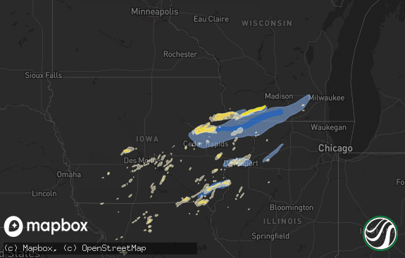
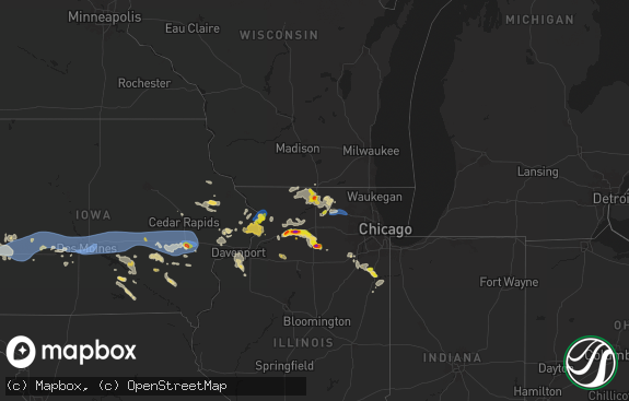
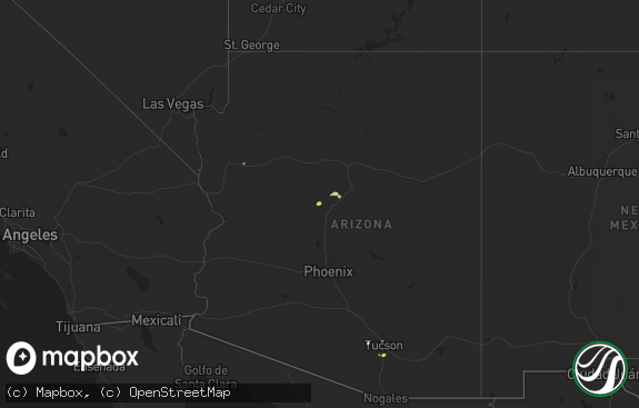
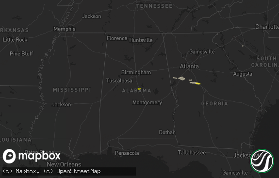
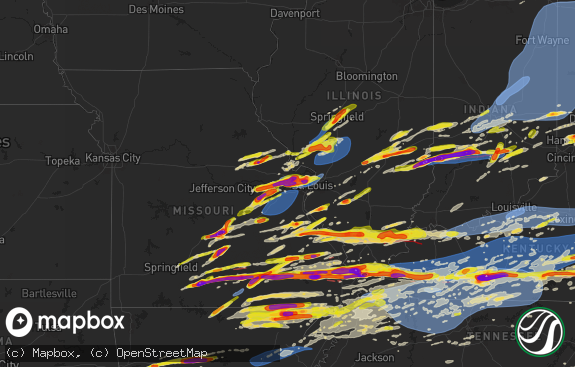
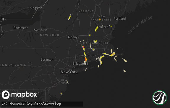
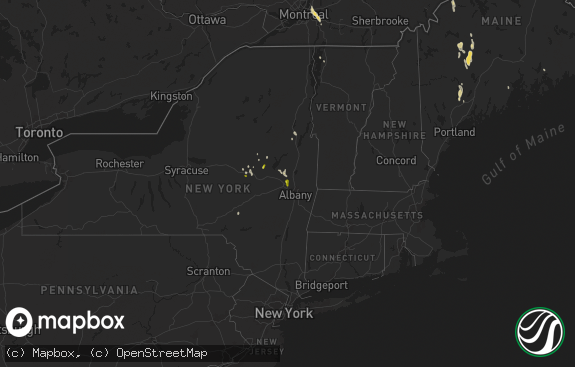
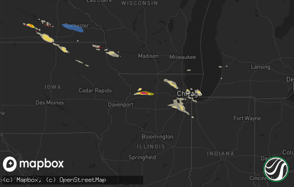
Hail Map in Vermont on July 5, 2020
The weather event in Vermont on July 5, 2020 includes Wind and Hail maps. 33 states and 713 cities were impacted and suffered possible damage. The total estimated number of properties impacted is 0.

Wind
Hail
0
Estimated number of impacted properties by a 1.00" hail or larger0
Estimated number of impacted properties by a 1.75" hail or larger0
Estimated number of impacted properties by a 2.50" hail or largerStorm reports in Vermont
Vermont
| Date | Description |
|---|---|
| 07/05/20206:25 PM CDT | Trees down along rte 5. |
| 07/05/20206:15 PM CDT | Trees/powerlines down near merrill st / will bean rd / stanley rd / east lane / south ridge st / charlestown rd |
| 07/05/20202:55 AM CDT | At 755 PM EDT, a severe thunderstorm was located over Gilsum, or near Keene, moving southeast at 30 mph. HAZARD...60 mph wind gusts and quarter size hail. SOURCE...Radar indicated. IMPACT...Hail damage to vehicles is expected. Expect wind damage to roofs, siding, and trees. Locations impacted include... Keene, Jaffrey, Milford, Hollis, Peterborough, Antrim, Greenfield, Lyndeborough, Dublin, Bennington, Richmond, Harrisville, Nelson, Gilsum, Marlborough, Rindge, Hancock, New Ipswich, Sharon and Walpole.This also includes... Mount Monadnock and North Pack Monadnock. |
| 07/05/20202:19 AM CDT | At 719 PM EDT, a severe thunderstorm was located near Charlestown, or near Bellows Falls, moving southeast at 30 mph. HAZARD...60 mph wind gusts and quarter size hail. SOURCE...Radar indicated. IMPACT...Hail damage to vehicles is expected. Expect wind damage to roofs, siding, and trees. Locations impacted include... Bellows Falls, Saxtons River, Westminster, Rockingham, North Westminster, Hadley Field, Brockways Mills, Bartonsville and Westminster Station. |
| 07/05/20202:18 AM CDT | At 717 PM EDT, a severe thunderstorm was located near Charlestown, or 11 miles southwest of Claremont, moving southeast at 30 mph. HAZARD...60 mph wind gusts and quarter size hail. SOURCE...Radar indicated. IMPACT...Hail damage to vehicles is expected. Expect wind damage to roofs, siding, and trees. Locations impacted include... Keene, Charlestown, Walpole, Gilsum, Marlow, Alstead, Surry, Sullivan, Lempster, Acworth, Langdon and Washington. |
All States Impacted by Hail Map on July 5, 2020
Cities Impacted by Hail Map on July 5, 2020
- Agar, SD
- Belvidere, SD
- Abilene, TX
- Newell, SD
- Capitan, NM
- Cornell, MI
- Escanaba, MI
- Bark River, MI
- Lorenzo, TX
- Kindred, ND
- Leola, SD
- Winter Garden, FL
- Hermosa, SD
- Keystone, SD
- Rapid City, SD
- Tinnie, NM
- Duluth, MN
- Ralph, SD
- Brimson, MN
- High Point, NC
- Grady, NM
- Fort Lauderdale, FL
- Pink Hill, NC
- Beulaville, NC
- Hayes, SD
- Baltimore, MD
- Dundalk, MD
- Essex, MD
- Roberts, MT
- Kadoka, SD
- Philip, SD
- Hopkinsville, KY
- Iron River, WI
- Mason, WI
- Saint Paul, MN
- Meriden, WY
- Murdo, SD
- Foxboro, WI
- Superior, WI
- Nickelsville, VA
- Granbury, TX
- Manville, WY
- Kaycee, WY
- Stoneville, NC
- Mayodan, NC
- Dundee, MS
- Mud Butte, SD
- Corydon, IN
- Verona, VA
- Mount Sidney, VA
- Staunton, VA
- Middle River, MD
- Tupelo, MS
- Saltillo, MS
- Satanta, KS
- Sublette, KS
- San Jon, NM
- Scranton, ND
- Lodgepole, SD
- Ludlow, SD
- Moorcroft, WY
- New Leipzig, ND
- Lead, SD
- Lakin, KS
- Pine Ridge, SD
- Tulare, SD
- Elizabethtown, KY
- Rineyville, KY
- Glendale, KY
- Eastview, KY
- Cecilia, KY
- Lipan, TX
- Saint Xavier, MT
- Redfield, SD
- Purlear, NC
- Fort Pierre, SD
- Nye, MT
- Roscoe, MT
- Fishtail, MT
- Red Lodge, MT
- Gillette, WY
- Belmont, MS
- Golden, MS
- Mantachie, MS
- Guntown, MS
- Baldwyn, MS
- Dennis, MS
- New Site, MS
- Burnsville, MS
- Fulton, MS
- Tishomingo, MS
- Booneville, MS
- Marietta, MS
- Garryowen, MT
- Lodge Grass, MT
- Reva, SD
- Orr, MN
- Cook, MN
- Springfield, TN
- Seven Springs, NC
- Hulett, WY
- Alzada, MT
- Jamestown, NC
- Killdeer, ND
- Dunn Center, ND
- Manning, ND
- Taylor, ND
- Halliday, ND
- Gladstone, ND
- Mott, ND
- Oakes, ND
- Fullerton, ND
- Ramer, TN
- Custer, SD
- Spearfish, SD
- Las Vegas, NM
- Loxahatchee, FL
- Rockledge, FL
- Scenic, SD
- Scottsville, VA
- Elkton, KY
- Elgin, ND
- Carson, ND
- Lidgerwood, ND
- Godwin, NC
- Hackleburg, AL
- Kilgore, TX
- Midland, SD
- Okaton, SD
- Martin, SD
- Wanblee, SD
- Liberty, KY
- Windsor, KY
- Russell Springs, KY
- Summerfield, NC
- Mentone, TX
- Harrold, SD
- Hudson, KY
- Leitchfield, KY
- Garden City, TX
- Sterling City, TX
- Drummond, WI
- Fort Supply, OK
- Buffalo, OK
- Lame Deer, MT
- Birney, MT
- Busby, MT
- Wilson, MI
- Powers, MI
- Sterling, VA
- Reston, VA
- Herndon, VA
- Marlinton, WV
- Campbellsville, KY
- Fort Smith, MT
- Fromberg, MT
- Bridger, MT
- Hill City, SD
- Bradford, AR
- Oil Trough, AR
- Gate City, VA
- Lubbock, TX
- Farmville, VA
- Kingsport, TN
- Lance Creek, WY
- Alva, WY
- Mesquite, TX
- Dallas, TX
- Garland, TX
- Grundy, VA
- Presho, SD
- Culbertson, MT
- Dunnville, KY
- Pioneer, TN
- Pilot Mountain, NC
- Lake Elmo, MN
- Danbury, WI
- Tolstoy, SD
- Bowdle, SD
- Upton, KY
- Hodgenville, KY
- Buffalo, KY
- Mount Sherman, KY
- Sonora, KY
- Magnolia, KY
- Alstead, NH
- Walpole, NH
- Lefor, ND
- Dickinson, ND
- New England, ND
- Carney, MI
- Perronville, MI
- Spalding, MI
- Osceola, AR
- Etowah, AR
- Lepanto, AR
- Pikeville, NC
- Kempner, TX
- Littlefork, MN
- Kennebec, SD
- Linden, TN
- Guernsey, WY
- Crossroads, NM
- Tatum, NM
- Stillwater, MN
- Draper, SD
- Wood, SD
- White River, SD
- Douglas, WY
- Cheyenne, WY
- West Palm Beach, FL
- Dowelltown, TN
- Curtis Bay, MD
- Clarksville, TN
- Lohn, TX
- Hayward, WI
- Ropesville, TX
- Tahoka, TX
- Edgemont, SD
- Scandia, MN
- Chisago City, MN
- Pembroke, KY
- Olmstead, KY
- Russellville, KY
- Hustonville, KY
- Cadiz, KY
- Glen Burnie, MD
- Pasadena, MD
- Fort Sumner, NM
- Cookeville, TN
- Baxter, TN
- Leoti, KS
- Cable, WI
- Weston, WY
- Devils Tower, WY
- Big Spring, TX
- Howes, SD
- Appomattox, VA
- Spout Spring, VA
- Concord, VA
- Tucumcari, NM
- Melrose, NM
- Mcalister, NM
- Wills Point, TX
- Edgewood, TX
- Fruitvale, TX
- Ranger, TX
- Overton, TX
- Henderson, TX
- Portland, TN
- House, NM
- Hohenwald, TN
- Tunica, MS
- Flasher, ND
- Marine On Saint Croix, MN
- Beulah, ND
- Mouth Of Wilson, VA
- Grassy Creek, NC
- Buckeye, WV
- New Haven, KY
- Trenton, KY
- Adams, TN
- Guthrie, KY
- Eastland, TX
- Piney Creek, NC
- Crumpler, NC
- Hinton, OK
- Hobbs, NM
- Buffalo, SD
- Lisbon, ND
- Hosmer, SD
- Weber City, VA
- Zap, ND
- Golden Valley, ND
- Sturgis, KY
- Gunpowder, MD
- Edgewood, MD
- Solon Springs, WI
- Long Lake, SD
- Froid, MT
- Pringle, SD
- Hot Springs, SD
- Buffalo Gap, SD
- Quinwood, WV
- Alexandria, TN
- Richardton, ND
- Wayland, MA
- Sudbury, MA
- Stuarts Draft, VA
- Waynesboro, VA
- Auburn, KY
- Cunningham, TN
- Cumberland Furnace, TN
- Lovington, NM
- Cary, NC
- Verona, ND
- Fort Ransom, ND
- Stirum, ND
- Gwinner, ND
- Faith, SD
- Monticello, KY
- Allensville, KY
- Dungannon, VA
- Fort Blackmore, VA
- Fall Branch, TN
- Limestone, TN
- Minong, WI
- Stow, MA
- Glen Ullin, ND
- Solen, ND
- Stanton, TX
- Tarzan, TX
- Saint Onge, SD
- Roy, NM
- Solano, NM
- Helenwood, TN
- Oneida, TN
- Stoystown, PA
- Somerset, PA
- Friedens, PA
- Abingdon, MD
- Aberdeen, MD
- Belcamp, MD
- Joppa, MD
- Dunn, NC
- Strawn, TX
- Drummonds, TN
- Selby, SD
- Java, SD
- Byers, TX
- Luray, VA
- Stanley, VA
- Hickory, NC
- Hettinger, ND
- Hitchcock, SD
- McLeansville, NC
- Grand Saline, TX
- Knott, TX
- Smithfield, NC
- Selma, NC
- San Saba, TX
- Renick, WV
- Cayuga, ND
- Huntsville, AL
- Greenville, VA
- Steeles Tavern, VA
- Morrilton, AR
- Rosedale, MD
- Raven, VA
- Oakwood, VA
- Huntsville, TN
- Palmyra, VA
- Charlottesville, VA
- Ballard, WV
- Tyler, TX
- Union Center, SD
- Hereford, TX
- Greenville, KY
- Marshall, TX
- Forbes, ND
- Evansville, WY
- Casper, WY
- Glenrock, WY
- Manter, KS
- Dickson, TN
- Breckenridge, TX
- Regent, ND
- Amidon, ND
- Electra, TX
- Nara Visa, NM
- Fort Hood, TX
- Alhambra, IL
- New Douglas, IL
- Weston, MA
- East Walpole, MA
- Wellesley, MA
- Maynard, MA
- Sharon, MA
- Medfield, MA
- Boxborough, MA
- Concord, MA
- Sherborn, MA
- Framingham, MA
- Wellesley Hills, MA
- Harvard, MA
- Acton, MA
- Walpole, MA
- Natick, MA
- Dover, MA
- Westmoreland, TN
- Lafayette, TN
- Newburyport, MA
- Newbury, MA
- White Bluff, TN
- Big Falls, MN
- Hugo, MN
- Horse Branch, KY
- Morgantown, KY
- Caneyville, KY
- Forest Lake, MN
- Crawford, NE
- Mays Landing, NJ
- Saint Jacob, IL
- Marine, IL
- Madison, NC
- Stokesdale, NC
- Sugar Grove, VA
- Franklin, KY
- Lawrenceburg, TN
- Rozet, WY
- Apex, NC
- Plains, TX
- Lismore, MN
- Kenneth, MN
- Hooversville, PA
- Bridgewater, VA
- Mount Solon, VA
- Dillwyn, VA
- Knoxville, TN
- Belle Fourche, SD
- Seminole, TX
- Wall, SD
- Arlington, VA
- Hughes, AR
- Robinsonville, MS
- Lake Cormorant, MS
- Deadwood, SD
- Traphill, NC
- Roaring River, NC
- Vale, NC
- Taiban, NM
- Erin, TN
- Sunnyvale, TX
- Lower Brule, SD
- Raleigh, NC
- Eubank, KY
- Science Hill, KY
- Petrolia, TX
- Temple, OK
- Waurika, OK
- Wichita Falls, TX
- Henrietta, TX
- Vaughn, NM
- Rockwall, TX
- New Salem, ND
- Gainesville, VA
- Nokesville, VA
- Hiltons, VA
- Bristol, VA
- Wilkesboro, NC
- Smithville, TN
- Solgohachia, AR
- Springfield, AR
- Copperas Cove, TX
- Alpha, KY
- Albany, KY
- Cotton, MN
- Clifton Forge, VA
- Wingina, VA
- Buckingham, VA
- Gladstone, VA
- Brickeys, AR
- Watersmeet, MI
- Havana, ND
- Frederick, SD
- Duff, TN
- Clairfield, TN
- Washburn, TN
- Millers Creek, NC
- Hurley, VA
- Kernersville, NC
- Belfast, TN
- Lewisburg, TN
- Elida, NM
- Hebron, ND
- Grand Chenier, LA
- Madison, VA
- Orange, VA
- Idalou, TX
- Isabella, MN
- McGrady, NC
- Ely, MN
- Dupree, SD
- Gettysburg, SD
- Jefferson, NC
- West Jefferson, NC
- Copeland, KS
- Britton, SD
- Brady, TX
- Rochelle, TX
- Owens Cross Roads, AL
- Enderlin, ND
- Hazen, ND
- Two Harbors, MN
- Eagle Butte, SD
- Jamestown, KY
- Falls Of Rough, KY
- Hardinsburg, KY
- Reeder, ND
- Aladdin, WY
- Melbourne, FL
- Merritt Island, FL
- Lebanon, KY
- Chapel Hill, TN
- Mount Crawford, VA
- Murray, KY
- Makinen, MN
- Mcleod, ND
- Edgeley, ND
- Nellysford, VA
- Roseland, VA
- Rutland, ND
- Roswell, NM
- Alvaton, KY
- Bowling Green, KY
- Scottsville, KY
- Adairville, KY
- Deep Gap, NC
- Ferguson, NC
- Boone, NC
- Sweetwater, TX
- Seney, MI
- Manistique, MI
- Roosevelt, OK
- Cogswell, ND
- Pulaski, TN
- Doole, TX
- Pierre, SD
- Chamberlain, SD
- Big Clifty, KY
- Clarkson, KY
- Indian Mound, TN
- Wentzville, MO
- Defiance, MO
- O'Fallon, MO
- Lake Saint Louis, MO
- Loudon, TN
- Greenwood Springs, MS
- Tremont, MS
- Smithville, MS
- Onida, SD
- Burkesville, KY
- Grapevine, TX
- White Plains, KY
- Crofton, KY
- Jacksboro, TN
- Manassas, VA
- Pilgrims Knob, VA
- Bolton, MA
- Chinquapin, NC
- Ulysses, KS
- North Wilkesboro, NC
- Silver Point, TN
- Buffalo Valley, TN
- Bath Springs, TN
- Prospect, TN
- Ardmore, TN
- Seagraves, TX
- Gordon, WI
- Sheldon, ND
- Lamoure, ND
- Ellsworth, NE
- Morganfield, KY
- Harrold, TX
- Middlebrook, VA
- Raphine, VA
- Charleston, TN
- Front Royal, VA
- Morton, TX
- Aberdeen Proving Ground, MD
- Manchester, KY
- Abernathy, TX
- Liberty, TN
- Nettleton, MS
- Westbrook, TX
- Watertown, TN
- Gordonsville, TN
- Crozet, VA
- Amherst, VA
- Raywick, KY
- Wessington, SD
- Lawton, OK
- Bowie, TX
- Goshen, VA
- South Heart, ND
- Mount Olive, NC
- Saginaw, MN
- Rochelle, VA
- Prospect, VA
- Kingston, TN
- Jacksboro, TX
- Riceville, TN
- McEwen, TN
- Clifton, TN
- Marianna, AR
- Friona, TX
- Vineland, NJ
- Franklin, WV
- Circleville, WV
- Glade Valley, NC
- Phelps, WI
- Richlands, NC
- Wallace, NC
- Blunt, SD
- Saint Lawrence, SD
- Havre De Grace, MD
- Harrisonburg, VA
- Broadway, VA
- Davenport, VA
- Saint Charles, MO
- Terrell, TX
- Canyon, MN
- Mooreville, MS
- Brownfield, TX
- Meadow, TX
- Wolfforth, TX
- Leavenworth, IN
- Newton Grove, NC
- Newport, AR
- Chester, VT
- Bellows Falls, VT
- Springfield, VT
- Newcastle, WY
- Wytheville, VA
- Lenoir City, TN
- Athens, TN
- Norwood, MA
- Needham, MA
- Westwood, MA
- Millis, MA
- Newport, MN
- Deerfield, VA
- Craigsville, VA
- Tannersville, VA
- Sparta, TN
- Smiths Grove, KY
- Flower Mound, TX
- Laneville, TX
- Wyndmere, ND
- Leonard, ND
- Forman, ND
- Elkin, NC
- Thurmond, NC
- Forney, TX
- Royse City, TX
- Mineral Wells, TX
- Pleasantville, NJ
- Absecon, NJ
- Egg Harbor Township, NJ
- Atlantic City, NJ
- Stafford, VA
- Quantico, VA
- Hudson, MA
- Nelson, NH
- Lake Worth, FL
- Lancaster, MA
- Floydada, TX
- Box Elder, SD
- Rowlett, TX
- Central City, KY
- Summersville, KY
- Burgaw, NC
- Spur, TX
- Crosbyton, TX
- Creston, NC
- Ovalo, TX
- Caddo, TX
- Hillsboro, WV
- Decatur, TN
- Lenorah, TX
- Fairburn, SD
- West Augusta, VA
- Walcott, ND
- Stephenson, MI
- Sparrows Point, MD
- Hialeah, FL
- Elk Creek, VA
- Langsville, OH
- Red Bay, AL
- Monterey, VA
- Arp, TX
- Troup, TX
- Rice, VA
- Aberdeen, SD
- Centerville, TN
- Saltillo, TN
- Morris Chapel, TN
- Turrell, AR
- Millington, TN
- Frenchmans Bayou, AR
- Denver City, TX
- Baird, TX
- Westport, SD
- Columbia, SD
- White Owl, SD
- Caputa, SD
- Owanka, SD
- Enning, SD
- New Underwood, SD
- Wasta, SD
- Ayer, MA
- Devens, MA
- Lincoln, MA
- Bel Air, MD
- South Range, WI
- Ashland, MT
- Greenville, ME
- Eureka, SD
- Almont, ND
- Noonan, ND
- Crosby, ND
- Columbus, ND
- Rileyville, VA


