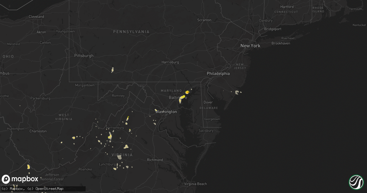
Hail Map on July 5, 2020
Get this storm
July 5 map
$229
one time, instant access
Download today. No call, no setup
Keep the $229
Bought the map and want the full workflow? Apply the entire $229 to a subscription within 7 days. None of it is wasted.
Every map, not just this one
This buys you this map. Subscription and you get every map we run, in the markets you choose from a few cities to whole states to nationwide. Plus real-time alerts the moment a storm fires.
Contact data
Name, contact info, occupancy, even credit band for addresses in the footprint. You go from where it hit to who to call.
Become the source they trust
Unlimited branding weather history reports on demand. You already have the documented answer ready for the property owner, and you are the one who showed up with it.
Property data and RoofTrace estimates
Pull up any address you have got, its value and the exact code rules for that jurisdiction, straight from One Click Code. Then RoofTrace estimates the squares, pitch, and roof value, priced the way you price.
States Impacted by Hail Map on July 5, 2020
Storm reports
Vermont
| Date | Description |
|---|---|
| 07/05/20206:25 PM CDT | Trees down along rte 5. |
| 07/05/20206:15 PM CDT | Trees/powerlines down near merrill st / will bean rd / stanley rd / east lane / south ridge st / charlestown rd |
| 07/05/20202:55 AM CDT | At 755 PM EDT, a severe thunderstorm was located over Gilsum, or near Keene, moving southeast at 30 mph. HAZARD...60 mph wind gusts and quarter size hail. SOURCE...Radar indicated. IMPACT...Hail damage to vehicles is expected. Expect wind damage to roofs, siding, and trees. Locations impacted include... Keene, Jaffrey, Milford, Hollis, Peterborough, Antrim, Greenfield, Lyndeborough, Dublin, Bennington, Richmond, Harrisville, Nelson, Gilsum, Marlborough, Rindge, Hancock, New Ipswich, Sharon and Walpole.This also includes... Mount Monadnock and North Pack Monadnock. |
| 07/05/20202:19 AM CDT | At 719 PM EDT, a severe thunderstorm was located near Charlestown, or near Bellows Falls, moving southeast at 30 mph. HAZARD...60 mph wind gusts and quarter size hail. SOURCE...Radar indicated. IMPACT...Hail damage to vehicles is expected. Expect wind damage to roofs, siding, and trees. Locations impacted include... Bellows Falls, Saxtons River, Westminster, Rockingham, North Westminster, Hadley Field, Brockways Mills, Bartonsville and Westminster Station. |
| 07/05/20202:18 AM CDT | At 717 PM EDT, a severe thunderstorm was located near Charlestown, or 11 miles southwest of Claremont, moving southeast at 30 mph. HAZARD...60 mph wind gusts and quarter size hail. SOURCE...Radar indicated. IMPACT...Hail damage to vehicles is expected. Expect wind damage to roofs, siding, and trees. Locations impacted include... Keene, Charlestown, Walpole, Gilsum, Marlow, Alstead, Surry, Sullivan, Lempster, Acworth, Langdon and Washington. |
South Dakota
| Date | Description |
|---|---|
| 07/05/20206:54 PM CDT | Mesonet station 54 reliance |
| 07/05/20206:35 PM CDT | A local report indicates 60 MPH wind near 12 NW IDEAL |
| 07/05/20206:07 PM CDT | A local report indicates 71 MPH wind near 3 NW WASTA |
| 07/05/20206:00 PM CDT | A local report indicates 60 MPH wind near 12 NNE WHITE RIVER |
| 07/05/20205:55 PM CDT | A local report indicates 60 MPH wind near 8 SW VIVIAN |
| 07/05/20205:38 PM CDT | A local report indicates 1.25 inch wind near 7 SSW HARROLD |
| 07/05/20205:26 PM CDT | A local report indicates 1.75 inch wind near 8 W HERMOSA |
| 07/05/20205:26 PM CDT | A local report indicates 2.00 inch wind near 5 WNW HERMOSA |
| 07/05/20205:22 PM CDT | Estimated over 70 mph winds. Winds stayed strong for around 30 minutes. 3 foot diameter tree downed. |
| 07/05/20205:22 PM CDT | A local report indicates 1.50 inch wind near 7 W HERMOSA |
| 07/05/20205:20 PM CDT | Cornfield completely destroyed due to wind damage. |
| 07/05/20205:20 PM CDT | Semi truck blown over. |
| 07/05/20205:19 PM CDT | Pea sized hail also reported. |
| 07/05/20205:15 PM CDT | A local report indicates 90 MPH wind near MURDO |
| 07/05/20205:09 PM CDT | A local report indicates 1.00 inch wind near 1 NE KEYSTONE |
| 07/05/20204:51 PM CDT | Mostly dimes |
| 07/05/20204:40 PM CDT | A local report indicates 1.00 inch wind near 7 E ROCKERVILLE |
| 07/05/20204:35 PM CDT | A local report indicates 2.50 inch wind near 1 E ROCKERVILLE |
| 07/05/20204:25 PM CDT | A local report indicates 60 MPH wind near 1 N BELVIDERE |
| 07/05/20204:23 PM CDT | A local report indicates 1.25 inch wind near 4 SW DWTN RAPID CITY |
| 07/05/20204:17 PM CDT | A local report indicates 1.50 inch wind near 5 SW DWTN RAPID CITY |
| 07/05/20204:13 PM CDT | A local report indicates 1.00 inch wind near 5 SW DWTN RAPID CITY |
| 07/05/20204:13 PM CDT | A local report indicates 1.00 inch wind near 5 SW DWTN RAPID CITY |
| 07/05/20204:03 PM CDT | A local report indicates 1.00 inch wind near 3 N SHERIDAN LAKE |
| 07/05/20204:00 PM CDT | A local report indicates 2.00 inch wind near 2 S PACTOLA RESV |
| 07/05/20203:57 PM CDT | A local report indicates 1.00 inch wind near PACTOLA RESV |
| 07/05/20201:10 PM CDT | 5 minutes of quarter sized hail... 0.60 inch rainfall... And winds about 30 mph... But no damage. |
| 07/05/20207:30 AM CDT | At 1230 AM CDT, a severe thunderstorm was located near Pleasant Valley Country Church, or 22 miles south of Miller, moving southeast at 25 mph. HAZARD...60 mph wind gusts and half dollar size hail. SOURCE...Radar indicated. IMPACT...Hail damage to vehicles is expected. Expect wind damage to roofs, siding, and trees. This severe thunderstorm will remain over mainly rural areas of southwestern Beadle and western Jerauld Counties. |
| 07/05/20207:00 AM CDT | At 1200 AM CDT, a severe thunderstorm was located 7 miles northeast of Highmore, moving southeast at 40 mph. HAZARD...60 mph wind gusts and half dollar size hail. SOURCE...Radar indicated. IMPACT...Hail damage to vehicles is expected. Expect wind damage to roofs, siding, and trees. This severe thunderstorm will be near... Ree Heights around 1210 AM CDT. Miller Dale Colony around 1225 AM CDT. |
| 07/05/20204:42 AM CDT | At 942 PM MDT, severe thunderstorms were located along a line extending from 3 miles northwest of Union Center to 7 miles north of Creighton, moving northeast at 45 mph. HAZARD...60 mph wind gusts and penny size hail. SOURCE...Radar indicated. IMPACT...Expect damage to roofs, siding, and trees. Severe thunderstorms will be near... Red Owl around 1000 PM MDT. Howes around 1005 PM MDT. Opal around 1015 PM MDT. Takini School around 1020 PM MDT. |
| 07/05/20204:19 AM CDT | At 919 PM CDT, a severe thunderstorm was located near Columbia, or 9 miles northeast of Aberdeen, moving southeast at 30 mph. HAZARD...70 mph wind gusts. SOURCE...Radar indicated. IMPACT...Expect considerable tree damage. Damage is likely to mobile homes, roofs, and outbuildings. This severe thunderstorm will be near... Bath around 930 PM CDT. Putney around 940 PM CDT. Groton around 950 PM CDT. |
| 07/05/20204:08 AM CDT | At 908 PM MDT, a severe thunderstorm was located over Dears Ears Butte, or 39 miles northeast of Belle Fourche, moving southeast at 20 mph. HAZARD...Quarter size hail. SOURCE...Radar indicated. IMPACT...Damage to vehicles is expected. This severe thunderstorm will remain over mainly rural areas of northeastern Butte County east of Castle Rock. |
| 07/05/20203:55 AM CDT | At 854 PM MDT, severe thunderstorms were located along a line extending from near Ellsworth Air Force Base to near New Underwood to 7 miles southwest of Owanka, moving northeast at 35 mph. HAZARD...60 mph wind gusts and penny size hail. SOURCE...Radar indicated. IMPACT...Expect damage to roofs, siding, and trees. Severe thunderstorms will be near... Owanka and Viewfield around 905 PM MDT. Curlew Lake around 910 PM MDT. Wicksville around 915 PM MDT. Hereford around 925 PM MDT. Elm Springs around 930 PM MDT. Union Center around 955 PM MDT.This includes Interstate 90 in South Dakota between Mile Markers 67and 95. |
| 07/05/20203:47 AM CDT | At 847 PM MDT, a severe thunderstorm was located over Brownsville, or 5 miles south of Lead, moving northeast at 20 mph. HAZARD...60 mph wind gusts and quarter size hail. SOURCE...Radar indicated. IMPACT...Hail damage to vehicles is expected. Expect wind damage to roofs, siding, and trees. This severe thunderstorm will be near... Brownsville around 850 PM MDT. Lead and Deadwood around 900 PM MDT. Galena around 905 PM MDT. Sturgis and Whitewood around 925 PM MDT. Fort Meade around 930 PM MDT.This includes Interstate 90 in South Dakota between Mile Markers 20and 40. |
| 07/05/20203:44 AM CDT | At 843 PM CDT, a severe thunderstorm was located over Deerfield Colony, or 10 miles northeast of Ipswich, moving southeast at 20 mph. HAZARD...60 mph wind gusts and nickel size hail. SOURCE...Radar indicated. IMPACT...Expect damage to roofs, siding, and trees. This severe thunderstorm will be near... Long Lake Colony around 850 PM CDT. Mina Lake Rec Area around 915 PM CDT. Mina around 920 PM CDT. |
| 07/05/20203:30 AM CDT | At 830 PM CDT, a severe thunderstorm was located 8 miles north of Tolstoy, or 25 miles southeast of Selby, moving southeast at 15 mph. HAZARD...60 mph wind gusts and quarter size hail. SOURCE...Radar indicated. IMPACT...Hail damage to vehicles is expected. Expect wind damage to roofs, siding, and trees. This severe thunderstorm will be near... Onaka around 905 PM CDT. Loyalton around 915 PM CDT. |
| 07/05/20203:24 AM CDT | At 824 PM MDT, a severe thunderstorm was located 5 miles northeast of Badlands National Park, or 42 miles southwest of Philip, moving northeast at 25 mph. HAZARD...Half dollar size hail. SOURCE...Radar indicated. IMPACT...Damage to vehicles is expected. This severe thunderstorm will be near... Pinnacles Ranger Station around 855 PM MDT. Delta 9 Missile Silo around 910 PM MDT. Quinn around 915 PM MDT.This includes Interstate 90 in South Dakota between Mile Markers 107and 124. |
| 07/05/20203:19 AM CDT | At 819 PM MDT, a severe thunderstorm was located 5 miles north of Haystack Buttes, or 30 miles south of Buffalo, moving southeast at 20 mph. HAZARD...Quarter size hail. SOURCE...Radar indicated. IMPACT...Damage to vehicles is expected. This severe thunderstorm will be near... Hoover around 845 PM MDT. Dears Ears Butte around 905 PM MDT. |
| 07/05/20203:12 AM CDT | At 811 PM CDT, a severe thunderstorm was located near Leola, or 15 miles north of Ipswich, moving northeast at 15 mph. HAZARD...60 mph wind gusts. SOURCE...Radar indicated. IMPACT...Expect damage to roofs, siding, and trees. This severe thunderstorm will be near... Leola around 835 PM CDT. |
| 07/05/20203:10 AM CDT | At 810 PM MDT, a severe thunderstorm was located 9 miles north of Alva, or 29 miles north of Sundance, moving southeast at 30 mph. HAZARD...Ping pong ball size hail. SOURCE...Radar indicated. IMPACT...People and animals outdoors will be injured. Expect damage to roofs, siding, windows, and vehicles. This severe thunderstorm will be near... Alva around 825 PM MDT. Bear Lodge Campground around 840 PM MDT. Aladdin around 855 PM MDT. Beulah around 910 PM MDT.This includes Interstate 90 in Wyoming between Mile Markers 199 and206. |
| 07/05/20203:04 AM CDT | At 804 PM CDT, a severe thunderstorm was located 7 miles south of Bowdle, or 21 miles southeast of Selby, moving southeast at 10 mph. HAZARD...60 mph wind gusts and quarter size hail. SOURCE...Radar indicated. IMPACT...Hail damage to vehicles is expected. Expect wind damage to roofs, siding, and trees. This severe thunderstorm will remain over mainly rural areas of southwestern Edmunds and east central Walworth Counties. |
| 07/05/20203:00 AM CDT | At 758 PM MDT, severe thunderstorms were located along a line extending from near Flag Mountain to Custer State Park to 6 miles northeast of Buffalo Gap, moving northeast at 40 mph. HAZARD...70 mph wind gusts and quarter size hail. SOURCE...Radar indicated. This line of storms has a history of producing winds in excess of 70 mph. IMPACT...Hail damage to vehicles is expected. Expect considerable tree damage. Wind damage is also likely to mobile homes, roofs, and outbuildings. Severe thunderstorms will be near... Mount Rushmore National Memorial around 805 PM MDT. Keystone, Silver City, and Fairburn around 810 PM MDT. Rockerville, Roubaix Lake and Pactola Reservoir around 815 PM MDT. Nemo and Hermosa around 820 PM MDT. Rapid City, Dalton Lake, Hart Ranch and Reptile Gardens around 825 PM MDT. Rapid City Airport around 835 PM MDT. Box Elder and Caputa around 840 PM MDT.This includes Interstate 90 in South Dakota between Mile Markers 34and 80. |
| 07/05/20202:57 AM CDT | At 756 PM MDT, severe thunderstorms were located along a line extending from 11 miles west of Rockypoint to 3 miles southwest of Carlile, moving northeast at 35 mph. HAZARD...Half dollar size hail. SOURCE...Radar indicated. IMPACT...Damage to vehicles is expected. Severe thunderstorms will be near... Rockypoint around 810 PM MDT. Devils Tower National Monument around 815 PM MDT. Lightning Flat around 820 PM MDT. Hulett around 830 PM MDT. |
| 07/05/20202:53 AM CDT | At 753 PM CDT, a severe thunderstorm was located near Long Lake, or 17 miles south of Ashley, moving southeast at 15 mph. HAZARD...60 mph wind gusts and quarter size hail. SOURCE...Radar indicated. IMPACT...Hail damage to vehicles is expected. Expect wind damage to roofs, siding, and trees. This severe thunderstorm will remain over mainly rural areas of central McPherson County. |
| 07/05/20202:50 AM CDT | At 749 PM CDT, severe thunderstorms were located along a line extending from 8 miles south of Pleasant Valley Country Church to 8 miles south of Gann Valley to 9 miles southwest of Kimball, moving east at 30 mph. HAZARD...60 mph wind gusts and nickel size hail. SOURCE...Surface observation station. IMPACT...Expect damage to roofs, siding, and trees. Severe thunderstorms will be near... Kimball around 810 PM CDT. Grass Ranch Colony around 815 PM CDT. Wessington Springs around 825 PM CDT. White Lake around 830 PM CDT. Lane around 840 PM CDT. Plankinton, Alpena and Storla around 845 PM CDT. |
| 07/05/20202:29 AM CDT | At 728 PM MDT, a severe thunderstorm was located 7 miles east of Intersection of Red Shirt and Cuny Table Roads, or 34 miles north of Pine Ridge, moving northeast at 25 mph. HAZARD...60 mph wind gusts and quarter size hail. SOURCE...Radar indicated. IMPACT...Hail damage to vehicles is expected. Expect wind damage to roofs, siding, and trees. This severe thunderstorm will remain over mainly rural areas of northwestern Oglala Lakota County between Red Shirt and Rockyford. |
| 07/05/20202:20 AM CDT | At 719 PM MDT, severe thunderstorms were located along a line extending from 5 miles northeast of Osage to 5 miles north of Elk Mountain Lookout to 7 miles northeast of Dewey, moving northeast at 45 mph. HAZARD...70 mph wind gusts and quarter size hail. SOURCE...Radar indicated. IMPACT...Hail damage to vehicles is expected. Expect considerable tree damage. Wind damage is also likely to mobile homes, roofs, and outbuildings. Locations impacted include... Newcastle, Custer, Hill City, Keystone, Silver City, Rochford, Mystic, Moon, Four Corners, Deerfield Reservoir, Mount Rushmore National Memorial, Crazy Horse Memorial, Sheridan Lake, Bear Mountain Lookout, and Mallo Camp. |
| 07/05/20202:15 AM CDT | At 714 PM CDT, a severe thunderstorm was located over Fort Thompson, moving east at 20 mph. HAZARD...60 mph wind gusts. SOURCE...Trained weather spotters. At 704 pm CDT a 59 mph wind gust was reported one mile northeast of Stephan. IMPACT...Expect damage to roofs, siding, and trees. This severe thunderstorm will be near... Lees Corner around 735 PM CDT. Etbauer Hill and Crow Creek Housing around 755 PM CDT. Shelby around 800 PM CDT. Gann Valley around 830 PM CDT. |
| 07/05/20202:07 AM CDT | At 706 PM CDT, severe thunderstorms were located along a line extending from Tailrace Rec Area to near Dude Ranch to near Hamill, moving southeast at 30 mph. HAZARD...70 mph wind gusts and nickel size hail. SOURCE...Surface observation station. IMPACT...Expect considerable tree damage. Damage is likely to mobile homes, roofs, and outbuildings. Severe thunderstorms will be near... Lake Francis Case around 710 PM CDT. Chamberlain around 720 PM CDT.Other locations impacted by these severe thunderstorms includePukwana. |
| 07/05/20201:42 AM CDT | At 642 PM CDT, severe thunderstorms were located along a line extending from 6 miles north of Byre Lake to near Kennebec to 6 miles north of Ideal, moving east at 25 mph. HAZARD...60 mph wind gusts and penny size hail. SOURCE...Radar indicated. IMPACT...Expect damage to roofs, siding, and trees. Severe thunderstorms will be near... Lyman around 655 PM CDT. Reliance and Medicine Butte around 710 PM CDT. Counselor Creek Boat Access Area around 720 PM CDT. Lake Francis Case around 725 PM CDT. Oacoma and Dude Ranch around 735 PM CDT. Iona around 750 PM CDT. |
| 07/05/20201:39 AM CDT | At 638 PM MDT, a severe thunderstorm was located 6 miles north of East Short Pines, or 11 miles southwest of Buffalo, moving northeast at 20 mph. HAZARD...Tennis ball size hail and 60 mph wind gusts. SOURCE...Radar indicated. IMPACT...People and animals outdoors will be injured. Expect hail damage to roofs, siding, windows, and vehicles. Expect wind damage to roofs, siding, and trees. This severe thunderstorm will be near... Lake Gardner around 710 PM MDT. Buffalo around 715 PM MDT. |
| 07/05/20201:35 AM CDT | At 634 PM CDT, severe thunderstorms were located along a line extending from Byre Lake to 6 miles northwest of Ideal, moving east at 25 mph. HAZARD...70 mph wind gusts and quarter size hail. SOURCE...Radar indicated. IMPACT...Hail damage to vehicles is expected. Expect considerable tree damage. Wind damage is also likely to mobile homes, roofs, and outbuildings. Severe thunderstorms will be near... Ideal around 650 PM CDT. Hamill around 710 PM CDT. |
| 07/05/20201:32 AM CDT | At 632 PM CDT, a severe thunderstorm was located near Zell, or 7 miles west of Redfield, moving southeast at 15 mph. HAZARD...60 mph wind gusts and quarter size hail. SOURCE...Radar indicated. IMPACT...Hail damage to vehicles is expected. Expect wind damage to roofs, siding, and trees. This severe thunderstorm will be near... Cottonwood Lake around 640 PM CDT. Redfield around 650 PM CDT. Twin Lakes around 705 PM CDT. Tulare around 715 PM CDT. Spottswood around 730 PM CDT. |
| 07/05/20201:27 AM CDT | At 626 PM MDT, a severe thunderstorm was located 6 miles west of Ralph, or 20 miles northeast of Buffalo, moving northeast at 20 mph. HAZARD...60 mph wind gusts and half dollar size hail. SOURCE...Radar indicated. IMPACT...Hail damage to vehicles is expected. Expect wind damage to roofs, siding, and trees. This severe thunderstorm will be near... Ralph around 640 PM MDT. |
| 07/05/20201:19 AM CDT | At 618 PM MDT, a severe thunderstorm was located 9 miles northeast of Hay Canyon Butte, or 24 miles east of Hot Springs, moving northeast at 20 mph. HAZARD...Ping pong ball size hail. SOURCE...Radar indicated. IMPACT...People and animals outdoors will be injured. Expect damage to roofs, siding, windows, and vehicles. This severe thunderstorm will be near... Intersection of Red Shirt and Cuny Table Roads around 655 PM MDT. Red Shirt Table Overlook around 705 PM MDT. |
| 07/05/20201:07 AM CDT | At 607 PM CDT, a severe thunderstorm was located near Zell, or 9 miles northwest of Redfield, moving east at 20 mph. HAZARD...60 mph wind gusts and quarter size hail. SOURCE...Radar indicated. IMPACT...Hail damage to vehicles is expected. Expect wind damage to roofs, siding, and trees. This severe thunderstorm will be near... Athol around 620 PM CDT. Redfield around 630 PM CDT. Ashton around 635 PM CDT. |
| 07/05/202012:53 AM CDT | At 553 PM CDT, severe thunderstorms were located along a line extending from near Vivian to 11 miles southwest of 5 Mile Corner to 10 miles east of Westover to near Intersection of Highway 83 and White River, moving east at 30 mph. HAZARD...70 mph wind gusts and quarter size hail. SOURCE...Radar indicated. IMPACT...Hail damage to vehicles is expected. Expect considerable tree damage. Wind damage is also likely to mobile homes, roofs, and outbuildings. Severe thunderstorms will be near... Vivian around 600 PM CDT. 5 Mile Corner around 605 PM CDT. Presho around 615 PM CDT. Fate Dam and Earling Hills around 620 PM CDT. Kennebec and Byre Lake around 635 PM CDT. |
| 07/05/202012:47 AM CDT | At 547 PM CDT, severe thunderstorms were located along a line extending from 7 miles northeast of Draper to 7 miles southwest of Vivian to 5 miles southeast of Cedar Butte, moving east at 30 mph. HAZARD...70 mph wind gusts and quarter size hail. SOURCE...Radar indicated. IMPACT...Hail damage to vehicles is expected. Expect considerable tree damage. Wind damage is also likely to mobile homes, roofs, and outbuildings. Severe thunderstorms will be near... White River around 605 PM CDT. Wood around 640 PM CDT. |
| 07/05/202012:42 AM CDT | At 541 PM CDT, a severe thunderstorm was located near Cedar Creek Rec Area, or 13 miles north of Presho, moving east at 15 mph. HAZARD...60 mph wind gusts and quarter size hail. SOURCE...Radar indicated. IMPACT...Hail damage to vehicles is expected. Expect wind damage to roofs, siding, and trees. This severe thunderstorm will be near... Cedar Creek Rec Area around 555 PM CDT. Joe Creek Rec Area around 625 PM CDT. |
| 07/05/202012:31 AM CDT | At 531 PM MDT, a severe thunderstorm was located 8 miles east of Buffalo, moving northeast at 15 mph. HAZARD...60 mph wind gusts and half dollar size hail. SOURCE...Radar indicated. IMPACT...Hail damage to vehicles is expected. Expect wind damage to roofs, siding, and trees. This severe thunderstorm will be near... Northwestern Slim Buttes around 620 PM MDT. Ralph around 630 PM MDT. |
| 07/05/202012:19 AM CDT | At 518 PM CDT, a severe thunderstorm was located near Draper, or near Murdo, moving east at 25 mph. HAZARD...60 mph wind gusts and quarter size hail. SOURCE...Radar indicated. IMPACT...Hail damage to vehicles is expected. Expect wind damage to roofs, siding, and trees. This severe thunderstorm will be near... Draper around 530 PM CDT. Vivian around 555 PM CDT. |
| 07/05/202012:04 AM CDT | A local report indicates 70 MPH wind near 1 NNE FAITH |
| 07/04/202011:56 PM CDT | A local report indicates 60 MPH wind near 1 NNE FAITH |
| 07/04/202011:36 PM CDT | At 436 PM CDT/336 PM MDT/, a severe thunderstorm was located 7 miles south of Capa, or 17 miles northwest of Murdo, moving northeast at 25 mph. HAZARD...60 mph wind gusts and quarter size hail. SOURCE...Radar indicated. IMPACT...Hail damage to vehicles is expected. Expect wind damage to roofs, siding, and trees. This severe thunderstorm will be near... Capa around 450 PM CDT. Van Metre around 510 PM CDT. |
| 07/04/202011:24 PM CDT | At 424 PM CDT/324 PM MDT/, a severe thunderstorm was located 7 miles southeast of Van Metre, or 12 miles north of Murdo, moving northeast at 15 mph. HAZARD...60 mph wind gusts and quarter size hail. SOURCE...Radar indicated. IMPACT...Hail damage to vehicles is expected. Expect wind damage to roofs, siding, and trees. This severe thunderstorm will remain over mainly rural areas of northeastern Jones and south central Stanley Counties. |
| 07/04/202011:24 PM CDT | At 424 PM CDT, a severe thunderstorm was located 7 miles northeast of Wentworth, or 11 miles northeast of Madison, moving east at 15 mph. HAZARD...60 mph wind gusts and quarter size hail. SOURCE...Radar indicated. IMPACT...Hail damage to vehicles is expected. Expect wind damage to roofs, siding, and trees. This severe thunderstorm will remain over mainly rural areas of northwestern Moody and east central Lake Counties. |
| 07/04/202011:07 PM CDT | At 407 PM MDT, a severe thunderstorm was located near Keystone, or 9 miles southeast of Hill City, moving southeast at 20 mph. HAZARD...Ping pong ball size hail. SOURCE...Radar indicated. IMPACT...People and animals outdoors will be injured. Expect damage to roofs, siding, windows, and vehicles. This severe thunderstorm will be near... Hayward around 415 PM MDT. Legion Lake around 420 PM MDT. State Game Lodge around 425 PM MDT. Hermosa around 435 PM MDT. Fairburn around 500 PM MDT. |
| 07/04/202010:45 PM CDT | Winds gusted to 50 to 60 mph |
| 07/04/202010:27 PM CDT | A local report indicates 59 MPH wind near 1 SE STURGIS |
| 07/04/202010:20 PM CDT | A local report indicates 60 MPH wind near 14 SE HOOVER |
| 07/04/202010:19 PM CDT | A local report indicates 61 MPH wind near ELLSWORTH AFB |
| 07/04/202010:19 PM CDT | At 319 PM MDT/419 PM CDT/, a severe thunderstorm was located 5 miles north of Belvidere, or 14 miles east of Kadoka, moving northeast at 35 mph. HAZARD...60 mph wind gusts and quarter size hail. SOURCE...Radar indicated. IMPACT...Hail damage to vehicles is expected. Expect wind damage to roofs, siding, and trees. This severe thunderstorm will be near... Midland around 340 PM MDT.This includes Interstate 90 in South Dakota between Mile Markers 159and 174. |
| 07/04/202010:10 PM CDT | At 309 PM MDT, a severe thunderstorm was located 3 miles northeast of Sheridan Lake, or 8 miles northeast of Hill City, moving southeast at 15 mph. HAZARD...Hail up to golf ball size hail. The largest hail should stay southwest of Rapid City. SOURCE...Radar indicated. IMPACT...People and animals outdoors will be injured. Expect damage to roofs, siding, windows, and vehicles. This severe thunderstorm will be near... Rockerville around 330 PM MDT. Southern Rapid City around 335 PM MDT. Bear Country and Reptile Gardens around 340 PM MDT. Hayward around 350 PM MDT. Hart Ranch around 355 PM MDT. Black Gap around 400 PM MDT. |
| 07/04/202010:08 PM CDT | A local report indicates 61 MPH wind near 3 NW WASTA |
| 07/04/20209:58 PM CDT | A local report indicates 66 MPH wind near 5 WNW NEW UNDERWOOD |
| 07/04/20209:49 PM CDT | At 249 PM MDT, a severe thunderstorm was located over Pactola Reservoir, or 10 miles northeast of Hill City, moving southeast at 10 mph. HAZARD...Golf ball size hail. SOURCE...Radar indicated. IMPACT...People and animals outdoors will be injured. Expect damage to roofs, siding, windows, and vehicles. This severe thunderstorm will be near... Johnson Siding around 300 PM MDT. Sheridan Lake around 310 PM MDT. Hisega around 315 PM MDT.This includes Interstate 90 in South Dakota near Mile Marker 54. |
| 07/04/20209:48 PM CDT | A local report indicates 58 MPH wind near RAPID CITY ARPT |
| 07/04/20209:40 PM CDT | 96 foot hay barn destroyed and fell on vehicles...lost a few cottonwood trees as well...time estimated via radar |
| 07/04/20209:25 PM CDT | A local report indicates 60 MPH wind near 9 ESE SCENIC |
| 07/04/20209:22 PM CDT | Asos station kabr aberdeen rgnl ap. |
| 07/04/20209:20 PM CDT | A local report indicates 1.00 inch wind near 12 WNW HOOVER |
| 07/04/20209:00 PM CDT | A local report indicates 70 MPH wind near 4 W RAPID CITY ARPT |
| 07/04/20208:57 PM CDT | A local report indicates 61 MPH wind near 2 SSW CUSTER |
| 07/04/20208:40 PM CDT | A local report indicates 60 MPH wind near 1 SW ARGYLE |
| 07/04/20208:39 PM CDT | A local report indicates 59 MPH wind near 8 W JEWEL CAVE |
| 07/04/20208:29 PM CDT | A local report indicates 77 MPH wind near 8 W JEWEL CAVE |
| 07/04/20208:19 PM CDT | A local report indicates 75 MPH wind near 8 W JEWEL CAVE |
| 07/04/20208:18 PM CDT | Mesonet station 214 sd rwis plankinton. |
| 07/04/20208:16 PM CDT | A local report indicates 75 MPH wind near 7 S BOWDLE |
| 07/04/20208:14 PM CDT | A local report indicates 62 MPH wind near 10 W EDGEMONT |
| 07/04/20208:05 PM CDT | At 104 PM CDT, a severe thunderstorm was located near Spottswood, or 20 miles east of Miller, moving east at 30 mph. HAZARD...60 mph wind gusts and quarter size hail. SOURCE...Radar indicated. IMPACT...Hail damage to vehicles is expected. Expect wind damage to roofs, siding, and trees. This severe thunderstorm will be near... Hitchcock around 125 PM CDT.Other locations impacted by this severe thunderstorm includeBroadland. |
| 07/04/20208:04 PM CDT | Mesonet station 201 gann valley |
| 07/04/20208:04 PM CDT | Mesonet station 216 bowdle |
| 07/04/20207:54 PM CDT | Mesonet station 201 gann valley |
| 07/04/20207:44 PM CDT | Mesonet station 201 gann valley |
| 07/04/20207:40 PM CDT | A local report indicates 1.00 inch wind near 8 ENE HARDING |
| 07/04/20207:35 PM CDT | A local report indicates 1.50 inch wind near 7 N RALPH |
| 07/04/20207:20 PM CDT | A local report indicates 2.00 inch wind near 4 N RALPH |
| 07/04/20207:15 PM CDT | A local report indicates 60 MPH wind near 1 WSW CHAMBERLAIN |
| 07/04/20207:07 PM CDT | A local report indicates 1.25 inch wind near 4 SW HARDING |
| 07/04/20207:04 PM CDT | Mesonet station 54 reliance |
| 07/04/20207:04 PM CDT | Mesonet station 183 mac''s corner |
Minnesota
| Date | Description |
|---|---|
| 07/05/20206:20 PM CDT | Time estimated by radar. |
| 07/05/20204:23 PM CDT | Hail ranging from pea sized to 1-1.5 inches. |
| 07/05/20204:20 PM CDT | Pea to one and one-half inch hail. |
| 07/05/20204:15 PM CDT | Tree on roadway. Time estimated by radar. |
| 07/05/20203:15 PM CDT | Reported at 4284 turner road... Duluth... Mn. |
| 07/05/20207:38 AM CDT | At 1238 PM CDT, a severe thunderstorm was located 7 miles northwest of Two Harbors, or 27 miles northeast of Duluth, moving northeast at 25 mph. HAZARD...Quarter size hail. SOURCE...Radar indicated. IMPACT...Damage to vehicles is expected. Locations impacted include... Highland Lake, Thomas Lake Near Brimson, Alger, Wales, Split Rock Lighthouse State Park, and Gooseberry Falls State Park. |
| 07/05/20202:00 AM CDT | At 700 PM CDT, a severe thunderstorm was located near Boulder Lake, or 23 miles north of Duluth, moving east at 15 mph. HAZARD...60 mph wind gusts and quarter size hail. SOURCE...Radar indicated. IMPACT...Hail damage to vehicles is expected. Expect wind damage to roofs, siding, and trees. Locations impacted include... Wolf Lake, Brimson, and Pequaywan Lake. |
| 07/05/20201:31 AM CDT | At 631 PM CDT, a severe thunderstorm was located near Boulder Lake, or 22 miles north of Duluth, moving northeast at 20 mph. HAZARD...60 mph wind gusts and half dollar size hail. SOURCE...Radar indicated. IMPACT...Hail damage to vehicles is expected. Expect wind damage to roofs, siding, and trees. Locations impacted include... Wolf Lake, Brimson, Boulder Lake, Island Lake, and Pequaywan Lake. |
| 07/05/20201:14 AM CDT | At 614 PM CDT, a severe thunderstorm was located near Lake Vermilion, moving northeast at 30 mph. HAZARD...60 mph wind gusts and quarter size hail. SOURCE...Radar indicated. IMPACT...Hail damage to vehicles is expected. Expect wind damage to roofs, siding, and trees. Locations impacted include... Lake Vermilion, Burntside Lake, Cummings Lake, High Lake, Trout Lake, and Big Moose Lake. |
| 07/05/202012:37 AM CDT | At 537 PM CDT, a severe thunderstorm was located near Webb Lake Wisconsin, or 22 miles northwest of Spooner, moving northeast at 10 mph. HAZARD...60 mph wind gusts and quarter size hail. SOURCE...Radar indicated. IMPACT...Hail damage to vehicles is expected. Expect wind damage to roofs, siding, and trees. Locations impacted include... Dairyland, Cozy Corner, Moose Junction, and Riverside. |
| 07/05/202012:27 AM CDT | At 527 PM CDT, a severe thunderstorm was located 7 miles west of Nett Lake, or 34 miles south of International Falls, moving east at 25 mph. HAZARD...60 mph wind gusts and quarter size hail. SOURCE...Radar indicated. IMPACT...Hail damage to vehicles is expected. Expect wind damage to roofs, siding, and trees. Locations impacted include... Nett Lake, Orr, Ash Lake, Pelican Lake, Cusson, Bois Forte Reservation, and Black Duck Lake. |
| 07/05/202012:08 AM CDT | At 508 PM CDT, a severe thunderstorm was located over northwestern Boundary Waters Canoe Area Wilderness, or 25 miles north of Lake Vermilion, moving northeast at 25 mph. HAZARD...60 mph wind gusts and quarter size hail. SOURCE...Radar indicated. IMPACT...Hail damage to vehicles is expected. Expect wind damage to roofs, siding, and trees. Locations impacted include... Lac la Croix and Loon Lake. |
| 07/05/202012:04 AM CDT | At 504 PM CDT, a severe thunderstorm was located 7 miles south of Barrie, or 29 miles northwest of Wahpeton, moving northeast at 30 mph. HAZARD...60 mph wind gusts and half dollar size hail. SOURCE...Radar indicated. IMPACT...Hail damage to vehicles is expected. Expect wind damage to roofs, siding, and trees. Locations impacted include... Kindred, Walcott, Christine, Colfax and Barrie. This includes Interstate 29 between mile markers 35 and 48. |
| 07/04/202011:31 PM CDT | At 431 PM CDT, a severe thunderstorm was located near Island Lake, or 16 miles north of Duluth, moving south at 20 mph. HAZARD...Ping pong ball size hail and 60 mph wind gusts. SOURCE...Trained weather spotters. IMPACT...People and animals outdoors will be injured. Expect hail damage to roofs, siding, windows, and vehicles. Expect wind damage to roofs, siding, and trees. Locations impacted include... Duluth, Hermantown, Boulder Lake, Island Lake, City of Rice Lake, French River, Fredenberg, Wild Rice Lake, Palmers, Congdon Park, Lakeside-Lester Park, Central Hillside, Chester Park, Kenwood, Piedmont Heights, Duluth Heights, Lakewood Twp, East Hillside, North Shore, and Morley Hts/Parkview. |
| 07/04/202011:03 PM CDT | At 403 PM CDT, a severe thunderstorm was located near Boulder Lake, or 19 miles north of Duluth, moving south at 20 mph. HAZARD...60 mph wind gusts and penny size hail. SOURCE...Radar indicated. IMPACT...Expect damage to roofs, siding, and trees. Locations impacted include... Boulder Lake, Island Lake, City of Rice Lake, Fredenberg, and Lakewood Twp. |
| 07/04/202010:30 PM CDT | At 329 PM CDT, a severe thunderstorm was located 11 miles northwest of Big Falls, or 29 miles southwest of International Falls, moving northeast at 15 mph. HAZARD...Half dollar size hail. SOURCE...Radar indicated. IMPACT...Damage to vehicles is expected. Locations impacted include... Littlefork and Loman. |
| 07/04/20208:09 PM CDT | At 108 PM CDT, a severe thunderstorm was located near Brimson, or 38 miles northeast of Duluth, moving northeast at 15 mph. HAZARD...Quarter size hail. SOURCE...Radar indicated. IMPACT...Damage to vehicles is expected. Locations impacted include... Whyte, Wales, and Greenwood Lake. |
| 07/04/20207:15 PM CDT | Pictures of trees down along briar lake shoreline. Time estimated from radar. |
Florida
| Date | Description |
|---|---|
| 07/05/20205:00 PM CDT | Tall tree down as reported by national weather service meteorologist just east of intersection of miramar parkway and southwest 172nd avenue. This is in association wit |
| 07/05/20202:40 PM CDT | Delayed report: report relayed by broadcast media of nickel-size hail on southern boulevard in eastern parts of west palm beach. |
| 07/05/20202:40 PM CDT | Trained spotter called nws miami to report quarter-size hail at intersection of belvedere road and interstate 95. This corroborates with mrms maximum estimated hail siz |
| 07/05/20202:32 PM CDT | National weather service meteorologist reported large... Long tree branch snapped alongside military trail by west palm beach international airport. Time of report is b |
| 07/05/20201:20 PM CDT | Report from social media of some trees reported down in the hollywood area. Picture evidence of a large tree branch snapped and leaning over roadway. Light... Thin bann |
| 07/05/202012:52 AM CDT | At 552 PM EDT, severe thunderstorms were located along a line extending from near Intersection Krome And U.S. 27 to Ojus, moving northeast at 15 mph. HAZARD...60 mph wind gusts and quarter size hail. SOURCE...Radar indicated. IMPACT...Hail damage to vehicles is expected. Expect wind damage to roofs, siding, and trees. Locations impacted include... Hialeah, Pembroke Pines, Hollywood, Miramar and Davie. |
| 07/04/202010:57 PM CDT | At 357 PM EDT, a severe thunderstorm was located over Rockledge, moving east at 5 mph. HAZARD...60 mph wind gusts and penny size hail. SOURCE...Radar indicated. IMPACT...Expect damage to roofs, siding, and trees. Locations impacted include... Rockledge, Cocoa, Cocoa Beach, Cape Canaveral and Merritt Island. |
| 07/04/202010:27 PM CDT | At 326 PM EDT, a severe thunderstorm was located over Gun Club Estates, or near West Palm Beach, and is nearly stationary. HAZARD...60 mph wind gusts and quarter size hail. SOURCE...Radar indicated. IMPACT...Hail damage to vehicles is expected. Expect wind damage to roofs, siding, and trees. Locations impacted include... West Palm Beach, Lake Worth, Palm Beach, Greenacres and Palm Springs. |
| 07/04/20209:58 PM CDT | At 258 PM EDT, severe thunderstorms were located along a line extending from Coconut Creek to Fort Lauderdale, moving north at 15 mph. HAZARD...60 mph wind gusts. SOURCE...Radar indicated. IMPACT...Expect damage to roofs, siding, and trees. Locations impacted include... Fort Lauderdale, Coral Springs, Pompano Beach, Boca Raton and Deerfield Beach. |
New Hampshire
| Date | Description |
|---|---|
| 07/05/20206:55 PM CDT | Multiple trees down. |
| 07/05/20206:35 PM CDT | Several reported trees down on alstead center road and route 12a on surry line. |
| 07/05/20206:25 PM CDT | Multiple trees down across town. |
| 07/05/20205:44 AM CDT | At 1043 PM EDT, a severe thunderstorm was located over Ipswich, or 10 miles northwest of Gloucester, moving southeast at 25 mph. HAZARD...60 mph wind gusts and nickel size hail. SOURCE...Radar indicated. IMPACT...Expect damage to trees and power lines. Locations impacted include... Haverhill, Beverly, Gloucester, Newburyport, Amesbury, Ipswich, Salisbury, Georgetown, Boxford, Hamilton, Rockport, Newbury, Groveland, Merrimac, Topsfield, Rowley, Manchester, Wenham, West Newbury and Essex. |
| 07/05/20204:19 AM CDT | At 919 PM EDT, a severe thunderstorm was located near Concord, moving east at 30 mph. HAZARD...60 mph wind gusts. SOURCE...Radar indicated. IMPACT...Expect damage to roofs, siding, and trees. Locations impacted include... Manchester, Concord, Northwood, Hooksett, Hopkinton, Epsom, Raymond, Weare, Goffstown, Bow, Chester, Allenstown, Deerfield, Candia, Dunbarton, Chichester, Pembroke, Sandown and Nottingham.This includes the following highways... Interstate 293 between mile markers 10 and 11. Interstate 89 between mile markers 0 and 6. Interstate 93 between mile markers 23 and 41. |
| 07/05/20203:57 AM CDT | At 857 PM EDT, a severe thunderstorm was located near Warner, or 10 miles south of Franklin, moving southeast at 20 mph. HAZARD...60 mph wind gusts and quarter size hail. SOURCE...Radar indicated. IMPACT...Hail damage to vehicles is expected. Expect wind damage to roofs, siding, and trees. Locations impacted include... Concord, Henniker, Hopkinton, Loudon, Canterbury, Warner, Weare, Bow, Boscawen, Dunbarton, Chichester, Webster, Salisbury and Pembroke.This includes the following highways... Interstate 89 between mile markers 1 and 19. Interstate 93 between mile markers 37 and 47. |
| 07/05/20203:37 AM CDT | At 837 PM EDT, a severe thunderstorm was located over Mason, or 7 miles northeast of Fitchburg, moving southeast at 25 mph. HAZARD...60 mph wind gusts and quarter size hail. SOURCE...Radar indicated. IMPACT...Expect wind damage to trees and power lines. Minor hail damage to vehicles is possible. Locations impacted include... Leominster, Fitchburg, Marlborough, Chelmsford, Westford, Acton, Hudson, Concord, Clinton, Pepperell, Tyngsborough, Groton, Maynard, Lunenburg, Townsend, Littleton, Lancaster, Ayer, Shirley and Stow. |
| 07/04/20208:50 PM CDT | A local report indicates 65 MPH wind near 1 S SUNCOOK |
| 07/04/20207:05 PM CDT | A local report indicates 1.25 inch wind near 2 NNE KEENE |
| 07/04/20207:00 PM CDT | Multiple trees down. |
Alabama
| Date | Description |
|---|---|
| 07/05/20206:54 PM CDT | Tree removal occurred on marsheutz ave sw. |
| 07/05/20206:52 PM CDT | Tree removal occurred in this area... On surrey road sw. |
| 07/05/20206:51 PM CDT | Tree removal occurred at this location. |
| 07/05/20206:50 PM CDT | Corrects the time from 648 pm to 650 pm for the previous tstm wnd dmg report from 4 ese huntsville. Tree removal occurred at this location. |
| 07/05/20206:48 PM CDT | Tree removal occurred at this location. |
| 07/05/20206:48 PM CDT | Tree removal occurred at this location. |
| 07/05/20206:46 PM CDT | Tree removal occurred in the 900 block of martin road. |
| 07/05/20206:46 PM CDT | Tree removal occurred at this location. |
| 07/05/20206:40 PM CDT | Tree removal occurred in the 1700 block of drake avenue se. |
| 07/05/20206:38 PM CDT | Report from mping: 1-inch tree limbs broken; shingles blown off. |
| 07/05/20206:37 PM CDT | Corrects previous tstm wnd dmg report from 5 nw owens crossroads. Tree removal occurred at this location. |
| 07/05/20206:35 PM CDT | Tree removal occurred at this location. |
| 07/05/20206:35 PM CDT | Tree removal occurred at this location. |
| 07/05/20206:34 PM CDT | Tree removal occurred on heartside road se. |
| 07/05/20201:34 AM CDT | At 633 PM CDT, a severe thunderstorm was located near Owens Cross Roads, moving west at 10 mph. HAZARD...60 mph wind gusts. SOURCE...Radar indicated. IMPACT...Expect damage to roofs, siding, and trees. Locations impacted include... Huntsville, Redstone Arsenal, Owens Cross Roads, Gurley, Alabama A And M University, Marshall Space Flight Center and Hampton Cove. |
| 07/05/202012:40 AM CDT | At 540 PM CDT, a severe thunderstorm was located 7 miles south of Pulaski, moving northwest at 15 mph. HAZARD...60 mph wind gusts. SOURCE...Radar indicated. IMPACT...Expect damage to roofs, siding, and trees. Locations impacted include... Pulaski, Elkton, Minor Hill, Prospect and Goodspring. |
| 07/04/20207:28 PM CDT | Khsv measured a gust of 60 mph. |
| 07/04/20207:21 PM CDT | Corrects time from previous wind gust report from 728 pm to 721 pm. Khsv measured a gust of 60 mph. |
| 07/04/20207:12 PM CDT | Report from mping: 3-inch tree limbs broken; power poles broken. |
Wisconsin
| Date | Description |
|---|---|
| 07/05/20206:20 PM CDT | Iowa county dispatch relayed a report of a tree down along with a powerline at the intersection of wearne rd and main st in linden. Time estimated by radar. |
| 07/05/20205:55 PM CDT | Trees down... Power out. |
| 07/05/20205:40 PM CDT | Tree down on a house. |
| 07/05/20205:40 PM CDT | Trees limbs down over roads and power lines. |
| 07/05/20204:35 PM CDT | Trees down. On phantom lake rd. |
| 07/05/20204:35 PM CDT | Corrects time of previous tstm wnd dmg report from 5 w ino. Trees down. Time and location estimated from radar. Actual report was called in around 9 pm. |
| 07/05/20204:30 PM CDT | Trees down. Time and location estimated from radar. Actual report was called in around 9 pm. |
| 07/05/20203:05 PM CDT | Tree down on powerlines in city. |
| 07/05/20202:54 PM CDT | One inch tree limbs broken. Report via mping. |
| 07/05/20202:28 AM CDT | At 728 PM CDT, a severe thunderstorm was located 7 miles southwest of South Range, or 14 miles south of Superior, moving east at 10 mph. HAZARD...Half dollar size hail. SOURCE...Radar indicated. IMPACT...Damage to vehicles is expected. Locations impacted include... Hawthorne, Poplar, South Range, Wentworth, Amnicon Falls State Park, Pattison State Park, Amnicon Lake, and Lyman Lake. |
| 07/05/202012:40 AM CDT | At 540 PM CDT, a severe thunderstorm was located over Drummond, or 24 miles northeast of Hayward, moving southeast at 20 mph. HAZARD...60 mph wind gusts and quarter size hail. SOURCE...Radar indicated. IMPACT...Hail damage to vehicles is expected. Expect wind damage to roofs, siding, and trees. Locations impacted include... Drummond, Clam Lake, Namekagon Lake, Namekagon, Ghost Lake, Lake Owen, Day Lake, and Grand View. |
| 07/05/202012:06 AM CDT | At 505 PM CDT, a severe thunderstorm was located near Barnes, or 22 miles north of Hayward, moving southeast at 15 mph. HAZARD...60 mph wind gusts and quarter size hail. SOURCE...Radar indicated. IMPACT...Hail damage to vehicles is expected. Expect wind damage to roofs, siding, and trees. Locations impacted include... Cable, Barnes, Middle Eau Claire Lake, Upper Eau Claire Lake, Lake Owen, and Totagatic Lake. |
| 07/04/202011:35 PM CDT | At 435 PM CDT, a severe thunderstorm was located near Ino, or 36 miles north of Hayward, moving east at 10 mph. HAZARD...60 mph wind gusts and quarter size hail. SOURCE...Radar indicated. IMPACT...Hail damage to vehicles is expected. Expect wind damage to roofs, siding, and trees. Locations impacted include... Ino, Benoit, Mason, and Moquah. |
| 07/04/202011:17 PM CDT | At 416 PM CDT, a severe thunderstorm was located over Stephenson, or 18 miles north of Menominee, moving east at 10 mph. HAZARD...60 mph wind gusts and quarter size hail. SOURCE...Radar indicated. IMPACT...Hail damage to vehicles is expected. Expect wind damage to roofs, siding, and trees. Locations impacted include... Stephenson, Cedar River, Daggett, Arthur Bay, Wallace, Ingalls, Wells State Park and Carbondale. |
| 07/04/20208:57 PM CDT | At 157 PM CDT, a severe thunderstorm was located 9 miles north of Ino, moving northeast at 15 mph. HAZARD...Half dollar size hail. SOURCE...Radar indicated. IMPACT...Damage to vehicles is expected. Locations impacted include... Washburn. |
| 07/04/20207:30 PM CDT | Trees blown over at the pattison park golf course. |
| 07/04/20207:23 PM CDT | A local report indicates 1.00 inch wind near 6 NE PATZAU |
North Dakota
| Date | Description |
|---|---|
| 07/05/20206:18 PM CDT | A local report indicates 1.00 inch wind near CARSON |
| 07/05/20206:05 PM CDT | Late report from yesterday evening. |
| 07/05/20205:45 PM CDT | A local report indicates 1.00 inch wind near 8 ENE FLASHER |
| 07/05/20205:15 PM CDT | Several large branches down across a township road. Also had 3.00 inches of rain. |
| 07/05/20204:50 PM CDT | Drifts of smaller hail. A few tennis balls noted. |
| 07/05/20204:45 PM CDT | Golf ball hail combined with 60 mph wind gusts. |
| 07/05/20204:45 PM CDT | Hail was combined with 60 mph wind gusts. |
| 07/05/20204:43 PM CDT | A local report indicates 1.00 inch wind near 2 SSW HEART BUTTE DAM |
| 07/05/20204:40 PM CDT | Broke windows on north and west side of home and out buildings. Metal sheds were dinged up. Corn crop was shredded and destroyed. |
| 07/05/20204:35 PM CDT | A local report indicates 1.75 inch wind near 2 SW HEART BUTTE DAM |
| 07/05/20204:35 PM CDT | A local report indicates 1.50 inch wind near 5 S HEART BUTTE DAM |
| 07/05/20204:33 PM CDT | A local report indicates 1.25 inch wind near 2 N HEART BUTTE DAM |
| 07/05/20204:30 PM CDT | Multiple windows broken on the barn and on the garage doors. |
| 07/05/20204:15 PM CDT | Strong wind gusts were combined with penny size hail. Hail lasted 5 minutes. |
| 07/05/20204:10 PM CDT | Also had 3.00 inches of rain. |
| 07/05/20203:52 PM CDT | 70 mph winds combined with hail to the size of pennies. Ground is completely white. |
| 07/05/20203:33 PM CDT | Drifts of quarter size hail. Hail combined with 60 mph or greater wind gusts to break some windows on the house... And break skylights on out buildings. One coral wall |
| 07/05/20202:32 AM CDT | At 732 PM CDT, a severe thunderstorm was located near Noonan, or 9 miles east of Crosby, moving southeast at 20 mph. HAZARD...Half dollar size hail. SOURCE...Radar indicated. IMPACT...Damage to vehicles is expected. This severe thunderstorm will be near... Noonan around 740 PM CDT.Other locations impacted by this severe thunderstorm include Larson. |
| 07/05/20201:42 AM CDT | At 642 PM CDT, a severe thunderstorm was located 9 miles northwest of Crosby, moving southeast at 20 mph. HAZARD...Ping pong ball size hail. SOURCE...Radar indicated. IMPACT...People and animals outdoors will be injured. Expect damage to roofs, siding, windows, and vehicles. This severe thunderstorm will be near... Crosby around 710 PM CDT.Other locations impacted by this severe thunderstorm include Ambrose. |
| 07/05/202012:41 AM CDT | At 541 PM CDT, a severe thunderstorm was located 7 miles east of Flasher, or 25 miles south of Mandan, moving east at 25 mph. HAZARD...60 mph wind gusts and half dollar size hail. SOURCE...Radar indicated. IMPACT...Hail damage to vehicles is expected. Expect wind damage to roofs, siding, and trees. This severe thunderstorm will be near... Solen around 620 PM CDT.Other locations impacted by this severe thunderstorm include Breien. |
| 07/05/202012:24 AM CDT | At 524 PM MDT, a severe thunderstorm was located 9 miles south of Reeder, or 18 miles west of Hettinger, moving east at 30 mph. HAZARD...60 mph wind gusts and half dollar size hail. SOURCE...Radar indicated. IMPACT...Hail damage to vehicles is expected. Expect wind damage to roofs, siding, and trees. This severe thunderstorm will be near... Hettinger around 600 PM MDT. Haynes around 615 PM MDT.Other locations impacted by this severe thunderstorm include BowmanHaley Dam and Bucyrus. |
| 07/04/202011:53 PM CDT | At 453 PM MDT, a severe thunderstorm was located over Elgin, moving east at 35 mph. HAZARD...60 mph wind gusts and half dollar size hail. SOURCE...Radar indicated. IMPACT...Hail damage to vehicles is expected. Expect wind damage to roofs, siding, and trees. This severe thunderstorm will be near... Carson around 515 PM MDT.Other locations impacted by this severe thunderstorm include Leith,Lark and Heil. |
| 07/04/202011:46 PM CDT | At 446 PM CDT, a severe thunderstorm was located near Cayuga, or 40 miles west of Wahpeton, moving northeast at 20 mph. HAZARD...60 mph wind gusts and quarter size hail. SOURCE...Radar indicated. IMPACT...Hail damage to vehicles is expected. Expect wind damage to roofs, siding, and trees. Locations impacted include... Wyndmere, De Lamere, McLeod, Barney, Geneseo, Cayuga and Hamlin. |
| 07/04/202011:39 PM CDT | At 438 PM CDT/338 PM MDT/, a severe thunderstorm was located 6 miles southeast of Heart Butte Dam, or 8 miles northeast of Elgin, moving east at 45 mph. This is a very dangerous storm. HAZARD...Baseball size hail and 70 mph wind gusts. SOURCE...Radar indicated. IMPACT...People and animals outdoors will be severely injured. Expect shattered windows, extensive damage to roofs, siding, and vehicles. This severe thunderstorm will be near... Carson around 350 PM MDT. Flasher around 515 PM CDT.Other locations impacted by this severe thunderstorm include Leith,Lark, Heil, St. Gertrude and Raleigh. |
| 07/04/202011:12 PM CDT | At 412 PM CDT/312 PM MDT/, a severe thunderstorm was located 14 miles west of Heart Butte Dam, or 18 miles northeast of Mott, moving east at 40 mph. HAZARD...70 mph wind gusts and ping pong ball size hail. SOURCE...Radar indicated. IMPACT...People and animals outdoors will be injured. Expect hail damage to roofs, siding, windows, and vehicles. Expect considerable tree damage. Wind damage is also likely to mobile homes, roofs, and outbuildings. This severe thunderstorm will be near... Heart Butte Dam around 335 PM MDT. |
| 07/04/202011:09 PM CDT | At 408 PM MDT, a severe thunderstorm was located near Bainville, or 7 miles east of Culbertson, moving east at 30 mph. HAZARD...Half dollar size hail. SOURCE...Trained weather spotters. IMPACT...Damage to vehicles is expected. Locations impacted include... Culbertson, Bainville, Froid and Mccabe. |
| 07/04/202011:07 PM CDT | At 407 PM CDT, a severe thunderstorm was located near Crete, or 55 miles south of Valley City, moving east at 25 mph. HAZARD...60 mph wind gusts and quarter size hail. SOURCE...Radar indicated. IMPACT...Hail damage to vehicles is expected. Expect wind damage to roofs, siding, and trees. Locations impacted include... Gwinner, Milnor, Forman, Rutland, Cogswell, Stirum and Cayuga. |
| 07/04/20209:51 PM CDT | At 251 PM MDT, a severe thunderstorm was located 14 miles south of Gladstone, or 19 miles southeast of Dickinson, moving east at 35 mph. HAZARD...Tennis ball size hail and 70 mph wind gusts. SOURCE...Radar indicated. IMPACT...People and animals outdoors will be injured. Expect hail damage to roofs, siding, windows, and vehicles. Expect considerable tree damage. Wind damage is also likely to mobile homes, roofs, and outbuildings. This severe thunderstorm will remain over mainly rural areas of northeastern Hettinger and southeastern Stark Counties, including the following locations... Lefor. |
| 07/04/20209:24 PM CDT | At 224 PM MDT, a severe thunderstorm was located 7 miles northwest of New England, or 18 miles south of Dickinson, moving east at 25 mph. HAZARD...60 mph wind gusts and half dollar size hail. SOURCE...Radar indicated. IMPACT...Hail damage to vehicles is expected. Expect wind damage to roofs, siding, and trees. This severe thunderstorm will be near... New England around 230 PM MDT.Other locations impacted by this severe thunderstorm includeSchefield, Lefor and Dickinson Regional Airport. |
| 07/04/20208:27 PM CDT | At 127 AM CDT, severe thunderstorms were located along a line extending from 8 miles northeast of Crosby to 6 miles west of Battleview to 11 miles southeast of Ray, moving east at 50 mph. HAZARD...70 mph wind gusts. SOURCE...Radar indicated. IMPACT...Expect considerable tree damage. Damage is likely to mobile homes, roofs, and outbuildings. Severe thunderstorms will be near... Battleview around 135 AM CDT. Powers Lake around 140 AM CDT. Ross around 155 AM CDT. Stanley around 205 AM CDT. Bowbells and Palermo around 210 AM CDT. Kenmare around 215 AM CDT. Blaisdell around 220 AM CDT.Other locations impacted by these severe thunderstorms includeHamlet, White Earth, Coteau, Larson, Mcgregor, Niobe and Northgate. |
| 07/04/20207:48 PM CDT | A local report indicates 1.25 inch wind near 5 SSE NOONAN |
| 07/04/20207:35 PM CDT | Damaged flowering canola field. |
Pennsylvania
| Date | Description |
|---|---|
| 07/05/20206:45 PM CDT | Tree down on road reported at 600 block waterfall drive. |
| 07/05/20206:20 PM CDT | Tree down reported at colemans station road pennsylvania. |
| 07/05/20206:15 PM CDT | Tree down on road reported at lower new town road somerset pennsylvania. |
| 07/05/20206:00 PM CDT | Tree down reported at cambria avenue and 12th street. |
| 07/05/20206:00 PM CDT | Tree down reported at holsopple pa. |
| 07/05/20206:00 PM CDT | Tree on wires reported on coleman station road between oak hill drive and mostoller road. |
| 07/05/20205:47 PM CDT | Tree down reported at dormer street in johnstown pa. |
| 07/05/20205:45 PM CDT | Tree down reported at taylor rd in friedens somerset county pennsylvania. |
| 07/05/20204:28 PM CDT | A few trees down around stoystown including on bicycle rd... Slagle hill rd... And lambertsville rd. |
| 07/05/20201:33 AM CDT | At 633 PM EDT, a severe thunderstorm was located over Friedens, moving south at 5 mph. HAZARD...60 mph wind gusts, nickel size hail and torrential rainfall. SOURCE...Radar indicated. IMPACT...Expect damage to trees, roofs, and siding. Locations impacted include... Berlin, Friedens, Indian Lake, Shanksville, New Baltimore and Flight 93 National Memorial.This includes The Pennsylvania Turnpike from mile markers 115 to 129. |
Virginia
| Date | Description |
|---|---|
| 07/05/20206:48 PM CDT | Several trees were reported down across the county. |
| 07/05/20205:58 PM CDT | Quarter sized hail reported on route 39 in rockbridge baths. |
| 07/05/20205:42 PM CDT | A local report indicates 1.00 inch wind near 3 W EVERGREEN |
| 07/05/20205:22 PM CDT | A few trees down and high winds. |
| 07/05/20205:01 PM CDT | A few trees down. |
| 07/05/20204:41 PM CDT | Two trees were down in the deerfield area. |
| 07/05/20204:24 PM CDT | Multiple trees down along slate creek road to edgewater drive... Picture provided of large healthy tree downed at local university in grundy |
| 07/05/20204:20 PM CDT | Most hail less than half inch but a few up to quarter size |
| 07/05/20204:19 PM CDT | Several trees down. |
| 07/05/20204:10 PM CDT | Downed tree on power lines near lee hwy and cedar ln |
| 07/05/20204:04 PM CDT | Several trees down and hail. Hail size was not known. |
| 07/05/20204:03 PM CDT | A local report indicates 1.00 inch wind near 3 S HERNDON |
| 07/05/20203:59 PM CDT | Four trees down on slate road in stacy. Numerous power outages ongoing in area. |
| 07/05/20203:43 PM CDT | Tree reported down on rt. 20 near keene... Va. |
| 07/05/20202:47 PM CDT | A local report indicates 1.25 inch wind near RILEYVILLE |
| 07/05/20202:30 PM CDT | Trees reported down on boxley lane near maddox drive |
| 07/05/20202:30 PM CDT | Tree fell onto power line at the intersection of dry run rd and clearview rd. |
| 07/05/20202:24 PM CDT | Two trees down at the intersection of us 340 northbound and pass run rd. Lat/lon corrected. |
| 07/05/20202:24 PM CDT | Two trees down at the intersection of us 340 northbound and pass run rd. |
| 07/05/20202:19 PM CDT | A few trees reported down in luray |
| 07/05/20202:10 PM CDT | Multiple trees down blocking roads in the ivy area |
| 07/05/20202:10 PM CDT | Large tree downed at residence |
| 07/05/20201:20 PM CDT | Large tree down on wolftown-hood rd at the greene and madison county border. |
| 07/05/20203:35 AM CDT | At 834 PM EDT, a severe thunderstorm was located over Evergreen, or near Appomattox, moving north at 15 mph. HAZARD...60 mph wind gusts and quarter size hail. SOURCE...Radar indicated. IMPACT...Hail damage to vehicles is expected. Expect wind damage to roofs, siding, and trees. Locations impacted include... Appomattox... Concord... Pamplin City... Appomattox National Historic Park... Stonewall... Hixburg... and Oakville. |
| 07/05/20202:14 AM CDT | At 714 PM EDT, a severe thunderstorm was located over Mayodan, moving north at 15 mph. HAZARD...60 mph wind gusts and quarter size hail. SOURCE...Radar indicated. IMPACT...Hail damage to vehicles is expected. Expect wind damage to roofs, siding, and trees. Locations impacted include... Mayodan... Madison... Stoneville... Spencer... Sandy Ridge... Intelligence... and Ayersville. |
| 07/05/20201:27 AM CDT | At 626 PM EDT, a severe thunderstorm was located over Bells Valley, or near Goshen, moving south at 10 mph. HAZARD...60 mph wind gusts and quarter size hail. SOURCE...Radar indicated. IMPACT...Hail damage to vehicles is expected. Expect wind damage to roofs, siding, and trees. Locations impacted include... Goshen... Rockbridge Baths... Bells Valley... Fairfield... Brownsburg... Yost... and Vesuvius. |
| 07/05/20201:22 AM CDT | At 621 PM EDT, a severe thunderstorm was located over Bells Valley, or 7 miles northeast of Goshen, moving southeast at 5 mph. HAZARD...60 mph wind gusts and quarter size hail. SOURCE...Radar indicated. IMPACT...Damaging winds will cause some trees and large branches to fall. This could injure those outdoors, as well as damage homes and vehicles. Roadways may become blocked by downed trees. Localized power outages are possible. Unsecured light objects may become projectiles. Locations impacted include... Craigsville and Augusta Springs. |
| 07/05/20201:13 AM CDT | At 613 PM EDT, a severe thunderstorm was located over Cleveland Va, or near Lebanon, moving north at 10 mph. HAZARD...60 mph wind gusts and quarter size hail. SOURCE...Radar indicated. IMPACT...Hail damage to vehicles is expected. Expect wind damage to roofs, siding, and trees. Locations impacted include... Lebanon, Cleveland Va, Honaker and Castlewood. |
| 07/05/202012:44 AM CDT | At 544 PM EDT, a severe thunderstorm was located 11 miles southeast of Norton, moving northeast at 10 mph. HAZARD...60 mph wind gusts and quarter size hail. SOURCE...Radar indicated. IMPACT...Hail damage to vehicles is expected. Expect wind damage to roofs, siding, and trees. Locations impacted include... Coeburn, St. Paul, Nickelsville, Dungannon and Castlewood. |
| 07/05/202012:42 AM CDT | At 542 PM EDT, a severe thunderstorm was located near Staunton, moving southeast at 10 mph. HAZARD...60 mph wind gusts and quarter size hail. SOURCE...Radar indicated. IMPACT...Damaging winds will cause some trees and large branches to fall. This could injure those outdoors, as well as damage homes and vehicles. Roadways may become blocked by downed trees. Localized power outages are possible. Unsecured light objects may become projectiles. Locations impacted include... Staunton, Waynesboro, Stuarts Draft, Sherando, Wintergreen, Afton, Fishersville, Verona, Lyndhurst, Nellysford, Greenville, Middlebrook, Greenwood, Hermitage, Mint Spring, Greenfield and Afton Mountain. |
| 07/05/202012:38 AM CDT | At 538 PM EDT, a severe thunderstorm was located over Dulles International Airport, and is nearly stationary. HAZARD...60 mph wind gusts and quarter size hail. SOURCE...Radar indicated. IMPACT...Damaging winds will cause some trees and large branches to fall. This could injure those outdoors, as well as damage homes and vehicles. Roadways may become blocked by downed trees. Localized power outages are possible. Unsecured light objects may become projectiles. Locations impacted include... Centreville, Reston, South Riding, Herndon, Brambleton, Dulles International Airport, Ashburn, Oakton, Sterling, Chantilly, Wolf Trap, Great Falls, Countryside, Arcola and Sterling Park. |
| 07/05/202012:23 AM CDT | At 523 PM EDT, a severe thunderstorm was located 16 miles southeast of Monterey, moving southeast at 5 mph. HAZARD...60 mph wind gusts and quarter size hail. SOURCE...Radar indicated. IMPACT...Damaging winds will cause some trees and large branches to fall. This could injure those outdoors, as well as damage homes and vehicles. Roadways may become blocked by downed trees. Localized power outages are possible. Unsecured light objects may become projectiles. Locations impacted include... Augusta Springs, Churchville, Deerfield, West Augusta, Buffalo Gap, Trimbles Mill, Christian and Swoope. |
| 07/05/202012:12 AM CDT | At 511 PM EDT, a severe thunderstorm was located over Linton Hall, or 9 miles southwest of Centreville, moving north at 5 mph. HAZARD...60 mph wind gusts and quarter size hail. SOURCE...Radar indicated. IMPACT...Damaging winds will cause some trees and large branches to fall. This could injure those outdoors, as well as damage homes and vehicles. Roadways may become blocked by downed trees. Localized power outages are possible. Unsecured light objects may become projectiles. Locations impacted include... Centreville, South Riding, Linton Hall, Chantilly, Bull Run, Haymarket, Manassas, Sudley, Manassas Park, Gainesville, Nokesville, Catharpin, Woolsey and Greenwich. |
| 07/05/202012:07 AM CDT | At 507 PM EDT, a severe thunderstorm was located near Gate City, and is nearly stationary. HAZARD...60 mph wind gusts and nickel size hail. SOURCE...Radar indicated. IMPACT...Expect damage to roofs, siding, and trees. Locations impacted include... Gate City, St. Paul, Nickelsville, Dungannon, Collingwood, Castlewood, Fort Blackmore and Hiltons. |
| 07/04/202011:57 PM CDT | At 457 PM EDT, a severe thunderstorm was located 11 miles west of Franklin, moving southeast at 20 mph. HAZARD...60 mph wind gusts and quarter size hail. SOURCE...Radar indicated. IMPACT...Damaging winds will cause some trees and large branches to fall. This could injure those outdoors, as well as damage homes and vehicles. Roadways may become blocked by downed trees. Localized power outages are possible. Unsecured light objects may become projectiles. Locations impacted include... Circleville, Palo Alto, Blue Grass, Doe Hill, Possum Trot, Moyers, Sirons Mill, Cherry Grove, Sugar Grove, New Hampden, Harper and Mcdowell. |
| 07/04/202011:55 PM CDT | At 455 PM EDT, a severe thunderstorm was located near Staunton, moving southeast at 15 mph. HAZARD...60 mph wind gusts and quarter size hail. SOURCE...Radar indicated. IMPACT...Damaging winds will cause some trees and large branches to fall. This could injure those outdoors, as well as damage homes and vehicles. Roadways may become blocked by downed trees. Localized power outages are possible. Unsecured light objects may become projectiles. Locations impacted include... Staunton, Waynesboro, Stuarts Draft, Crimora, Sherando, Fishersville, Verona, Lyndhurst, New Hope, Mount Sidney, Churchville, Hermitage, Mint Spring and Fort Defiance. |
| 07/04/202011:46 PM CDT | At 446 PM EDT, a severe thunderstorm was located over Gate City, and is nearly stationary. HAZARD...60 mph wind gusts and penny size hail. SOURCE...Radar indicated. IMPACT...Expect damage to roofs, siding, and trees. Locations impacted include... Kingsport, Gate City, Weber City, Church Hill, Mount Carmel, Clinchport and Bloomingdale.This includes Interstate 26 in Tennessee near mile marker 1. |
| 07/04/202011:32 PM CDT | At 432 PM EDT, a severe thunderstorm was located 10 miles west of Lake Monticello, or 11 miles south of Charlottesville, moving southeast at 15 mph. HAZARD...60 mph wind gusts and quarter size hail. SOURCE...Radar indicated. IMPACT...Damaging winds will cause some trees and large branches to fall. This could injure those outdoors, as well as damage homes and vehicles. Roadways may become blocked by downed trees. Localized power outages are possible. Unsecured light objects may become projectiles. Locations impacted include... Scottsville, Esmont, Woodridge, Keene and Glendower. |
| 07/04/202011:30 PM CDT | At 429 PM EDT, a severe thunderstorm was located 8 miles east of Monterey, moving southeast at 10 mph. HAZARD...60 mph wind gusts and quarter size hail. SOURCE...Radar indicated. IMPACT...Damaging winds will cause some trees and large branches to fall. This could injure those outdoors, as well as damage homes and vehicles. Roadways may become blocked by downed trees. Localized power outages are possible. Unsecured light objects may become projectiles. Locations impacted include... West Augusta, Palo Alto, Doe Hill, Head Waters and Sirons Mill. |
| 07/04/202011:23 PM CDT | At 423 PM EDT, a severe thunderstorm was located near Bridgewater, or 7 miles southwest of Harrisonburg, and is nearly stationary. HAZARD...60 mph wind gusts and quarter size hail. SOURCE...Radar indicated. IMPACT...Damaging winds will cause some trees and large branches to fall. This could injure those outdoors, as well as damage homes and vehicles. Roadways may become blocked by downed trees. Localized power outages are possible. Unsecured light objects may become projectiles. Locations impacted include... Harrisonburg, Bridgewater, Grottoes, Massanutten, Crimora, Verona, Weyers Cave, Dayton, New Hope, Mount Sidney, Mount Crawford, Rocky Bar, Penn Laird, Port Republic, Hermitage, Pleasant Valley, Moscow, Montezuma, Mount Solon and Fort Defiance. |
| 07/04/202011:18 PM CDT | At 418 PM EDT, a severe thunderstorm was located near Front Royal, and is nearly stationary. HAZARD...60 mph wind gusts and quarter size hail. SOURCE...Radar indicated. IMPACT...Damaging winds will cause some trees and large branches to fall. This could injure those outdoors, as well as damage homes and vehicles. Roadways may become blocked by downed trees. Localized power outages are possible. Unsecured light objects may become projectiles. Locations impacted include... Front Royal, Karo, Glen Echo and Riverside. |
| 07/04/202011:12 PM CDT | At 412 PM EDT, a severe thunderstorm was located near Triangle, or near Quantico, and is nearly stationary. HAZARD...60 mph wind gusts and quarter size hail. SOURCE...Radar indicated. IMPACT...Damaging winds will cause some trees and large branches to fall. This could injure those outdoors, as well as damage homes and vehicles. Roadways may become blocked by downed trees. Localized power outages are possible. Unsecured light objects may become projectiles. Locations impacted include... Garrisonville, Widewater, Aquia, Ruby and Arkendale. |
| 07/04/202011:10 PM CDT | At 410 PM EDT, a severe thunderstorm was located over Colonial Heights, or near Kingsport, moving west at 5 mph. HAZARD...60 mph wind gusts and nickel size hail. SOURCE...Radar indicated. IMPACT...Expect damage to roofs, siding, and trees. Locations impacted include... Johnson City, Kingsport, Gray, Oak Grove, Spurgeon, Colonial Heights, Tri-City Airport, Sullivan Gardens, Fall Branch and Warriors Path State Park.This includes the following highways... Interstate 26 in Tennessee between mile markers 1 and 12. Interstate 81 in Tennessee between mile markers 52 and 68. |
| 07/04/202011:04 PM CDT | At 404 PM EDT, a severe thunderstorm was located near Charlottesville, moving southeast at 15 mph. HAZARD...60 mph wind gusts and quarter size hail. SOURCE...Radar indicated. IMPACT...Damaging winds will cause some trees and large branches to fall. This could injure those outdoors, as well as damage homes and vehicles. Roadways may become blocked by downed trees. Localized power outages are possible. Unsecured light objects may become projectiles. Locations impacted include... Boyd Tavern, Woodridge, Monticello and Overton. |
| 07/04/202011:02 PM CDT | At 402 PM EDT, a severe thunderstorm was located near Wingina, or 9 miles northeast of Bent Creek, moving southeast at 15 mph. HAZARD...60 mph wind gusts and quarter size hail. SOURCE...Radar indicated. IMPACT...Damaging winds will cause some trees and large branches to fall. This could injure those outdoors, as well as damage homes and vehicles. Roadways may become blocked by downed trees. Localized power outages are possible. Unsecured light objects may become projectiles. Locations impacted include... Shipman, Arrington, Norwood and Wingina. |
| 07/04/202010:40 PM CDT | At 340 PM EDT, a severe thunderstorm was located near Luray, or 12 miles southeast of Woodstock, moving northeast at 10 mph. HAZARD...60 mph wind gusts and quarter size hail. SOURCE...Radar indicated. IMPACT...Damaging winds will cause some trees and large branches to fall. This could injure those outdoors, as well as damage homes and vehicles. Roadways may become blocked by downed trees. Localized power outages are possible. Unsecured light objects may become projectiles. Locations impacted include... Luray, Sperryville, Washington, Kimball, Compton, Fourway, Fairview, Karo, Glen Echo, Bentonville, Panorama, Browntown and Rileyville. |
| 07/04/202010:25 PM CDT | At 324 PM EDT, a severe thunderstorm was located near Orange, moving east at 10 mph. HAZARD...60 mph wind gusts and quarter size hail. SOURCE...Radar indicated. IMPACT...Damaging winds will cause some trees and large branches to fall. This could injure those outdoors, as well as damage homes and vehicles. Roadways may become blocked by downed trees. Localized power outages are possible. Unsecured light objects may become projectiles. Locations impacted include... Orange, Thornhill, Madison Run and Lahore. |
| 07/04/202010:16 PM CDT | At 316 PM EDT, a severe thunderstorm was located over Luray, or 12 miles south of Woodstock, moving northeast at 15 mph. HAZARD...60 mph wind gusts and quarter size hail. SOURCE...Radar indicated. IMPACT...Damaging winds will cause some trees and large branches to fall. This could injure those outdoors, as well as damage homes and vehicles. Roadways may become blocked by downed trees. Localized power outages are possible. Unsecured light objects may become projectiles. Locations impacted include... Luray, Fairview, Kimball, Compton, Hamburg, Fourway and Rileyville. |
| 07/04/202010:07 PM CDT | At 306 PM EDT, a severe thunderstorm was located near Crozet, or near Charlottesville, moving southeast at 5 mph. HAZARD...60 mph wind gusts and quarter size hail. SOURCE...Radar indicated. IMPACT...Damaging winds will cause some trees and large branches to fall. This could injure those outdoors, as well as damage homes and vehicles. Roadways may become blocked by downed trees. Localized power outages are possible. Unsecured light objects may become projectiles. Locations impacted include... Charlottesville, Crozet, Westmoreland, Ivy, Newcomb Hall, Monticello, Keswick, Flordon, Carrsbrook, Shadwell, Barracks, Keene, Overton and Scott Stadium. |
| 07/04/202010:01 PM CDT | At 301 PM EDT, a severe thunderstorm was located near Big Meadows, or 16 miles northwest of Madison, moving east at 5 mph. HAZARD...60 mph wind gusts and quarter size hail. SOURCE...Radar indicated. IMPACT...Damaging winds will cause some trees and large branches to fall. This could injure those outdoors, as well as damage homes and vehicles. Roadways may become blocked by downed trees. Localized power outages are possible. Unsecured light objects may become projectiles. Locations impacted include... Luray, Stanley, Sperryville, Big Meadows, Fairview, Panorama, Pine Grove, Ida, Etlan, Nethers and Skyland. |
| 07/04/20209:58 PM CDT | At 258 PM EDT, a severe thunderstorm was located near Shenandoah, or 16 miles east of Harrisonburg, moving east at 5 mph. HAZARD...60 mph wind gusts and quarter size hail. SOURCE...Radar indicated. IMPACT...Damaging winds will cause some trees and large branches to fall. This could injure those outdoors, as well as damage homes and vehicles. Roadways may become blocked by downed trees. Localized power outages are possible. Unsecured light objects may become projectiles. Locations impacted include... Shenandoah, Elkton, Mcmullen, Fletcher and Jollett. |
| 07/04/20209:08 PM CDT | At 207 PM EDT, a severe thunderstorm was located near Madison, and is nearly stationary. HAZARD...60 mph wind gusts and quarter size hail. SOURCE...Radar indicated. IMPACT...Damaging winds will cause some trees and large branches to fall. This could injure those outdoors, as well as damage homes and vehicles. Roadways may become blocked by downed trees. Localized power outages are possible. Unsecured light objects may become projectiles. Locations impacted include... Madison, Brightwood, Criglersville, Oakpark, Pratts, Rochelle, Aroda, Banco, Shelby, Fordsville, Graves Mill, Twymans Mill, Aylor, Wolftown, Hood and Locust Dale. |
| 07/04/20208:36 PM CDT | At 134 PM EDT, a severe thunderstorm was located near Madison, and is nearly stationary. HAZARD...60 mph wind gusts and quarter size hail. SOURCE...Radar indicated. IMPACT...Damaging winds will cause some trees and large branches to fall. This could injure those outdoors, as well as damage homes and vehicles. Roadways may become blocked by downed trees. Localized power outages are possible. Unsecured light objects may become projectiles. Locations impacted include... Madison, Brightwood, Aroda, Criglersville, Banco, Graves Mill, Haywood, Aylor, Pratts and Syria. |
| 07/04/20208:01 PM CDT | Tree down on salem road. |
| 07/04/20208:00 PM CDT | A thunderstorm produced damaging winds... Which brought a tree down along purdum mill road... Just south of the intersection with country club road. |
| 07/04/20207:49 PM CDT | Tree down on road. |
| 07/04/20207:47 PM CDT | Tree down on power line along promise land road. |
| 07/04/20207:38 PM CDT | Tree down along promise land road. |
| 07/04/20207:35 PM CDT | Tree down on double bridges road. |
| 07/04/20207:29 PM CDT | Tree down on red house road. |
Kentucky
| Date | Description |
|---|---|
| 07/05/20205:27 PM CDT | Tree down on sunbeam road. Report relayed via twitter. Time estimated by radar. |
| 07/05/20204:50 PM CDT | Tree down on power line. Time estimate based on radar. |
| 07/05/20204:35 PM CDT | Report of quarter size hail. |
| 07/05/20204:27 PM CDT | Corrects previous tstm wnd dmg report from hodgenville. Photo of quarter size hail via social media |
| 07/05/20204:27 PM CDT | Report of tree down via social media post on facebook. |
| 07/05/20204:18 PM CDT | Power lines down on a porch and truck on dixon st. |
| 07/05/20203:38 PM CDT | Report from resident of power lines down on bowman trail rd. |
| 07/05/20203:30 PM CDT | Tree and barn damage from storms. Report relayed via twitter. Time of report estimated by radar. |
| 07/05/20203:27 PM CDT | Metal roof blow off at the intersection of pitman valley rd/ finley ridge rd. |
| 07/05/20203:27 PM CDT | Emergency management/ dispatch reported numerous trees and power lines down on pitman valley rd near hwy 744. Also reports of a person trapped in the vehicle. |
| 07/05/20202:12 PM CDT | Trees down at 3284 pearl smith rd. Monticello... Ky. |
| 07/05/202012:15 AM CDT | At 515 PM EDT, a severe thunderstorm was located near Hodgenville, moving north at 5 mph. HAZARD...70 mph wind gusts. SOURCE...Radar indicated. IMPACT...Expect considerable tree damage. Damage is likely to mobile homes, roofs, and outbuildings. Locations impacted include... Hodgenville, Boundary Oak, Mathers Mill, Howardstown, Stiles, Leafdale, Tanner and Ginseng. |
| 07/05/202012:05 AM CDT | At 505 PM EDT/405 PM CDT/, a severe thunderstorm was located 13 miles northwest of Campbellsville, moving north at 10 mph. HAZARD...70 mph wind gusts. SOURCE...Radar indicated. IMPACT...Expect considerable tree damage. Damage is likely to mobile homes, roofs, and outbuildings. Locations impacted include... Raywick, Wards, Saint Joseph, Attilla, Stiles, Bloyd, Gleanings, Badger, Mac and White Rose. |
| 07/04/202011:48 PM CDT | At 448 PM CDT, a severe thunderstorm was located near Nortonville, or 13 miles southeast of Madisonville, moving north at 10 mph. HAZARD...60 mph wind gusts and quarter size hail. SOURCE...Radar indicated. IMPACT...Hail damage to vehicles is expected. Expect wind damage to roofs, siding, and trees. Locations impacted include... Nortonville, Mortons Gap, Graham and White Plains. This includes the following highways... Interstate 69 in Kentucky between Mile Markers 102 and 108. Western Kentucky Parkway between Mile Markers 39 and 50. Pennyrile Parkway between Mile Markers 26 and 34. |
| 07/04/202011:33 PM CDT | At 433 PM EDT, a severe thunderstorm was located near Campbellsville, moving north at 10 mph. HAZARD...70 mph wind gusts. SOURCE...Radar indicated. IMPACT...Expect considerable tree damage. Damage is likely to mobile homes, roofs, and outbuildings. Locations impacted include... Hobson, White Rose, Durhamtown, Willowtown, Jessietown, New Market, Finley and Saloma. |
| 07/04/202011:33 PM CDT | At 433 PM CDT, a severe thunderstorm was located near Canton, or 7 miles southeast of Land Between The Lakes Area, and is nearly stationary. HAZARD...60 mph wind gusts and quarter size hail. SOURCE...Radar indicated. IMPACT...Hail damage to vehicles is expected. Expect wind damage to roofs, siding, and trees. Locations impacted include... Land Between The Lakes Area and Canton. |
| 07/04/202011:18 PM CDT | At 418 PM EDT, a severe thunderstorm was located near Liberty, moving north at 10 mph. HAZARD...60 mph wind gusts. SOURCE...Radar indicated. IMPACT...Expect damage to roofs, siding, and trees. Locations impacted include... Liberty, Evans Ford, Rheber, Pricetown, Dunnville, Creston, Rubert Ford, Lanhamtown and Beech Bottom. |
| 07/04/202011:08 PM CDT | At 408 PM EDT, a severe thunderstorm was located 7 miles northeast of Campbellsville, and is nearly stationary. HAZARD...60 mph wind gusts. SOURCE...Radar indicated. IMPACT...Expect damage to roofs, siding, and trees. Locations impacted include... Salleetown, Phillipsburg and Spurlington. |
| 07/04/202010:21 PM CDT | At 319 PM CDT, a severe thunderstorm was located near Dunmor, or 14 miles northeast of Elkton, moving north at 10 mph. HAZARD...Quarter size hail. SOURCE...Radar indicated. IMPACT...Damage to vehicles is expected. Locations impacted include... Clifty and Allegre. |
| 07/04/202010:06 PM CDT | At 305 PM EDT, a severe thunderstorm was located over Susie, or near Monticello, and is nearly stationary. HAZARD...60 mph wind gusts and penny size hail. SOURCE...Radar indicated. IMPACT...Expect damage to roofs, siding, and trees. Locations impacted include... Monticello, Susie, Cabell, Zula, Parnell, Hidalgo, Cooper and Alpha. |
| 07/04/20208:28 PM CDT | At 128 PM EDT, a severe thunderstorm was located over Pruden, or 11 miles west of Middlesboro, and is nearly stationary. HAZARD...60 mph wind gusts and quarter size hail. SOURCE...Radar indicated. IMPACT...Hail damage to vehicles is expected. Expect wind damage to roofs, siding, and trees. Locations impacted include... Arthur and Clairfield. |
Texas
| Date | Description |
|---|---|
| 07/05/20205:09 PM CDT | Social media report indicated quarter-sized hail. |
| 07/05/20204:23 PM CDT | Quarter-sized hail in garland near belt line rd and i-30. |
| 07/05/20206:28 AM CDT | At 1127 PM CDT, a severe thunderstorm was located 5 miles north of Lorenzo, or 18 miles east of Abernathy, moving south at 15 mph. HAZARD...60 mph wind gusts. SOURCE...Radar indicated. IMPACT...Expect damage to roofs, siding, and trees. Locations impacted include... Lorenzo. |
| 07/05/20204:25 AM CDT | At 925 PM CDT, severe thunderstorms were located along a line extending from 6 miles southwest of Abernathy to near Wolfforth to 4 miles northeast of Brownfield, moving east at 45 mph. HAZARD...70 mph wind gusts. SOURCE...Radar indicated. IMPACT...Expect considerable tree damage. Damage is likely to mobile homes, roofs, and outbuildings. Locations impacted include... Lubbock, Brownfield, Slaton, Abernathy, Tahoka, Wolfforth, Shallowater, Idalou, Lorenzo, Ransom Canyon, Lubbock South Plains Mall, Lubbock International Airport, Texas Tech University, Slide, Downtown Lubbock, Woodrow, Reese Center, New Deal, Wilson and Buffalo Springs. |
| 07/05/20203:57 AM CDT | At 856 PM CDT, a severe thunderstorm was located 4 miles southeast of Downtown Lubbock, or 5 miles southeast of Lubbock, moving south at 15 mph. HAZARD...60 mph wind gusts and quarter size hail. SOURCE...Radar indicated. IMPACT...Hail damage to vehicles is expected. Expect wind damage to roofs, siding, and trees. Locations impacted include... Lubbock, Woodrow and Buffalo Springs. |
| 07/05/20203:38 AM CDT | At 838 PM CDT, a severe thunderstorm was located 7 miles southwest of Liberty City, or 10 miles west of Kilgore, moving east at 20 mph. HAZARD...60 mph wind gusts and penny size hail. SOURCE...Radar indicated. IMPACT...Expect damage to roofs, siding, and trees. Locations impacted include... Longview, Kilgore, Overton, New London, Clarksville City, Liberty City, Lakeport, New Chapel Hill, Rolling Meadows and Laird Hill. |
| 07/05/20203:24 AM CDT | At 823 PM CDT, a severe thunderstorm was located 5 miles south of Petrolia, moving south at 15 mph. HAZARD...60 mph wind gusts and quarter size hail. SOURCE...Radar indicated. IMPACT...Hail damage to vehicles is expected. Expect wind damage to roofs, siding, and trees. Locations impacted include... Henrietta, Bellevue, Bluegrove and Joy. |
| 07/05/20203:10 AM CDT | At 810 PM CDT, a severe thunderstorm was located 13 miles northwest of Bootleg, or 27 miles northwest of Friona, moving southeast at 25 mph. HAZARD...Ping pong ball size hail and 60 mph wind gusts. SOURCE...Radar indicated. IMPACT...Minor damage to roofs, siding, and trees is possible. People and animals outdoors will be injured. Expect hail damage to roofs, siding, windows, and vehicles. Locations impacted include... Simms and Bootleg. |
| 07/05/20202:56 AM CDT | At 755 PM CDT, a severe thunderstorm was located 5 miles north of Rhea, or 14 miles northwest of Friona, moving south at 15 mph. HAZARD...60 mph wind gusts and quarter size hail. SOURCE...Radar indicated. IMPACT...Hail damage to vehicles is expected. Expect wind damage to roofs, siding, and trees. Locations impacted include... Friona and Rhea. |
| 07/05/20202:42 AM CDT | At 742 PM CDT, severe thunderstorms were located along a line extending from near Harrold to 3 miles east of Electra, moving south at 5 mph. HAZARD...60 to 65 mph wind gusts and quarter size hail. SOURCE...Radar indicated. IMPACT...Hail damage to vehicles is expected. Expect wind damage to roofs, siding, and trees. Locations impacted include... Electra, Harrold and Haynesville. |
| 07/05/20202:23 AM CDT | At 723 PM CDT, a severe thunderstorm was located near Bootleg, or 15 miles northwest of Friona, moving southeast at 20 mph. HAZARD...60 mph wind gusts and quarter size hail. SOURCE...Radar indicated. IMPACT...Minor damage to roofs, siding, and trees is possible. Hail damage to vehicles is expected. Locations impacted include... Bootleg. |
| 07/04/202011:47 PM CDT | At 447 PM CDT, severe thunderstorms were located along a line extending from Farmers Branch to near Terrell, moving southeast at 10 mph. HAZARD...60 mph wind gusts and quarter size hail. SOURCE...Radar indicated. IMPACT...Hail damage to vehicles is expected. Expect wind damage to roofs, siding, and trees. Locations impacted include... Dallas, Garland, Irving, Grand Prairie, Mesquite, Carrollton, Richardson, Rowlett, Grapevine, Coppell, Rockwall, Farmers Branch, Balch Springs, University Park, Terrell, Seagoville, Forney, Addison, Highland Park and Heath.This includes the following highways... Interstate 35E between mile markers 425 and 444. Interstate 20 between mile markers 480 and 506. Interstate 30 between mile markers 39 and 68. Interstate 45 between mile markers 282 and 284. |
| 07/04/202011:09 PM CDT | At 409 PM CDT, a severe thunderstorm was located near Sunnyvale, or near Mesquite, moving southeast at 10 mph. HAZARD...60 mph wind gusts and quarter size hail. SOURCE...Radar indicated. IMPACT...Hail damage to vehicles is expected. Expect wind damage to roofs, siding, and trees. Locations impacted include... Dallas, Garland, Mesquite, Richardson, Rowlett, Wylie, Rockwall, Balch Springs, University Park, Sachse, Seagoville, Forney, Addison, Highland Park, Heath, Sunnyvale and Buckingham.This includes the following highways... Interstate 35E between mile markers 425 and 429. Interstate 20 between mile markers 476 and 488. Interstate 30 between mile markers 45 and 67. Interstate 45 between mile markers 278 and 284. |
| 07/04/202010:07 PM CDT | A local report indicates 58 MPH wind near 6 NNE LUBBOCK |
| 07/04/20209:54 PM CDT | At 253 AM CDT, a severe thunderstorm was located over Jefferson, or 15 miles north of Marshall, moving southeast at 20 mph. HAZARD...60 mph wind gusts. SOURCE...Radar indicated. IMPACT...Expect damage to roofs, siding, and trees. Locations impacted include... Marshall, Jefferson, Berea, Karnack, Woodlawn and Uncertain. |
| 07/04/20209:50 PM CDT | At 250 AM CDT, severe thunderstorms were located along a line extending from Ida to near Rodessa to near Vivian to near Smithland, moving southeast at 20 mph. HAZARD...60 mph wind gusts. SOURCE...Radar indicated. IMPACT...Expect damage to roofs, siding, and trees. Locations impacted include... Vivian, Oil City, Hosston, Rodessa, Ida, Gilliam, McLeod, Brightstar and Gray. |
| 07/04/20209:15 PM CDT | Corrects previous tstm wnd dmg report from 3 ssw new london. Several trees down on hwy 42 just north of hwy 323. |
| 07/04/20209:15 PM CDT | Trees and power lines down. |
| 07/04/20209:15 PM CDT | Trees and power lines down. |
| 07/04/20209:11 PM CDT | A local report indicates 68 MPH wind near REESE CENTER |
| 07/04/20208:40 PM CDT | Trees and power lines down southeast of winona. |
| 07/04/20208:22 PM CDT | At 121 AM CDT, a severe thunderstorm was located near Pittsburg, moving south at 10 mph. HAZARD...60 mph wind gusts and quarter size hail. SOURCE...Radar indicated. IMPACT...Hail damage to vehicles is expected. Expect wind damage to roofs, siding, and trees. Locations impacted include... Pittsburg, Rocky Mound, Center Point, Holly Springs and Harvard. |
| 07/04/20207:33 PM CDT | A local report indicates 1.50 inch wind near BOOTLEG |
Montana
| Date | Description |
|---|---|
| 07/05/20204:56 PM CDT | A lot of dime to penny sized hail with some as large as half dollars. Pictures sent in via social media. |
| 07/05/20207:39 AM CDT | At 1238 AM CDT, severe thunderstorms were located along a line extending from 5 miles south of Grenora to 5 miles southeast of Bonetrail to 5 miles southwest of Williston, moving northeast at 35 mph. HAZARD...60 mph wind gusts and nickel size hail. SOURCE...Radar indicated. IMPACT...Expect damage to roofs, siding, and trees. Severe thunderstorms will be near... Alamo around 110 AM CDT. Epping around 115 AM CDT. Ray around 130 AM CDT. Wildrose around 135 AM CDT.Other locations impacted by these severe thunderstorms include Zahl,Appam, Wheelock, Hanks, Spring Brook, Corinth and Blacktail Lake. |
| 07/05/20207:05 AM CDT | At 1204 AM CDT, severe thunderstorms were located along a line extending from 8 miles north of Westby to 12 miles west of Bonetrail, moving east at 30 mph. HAZARD...70 mph wind gusts and nickel size hail. SOURCE...Radar indicated. IMPACT...Expect considerable tree damage. Damage is likely to mobile homes, roofs, and outbuildings. Severe thunderstorms will be near... Bonetrail around 1230 AM CDT. Fortuna around 1235 AM CDT.Other locations impacted by these severe thunderstorms include Hanks,Zahl, Ambrose, Corinth, Blacktail Lake and Appam. |
| 07/05/202012:42 AM CDT | At 542 PM MDT, a severe thunderstorm was located near Gustave, or 31 miles southwest of Buffalo, moving northeast at 10 mph. HAZARD...60 mph wind gusts and half dollar size hail. SOURCE...Radar indicated. IMPACT...Hail damage to vehicles is expected. Expect wind damage to roofs, siding, and trees. Locations impacted include... Capitol. |
| 07/05/202012:40 AM CDT | At 540 PM MDT, a severe thunderstorm was located 3 miles northwest of Gustave, or 29 miles southwest of Buffalo, moving northeast at 15 mph. HAZARD...60 mph wind gusts and half dollar size hail. SOURCE...Radar indicated. IMPACT...Hail damage to vehicles is expected. Expect wind damage to roofs, siding, and trees. This severe thunderstorm will be near... West Short Pines around 610 PM MDT. Harding around 620 PM MDT. East Short Pines around 645 PM MDT. |
| 07/05/202012:31 AM CDT | At 530 PM CDT, a severe thunderstorm was located near Bainville, or 17 miles east of Culbertson, moving east at 30 mph. HAZARD...Half dollar size hail. SOURCE...Radar indicated. IMPACT...Damage to vehicles is expected. Locations impacted include... Williston, Trenton and Fort Union. |
| 07/04/20209:28 PM CDT | A local report indicates 1.00 inch wind near 3 NW ALZADA |
| 07/04/20208:25 PM CDT | A local report indicates 1.00 inch wind near 5 S CROW AGENCY |
Maryland
| Date | Description |
|---|---|
| 07/05/20204:15 PM CDT | Large tree blocking roadway at 600 chain bridge rd in mclean va |
| 07/05/20204:05 PM CDT | *** 19 inj *** large tree fell on a detached outbuilding causing it to collapse. 19 people taking shelter inside were injured... 1 critically. |
| 07/05/20203:30 PM CDT | A local report indicates 58 MPH wind near 1 S FELLS POINT |
| 07/05/20202:52 PM CDT | Hail up to quarter size in rockaway beach |
| 07/05/20202:38 PM CDT | A local report indicates 1.25 inch wind near BOWLEYS QUARTERS |
| 07/05/20202:19 PM CDT | A local report indicates 1.50 inch wind near EDGEWOOD |
| 07/05/20201:57 PM CDT | Tree down at the intersection of abingdon rd and federal ln that fell ontop of a vehicle. |
| 07/05/20201:55 PM CDT | A local report indicates 1.25 inch wind near 1 SE ABINGDON |
| 07/05/20201:53 PM CDT | Tree down at the intersection of rt 40 and the otter creek ramp. |
| 07/05/202012:08 AM CDT | At 508 PM EDT, a severe thunderstorm was located over Ballston, or over Arlington, and is nearly stationary. HAZARD...60 mph wind gusts and quarter size hail. SOURCE...Radar indicated. IMPACT...Damaging winds will cause some trees and large branches to fall. This could injure those outdoors, as well as damage homes and vehicles. Roadways may become blocked by downed trees. Localized power outages are possible. Unsecured light objects may become projectiles. Locations impacted include... Arlington, Alexandria, Bethesda, Falls Church, Pimmit Hills, Reagan National Airport, Mclean, Rosslyn, Crystal City, Nationals Park, Howard University, Lincolnia, Tysons Corner, Lake Barcroft, Chevy Chase, Martin's Additions, Anacostia, American University, Friendship Village and Georgetown. |
| 07/05/202012:05 AM CDT | At 505 PM EDT, a severe thunderstorm was located over Lake Shore, or near Dobbins Island, moving south at 20 mph. HAZARD...60 mph wind gusts and quarter size hail. SOURCE...Radar indicated. IMPACT...Damaging winds will cause some trees and large branches to fall. This could injure those outdoors, as well as damage homes and vehicles. Roadways may become blocked by downed trees. Localized power outages are possible. Unsecured light objects may become projectiles. Locations impacted include... Annapolis, Crofton, Riviera Beach, Mayo, Naval Academy, Magothy River, Dobbins Island, Severn River, South River, Pinehurst, Gibson Island, Bodkin Point, Sillery Bay, Glen Burnie, Severna Park, Pasadena, Arnold, Lake Shore, Parole and Millersville. |
| 07/04/202011:39 PM CDT | At 438 PM EDT, severe thunderstorms were located along a line extending from 8 miles south of Linton Hall to Quantico, moving northeast at 10 mph. HAZARD...60 mph wind gusts and quarter size hail. SOURCE...Radar indicated. IMPACT...Damaging winds will cause some trees and large branches to fall. This could injure those outdoors, as well as damage homes and vehicles. Roadways may become blocked by downed trees. Localized power outages are possible. Unsecured light objects may become projectiles. Locations impacted include... Dale City, Woodbridge, Quantico, Lake Ridge, Montclair, Triangle, Dumfries, Cherry Hill, Independent Hill, Nokesville and Aden. |
| 07/04/202011:24 PM CDT | At 424 PM EDT, a severe thunderstorm was located over Dundalk, or over Sparrows Point, moving south at 10 mph. HAZARD...60 mph wind gusts and quarter size hail. SOURCE...Radar indicated. IMPACT...Damaging winds will cause some trees and large branches to fall. This could injure those outdoors, as well as damage homes and vehicles. Roadways may become blocked by downed trees. Localized power outages are possible. Unsecured light objects may become projectiles. Locations impacted include... Baltimore, Severn, Riviera Beach, North Point State Park, Sparrows Point, Dobbins Island, Fort Smallwood State Park, Pinehurst, Gibson Island, Bodkin Point, Sillery Bay, Back River, Millers Island, Glen Burnie, Dundalk, Severna Park, Pasadena, Lake Shore, Ferndale and Brooklyn Park. |
| 07/04/202010:51 PM CDT | At 351 PM EDT, a severe thunderstorm was located over Essex, or over Middle River, moving west at 15 mph. HAZARD...60 mph wind gusts and quarter size hail. SOURCE...Radar indicated. IMPACT...Damaging winds will cause some trees and large branches to fall. This could injure those outdoors, as well as damage homes and vehicles. Roadways may become blocked by downed trees. Localized power outages are possible. Unsecured light objects may become projectiles. Locations impacted include... Baltimore, Middle River, Sparrows Point, Back River, Millers Island, Glen Burnie, Dundalk, Essex, Pasadena, Rosedale, Rossville, Brooklyn Park, White Marsh, Edgemere, Nottingham, Eastpoint, Martin State Airport and Turners Station. |
| 07/04/202010:23 PM CDT | At 323 PM EDT, a severe thunderstorm was located over Bowleys Quarters, or near Middle River, moving south at 15 mph. HAZARD...60 mph wind gusts and quarter size hail. SOURCE...Radar indicated. IMPACT...Damaging winds will cause some trees and large branches to fall. This could injure those outdoors, as well as damage homes and vehicles. Roadways may become blocked by downed trees. Localized power outages are possible. Unsecured light objects may become projectiles. Locations impacted include... Middle River, Essex, Bowleys Quarters, Edgemere and Chase. |
| 07/04/202010:00 PM CDT | At 259 PM EDT, a severe thunderstorm was located over Riverside, or near Aberdeen, and is nearly stationary. HAZARD...60 mph wind gusts and quarter size hail. SOURCE...Radar indicated. IMPACT...Damaging winds will cause some trees and large branches to fall. This could injure those outdoors, as well as damage homes and vehicles. Roadways may become blocked by downed trees. Localized power outages are possible. Unsecured light objects may become projectiles. Locations impacted include... Bel Air South, Riverside, Perryman, Edgewood, Abingdon and Belcamp. |
| 07/04/20209:14 PM CDT | At 214 PM EDT, a severe thunderstorm was located over Aberdeen Proving Ground, moving southeast at 5 mph. HAZARD...60 mph wind gusts and quarter size hail. SOURCE...Radar indicated. IMPACT...Damaging winds will cause some trees and large branches to fall. This could injure those outdoors, as well as damage homes and vehicles. Roadways may become blocked by downed trees. Localized power outages are possible. Unsecured light objects may become projectiles. Locations impacted include... Aberdeen, Havre De Grace, Aberdeen Proving Ground, Bel Air South, Riverside, Perryman, Edgewood, Harford Furnace, Abingdon, Carsins and Belcamp. |
Massachusetts
| Date | Description |
|---|---|
| 07/05/20203:55 PM CDT | Tree down at the hancock and central street intersection |
| 07/05/20206:00 AM CDT | At 1100 PM EDT, a severe thunderstorm was located over Sharon, or near Norwood, moving southeast at 30 mph. HAZARD...60 mph wind gusts and quarter size hail. SOURCE...Radar indicated. IMPACT...Expect wind damage to trees and power lines. Minor hail damage to vehicles is possible. Locations impacted include... Boston, Brockton, Quincy, Plymouth, Taunton, Weymouth, Braintree, Randolph, Franklin, Norwood, Milton, Stoughton, Bridgewater, Dedham, Walpole, Mansfield, Middleborough, Easton, Canton and Norton. |
| 07/05/20205:25 AM CDT | At 1024 PM EDT, a severe thunderstorm was located over Wayland, or near Framingham, moving southeast at 15 mph. HAZARD...60 mph wind gusts and quarter size hail. SOURCE...Radar indicated. At 1013 PM, trees were downed in Stow from this severe thunderstorm. IMPACT...Expect wind damage to trees and power lines. Minor hail damage to vehicles is possible. Locations impacted include... Boston, Cambridge, Brockton, Quincy, Newton, Framingham, Waltham, Brookline, Weymouth, Marlborough, Braintree, Natick, Randolph, Watertown, Needham, Norwood, Wellesley, Milton, Stoughton and Dedham. |
| 07/05/20204:31 AM CDT | At 930 PM EDT, a severe thunderstorm was located over Boxborough, or 8 miles north of Marlborough, moving southeast at 25 mph. HAZARD...Ping pong ball size hail and 60 mph wind gusts. SOURCE...Radar indicated. IMPACT...Expect wind damage to trees and power lines. Minor hail damage to vehicles is possible. Locations impacted include... Boston, Newton, Framingham, Waltham, Marlborough, Chelmsford, Natick, Franklin, Needham, Norwood, Milford, Wellesley, Dedham, Walpole, Westford, Acton, Canton, Hudson, Westborough and Concord. |
| 07/04/202010:02 PM CDT | Large tree and wires down on main street |
| 07/04/202010:00 PM CDT | Tree down on pound street |
| 07/04/20209:45 PM CDT | Tree down on glen street |
| 07/04/20209:13 PM CDT | Tree down on house on golden drive. Tree down on randall and hudson road. |
| 07/04/20209:12 PM CDT | Multiple trees and wires down on rice road at mainstone road |
| 07/04/20208:49 PM CDT | Tree down across road at mass ave near fire station |
| 07/04/20208:45 PM CDT | Tree down across road on saras way |
| 07/04/20208:40 PM CDT | Tree down on house on ethan allen drive |
| 07/04/20208:24 PM CDT | Tree down blocking ayer road at myrick lane |
Missouri
| Date | Description |
|---|---|
| 07/05/20203:30 PM CDT | Public report...many nickle size hail stones... Few quarters. Time and location is approximate based on radar data. |
| 07/04/202010:21 PM CDT | At 320 PM CDT, a severe thunderstorm was located over Lake St. Louis, moving northeast at 5 mph. HAZARD...60 mph wind gusts and penny size hail. SOURCE...Radar indicated. IMPACT...Expect damage to roofs, siding, and trees. Locations impacted include... O'Fallon, St. Peters, Wentzville, Lake St. Louis, Dardenne Prairie, Weldon Spring, Cottleville, St. Paul, New Melle, Josephville and Flint Hill.This includes Interstate 70 in Missouri between exits 208 and 220. |
New Jersey
| Date | Description |
|---|---|
| 07/05/20202:05 PM CDT | Downed wires near north street. Time estimated from radar. |
| 07/05/20202:00 PM CDT | Corrects previous hail report from absecon. Winds of 50 to 60 mph and half-inch hail reported. Utility company reported power outages in the area. Time verified by rada |
| 07/04/202010:39 PM CDT | At 339 PM EDT, a severe thunderstorm was located over Ventnor City, or near Atlantic City, moving southeast at 20 mph. HAZARD...60 mph wind gusts and quarter size hail. SOURCE...Radar indicated. IMPACT...Minor damage to vehicles is possible. Wind damage to roofs, siding, trees, and power lines is possible. Locations impacted include... Atlantic City, Ocean City, Pleasantville, Somers Point, Ventnor City, Brigantine, Northfield, Absecon, Margate City, Port Republic, Longport, Pomona and Linwood.This includes the following highways... Garden State Parkway between mile markers 28 and 45. Atlantic City Expressway between mile markers 0 and 11. |
| 07/04/20209:54 PM CDT | At 254 PM EDT, a severe thunderstorm was located over Pomona, or 7 miles northwest of Atlantic City, moving southeast at 10 mph. HAZARD...60 mph wind gusts and quarter size hail. SOURCE...Radar indicated. IMPACT...Minor damage to vehicles is possible. Wind damage to roofs, siding, trees, and power lines is possible. Locations impacted include... Atlantic City, Pleasantville, Ventnor City, Brigantine, Northfield, Absecon, Margate City, Port Republic, Longport, Pomona and Linwood.This includes the following highways... Garden State Parkway between mile markers 34 and 45. Atlantic City Expressway between mile markers 0 and 11. |
Oklahoma
| Date | Description |
|---|---|
| 07/05/20202:57 AM CDT | At 757 PM CDT, a severe thunderstorm was located near Byers, and is nearly stationary. HAZARD...Golf ball size hail and 70 mph wind gusts. SOURCE...Radar indicated. IMPACT...People and animals outdoors will be injured. Expect hail damage to roofs, siding, windows, and vehicles. Expect considerable tree damage. Wind damage is also likely to mobile homes, roofs, and outbuildings. Locations impacted include... Petrolia and Byers. |
| 07/05/20201:25 AM CDT | At 625 PM CDT, a severe thunderstorm was located 5 miles northeast of Geronimo, moving southeast at 10 mph. HAZARD...60 to 65 mph wind gusts and quarter size hail. SOURCE...Radar indicated. IMPACT...Hail damage to vehicles is expected. Expect wind damage to roofs, siding, and trees. Locations impacted include... Southeastern Lawton, Geronimo and Hulen. |
Wyoming
| Date | Description |
|---|---|
| 07/05/20202:14 AM CDT | At 714 PM MDT, a severe thunderstorm was located 3 miles west of Rozet, or 11 miles east of Gillette, moving northeast at 20 mph. HAZARD...Half dollar size hail. SOURCE...Radar indicated. IMPACT...Damage to vehicles is expected. This severe thunderstorm will be near... Rozet around 720 PM MDT. Southwestern Keyhole Reservoir around 800 PM MDT.This includes Interstate 90 in Wyoming between Mile Markers 131 and156. |
| 07/05/20202:01 AM CDT | At 701 PM MDT, a severe thunderstorm was located 7 miles northeast of Echeta, or 22 miles northwest of Gillette, moving north at 30 mph. HAZARD...Golf ball size hail. SOURCE...Radar indicated. IMPACT...People and animals outdoors will be injured. Expect damage to roofs, siding, windows, and vehicles. This severe thunderstorm will be near... Recluse around 730 PM MDT. |
| 07/05/20201:28 AM CDT | At 628 PM MDT, severe thunderstorms were located along a line extending from 8 miles northwest of Rochelle to 9 miles northeast of Dull Center to 20 miles north of Lance Creek, moving northeast at 25 mph. HAZARD...70 mph wind gusts and quarter size hail. SOURCE...Radar indicated. IMPACT...Hail damage to vehicles is expected. Expect considerable tree damage. Wind damage is also likely to mobile homes, roofs, and outbuildings. Severe thunderstorms will be near... Clareton around 705 PM MDT. Morrisey around 720 PM MDT. |
| 07/05/20201:06 AM CDT | At 605 PM MDT, a severe thunderstorm was located 9 miles southeast of Powder River Rest Area, or 29 miles southwest of Gillette, moving northeast at 30 mph. This is a very dangerous storm. HAZARD...Baseball size hail. SOURCE...Radar indicated. IMPACT...People and animals outdoors will be severely injured. Expect shattered windows, extensive damage to roofs, siding, and vehicles. This severe thunderstorm will remain over mainly rural areas of west central Campbell County southwest of Gillette.This includes Interstate 90 in Wyoming between Mile Markers 97 and126. |
| 07/05/202012:39 AM CDT | At 538 PM MDT, a severe thunderstorm was located 11 miles northeast of Fort Reno Historical Site, which is 31 miles northeast of Kaycee, moving northeast at 30 mph. HAZARD...60 mph wind gusts and half dollar size hail. SOURCE...Radar indicated. IMPACT...Hail damage to vehicles is expected. Expect wind damage to roofs, siding, and trees. This severe thunderstorm will remain over mainly rural areas of east central Johnson County.This includes Interstate 90 between mile markers 92 and 95. |
| 07/04/202011:56 PM CDT | At 456 PM MDT, a severe thunderstorm was located 10 miles northeast of Kaycee, moving northeast at 25 mph. HAZARD...60 mph wind gusts and quarter size hail. SOURCE...Radar indicated. IMPACT...Hail damage to vehicles is expected. Expect wind damage to roofs, siding, and trees. This severe thunderstorm will be near... Fort Reno Historical Site around 520 PM MDT.This includes Interstate 25 between mile markers 245 and 258. |
| 07/04/202011:43 PM CDT | At 443 PM MDT, severe thunderstorms were located along a line extending from 10 miles east of Antelope Hills to near Laprele Reservoir, moving northeast at 40 mph. HAZARD...60 mph wind gusts and quarter size hail. SOURCE...Radar indicated. IMPACT...Hail damage to vehicles is expected. Expect wind damage to roofs, siding, and trees. Locations impacted include... Douglas, Glenrock, Rolling Hills, Rolling Hills Estates, Laprele Reservoir and Deer Creek.This includes Interstate 25 in Wyoming between mile markers 141 and172. |
| 07/04/202010:45 PM CDT | At 344 PM MDT, a severe thunderstorm was located 7 miles southwest of Red Wall, which is 32 miles southwest of Kaycee, moving northeast at 20 mph. HAZARD...60 mph wind gusts and quarter size hail. SOURCE...Radar indicated. IMPACT...Hail damage to vehicles is expected. Expect wind damage to roofs, siding, and trees. This severe thunderstorm will be near... Red Wall around 405 PM MDT. Hole In The Wall around 430 PM MDT. |
| 07/04/20209:17 PM CDT | A local report indicates 1.00 inch wind near 10 SSW ROCKYPOINT |
| 07/04/20209:10 PM CDT | A local report indicates 1.00 inch wind near 12 NNW ALVA |
| 07/04/20208:46 PM CDT | A local report indicates 1.00 inch wind near 15 SSE RECLUSE |
| 07/04/20208:25 PM CDT | A local report indicates 1.00 inch wind near 17 N DWTN GILLETTE |
| 07/04/20207:33 PM CDT | Time estimated from radar |
| 07/04/20207:28 PM CDT | Time estimated from radar |
Nebraska
| Date | Description |
|---|---|
| 07/05/20202:09 AM CDT | At 708 PM MDT, severe thunderstorms were located along a line extending from 2 miles west of Dewey to 5 miles southwest of Edgemont to 8 miles northwest of Montrose, moving northeast at 40 mph. HAZARD...70 mph wind gusts and quarter size hail. SOURCE...Radar indicated. IMPACT...Hail damage to vehicles is expected. Expect considerable tree damage. Wind damage is also likely to mobile homes, roofs, and outbuildings. Severe thunderstorms will be near... Edgemont around 715 PM MDT. Ardmore around 720 PM MDT. Cascade Falls around 735 PM MDT. Hot Springs, Cold Brook Reservoir, Wind Cave National Park and Angostura Reservoir around 745 PM MDT. Maverick Junction around 750 PM MDT. Buffalo Gap, Oelrichs, and Custer State Park around 755 PM MDT. |
Michigan
| Date | Description |
|---|---|
| 07/05/20203:24 PM CDT | Multiple trees down. Report from facebook. |
| 07/05/20202:34 PM CDT | Corrects previous tstm wnd dmg report from wilson for time. Multiple trees down. Report from facebook. Time of tstm wnd dmg estimated by radar. |
| 07/05/20202:34 PM CDT | Road blocked by a downed tree. Time estimated by radar. |
| 07/05/20202:30 PM CDT | About 1/4 mile of road blocked by tree debris on county road 400 near wilson creek. Time estimated by radar. |
| 07/05/20202:10 PM CDT | Tree down across the road near sage run golf course. Time estimated by radar. |
| 07/05/20202:05 PM CDT | Photo on social media of a tree down on an above-ground pool. Time estimated by radar. |
| 07/05/20203:53 AM CDT | At 852 PM EDT/752 PM CDT/, a severe thunderstorm was located near Watersmeet, or 27 miles northwest of Iron River, moving northeast at 15 mph. HAZARD...60 mph wind gusts and quarter size hail. SOURCE...Radar indicated. IMPACT...Hail damage to vehicles is expected. Expect wind damage to roofs, siding, and trees. Locations impacted include... Watersmeet, Paulding, Trout Creek and Bond Falls. |
| 07/04/20209:51 PM CDT | At 250 PM EDT/150 PM CDT/, a severe thunderstorm was located 7 miles east of La Branche, or 13 miles northwest of Escanaba, moving south at 15 mph. HAZARD...Quarter size hail. SOURCE...Radar indicated. IMPACT...Damage to vehicles is expected. Locations impacted include... Escanaba, Whitney, Cornell, Schaeffer and Hyde. |
| 07/04/20209:43 PM CDT | At 242 PM CDT, a severe thunderstorm was located near Powers, or 18 miles west of Escanaba, moving south at 15 mph. HAZARD...Quarter size hail. SOURCE...Radar indicated. IMPACT...Damage to vehicles is expected. Locations impacted include... Powers, Bagley, Wilson, Spalding, Nadeau, Gourley and Carney. |
| 07/04/20209:16 PM CDT | At 216 PM EDT, a severe thunderstorm was located near M-28 between Shingleton and Seney, or 11 miles southeast of Chapel Lake, moving east at 20 mph. HAZARD...Quarter size hail. SOURCE...Radar indicated. IMPACT...Damage to vehicles is expected. Locations impacted include... M-28 between Shingleton and Seney and Cusino Lake. |
| 07/04/20209:13 PM CDT | At 213 PM CDT, a severe thunderstorm was located 8 miles northeast of Powers, or 15 miles west of Escanaba, moving south at 15 mph. HAZARD...Quarter size hail. SOURCE...Radar indicated. IMPACT...Damage to vehicles is expected. Locations impacted include... Powers, Wilson, Spalding and Whitney. |
| 07/04/20207:55 PM CDT | Photo received via social media of a tree down near marion lake. Time estimated by radar. *delayed report from storm on sunday.*. |
Maine
| Date | Description |
|---|---|
| 07/05/20201:14 AM CDT | At 613 PM EDT, a severe thunderstorm was located near Greenville, moving southeast at 15 mph. HAZARD...60 mph wind gusts and quarter size hail. SOURCE...Radar indicated. IMPACT...Minor hail damage to vehicles is possible. Expect wind damage to trees and power lines. Locations impacted include... Greenville, Monson, Elliottsville, Frenchtown, Willimantic, Beaver Cove, Bowerbank, Onawa, Barnard, Lily Bay and Katahdin Iron Works. |
| 07/04/20209:31 PM CDT | At 230 PM EDT, a severe thunderstorm was located near Masardis, or 15 miles south of Portage, moving southeast at 20 mph. HAZARD...60 mph wind gusts and quarter size hail. SOURCE...Radar indicated. IMPACT...Minor hail damage to vehicles is possible. Expect wind damage to trees and power lines. Locations impacted include... Ashland, Masardis, Oxbow, Scopan, Nashville Plantation, Scopan Lake, Squa Pan, Saint Croix and Garfield. |
Tennessee
| Date | Description |
|---|---|
| 07/05/20205:06 PM CDT | Several trees down. |
| 07/05/20204:34 PM CDT | Measured 54 mph winds and reported a few trees down. |
| 07/05/20204:12 PM CDT | A few trees down. |
| 07/05/20203:48 PM CDT | Several trees down. |
| 07/05/20203:38 PM CDT | A few trees down. |
| 07/05/20203:27 PM CDT | Several trees and power lines down. |
| 07/05/20202:30 PM CDT | A tree down onto a barn. |
| 07/05/20201:25 PM CDT | Large roof ripped off barn |
| 07/05/202012:51 AM CDT | At 551 PM EDT/451 PM CDT/, a severe thunderstorm was located 7 miles southwest of Decatur, moving northwest at 15 mph. HAZARD...60 mph wind gusts and nickel size hail. SOURCE...Radar indicated. IMPACT...Expect damage to roofs, siding, and trees. Locations impacted include... Dayton, Pikeville, Decatur, Graysville, Evensville, Brayton, Old Washington, Birchwood, Big Spring and Sale Creek. |
| 07/05/202012:10 AM CDT | At 510 PM EDT, a severe thunderstorm was located over Etowah, or 10 miles south of Athens, and is nearly stationary. HAZARD...60 mph wind gusts and penny size hail. SOURCE...Radar indicated. IMPACT...Expect damage to roofs, siding, and trees. Locations impacted include... Athens, Decatur, Etowah, Englewood, Calhoun, Riceville, Hillsview, Big Spring and Dentville.This includes Interstate 75 in Tennessee between mile markers 36 and49. |
| 07/04/202011:44 PM CDT | At 443 PM CDT, a severe thunderstorm was located over Guthrie, or 10 miles south of Elkton, moving northwest at 15 mph. HAZARD...60 mph wind gusts and quarter size hail. SOURCE...Radar indicated. IMPACT...Hail damage to vehicles is expected. Expect wind damage to roofs, siding, and trees. Locations impacted include... Guthrie and Trenton. |
| 07/04/202011:42 PM CDT | At 442 PM EDT, a severe thunderstorm was located near Oak Ridge, and is nearly stationary. HAZARD...60 mph wind gusts and penny size hail. SOURCE...Radar indicated. IMPACT...Expect damage to roofs, siding, and trees. Locations impacted include... Oak Ridge, Lenoir City, Kingston, Loudon, Oliver Springs, Bradbury and Coalfield.This includes the following highways... Interstate 40 in Tennessee between mile markers 353 and 368. Interstate 75 in Tennessee between mile markers 72 and 80, andbetween mile markers 83 and 84. |
| 07/04/202011:37 PM CDT | At 436 PM EDT, a severe thunderstorm was located 9 miles southwest of Gray, or 13 miles south of Kingsport, moving northeast at 5 mph. HAZARD...60 mph wind gusts and penny size hail. SOURCE...Radar indicated. IMPACT...Expect damage to roofs, siding, and trees. Locations impacted include... Johnson City, Kingsport, Gray, Fall Branch and Leesburg. This includes Interstate 81 in Tennessee between mile markers 41 and54. |
| 07/04/202011:15 PM CDT | At 415 PM EDT, a severe thunderstorm was located 10 miles southwest of New Market, or 12 miles northwest of Sevierville, and is nearly stationary. HAZARD...60 mph wind gusts and quarter size hail. SOURCE...Radar indicated. IMPACT...Hail damage to vehicles is expected. Expect wind damage to roofs, siding, and trees. Locations impacted include... Knoxville, Sevierville, Strawberry Plains, Blaine, House Mountain State Park, Mascot, Kodak, Kimberlin Heights and Seymour.This includes Interstate 40 in Tennessee between mile markers 395 and412. |
New Mexico
| Date | Description |
|---|---|
| 07/05/20201:07 AM CDT | At 607 PM MDT, a severe thunderstorm was located 10 miles southeast of Ragland, or 31 miles northwest of Clovis, moving southeast at 15 mph. HAZARD...Ping pong ball size hail and 60 mph wind gusts. SOURCE...Radar indicated. IMPACT...People and animals outdoors will be injured. Expect hail damage to roofs, siding, windows, and vehicles. Expect wind damage to roofs, siding, and trees. Locations impacted include... Ragland, Forrest and Mcalister. |
| 07/05/202012:54 AM CDT | At 554 PM MDT, a severe thunderstorm was located 8 miles southwest of San Jon, or 18 miles southeast of Tucumcari, moving south at 10 mph. HAZARD...Ping pong ball size hail and 60 mph wind gusts. SOURCE...Radar indicated. IMPACT...People and animals outdoors will be injured. Expect hail damage to roofs, siding, windows, and vehicles. Expect wind damage to roofs, siding, and trees. Locations impacted include... San Jon and Wheatland. This includes Interstate 40 between Mile Markers 350 and 357. |
| 07/04/202011:54 PM CDT | At 454 PM MDT, severe thunderstorms were located along a line extending from 13 miles west of Quay to 7 miles east of Sumner Lake State Park, moving southeast at 20 mph. HAZARD...60 mph wind gusts and quarter size hail. SOURCE...Radar indicated. IMPACT...Hail damage to vehicles is expected. Expect wind damage to roofs, siding, and trees. Locations impacted include... Fort Sumner, House and Ragland. This includes Highway 60 between Mile Markers 331 and 332. |
| 07/04/20209:44 PM CDT | At 243 PM MDT, a severe thunderstorm was located 7 miles west of Trujillo, or 23 miles east of Las Vegas, moving east at 10 mph. HAZARD...60 mph wind gusts and half dollar size hail. SOURCE...Radar indicated. IMPACT...Hail damage to vehicles is expected. Expect wind damage to roofs, siding, and trees. Locations impacted include... Trujillo.This includes State Road 104 between Mile Markers 17 and 36. |
West Virginia
| Date | Description |
|---|---|
| 07/05/202012:09 AM CDT | At 508 PM EDT, a severe thunderstorm was located 8 miles northeast of Grundy, and is nearly stationary. HAZARD...60 mph wind gusts and penny size hail. SOURCE...Radar indicated. IMPACT...Expect damage to roofs, siding, and trees. Locations impacted include... Grundy and Stacy. |
Arkansas
| Date | Description |
|---|---|
| 07/04/202010:49 PM CDT | At 348 PM CDT, a severe thunderstorm was located over St. Vincent, or 7 miles north of Morrilton, moving northwest at 20 mph. HAZARD...60 mph wind gusts and quarter size hail. SOURCE...Radar indicated. IMPACT...Hail damage to vehicles is expected. Expect wind damage to roofs, siding, and trees. Locations impacted include... Atkins... Hill Creek... Jerusalem... Happy Bend... Solgohachia... St. Vincent... Hattieville... Appleton... Blackwell... Overcup... Wonderview... Economy... Macedonia in Conway County... Kenwood...This includes Interstate 40 between mile markers 92 and 102. |
North Carolina
| Date | Description |
|---|---|
| 07/05/20206:45 PM CDT | Trees down in high point at guyer/beaucrest intersection. |
| 07/05/20206:19 PM CDT | Several trees blown down along angell road near jacobs creek. |
| 07/05/20206:19 PM CDT | Several trees blown down along angell road near jacobs creek... Corrected to four miles west of bethany. |
| 07/05/20204:31 PM CDT | Power lines down at intersection of sw main st. And s. Church st. |
| 07/05/20204:30 PM CDT | Tree down at intersection of 55w and dura bilt ln. |
| 07/05/20204:13 PM CDT | Tree down at intersection of brookleaf drive and fairground rd. |
| 07/05/20203:00 PM CDT | Mostly nickel size hail with a few quarter size hail stones. Fell at residence of employee. |
| 07/05/20202:55 PM CDT | One tree blown down that is blocking one lane on route 21 close to the alleghany and wilkes county line. |
| 07/05/20202:45 PM CDT | One tree blown down along green acres road near the intersection with boone trail. |
| 07/05/20201:55 PM CDT | *** 1 fatal *** tree blown down on eddie nichols drive at the riverbend boat ramp. Person struck and killed by the tree. |
| 07/05/20201:42 PM CDT | One tree blown down along highway 16 south between vannoy construction road and buckeye lane. |
| 07/05/202012:54 PM CDT | Tree on a house power lines down at n. Hyde park ave and elmo st. |
| 07/05/20203:30 AM CDT | At 829 PM EDT, a severe thunderstorm was located near Kernersville, or near Winston-Salem, moving northwest at 15 mph. HAZARD...60 mph wind gusts. SOURCE...Radar indicated. IMPACT...Expect damage to roofs, siding, and trees. Locations impacted include... Winston-Salem, Kernersville, Walkertown, Rural Hall, Pfafftown, Stanleyville, Belews Lake, Sedge Garden and Belews Creek. |
| 07/05/20202:40 AM CDT | At 740 PM EDT, a severe thunderstorm was located over High Point, moving north at 15 mph. HAZARD...60 mph wind gusts. SOURCE...Radar indicated. IMPACT...Expect damage to roofs, siding, and trees. Locations impacted include... Greensboro, High Point, Kernersville, Jamestown, Sedge Garden, Colfax and Oak Hollow Marina. |
| 07/05/202012:04 AM CDT | At 504 PM EDT, severe thunderstorms were located along a line extending from 7 miles north of Smithfield to near Benson to near Dunn, moving northwest at 15 mph. HAZARD...60 mph wind gusts. SOURCE...Radar indicated. IMPACT...Expect damage to roofs, siding, and trees. Locations impacted include... Smithfield, Lillington, Clayton, Dunn, Angier, Benson, Micro, Selma, Erwin and Coats. |
| 07/04/202011:09 PM CDT | At 408 PM EDT, a severe thunderstorm was located near Fuquay-Varina, or 8 miles south of Cary, moving north at 10 mph. HAZARD...60 mph wind gusts. SOURCE...Radar indicated. IMPACT...Expect damage to roofs, siding, and trees. Locations impacted include... Raleigh, Cary, Garner, Fuquay-Varina, Apex, Holly Springs, Lake Wheeler, New Hill, Lake Benson and Shearon Harris Reservoir. |
| 07/04/202010:38 PM CDT | At 338 PM EDT, a severe thunderstorm was located over Halls Mills, or near Mc Grady, and is nearly stationary. HAZARD...60 mph wind gusts and quarter size hail. SOURCE...Radar indicated. IMPACT...Hail damage to vehicles is expected. Expect wind damage to roofs, siding, and trees. Locations impacted include... North Wilkesboro... Laurel Springs... Traphill... Glendale Springs... Wilbar... Mc Grady... and Mulberry. |
| 07/04/20209:23 PM CDT | At 222 PM EDT, a severe thunderstorm was located 8 miles southwest of Huntersville, or 4 miles northeast of Mt Holly, moving north at 10 mph. HAZARD...60 mph wind gusts and quarter size hail. SOURCE...Radar indicated. IMPACT...Minor hail damage to vehicles is expected. Expect wind damage to trees and power lines. Locations impacted include... Huntersville, Northwest Charlotte, Cornelius, Mt Holly, Davidson, Stanley, Westport, Paw Creek, Ramsey Creek Park and Lowesville. |
| 07/04/20208:55 PM CDT | At 154 PM EDT, a severe thunderstorm was located over Mouth Of Wilson, moving east at 10 mph. HAZARD...60 mph wind gusts and quarter size hail. SOURCE...Radar indicated. IMPACT...Hail damage to vehicles is expected. Expect wind damage to roofs, siding, and trees. Locations impacted include... Sparta... Independence... Mouth Of Wilson... Volney... Stratford... Flatridge... and Elk Creek. |
| 07/04/20208:52 PM CDT | At 152 PM EDT, a severe thunderstorm was located over Durham, and is nearly stationary. HAZARD...60 mph wind gusts. SOURCE...Radar indicated. IMPACT...Expect damage to roofs, siding, and trees. Locations impacted include... Durham, Chapel Hill, Butner, Lake Michie, Eno River State Park, Gorman, Parkwood, Bahama, Bethesda and Research Triangle. |
| 07/04/20208:15 PM CDT | Tree down on road at intersection of ebert rd and clemmonsville rd. |
| 07/04/20207:05 PM CDT | Tree down through house on 200 block of bear run lane in kernersville. |
| 07/04/20207:02 PM CDT | Tree down... Fallen across elevated cable lines on 500 block of curry rd in high point... Nc. |
Cities Impacted by Hail Map on July 5, 2020
- Agar, SD
- Belvidere, SD
- Abilene, TX
- Newell, SD
- Capitan, NM
- Cornell, MI
- Escanaba, MI
- Bark River, MI
- Lorenzo, TX
- Kindred, ND
- Leola, SD
- Winter Garden, FL
- Hermosa, SD
- Keystone, SD
- Rapid City, SD
- Tinnie, NM
- Duluth, MN
- Ralph, SD
- Brimson, MN
- High Point, NC
- Grady, NM
- Fort Lauderdale, FL
- Pink Hill, NC
- Beulaville, NC
- Hayes, SD
- Baltimore, MD
- Dundalk, MD
- Essex, MD
- Roberts, MT
- Kadoka, SD
- Philip, SD
- Hopkinsville, KY
- Iron River, WI
- Mason, WI
- Saint Paul, MN
- Meriden, WY
- Murdo, SD
- Foxboro, WI
- Superior, WI
- Nickelsville, VA
- Granbury, TX
- Manville, WY
- Kaycee, WY
- Stoneville, NC
- Mayodan, NC
- Dundee, MS
- Mud Butte, SD
- Corydon, IN
- Verona, VA
- Mount Sidney, VA
- Staunton, VA
- Middle River, MD
- Tupelo, MS
- Saltillo, MS
- Satanta, KS
- Sublette, KS
- San Jon, NM
- Scranton, ND
- Lodgepole, SD
- Ludlow, SD
- Moorcroft, WY
- New Leipzig, ND
- Lead, SD
- Lakin, KS
- Pine Ridge, SD
- Tulare, SD
- Elizabethtown, KY
- Rineyville, KY
- Glendale, KY
- Eastview, KY
- Cecilia, KY
- Lipan, TX
- Saint Xavier, MT
- Redfield, SD
- Purlear, NC
- Fort Pierre, SD
- Nye, MT
- Roscoe, MT
- Fishtail, MT
- Red Lodge, MT
- Gillette, WY
- Belmont, MS
- Golden, MS
- Mantachie, MS
- Guntown, MS
- Baldwyn, MS
- Dennis, MS
- New Site, MS
- Burnsville, MS
- Fulton, MS
- Tishomingo, MS
- Booneville, MS
- Marietta, MS
- Garryowen, MT
- Lodge Grass, MT
- Reva, SD
- Orr, MN
- Cook, MN
- Springfield, TN
- Seven Springs, NC
- Hulett, WY
- Alzada, MT
- Jamestown, NC
- Killdeer, ND
- Dunn Center, ND
- Manning, ND
- Taylor, ND
- Halliday, ND
- Gladstone, ND
- Mott, ND
- Oakes, ND
- Fullerton, ND
- Ramer, TN
- Custer, SD
- Spearfish, SD
- Las Vegas, NM
- Loxahatchee, FL
- Rockledge, FL
- Scenic, SD
- Scottsville, VA
- Elkton, KY
- Elgin, ND
- Carson, ND
- Lidgerwood, ND
- Godwin, NC
- Hackleburg, AL
- Kilgore, TX
- Midland, SD
- Okaton, SD
- Martin, SD
- Wanblee, SD
- Liberty, KY
- Windsor, KY
- Russell Springs, KY
- Summerfield, NC
- Mentone, TX
- Harrold, SD
- Hudson, KY
- Leitchfield, KY
- Garden City, TX
- Sterling City, TX
- Drummond, WI
- Fort Supply, OK
- Buffalo, OK
- Lame Deer, MT
- Birney, MT
- Busby, MT
- Wilson, MI
- Powers, MI
- Sterling, VA
- Reston, VA
- Herndon, VA
- Marlinton, WV
- Campbellsville, KY
- Fort Smith, MT
- Fromberg, MT
- Bridger, MT
- Hill City, SD
- Bradford, AR
- Oil Trough, AR
- Gate City, VA
- Lubbock, TX
- Farmville, VA
- Kingsport, TN
- Lance Creek, WY
- Alva, WY
- Mesquite, TX
- Dallas, TX
- Garland, TX
- Grundy, VA
- Presho, SD
- Culbertson, MT
- Dunnville, KY
- Pioneer, TN
- Pilot Mountain, NC
- Lake Elmo, MN
- Danbury, WI
- Tolstoy, SD
- Bowdle, SD
- Upton, KY
- Hodgenville, KY
- Buffalo, KY
- Mount Sherman, KY
- Sonora, KY
- Magnolia, KY
- Alstead, NH
- Walpole, NH
- Lefor, ND
- Dickinson, ND
- New England, ND
- Carney, MI
- Perronville, MI
- Spalding, MI
- Osceola, AR
- Etowah, AR
- Lepanto, AR
- Pikeville, NC
- Kempner, TX
- Littlefork, MN
- Kennebec, SD
- Linden, TN
- Guernsey, WY
- Crossroads, NM
- Tatum, NM
- Stillwater, MN
- Draper, SD
- Wood, SD
- White River, SD
- Douglas, WY
- Cheyenne, WY
- West Palm Beach, FL
- Dowelltown, TN
- Curtis Bay, MD
- Clarksville, TN
- Lohn, TX
- Hayward, WI
- Ropesville, TX
- Tahoka, TX
- Edgemont, SD
- Scandia, MN
- Chisago City, MN
- Pembroke, KY
- Olmstead, KY
- Russellville, KY
- Hustonville, KY
- Cadiz, KY
- Glen Burnie, MD
- Pasadena, MD
- Fort Sumner, NM
- Cookeville, TN
- Baxter, TN
- Leoti, KS
- Cable, WI
- Weston, WY
- Devils Tower, WY
- Big Spring, TX
- Howes, SD
- Appomattox, VA
- Spout Spring, VA
- Concord, VA
- Tucumcari, NM
- Melrose, NM
- Mcalister, NM
- Wills Point, TX
- Edgewood, TX
- Fruitvale, TX
- Ranger, TX
- Overton, TX
- Henderson, TX
- Portland, TN
- House, NM
- Hohenwald, TN
- Tunica, MS
- Flasher, ND
- Marine On Saint Croix, MN
- Beulah, ND
- Mouth Of Wilson, VA
- Grassy Creek, NC
- Buckeye, WV
- New Haven, KY
- Trenton, KY
- Adams, TN
- Guthrie, KY
- Eastland, TX
- Piney Creek, NC
- Crumpler, NC
- Hinton, OK
- Hobbs, NM
- Buffalo, SD
- Lisbon, ND
- Hosmer, SD
- Weber City, VA
- Zap, ND
- Golden Valley, ND
- Sturgis, KY
- Gunpowder, MD
- Edgewood, MD
- Solon Springs, WI
- Long Lake, SD
- Froid, MT
- Pringle, SD
- Hot Springs, SD
- Buffalo Gap, SD
- Quinwood, WV
- Alexandria, TN
- Richardton, ND
- Wayland, MA
- Sudbury, MA
- Stuarts Draft, VA
- Waynesboro, VA
- Auburn, KY
- Cunningham, TN
- Cumberland Furnace, TN
- Lovington, NM
- Cary, NC
- Verona, ND
- Fort Ransom, ND
- Stirum, ND
- Gwinner, ND
- Faith, SD
- Monticello, KY
- Allensville, KY
- Dungannon, VA
- Fort Blackmore, VA
- Fall Branch, TN
- Limestone, TN
- Minong, WI
- Stow, MA
- Glen Ullin, ND
- Solen, ND
- Stanton, TX
- Tarzan, TX
- Saint Onge, SD
- Roy, NM
- Solano, NM
- Helenwood, TN
- Oneida, TN
- Stoystown, PA
- Somerset, PA
- Friedens, PA
- Abingdon, MD
- Aberdeen, MD
- Belcamp, MD
- Joppa, MD
- Dunn, NC
- Strawn, TX
- Drummonds, TN
- Selby, SD
- Java, SD
- Byers, TX
- Luray, VA
- Stanley, VA
- Hickory, NC
- Hettinger, ND
- Hitchcock, SD
- McLeansville, NC
- Grand Saline, TX
- Knott, TX
- Smithfield, NC
- Selma, NC
- San Saba, TX
- Renick, WV
- Cayuga, ND
- Huntsville, AL
- Greenville, VA
- Steeles Tavern, VA
- Morrilton, AR
- Rosedale, MD
- Raven, VA
- Oakwood, VA
- Huntsville, TN
- Palmyra, VA
- Charlottesville, VA
- Ballard, WV
- Tyler, TX
- Union Center, SD
- Hereford, TX
- Greenville, KY
- Marshall, TX
- Forbes, ND
- Evansville, WY
- Casper, WY
- Glenrock, WY
- Manter, KS
- Dickson, TN
- Breckenridge, TX
- Regent, ND
- Amidon, ND
- Electra, TX
- Nara Visa, NM
- Fort Hood, TX
- Alhambra, IL
- New Douglas, IL
- Weston, MA
- East Walpole, MA
- Wellesley, MA
- Maynard, MA
- Sharon, MA
- Medfield, MA
- Boxborough, MA
- Concord, MA
- Sherborn, MA
- Framingham, MA
- Wellesley Hills, MA
- Harvard, MA
- Acton, MA
- Walpole, MA
- Natick, MA
- Dover, MA
- Westmoreland, TN
- Lafayette, TN
- Newburyport, MA
- Newbury, MA
- White Bluff, TN
- Big Falls, MN
- Hugo, MN
- Horse Branch, KY
- Morgantown, KY
- Caneyville, KY
- Forest Lake, MN
- Crawford, NE
- Mays Landing, NJ
- Saint Jacob, IL
- Marine, IL
- Madison, NC
- Stokesdale, NC
- Sugar Grove, VA
- Franklin, KY
- Lawrenceburg, TN
- Rozet, WY
- Apex, NC
- Plains, TX
- Lismore, MN
- Kenneth, MN
- Hooversville, PA
- Bridgewater, VA
- Mount Solon, VA
- Dillwyn, VA
- Knoxville, TN
- Belle Fourche, SD
- Seminole, TX
- Wall, SD
- Arlington, VA
- Hughes, AR
- Robinsonville, MS
- Lake Cormorant, MS
- Deadwood, SD
- Traphill, NC
- Roaring River, NC
- Vale, NC
- Taiban, NM
- Erin, TN
- Sunnyvale, TX
- Lower Brule, SD
- Raleigh, NC
- Eubank, KY
- Science Hill, KY
- Petrolia, TX
- Temple, OK
- Waurika, OK
- Wichita Falls, TX
- Henrietta, TX
- Vaughn, NM
- Rockwall, TX
- New Salem, ND
- Gainesville, VA
- Nokesville, VA
- Hiltons, VA
- Bristol, VA
- Wilkesboro, NC
- Smithville, TN
- Solgohachia, AR
- Springfield, AR
- Copperas Cove, TX
- Alpha, KY
- Albany, KY
- Cotton, MN
- Clifton Forge, VA
- Wingina, VA
- Buckingham, VA
- Gladstone, VA
- Brickeys, AR
- Watersmeet, MI
- Havana, ND
- Frederick, SD
- Duff, TN
- Clairfield, TN
- Washburn, TN
- Millers Creek, NC
- Hurley, VA
- Kernersville, NC
- Belfast, TN
- Lewisburg, TN
- Elida, NM
- Hebron, ND
- Grand Chenier, LA
- Madison, VA
- Orange, VA
- Idalou, TX
- Isabella, MN
- McGrady, NC
- Ely, MN
- Dupree, SD
- Gettysburg, SD
- Jefferson, NC
- West Jefferson, NC
- Copeland, KS
- Britton, SD
- Brady, TX
- Rochelle, TX
- Owens Cross Roads, AL
- Enderlin, ND
- Hazen, ND
- Two Harbors, MN
- Eagle Butte, SD
- Jamestown, KY
- Falls Of Rough, KY
- Hardinsburg, KY
- Reeder, ND
- Aladdin, WY
- Melbourne, FL
- Merritt Island, FL
- Lebanon, KY
- Chapel Hill, TN
- Mount Crawford, VA
- Murray, KY
- Makinen, MN
- Mcleod, ND
- Edgeley, ND
- Nellysford, VA
- Roseland, VA
- Rutland, ND
- Roswell, NM
- Alvaton, KY
- Bowling Green, KY
- Scottsville, KY
- Adairville, KY
- Deep Gap, NC
- Ferguson, NC
- Boone, NC
- Sweetwater, TX
- Seney, MI
- Manistique, MI
- Roosevelt, OK
- Cogswell, ND
- Pulaski, TN
- Doole, TX
- Pierre, SD
- Chamberlain, SD
- Big Clifty, KY
- Clarkson, KY
- Indian Mound, TN
- Wentzville, MO
- Defiance, MO
- O'Fallon, MO
- Lake Saint Louis, MO
- Loudon, TN
- Greenwood Springs, MS
- Tremont, MS
- Smithville, MS
- Onida, SD
- Burkesville, KY
- Grapevine, TX
- White Plains, KY
- Crofton, KY
- Jacksboro, TN
- Manassas, VA
- Pilgrims Knob, VA
- Bolton, MA
- Chinquapin, NC
- Ulysses, KS
- North Wilkesboro, NC
- Silver Point, TN
- Buffalo Valley, TN
- Bath Springs, TN
- Prospect, TN
- Ardmore, TN
- Seagraves, TX
- Gordon, WI
- Sheldon, ND
- Lamoure, ND
- Ellsworth, NE
- Morganfield, KY
- Harrold, TX
- Middlebrook, VA
- Raphine, VA
- Charleston, TN
- Front Royal, VA
- Morton, TX
- Aberdeen Proving Ground, MD
- Manchester, KY
- Abernathy, TX
- Liberty, TN
- Nettleton, MS
- Westbrook, TX
- Watertown, TN
- Gordonsville, TN
- Crozet, VA
- Amherst, VA
- Raywick, KY
- Wessington, SD
- Lawton, OK
- Bowie, TX
- Goshen, VA
- South Heart, ND
- Mount Olive, NC
- Saginaw, MN
- Rochelle, VA
- Prospect, VA
- Kingston, TN
- Jacksboro, TX
- Riceville, TN
- McEwen, TN
- Clifton, TN
- Marianna, AR
- Friona, TX
- Vineland, NJ
- Franklin, WV
- Circleville, WV
- Glade Valley, NC
- Phelps, WI
- Richlands, NC
- Wallace, NC
- Blunt, SD
- Saint Lawrence, SD
- Havre De Grace, MD
- Harrisonburg, VA
- Broadway, VA
- Davenport, VA
- Saint Charles, MO
- Terrell, TX
- Canyon, MN
- Mooreville, MS
- Brownfield, TX
- Meadow, TX
- Wolfforth, TX
- Leavenworth, IN
- Newton Grove, NC
- Newport, AR
- Chester, VT
- Bellows Falls, VT
- Springfield, VT
- Newcastle, WY
- Wytheville, VA
- Lenoir City, TN
- Athens, TN
- Norwood, MA
- Needham, MA
- Westwood, MA
- Millis, MA
- Newport, MN
- Deerfield, VA
- Craigsville, VA
- Tannersville, VA
- Sparta, TN
- Smiths Grove, KY
- Flower Mound, TX
- Laneville, TX
- Wyndmere, ND
- Leonard, ND
- Forman, ND
- Elkin, NC
- Thurmond, NC
- Forney, TX
- Royse City, TX
- Mineral Wells, TX
- Pleasantville, NJ
- Absecon, NJ
- Egg Harbor Township, NJ
- Atlantic City, NJ
- Stafford, VA
- Quantico, VA
- Hudson, MA
- Nelson, NH
- Lake Worth, FL
- Lancaster, MA
- Floydada, TX
- Box Elder, SD
- Rowlett, TX
- Central City, KY
- Summersville, KY
- Burgaw, NC
- Spur, TX
- Crosbyton, TX
- Creston, NC
- Ovalo, TX
- Caddo, TX
- Hillsboro, WV
- Decatur, TN
- Lenorah, TX
- Fairburn, SD
- West Augusta, VA
- Walcott, ND
- Stephenson, MI
- Sparrows Point, MD
- Hialeah, FL
- Elk Creek, VA
- Langsville, OH
- Red Bay, AL
- Monterey, VA
- Arp, TX
- Troup, TX
- Rice, VA
- Aberdeen, SD
- Centerville, TN
- Saltillo, TN
- Morris Chapel, TN
- Turrell, AR
- Millington, TN
- Frenchmans Bayou, AR
- Denver City, TX
- Baird, TX
- Westport, SD
- Columbia, SD
- White Owl, SD
- Caputa, SD
- Owanka, SD
- Enning, SD
- New Underwood, SD
- Wasta, SD
- Ayer, MA
- Devens, MA
- Lincoln, MA
- Bel Air, MD
- South Range, WI
- Ashland, MT
- Greenville, ME
- Eureka, SD
- Almont, ND
- Noonan, ND
- Crosby, ND
- Columbus, ND
- Rileyville, VA