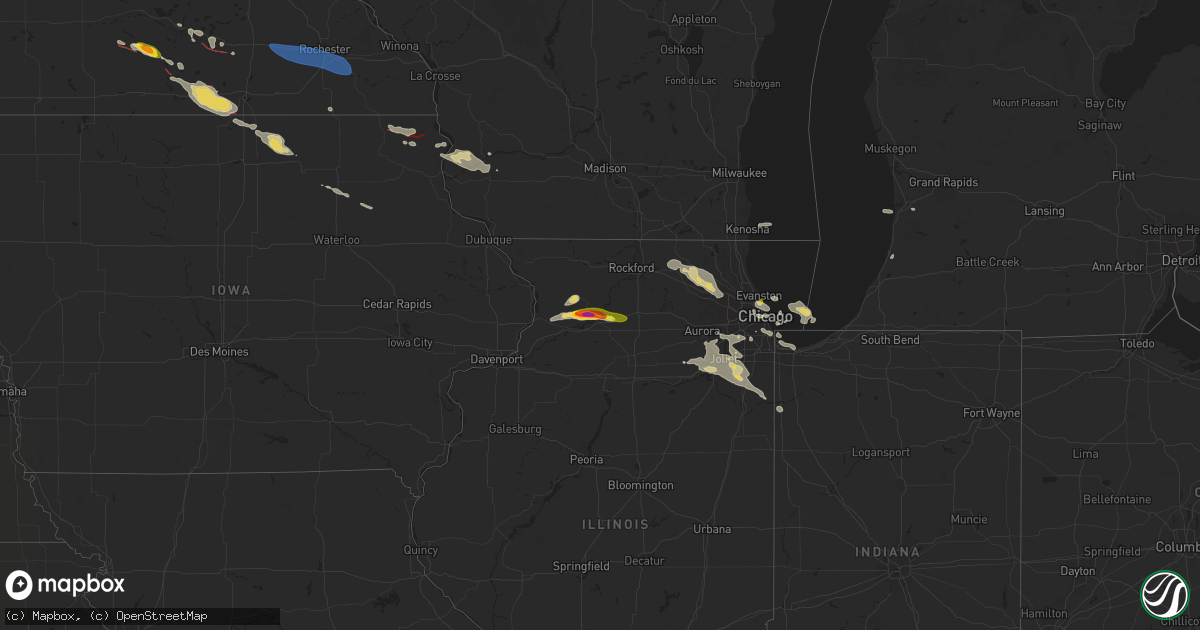
Hail Map on August 5, 2024
Get this storm
August 5 map
$229
one time, instant access
Download today. No call, no setup
Keep the $229
Bought the map and want the full workflow? Apply the entire $229 to a subscription within 7 days. None of it is wasted.
Every map, not just this one
This buys you this map. Subscription and you get every map we run, in the markets you choose from a few cities to whole states to nationwide. Plus real-time alerts the moment a storm fires.
Contact data
Name, contact info, occupancy, even credit band for addresses in the footprint. You go from where it hit to who to call.
Become the source they trust
Unlimited branding weather history reports on demand. You already have the documented answer ready for the property owner, and you are the one who showed up with it.
Property data and RoofTrace estimates
Pull up any address you have got, its value and the exact code rules for that jurisdiction, straight from One Click Code. Then RoofTrace estimates the squares, pitch, and roof value, priced the way you price.
States Impacted by Hail Map on August 5, 2024
Storm reports
South Carolina
| Date | Description |
|---|---|
| 08/05/20241:54 AM CDT | Social media video shows a tornado tracking across a portion of a car lot near the intersection of north us highway 52 and rembert dennis blvd. |
| 08/05/20241:54 AM CDT | Berkeley county em reported a tornado on the eastern side of moncks corner. An applebees was damaged. Several trees and power poles were blown down... Some onto cars. A |
| 08/04/202411:00 PM CDT | Media relayed a picture of a couple of trees down on 490 sams point road due to tropical storm debby. |
| 08/04/202410:02 PM CDT | Public reported a couple of big trees down in their backayard at the 4700 block of river road due to tropical storm debby. |
| 08/04/20249:55 PM CDT | Social media reported trees downs at burroughs hall at govenors drive due to tropical storm debby. |
| 08/04/20248:38 PM CDT | Charleston county consolidated dispatch relayed a report of a sighted tornado touchdown on outback lane off palmetto rd on edisto island. Numerous trees down. |
| 08/04/20248:37 PM CDT | Social media reported trees downs at burroughs hall at govenors drive due to tropical storm debby. |
| 08/04/20248:37 PM CDT | Charleston county dispatch reported a sighted tornado going over a residence's home on the 500 block of fishing creek drive. Damage to the residence's porch was reporte |
| 08/04/20248:37 PM CDT | Colleton county emergency manager reported a sighted tornado on 2700 block of palmetto blvd. |
Minnesota
| Date | Description |
|---|---|
| 08/05/20246:58 PM CDT | Ef-1 began 5 s waseca and tracked ese 1.4 miles. Multiple large trees were snapped or uprooted. |
| 08/05/20246:45 PM CDT | Several large trees snapped. Relayed via broadcast media. Time estimated from radar. |
| 08/05/20246:42 PM CDT | Several downed branches and damage to a structure within alma city. Time estimated from radar. |
| 08/05/20246:42 PM CDT | Several large trees and branches down along county road 2 south of janesville. Time estimated from radar. |
| 08/05/20246:38 PM CDT | Spotter report of a large tornado moving ese just south of janesville. |
| 08/05/20246:30 PM CDT | Trained spotter report relayed by county dispatch. |
| 08/05/20246:19 PM CDT | Ef-1 began 2 wsw smiths mill and tracked se 6.25 miles. Garage door blown in... An empty farm trailer was blown onto its side... Numerous trees uprooted or snapped... A |
| 08/05/20246:15 PM CDT | Several branches down on power lines. Relayed via county dispatch. Time estimated from radar. |
| 08/05/20246:04 PM CDT | Delayed report... Time estimated from radar. |
| 08/05/20245:35 PM CDT | Several reports of trees downed and power line damage. Relayed via county dispatch. Time estimated from radar. |
| 08/05/20245:33 PM CDT | Multiple reports from trained spotters of a brief tornado north of st james. |
| 08/05/20245:26 PM CDT | Ef-1 began 6 e darfur and continued ese 2.3 miles. Non-continuous crop damage... Trees uprooted... And a power pole damaged. |
| 08/04/20249:17 PM CDT | Tree split lengthwise. Time estimated from radar. |
| 08/04/20249:03 PM CDT | A medium sized healthy tree was partially uprooted and many other trees were snapped in half - report from mping. |
| 08/04/20248:18 PM CDT | An ef-0 tornado was confirmed with a path from southwest to northeast for 1 mile... Max winds of 75 mph and width of 30 yards with damage mainly in a farm field just no |
| 08/04/20248:01 PM CDT | Several downed trees near the area of 145th and 670th north of emmons. Time estimated from radar. |
| 08/04/20247:59 PM CDT | Multiple spotters reporting tornado on the ground. |
| 08/04/20247:50 PM CDT | Ef-1 began 3 nw emmons and tracked e 6.6 miles. Trees uprooted or trunks snapped. Some outbuildings were heavily damaged. One silo was lofted toward a tree line. |
| 08/04/20247:48 PM CDT | Powerline blown down. |
| 08/04/20247:46 PM CDT | Tree blown down on county hwy 24. |
| 08/04/20247:42 PM CDT | A local report indicates 58 MPH wind near 1 S Dodge Center |
| 08/04/20247:32 PM CDT | Multiple spotter reports of tornado and ongoing tree damage. |
| 08/04/20247:28 PM CDT | Time delayed lsr - an ef-0 tornado uprooted trees and downed large 12 diameter limbs halfway up the base. One fallen limb caused damage to the roof of a house. Crop dam |
| 08/04/20247:06 PM CDT | Multiple trees snapped off along highway 109. Time estimated from radar. |
New Hampshire
| Date | Description |
|---|---|
| 08/05/20246:40 PM CDT | Strafford county em reports a p |
| 08/05/20246:40 PM CDT | Strafford county em reports a pole and tree down in farmington. Time estimated by radar. |
| 08/05/20246:32 PM CDT | Delated report: reported by amateur radio. Social media photos of trees down on old bay rd... Davis crossing rd and ham rd in new durham. |
| 08/05/20246:26 PM CDT | Tree down near youngtown rd and frank c gilman hwy. |
| 08/05/20246:23 PM CDT | Trees and wires down near halls hill rd and horne rd. |
| 08/05/20242:26 PM CDT | Reported by weather spotter. Tree down on wires. Time estimated by radar. |
| 08/05/20242:04 PM CDT | A local report indicates 1.00 inch wind near 1 W Bennington |
| 08/05/20242:01 PM CDT | Tree across route 202. |
| 08/05/20242:00 PM CDT | Reported by amateur radio. |
| 08/05/20241:57 PM CDT | Tree down near kimball and forest intersection. |
| 08/05/20241:55 PM CDT | Three large trees down... Nh137 closed. |
| 08/05/20241:52 PM CDT | Reported by weather spotter. Tree on wires on kimball rd near bobalink circle. Observed numerous trees down in the hancock area. Time estimated by radar. |
| 08/05/20241:44 PM CDT | Tree down across brown rd. |
| 08/05/20241:40 PM CDT | Half dollar-sized hail fell for almost 10 mins. Hail covered grassy areas and fractured a few car windows. |
| 08/05/20241:34 PM CDT | Reported by weather spotter. |
| 08/05/20241:26 PM CDT | A local report indicates 1.00 inch wind near 2 S Surry |
| 08/05/20241:08 PM CDT | Reported by weather spotter. Trees down on surry and louder rd. Trees are 7-12 inches in diameter. Time estimated by radar. |
| 08/05/202412:57 PM CDT | Reported by amateur radio. |
Idaho
| Date | Description |
|---|---|
| 08/05/20246:44 PM CDT | Mesonet station dehi1 deer haven. |
| 08/05/20245:30 PM CDT | Tree down and damaged outdoor pool. Fences blown over. Asos reported 52 mph. |
| 08/04/20248:07 PM CDT | Hail up to the size of quarters and very heavy rain reported. |
| 08/04/20247:30 PM CDT | Idaho power reports 1820 weather related power outages in the hailey/bellevue area due to strong thunderstorms moving through the area. |
Michigan
| Date | Description |
|---|---|
| 08/05/202411:39 AM CDT | Several large tree limbs down and a fence knocked over near 24 mile and sass rd. |
| 08/05/20246:55 AM CDT | Scattered trees down in valley... Heath... And trowbridge townships. Time approximate. |
| 08/05/20246:50 AM CDT | Several locations of isolated trees or large limbs blocking roads or with wires down between lawrence... Decatur... And lawton. |
Oregon
| Date | Description |
|---|---|
| 08/05/20246:28 PM CDT | A local report indicates 1.00 inch wind near 1 WNW Lostine |
| 08/05/20246:27 PM CDT | Social media report. |
| 08/05/20246:27 PM CDT | Social media |
Pennsylvania
| Date | Description |
|---|---|
| 08/05/20245:46 PM CDT | Trees down. |
| 08/05/20245:41 PM CDT | Corrects previous tstm wnd dmg report from lenoxville. Trees and wires down. |
| 08/05/20245:36 PM CDT | Multiple reports of trees and wires down around lenox township. |
| 08/05/20245:12 PM CDT | Additional reports of downed trees and wires. |
| 08/05/20245:07 PM CDT | Multiple reports of trees and wires down. |
| 08/05/20245:00 PM CDT | Trees and wires down. |
| 08/05/20244:58 PM CDT | Minor damage to metal roofing on house and barn. Chimney on one of the structures also knocked over. Multiple trees snapped in the surrounding area as well. |
| 08/05/20244:53 PM CDT | 5 trees uprooted. Multiple other trees snapped. |
| 08/05/20244:53 PM CDT | A few trees knocked down. |
| 08/05/20244:45 PM CDT | Multiple trees down in forest lake township. |
| 08/05/20244:31 PM CDT | Corrects previous tstm wnd dmg report from 1 se friendsville. Trees and wires down. |
| 08/05/20244:27 PM CDT | Corrects previous tstm wnd dmg report from new milford. Trees and wires down. |
| 08/05/20244:22 PM CDT | Wire down in backyard of house. |
| 08/05/20244:04 PM CDT | Corrects previous tstm wnd dmg report from hallstead. Trees down on snake creek road. |
| 08/05/20244:04 PM CDT | Wires down on snake creek road. |
| 08/05/20243:55 PM CDT | A few reports of trees down in the area. |
| 08/05/20243:51 PM CDT | Trees and wires down on barney road. |
| 08/05/20243:47 PM CDT | Tree down on road. |
Utah
| Date | Description |
|---|---|
| 08/05/20245:21 PM CDT | Large section of tree roughly 12 inches or so in diameter split from trunk. Per pictures... This fell mostly into yard... But some minor gutter damage to house was repo |
Illinois
| Date | Description |
|---|---|
| 08/05/20245:45 PM CDT | Mping report of 2 inch hail in woosung. |
| 08/05/20245:34 PM CDT | Report from mping. |
| 08/05/20245:25 PM CDT | Corrects time of hail report from 1 w penrose. Time estimated from radar. |
| 08/05/20248:04 AM CDT | Photos showed trees and tree limbs blown down near 151st street and parker road. Time estimated. |
| 08/05/20248:03 AM CDT | Large tree uprooted. |
| 08/05/20247:07 AM CDT | Report from mping: quarter |
| 08/05/20243:45 AM CDT | Large willow tree snapped at its trunk and crushed a fence along county line road in barrington hills. Time estimated from radar. |
| 08/05/20243:40 AM CDT | Pine tree uprooted. |
| 08/05/20243:40 AM CDT | Large tree downed onto shed. |
| 08/05/20243:40 AM CDT | Tree branches and limbs down in sporadic locations across town. |
| 08/05/20243:40 AM CDT | Parking lot light pole downed... A couple trees damaged... Minor roof/siding damage to building. |
| 08/05/20243:39 AM CDT | Photos shared on social media show several trees and a light pole downed in the algonquin/lake in the hills area. Time estimated from radar. |
| 08/05/20243:36 AM CDT | Photos shared on social media show large tree limbs downed across various parts of crystal lake. Time estimated from radar. |
| 08/05/20243:32 AM CDT | Photo shared on social media shows a large tree limb downed in lakewood with several smaller branches and limbs downed in the vicinity. Time estimated from radar. |
| 08/05/20243:23 AM CDT | Several trees were downed in or near woodstock. Time estimated from radar. |
| 08/05/20243:15 AM CDT | 8 large hardwood trees downed along a 300 foot section of roadway. Photos show trees splinter-snapped near their base. Time estimated by radar. |
| 08/05/20243:15 AM CDT | Corrects location of previous tstm wnd dmg report from 2 wsw richmond. 8 large hardwood trees downed along a 300 foot section of keystone road south of tryon grove road |
| 08/05/20243:05 AM CDT | Power lines/poles were downed onto thayer road between alden road and johnson road. Time estimated from radar. |
Wisconsin
| Date | Description |
|---|---|
| 08/05/20242:09 AM CDT | Barn destroyed and trees down. |
| 08/05/20242:03 AM CDT | Some trees down in whitewater... Richmond and sugar creek. Time estimated from radar. |
| 08/05/202412:55 AM CDT | 4 to 5 reports of trees down on the east side of madison. Some 1 foot in diameter. |
| 08/05/202412:28 AM CDT | A tree down on a house. Other reports of small branches down and power lines down. |
| 08/04/202411:30 PM CDT | A local report indicates 60 MPH wind near 4 WNW Blue River |
| 08/04/202411:30 PM CDT | Large branch downed. Report via social media. Time estimated from radar. |
| 08/04/202411:01 PM CDT | Several trees downed and snapped. Report via social media without photo. Time estimated from radar. |
New York
| Date | Description |
|---|---|
| 08/05/20244:55 PM CDT | 1 foot diameter tree down. Retired nws employee. |
| 08/05/20244:51 PM CDT | Tree down on wires. |
| 08/05/20244:38 PM CDT | Numerous trees down at camp hunt. Some trees landed on cabins. Any damage is unknown. Fortunately there were no injuries. |
| 08/05/20244:35 PM CDT | Tree down on primary wires. Time radar estimated. |
| 08/05/20244:30 PM CDT | Tree down on power lines. Time radar estimated. |
| 08/05/20244:00 PM CDT | Main street shutdown in broadalbin due to downed trees and wires. |
| 08/05/20244:00 PM CDT | Several trees down. |
| 08/05/20243:56 PM CDT | Multiple trees down across route 10a. Road impassable. Time radar estimated. |
| 08/05/20243:51 PM CDT | Tree down on a house. Time radar estimated. |
| 08/05/20243:47 PM CDT | Multiple trees down throughout fulton county per 911 dispatch. |
| 08/05/20243:28 PM CDT | Trees down on blodgett rd |
| 08/05/20243:28 PM CDT | Trees down on hollister road |
| 08/05/20243:28 PM CDT | Trees down on lile road |
| 08/05/20243:21 PM CDT | Trees down on rail tail. |
| 08/05/20243:19 PM CDT | Trees down |
| 08/05/20243:17 PM CDT | Wires down on north street. |
| 08/05/20243:15 PM CDT | Roof blown off american legion building. |
| 08/05/20243:15 PM CDT | Trees down |
| 08/05/20243:13 PM CDT | Tree down on a house. |
| 08/05/20243:13 PM CDT | Tree down on river drive and orman street intersection. |
| 08/05/20243:13 PM CDT | Trees and wires down. |
| 08/05/20242:47 PM CDT | Wires down. |
| 08/05/20242:47 PM CDT | Multiple reports of wires and poles down around brookfield. |
| 08/05/20242:43 PM CDT | Trees down |
| 08/05/20242:38 PM CDT | Tree down on car... No injuries |
| 08/05/20242:38 PM CDT | Trees down |
| 08/05/20242:34 PM CDT | Wires down on randalsville rd. |
| 08/05/20242:34 PM CDT | Trees down at colgate university. |
| 08/05/20242:34 PM CDT | Tree blocking road |
| 08/05/20242:33 PM CDT | Picture shared on social media. |
| 08/05/20242:29 PM CDT | Trees down on barden road. |
| 08/05/20242:29 PM CDT | Trees down on reservoir hill road |
| 08/05/20242:03 PM CDT | Tree down. |
| 08/05/20242:00 PM CDT | Wire down on building green street. |
| 08/05/20242:00 PM CDT | Poles and wires down on game farm road. |
| 08/05/20241:22 PM CDT | Trees down |
| 08/05/20241:08 PM CDT | Trees down on a powerline on haskell road. Time estimated from radar. |
| 08/05/202411:49 AM CDT | Nws storm survey confirms that a tornado touched down in the city of buffalo near niagara st and carolina st. |
| 08/05/202411:45 AM CDT | Trees down... Car flipped and bricks fell off a building in the city of buffalo. Time estimated. |
Iowa
| Date | Description |
|---|---|
| 08/04/202410:48 PM CDT | Large tree snapped at base. Report via social media. Time estimated from radar. |
| 08/04/202410:29 PM CDT | This shorter ef1 tornado damaged mainly trees along its path north of waukon. One home and several outbuildings/vehicles were damaged as well. |
| 08/04/202410:15 PM CDT | Fallen tree over roadway. Time estimated via radar. |
| 08/04/202410:10 PM CDT | Large branch snapped. |
| 08/04/202410:09 PM CDT | Roof damage. |
| 08/04/202410:08 PM CDT | Many trees downed lying mostly ne to sw. |
| 08/04/202410:08 PM CDT | Bunch of trees damaged off canoe valley rd. |
| 08/04/202410:00 PM CDT | Fallen tree over roadway. Loss of power. Time estimated via radar. |
| 08/04/202410:00 PM CDT | Fallen tree in roadway. Time estimated via radar. |
| 08/04/20249:56 PM CDT | Tree damage around a house with some larger trees snapped of 12 diameter. |
| 08/04/20249:50 PM CDT | Tree limbs 2-5 in diameter broken off sporadically through town. |
| 08/04/20249:30 PM CDT | Fallen tree on roadway. Time estimated via radar. |
| 08/04/20248:44 PM CDT | Chaser report with attached photo via social media. No damage reports as of yet. |
Vermont
| Date | Description |
|---|---|
| 08/05/202412:54 PM CDT | Social media report of multiple trees down on vermont sr 5 south of westminster vt. |
Cities Impacted by Hail Map on August 5, 2024
- Chicago, IL
- Naperville, IL
- Bolingbrook, IL
- Plainfield, IL
- Oswego, IL
- South Haven, MI
- Holland, MI
- Palos Hills, IL
- Palos Heights, IL
- Palos Park, IL
- Worth, IL
- Chicago Ridge, IL
- Alsip, IL
- Woodridge, IL
- Lemont, IL
- Lockport, IL
- Romeoville, IL
- Crest Hill, IL
- Joliet, IL
- Homer Glen, IL
- Whiting, IN
- East Chicago, IN
- Hammond, IN
- Gary, IN
- New Lenox, IL
- Orland Park, IL
- Mokena, IL
- Manhattan, IL
- Pendleton, OR
- Frankfort, IL
- Monee, IL
- Elwood, IL
- Peotone, IL
- Grant Park, IL
- Manteno, IL
- Momence, IL
- Buffalo, NY
- Putney, VT
- Walpole, NH
- Westmoreland, NH
- Keene, NH
- Sullivan, NH
- Gilsum, NH
- Nelson, NH
- Marlborough, NH
- Weston, CO
- Hancock, NH
- Antrim, NH
- Greenfield, NH
- Bennington, NH
- Harrisville, NH
- Peterborough, NH
- Lyndeborough, NH
- Francestown, NH
- Eaton, NY
- Earlville, NY
- Hamilton, NY
- Hubbardsville, NY
- Waterville, NY
- North Brookfield, NY
- Brookfield, NY
- West Edmeston, NY
- West Winfield, NY
- Owego, NY
- Endicott, NY
- Vestal, NY
- Madison, NY
- Bouckville, NY
- Binghamton, NY
- Corfu, NY
- Darien Center, NY
- Lancaster, NY
- Alden, NY
- Akron, NY
- Apalachin, NY
- Brackney, PA
- Hallstead, PA
- Montrose, PA
- Conklin, NY
- Ponte Vedra, FL
- Saint Augustine, FL
- Morrison, IL
- Willowbrook, IL
- Willow Springs, IL
- Downers Grove, IL
- Darien, IL
- Schaghticoke, NY
- Valley Falls, NY
- Buskirk, NY
- Johnsonville, NY
- Hoosick Falls, NY
- Sterling, IL
- Santa Fe, NM
- Eagle Bridge, NY
- Milledgeville, IL
- Chadwick, IL
- Saint James, MN
- Dixon, IL
- Lanark, IL
- Polo, IL
- Woosung, IL
- Oregon, IL
- Madelia, MN
- Franklin Grove, IL
- Ashton, IL
- Mankato, MN
- Eagle Lake, MN
- Belmont, NH
- Gilmanton, NH
- Darfur, MN
- Lostine, OR
- Wallowa, OR
- Vernon Center, MN
- Alton, NH
- Gilmanton Iron Works, NH
- Center Barnstead, NH
- Amboy, MN
- Lake Village, IN
- Alton Bay, NH
- Morris, IL
- Minooka, IL
- Newark, IL
- Shorewood, IL
- Winnebago, MN
- Farmington, NH
- New Durham, NH
- Janesville, MN
- Pemberton, MN
- Mapleton, MN
- Channahon, IL
- Waseca, MN
- Imnaha, OR
- Delavan, MN
- Easton, MN
- Wells, MN
- Minnesota Lake, MN
- North Berwick, ME
- Lebanon, ME
- Berwick, ME
- Bricelyn, MN
- Blue Earth, MN
- Cottonwood, ID
- Wilmington, IL
- Lordsburg, NM
- Cape Elizabeth, ME
- Alden, MN
- Kiester, MN
- Silver City, NM
- Hurley, NM
- Bayard, NM
- Hanover, NM
- Santa Clara, NM
- Hayfield, MN
- Kasson, MN
- Dodge Center, MN
- Claremont, MN
- Byron, MN
- Rochester, MN
- Stewartville, MN
- Emmons, MN
- Albert Lea, MN
- Twin Lakes, MN
- Conger, MN
- Northwood, IA
- Lake Mills, IA
- Arenas Valley, NM
- White Bird, ID
- Scarville, IA
- Eyota, MN
- Chatfield, MN
- Spring Valley, MN
- Kensett, IA
- Grafton, IA
- Edisto Island, SC
- Johns Island, SC
- Osage, IA
- Manly, IA
- Plymouth, IA
- Le Roy, MN
- Nora Springs, IA
- Rudd, IA
- Decorah, IA
- Waukon, IA
- Dorchester, IA
- Nashua, IA
- Lansing, IA
- Harpers Ferry, IA
- Ionia, IA
- Fredericksburg, IA
- Sumner, IA
- Tripoli, IA
- Frederika, IA
- Waverly, IA
- Steuben, WI
- Wauzeka, WI
- Eastman, WI
- Westgate, IA
- Maynard, IA
- Boscobel, WI
- Woodman, WI
- Fennimore, WI
- Enterprise, OR
- Ferdinand, ID
- Orofino, ID
- Union, IL
- Woodstock, IL
- Marengo, IL
- Harvard, IL
- Huntley, IL
- Moncks Corner, SC
- Pinopolis, SC
- Algonquin, IL
- Lake In The Hills, IL
- Crystal Lake, IL
- Dundee, IL
- Cross, SC
- Eutawville, SC
- Carpentersville, IL
- Cary, IL
- Barrington, IL
- Fox River Grove, IL
- Hoffman Estates, IL
- Oakfield, NY
- Batavia, NY
- Basom, NY
- Elba, NY
- Allegany, NY
- Olean, NY
- Streamwood, IL
- Schaumburg, IL
- Elgin, IL
- Harwood Heights, IL
- Austin, MN
- Grand Meadow, MN
- Charleston, SC
- Isle Of Palms, SC
- Beaufort, SC
- Saint Helena Island, SC