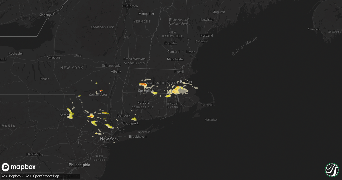
Hail Map in Massachusetts on June 28, 2020
Get this storm
June 28 map
$229
one time, instant access
Download today. No call, no setup
Keep the $229
Bought the map and want the full workflow? Apply the entire $229 to a subscription within 7 days. None of it is wasted.
Every map, not just this one
This buys you this map. Subscription and you get every map we run, in the markets you choose from a few cities to whole states to nationwide. Plus real-time alerts the moment a storm fires.
Contact data
Name, contact info, occupancy, even credit band for addresses in the footprint. You go from where it hit to who to call.
Become the source they trust
Unlimited branding weather history reports on demand. You already have the documented answer ready for the property owner, and you are the one who showed up with it.
Property data and RoofTrace estimates
Pull up any address you have got, its value and the exact code rules for that jurisdiction, straight from One Click Code. Then RoofTrace estimates the squares, pitch, and roof value, priced the way you price.
Storm reports in Massachusetts
Massachusetts
| Date | Description |
|---|---|
| 06/28/20205:05 PM CDT | Tree down on paine street |
| 06/28/20205:00 PM CDT | Tree down on a house and car on davis street. A second tree down also on davis street. |
| 06/28/20204:50 PM CDT | Tree and wires down on ridge street... Spark street... And circle street. |
| 06/28/20204:44 PM CDT | Tree down on north main street in avon. |
| 06/28/20204:35 PM CDT | Wires down on bullard street |
| 06/28/20204:30 PM CDT | Large tree down on oak street |
| 06/28/20204:30 PM CDT | Trees and wires down on kingsbury road. |
| 06/28/20204:20 PM CDT | Large tree down on elm street |
| 06/28/20204:10 PM CDT | Preceded by pea sized hail for 15 mins |
| 06/28/20204:10 PM CDT | Large tree and wires down on mountain road. |
| 06/28/20203:50 PM CDT | A local report indicates 1.00 inch wind near FRANKLIN |
| 06/28/20203:40 PM CDT | A local report indicates 1.00 inch wind near NORWOOD |
| 06/28/20203:16 PM CDT | Tree and wires down on randolf ave. |
| 06/28/20203:01 PM CDT | Tree down on route 202 at northampton line |
| 06/28/20202:58 PM CDT | Forwarded by media. |
| 06/28/20202:56 PM CDT | Forwarded by media. |
| 06/28/20202:48 PM CDT | A local report indicates 1.25 inch wind near NORTHAMPTON |
| 06/28/20202:29 PM CDT | Tree down at perley place... Blocking road. |
| 06/28/20202:09 PM CDT | Tree down on jerusalem road... Second tree down at joy place and north main street. |
| 06/28/20201:45 PM CDT | Large tree branch down blocking rockland road at martins lane. |
| 06/28/20201:37 PM CDT | Tree fell on road near green line mbta outbound tracks near huntington ave. |
| 06/28/20201:10 PM CDT | Pleasant street... Tree down against a house with wires down. |
| 06/28/20201:08 PM CDT | Large tree branch down on vehicle and blocking reservoir ave. |
| 06/28/20201:01 PM CDT | Tree down at the 200 block of walnut street |
| 06/28/20201:00 PM CDT | Powerlines down at calumet street |
| 06/28/202012:59 PM CDT | Tree down blocking the road on border street. |
| 06/28/202012:59 PM CDT | Tree down on a building on perry road. |
| 06/28/202012:53 PM CDT | Trees crossing road and powerlines on carver road |
| 06/28/202012:50 PM CDT | Newton pd responding to nonantum road and charlesbank road for a tree down on the road. |
| 06/28/202012:40 PM CDT | Tree down blocking lewis terrace at washington street. A second tree and wires down in the same area. |
| 06/28/202012:30 PM CDT | Watertown square |
| 06/28/202012:29 PM CDT | Tree and powerlines down on highland ave. |
| 06/27/202011:39 PM CDT | At 438 PM EDT, a severe thunderstorm was located over Medway, or over Milford, moving east at 15 mph. HAZARD...60 mph wind gusts and half dollar size hail. SOURCE...Radar indicated. IMPACT...Expect wind damage to trees and power lines. Minor hail damage to vehicles is possible. Locations impacted include... Franklin, Milford, Walpole, Sharon, Bellingham, Holliston, Medway, Medfield, Norfolk, Millis and Hopedale. |
| 06/27/202011:02 PM CDT | At 401 PM EDT, a severe thunderstorm was located over Westwood, or near Norwood, moving east at 15 mph. HAZARD...60 mph wind gusts and half dollar size hail. Also torrential rain and frequent cloud to ground lightning. SOURCE...Radar indicated. IMPACT...Expect wind damage to trees and power lines. Minor hail damage to vehicles is possible. Locations impacted include... Boston, Quincy, Newton, Brookline, Weymouth, Braintree, Natick, Randolph, Needham, Norwood, Wellesley, Milton, Stoughton, Dedham, Walpole, Canton, Sharon, Rockland, Abington and Westwood. |
| 06/27/202010:16 PM CDT | At 316 PM EDT, a severe thunderstorm was located over Westhampton, or near Northampton, moving east at 20 mph. HAZARD...60 mph wind gusts and quarter size hail. SOURCE...Radar indicated. IMPACT...Expect wind damage to trees and power lines. Minor hail damage to vehicles is possible. Locations impacted include... Springfield, Chicopee, Holyoke, Amherst, Northampton, Ludlow, South Hadley, Easthampton, Belchertown, Wilbraham, Palmer, Ware, Monson, Granby, Southampton, Hadley, Hatfield, Huntington, Westhampton and Pelham. |
| 06/27/202010:02 PM CDT | At 301 PM EDT, a severe thunderstorm was located over Scituate, or 7 miles north of Marshfield, moving east at 15 mph. HAZARD...60 mph wind gusts and quarter size hail. SOURCE...Radar indicated. IMPACT...Expect wind damage to trees and power lines. Minor hail damage to vehicles is possible. Locations impacted include... Marshfield, Hingham, Scituate, Hanover, Norwell, Hull and Cohasset. |
| 06/27/20208:26 PM CDT | At 125 PM EDT, a severe thunderstorm was located over Watertown, moving east at 20 mph. HAZARD...60 mph wind gusts and quarter size hail. SOURCE...Radar indicated. IMPACT...Expect wind damage to trees and power lines. Minor hail damage to vehicles is possible. Locations impacted include... Boston, Cambridge, Quincy, Newton, Somerville, Waltham, Malden, Brookline, Medford, Weymouth, Revere, Arlington, Everett, Braintree, Chelsea, Natick, Watertown, Lexington, Needham and Wellesley. |
All States Impacted by Hail Map on June 28, 2020
Cities Impacted by Hail Map on June 28, 2020
- Carpio, ND
- Lansford, ND
- Millington, MD
- Chestertown, MD
- Worton, MD
- Still Pond, MD
- Sudlersville, MD
- Crumpton, MD
- Kennedyville, MD
- Mandan, ND
- Napoleon, ND
- Hill City, SD
- Granville, ND
- Surrey, ND
- Norwich, ND
- Casper, WY
- West Haven, CT
- Orange, CT
- Shelton, CT
- Milford, CT
- Stratford, CT
- Mud Butte, SD
- Alfred, ME
- Glenwood City, WI
- Lake Crystal, MN
- Courtland, MN
- Midland, SD
- Wilton, ND
- Scenic, SD
- Kyle, SD
- Wharton, NJ
- Lake Hopatcong, NJ
- Clayton, AL
- Louisville, AL
- Montvale, NJ
- Westwood, NJ
- Orangeburg, NY
- Tappan, NY
- Pearl River, NY
- Moorcroft, WY
- Aladdin, WY
- Sundance, WY
- Belle Fourche, SD
- Beulah, WY
- Rozet, WY
- Gillette, WY
- Coleharbor, ND
- Riverdale, ND
- Garrison, ND
- Saint Paul, MN
- Montgomery, MN
- New Prague, MN
- Baldwin, ND
- Bismarck, ND
- Moscow, PA
- Gouldsboro, PA
- Lake Ariel, PA
- Custer, SD
- Keystone, SD
- Rapid City, SD
- Allen, SD
- Center, ND
- Newell, SD
- Buffalo, SD
- Lodgepole, SD
- Ralph, SD
- Ludlow, SD
- Reva, SD
- Stockholm, NJ
- Branchville, NJ
- Highland Lakes, NJ
- Glenwood, NJ
- Augusta, NJ
- Lafayette, NJ
- Vernon, NJ
- Franklin, NJ
- Hamburg, NJ
- Sussex, NJ
- Solen, ND
- Flasher, ND
- Denville, NJ
- Randolph, NJ
- Morris Plains, NJ
- Deadwood, SD
- Black Hawk, SD
- Nemo, SD
- Piedmont, SD
- Layton, NJ
- Adairville, KY
- Lead, SD
- Sturgis, SD
- Phoenicia, NY
- Dupree, SD
- Nisland, SD
- Faith, SD
- Meadow, SD
- Pierre, SD
- Saint Ansgar, IA
- Lyle, MN
- Fullerton, ND
- Lamoure, ND
- Downing, WI
- Clear Lake, WI
- Porcupine, SD
- Interior, SD
- Kadoka, SD
- Wanblee, SD
- Pine Ridge, SD
- Thompson, PA
- Olivia, MN
- Bird Island, MN
- Medway, MA
- Bellingham, MA
- Franklin, MA
- Kintyre, ND
- Philip, SD
- Pembroke, KY
- Hopkinsville, KY
- Wakpala, SD
- Millis, MA
- Milford, MA
- Cannon Falls, MN
- Dennison, MN
- Hampton, MN
- Farmington, MN
- Welch, MN
- Northfield, MN
- Hastings, MN
- Randolph, MN
- Sparrow Bush, NY
- Milford, PA
- Port Jervis, NY
- Huguenot, NY
- Montague, NJ
- Matamoras, PA
- Southfields, NY
- Pomona, NY
- Stony Point, NY
- Kaycee, WY
- Washburn, ND
- Martin, SD
- New Salem, ND
- Stewartville, MN
- Racine, MN
- Spring Valley, MN
- Grand Meadow, MN
- Parsippany, NJ
- Verona, ND
- Inver Grove Heights, MN
- Mcminnville, TN
- McKenzie, AL
- Evergreen, AL
- Georgiana, AL
- Fort Yates, ND
- Saint Anthony, ND
- Union Center, SD
- Forbes, ND
- Chatfield, MN
- Union, NH
- Deering, ND
- Minot, ND
- Upham, ND
- Velva, ND
- Bantry, ND
- Jermyn, PA
- Archbald, PA
- Carbondale, PA
- River Falls, WI
- Ellsworth, WI
- Bay City, WI
- Beldenville, WI
- Hager City, WI
- Elmwood, WI
- Maiden Rock, WI
- Spring Valley, WI
- Monson, MA
- Wales, MA
- Stafford Springs, CT
- Appleton, MN
- Opp, AL
- Winthrop, MN
- Gibbon, MN
- Steele, ND
- Berthold, ND
- Burlington, ND
- Buffalo, ND
- Scituate, MA
- Ocklawaha, FL
- Silver Springs, FL
- Fort McCoy, FL
- Long Eddy, NY
- Hancock, NY
- Fort Pierre, SD
- Seville, FL
- Pierson, FL
- Selfridge, ND
- Stanton, ND
- Cannon Ball, ND
- Shields, ND
- Danvers, MN
- Spring Valley, NY
- Suffern, NY
- Monsey, NY
- Maxbass, ND
- Park Ridge, NJ
- Sparkill, NY
- Piermont, NY
- Northvale, NJ
- Blauvelt, NY
- Nanuet, NY
- Nyack, NY
- Butler, AL
- Devils Tower, WY
- Easthampton, MA
- Northampton, MA
- Southampton, MA
- South Hadley, MA
- Hadley, MA
- Holyoke, MA
- Huntington, MA
- Florence, MA
- Rochester, MN
- Oronoco, MN
- Alzada, MT
- Trenton, KY
- Oshkosh, NE
- Dalton, MN
- Webster, MN
- Lonsdale, MN
- Savage, MN
- Rock Island, TN
- Holland, MA
- Hampden, MA
- Cerulean, KY
- McLaughlin, SD
- Northwood, IA
- Elkton, MN
- Adams, MN
- Kensett, IA
- Dexter, MN
- Rose Creek, MN
- Austin, MN
- Menomonie, WI
- Boyceville, WI
- Knapp, WI
- Gaylord, MN
- New Ulm, MN
- Nicollet, MN
- Saint Peter, MN
- Hanska, MN
- Madelia, MN
- Lafayette, MN
- Alton, NH
- Wolfeboro, NH
- Edgemont, SD
- Hermosa, SD
- Hazelton, ND
- Mendham, NJ
- Chester, NJ
- Hayes, SD
- Whitinsville, MA
- Sutton, MA
- Uxbridge, MA
- Harrisville, RI
- Long Valley, SD
- Johnston, SC
- Kilkenny, MN
- Faribault, MN
- Warsaw, MN
- Morristown, MN
- Waterville, MN
- North Smithfield, RI
- Aberdeen, SD
- Eagle Butte, SD
- Minneapolis, MN
- Burnsville, MN
- Lincoln, RI
- Smithfield, RI
- Granby, MA
- Chicopee, MA
- Glenburn, ND
- Brockton, MA
- Afton, MN
- Midway, AL
- Elkton, KY
- Oak Grove, KY
- Boyes, MT
- Hammond, MT
- Leola, SD
- Cohasset, MA
- Ludlow, MA
- Robinson, ND
- Caldwell, NJ
- Pine Brook, NJ
- Mountain Lakes, NJ
- Dover, NJ
- Whippany, NJ
- Lake Hiawatha, NJ
- Fairfield, NJ
- Montville, NJ
- Roseland, NJ
- Mount Tabor, NJ
- Rockaway, NJ
- East Hanover, NJ
- Shakopee, MN
- Prior Lake, MN
- Hobart, NY
- South Kortright, NY
- Guthrie, KY
- Mapleville, RI
- Putnam, CT
- Chepachet, RI
- Thompson, CT
- Pascoag, RI
- Oakland, RI
- Cologne, MN
- Carver, MN
- Chaska, MN
- Jordan, MN
- Prompton, PA
- Waymart, PA
- Gaffney, SC
- West Springfield, MA
- Ellendale, ND
- Waseca, MN
- Franklin, MN
- Chestnut Hill, MA
- Roxbury, MA
- Brookline, MA
- Jamaica Plain, MA
- Driscoll, ND
- Braddock, ND
- Medford, WI
- Roebuck, SC
- Spartanburg, SC
- Oakes, ND
- Lewiston, MN
- Winona, MN
- Walpole, MA
- Dover, MA
- Norwood, MA
- Sharon, MA
- Westwood, MA
- Canton, MA
- East Walpole, MA
- Blackstone, MA
- Southbridge, MA
- Letohatchee, AL
- Linton, ND
- Acton, ME
- East Wakefield, NH
- Enderlin, ND
- Belvidere, SD
- Sherborn, MA
- Morris, MN
- Donnelly, MN
- Fort Deposit, AL
- Joice, IA
- Pleasant Mount, PA
- Hector, MN
- Ashby, NE
- Nichols, SC
- Avon, MA
- Lapine, AL
- Hudson, WI
- Mankato, MN
- Cleveland, MN
- Le Center, MN
- Le Sueur, MN
- Madison Lake, MN
- Kasota, MN
- Minot Afb, ND
- Des Lacs, ND
- Newburg, ND
- Nome, ND
- Fingal, ND
- Mendota, MN
- Lakeville, MN
- Elko New Market, MN
- Hopkinton, MA
- Ashland, MA
- Upton, MA
- Scranton, PA
- Agar, SD
- Rib Lake, WI
- Holliston, MA
- Eddyville, IL
- Stirum, ND
- Deer Park, WI
- Spearfish, SD
- Charlotte, NC
- Hecla, SD
- Ware, MA
- Three Rivers, MA
- Palmer, MA
- Belchertown, MA
- Wilbraham, MA
- Bondsville, MA
- Wishek, ND
- Gurley, NE
- Florien, LA
- Graceville, MN
- Dorchester, MA
- Brighton, MA
- Hull, MA
- Roslindale, MA
- Quincy, MA
- Dorchester Center, MA
- Newton Center, MA
- Roxbury Crossing, MA
- Boston, MA
- Ninety Six, SC
- Pepin, WI
- Trempealeau, WI
- Saint Charles, MN
- Galesville, WI
- Rollingstone, MN
- Eyota, MN
- Altura, MN
- Lake Mills, IA
- Dodge, WI
- Minnesota City, MN
- Hanlontown, IA
- Fountain City, WI
- Utica, MN
- Dover, MN
- Hammond, WI
- Wrentham, MA
- Norfolk, MA
- Abington, MA
- Whitman, MA
- Millville, MA
- Hopedale, MA
- Stoughton, MA
- Mendon, MA
- Woonsocket, RI
- Medfield, MA
- Northbridge, MA
- Plainville, MA
- Cumberland, RI
- Clara City, MN
- Raymond, MN
- Capitol, MT
- Woodville, WI
- Winthrop, MA
- Wing, AL
- Trail City, SD
- Stewart, MN
- Buffalo Lake, MN
- Janesville, MN
- Souris, ND
- Hoffman, MN
- Herman, MN
- Prescott, WI
- Baldwin, WI
- Red Wing, MN
- Roberts, WI
- Monroe, NY
- Marion, LA
- Washingtonville, NY
- Campbell Hall, NY
- Rock Tavern, NY
- Hingham, MA
- Norwell, MA
- Lancaster, SC
- Waxhaw, NC
- Glenham, SD
- Dawson, ND
- Houghton, SD
- Columbia, SD
- Katonah, NY
- Bedford Hills, NY
- Tompkinsville, KY
- Kenyon, MN
- Wanamingo, MN
- Andalusia, AL
- Murdock, MN
- Bastrop, LA
- Crossett, AR
- Bethany, CT
- Belle Plaine, MN
- Sanbornville, NH
- Shapleigh, ME
- West Newfield, ME
- South Walpole, MA
- East Bridgewater, MA
- Holbrook, MA
- Glendale, RI
- Mansfield, MA
- Norton, MA
- Randolph, MA
- West Bridgewater, MA
- North Easton, MA
- Douglas, MA
- South Easton, MA
- Foxboro, MA
- Greenville, AL
- Valley City, ND
- Leeds, NY
- Freehold, NY
- Cairo, NY
- Montclair, NJ
- Little Falls, NJ
- Cedar Grove, NJ
- Chichester, NY
- Castleberry, AL
- Belmont, NC
- Yulan, NY
- Eldred, NY
- Narrowsburg, NY
- Pond Eddy, NY
- Highland Lake, NY
- Glen Spey, NY
- Barryville, NY
- Suffield, CT
- Correll, MN
- Odessa, MN
- Ortonville, MN
- Bloomingburg, NY
- Circleville, NY
- Pine Bush, NY
- Montgomery, NY
- Middletown, NY
- Exline, IA
- Mendon, IL
- Fowler, IL
- Adolphus, KY
- Hancock, MN
- Mondovi, WI
- Alma, WI
- Eufaula, AL
- Hannaford, ND
- Big Springs, NE
- Moravia, IA
- Mobridge, SD
- Little Eagle, SD
- Gilbertville, MA
- New Braintree, MA
- Millbury, MA
- Roxbury, NY
- Honoraville, AL
- Blenheim, SC
- Bennettsville, SC
- Woodstock, CT
- Westmoreland, TN
- Dedham, MA
- Hyde Park, MA
- Milton, MA
- Byron, MN
- Pine Island, MN
- Kellogg, MN
- Millville, MN
- Plainview, MN
- Elgin, MN
- Pikeville, TN
- Bangor, PA
- Rosemount, MN
- Banks, AL
- Rogers, MN
- Greenwich, CT
- Port Chester, NY
- Camp Crook, SD
- Union Springs, AL
- Box Elder, SD
- Selby, SD
- Gettysburg, SD
- Cuddebackville, NY
- Otisville, NY
- Westbrookville, NY
- Princeton, KY
- Dawson Springs, KY
- Cottage Grove, MN
- Saint Paul Park, MN
- Newport, MN
- Amherst, NH
- Milford, NH
- Malden, MA
- Everett, MA
- Haydenville, MA
- Stillwater, MN
- Shandaken, NY
- Tracy, IA
- Knoxville, IA
- Crofton, KY
- Dazey, ND
- Marine On Saint Croix, MN
- Florida, NY
- Goshen, NY
- Warwick, NY
- Chester, NY
- Williamsburg, MA
- Pollock, SD
- Belgrade, MN
- Fiskdale, MA
- Lodgepole, NE
- Julesburg, CO
- Frederick, SD
- West Brookfield, MA
- Warren, MA
- Forest Hill, MD
- Fort Mill, SC
- Tappen, ND
- Lumpkin, GA
- Morris, GA
- Seale, AL
- Pittsview, AL
- Onida, SD
- Dundas, MN
- Kearny, NJ
- Newark, NJ
- Blomkest, MN
- Danube, MN
- Page, ND
- Ramer, AL
- Grady, AL
- Springfield, MA
- Jessup, PA
- Olyphant, PA
- Claremont, SD
- North Hatfield, MA
- West Hatfield, MA
- Sunderland, MA
- Hatfield, MA
- Leverett, MA
- South Deerfield, MA
- Shutesbury, MA
- Amherst, MA
- Ooltewah, TN
- Jonesville, SC
- Montevideo, MN
- Maynard, MN
- Scottsville, KY
- Callicoon, NY
- Damascus, PA
- Topeka, KS
- Maple Hill, KS
- Harveyville, KS
- Mountain Lake, MN
- Prinsburg, MN
- Millry, AL
- Frankville, AL
- Middlebury, CT
- Woodbury, CT
- Benson, MN
- Barrett, MN
- Dale, TX
- Westtown, NY
- Amherst, SD
- Boonton, NJ
- Lincoln Park, NJ
- Butler, NJ
- Towaco, NJ
- Far Rockaway, NY
- Arverne, NY
- Cogswell, ND
- Saluda, SC
- Chappells, SC
- Arthur, NE
- Mound City, SD
- Colchester, CT
- West Newton, MA
- Auburndale, MA
- Newtonville, MA
- Waltham, MA
- Waban, MA
- Palisades, NY
- Irvington, NY
- Downing, MO
- Arkville, NY
- Big Indian, NY
- Amery, WI
- West Concord, MN
- Colfax, WI
- Lakeland, MN
- Wabasha, MN
- Woodstock Valley, CT
- Westborough, MA
- Fredonia, ND
- Kulm, ND
- Prairie City, SD
- Hoven, SD
- Milton, NH
- Milton Mills, NH
- Chidester, AR
- North Grafton, MA
- Shrewsbury, MA
- Oxford, MA
- Glen Gardner, NJ
- New Richmond, WI
- Fitzpatrick, AL
- Oriska, ND
- Westboro, WI
- Nerstrand, MN
- Cyrus, MN
- Elmsford, NY
- West Nyack, NY
- Tarrytown, NY
- White Plains, NY
- Dobbs Ferry, NY
- Ardsley, NY
- Hartsdale, NY
- Britton, SD
- Glenwood, MO
- Queen City, MO
- Sudbury, MA
- Weston, MA
- Wayland, MA
- Chattanooga, TN
- Medford, MN
- Owatonna, MN
- Carlisle, SC
- Buffalo, SC
- Union, SC
- Batesburg, SC
- Leesville, SC
- Mullins, SC
- Florence, SC
- Sellers, SC
- Darlington, SC
- Marion, SC
- Green Sea, SC
- Tabor City, NC
- Nakina, NC
- Loris, SC
- Derby, CT
- Woodbridge, CT
- Bridgton, ME
- Sebago, ME
- Naples, ME
- Denmark, ME
- Hiram, ME
- Fishs Eddy, NY
- Salisbury Mills, NY
- Maybrook, NY
- New Windsor, NY
- Cornwall, NY
- Prattsville, NY
- Harriman, NY
- Lanesville, NY
- New City, NY
- Allensville, KY
- Ekalaka, MT
- Batesland, SD
- Highland Home, AL
- Montgomery, AL
- Richland, GA
- Preston, GA
- Lewellen, NE
- Mohall, ND


