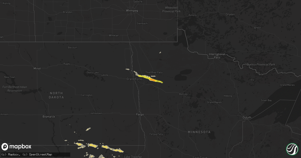
Hail Map on August 14, 2025
Get this storm
August 14 map
$229
one time, instant access
Download today. No call, no setup
Keep the $229
Bought the map and want the full workflow? Apply the entire $229 to a subscription within 7 days. None of it is wasted.
Every map, not just this one
This buys you this map. Subscription and you get every map we run, in the markets you choose from a few cities to whole states to nationwide. Plus real-time alerts the moment a storm fires.
Contact data
Name, contact info, occupancy, even credit band for addresses in the footprint. You go from where it hit to who to call.
Become the source they trust
Unlimited branding weather history reports on demand. You already have the documented answer ready for the property owner, and you are the one who showed up with it.
Property data and RoofTrace estimates
Pull up any address you have got, its value and the exact code rules for that jurisdiction, straight from One Click Code. Then RoofTrace estimates the squares, pitch, and roof value, priced the way you price.
States Impacted by Hail Map on August 14, 2025
Storm reports
Idaho
| Date | Description |
|---|---|
| 08/14/20256:30 PM CDT | Mesonet station blu blue dome. |
| 08/14/20255:15 PM CDT | Mesonet station 3004 d4 juniper interchange i-84. |
| 08/13/20258:50 PM CDT | Mesonet station pc624 alpon east. |
Virginia
| Date | Description |
|---|---|
| 08/14/20252:27 PM CDT | Several trees down on the 800 block of mt. Atlas road. |
| 08/14/20252:15 PM CDT | One tree down across maplewood avenue. |
Maine
| Date | Description |
|---|---|
| 08/14/20254:29 PM CDT | Washington county emergency management reports multiple trees down on route 1 in princeton. Time estimated based on radar. |
| 08/14/20254:25 PM CDT | Social media report of numerous pine trees down on route 1 near calais. Time estimated based on radar. |
| 08/14/20254:20 PM CDT | A spotter reported trees down in calais. Time estimated by radar. |
| 08/14/20253:29 PM CDT | Corrects previous tstm wnd dmg report from princeton. Washington county emergency management reports multiple trees down on route 1 in princeton. Time estimated based o |
| 08/14/20253:29 PM CDT | Tree and powerlines down across a road in princeton. Time estimated by radar. |
| 08/14/20251:25 PM CDT | Fire department reported large tree down blocking intersection of high st and rt. 35 in hollis. Time estimated by radar. |
North Dakota
| Date | Description |
|---|---|
| 08/13/20258:19 PM CDT | Public called in with report of hail around size of a quarter 4 miles east of ardoch. Noted on minor crop damage as well. Time estimated from radar. |
Massachusetts
| Date | Description |
|---|---|
| 08/14/20256:39 PM CDT | In |
| 08/14/20256:39 PM CDT | In whitman two trees down in area of auburn street. |
| 08/14/20256:26 PM CDT | A local report indicates 1.50 inch wind near 1 NW Rockland |
| 08/14/20256:24 PM CDT | Tree down across road area of pratt street. |
| 08/14/20256:20 PM CDT | Tree down on house in howe circle. Relayed by amateur radio. |
| 08/14/20256:14 PM CDT | In stoughton tree and wires down in area of kenmore road. |
| 08/14/20256:00 PM CDT | Tree and wires down on south street. Relayed by amateur radio. |
Mississippi
| Date | Description |
|---|---|
| 08/14/20254:35 PM CDT | Trees downed on brooks ave... Rhonda dr... And leesburg rd. A window was blown out at pelahatchie city hall. |
Louisiana
| Date | Description |
|---|---|
| 08/14/20253:00 PM CDT | A tree was blown down across a power line along highway 154 near branch loop road. |
| 08/14/20251:49 PM CDT | A large tree was downed near the intersection of state routes 128 and 568. |
| 08/14/20251:40 PM CDT | [landspout] picture received via social media of a landspout off us 65 between oak grove and lake providence. |
Wyoming
| Date | Description |
|---|---|
| 08/14/20256:00 PM CDT | Mesonet station pc457 hidden dome. |
| 08/14/20255:46 PM CDT | Mesonet station krec red canyon - south pass. |
| 08/14/20255:20 PM CDT | Mesonet station pc462 irma lake. |
| 08/13/202510:32 PM CDT | A local report indicates 59 MPH wind near Four Corners |
Utah
| Date | Description |
|---|---|
| 08/14/20255:40 PM CDT | Mesonet station dpg24 w of wildcat. |
| 08/14/20255:11 PM CDT | Mesonet station ur308 2.5 nw lucin. |
| 08/14/20254:30 PM CDT | Mesonet station bflat bonneville salt flats. Peak gust over prior 30 min. |
| 08/14/20254:27 PM CDT | Semi blower on i-80 mile marker 8. Time estimated from radar. |
| 08/14/20254:15 PM CDT | Mesonet station bflat bonneville salt flats. |
| 08/14/20253:43 PM CDT | Asos station kpuc price-carbon cnty rgnl arpt. |
Florida
| Date | Description |
|---|---|
| 08/14/20256:08 PM CDT | Tree fell down onto powerline near the intersection of southwest ponce de leon avenue and southwest coronado street. Time of event based on radar data and 911 call cent |
South Dakota
| Date | Description |
|---|---|
| 08/14/20257:18 AM CDT | South side barn door and roof heavily damaged. Time estimated from radar. |
| 08/14/20256:54 AM CDT | Estimated hail size between 1.25 to 1.5 inches. |
| 08/14/20256:42 AM CDT | Picture of quarter size hail from britton sent via facebook. Time estimated by rada |
| 08/14/20256:42 AM CDT | Picture of quarter size hail from britton sent via facebook. Time estimated by radar. |
| 08/14/20256:35 AM CDT | Thunderstorm wind gust measurement from a personal weather station. |
| 08/14/20256:22 AM CDT | Branches of 2-4 inches in diameter down. Time estimated by radar. |
| 08/14/20256:20 AM CDT | Public report of branches down west of britton. Time estimated by radar. |
| 08/14/20251:32 AM CDT | A local report indicates 68 MPH wind near Howes |
| 08/14/20251:23 AM CDT | A local report indicates 60 MPH wind near 4 E Cactus Flat |
| 08/14/202512:38 AM CDT | A local report indicates 60 MPH wind near 3 NW Wasta |
| 08/14/202512:30 AM CDT | A local report indicates 60 MPH wind near Wasta |
| 08/14/202512:28 AM CDT | A local report indicates 58 MPH wind near 3 NW Wasta |
| 08/14/202512:26 AM CDT | A local report indicates 64 MPH wind near 3 NNW Scenic |
Colorado
| Date | Description |
|---|---|
| 08/14/20256:43 PM CDT | Wl-prospect valley2.52ne. |
| 08/14/20256:05 PM CDT | Off duty nws employee reported hail up to quarter size. Time and location estimated by radar. |
| 08/13/202510:15 PM CDT | Associated with likely heatburst. |
North Carolina
| Date | Description |
|---|---|
| 08/14/20251:50 PM CDT | Tree down on randy lane. |
Minnesota
| Date | Description |
|---|---|
| 08/14/20256:48 PM CDT | Quarter to half dollar s |
| 08/14/20256:48 PM CDT | Quarter to half dollar sized hail... Along with moderate to heavy rain. |
| 08/14/20256:04 PM CDT | Report and photo via social media. Time estimated by radar. |
| 08/14/20253:46 PM CDT | Spotter also estimated wind gusts of 60 mph. |
| 08/13/202511:45 PM CDT | A local report indicates 1.00 inch wind near Oklee |
| 08/13/202511:18 PM CDT | Photo of hail measuring 2.75 inches next to ruler south of plummer |
| 08/13/202511:18 PM CDT | Photo of hail measuring 2.75 inches next to ruler south of plummer collected 45 minutes after storm. Via social media. Time estimated from radar. |
| 08/13/202511:00 PM CDT | Hail intermittent for 15 mins with stones ranging in size up to 2 inches. |
| 08/13/202510:34 PM CDT | Public report of about 20 minutes of light hail up to quarter-size. Via social media. Time estimated from radar. |
| 08/13/202510:21 PM CDT | Hailing at time of the report. Estimated size. |
| 08/13/20259:45 PM CDT | A few stones up to an inch in size... Mostly soft hail. |
New Hampshire
| Date | Description |
|---|---|
| 08/14/20253:55 PM CDT | Delayed report...off-duty firefighter observed winds blow down a tree onto a home on the 70-block of kings hwy. No injuries. Time estimated by radar. |
| 08/14/20253:50 PM CDT | Tree snapped in half and downed near watsons ln on mill rd partially blocking traffic. Time estimated by radar. |
| 08/14/20253:44 PM CDT | Personal weather station knhnewha17 gusted to 58 mph. |
Arizona
| Date | Description |
|---|---|
| 08/14/20251:00 AM CDT | Videos sent in showing multiple palo verde trees and branches down near scottsdale road and e princess drive. Wind gusts estimated around 50 mph. |
| 08/14/202512:16 AM CDT | Semi-truck overturned on i-17 southbound near union hills drive. |
| 08/14/202512:00 AM CDT | Public sent a video in parking lot of local shopping area showing strong wind gusts estimated up to 60 mph which caused tree branches to snap in half. |
Cities Impacted by Hail Map on August 14, 2025
- Eros, LA
- Choudrant, LA
- Calhoun, LA
- Saint Joseph, LA
- Ayden, NC
- Hollis Center, ME
- Harrisonburg, LA
- Jonesville, LA
- Tallulah, LA
- Clayton, LA
- Waterproof, LA
- Buxton, ME
- Ferriday, LA
- Canby, MN
- Natchez, MS
- Ruston, LA
- Quitman, LA
- Port Gibson, MS
- Monroe, LA
- Baltimore, MD
- Towson, MD
- Pikesville, MD
- Parkville, MD
- Nottingham, MD
- Columbia, LA
- Louin, MS
- Madison, MN
- Lutherville Timonium, MD
- Hermanville, MS
- Prescott, AZ
- Springfield, ME
- Raleigh, MS
- Jena, LA
- Dawson, MN
- Boyd, MN
- Gibsland, LA
- Jamestown, LA
- Cherryfield, ME
- Danforth, ME
- Bay Springs, MS
- Rayville, LA
- Grayson, LA
- Hopkinsville, KY
- Utica, MS
- Chatham, LA
- Delhi, LA
- Sikes, LA
- Wesson, MS
- Quitman, GA
- Pelahatchie, MS
- Brandon, MS
- Crystal Springs, MS
- Bienville, LA
- Epps, LA
- Pioneer, LA
- Benton, MS
- Dewey, AZ
- Hazlehurst, MS
- Jonesboro, LA
- Cottonwood, AZ
- Bentonia, MS
- Vaughan, MS
- Dixie, GA
- Montevideo, MN
- Lena, MS
- Porter, MN
- Tullos, LA
- Dodson, LA
- Port Orange, FL
- Daytona Beach, FL
- Ringgold, LA
- Heflin, LA
- Greenville, FL
- Portsmouth, NH
- Kittery, ME
- Eliot, ME
- Rye, NH
- New Castle, NH
- Kittery Point, ME
- Tichnor, AR
- Leakesville, MS
- Minneota, MN
- Elm Grove, LA
- Ash Fork, AZ
- Olla, LA
- New Smyrna Beach, FL
- Winnfield, LA
- Sallis, MS
- Goodman, MS
- De Witt, AR
- Shreveport, LA
- Frierson, LA
- Hamburg, AR
- Clarkfield, MN
- Watson, MN
- Athens, LA
- Richton, MS
- Boyce, LA
- Crossett, AR
- Olive Branch, MS
- Durant, MS
- Taunton, MN
- Haughton, LA
- Noxapater, MS
- Philadelphia, MS
- Camp Verde, AZ
- Memphis, TN
- Dry Prong, LA
- Hermitage, AR
- El Dorado, AR
- Forest Hill, LA
- Carrollton, MS
- McCarley, MS
- Hanley Falls, MN
- Pineville, LA
- Alexandria, LA
- West, MS
- Orlando, FL
- Cascilla, MS
- Oviedo, FL
- Geneva, FL
- Cleveland, MS
- Hornsby, TN
- Grenada, MS
- French Camp, MS
- Charleston, MS
- Weir, MS
- Ethel, MS
- McCool, MS
- Cottonport, LA
- Bunkie, LA
- Holcomb, MS
- Pocahontas, TN
- Wellborn, FL
- Lake City, FL
- Elmer, LA
- Middleton, TN
- Starkville, MS
- Columbus, MS
- Tutwiler, MS
- Marshall, MN
- Cottonwood, MN
- Otis, LA
- Mattapan, MA
- Hyde Park, MA
- Dorchester Center, MA
- Roslindale, MA
- Jamaica Plain, MA
- Dorchester, MA
- Milton, MA
- Roxbury, MA
- Chestnut Hill, MA
- Briggsdale, CO
- Matheson, CO
- Limon, CO
- Ghent, MN
- Quincy, MA
- Kilmichael, MS
- Randolph, MA
- Braintree, MA
- Eupora, MS
- Weymouth, MA
- North Weymouth, MA
- Ackerman, MS
- Lucedale, MS
- Canton, MA
- Brookline, MA
- East Weymouth, MA
- Vance, MS
- Lambert, MS
- Mathiston, MS
- Drew, MS
- Kissimmee, FL
- Orchard, CO
- Dundee, FL
- West Point, MS
- Holbrook, MA
- South Weymouth, MA
- Saulsbury, TN
- Avon, MA
- Brockton, MA
- Abington, MA
- Stoughton, MA
- Hamilton, MS
- Philipp, MS
- Whitman, MA
- Walnut, MS
- Leesville, LA
- Rockland, MA
- East Bridgewater, MA
- Hanson, MA
- Hingham, MA
- Jasper, TX
- Colmesneil, TX
- Fort Morgan, CO
- Lynd, MN
- Haines City, FL
- Sugar City, CO
- Snyder, CO
- Rush, CO
- Caledonia, MS
- Aberdeen, MS
- Doddsville, MS
- Ruleville, MS
- Ashland, MS
- Minter City, MS
- Wiggins, CO
- Hugo, CO
- Wiergate, TX
- Karval, CO
- Greenwood, MS
- Shannon, MS
- Schlater, MS
- Sells, AZ
- Forest River, ND
- Minto, ND
- Ramah, CO
- Brookeland, TX
- West Bridgewater, MA
- Bridgewater, MA
- Hanover, MA
- Alliance, NE
- West Roxbury, MA
- East Grand Forks, MN
- Oslo, MN
- Warren, MN
- Euclid, MN
- Hay Springs, NE
- Cope, CO
- Rushville, NE
- Akron, CO
- Red Lake Falls, MN
- Badger, MN
- Pine Ridge, SD
- Thief River Falls, MN
- Otis, CO
- Yuma, CO
- Gordon, NE
- Morristown, AZ
- Plummer, MN
- Peoria, AZ
- Brooks, MN
- Oklee, MN
- Trail, MN
- Congress, AZ
- Ashley, ND
- Dupree, SD
- Isabel, SD
- Timber Lake, SD
- Eagle Butte, SD
- Strasburg, ND
- Agar, SD
- Selby, SD
- Bowdle, SD
- Java, SD
- Hoven, SD
- Fredonia, ND
- Leola, SD
- Eureka, SD
- Hosmer, SD
- Roscoe, SD
- Forbes, ND
- Gackle, ND
- Kulm, ND
- Long Lake, SD
- Hague, ND
- Ipswich, SD
- Frederick, SD
- Ellendale, ND
- Oakland, IA
- Hancock, IA
- Aberdeen, SD
- Hecla, SD
- Oakes, ND
- Westport, SD
- Kintyre, ND
- Columbia, SD
- Bath, SD
- Groton, SD
- Britton, SD
- Amherst, SD
- Langford, SD
- Claremont, SD
- Lake City, SD
- Saint Hilaire, MN