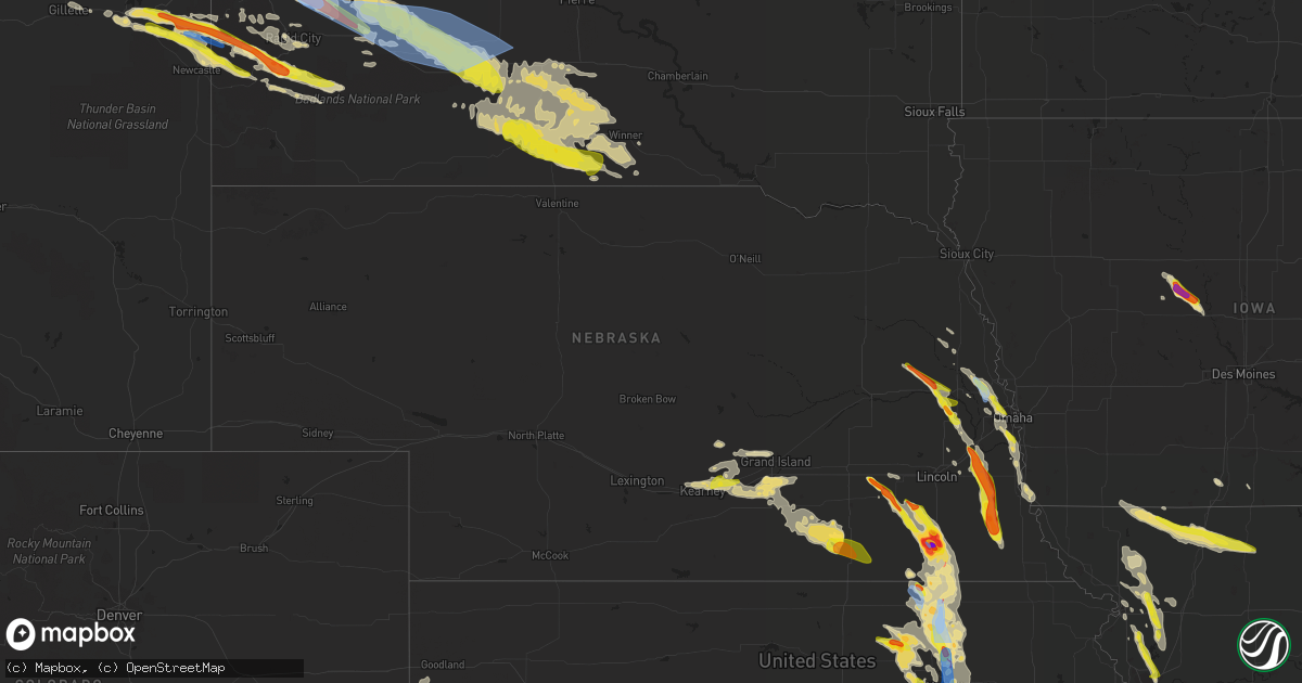
Hail Map in Nebraska on June 11, 2022
Get this storm
June 11 map
$229
one time, instant access
Download today. No call, no setup
Keep the $229
Bought the map and want the full workflow? Apply the entire $229 to a subscription within 7 days. None of it is wasted.
Every map, not just this one
This buys you this map. Subscription and you get every map we run, in the markets you choose from a few cities to whole states to nationwide. Plus real-time alerts the moment a storm fires.
Contact data
Name, contact info, occupancy, even credit band for addresses in the footprint. You go from where it hit to who to call.
Become the source they trust
Unlimited branding weather history reports on demand. You already have the documented answer ready for the property owner, and you are the one who showed up with it.
Property data and RoofTrace estimates
Pull up any address you have got, its value and the exact code rules for that jurisdiction, straight from One Click Code. Then RoofTrace estimates the squares, pitch, and roof value, priced the way you price.
Storm reports in Nebraska
Nebraska
| Date | Description |
|---|---|
| 06/11/20226:55 PM CDT | Tree limbs broken. Shingles blown off roof. |
| 06/11/20226:10 PM CDT | Shingles blown off roof. |
| 06/11/20226:08 PM CDT | Nickel to quarter sized hail on south side of bellevue. Time estimated from radar. Relayed via social media. |
| 06/11/20226:01 PM CDT | Corrects previous tstm wnd gst report from 1 sw papillion. Trained storm spotter measured a peak wind gust of 53 knots. |
| 06/11/20225:56 PM CDT | Report for quarter sized hail. |
| 06/11/20225:43 PM CDT | Quarter |
| 06/11/20225:40 PM CDT | A local report indicates 1.00 inch wind near 1 S ASHLAND |
| 06/11/20225:33 PM CDT | Trees and powerlines down. Time estimated from radar. |
| 06/11/20225:24 PM CDT | Extensive tree damage around wymore. |
| 06/11/20225:23 PM CDT | A local report indicates a tornado near 2 SE WYMORE |
| 06/11/20225:18 PM CDT | Trained spotter reported brief touch down of tornado east of blue springs. |
| 06/11/20224:54 PM CDT | Quarter |
| 06/11/20224:39 PM CDT | Report from mping: baseball+ |
| 06/11/20224:36 PM CDT | A local report indicates 1.00 inch wind near CEDAR BLUFFS |
| 06/11/20224:33 PM CDT | Time estimated by radar. |
| 06/11/20224:29 PM CDT | Grapefruit- |
| 06/11/20224:28 PM CDT | Photo sent to broadcast media. |
| 06/11/20224:27 PM CDT | A local report indicates 3.75 inch wind near 1 N BEATRICE |
| 06/11/20224:23 PM CDT | Corrects previous hail report from 1 n beatrice. |
| 06/11/20224:10 PM CDT | Public reported golf ball sized hail via social media. |
| 06/11/20226:58 AM CDT | 50mph winds and ping pong sized hail. |
| 06/11/20225:30 AM CDT | A local report indicates 1.00 inch wind near 7 NNW GIBBON |
| 06/11/20221:58 AM CDT | At 657 PM CDT, a severe thunderstorm was located 5 miles southwest of Johnson, or 5 miles east of Tecumseh, moving south at 40 mph. HAZARD...Ping pong ball size hail and 60 mph wind gusts. SOURCE...Radar indicated. IMPACT...People and animals outdoors will be injured. Expect hail damage to roofs, siding, windows, and vehicles. Expect wind damage to roofs, siding, and trees. This severe thunderstorm will be near... Table Rock around 715 PM CDT.Other locations in the path of this severe thunderstorm includeHumboldt. |
| 06/11/20221:12 AM CDT | At 611 PM CDT, a severe thunderstorm was located near Syracuse, or 17 miles west of Nebraska City, moving south at 40 mph. HAZARD...Ping pong ball size hail and 60 mph wind gusts. SOURCE...Radar indicated. This storm has a history of producing quarter sized hail. IMPACT...People and animals outdoors will be injured. Expect hail damage to roofs, siding, windows, and vehicles. Expect wind damage to roofs, siding, and trees. This severe thunderstorm will be near... Syracuse around 615 PM CDT. Lorton around 625 PM CDT. Cook around 630 PM CDT.Other locations in the path of this severe thunderstorm includeTalmage, Brock and Johnson. |
| 06/11/20221:07 AM CDT | At 607 PM CDT, a severe thunderstorm was located near Offutt AFB, moving southeast at 40 mph. HAZARD...Ping pong ball size hail and 60 mph wind gusts. SOURCE...Radar indicated. IMPACT...People and animals outdoors will be injured. Expect hail damage to roofs, siding, windows, and vehicles. Expect wind damage to roofs, siding, and trees. This severe thunderstorm will be near... Plattsmouth, Glenwood and Pacific Junction around 615 PM CDT. Beaver Lake around 620 PM CDT.Other locations in the path of this severe thunderstorm includeTabor.This includes Interstate 29 between mile markers 17 and 42. |
| 06/11/202212:51 AM CDT | At 550 PM CDT, a severe thunderstorm was located 4 miles west of Barneston, or 13 miles north of Marysville, moving southeast at 35 mph. HAZARD...Quarter size hail. SOURCE...Radar indicated. IMPACT...Damage to vehicles is expected. This severe thunderstorm will remain over mainly rural areas of south central Gage County. |
| 06/11/202212:25 AM CDT | At 524 PM CDT, a severe thunderstorm was located 3 miles north of Bennington, moving southeast at 30 mph. HAZARD...Ping pong ball size hail and 60 mph wind gusts. SOURCE...Radar indicated. IMPACT...People and animals outdoors will be injured. Expect hail damage to roofs, siding, windows, and vehicles. Expect wind damage to roofs, siding, and trees. This severe thunderstorm will be near... Omaha and Flanagan Lake around 535 PM CDT. Standing Bear Lake around 540 PM CDT.Other locations in the path of this severe thunderstorm include BoysTown, Benson, Aksarben, Florence, Ralston, La Vista, Carter Lake,Midtown, Eppley Airfield, Council Bluffs, Papillion, South Omaha,Bellevue and Offutt AFB.People attending Westfair Fairground & Amphitheater should seek safeshelter immediately!This includes the following highways... Interstate 29 between mile markers 42 and 63. Interstate 80 in Iowa between mile markers 1 and 11. Interstate 80 in Nebraska between mile markers 439 and 454. |
| 06/11/202212:06 AM CDT | At 505 PM CDT, a severe thunderstorm was located 5 miles south of Gretna, moving southeast at 35 mph. HAZARD...Ping pong ball size hail and 60 mph wind gusts. SOURCE...Public. This storm has a history of producing quarter sized hail. IMPACT...People and animals outdoors will be injured. Expect hail damage to roofs, siding, windows, and vehicles. Expect wind damage to roofs, siding, and trees. This severe thunderstorm will be near... Springfield around 510 PM CDT. Louisville, Cedar Creek and Murdock around 515 PM CDT.This includes Interstate 80 in Nebraska between mile markers 418 and437. |
| 06/10/202211:38 PM CDT | At 437 PM CDT, a severe thunderstorm was located 4 miles north of Mead, or 7 miles northeast of Wahoo, moving southeast at 30 mph. HAZARD...Ping pong ball size hail and 60 mph wind gusts. SOURCE...Radar indicated. IMPACT...People and animals outdoors will be injured. Expect hail damage to roofs, siding, windows, and vehicles. Expect wind damage to roofs, siding, and trees. This severe thunderstorm will be near... Valley around 445 PM CDT. Yutan and Ithaca around 450 PM CDT. Waterloo around 455 PM CDT.Other locations in the path of this severe thunderstorm includeGretna and Ashland.This includes Interstate 80 in Nebraska between mile markers 428 and435. |
| 06/10/202211:25 PM CDT | At 424 PM CDT, a severe thunderstorm was located 3 miles north of Friend, or 17 miles southwest of Seward, moving southeast at 10 mph. HAZARD...Two inch hail and 60 mph wind gusts. SOURCE...Radar indicated. IMPACT...People and animals outdoors will be injured. Expect hail damage to roofs, siding, windows, and vehicles. Expect wind damage to roofs, siding, and trees. This severe thunderstorm will be near... Friend around 435 PM CDT.Other locations in the path of this severe thunderstorm includeDorchester. |
| 06/10/202211:04 PM CDT | At 404 PM CDT, a severe thunderstorm was located 5 miles north of Cedar Bluffs, or 6 miles northwest of Fremont, moving southeast at 35 mph. HAZARD...Ping pong ball size hail and 60 mph wind gusts. SOURCE...Radar indicated. IMPACT...People and animals outdoors will be injured. Expect hail damage to roofs, siding, windows, and vehicles. Expect wind damage to roofs, siding, and trees. This severe thunderstorm will be near... Fremont, Inglewood and Woodcliff around 415 PM CDT.Other locations in the path of this severe thunderstorm includeArlington, Leshara and Valley. |
| 06/10/202211:03 PM CDT | At 403 PM CDT, a severe thunderstorm was located 5 miles southwest of Pickrell, or 5 miles northwest of Beatrice, moving east at 30 mph. HAZARD...Ping pong ball size hail and 60 mph wind gusts. SOURCE...Radar indicated. IMPACT...People and animals outdoors will be injured. Expect hail damage to roofs, siding, windows, and vehicles. Expect wind damage to roofs, siding, and trees. This severe thunderstorm will be near... Beatrice and Pickrell around 410 PM CDT.Other locations in the path of this severe thunderstorm includeHolmesville, Filley and Virginia. |
| 06/10/202210:59 PM CDT | At 359 PM CDT, a severe thunderstorm was located near Crete, or 20 miles southwest of Lincoln, moving southeast at 10 mph. HAZARD...Ping pong ball size hail and 60 mph wind gusts. SOURCE...Radar indicated. IMPACT...People and animals outdoors will be injured. Expect hail damage to roofs, siding, windows, and vehicles. Expect wind damage to roofs, siding, and trees. Locations impacted include... Wilber, Cortland, Clatonia, Hallam and Sprague. |
| 06/10/202210:52 PM CDT | At 351 PM CDT, a severe thunderstorm was located 3 miles west of Beaver Crossing, or 14 miles southeast of York, moving east at 25 mph. HAZARD...Ping pong ball size hail and 60 mph wind gusts. SOURCE...Radar indicated. IMPACT...People and animals outdoors will be injured. Expect hail damage to roofs, siding, windows, and vehicles. Expect wind damage to roofs, siding, and trees. This severe thunderstorm will be near... Beaver Crossing around 400 PM CDT. Goehner around 405 PM CDT. Friend around 410 PM CDT.Other locations in the path of this severe thunderstorm includeMilford and Dorchester.This includes Interstate 80 in Nebraska between mile markers 366 and379. |
| 06/10/202210:36 PM CDT | At 336 PM CDT, a severe thunderstorm was located 7 miles southwest of Snyder, or 17 miles southwest of West Point, moving east at 40 mph. HAZARD...Ping pong ball size hail and 60 mph wind gusts. SOURCE...Radar indicated. IMPACT...People and animals outdoors will be injured. Expect hail damage to roofs, siding, windows, and vehicles. Expect wind damage to roofs, siding, and trees. This severe thunderstorm will be near... North Bend around 350 PM CDT. |
| 06/10/20227:10 PM CDT | Trained storm spotter measured a peak wind gust of 53 knots. |
All States Impacted by Hail Map on June 11, 2022
Cities Impacted by Hail Map on June 11, 2022
- Broadus, MT
- Wall, SD
- Gilbert, LA
- Winnsboro, LA
- Ashdown, AR
- Murray, NE
- Plattsmouth, NE
- Bellevue, NE
- La Vista, NE
- Union, NE
- Papillion, NE
- Omaha, NE
- Burlington, CO
- Wheatland, IA
- Donahue, IA
- Walcott, IA
- Dixon, IA
- Bennett, IA
- Lowden, IA
- Clarence, IA
- Calamus, IA
- Stockton, IA
- New Liberty, IA
- Rozet, WY
- Moorcroft, WY
- Fremont, NE
- Clearmont, WY
- Churdan, IA
- Owanka, SD
- Midland, SD
- Newell, SD
- White River, SD
- Enning, SD
- Winner, SD
- Saint Francis, SD
- Vivian, SD
- Sturgis, SD
- Witten, SD
- Union Center, SD
- Quinn, SD
- Long Valley, SD
- Wood, SD
- Vale, SD
- Ideal, SD
- Mission, SD
- Draper, SD
- Okaton, SD
- Nisland, SD
- Kadoka, SD
- Colome, SD
- Parmelee, SD
- Presho, SD
- Norris, SD
- Philip, SD
- Whitewood, SD
- New Underwood, SD
- Wasta, SD
- Belvidere, SD
- Belle Fourche, SD
- Howes, SD
- Murdo, SD
- Okreek, SD
- Midway, GA
- Oakland, NE
- Carthage, NC
- Delaware, OK
- Nowata, OK
- Wanblee, SD
- Pope Army Airfield, NC
- Vass, NC
- Spring Lake, NC
- Fort Bragg, NC
- Cameron, NC
- Rapid City, SD
- Lame Deer, MT
- Busby, MT
- Birney, MT
- Crow Agency, MT
- Hardin, MT
- Otter, MT
- Scenic, SD
- Cosby, MO
- Saint Joseph, MO
- Alzada, MT
- Hammond, MT
- Boyes, MT
- Custer, MT
- Riley, KS
- Leonardville, KS
- Manhattan, KS
- Piedmont, SD
- Nemo, SD
- Lincoln, NE
- Waverly, NE
- Lewisville, AR
- Lyons, NE
- West Point, NE
- Bancroft, NE
- Spearfish, SD
- Saint Joseph, LA
- Galliano, LA
- El Dorado, KS
- Cassoday, KS
- Mead, NE
- North Bend, NE
- Wahoo, NE
- Dodge, NE
- Colon, NE
- Howells, NE
- Rogers, NE
- Cedar Bluffs, NE
- Lead, SD
- Deadwood, SD
- Junction City, KS
- Sundance, WY
- Hulett, WY
- Devils Tower, WY
- Alva, WY
- Keystone, SD
- Hill City, SD
- Hermosa, SD
- Forsyth, MT
- Volborg, MT
- Mangham, LA
- Baskin, LA
- Rayville, LA
- Hooper, NE
- Barnes, KS
- Palmer, KS
- Clay Center, KS
- Randolph, KS
- Morganville, KS
- Greenleaf, KS
- Clifton, KS
- Green, KS
- Beulah, WY
- Aladdin, WY
- Garden Grove, IA
- Allerton, IA
- Ogden, AR
- Marion, LA
- Ballantine, MT
- Ceresco, NE
- Gibbon, NE
- Dearborn, MO
- Nickerson, NE
- Herman, NE
- Arlington, NE
- Kennard, NE
- Washington, NE
- Bennington, NE
- Blair, NE
- Fayette, MS
- Ogden, IA
- Callender, IA
- Gowrie, IA
- Paton, IA
- Harcourt, IA
- Boxholm, IA
- Upton, WY
- Newcastle, WY
- Osage, WY
- Shickley, NE
- Davenport, NE
- Carleton, NE
- Gillette, WY
- Milford, NE
- Seward, NE
- Beaver Crossing, NE
- Giltner, NE
- Ravenna, NE
- Pleasanton, NE
- Kearney, NE
- Saronville, NE
- Shelton, NE
- Hebron, NE
- Sutton, NE
- Doniphan, NE
- Inland, NE
- Glenvil, NE
- Fairfield, NE
- Ong, NE
- Clay Center, NE
- Wood River, NE
- Kenesaw, NE
- Alda, NE
- Deweese, NE
- Edgar, NE
- Geneva, NE
- Harvard, NE
- Hastings, NE
- Trumbull, NE
- Juniata, NE
- Oak, NE
- Elkhorn, NE
- Osco, IL
- Lynn Center, IL
- Andover, IL
- Altona, IL
- Bishop Hill, IL
- Cambridge, IL
- Orion, IL
- Galva, IL
- Kanorado, KS
- Clarksdale, MO
- Helena, MO
- Union Star, MO
- Herington, KS
- Bedford, IA
- Ridgeway, MO
- Spickard, MO
- Eagleville, MO
- Sheridan, MO
- Gentry, MO
- New Hampton, MO
- Grant City, MO
- Parnell, MO
- Denver, MO
- Worth, MO
- Princeton, MO
- Albany, MO
- Bethany, MO
- Hopkins, MO
- Martinsville, MO
- Gilman City, MO
- Council Grove, KS
- Weston, WY
- Stratton, CO
- Redding, IA
- Easton, MO
- Friend, NE
- Wakefield, KS
- Yutan, NE
- Hilliard, FL
- Callahan, FL
- Edgard, LA
- Kansas City, MO
- Agency, MO
- Gower, MO
- Edgerton, MO
- Liberty, MO
- Smithville, MO
- Trimble, MO
- Elmwood, NE
- Humboldt, NE
- Ames, NE
- Gretna, NE
- Weeping Water, NE
- Springfield, NE
- Talmage, NE
- Ithaca, NE
- Louisville, NE
- Clarkson, NE
- Tecumseh, NE
- Syracuse, NE
- Morse Bluff, NE
- Otoe, NE
- Ashland, NE
- Greenwood, NE
- Burr, NE
- Cook, NE
- Sterling, NE
- Johnson, NE
- Elk Creek, NE
- Table Rock, NE
- Unadilla, NE
- Alvo, NE
- Murdock, NE
- Memphis, NE
- Avoca, NE
- Lorman, MS
- Waterproof, LA
- Custer, SD
- Fairburn, SD
- Nebraska City, NE
- Hamburg, IA
- Percival, IA
- Bethune, CO
- Hanover, KS
- Bremen, KS
- Emporia, KS
- Strong City, KS
- Olpe, KS
- Beatrice, NE
- Cottonwood Falls, KS
- Matfield Green, KS
- De Witt, NE
- Olsburg, KS
- Blue Rapids, KS
- Clatonia, NE
- Filley, NE
- Oketo, KS
- Hallam, NE
- Beattie, KS
- Blue Springs, NE
- Frankfort, KS
- Waterville, KS
- Wilber, NE
- Pickrell, NE
- Cortland, NE
- Home, KS
- Barneston, NE
- Marysville, KS
- Liberty, NE
- Westmoreland, KS
- Wymore, NE
- Odell, NE
- Crete, NE
- Dorchester, NE
- Hollenberg, KS
- Elk City, KS
- Sedan, KS
- Saint George, KS
- Milford, KS
- Alma, KS
- Washington, KS
- Virginia, NE
- Alta Vista, KS
- Diller, NE
- Cordova, NE
- Waco, NE
- Linn, KS
- Fort Riley, KS
- Wamego, KS
- York, NE
- Cairo, NE
- Grand Island, NE
- Madison, KS
- Cedar Point, KS
- Steele City, NE
- Stanberry, MO
- Barnard, MO
- Guilford, MO
- Rea, MO
- Bolckow, MO
- Fall River, KS
- Severy, KS
- Copan, OK
- Caney, KS
- Eureka, KS
- Lenapah, OK
- Niotaze, KS
- Wann, OK
- Havana, KS
- Dewey, OK
- Longton, KS
- Goodland, KS
- Decatur, IA
- Leon, IA
- Somers, IA
- Farnhamville, IA
- Roseville, IL
- Smithshire, IL
- Grand River, IA
- Lincolnville, KS
- Burdick, KS
- Plattsburg, MO
- Holt, MO
- Stewartsville, MO
- Amity, MO
- Savannah, MO
- Maryville, MO
- Conception, MO
- King City, MO
- Osborn, MO
- Lathrop, MO
- Conception Junction, MO
- Texarkana, AR
- Garland City, AR
- Maysville, MO
- Cameron, MO
- Wilsey, KS
- White City, KS
- Woodbine, KS
- Burns, KS
- Fredonia, KS
- Hamilton, KS
- Elmdale, KS
- Golden Meadow, LA
- Jeanerette, LA
- Grand Junction, IA
- Ossineke, MI
- Spotsylvania, VA
- Fredericksburg, VA
- Rosebud, SD
- Milesville, SD
- Hysham, MT
- Rockville, VA
- Manakin Sabot, VA
- Pine Ridge, SD
- Dunbar, NE
- Alexandria, NE
- Bruning, NE
- Belvidere, NE
- Gilead, NE
- Dwight, KS
- Marion, KS
- Florence, KS
- Pilot Mound, IA


