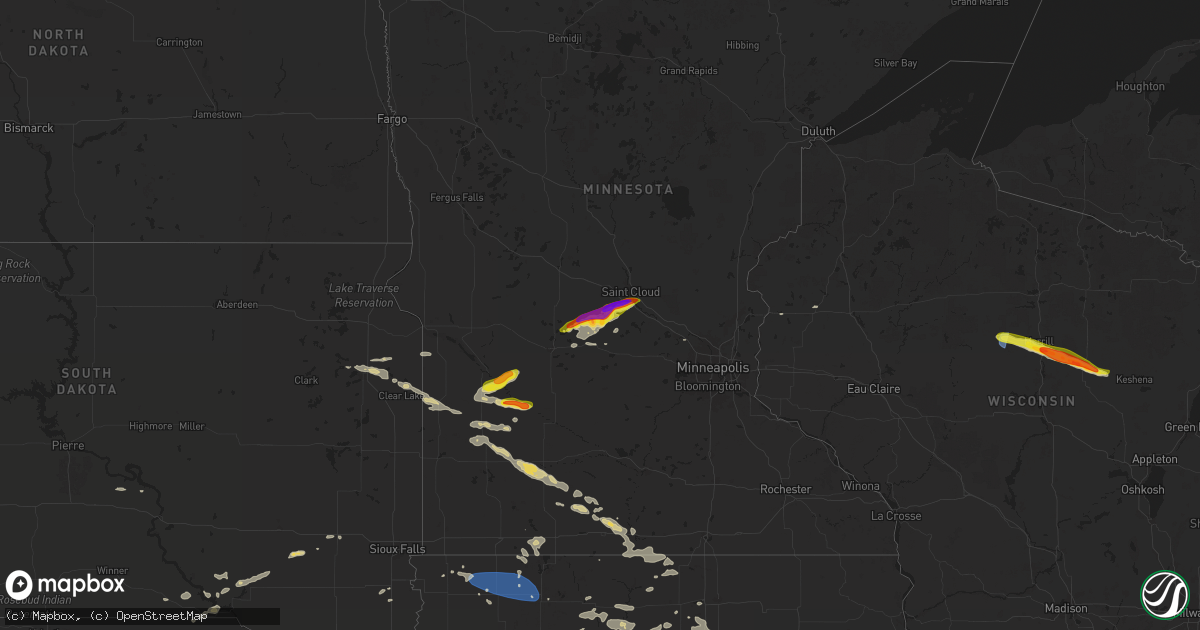
Hail Map on July 18, 2025
Get this storm
July 18 map
$229
one time, instant access
Download today. No call, no setup
Keep the $229
Bought the map and want the full workflow? Apply the entire $229 to a subscription within 7 days. None of it is wasted.
Every map, not just this one
This buys you this map. Subscription and you get every map we run, in the markets you choose from a few cities to whole states to nationwide. Plus real-time alerts the moment a storm fires.
Contact data
Name, contact info, occupancy, even credit band for addresses in the footprint. You go from where it hit to who to call.
Become the source they trust
Unlimited branding weather history reports on demand. You already have the documented answer ready for the property owner, and you are the one who showed up with it.
Property data and RoofTrace estimates
Pull up any address you have got, its value and the exact code rules for that jurisdiction, straight from One Click Code. Then RoofTrace estimates the squares, pitch, and roof value, priced the way you price.
States Impacted by Hail Map on July 18, 2025
Storm reports
North Carolina
| Date | Description |
|---|---|
| 07/18/20256:58 PM CDT | Power line down along rosewood road near autumn winds drive. |
| 07/18/20256:55 PM CDT | Tree down near west memorial highway. |
| 07/18/20256:55 PM CDT | Tree down near west memorial highway and souther road. |
| 07/18/20256:34 PM CDT | Power outage caused by fallen trees damaging equipment along nc-96 and keen road near four oaks. |
| 07/18/20256:21 PM CDT | Wral on scene where eastbound lanes of i-40 were closed near mile marker 338 due to several trees down... One of which fell on a car. No injuries reported. |
| 07/18/20255:58 PM CDT | Power outage caused by fallen trees near godwin. |
| 07/18/20255:51 PM CDT | Tree down at godwin-falcon rd and allie cooper rd. |
| 07/18/20255:47 PM CDT | Tree down on bunnlevel erwin rd. |
| 07/18/20254:55 PM CDT | Tree and powerline down along wheelers church road near the intersection with burlington road. |
| 07/18/20252:00 PM CDT | Tree down blocking both lanes of travel on belvue drive in mount airy... Nc. |
| 07/18/20251:15 PM CDT | Tree down near the intersection of epperson church road and banks valley lane in mount airy... Nc. |
| 07/18/20251:06 PM CDT | Tree down near the intersection of east pine street and slate mountain road in mount airy... Nc. |
| 07/17/20258:00 PM CDT | Tree downed by thunderstorm winds at the intersection of jessup road and asbury road. |
| 07/17/20257:48 PM CDT | Tree downed by thunderstorm winds at the intersection of beamer road and maple grove church road... And landed in the roadway. |
| 07/17/20257:46 PM CDT | Tree downed by thunderstorm winds... And fell on a powerline. |
| 07/17/20257:46 PM CDT | Tree downed by thunderstorm winds... And blocking one lane... On stanford church road. |
| 07/17/20257:33 PM CDT | Tree downed by thunderstorm winds near the intersection of jenkinstown road and crest rock trail. |
| 07/17/20257:25 PM CDT | Tree downed by thunderstorm winds on nc state road 268... And blocked one side of the road... And also partially caught a powerline. |
| 07/17/20257:01 PM CDT | Delayed report. Tideland electric membership corporation reported two broken power poles and downed wire resulting in power outages. Time estimated from radar. |
South Carolina
| Date | Description |
|---|---|
| 07/18/20253:40 PM CDT | Emergency manager reports one tree on house on fieldfare way. Time estimated by radar. |
| 07/18/20253:19 PM CDT | Emergency manager reports one tree down on stuart towne lane. Time estimated by radar. |
| 07/18/20253:19 PM CDT | Emergency manager reports one tree down on paige point bluff road. Damage is likely from thunderstorm outflow. Time estimated by radar. |
| 07/18/20253:03 PM CDT | Tree down across portions of i-95. |
| 07/18/20253:03 PM CDT | Emergency manager reported 3 trees down west of beaufort. One tree on car at 29 franklin drive... One tree down at james habersham and hollingsworth run... And one tree |
| 07/18/20253:03 PM CDT | Emergency manager reports trees down west of beaufort. One tree on car on franklin drive... One tree down at james habersham and hollingsworth run... And one tree on wi |
Idaho
| Date | Description |
|---|---|
| 07/18/20256:42 PM CDT | Tree down on power lines. Power outage in the area. |
| 07/18/20256:00 PM CDT | Sheep creek hills... Id |
| 07/18/20255:50 PM CDT | Sheep creek hills... Id |
| 07/18/20254:45 PM CDT | Noaa arl frd dubois. |
| 07/18/20254:20 PM CDT | Pacficorp medicine lodge. |
| 07/18/20254:20 PM CDT | Noaa arl frd specific manufacturing capability. |
| 07/18/20254:18 PM CDT | Power lines damaged. Multiple reports of power outages. |
| 07/18/20254:14 PM CDT | Power lines damaged. Power outages across the area. |
Georgia
| Date | Description |
|---|---|
| 07/18/20255:15 PM CDT | Tree down on vehicles along jimmy carter boulevard near atlantic drive. |
| 07/18/20255:08 PM CDT | Asos site at dekalb-peachtree airport |
Wisconsin
| Date | Description |
|---|---|
| 07/18/20256:20 AM CDT | Report relayed via wsaw-tv. |
| 07/18/20256:16 AM CDT | Several trees down in aniwa. |
| 07/18/20256:15 AM CDT | Trees do |
| 07/18/20256:15 AM CDT | Trees down. (g |
| 07/18/20256:15 AM CDT | Trees down. |
| 07/18/20256:06 AM CDT | Rv blown over in the town of harrison. |
| 07/18/20256:05 AM CDT | Numerous trees down. Three campers received minor injuries. |
| 07/18/20256:03 AM CDT | Trees down in hewitt. |
| 07/18/20256:03 AM CDT | Corrects previous hail report from 6 wnw hogarty. |
| 07/18/20256:03 AM CDT | Corrects previous hail report from 6 w |
| 07/18/20256:02 AM CDT | Newly finished barn down. Multiple trees in the area damaged. Chicken coop gone. Time estimated via radar... Report via social media. |
| 07/18/20255:52 AM CDT | Report from mping: quarter |
| 07/18/20255:42 AM CDT | Report relayed via law enforcement. |
| 07/18/20255:36 AM CDT | Several trees down in pine river. |
| 07/18/20255:26 AM CDT | Trees down at council grounds state park. One injury was reported. |
Illinois
| Date | Description |
|---|---|
| 07/18/20254:40 AM CDT | Tree down on house about 12 inch diameter. |
Minnesota
| Date | Description |
|---|---|
| 07/17/20259:35 PM CDT | A local report indicates 1.00 inch wind near St. Augusta |
| 07/17/20259:24 PM CDT | A local report indicates 1.00 inch wind near Luxemburg |
| 07/17/20259:10 PM CDT | Re |
| 07/17/20259:10 PM CDT | Reported via stearns co em in slack. |
| 07/17/20259:03 PM CDT | A local report indicates 1.75 inch wind near 4 N Eden Valley |
Kansas
| Date | Description |
|---|---|
| 07/18/20256:16 PM CDT | A local report indicates 60 MPH wind near Peabody |
| 07/18/20255:48 PM CDT | Delayed report... Large tree limb was knocked down by thunderstorm wind gusts. |
| 07/18/20255:30 PM CDT | Nws employee reported tree damage on zoo blvd just east of i-235... Part of the lane was being blocked by the downed tree. |
| 07/18/20255:29 PM CDT | Emergency management reported a tree limb blown down on a car near irma & 45th n in maize. |
| 07/18/20255:26 PM CDT | Reported wind gust of 65mph came from a trained spotter at central and oliver. |
| 07/18/20255:26 PM CDT | Nws employee reported 70mph winds at 9th and zoo blvd. |
| 07/18/20255:16 PM CDT | Delayed report. Yingling aviation at eisenhower airport reported a small fedex cessna 208 caravan plane was tipped over with wing damage by thunderstorm wind gusts. |
| 07/18/20255:15 PM CDT | A local report indicates 71 MPH wind near Wichita NWS Office |
| 07/18/20255:03 PM CDT | A local report indicates 60 MPH wind near 4 NW Clearwater |
| 07/18/20254:57 PM CDT | A local report indicates 60 MPH wind near Clearwater |
| 07/18/20254:39 PM CDT | A local report indicates 1.75 inch wind near Conway Springs |
| 07/18/20254:35 PM CDT | A local report indicates 70 MPH wind near Conway Springs |
| 07/18/20254:29 PM CDT | A local report indicates 60 MPH wind near Conway Springs |
Alabama
| Date | Description |
|---|---|
| 07/18/202512:30 PM CDT | Tree down blocking both lanes of roadway. |
Nebraska
| Date | Description |
|---|---|
| 07/17/202511:49 PM CDT | A local report indicates 1.00 inch wind near 4 NW Burwell |
| 07/17/20259:22 PM CDT | Estimated 65 mph wind gust. |
| 07/17/20259:13 PM CDT | A local report indicates 64 MPH wind near Scottsbluff |
| 07/17/20259:11 PM CDT | A local report indicates 1.00 inch wind near Gering |
| 07/17/20259:10 PM CDT | A local report indicates 1.50 inch wind near 2 SSW Gering |
| 07/17/20258:42 PM CDT | Delayed report. Outbuilding blown apart by thunderstorm winds. Accompanied by pea sized hail. Report received via social media. |
| 07/17/20258:38 PM CDT | Also received dime size hail. |
| 07/17/20258:38 PM CDT | A local report indicates a tornado near 9 S Johnstown |
| 07/17/20258:28 PM CDT | Late report from area storm chaser. |
| 07/17/20258:24 PM CDT | A local report indicates a tornado near 7 S Johnstown |
Utah
| Date | Description |
|---|---|
| 07/17/20259:10 PM CDT | Mesonet station uttpd torpedo hill big cttnwd cnyn. |
| 07/17/20259:10 PM CDT | Mesonet station snd arrowhead summit. |
Montana
| Date | Description |
|---|---|
| 07/18/20254:14 PM CDT | Time estimated by radar. |
Wyoming
| Date | Description |
|---|---|
| 07/18/20256:55 PM CDT | Social media post showing ping pong ball size hail. |
| 07/18/20255:12 PM CDT | Mesonet station wy62 i25 us87 - smokey gap. |
| 07/17/20259:30 PM CDT | Downed power lines and tree damage. |
| 07/17/20258:25 PM CDT | A local report indicates 1.00 inch wind near 4 SW Lyman |
| 07/17/20258:25 PM CDT | Delayed report. Broken windows reported due to wind driven quarter sized hail. Time estimated via radar. |
| 07/17/20257:38 PM CDT | Spotter reported 1.2 inch hail 10 miles nw of henry... Ne. |
| 07/17/20257:21 PM CDT | A local report indicates 1.00 inch wind near Lost Springs |
| 07/17/20257:15 PM CDT | Estimated 60 mph winds. |
Iowa
| Date | Description |
|---|---|
| 07/18/20256:09 AM CDT | Recorded on personal weather station. |
| 07/18/20256:00 AM CDT | A few 3 inch tree limbs down. |
| 07/18/20255:58 AM CDT | A few tree limbs down in town. At least one greater than 4 in diameter. Relayed by kcci. Time estimated by radar. |
| 07/18/20255:54 AM CDT | Measured on personal weather station. |
| 07/18/20255:36 AM CDT | Time estimated from radar. Images of several 3 to 6 inch diameter tree branches down. One tree is also uprooted. |
| 07/18/20255:00 AM CDT | Time estimated. |
Kentucky
| Date | Description |
|---|---|
| 07/18/20254:30 PM CDT | Power lines down on a firetruck at levin and park avenue in paducah. Time estimated from radar. |
Virginia
| Date | Description |
|---|---|
| 07/18/20256:54 PM CDT | Large... Healthy tree fell onto an unoccupied car. Time estimated from radar. Report via facebook. |
| 07/18/20256:51 PM CDT | Large tree fell down along ferndale ave. |
| 07/18/20256:48 PM CDT | Reports of numerous trees down across southern dinwiddie county. Time estimated via radar. |
| 07/18/20256:47 PM CDT | A large tree limb fell near iron bridge rd. |
| 07/18/20256:45 PM CDT | A large tree down at the intersection of s chester rd and millwood rd. |
| 07/18/20256:45 PM CDT | A large tree fell down along twin cliffs ln. |
| 07/18/20256:45 PM CDT | A tree fell at the intersection of route-10 and lewis rd. |
| 07/18/20256:43 PM CDT | Tree knocked down along us-460 in the vicinity of courthouse rd. Time estimated from radar. |
| 07/18/20256:43 PM CDT | Large tree fell down along courtney ct. |
| 07/18/20256:43 PM CDT | Tree knocked down along hills dr. Time estimated from radar. |
| 07/18/20256:40 PM CDT | Numerous trees down in the vicinity of danton pond in bealeton. |
| 07/18/20256:16 PM CDT | Report of 10 trees down in the proximity of blackstone. |
| 07/18/20256:15 PM CDT | Tree downed and partially closing va-40 near laurel dr. |
| 07/18/20256:14 PM CDT | Numerous trees down along namozine rd. |
| 07/18/20256:14 PM CDT | Numerous trees down along greenes rd. |
| 07/18/20256:14 PM CDT | Numerous tr |
| 07/18/20255:55 PM CDT | Tree knocked down on us-360 in the vicinity of mount zion rd. Time |
| 07/18/20255:55 PM CDT | Tree knocked down on us-360 in the vicinity of mount zion rd. Time estimated from radar. |
| 07/18/20255:55 PM CDT | Debris on route 360 due to weather southwest of amelia courthouse. Report via waze. |
| 07/18/20255:53 PM CDT | Numerous trees down along cellar creek rd. |
| 07/18/20255:53 PM CDT | Numerous trees down along namozine rd in nottaway. |
| 07/18/20255:52 PM CDT | Numerous trees down along west creek rd. |
| 07/18/20255:49 PM CDT | Numerous trees down along little creek rd. |
| 07/18/20255:44 PM CDT | A large tree was down along perkinson rd. |
| 07/18/20255:36 PM CDT | Tree down along route 360 near mount zion rd. |
| 07/18/20255:36 PM CDT | Tree down at the intersection of amelia springs rd and 360. |
| 07/18/20255:33 PM CDT | A large tree down along st james rd. |
| 07/18/20254:50 PM CDT | Power pole snapped... Lines blocking dickens rd at wilton office park near intersection w/ staples mill rd. One mature tree uprooted and two 12 inch diameter trees each |
| 07/18/20254:50 PM CDT | Corrects previous tstm wnd dmg report from 1 ese dumbarton. A large tree fell on a house along battery ave. |
| 07/18/20254:50 PM CDT | A large tree fell on a house along buckingham ave. |
| 07/18/20254:50 PM CDT | A large tree fell on a house along irisdale ave. |
| 07/18/20254:50 PM CDT | *** 1 inj *** a large tree fell on a house along kent street causing minor injuries to one person. |
| 07/18/20254:50 PM CDT | Received numerous reports of down trees and power lines across lakeside and other parts of the county. |
| 07/18/20254:45 PM CDT | Tree limbs down near the intersection of i-64 and parham rd reported by trained spotter. |
| 07/18/20254:33 PM CDT | Tree downed by thunderstorm winds and landed on a powerline... That led to a power outage in the surrounding area. |
| 07/18/20254:30 PM CDT | Tree downed by thunderstorm winds near the intersection of lewis ford road and harper valley road... And blocked the road. |
| 07/18/20254:22 PM CDT | Tree downed by thunderstorm winds on salem road. |
| 07/18/20254:17 PM CDT | Tree downed by thunderstorm winds at the intersection of red house road and three creeks road... And blocked both lanes of travel. |
| 07/18/20253:45 PM CDT | Tree downed by thunderstorm winds at the intersection of n river road and william f stone highway... And landed across the exit ramp and blocked the entire road. |
| 07/18/20253:45 PM CDT | Tree downed by thunderstorm winds on philpott drive. |
| 07/18/20253:26 PM CDT | Tree downed by thunderstorm winds on truman hill road... And blocked the entire road. |
| 07/18/20253:20 PM CDT | Quarter size hail in locust creek. |
| 07/18/20253:17 PM CDT | Tree downed by thunderstorm winds at the intersection of whetstone road and sawmill road... And blocked the entire road. |
| 07/18/20253:17 PM CDT | Tree down on the 1500 block of copper line road. Time estimated. |
| 07/18/20253:15 PM CDT | Social media report of a large tree down on a house near the intersection of dickerson mill road and stewartsville road near chamblissburg... Va. Time is estimated from |
| 07/18/20252:50 PM CDT | Personal weather station measured a 62 mph wind gust near stewartsville... Va. |
| 07/18/20252:50 PM CDT | Tree down on davis lane in stewartsville... Va. |
| 07/18/20252:50 PM CDT | A personal weather station reported a 60mph wind gust. |
| 07/18/20252:50 PM CDT | Measured report of quarter size hail in stewartsville... Va. |
| 07/18/20252:45 PM CDT | Measured hail report of quarter size north of stewartsville... Va. |
| 07/18/20252:35 PM CDT | Tree is down on irvindale road near brookneal... Va... Blocking one lane of traffic. |
| 07/18/20252:30 PM CDT | Multiple trees down... Partially blocking the roadway near the intersection of franklin street and sawmill road near ferrum... Va. Time is estimated from radar. |
| 07/18/20251:10 PM CDT | Tree down on power line... Blocking the southbound lane of axton road near axton... Va. |
| 07/18/202512:55 PM CDT | Tree down along old liberty drive near the intersection at mount olive road in axton... Va. |
| 07/18/202512:55 PM CDT | Report of quarter size hail near ridgeway... Va. Time estimated from radar. |
| 07/18/202512:55 PM CDT | Tree down along old liberty drive near the intersection at mount oli |
| 07/18/202512:45 PM CDT | Tree down at a residence on irisburg road near axton... Va. |
| 07/18/202512:45 PM CDT | Two large trees down near the intersection of emerald drive and ruby court... Power lines also brought down with the trees. |
| 07/18/202512:40 PM CDT | Small tree down and blocking one lane near the dump at the intersection of clearview drive and arden drive in martinsville... Va. Time estimated from radar. |
| 07/17/20258:20 PM CDT | Weather station at poquoson reported a wind gust to 50 kt. |
| 07/17/20258:20 PM CDT | A large tree fell on a house along battery ave. |
| 07/17/20258:20 PM CDT | A large tree fell on a house along battery ave |
| 07/17/20257:26 PM CDT | Multiple large tree branches fell near 460. |
Cities Impacted by Hail Map on July 18, 2025
- Axton, VA
- Ridgeway, VA
- Vinton, VA
- Goodview, VA
- Moneta, VA
- Mineral, VA
- Bumpass, VA
- Montpelier, VA
- Milan, KS
- Argonia, KS
- Conway Springs, KS
- Clearwater, KS
- Viola, KS
- Midwest, WY
- Casper, WY
- Thermopolis, WY
- Worland, WY
- Wichita, KS
- Haysville, KS
- Valley Center, KS
- Kechi, KS
- Wheatland, WY
- Guernsey, WY
- Fort Laramie, WY
- Sedgwick, KS
- Newton, KS
- Whitewater, KS
- Yoder, WY
- Manville, WY
- Shawnee, WY
- Glendo, WY
- Torrington, WY
- Lingle, WY
- Kim, CO
- Pritchett, CO
- Granite Falls, MN
- Sacred Heart, MN
- Maynard, MN
- Clarkfield, MN
- Montevideo, MN
- Wood Lake, MN
- Echo, MN
- Clara City, MN
- Belview, MN
- Renville, MN
- Lusk, WY
- Lance Creek, WY
- Ainsworth, NE
- Johnstown, NE
- Morrill, NE
- Lyman, NE
- Hampton, VA
- Poquoson, VA
- Mitchell, NE
- Gering, NE
- Scottsbluff, NE
- Richmond, MN
- Grove City, MN
- New London, MN
- Paynesville, MN
- Atwater, MN
- Spicer, MN
- Eden Valley, MN
- Watkins, MN
- Cold Spring, MN
- Kimball, MN
- Minatare, NE
- Melbeta, NE
- South Haven, MN
- Saint Cloud, MN
- Clearwater, MN
- Bayard, NE
- Burwell, NE
- Harrisburg, NE
- Sibley, IA
- Melvin, IA
- Ashton, IA
- Sheldon, IA
- Sanborn, IA
- Ocheyedan, IA
- Hartley, IA
- George, IA
- Everly, IA
- Spencer, IA
- Harris, IA
- Milford, IA
- Lake Park, IA
- Primghar, IA
- Rockville, MN
- Walton, KS
- Peabody, KS
- Elbing, KS
- Merrill, WI
- Athens, WI
- Rib Lake, WI
- Medford, WI
- Wausau, WI
- Boone, IA
- Stratford, IA
- Ames, IA
- Aniwa, WI
- Birnamwood, WI
- Antigo, WI
- Bowler, WI
- Clear Lake, MN
- Kennebec, SD
- Lower Brule, SD
- Byrdstown, TN
- Martinsville, VA
- Riner, VA
- Christiansburg, VA
- Ravenel, SC
- Conway, SC
- Radford, VA
- Trinidad, CO
- Monte Vista, CO
- Latta, SC
- Rowland, NC
- Meeteetse, WY
- Magnolia, KY
- Jetersville, VA
- Amelia Court House, VA
- Moncks Corner, SC
- Capitan, NM
- Paducah, KY
- Monroe, LA
- Alton, VA
- Whiteville, NC
- Princeton, KY
- Fairfield, NC
- Trementina, NM
- Appomattox, VA
- Pamplin, VA
- Monroe, TN
- Las Vegas, NV
- Chadbourn, NC
- Clarendon, NC
- Dublin, VA
- Hurricane, UT
- Okatie, SC
- Kaycee, WY
- Waverly, VA
- Spring Grove, VA
- Hanley Falls, MN
- West Monroe, LA
- Stony Creek, VA
- Disputanta, VA
- Fairmont, NC
- Del Norte, CO
- Pilot, VA
- Metropolis, IL
- Brookport, IL
- Bolton, NC
- Roanoke, VA
- Cloverdale, VA
- Rice, VA
- Watertown, SD
- Tamms, IL
- Mounds, IL
- Amorita, OK
- Burlington, OK
- Canby, MN
- Porter, MN
- Taunton, MN
- Gary, SD
- Clear Lake, SD
- Loris, SC
- Farmville, VA
- Grenville, NM
- Folkston, GA
- Hermitage, AR
- Cumberland, VA
- Dillwyn, VA
- Georgetown, SC
- Cherokee, OK
- Shawneetown, IL
- Munfordville, KY
- Callahan, FL
- Bluff City, KS
- Richmond, VA
- Henrico, VA
- Raton, NM
- Strandburg, SD
- Caldwell, KS
- Freeport, KS
- Maxwell, NM
- Morrilton, AR
- Benson, NC
- Dunn, NC
- Powell, WY
- White City, KS
- Herington, KS
- Burlington, NC
- Yanceyville, NC
- Mebane, NC
- Hardy, VA
- Goodwin, SD
- Douglas, WY
- Newton Grove, NC
- Revillo, SD
- Marietta, MN
- Tabor City, NC
- Wakefield, VA
- Glasgow, KY
- Milroy, MN
- Vesta, MN
- Goddard, KS
- Strong City, KS
- Emporia, KS
- Darlington, SC
- Ghent, MN
- Roper, NC
- Winona, MO
- North Wilkesboro, NC
- Roaring River, NC
- Junction City, KS
- Cottonwood, MN
- Marshall, MN
- Minneota, MN
- Bluffton, SC
- Hartville, WY
- Newport News, VA
- Yorktown, VA
- Cave City, KY
- Horse Cave, KY
- Dendron, VA
- Burns, KS
- Amelia, NE
- Jarratt, VA
- Lynd, MN
- Litchfield, MN
- Darwin, MN
- Florence, SD
- Mount Airy, NC
- Brewster, NE
- Tracy, MN
- Plymouth, NC
- Gurdon, AR
- Arkadelphia, AR
- Colwich, KS
- Fairfax, SD
- Walnut Grove, MN
- Windsor, NC
- Prescott, AR
- Golconda, IL
- Herod, IL
- Andale, KS
- Jonesville, NC
- Ronda, NC
- Creswell, NC
- West Plains, MO
- Revere, MN
- Rogers, MN
- Turtle Lake, WI
- Saint Croix Falls, WI
- Dresser, WI
- Ericson, NE
- Greeley, NE
- Scotia, NE
- Ord, NE
- Bartlett, NE
- Spalding, NE
- Taylor, NE
- Butterfield, MN
- Saint James, MN
- Bassett, NE
- Lamberton, MN
- Arvonia, VA
- Comfrey, MN
- Mountain Lake, MN
- Purdum, NE
- Lakefield, MN
- Round Lake, MN
- Bridgeport, NE
- Jeffers, MN
- Bingham Lake, MN
- Springfield, MN
- Sanborn, MN
- Spirit Lake, IA
- Jackson, MN
- Long Pine, NE
- Granada, MN
- Fairmont, MN
- Truman, MN
- Jetmore, KS
- Butte, NE
- Naper, NE
- Beresford, SD
- Corsica, SD
- Geddes, SD
- Okabena, MN
- Thompson, IA
- Buffalo Center, IA
- Elmore, MN
- Rake, IA
- Frost, MN
- Newport, NE
- Ormsby, MN
- Odin, MN
- Blue Earth, MN
- Winnebago, MN
- Swea City, IA
- Ledyard, IA
- Stuart, NE
- Atkinson, NE
- Angora, NE
- Mallard, IA
- Havelock, IA
- West Bend, IA
- Ottosen, IA
- Algona, IA
- Centerville, SD
- Lennox, SD
- Burke, SD
- Rock Rapids, IA
- Rolfe, IA
- Bode, IA
- Belmond, IA
- Kanawha, IA
- Clarion, IA
- Goldfield, IA
- Renwick, IA
- Leland, IA
- Lu Verne, IA
- Livermore, IA
- Chambers, NE
- Armour, SD
- Glen Allen, VA
- Alden, IA
- Eagle Grove, IA
- Badger, IA
- Clare, IA
- Fort Dodge, IA
- Humboldt, IA
- Dows, IA
- Alexander, IA
- Rowan, IA
- Latimer, IA
- Galt, IA
- Hardy, IA
- Blairsburg, IA
- Williams, IA
- Lake Andes, SD
- Emmetsburg, IA
- Bonesteel, SD
- Saint Charles, SD
- Thor, IA
- Woolstock, IA
- Vincent, IA
- Thornton, IA
- Swaledale, IA
- Ethan, SD
- Traer, IA
- Brusett, MT
- Cylinder, IA
- Whittemore, IA
- Canistota, SD
- Sheffield, IA
- New Sharon, IA
- Ogden, IA
- Paton, IA
- Iowa Falls, IA
- Popejoy, IA
- Salem, SD
- Jefferson, IA
- Churdan, IA
- Bradgate, IA
- Bouton, IA
- Doon, IA
- Polk City, IA
- Woodward, IA
- Madrid, IA
- Perry, IA
- Alexandria, SD
- Grand Junction, IA
- Dana, IA
- Dumont, IA
- Ottumwa, IA
- Dimock, SD
- Parkston, SD
- Hampton, IA
- Kamrar, IA
- Webster City, IA
- Ackley, IA
- Geneva, IA
- Meservey, IA
- Klemme, IA
- Goodell, IA
- Curlew, IA
- Dysart, IA
- Clear Lake, IA
- Gladbrook, IA
- Austinville, IA
- Parkersburg, IA
- New Hartford, IA
- Stout, IA
- Aplington, IA
- Garner, IA
- Scarville, IA
- Gilmore City, IA
- Boxholm, IA
- Rippey, IA
- Bridgewater, SD
- Jordan, MT
- Agency, IA
- Archer, IA
- Delmont, SD
- Garwin, IA
- Toledo, IA
- Luther, IA
- Jamaica, IA
- Dawson, IA
- Sheldahl, IA
- Slater, IA
- Dayton, IA
- Pilot Mound, IA
- Lehigh, IA
- Belle Plaine, IA
- Chelsea, IA
- Blairstown, IA
- Elberon, IA
- Van Horne, IA
- Luzerne, IA
- Keystone, IA
- Shell Rock, IA
- Woden, IA
- Titonka, IA
- Radcliffe, IA
- Cedar Falls, IA
- Dike, IA
- Milton, NC
- La Porte City, IA
- Flint Hill, VA
- Huntly, VA
- Cairo, IL
- Las Vegas, NM
- Pulaski, IL
- Platte, SD
- Garrison, IA
- Columbia, NC
- Jesup, GA
- Coulter, IA
- Malta, MT
- Summerfield, IL
- Trenton, IL
- Ringle, WI
- Kelley, IA
- Marathon, WI