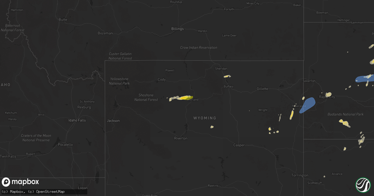
Hail Map on July 22, 2025
Get this storm
July 22 map
$229
one time, instant access
Download today. No call, no setup
Keep the $229
Bought the map and want the full workflow? Apply the entire $229 to a subscription within 7 days. None of it is wasted.
Every map, not just this one
This buys you this map. Subscription and you get every map we run, in the markets you choose from a few cities to whole states to nationwide. Plus real-time alerts the moment a storm fires.
Contact data
Name, contact info, occupancy, even credit band for addresses in the footprint. You go from where it hit to who to call.
Become the source they trust
Unlimited branding weather history reports on demand. You already have the documented answer ready for the property owner, and you are the one who showed up with it.
Property data and RoofTrace estimates
Pull up any address you have got, its value and the exact code rules for that jurisdiction, straight from One Click Code. Then RoofTrace estimates the squares, pitch, and roof value, priced the way you price.
States Impacted by Hail Map on July 22, 2025
Storm reports
Minnesota
| Date | Description |
|---|---|
| 07/22/20254:00 PM CDT | Large tree over comstock rd. |
| 07/22/20253:15 PM CDT | Corrects time of previous tstm wnd dmg report from 2 ese libby. Several pontoon boats flipped over on big sandy lake. Time estimated from radar. |
| 07/22/20253:15 PM CDT | Corrects time of previous tstm wnd dmg report from 5 n mcgregor. Time estimated from radar. Trained spotter said trees were down on powerlines in the area. |
| 07/22/20253:07 PM CDT | A large tree was blown over onto a camper at the eagle point campground on big sandy lake. Time estimated by radar. |
| 07/22/20253:01 PM CDT | Four large oak trees were down at the spotters location. Time estimated by radar. |
| 07/22/20252:50 PM CDT | Several 5 inch diameter oak tree limbs broken off. |
| 07/22/20252:30 PM CDT | Several small trees down at golf course in emily. Course had a lot of standing waters. Time estimated from radar. |
| 07/22/20252:15 PM CDT | Several pontoon boats flipped over on big sandy lake. Time estimated from radar. |
| 07/22/20252:15 PM CDT | Time estimated from radar. Trained spotter said trees were down on powerlines in the area. |
| 07/21/20258:50 PM CDT | Measured at kaxn. |
Iowa
| Date | Description |
|---|---|
| 07/22/20256:56 PM CDT | Measured at the ottumwa airport. |
Alabama
| Date | Description |
|---|---|
| 07/22/20255:46 PM CDT | Power pole leaning off memorial parkway resulting in power outages. Time estimated from radar. |
Tennessee
| Date | Description |
|---|---|
| 07/21/20257:00 PM CDT | Several trees were blown down in lawrenceburg including one that fell on a car on 4th st. |
Texas
| Date | Description |
|---|---|
| 07/22/20254:39 PM CDT | A local report indicates 60 MPH wind near 5 W Dryden |
| 07/22/20253:37 PM CDT | A local report indicates 59 MPH wind near 3 NNW Belding |
| 07/22/202510:50 AM CDT | A local report indicates 70 MPH wind near 6 ENE Amarillo |
| 07/22/20251:39 AM CDT | Heat burst; first severe wind gust occurred at 0129... Followed by two severe wind gusts at 0138 and 0139. |
| 07/21/202510:50 PM CDT | Corrects previous tstm wnd gst report from 6 ene amarillo. |
| 07/21/202510:40 PM CDT | A local report indicates 59 MPH wind near 6 S Olton |
| 07/21/202510:32 PM CDT | A local report indicates 64 MPH wind near Reese Center |
| 07/21/20259:56 PM CDT | A local report indicates 63 MPH wind near 1 NNW Lubbock Int. Airp |
| 07/21/20259:40 PM CDT | A local report indicates 63 MPH wind near 6 S Wolfforth |
| 07/21/20259:35 PM CDT | Thunderstorm winds lifted and peeled back the entire south-facing roof of a barn. Time estimated from radar. |
South Carolina
| Date | Description |
|---|---|
| 07/22/20255:01 PM CDT | Powerpole down and tree down in the 700 block of shirley street. |
| 07/22/20254:22 PM CDT | Tree down in the 1050 block of tillman road. This was associated with thunerstorm outflow. Time estimiated based on radar. |
| 07/22/20254:19 PM CDT | Tree down along kato bay road near okeetee club road. This was associated with thunderstorm outflow. Time estimated based on radar. |
| 07/22/20254:19 PM CDT | Tree down along kato bay road near okeetee club road. This was associated with thunderstorm outflow. Time estimated b |
| 07/22/20254:07 PM CDT | Tree down near log hall road and wooden horse run. This was associated with thunderstorm outflow. Time estimated based on radar. |
| 07/22/20252:46 PM CDT | Reports of several trees down along parts of toogoodoo road. Reports relayed by charleston county emergency management and a member of the charleston broadcast media. T |
Colorado
| Date | Description |
|---|---|
| 07/22/20256:18 PM CDT | Mesonet station co001 i-25 and c470. |
| 07/22/20256:16 PM CDT | Awos station kapa 2 sse centennial. |
Florida
| Date | Description |
|---|---|
| 07/22/20255:15 PM CDT | Quarter-sized hail reported on hwy 388... East of ecp airport. |
| 07/22/20254:40 PM CDT | Social media report of a large pine tree down on highway 22... Blocking an eastbound lane of traffic. |
| 07/22/20252:41 PM CDT | Talquin electric reports downed trees and powerlines in the woodville area. Time estimated by radar. |
| 07/22/20252:29 PM CDT | Asos station ktlh tallahassee international airport reported a gust of 60 mph. |
South Dakota
| Date | Description |
|---|---|
| 07/22/202510:30 AM CDT | Call from public with estimated winds and 0.77 in rain. |
| 07/22/20256:56 AM CDT | A local report indicates 73 MPH wind near 8 NNW Harrison |
| 07/22/20256:55 AM CDT | Report via social media. Hail the size of a pheasant egg |
| 07/22/20256:51 AM CDT | A local report indicates 59 MPH wind near 4 SSE Witten |
| 07/22/20256:15 AM CDT | Sd mesonet site near la plant. |
| 07/22/20256:15 AM CDT | A local report indicates 75 MPH wind near 10 NW Okobojo Creek Rec |
| 07/22/20256:15 AM CDT | Sd mesonet site near la pla |
| 07/22/20256:09 AM CDT | Personal weather station. |
| 07/22/20255:40 AM CDT | Personal weather station. |
| 07/22/20254:35 AM CDT | A local report indicates 66 MPH wind near 2 SW Bridger |
| 07/22/20253:20 AM CDT | A local report indicates 59 MPH wind near 3 NW Wasta |
| 07/22/20251:15 AM CDT | A local report indicates 64 MPH wind near 10 W Jewel Cave |
Georgia
| Date | Description |
|---|---|
| 07/22/20252:19 PM CDT | Several large... Deep rooted trees were reported blown down along parts of us-301 in statesboro by bulloch county emergency management. Time estimated based on radar. |
Cities Impacted by Hail Map on July 22, 2025
- Midland, SD
- Belvidere, SD
- Okaton, SD
- Murdo, SD
- Fifty Lakes, MN
- Pine River, MN
- Leola, SD
- Frederick, SD
- Westport, SD
- Columbia, SD
- Mcgregor, MN
- Palisade, MN
- Jacobson, MN
- Henning, MN
- Ottertail, MN
- New York Mills, MN
- Deer Creek, MN
- Wadena, MN
- Bluffton, MN
- Cordesville, SC
- Damascus, GA
- Blakely, GA
- Bainbridge, GA
- Okeechobee, FL
- Johns Island, SC
- Ravenel, SC
- Crosslake, MN
- Crosby, MN
- Emily, MN
- Merrifield, MN
- Pequot Lakes, MN
- Aitkin, MN
- Outing, MN
- Tallahassee, FL
- Tuskegee, AL
- Crawfordville, FL
- Monticello, FL
- Hollywood, SC
- Swatara, MN
- Hill City, MN
- Worland, WY
- Thermopolis, WY
- Summerton, SC
- Clayton, AL
- Eufaula, AL
- Abbeville, AL
- Clopton, AL
- Tamarack, MN
- Limon, CO
- Wright, MN
- Floodwood, MN
- Clio, AL
- Gettysburg, SD
- Rush, CO
- Cromwell, MN
- Meadowlands, MN
- Brookston, MN
- Alborn, MN
- White River, SD
- Hoven, SD
- Fort Stockton, TX
- Yoder, CO
- Fort Pierre, SD
- Keysville, GA
- Kite, GA
- Wrightsville, GA
- Cloquet, MN
- Saginaw, MN
- Forest Grove, MT
- Tolstoy, SD
- Tallassee, AL
- Louisville, GA
- Fort Lauderdale, FL
- Grass Range, MT
- Wadley, GA
- Onaka, SD
- Panama City, FL
- Presho, SD
- Pine Ridge, SD
- Bonifay, FL
- Winnett, MT
- Dryden, TX
- Youngstown, FL
- Pierre, SD
- Arriba, CO
- Swainsboro, GA
- Ridgeland, SC
- Hardeeville, SC
- Rincon, GA
- Lynnville, TN
- Guyton, GA
- Flagler, CO
- Dellrose, TN
- Lynn Haven, FL
- Elbert, CO
- Iraan, TX
- Kyle, SD
- Calhan, CO
- Manderson, SD
- Colorado Springs, CO
- Larkspur, CO
- Collyer, KS
- Deatsville, AL
- Prattville, AL
- Seneca, SD
- Eagleville, MO
- Hatfield, MO
- Kaycee, WY
- Quinter, KS
- Ebro, FL
- Cheyenne Wells, CO
- Springfield, GA
- Big Lake, TX
- Huger, SC
- Ridgeway, MO
- Ozona, TX
- Panama City Beach, FL
- Banner, WY
- Morland, KS
- Park, KS
- Midland, TX
- Hoxie, KS
- Bloomfield, IA
- Drakesville, IA
- Garden City, TX
- Kit Carson, CO
- Ottumwa, IA
- Blakesburg, IA
- Clearmont, WY
- Ponce De Leon, FL
- La Junta, CO
- Staples, MN
- Lorimor, IA
- Albia, IA
- Grady, AL
- Nisswa, MN
- Lovilia, IA
- White Sands Missile Range, NM
- Murray, IA
- Winterset, IA
- Norcross, MN
- Alliance, NE
- Lapine, AL
- Goshen, AL
- Sterling, CO
- Wheaton, MN
- Highland Home, AL
- Luverne, AL
- Bussey, IA
- McDonald, KS
- Floris, IA
- Selma, IA
- Levelland, TX
- Hay Springs, NE
- Sidney, NE
- Stanton, TX
- Elbow Lake, MN
- Tarzan, TX
- Richey, MT
- Lamesa, TX
- Gail, TX
- White Sulphur Springs, MT
- Muleshoe, TX
- Newton, IA
- Tucson, AZ
- Florence, AZ
- Bloomfield, MT
- Fluvanna, TX
- Lambert, MT
- Savage, MT
- Sidney, MT
- Quemado, TX
- Baxter, IA
- Rhodes, IA
- Brackettville, TX
- Melbourne, IA
- Plainview, TX
- Amarillo, TX
- Douglas, WY
- Kress, TX
- Hale Center, TX
- Littlefield, TX
- Fieldton, TX
- Olton, TX
- Amherst, TX
- Meadow, TX
- Wolfforth, TX
- Tahoka, TX
- Brownfield, TX
- Tulia, TX
- Ropesville, TX
- Lubbock, TX
- Shallowater, TX
- Fleming, CO
- Claude, TX
- Castle Rock, CO
- Sedalia, CO
- Parker, CO
- Englewood, CO
- Lone Tree, CO
- Aurora, CO
- Eddyville, IA
- Hedrick, IA
- Fremont, IA
- Alexandria, MN
- Lowry, MN
- Sanborn, ND
- Valley City, ND
- Newcastle, WY
- Hill City, SD
- Custer, SD
- Edgemont, SD
- Prairie Du Chien, WI
- Potter, NE
- Rapid City, SD
- Black Hawk, SD
- Bayard, NE
- Lisbon, ND
- Bagley, WI
- Bloomington, WI
- Cassville, WI
- Box Elder, SD
- Ellsworth Afb, SD
- Piedmont, SD
- Glen Haven, WI
- Hereford, TX
- New Underwood, SD
- Wasta, SD
- Wall, SD
- Howes, SD
- Milesville, SD
- Dupree, SD
- Cherry Creek, SD
- Union Center, SD
- Enning, SD
- White Owl, SD
- Meadow, SD
- Merriman, NE
- Eagle Butte, SD
- Lantry, SD
- Solway, MN
- Gordon, NE
- Martin, SD
- Crookston, NE
- Bemidji, MN
- Laporte, MN
- Valentine, NE
- Ridgeview, SD
- Saint Francis, SD
- Mission, SD
- Federal Dam, MN
- Batesland, SD
- Cass Lake, MN
- Wood, SD
- Platte, SD
- Agar, SD
- Bena, MN
- Park Rapids, MN
- Winner, SD
- Corsica, SD
- Stickney, SD
- Harrison, SD
- Hamill, SD
- Deer River, MN
- Ideal, SD
- Witten, SD
- Nevis, MN
- Hayes, SD
- Glenham, SD
- Mobridge, SD
- Onida, SD
- Okreek, SD