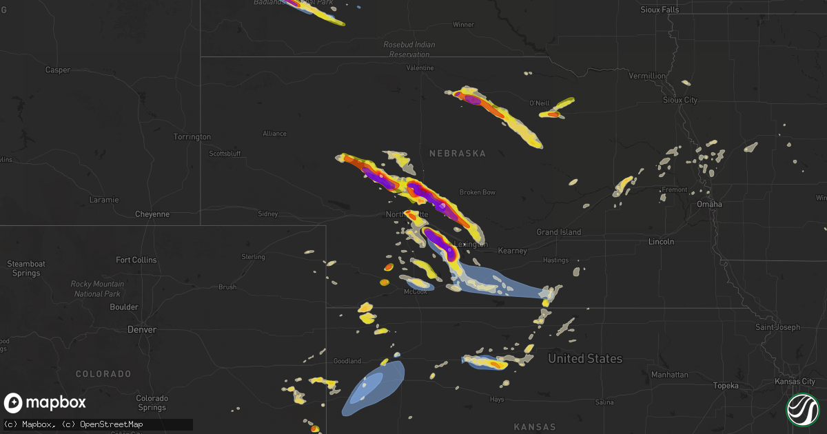
Hail Map on July 19, 2025
Get this storm
July 19 map
$229
one time, instant access
Download today. No call, no setup
Keep the $229
Bought the map and want the full workflow? Apply the entire $229 to a subscription within 7 days. None of it is wasted.
Every map, not just this one
This buys you this map. Subscription and you get every map we run, in the markets you choose from a few cities to whole states to nationwide. Plus real-time alerts the moment a storm fires.
Contact data
Name, contact info, occupancy, even credit band for addresses in the footprint. You go from where it hit to who to call.
Become the source they trust
Unlimited branding weather history reports on demand. You already have the documented answer ready for the property owner, and you are the one who showed up with it.
Property data and RoofTrace estimates
Pull up any address you have got, its value and the exact code rules for that jurisdiction, straight from One Click Code. Then RoofTrace estimates the squares, pitch, and roof value, priced the way you price.
States Impacted by Hail Map on July 19, 2025
Storm reports
Montana
| Date | Description |
|---|---|
| 07/19/20256:55 PM CDT | A local report indicates 2.00 inch wind near 8 WSW Lindsay |
| 07/19/20256:20 PM CDT | Windshield cracked. |
| 07/19/20256:15 PM CDT | A local report indicates 2.00 inch wind near 6 NE Brockway |
| 07/19/20255:53 PM CDT | Truck window broken due to the hail. |
| 07/19/20255:15 PM CDT | Mesonet station mtbid 6.2 s biddle |
| 07/18/202510:38 PM CDT | Mostly peas with a few golf balls. |
| 07/18/202510:32 PM CDT | A local report indicates 65 MPH wind near 7 NE Mill Iron |
| 07/18/20259:15 PM CDT | A local report indicates 60 MPH wind near 1 E Knowlton |
| 07/18/20258:00 PM CDT | Emergency management reported branches down from multiple trees across town... A main power line down causing power outage in terry. Damage to a tin roof at ball field. |
| 07/18/20257:42 PM CDT | Winds estimated to be in excess of 60 mph based on social media video post and tree limb damage. |
| 07/18/20257:42 PM CDT | Winds e |
| 07/18/20257:30 PM CDT | Blm terry station. |
West Virginia
| Date | Description |
|---|---|
| 07/18/202510:03 PM CDT | Tree down near justice. |
Nevada
| Date | Description |
|---|---|
| 07/19/20253:30 PM CDT | Mesonet station a18aa 26.2 ne beatty |
North Carolina
| Date | Description |
|---|---|
| 07/19/20256:33 PM CDT | Tree down at miller rd and meadow wind lane. |
| 07/19/20256:29 PM CDT | Tree down at lannie dr and piney grove church rd. |
| 07/19/20256:20 PM CDT | Trees down at nc 49 and nc 119. |
| 07/19/20256:17 PM CDT | Trees down at smith dr and nc 119. |
| 07/19/20254:40 PM CDT | Trees down on alamance drive in reidsville... Nc. Time is estimated from radar. |
| 07/19/20254:30 PM CDT | Tree down near the intersection of old hwy 86 south and corbett ridge road near mebane... Nc. Time is estimated from radar. |
| 07/19/20254:15 PM CDT | Tree damage reported on roanoke rapids rd. Time estimated by radar. |
| 07/19/20253:52 PM CDT | Trees on power lines resulting in power outages at morgan rd and nc highway 39. |
| 07/19/20253:15 PM CDT | Trees down at nc highway 43 n and temperance hall rd. |
| 07/19/20252:51 PM CDT | Trees down on power lines resulting in power outages at schley rd and nc highway 57. |
| 07/19/20252:20 PM CDT | Trees on power lines resulting in power outages at us highway 1 and nc highway 96. |
| 07/19/20252:15 PM CDT | Downed tree along nc 137. Time estimated by radar. |
| 07/19/20251:39 PM CDT | A few trees down in durham county. |
| 07/19/20251:36 PM CDT | Tree downed by thunderstorm winds on pat nixon road... And landed on a power transformer. |
| 07/19/202512:58 PM CDT | Tree downed by thunderstorm winds near the intersection of round peak church road and west pine street... And blocked the entire road. |
| 07/18/20259:05 PM CDT | A few hundred power outages due to trees on powerlines. |
| 07/18/20259:00 PM CDT | Tree down on faro road. |
| 07/18/20259:00 PM CDT | Flooding on old greensboro road. Moving water on roadway. |
| 07/18/20258:05 PM CDT | Trees down along 400 block of wc braswell rd. |
| 07/18/20257:50 PM CDT | Trees down along 4400 block of brogden rd. |
| 07/18/20257:35 PM CDT | Several hundred outages due to fallen trees on powerlines. |
| 07/18/20257:31 PM CDT | Tree down on i-40 near exit 319. |
South Dakota
| Date | Description |
|---|---|
| 07/19/202512:56 AM CDT | A local report indicates 58 MPH wind near 7 E Wanblee |
| 07/19/202512:10 AM CDT | A local report indicates 60 MPH wind near 5 S Potato Creek |
| 07/18/202511:08 PM CDT | A local report indicates 60 MPH wind near 7 N Rockyford |
| 07/18/202510:25 PM CDT | A local report indicates 61 MPH wind near 7 SSW Folsom |
| 07/18/20259:30 PM CDT | A local report indicates 1.00 inch wind near 4 S Dwtn Rapid City |
| 07/18/20259:26 PM CDT | A local report indicates 1.00 inch wind near 5 SW Downtown Rapid Cit |
| 07/18/20259:25 PM CDT | Nickel to quarter |
| 07/18/20259:02 PM CDT | 69.6 mph |
| 07/18/20258:58 PM CDT | A local report indicates 60 MPH wind near 1 W Box Elder |
| 07/18/20258:55 PM CDT | A local report indicates 1.00 inch wind near 3 SSE SILVER CITY |
| 07/18/20258:53 PM CDT | A local report indicates 62 MPH wind near Ellsworth AFB |
| 07/18/20258:53 PM CDT | A local report indicates 63 MPH wind near Rapid City Arpt |
| 07/18/20258:45 PM CDT | A local report indicates 1.00 inch wind near 4 N Dwtn Rapid City |
| 07/18/20258:40 PM CDT | 3/4 inch hail |
| 07/18/20258:24 PM CDT | A local report indicates 1.00 inch wind near 2 W Black Hawk |
| 07/18/20257:48 PM CDT | A few of the larger pieces were 1 inch in diameter... Most was smaller. |
Nebraska
| Date | Description |
|---|---|
| 07/19/20256:57 PM CDT | Report from mping: hen egg |
| 07/19/20256:55 PM CDT | Had large hail between 650 to 7pm ct with heavy rainfall. (lb |
| 07/19/20256:55 PM CDT | Had large hail between 650 to 7pm ct with heavy rainfall. |
| 07/19/20256:55 PM CDT | Time estimated by radar. |
| 07/19/20256:52 PM CDT | A local report indicates 1.75 inch wind near Eustis |
| 07/19/20256:41 PM CDT | Report from mping: quarter |
| 07/19/20256:40 PM CDT | Spotter network reports baseball sized hail northeast of farnam. |
| 07/19/20256:33 PM CDT | Report of tree branches knocked down onto a vehicle. |
| 07/19/20256:11 PM CDT | Delayed report via social media. Time estimated by radar. |
| 07/19/20255:52 PM CDT | Delayed report via social media. Time estimated by radar. |
| 07/19/20255:33 PM CDT | Delayed report via social media. Time estimated by radar. |
| 07/19/20255:22 PM CDT | Ping pong size hail and 50 mph winds. |
| 07/19/20255:22 PM CDT | A local report indicates 1.75 inch wind near 1 S Long Pine |
| 07/19/20255:20 PM CDT | A local report indicates 1.25 inch wind near Long Pine |
| 07/19/20255:18 PM CDT | A local report indicates 1.75 inch wind near 4 E North Platte |
| 07/19/20255:17 PM CDT | A local report indicates 1.00 inch wind near 1 N North Platte |
| 07/19/20255:17 PM CDT | A local report indicates 1.75 inch wind near 2 NNE North Platte |
| 07/19/20255:16 PM CDT | A local report indicates 1.00 inch wind near 1 W North Platte |
| 07/19/20255:02 PM CDT | A local report indicates 3.00 inch wind near 11 S Arnold |
| 07/19/20254:55 PM CDT | A local report indicates 3.00 inch wind near 12 W Tryon |
| 07/19/20254:48 PM CDT | A local report indicates 1.75 inch wind near 14 W Tryon |
| 07/19/20254:37 PM CDT | Had reports of hail breaking out windows on several houses in town. There was some water over the county roads. |
| 07/19/20254:28 PM CDT | A local report indicates 1.00 inch wind near 9 SW Verdigre |
| 07/19/20254:13 PM CDT | Report from mping: grapefruit |
| 07/19/20254:11 PM CDT | Report from mping: baseball |
| 07/19/20253:41 PM CDT | Baseball size hail reported from coop observer. |
| 07/19/20253:41 PM CDT | Baseball size hail reported from coop observer. |
| 07/19/20253:36 PM CDT | Golf ball size hail... Possibly larger reported by coop observer. |
| 07/19/20253:36 PM CDT | Golf ball size hail... Possibly larger reported by coop observer. |
| 07/18/20258:50 PM CDT | Personal weather station reports gust to 62mph. |
| 07/18/20258:35 PM CDT | Personal weather station reports gust to 62mph. |
| 07/18/20258:31 PM CDT | Personal weather station reports gust to 59mph. |
| 07/18/20258:20 PM CDT | Trained spotter estimates 50-60 mph wind gusts. |
| 07/18/20258:14 PM CDT | Site timmerman house measures 62 mph wind gust. |
| 07/18/20258:10 PM CDT | Personal weather station reports gust to 72mph. |
| 07/18/20258:00 PM CDT | Video on social media of a large tree limb on the ground in oxford. Time estimated from radar. |
| 07/18/20257:43 PM CDT | [landspout] caller reported thin tornado south of palisade. They were in wauneta... Ne looking east. |
| 07/18/20257:30 PM CDT | Off-duty nws employee estimates 60mph wind gusts in arapahoe. |
| 07/18/20257:04 PM CDT | A local report indicates 1.00 inch wind near 1 NW Hayes Center |
Kansas
| Date | Description |
|---|---|
| 07/19/20256:50 PM CDT | Sporadic quarter sized hail. |
| 07/19/20255:59 PM CDT | Delayed entry. Site black_tub_ranch measured 60 mph wind gust. |
| 07/19/202512:42 AM CDT | Asos station khlc hill city. |
| 07/18/202511:05 PM CDT | Dispatch relayed report |
| 07/18/202511:05 PM CDT | Dispatch relayed report of two semis blown over on i-70. Time estimated from first called in report. Location approximated. |
| 07/18/202511:05 PM CDT | Site k5ok7 measured 63 mph wind gust. |
| 07/18/202510:40 PM CDT | Site kksmonum6 reports 64 mph wind gust. |
| 07/18/202510:39 PM CDT | Site jake_from_the_farm measured 60 mph wind gust. |
| 07/18/202510:30 PM CDT | Delayed report. 15 foot section of a roof from a limestone block building was blown to the east. Time estimated via other reports in the area. |
| 07/18/202510:28 PM CDT | Mesonet station up840 9.0 w winona |
| 07/18/202510:27 PM CDT | Site ks_russellsprings3sw measured 64 mph wind gust. |
| 07/18/202510:24 PM CDT | Site section_17 |
| 07/18/202510:23 PM CDT | Mesonet station up840 9.0 w winona |
| 07/18/202510:19 PM CDT | Site ks-russellsprings3sw measures 64 mph wind gust. |
| 07/18/202510:10 PM CDT | Reported numerous large tree limbs down in winona and provided several pictures. |
| 07/18/202510:00 PM CDT | Emergency manager reports ping-pong ball sized hail north of plainville. |
| 07/18/20259:57 PM CDT | Emergency manager reports power poles broken of hwy 183 and s road. Time estimated from radar. |
| 07/18/20259:57 PM CDT | Emergency manager reports broken power poles off hwy 183 and s road. Time estimated from radar. |
| 07/18/20259:32 PM CDT | Personal weather station reports gust to 59mph. |
| 07/18/20257:01 PM CDT | Lots of pea size hail and torrential rainfall occurring as well. |
North Dakota
| Date | Description |
|---|---|
| 07/18/202511:33 PM CDT | Ndawn station grenora 8 |
| 07/18/202511:33 PM CDT | Ndawn station grenora 8n. |
Wisconsin
| Date | Description |
|---|---|
| 07/19/20254:28 PM CDT | Large pine tree down... Several small-medium branches down... And damage to roofing. Video taken from public... Relayed by media. |
| 07/19/20254:28 PM CDT | Large pine tree down... |
| 07/19/20254:24 PM CDT | Time estimated by radar. |
Illinois
| Date | Description |
|---|---|
| 07/19/202511:54 AM CDT | Photos shared showed a few tree limbs blown down near cherry wood lane & cimarron drive and also near andrea drive. |
| 07/19/20256:29 AM CDT | Delayed report. Large tree fell onto an adjacent home causing damage to roof and siding. Time estimated from radar. |
Virginia
| Date | Description |
|---|---|
| 07/19/20256:59 PM CDT | A powerline fell due to thunderstorm wind. |
| 07/19/20256:59 PM CDT | 3 trees have fallen across the eastern portion of the county. |
| 07/19/20256:53 PM CDT | Tree down on va-155 in the county of charles city... In the vicinity of kenthill ln; county/city/town line: new kent county line/charles city county line. |
| 07/19/20256:43 PM CDT | Numerous trees down across king william county. |
| 07/19/20256:14 PM CDT | Tree down on i-95 via waze and traffic camera. |
| 07/19/20256:11 PM CDT | Tree reported down on mountain rd. Tim estimated by radar. |
| 07/19/20256:10 PM CDT | Numerous trees down across broad street. |
| 07/19/20256:10 PM CDT | Numerous trees down along staples mill rd. |
| 07/19/20256:09 PM CDT | Tree down on howards mill road. Time estimated by radar. |
| 07/19/20256:09 PM CDT | Numerous trees reported down along ashland rd. Time estimated by radar. |
| 07/19/20256:08 PM CDT | Tree fell on car on cauthorne rd. No injuries were reported. Time estimated by radar. |
| 07/19/20256:05 PM CDT | Numerous trees down along twin hickory lake dr. |
| 07/19/20256:01 PM CDT | Power line wires down along broad street rd. |
| 07/19/20256:00 PM CDT | Tree down along st matthews ln. |
| 07/19/20256:00 PM CDT | Tree knocked down blocking ashland rd. Near three chopt rd. Time estimated from radar. |
| 07/19/20255:58 PM CDT | A large tree down along hermitage rd. |
| 07/19/20255:58 PM CDT | Tree down along millers ln. |
| 07/19/20255:58 PM CDT | 2 reports of trees blocking portions of i-64 in eastern goochland county. Time estimated from radar. |
| 07/19/20255:58 PM CDT | Power line wires down along millers ln. |
| 07/19/20255:56 PM CDT | Tree down along 656 rockford rd. |
| 07/19/20255:56 PM CDT | Tree down along manakin rd. |
| 07/19/20255:52 PM CDT | Tree down along river rd w. |
| 07/19/20255:40 PM CDT | Tree down along nash rd. |
| 07/19/20255:34 PM CDT | Tree down along old white oak rd. |
| 07/19/20255:23 PM CDT | Corrects previous tstm wnd dmg report from 1 n meredithville. Tree reported down across brunswick dr. Time estimated by radar. |
| 07/19/20255:21 PM CDT | Corrects previous tstm wnd dmg report from 2 nw meredithville. Tree reported down across shining creek rd. Time estimated by radar. |
| 07/19/20254:32 PM CDT | Tree reported down across brunswick dr. Time estimated by radar. |
| 07/19/20254:31 PM CDT | Tree reported down across shining creek rd. Time estimated by radar. |
| 07/19/20254:30 PM CDT | Tree reported down at the intersection of huckstep rd. And robinson ferry rd. Time estimated by radar. |
| 07/19/20254:30 PM CDT | Tree reported down across tillman rd. Time estimated by radar. |
| 07/19/20254:29 PM CDT | Tree reported down across alvis rd. Time estimated by radar. |
| 07/19/20254:21 PM CDT | Tree down across the road blocking all lanes. Time estimated by radar. |
| 07/19/20254:21 PM CDT | Updates previous tstm wnd dmg report from 3 w gasburg. Several trees down across the road blocking all lanes. Time estimated by radar. |
| 07/19/20254:15 PM CDT | Tree down across the road blocking traffic. Time estimated by radar. |
| 07/19/20253:08 PM CDT | Tree downed by thunderstorm winds on irisburg road... And blocked one lane. |
| 07/19/20252:21 PM CDT | Trees down on proffit road and proffit station road. |
| 07/19/20252:20 PM CDT | Multiple trees knocked down along w river rd. Time estimated from radar. |
| 07/19/20252:19 PM CDT | 3 trees down across the town of scottsville. Relayed from albemarle county. Time estimated from radar. |
| 07/19/20252:16 PM CDT | Three trees down near scottsville on james river road. |
| 07/18/20259:20 PM CDT | Tree downed by thunderstorm winds near the intersection of meadowood trail and preston road... And blocked the entire roadway. |
| 07/18/20258:38 PM CDT | Tree downed by thunderstorm winds and blocking both lanes of iron bridge road... About a mile and a half from route 57. |
| 07/18/20257:45 PM CDT | Tree down along lottsburg rd. |
| 07/18/20257:44 PM CDT | Tree down along sydnors millpond rd. |
| 07/18/20257:44 PM CDT | Trees down at the intersection of dodlyt rd and northumberland hwy. |
| 07/18/20257:34 PM CDT | Numerous trees down across lancaster county. |
| 07/18/20257:30 PM CDT | Report of a tree down on tucker hill road. Time estimated via radar. |
| 07/18/20257:19 PM CDT | Tree down at the intersection of town bridge rd and old virginia street. |
| 07/18/20257:19 PM CDT | Tree down at the intersection of old virginia street and warner rd. |
| 07/18/20257:01 PM CDT | A large tree down on on rt. 632 in the county of king william... In the vicinity of smith ferry rd; rt. 630n/s |
Kentucky
| Date | Description |
|---|---|
| 07/19/20253:35 PM CDT | Tree downed by thunderstorm winds on madison st south of nebo. |
Indiana
| Date | Description |
|---|---|
| 07/19/20252:08 PM CDT | Tree down blocking the right lane of veterans memorial parkway. Time estimated from radar. |
Alabama
| Date | Description |
|---|---|
| 07/19/202510:19 AM CDT | Tree down on cr 339 with partial blockage of roadway. Time estimated based on radar. |
| 07/19/20259:31 AM CDT | Metal roof partially torn off a large barn or shed. Time estimated from radar. |
| 07/19/20257:39 AM CDT | Tree on power line. Time estimated from radar. |
| 07/19/20257:33 AM CDT | Large tree down at the intersection of county rd 221 and county rd 220. Time estimated from radar. |
| 07/19/20257:15 AM CDT | Tree down. Time estimated based on radar. |
| 07/19/20257:03 AM CDT | Tree down across bethel circle. Time estimated from radar. |
California
| Date | Description |
|---|---|
| 07/18/20258:42 PM CDT | Mesonet station idpc1 independence 4 wnw. |
Ohio
| Date | Description |
|---|---|
| 07/18/20258:36 PM CDT | Trees and power lines down at moorefield and west ridgewood. Possible tornado. Time estimated from radar. |
| 07/18/20258:36 PM CDT | Corrects previous tstm wnd dmg report from 3 ese tremont city. Trees and power lines down at moorefield and west ridgewood. Two buildings damaged as well. Possible torn |
| 07/18/20258:15 PM CDT | Damage to crops near lochard road and wells road intersection. Possible tornado. Time estimated from radar. |
Cities Impacted by Hail Map on July 19, 2025
- Scottsville, VA
- Esmont, VA
- Tryon, NE
- Stapleton, NE
- Hyannis, NE
- Mullen, NE
- Seneca, NE
- Inman, NE
- Oneill, NE
- Page, NE
- Ewing, NE
- Arthur, NE
- Orchard, NE
- Winnetoon, NE
- Brady, NE
- Arnold, NE
- North Platte, NE
- Verdigre, NE
- Creighton, NE
- Burlington, CO
- Sheridan Lake, CO
- Johnstown, NE
- Ainsworth, NE
- Sutherland, NE
- Gothenburg, NE
- Callaway, NE
- McDonald, KS
- Bird City, KS
- Weskan, KS
- Sharon Springs, KS
- Long Pine, NE
- Bassett, NE
- Brockway, MT
- Biddle, MT
- Boyes, MT
- Atwood, KS
- Maxwell, NE
- Newport, NE
- Atkinson, NE
- Stuart, NE
- Circle, MT
- Cozad, NE
- Oconto, NE
- Lexington, NE
- Eddyville, NE
- Farnam, NE
- Eustis, NE
- Elwood, NE
- Terry, MT
- Lindsay, MT
- Fallon, MT
- Ismay, MT
- Hayes Center, NE
- Maywood, NE
- Curtis, NE
- Stockville, NE
- Sumner, NE
- Glendive, MT
- Burwell, NE
- Palisade, NE
- Moorefield, NE
- Lead, SD
- Plevna, MT
- Arapahoe, NE
- Holbrook, NE
- Edison, NE
- Loomis, NE
- Bertrand, NE
- Oxford, NE
- Holdrege, NE
- Orleans, NE
- Atlanta, NE
- Wilcox, NE
- Alma, NE
- Republican City, NE
- Indianola, NE
- McCook, NE
- Culbertson, NE
- Black Hawk, SD
- Rapid City, SD
- Piedmont, SD
- Naponee, NE
- Hildreth, NE
- Bloomington, NE
- Ellsworth Afb, SD
- Box Elder, SD
- Red Cloud, NE
- Riverton, NE
- Upland, NE
- Franklin, NE
- Inavale, NE
- Campbell, NE
- New Underwood, SD
- Bladen, NE
- Blue Hill, NE
- Plainville, KS
- Bogue, KS
- Damar, KS
- Palco, KS
- Stockton, KS
- Volborg, MT
- Natoma, KS
- Woodston, KS
- Ekalaka, MT
- Hermosa, SD
- Scenic, SD
- Baker, MT
- Camp Crook, SD
- Buffalo, SD
- Winona, KS
- Wallace, KS
- Tribune, KS
- Colby, KS
- Edson, KS
- Monument, KS
- Levant, KS
- Pine Ridge, SD
- Kyle, SD
- Oakley, KS
- Wanblee, SD
- Allen, SD
- Bartlett, NE
- Chambers, NE
- Whitman, NE
- Rexford, KS
- Marengo, IA
- Blairstown, IA
- Watkins, IA
- Petersburg, IL
- Loraine, IL
- Greenview, IL
- Athens, IL
- Oakland City, IN
- Golden, IL
- Mount Vernon, IN
- Augusta, IL
- Huntsville, IL
- La Prairie, IL
- Plymouth, IL
- Luzerne, IA
- Schuyler, VA
- Blandinsville, IL
- Campbellsville, KY
- New Haven, KY
- Tarboro, NC
- Winslow, IN
- Ahoskie, NC
- Ocala, FL
- Whitakers, NC
- New Harmony, IN
- Wadesville, IN
- White Plains, VA
- Gasburg, VA
- Littleton, NC
- Louisburg, NC
- Warrenton, NC
- North Garden, VA
- Horse Branch, KY
- Sumterville, FL
- Wildwood, FL
- Coleman, FL
- Macon, NC
- Henrico, NC
- Durham, NC
- Cheyenne Wells, CO
- Kit Carson, CO
- Pierson, FL
- De Leon Springs, FL
- Castalia, NC
- Nashville, NC
- Bainville, MT
- Bowen, IL
- Carthage, IL
- Cofield, NC
- Winton, NC
- Benton, IL
- Bethune, CO
- Keene, VA
- Beaver Dam, KY
- Ebony, VA
- Bunnell, FL
- Brodnax, VA
- Hollister, NC
- Philpot, KY
- Whitesville, KY
- San Mateo, FL
- Cohagen, MT
- Palatka, FL
- Deland, FL
- Hulett, WY
- Wellfleet, NE
- Karval, CO
- Fordsville, KY
- Hartford, KY
- Olaton, KY
- Gem, KS
- Grayson, LA
- Bushnell, FL
- Catharine, KS
- Osborne, KS
- Williston, ND
- Simpson, IL
- Columbia, LA
- Hammond, MT
- Tekamah, NE
- Ozark, IL
- Overton, NE
- Upton, WY
- Sundance, WY
- Moorcroft, WY
- Benkelman, NE
- Max, NE
- Amelia, NE
- Hinsdale, MT
- State Farm, VA
- Maidens, VA
- Glen Allen, VA
- Oilville, VA
- Rockville, VA
- Henrico, VA
- Manakin Sabot, VA
- Crozier, VA
- Arapahoe, CO
- Alton, KS
- Portis, KS
- Branchland, WV
- Burlington, NC
- Elon, NC
- Forsyth, MT
- Cambridge, NE
- Bartley, NE
- Hill City, KS
- Hays, KS
- Morgantown, KY
- Nemo, SD
- Onawa, IA
- Castana, IA
- Moorhead, IA
- Soldier, IA
- Sanford, NC
- Mankato, KS
- Jetersville, VA
- Smithfield, NE
- Burkesville, KY
- Russellville, KY
- Auburn, KY
- Osage, WY
- Newcastle, WY
- Pisgah, IA
- Little Sioux, IA
- Smith Center, KS
- Lebanon, KS
- Deadwood, SD
- Stratton, CO
- Peerless, MT
- Broomes Island, MD
- Saint Leonard, MD
- Imperial, NE
- Champion, NE
- Saint Francis, KS
- Scribner, NE
- Jewell, KS
- Racine, OH
- Stratton, NE
- Saronville, NE
- Clay Center, NE
- Fairfield, NE
- Richland, MT
- Opheim, MT
- Caputa, SD
- Larslan, MT
- Gaylord, KS
- Osceola, IA
- West Columbia, WV
- Syracuse, OH
- Middleport, OH
- Pomeroy, OH
- Mason, WV
- Hartford, WV
- Holyoke, CO
- Haxtun, CO
- Dickens, NE
- Guide Rock, NE
- Columbus, NE
- Schuyler, NE
- Bellwood, NE
- Glasgow, MT
- Nashua, MT
- Edgar, NE
- Haigler, NE
- Weldon, IA
- Chariton, IA
- Corydon, IA
- Derby, IA
- Humeston, IA
- Woodburn, IA
- Cedar Rapids, NE
- Belgrade, NE
- Shelby, NE
- Hoxie, KS
- Esbon, KS
- Seymour, IA
- Park, KS
- Republic, KS
- Leigh, NE
- Cedar Bluffs, NE
- Wakeeney, KS
- Rising City, NE
- Clarks, NE
- Central City, NE
- Unionville, MO
- Merrill, IA
- Hooper, NE
- Thayer, IA
- Fort Calhoun, NE
- Omaha, NE
- Colon, NE
- Russell, IA
- Malmo, NE
- Morland, KS
- Hinton, IA
- Mondamin, IA
- Modale, IA
- Logan, IA
- Missouri Valley, IA
- Lucerne, MO
- Saint Edward, NE
- Allerton, IA
- Howells, NE
- Clarkson, NE
- Kennard, NE
- Bennington, NE
- Cincinnati, IA
- Centerville, IA
- Woodbine, IA
- Dunlap, IA
- West Point, NE
- Oakland, NE
- Randall, KS
- Blencoe, IA
- Guthrie Center, IA
- Bayard, IA
- Vail, IA
- Dow City, IA
- Manilla, IA
- Denison, IA
- Defiance, IA
- Carroll, IA
- Millerton, IA
- Glidden, IA
- Lake City, IA
- Lyons, NE
- Coon Rapids, IA
- Rhame, ND
- Lemmon, SD
- Hettinger, ND
- Gladbrook, IA
- East Lynn, WV
- Mechanicsville, MD
- The Villages, FL
- Fairfield, IA
- Hodgenville, KY
- Van Horne, IA
- Letart, WV
- Ellis, KS
- Wray, CO
- Charlottesville, VA
- Snyder, NE
- Beaman, IA
- Lacon, IL
- Grenora, ND
- Broadus, MT
- Long Valley, SD
- Penokee, KS
- Grinnell, KS