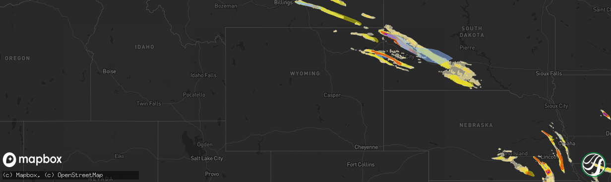
Hail Map in Wyoming on June 11, 2022
The weather event in Wyoming on June 11, 2022 includes Tornado, Wind, and Hail maps. 18 states and 399 cities were impacted and suffered possible damage. The total estimated number of properties impacted is 1,494.
Want more than just the map?
Turn this storm into a full workflow.
- Owner + property data so you know who to knock
- OnDemand branded weather history reports to win the "did we even have hail?" argument
- RoofTrace estimate so reps stop guessing numbers at the door
Bought this map? Upgrade within 7 days and we'll credit the $230. (10-15 min setup call)
Tornado
Wind
Hail
1,494
Estimated number of impacted properties by a 1.00" hail or larger360
Estimated number of impacted properties by a 1.75" hail or larger0
Estimated number of impacted properties by a 2.50" hail or largerStorm reports in Wyoming
Wyoming
| Date | Description |
|---|---|
| 06/11/20223:54 AM CDT | At 853 PM MDT, a severe thunderstorm was located 5 miles west of Rozet, or 9 miles east of Gillette, moving east at 40 mph. Another severe storm was located near Moorcroft, also moving east. HAZARD...60 mph wind gusts and half dollar size hail. SOURCE...Radar indicated. IMPACT...Hail damage to vehicles is expected. Expect wind damage to roofs, siding, and trees. This severe thunderstorm will be near... Rozet around 900 PM MDT.Other locations in the path of this severe thunderstorm includeMoorcroft, southern Keyhole Reservoir, Pine Haven and Upton.This includes Interstate 90 in Wyoming between Mile Markers 133 and186. |
| 06/11/20221:44 AM CDT | At 643 PM MDT, a severe thunderstorm was located near Biddle, or 19 miles south of Broadus, moving east southeast at 50 mph. HAZARD...Golf ball size hail and 60 mph wind gusts, along with very heavy rain. SOURCE...Radar indicated. IMPACT...People and animals outdoors will be injured. Expect hail damage to roofs, siding, windows, and vehicles. Expect wind damage to roofs, siding, and trees. Locations impacted include... Alzada, Biddle, Belle Creek and Ridge. This replaces the warning previously in effect for this area. |
| 06/11/202212:45 AM CDT | At 543 PM MDT, a severe thunderstorm was located 14 miles south of Ashland, or 37 miles southeast of Colstrip, moving east southeast at 45 mph. The strongest portion of this storm is expected to remain south of US-212. HAZARD...Ping pong ball size hail and 60 mph wind gusts, along with heavy rain. SOURCE...Radar indicated. IMPACT...People and animals outdoors will be injured. Expect hail damage to roofs, siding, windows, and vehicles. Expect wind damage to roofs, siding, and trees. Locations impacted include... Broadus, Biddle and Sonnette. |
| 06/10/202210:38 PM CDT | A local report indicates 1.00 inch wind near 5 NNE UPTON |
| 06/10/202210:22 PM CDT | A local report indicates 1.00 inch wind near 1 NNE HULETT |
All States Impacted by Hail Map on June 11, 2022
Cities Impacted by Hail Map on June 11, 2022
- Broadus, MT
- Wall, SD
- Gilbert, LA
- Winnsboro, LA
- Ashdown, AR
- Murray, NE
- Plattsmouth, NE
- Bellevue, NE
- La Vista, NE
- Union, NE
- Papillion, NE
- Omaha, NE
- Burlington, CO
- Wheatland, IA
- Donahue, IA
- Walcott, IA
- Dixon, IA
- Bennett, IA
- Lowden, IA
- Clarence, IA
- Calamus, IA
- Stockton, IA
- New Liberty, IA
- Rozet, WY
- Moorcroft, WY
- Fremont, NE
- Clearmont, WY
- Churdan, IA
- Owanka, SD
- Midland, SD
- Newell, SD
- White River, SD
- Enning, SD
- Winner, SD
- Saint Francis, SD
- Vivian, SD
- Sturgis, SD
- Witten, SD
- Union Center, SD
- Quinn, SD
- Long Valley, SD
- Wood, SD
- Vale, SD
- Ideal, SD
- Mission, SD
- Draper, SD
- Okaton, SD
- Nisland, SD
- Kadoka, SD
- Colome, SD
- Parmelee, SD
- Presho, SD
- Norris, SD
- Philip, SD
- Whitewood, SD
- New Underwood, SD
- Wasta, SD
- Belvidere, SD
- Belle Fourche, SD
- Howes, SD
- Murdo, SD
- Okreek, SD
- Midway, GA
- Oakland, NE
- Carthage, NC
- Delaware, OK
- Nowata, OK
- Wanblee, SD
- Pope Army Airfield, NC
- Vass, NC
- Spring Lake, NC
- Fort Bragg, NC
- Cameron, NC
- Rapid City, SD
- Lame Deer, MT
- Busby, MT
- Birney, MT
- Crow Agency, MT
- Hardin, MT
- Otter, MT
- Scenic, SD
- Cosby, MO
- Saint Joseph, MO
- Alzada, MT
- Hammond, MT
- Boyes, MT
- Custer, MT
- Riley, KS
- Leonardville, KS
- Manhattan, KS
- Piedmont, SD
- Nemo, SD
- Lincoln, NE
- Waverly, NE
- Lewisville, AR
- Lyons, NE
- West Point, NE
- Bancroft, NE
- Spearfish, SD
- Saint Joseph, LA
- Galliano, LA
- El Dorado, KS
- Cassoday, KS
- Mead, NE
- North Bend, NE
- Wahoo, NE
- Dodge, NE
- Colon, NE
- Howells, NE
- Rogers, NE
- Cedar Bluffs, NE
- Lead, SD
- Deadwood, SD
- Junction City, KS
- Sundance, WY
- Hulett, WY
- Devils Tower, WY
- Alva, WY
- Keystone, SD
- Hill City, SD
- Hermosa, SD
- Forsyth, MT
- Volborg, MT
- Mangham, LA
- Baskin, LA
- Rayville, LA
- Hooper, NE
- Barnes, KS
- Palmer, KS
- Clay Center, KS
- Randolph, KS
- Morganville, KS
- Greenleaf, KS
- Clifton, KS
- Green, KS
- Beulah, WY
- Aladdin, WY
- Garden Grove, IA
- Allerton, IA
- Ogden, AR
- Marion, LA
- Ballantine, MT
- Ceresco, NE
- Gibbon, NE
- Dearborn, MO
- Nickerson, NE
- Herman, NE
- Arlington, NE
- Kennard, NE
- Washington, NE
- Bennington, NE
- Blair, NE
- Fayette, MS
- Ogden, IA
- Callender, IA
- Gowrie, IA
- Paton, IA
- Harcourt, IA
- Boxholm, IA
- Upton, WY
- Newcastle, WY
- Osage, WY
- Shickley, NE
- Davenport, NE
- Carleton, NE
- Gillette, WY
- Milford, NE
- Seward, NE
- Beaver Crossing, NE
- Giltner, NE
- Ravenna, NE
- Pleasanton, NE
- Kearney, NE
- Saronville, NE
- Shelton, NE
- Hebron, NE
- Sutton, NE
- Doniphan, NE
- Inland, NE
- Glenvil, NE
- Fairfield, NE
- Ong, NE
- Clay Center, NE
- Wood River, NE
- Kenesaw, NE
- Alda, NE
- Deweese, NE
- Edgar, NE
- Geneva, NE
- Harvard, NE
- Hastings, NE
- Trumbull, NE
- Juniata, NE
- Oak, NE
- Elkhorn, NE
- Osco, IL
- Lynn Center, IL
- Andover, IL
- Altona, IL
- Bishop Hill, IL
- Cambridge, IL
- Orion, IL
- Galva, IL
- Kanorado, KS
- Clarksdale, MO
- Helena, MO
- Union Star, MO
- Herington, KS
- Bedford, IA
- Ridgeway, MO
- Spickard, MO
- Eagleville, MO
- Sheridan, MO
- Gentry, MO
- New Hampton, MO
- Grant City, MO
- Parnell, MO
- Denver, MO
- Worth, MO
- Princeton, MO
- Albany, MO
- Bethany, MO
- Hopkins, MO
- Martinsville, MO
- Gilman City, MO
- Council Grove, KS
- Weston, WY
- Stratton, CO
- Redding, IA
- Easton, MO
- Friend, NE
- Wakefield, KS
- Yutan, NE
- Hilliard, FL
- Callahan, FL
- Edgard, LA
- Kansas City, MO
- Agency, MO
- Gower, MO
- Edgerton, MO
- Liberty, MO
- Smithville, MO
- Trimble, MO
- Elmwood, NE
- Humboldt, NE
- Ames, NE
- Gretna, NE
- Weeping Water, NE
- Springfield, NE
- Talmage, NE
- Ithaca, NE
- Louisville, NE
- Clarkson, NE
- Tecumseh, NE
- Syracuse, NE
- Morse Bluff, NE
- Otoe, NE
- Ashland, NE
- Greenwood, NE
- Burr, NE
- Cook, NE
- Sterling, NE
- Johnson, NE
- Elk Creek, NE
- Table Rock, NE
- Unadilla, NE
- Alvo, NE
- Murdock, NE
- Memphis, NE
- Avoca, NE
- Lorman, MS
- Waterproof, LA
- Custer, SD
- Fairburn, SD
- Nebraska City, NE
- Hamburg, IA
- Percival, IA
- Bethune, CO
- Hanover, KS
- Bremen, KS
- Emporia, KS
- Strong City, KS
- Olpe, KS
- Beatrice, NE
- Cottonwood Falls, KS
- Matfield Green, KS
- De Witt, NE
- Olsburg, KS
- Blue Rapids, KS
- Clatonia, NE
- Filley, NE
- Oketo, KS
- Hallam, NE
- Beattie, KS
- Blue Springs, NE
- Frankfort, KS
- Waterville, KS
- Wilber, NE
- Pickrell, NE
- Cortland, NE
- Home, KS
- Barneston, NE
- Marysville, KS
- Liberty, NE
- Westmoreland, KS
- Wymore, NE
- Odell, NE
- Crete, NE
- Dorchester, NE
- Hollenberg, KS
- Elk City, KS
- Sedan, KS
- Saint George, KS
- Milford, KS
- Alma, KS
- Washington, KS
- Virginia, NE
- Alta Vista, KS
- Diller, NE
- Cordova, NE
- Waco, NE
- Linn, KS
- Fort Riley, KS
- Wamego, KS
- York, NE
- Cairo, NE
- Grand Island, NE
- Madison, KS
- Cedar Point, KS
- Steele City, NE
- Stanberry, MO
- Barnard, MO
- Guilford, MO
- Rea, MO
- Bolckow, MO
- Fall River, KS
- Severy, KS
- Copan, OK
- Caney, KS
- Eureka, KS
- Lenapah, OK
- Niotaze, KS
- Wann, OK
- Havana, KS
- Dewey, OK
- Longton, KS
- Goodland, KS
- Decatur, IA
- Leon, IA
- Somers, IA
- Farnhamville, IA
- Roseville, IL
- Smithshire, IL
- Grand River, IA
- Lincolnville, KS
- Burdick, KS
- Plattsburg, MO
- Holt, MO
- Stewartsville, MO
- Amity, MO
- Savannah, MO
- Maryville, MO
- Conception, MO
- King City, MO
- Osborn, MO
- Lathrop, MO
- Conception Junction, MO
- Texarkana, AR
- Garland City, AR
- Maysville, MO
- Cameron, MO
- Wilsey, KS
- White City, KS
- Woodbine, KS
- Burns, KS
- Fredonia, KS
- Hamilton, KS
- Elmdale, KS
- Golden Meadow, LA
- Jeanerette, LA
- Grand Junction, IA
- Ossineke, MI
- Spotsylvania, VA
- Fredericksburg, VA
- Rosebud, SD
- Milesville, SD
- Hysham, MT
- Rockville, VA
- Manakin Sabot, VA
- Pine Ridge, SD
- Dunbar, NE
- Alexandria, NE
- Bruning, NE
- Belvidere, NE
- Gilead, NE
- Dwight, KS
- Marion, KS
- Florence, KS
- Pilot Mound, IA


