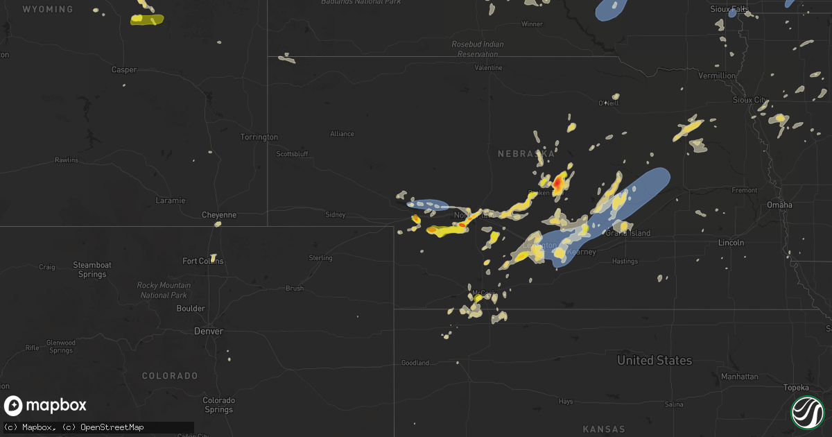
Hail Map on July 23, 2025
Get this storm
July 23 map
$229
one time, instant access
Download today. No call, no setup
Keep the $229
Bought the map and want the full workflow? Apply the entire $229 to a subscription within 7 days. None of it is wasted.
Every map, not just this one
This buys you this map. Subscription and you get every map we run, in the markets you choose from a few cities to whole states to nationwide. Plus real-time alerts the moment a storm fires.
Contact data
Name, contact info, occupancy, even credit band for addresses in the footprint. You go from where it hit to who to call.
Become the source they trust
Unlimited branding weather history reports on demand. You already have the documented answer ready for the property owner, and you are the one who showed up with it.
Property data and RoofTrace estimates
Pull up any address you have got, its value and the exact code rules for that jurisdiction, straight from One Click Code. Then RoofTrace estimates the squares, pitch, and roof value, priced the way you price.
States Impacted by Hail Map on July 23, 2025
Storm reports
Nebraska
| Date | Description |
|---|---|
| 07/23/20256:54 PM CDT | Photo on facebook of power lines down north of kearney. Time estimated from radar. |
| 07/23/20256:46 PM CDT | Personal weather station reports gust to 58mph. |
| 07/23/20256:34 PM CDT | Personal weather station reports gust to 72mph. |
| 07/23/20256:00 PM CDT | Pws measured wind gust. |
| 07/23/20255:50 PM CDT | A local report indicates 2.50 inch wind near 2 NW Weissert |
| 07/23/20255:15 PM CDT | Delayed report. No damage observed but multiple reports of a brief touchdown. |
| 07/23/20254:15 PM CDT | A local report indicates 1.00 inch wind near 11 N Dickens |
| 07/23/20254:11 PM CDT | Delayed report. Brief touchdown. No damage reported. |
| 07/23/20253:55 PM CDT | A local report indicates 1.00 inch wind near 5 SW Mccook |
| 07/23/20253:54 PM CDT | Ems reports ping pong ball sized hail. Picture sent via nwschat. |
| 07/23/20252:57 PM CDT | Up sensor measured wind gusts associated with thunderstorms. |
| 07/23/20252:28 PM CDT | Dispatch reports ping pong sized hail in town. |
| 07/22/20259:42 PM CDT | 6-8 inch tree limb broken off tree. Public report and photo received via social media. Report time based on radar. |
| 07/22/20258:57 PM CDT | Report of gusts around 60 mph on the nw side of columbus via social media. |
| 07/22/20258:45 PM CDT | Trees uprooted and power lines down in st edward. |
| 07/22/20258:40 PM CDT | A local report indicates 61 MPH wind near 2 W Saint Edward |
| 07/22/20258:09 PM CDT | Emergency manager reports trees down on powerlines in fullerton. |
| 07/22/20257:54 PM CDT | Powerline down abbott/north rd and it is sparking. Relayed by emergency manager. |
| 07/22/20257:53 PM CDT | Davis weather station. |
| 07/22/20257:40 PM CDT | Social media report with photo of a large elm tree branch down in town. |
| 07/22/20257:40 PM CDT | Emergency manager reported downed trees... Damage to an outbuilding... And a segment of the ballfields fence was blown over. |
| 07/22/20257:32 PM CDT | Social media report of a hackberry tree blown down. |
| 07/22/20257:32 PM CDT | Dispatcher reported an outbuilding blown down in town. Time estimated based on radar. |
| 07/22/20257:23 PM CDT | Personal weather station reports gust to 58mph. |
| 07/22/20257:22 PM CDT | 911 dispatch center reports power lines down in boelus. Time estimated from radar. |
| 07/22/20257:21 PM CDT | Personal weather station reports gust to 73mph. |
| 07/22/20257:21 PM CDT | Broadcast media reports several branches of 4 to 8 inches in diameter down in wood river. Largest branches were around 10 to 12 inches in diameter. |
| 07/22/20257:19 PM CDT | Personal weather station reports gust to 59mph. |
| 07/22/20257:18 PM CDT | Emergency manager reports power lines down in ravenna. Time estimated from radar. |
| 07/22/20257:17 PM CDT | Boelus fire chief reports 60-70mph winds in boelus. |
| 07/22/20257:16 PM CDT | Video shared on social media of a large tree branch that was broken off and had landed on top of a pickup. |
| 07/22/20257:12 PM CDT | Photo from emergency manager of a destroyed shed north of ravenna. Time estimated from radar. |
| 07/22/20257:12 PM CDT | Emergency manager reports 70mph winds in ravenna. |
| 07/22/20257:10 PM CDT | Delayed social media report o |
| 07/22/20257:10 PM CDT | Delayed social media report of hail ranging in size from peas to quarters. |
Wyoming
| Date | Description |
|---|---|
| 07/23/20255:07 PM CDT | A local report indicates 69 MPH wind near 2 ENE Osage |
Minnesota
| Date | Description |
|---|---|
| 07/23/20258:30 AM CDT | Several trees done on hummingbird drive. Time estimated from radar. |
| 07/23/20257:40 AM CDT | Mesonet station mn007 i-90 - rushmore - mp 35. |
| 07/23/20257:30 AM CDT | A dozen large trees down on highway 200 blocking at least one lane. One tree down on highway 8 just north of highway 200. |
| 07/23/20257:20 AM CDT | City park sustained tree and structure damage. Time estimated from radar. |
| 07/23/20257:20 AM CDT | Damage to marina. Time estimated from radar. |
| 07/23/20257:16 AM CDT | Walker ambient weather station on first pt drive. |
| 07/23/20257:14 AM CDT | Several branches larger than 4 in diameter broken off. |
Montana
| Date | Description |
|---|---|
| 07/23/20254:23 PM CDT | A local report indicates 1.00 inch wind near 10 NE Moorhead |
| 07/23/20253:59 PM CDT | Personal weather station. |
| 07/23/20252:45 PM CDT | Quarter size hail between 130 pm and 2pm. |
Michigan
| Date | Description |
|---|---|
| 07/22/20258:50 PM CDT | Wexford county dispatch reported significant power outages in and near manton. |
| 07/22/20258:33 PM CDT | Significant power outages in mesick reported by wexford co dispatch. |
| 07/22/20258:30 PM CDT | Corrects previous tstm wnd dmg report from 3 sse traverse city. Emergency manager relayed a report from the public of numerous trees down and a roof ripped off a silo. |
| 07/22/20258:25 PM CDT | County dispatch reports trees and powerlines down on hammond rd in garfield twp. Also reported that trees and powerlines are down across various other portions of grand |
| 07/22/20258:17 PM CDT | Multiple trees and powerlines down. Time estimated via radar. |
| 07/22/20258:07 PM CDT | Multiple trees and powerlines down on thompsonville hwy south of us-31. Time estimated via radar. |
| 07/22/20258:05 PM CDT | Multiple trees and powerlines down reported in glen arbor. Time estimated via radar. |
| 07/22/20257:51 PM CDT | Multiple trees reported down across various areas around frankfort... Including along south shore rd. Time estimated via radar. |
Wisconsin
| Date | Description |
|---|---|
| 07/23/20256:51 PM CDT | Report of partial tree blocking road loggerquist road at waseda farms... Jacksonport. |
| 07/23/20256:40 PM CDT | Report of a tree down in the south bound lane of state highway 57. |
| 07/23/20256:38 PM CDT | Roof torn off of storage building. Other minor tree damage. Time estimated by radar. |
| 07/23/20256:36 PM CDT | Dc dispatch reports 4630 harbor heights ct... Egg harbor tree down on lines power pole on fire time estimated by radar. |
| 07/23/20256:32 PM CDT | Tree down in the roadway. Time estimated by radar. |
| 07/23/20256:31 PM CDT | Dc dispatch reports tree down in the roadway vicinity of 7491 co rd h... Sturgeon bay |
| 07/23/20256:24 PM CDT | Tree down hitting a wire... Creating sparks. |
| 07/23/20256:21 PM CDT | One uprooted tree... One snapped tree. Both about 10 inches in diameter. Time estimated from radar. |
| 07/23/20256:19 PM CDT | One tree snapped. |
| 07/23/20256:11 PM CDT | Tree down. Time estimated by radar. |
| 07/23/20256:05 PM CDT | Train spotter reported 66 mph wind gust measured by a home weather station. |
| 07/23/20256:05 PM CDT | Barn destroyed. Time estimated by radar. |
| 07/23/20256:04 PM CDT | Extensive tree damage and down power lines. Time estimated by radar. |
| 07/23/20256:01 PM CDT | Siding and roof damage to several structures. |
| 07/23/20256:00 PM CDT | Preliminary ef0. Max wind 77 mph. |
| 07/23/20255:57 PM CDT | A local report indicates a tornado near 4 ESE Lena |
| 07/23/20255:50 PM CDT | Trees down just north of shiocton. |
| 07/23/20255:40 PM CDT | Via personal weather station. |
| 07/23/20255:38 PM CDT | Tree blocking southbound lane cty ff... 1 mile north of 76 time estimated by radar. |
| 07/23/20255:37 PM CDT | Preliminary ef1. Max wind 95 mph. |
| 07/23/20255:37 PM CDT | Trees down. Time estimated by radar. |
| 07/23/20255:28 PM CDT | Trees down. Time estimated by radar. |
| 07/23/20255:23 PM CDT | Time estimated by radar. |
| 07/23/20255:18 PM CDT | Tree on powerline. Time estimated by radar. |
| 07/23/20255:16 PM CDT | Report from menominee tribe emergency manager trees and power lines down. Cause of damage will be reviewed. |
| 07/23/20255:16 PM CDT | Trees and power lines down. |
| 07/23/20255:15 PM CDT | Trees down. Time estimated by radar. |
| 07/23/20255:15 PM CDT | Survey team has found tornadic damage near keshena area. Mostly tree damage has been observed so far. Preliminary rating of ef1 |
| 07/23/20254:30 PM CDT | Marathon co. Dispatch reported trees and powerlines down near the intersection of county z and thornapple creek rd in the township of easton. Funnel clouds were also re |
| 07/23/20253:58 PM CDT | Tree down. Time estimated by radar. |
| 07/23/20253:56 PM CDT | Power line down. Time estimated by radar. |
| 07/22/20257:02 PM CDT | 50x70 pole barn destroyed at n6318 cth c |
| 07/22/20257:02 PM CDT | 50x70 pole barn destroyed at n6318 cth c... South of seymour estimated 604pm. |
Kansas
| Date | Description |
|---|---|
| 07/23/20256:30 PM CDT | Personal weather station kksnessc2. |
| 07/23/20254:45 PM CDT | Personal weather station kksashla4. |
South Dakota
| Date | Description |
|---|---|
| 07/23/20256:45 PM CDT | A local report indicates 63 MPH wind near 10 W Edgemont |
| 07/23/20256:40 PM CDT | Several large tree limbs down up to 6 inches in diameter. |
| 07/23/20256:37 PM CDT | Measured by personal weather station. |
| 07/23/20256:35 PM CDT | A local report indicates 65 MPH wind near 10 W Edgemont |
| 07/23/20256:25 PM CDT | A local report indicates 59 MPH wind near 14 NNW Edgemont |
| 07/23/202510:14 AM CDT | Personal weather station. |
| 07/23/20259:50 AM CDT | Door torn off machine shed and other sheet metal damage to building. |
| 07/23/20259:50 AM CDT | Cattle pod and grain bin damage. |
| 07/23/20259:33 AM CDT | Roof blown off post frame building. Time estimated from radar. |
| 07/23/20259:28 AM CDT | Roof blown off of a metal shed along the south shore of lake byron. Time estimated by radar. |
| 07/23/20259:26 AM CDT | Boat capsized on dry lake due to strong winds. |
| 07/23/20259:23 AM CDT | Mesonet station 284 spink colony 9 sse jct sd28/sd37 |
| 07/23/20259:21 AM CDT | 71 mph gust recorded at a personal weather station. |
| 07/23/20259:20 AM CDT | Images of trees broken at the trunk sent via social media. Time estimated based on radar and other nearby damage reports. |
| 07/23/20259:18 AM CDT | About 20 trees downed at golf course. Time estimated based on khon asos observation. |
| 07/23/20259:15 AM CDT | Large tree down in huron near the intersection of 7th st. And dakota ave. |
| 07/23/20259:13 AM CDT | Mesonet station 215 polo 17 w jct sd47/sd26 |
| 07/23/20259:11 AM CDT | 64 mph gust recorded at a personal weather station. |
| 07/23/20259:11 AM CDT | Asos station khon huron regional airport. Gusted again to 82 mph at 9:18 am. |
| 07/23/20259:06 AM CDT | Mesonet station 164 sd rwis wolsey. |
| 07/23/20259:03 AM CDT | Mesonet station 164 sd rwis wolsey. |
| 07/23/20259:03 AM CDT | Asos station khon huron regional airport. |
| 07/23/20259:00 AM CDT | Roof blown off outbuilding. Time estimated from radar. |
| 07/23/20258:48 AM CDT | Mesonet station 312 ree heights |
| 07/23/20258:30 AM CDT | Mesonet station 173 craven |
| 07/23/20258:25 AM CDT | Mesonet station 4 sse canning sdsu site. |
| 07/23/20258:25 AM CDT | Mesonet station 173 craven |
| 07/23/20258:13 AM CDT | Mesonet station 315 cresbard |
| 07/23/20258:12 AM CDT | Mesonet station 289 lees corner |
| 07/23/20258:05 AM CDT | Mesonet station lbms2 lower brule 2wnw |
| 07/23/20258:00 AM CDT | Spotter also reports 1 inch of rain in 15 minutes. |
| 07/23/20258:00 AM CDT | Mesonet station lbms2 lower brule 2wnw |
| 07/23/20257:45 AM CDT | Mesonet station hmms2 highmore 23n |
| 07/23/20257:40 AM CDT | Mesonet station kbms2 kennebec 6sse |
| 07/23/20257:23 AM CDT | Via personal weather station. |
| 07/23/20257:17 AM CDT | Several 3-4 inch diameter tree branches down in town. |
| 07/23/20257:15 AM CDT | A local report indicates 70 MPH wind near 3 SE Plankinton |
| 07/23/20257:10 AM CDT | Mesonet station lrms2 lowry 2s |
| 07/22/20257:31 PM CDT | A local report indicates 64 MPH wind near 8 SSW Folsom |
| 07/22/20257:26 PM CDT | A local report indicates 64 MPH wind near 8 SSW Folsom |
| 07/22/20257:25 PM CDT | A local report indicates 66 MPH wind near 7 SSW Folsom |
Texas
| Date | Description |
|---|---|
| 07/23/20255:29 PM CDT | A local report indicates 70 MPH wind near 6 ESE Lora |
| 07/23/20255:15 PM CDT | A local report indicates 58 MPH wind near 23 NW Codman |
Oklahoma
| Date | Description |
|---|---|
| 07/23/20253:20 PM CDT | A local report indicates 62 MPH wind near 8 W Slapout |
| 07/22/20257:25 PM CDT | 3 vehicles in a 100 yard area had windows blown out; multiple tree limbs down with two as large as 8 inches in diameter. |
Iowa
| Date | Description |
|---|---|
| 07/23/20251:30 AM CDT | Delayed report. Peak wind gust from the rwis mesonet station raki4 ankeny. |
| 07/23/202512:36 AM CDT | A local report indicates 75 MPH wind near Bagley |
| 07/23/202512:14 AM CDT | Measured by personal weather station near intersection of storms along pre-existing outflow boundary. |
| 07/23/202512:14 AM CDT | Measured by personal weather statio |
| 07/23/202512:04 AM CDT | Measured by personal weather station. |
| 07/22/202510:10 PM CDT | Trees down in town. |
Cities Impacted by Hail Map on July 23, 2025
- Stickney, SD
- Plankinton, SD
- Hamill, SD
- Ideal, SD
- Laporte, MN
- Akeley, MN
- Deer River, MN
- Wood, SD
- Presho, SD
- Gregory, SD
- White River, SD
- Bena, MN
- Kennebec, SD
- Walker, MN
- Hoven, SD
- Hardin, MT
- Selby, SD
- Gettysburg, SD
- Java, SD
- Agar, SD
- Glenham, SD
- Akaska, SD
- Eagle Butte, SD
- Bowdle, SD
- Onaka, SD
- Seneca, SD
- Onida, SD
- Tolstoy, SD
- Lebanon, SD
- Roscoe, SD
- Faulkton, SD
- Corsica, SD
- Platte, SD
- Kimball, SD
- Harrison, SD
- White Lake, SD
- Mount Vernon, SD
- Letcher, SD
- Miller, SD
- Murdo, SD
- Reliance, SD
- Vivian, SD
- Ipswich, SD
- Orient, SD
- Cresbard, SD
- Fort Thompson, SD
- Hayes, SD
- Fort Pierre, SD
- Draper, SD
- Bovey, MN
- Gann Valley, SD
- Saint Lawrence, SD
- Woonsocket, SD
- Chamberlain, SD
- Lower Brule, SD
- Wessington, SD
- Artesian, SD
- Cohasset, MN
- Mansfield, SD
- Northville, SD
- Rockham, SD
- Ashton, SD
- Pierre, SD
- Ree Heights, SD
- Stephan, SD
- Blunt, SD
- Holabird, SD
- Harrold, SD
- Highmore, SD
- Grand Rapids, MN
- Wessington Springs, SD
- Willow Lake, SD
- Virgil, SD
- Aberdeen, SD
- Warner, SD
- Mellette, SD
- Redfield, SD
- Bryant, SD
- Hayti, SD
- Hazel, SD
- Hitchcock, SD
- Wolsey, SD
- Huron, SD
- Cavour, SD
- Alpena, SD
- Otter, MT
- Tulare, SD
- Yale, SD
- Carpenter, SD
- Iroquois, SD
- Doland, SD
- Frankfort, SD
- Raymond, SD
- Clark, SD
- Turton, SD
- Garden City, SD
- Conde, SD
- Brentford, SD
- Henry, SD
- Vienna, SD
- Stratford, SD
- Bradley, SD
- Andover, SD
- Groton, SD
- Webster, SD
- Bristol, SD
- Florence, SD
- Wallace, SD
- Siren, WI
- Fairhope, AL
- Kaycee, WY
- Lewellen, NE
- Ryegate, MT
- Iuka, MS
- Ogallala, NE
- Buffalo, WY
- Eleva, WI
- Lemoyne, NE
- Mondovi, WI
- Strum, WI
- Osseo, WI
- Venango, NE
- Kinmundy, IL
- Marion, IL
- Paxton, NE
- Keystone, NE
- Creal Springs, IL
- Grant, NE
- Lavina, MT
- Stanley, WI
- Madrid, NE
- Elsie, NE
- Greenwood, WI
- Broadview, MT
- Gillette, WY
- Alma, WI
- Iuka, IL
- McCook, NE
- North Platte, NE
- Hershey, NE
- Wallace, NE
- Owen, WI
- Midwest, WY
- Independence, WI
- Whitehall, WI
- Burwell, NE
- Fort Collins, CO
- Acton, MT
- Merna, NE
- Callaway, NE
- Brady, NE
- Culbertson, NE
- Herndon, KS
- Imperial, NE
- Ringle, WI
- Schofield, WI
- Sutherland, NE
- Glenrock, WY
- Lebanon, NE
- Indianola, NE
- Wheatland, WY
- Chambers, NE
- Sargent, NE
- Dickens, NE
- Birnamwood, WI
- Hatley, WI
- Biloxi, MS
- Ault, CO
- Wellfleet, NE
- Maywood, NE
- Comstock, NE
- Mattoon, WI
- McDonald, KS
- Altura, MN
- Ashland, KS
- Aniwa, WI
- Bartley, NE
- Moorefield, NE
- Danbury, NE
- Antigo, WI
- Mosinee, WI
- Maxwell, NE
- Upton, WY
- Booker, TX
- Broken Bow, NE
- Curtis, NE
- Rosholt, WI
- Bowler, WI
- Wittenberg, WI
- Neopit, WI
- Tigerton, WI
- Osage, WY
- Atwood, KS
- Gothenburg, NE
- Ewing, NE
- Gresham, WI
- Hanlontown, IA
- Kensett, IA
- Fertile, IA
- Brewster, NE
- Keshena, WI
- Broadus, MT
- Billings, MT
- Douglas, WY
- Ansley, NE
- Westerville, NE
- Iola, WI
- Ventura, IA
- Garner, IA
- Oberlin, KS
- Cambridge, NE
- Newcastle, WY
- Arapahoe, NE
- Sundance, WY
- Moorcroft, WY
- Hill City, SD
- Westbrook, TX
- Bassett, NE
- Suring, WI
- Stockville, NE
- Gillett, WI
- Pound, WI
- Farnam, NE
- Marion, WI
- Boaz, KY
- Hickory, KY
- Cheyenne, WY
- Pampa, TX
- Miami, TX
- Canadian, TX
- Mobeetie, TX
- Perryton, TX
- Custer, SD
- Anselmo, NE
- Saint Charles, MN
- Eustis, NE
- Lance Creek, WY
- Forest City, IA
- Cozad, NE
- Dannebrog, NE
- Taylor, NE
- Clintonville, WI
- Shiocton, WI
- Bear Creek, WI
- Lena, WI
- Oconto Falls, WI
- Oconto, WI
- New London, WI
- Manawa, WI
- Ogdensburg, WI
- Black Creek, WI
- Appleton, WI
- Nichols, WI
- Kaukauna, WI
- Seymour, WI
- Cecil, WI
- Shawano, WI
- Abrams, WI
- Peshtigo, WI
- Elwood, NE
- Oconto, NE
- Fountain, MN
- Chatfield, MN
- Mason City, NE
- Oneill, NE
- Saint Paul, NE
- Coleman, WI
- Lexington, NE
- Lake Mills, IA
- Leland, IA
- Spring Valley, MN
- Clear Lake, IA
- Oneida, WI
- Green Bay, WI
- De Pere, WI
- Bonduel, WI
- Marinette, WI
- Denmark, WI
- Wrightstown, WI
- Greenleaf, WI
- Colorado City, TX
- Norcatur, KS
- Joice, IA
- Loomis, NE
- Smithfield, NE
- Holdrege, NE
- Elm Creek, NE
- Lawton, IA
- Wolbach, NE
- Valley Springs, SD
- Brandon, SD
- Eddyville, NE
- Sumner, NE
- Larchwood, IA
- Lanesboro, MN
- Maribel, WI
- Colby, KS
- Brussels, WI
- Elizabeth, CO
- Franktown, CO
- Overton, NE
- Lennox, SD
- Chancellor, SD
- Tea, SD
- Stratton, NE
- Hills, MN
- Amelia, NE
- Bronson, IA
- Hermosa, SD
- Keystone, SD
- Salix, IA
- Lismore, MN
- Bertrand, NE
- Shelton, NE
- Odessa, NE
- Miller, NE
- Heartwell, NE
- Hildreth, NE
- Ravenna, NE
- Amherst, NE
- Holstein, NE
- Kearney, NE
- Minden, NE
- Hazard, NE
- Gibbon, NE
- Juniata, NE
- Axtell, NE
- Pleasanton, NE
- Funk, NE
- Kenesaw, NE
- Roseland, NE
- Wood River, NE
- Riverdale, NE
- Worthington, MN
- Hammond, MT
- Ord, NE
- Follett, TX
- Wilmont, MN
- Manly, IA
- Northwood, IA
- Trimont, MN
- Welcome, MN
- Madelia, MN
- Rock Rapids, IA
- Elba, NE
- Ashton, NE
- Scotia, NE
- Reading, MN
- Rushmore, MN
- Saint Ansgar, IA
- Sheridan, WY
- Brewster, MN
- Swea City, IA
- Bancroft, IA
- Cairo, NE
- Rockville, NE
- Boelus, NE
- Jackson, MN
- Greeley, NE
- Emmons, MN
- Scarville, IA
- Centerville, SD
- Parker, CO
- Farwell, NE
- Loup City, NE
- Capitol, MT
- Litchfield, NE
- Grand Island, NE
- Saint Libory, NE
- Janesville, MN
- Mankato, MN
- Saint Clair, MN
- Pierson, IA
- Sherburn, MN
- Beresford, SD
- Spalding, NE
- Harrison, NE
- Worthing, SD
- Palmer, NE
- Scenic, SD
- Conger, MN
- Albert Lea, MN
- Alden, MN
- Cedar Rapids, NE
- Petersburg, NE
- Correctionville, IA
- Washta, IA
- Quimby, IA
- Vermillion, SD
- North Loup, NE
- Blue Earth, MN
- Easton, MN
- Bricelyn, MN
- Pemberton, MN
- Alcester, SD
- Cherokee, IA
- Delavan, MN
- Sibley, IA
- Fairmont, MN
- Dodge Center, MN
- Round Lake, MN
- Ceylon, MN
- Ashton, IA
- Wells, MN
- Ocheyedan, IA
- Kiester, MN
- Albion, NE
- Storm Lake, IA
- Pine Island, MN
- West Concord, MN
- Ledyard, IA
- Battle Creek, NE
- Winnebago, MN
- Estherville, IA
- Primghar, IA
- Archer, IA
- Genoa, NE
- Belgrade, NE
- Fullerton, NE
- Saint Edward, NE
- Central City, NE
- Archer, NE
- Norfolk, NE
- Terril, IA
- Ruthven, IA
- Graettinger, IA
- Lakota, IA
- Northfield, MN
- Le Mars, IA
- Frost, MN
- Buffalo Center, IA
- Dunnell, MN
- Hartley, IA
- Newman Grove, NE
- Lindsay, NE
- Monroe, NE
- Wallingford, IA
- Titonka, IA
- Pierce, NE
- Dickens, IA
- Winside, NE
- Hoskins, NE
- Newell, IA
- Spencer, IA
- Stanton, NE
- Rising City, NE
- Aurelia, IA
- Randolph, NE
- Crofton, NE
- Bloomfield, NE
- Rolfe, IA
- Havelock, IA
- Madison, NE
- Emmetsburg, IA
- Cylinder, IA
- Onawa, IA
- Osceola, NE
- West Bend, IA
- Castana, IA
- Mapleton, IA
- Carroll, NE
- Brainard, NE
- Alta, IA
- David City, NE
- Fenton, IA
- Lone Rock, IA
- Ayrshire, IA
- Weston, WY
- Danbury, IA
- Battle Creek, IA
- Pilger, NE
- Adams, MN
- Valparaiso, NE
- Weston, NE
- Palmer, IA
- Dexter, MN
- Brownsdale, MN
- Austin, MN
- Lyle, MN
- Rose Creek, MN
- Wayne, NE
- Fort Stockton, TX
- Wakefield, NE
- Smithland, IA
- Oto, IA
- Rodney, IA
- Gilmore City, IA
- Humboldt, IA
- Ulysses, NE
- Rembrandt, IA
- Grand Meadow, MN
- Galva, IA
- Schaller, IA
- Dwight, NE
- Clare, IA
- Seward, NE
- Staplehurst, NE
- Anthon, IA
- Hornick, IA
- Pocahontas, IA
- Fonda, IA
- Friend, NE
- Grafton, IA
- Plymouth, IA
- Thor, IA
- Mason City, IA
- Osage, IA
- Thornton, IA
- Varina, IA
- Edgar, NE
- Ong, NE
- Jolley, IA
- Sac City, IA
- Nora Springs, IA
- Lytton, IA
- Rockwell City, IA
- Fort Dodge, IA
- Barnum, IA
- Denison, IA
- Schleswig, IA
- Shickley, NE
- Davenport, NE
- Lake View, IA
- Moville, IA
- Somers, IA
- Moorland, IA
- Callender, IA
- Cortland, NE
- Dow City, IA
- Carroll, IA
- Deloit, IA
- Gowrie, IA
- Farnhamville, IA
- Lohrville, IA
- Breda, IA
- Clatonia, NE
- Churdan, IA
- Scranton, IA
- Templeton, IA
- Halbur, IA
- Manning, IA
- Arcadia, IA
- Westside, IA
- Glidden, IA
- Crete, NE
- Bennet, NE
- Jefferson, IA
- Paton, IA
- Grand Junction, IA
- Dana, IA
- Randolph, IA
- Firth, NE
- Dedham, IA
- Coon Rapids, IA
- Bagley, IA
- Jamaica, IA
- Rippey, IA
- Bayard, IA
- Yale, IA
- Ogden, IA
- Perry, IA
- Dawson, IA
- Hallam, NE
- Percival, IA
- Nebraska City, NE
- Shawmut, MT
- Adrian, MN
- Ellsworth, MN
- Bigelow, MN
- Harrisburg, SD
- Davis, SD
- Sioux Falls, SD
- Canton, SD