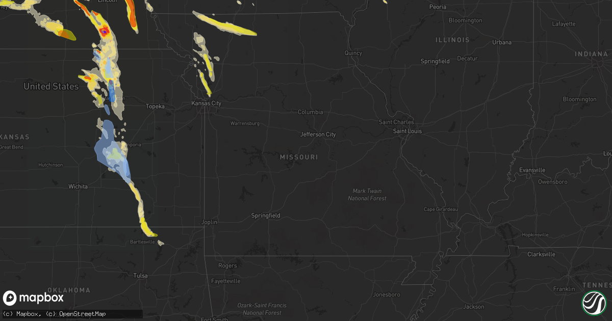
Hail Map in Missouri on June 11, 2022
Get this storm
June 11 map
$229
one time, instant access
Download today. No call, no setup
Keep the $229
Bought the map and want the full workflow? Apply the entire $229 to a subscription within 7 days. None of it is wasted.
Every map, not just this one
This buys you this map. Subscription and you get every map we run, in the markets you choose from a few cities to whole states to nationwide. Plus real-time alerts the moment a storm fires.
Contact data
Name, contact info, occupancy, even credit band for addresses in the footprint. You go from where it hit to who to call.
Become the source they trust
Unlimited branding weather history reports on demand. You already have the documented answer ready for the property owner, and you are the one who showed up with it.
Property data and RoofTrace estimates
Pull up any address you have got, its value and the exact code rules for that jurisdiction, straight from One Click Code. Then RoofTrace estimates the squares, pitch, and roof value, priced the way you price.
Storm reports in Missouri
Missouri
| Date | Description |
|---|---|
| 06/11/20226:42 AM CDT | At 1142 PM CDT, a severe thunderstorm was located over Courtney, moving southeast at 30 mph. HAZARD...60 mph wind gusts and quarter size hail. SOURCE...Radar indicated. IMPACT...Hail damage to vehicles is expected. Expect wind damage to roofs, siding, and trees. Locations impacted include... Kansas City, Independence, Lee's Summit, Blue Springs, Raytown, Liberty, Gladstone, Grain Valley, Excelsior Springs, Smithville, Kearney, Sugar Creek, Buckner, Claycomo, Courtney, Pleasant Valley, Lake Tapawingo, Glenaire, Sibley and Missouri City.This includes the following highways... Interstate 70 in Missouri between mile markers 7 and 28. Interstate 35 in Missouri between mile markers 10 and 28. Interstate 470 between mile markers 14 and 16. Interstate 435 between mile markers 41 and 64. |
| 06/11/20225:39 AM CDT | At 1038 PM CDT, a severe thunderstorm was located over Agency, or 8 miles southeast of St. Joseph, moving southeast at 25 mph. HAZARD...60 mph wind gusts and quarter size hail. SOURCE...Radar indicated. IMPACT...Hail damage to vehicles is expected. Expect wind damage to roofs, siding, and trees. Locations impacted include... Agency, Edgerton, Dearborn and Faucett. This includes Interstate 29 between mile markers 28 and 42. |
| 06/11/20225:26 AM CDT | At 1026 PM CDT, a severe thunderstorm was located near Plattsburg, moving south at 25 mph. HAZARD...60 mph wind gusts and quarter size hail. SOURCE...Radar indicated. IMPACT...Hail damage to vehicles is expected. Expect wind damage to roofs, siding, and trees. Locations impacted include... Smithville, Kearney, Lawson, Plattsburg, Lathrop, Gower, Stewartsville, Trimble, Holt, Easton and Turney.This includes Interstate 35 in Missouri between mile markers 28 and50. |
| 06/11/20225:00 AM CDT | At 1000 PM CDT, a severe thunderstorm was located near Plattsburg, moving southeast at 35 mph. HAZARD...60 mph wind gusts and half dollar size hail. SOURCE...Radar indicated. IMPACT...Hail damage to vehicles is expected. Expect wind damage to roofs, siding, and trees. Locations impacted include... Plattsburg, Lathrop, Gower, Stewartsville, Trimble, Holt, Osborn, Easton and Turney.This includes Interstate 35 in Missouri between mile markers 33 and46. |
| 06/11/20224:28 AM CDT | At 928 PM CDT, a severe thunderstorm was located near Clarksdale, or 8 miles west of Maysville, moving southeast at 50 mph. HAZARD...60 mph wind gusts and quarter size hail. SOURCE...Radar indicated. IMPACT...Hail damage to vehicles is expected. Expect wind damage to roofs, siding, and trees. Locations impacted include... Cameron, Maysville, Stewartsville, Union Star, Osborn, Clarksdale, Cosby, Amity and Helena.This includes Interstate 35 in Missouri between mile markers 53 and54. |
| 06/11/20223:56 AM CDT | At 856 PM CDT, a severe thunderstorm was located 7 miles southwest of Stanberry, moving southeast at 35 mph. HAZARD...60 mph wind gusts and quarter size hail. SOURCE...Radar indicated. IMPACT...Hail damage to vehicles is expected. Expect wind damage to roofs, siding, and trees. Locations impacted include... King City, Union Star, Bolckow, Guilford, Rea and Ford City. |
| 06/11/20223:21 AM CDT | At 821 PM CDT, a severe thunderstorm was located over Ridgeway, or 8 miles northeast of Bethany, moving east at 40 mph. HAZARD...60 mph wind gusts and quarter size hail. SOURCE...Radar indicated. IMPACT...Hail damage to vehicles is expected. Expect wind damage to roofs, siding, and trees. Locations impacted include... Bethany, Princeton, Ridgeway, Eagleville, Cainsville, Spickard, Blythedale, Mount Moriah, Modena and Mill Grove.This includes Interstate 35 in Missouri between mile markers 89 and106. |
| 06/11/20222:42 AM CDT | At 742 PM CDT, a severe thunderstorm was located near Grant City, or 17 miles southeast of Bedford, moving southeast at 40 mph. HAZARD...60 mph wind gusts and half dollar size hail. SOURCE...Radar indicated. IMPACT...Hail damage to vehicles is expected. Expect wind damage to roofs, siding, and trees. Locations impacted include... Bethany, Grant City, Ridgeway, Eagleville, New Hampton, Irena, Gentry, Worth, Allendale, Denver and Martinsville.This includes Interstate 35 in Missouri between mile markers 88 and106. |
| 06/11/20221:39 AM CDT | At 639 PM CDT, a severe thunderstorm was located 7 miles east of Union, or 9 miles northeast of Nebraska City, moving southeast at 40 mph. HAZARD...60 mph wind gusts and quarter size hail. SOURCE...Radar indicated. IMPACT...Hail damage to vehicles is expected. Expect wind damage to roofs, siding, and trees. This severe thunderstorm will be near... Nebraska City around 645 PM CDT. Sidney around 650 PM CDT. Riverton around 655 PM CDT.Other locations in the path of this severe thunderstorm includeHamburg.This includes Interstate 29 between mile markers 1 and 24. |
| 06/10/202211:30 PM CDT | A local report indicates 1.00 inch wind near 6 SSE SMITHVILLE |
| 06/10/202210:45 PM CDT | A local report indicates 60 MPH wind near 5 WNW HOLT |
| 06/10/202210:10 PM CDT | A local report indicates 1.00 inch wind near 2 SSW STEWARTSVILLE |
| 06/10/202210:07 PM CDT | Social media photos of badly damaged pole barn. |
| 06/10/202210:07 PM CDT | A local report indicates 1.00 inch wind near STEWARTSVILLE |
All States Impacted by Hail Map on June 11, 2022
Cities Impacted by Hail Map on June 11, 2022
- Broadus, MT
- Wall, SD
- Gilbert, LA
- Winnsboro, LA
- Ashdown, AR
- Murray, NE
- Plattsmouth, NE
- Bellevue, NE
- La Vista, NE
- Union, NE
- Papillion, NE
- Omaha, NE
- Burlington, CO
- Wheatland, IA
- Donahue, IA
- Walcott, IA
- Dixon, IA
- Bennett, IA
- Lowden, IA
- Clarence, IA
- Calamus, IA
- Stockton, IA
- New Liberty, IA
- Rozet, WY
- Moorcroft, WY
- Fremont, NE
- Clearmont, WY
- Churdan, IA
- Owanka, SD
- Midland, SD
- Newell, SD
- White River, SD
- Enning, SD
- Winner, SD
- Saint Francis, SD
- Vivian, SD
- Sturgis, SD
- Witten, SD
- Union Center, SD
- Quinn, SD
- Long Valley, SD
- Wood, SD
- Vale, SD
- Ideal, SD
- Mission, SD
- Draper, SD
- Okaton, SD
- Nisland, SD
- Kadoka, SD
- Colome, SD
- Parmelee, SD
- Presho, SD
- Norris, SD
- Philip, SD
- Whitewood, SD
- New Underwood, SD
- Wasta, SD
- Belvidere, SD
- Belle Fourche, SD
- Howes, SD
- Murdo, SD
- Okreek, SD
- Midway, GA
- Oakland, NE
- Carthage, NC
- Delaware, OK
- Nowata, OK
- Wanblee, SD
- Pope Army Airfield, NC
- Vass, NC
- Spring Lake, NC
- Fort Bragg, NC
- Cameron, NC
- Rapid City, SD
- Lame Deer, MT
- Busby, MT
- Birney, MT
- Crow Agency, MT
- Hardin, MT
- Otter, MT
- Scenic, SD
- Cosby, MO
- Saint Joseph, MO
- Alzada, MT
- Hammond, MT
- Boyes, MT
- Custer, MT
- Riley, KS
- Leonardville, KS
- Manhattan, KS
- Piedmont, SD
- Nemo, SD
- Lincoln, NE
- Waverly, NE
- Lewisville, AR
- Lyons, NE
- West Point, NE
- Bancroft, NE
- Spearfish, SD
- Saint Joseph, LA
- Galliano, LA
- El Dorado, KS
- Cassoday, KS
- Mead, NE
- North Bend, NE
- Wahoo, NE
- Dodge, NE
- Colon, NE
- Howells, NE
- Rogers, NE
- Cedar Bluffs, NE
- Lead, SD
- Deadwood, SD
- Junction City, KS
- Sundance, WY
- Hulett, WY
- Devils Tower, WY
- Alva, WY
- Keystone, SD
- Hill City, SD
- Hermosa, SD
- Forsyth, MT
- Volborg, MT
- Mangham, LA
- Baskin, LA
- Rayville, LA
- Hooper, NE
- Barnes, KS
- Palmer, KS
- Clay Center, KS
- Randolph, KS
- Morganville, KS
- Greenleaf, KS
- Clifton, KS
- Green, KS
- Beulah, WY
- Aladdin, WY
- Garden Grove, IA
- Allerton, IA
- Ogden, AR
- Marion, LA
- Ballantine, MT
- Ceresco, NE
- Gibbon, NE
- Dearborn, MO
- Nickerson, NE
- Herman, NE
- Arlington, NE
- Kennard, NE
- Washington, NE
- Bennington, NE
- Blair, NE
- Fayette, MS
- Ogden, IA
- Callender, IA
- Gowrie, IA
- Paton, IA
- Harcourt, IA
- Boxholm, IA
- Upton, WY
- Newcastle, WY
- Osage, WY
- Shickley, NE
- Davenport, NE
- Carleton, NE
- Gillette, WY
- Milford, NE
- Seward, NE
- Beaver Crossing, NE
- Giltner, NE
- Ravenna, NE
- Pleasanton, NE
- Kearney, NE
- Saronville, NE
- Shelton, NE
- Hebron, NE
- Sutton, NE
- Doniphan, NE
- Inland, NE
- Glenvil, NE
- Fairfield, NE
- Ong, NE
- Clay Center, NE
- Wood River, NE
- Kenesaw, NE
- Alda, NE
- Deweese, NE
- Edgar, NE
- Geneva, NE
- Harvard, NE
- Hastings, NE
- Trumbull, NE
- Juniata, NE
- Oak, NE
- Elkhorn, NE
- Osco, IL
- Lynn Center, IL
- Andover, IL
- Altona, IL
- Bishop Hill, IL
- Cambridge, IL
- Orion, IL
- Galva, IL
- Kanorado, KS
- Clarksdale, MO
- Helena, MO
- Union Star, MO
- Herington, KS
- Bedford, IA
- Ridgeway, MO
- Spickard, MO
- Eagleville, MO
- Sheridan, MO
- Gentry, MO
- New Hampton, MO
- Grant City, MO
- Parnell, MO
- Denver, MO
- Worth, MO
- Princeton, MO
- Albany, MO
- Bethany, MO
- Hopkins, MO
- Martinsville, MO
- Gilman City, MO
- Council Grove, KS
- Weston, WY
- Stratton, CO
- Redding, IA
- Easton, MO
- Friend, NE
- Wakefield, KS
- Yutan, NE
- Hilliard, FL
- Callahan, FL
- Edgard, LA
- Kansas City, MO
- Agency, MO
- Gower, MO
- Edgerton, MO
- Liberty, MO
- Smithville, MO
- Trimble, MO
- Elmwood, NE
- Humboldt, NE
- Ames, NE
- Gretna, NE
- Weeping Water, NE
- Springfield, NE
- Talmage, NE
- Ithaca, NE
- Louisville, NE
- Clarkson, NE
- Tecumseh, NE
- Syracuse, NE
- Morse Bluff, NE
- Otoe, NE
- Ashland, NE
- Greenwood, NE
- Burr, NE
- Cook, NE
- Sterling, NE
- Johnson, NE
- Elk Creek, NE
- Table Rock, NE
- Unadilla, NE
- Alvo, NE
- Murdock, NE
- Memphis, NE
- Avoca, NE
- Lorman, MS
- Waterproof, LA
- Custer, SD
- Fairburn, SD
- Nebraska City, NE
- Hamburg, IA
- Percival, IA
- Bethune, CO
- Hanover, KS
- Bremen, KS
- Emporia, KS
- Strong City, KS
- Olpe, KS
- Beatrice, NE
- Cottonwood Falls, KS
- Matfield Green, KS
- De Witt, NE
- Olsburg, KS
- Blue Rapids, KS
- Clatonia, NE
- Filley, NE
- Oketo, KS
- Hallam, NE
- Beattie, KS
- Blue Springs, NE
- Frankfort, KS
- Waterville, KS
- Wilber, NE
- Pickrell, NE
- Cortland, NE
- Home, KS
- Barneston, NE
- Marysville, KS
- Liberty, NE
- Westmoreland, KS
- Wymore, NE
- Odell, NE
- Crete, NE
- Dorchester, NE
- Hollenberg, KS
- Elk City, KS
- Sedan, KS
- Saint George, KS
- Milford, KS
- Alma, KS
- Washington, KS
- Virginia, NE
- Alta Vista, KS
- Diller, NE
- Cordova, NE
- Waco, NE
- Linn, KS
- Fort Riley, KS
- Wamego, KS
- York, NE
- Cairo, NE
- Grand Island, NE
- Madison, KS
- Cedar Point, KS
- Steele City, NE
- Stanberry, MO
- Barnard, MO
- Guilford, MO
- Rea, MO
- Bolckow, MO
- Fall River, KS
- Severy, KS
- Copan, OK
- Caney, KS
- Eureka, KS
- Lenapah, OK
- Niotaze, KS
- Wann, OK
- Havana, KS
- Dewey, OK
- Longton, KS
- Goodland, KS
- Decatur, IA
- Leon, IA
- Somers, IA
- Farnhamville, IA
- Roseville, IL
- Smithshire, IL
- Grand River, IA
- Lincolnville, KS
- Burdick, KS
- Plattsburg, MO
- Holt, MO
- Stewartsville, MO
- Amity, MO
- Savannah, MO
- Maryville, MO
- Conception, MO
- King City, MO
- Osborn, MO
- Lathrop, MO
- Conception Junction, MO
- Texarkana, AR
- Garland City, AR
- Maysville, MO
- Cameron, MO
- Wilsey, KS
- White City, KS
- Woodbine, KS
- Burns, KS
- Fredonia, KS
- Hamilton, KS
- Elmdale, KS
- Golden Meadow, LA
- Jeanerette, LA
- Grand Junction, IA
- Ossineke, MI
- Spotsylvania, VA
- Fredericksburg, VA
- Rosebud, SD
- Milesville, SD
- Hysham, MT
- Rockville, VA
- Manakin Sabot, VA
- Pine Ridge, SD
- Dunbar, NE
- Alexandria, NE
- Bruning, NE
- Belvidere, NE
- Gilead, NE
- Dwight, KS
- Marion, KS
- Florence, KS
- Pilot Mound, IA


