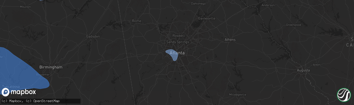
Hail Map in Atlanta, GA on February 15, 2025
The weather event in Atlanta, GA on February 15, 2025 includes Wind, Tornado, and Hail maps. 12 states and 394 cities were impacted and suffered possible damage. The total estimated number of properties impacted is 0.
Wind
Tornado
Hail
0
Estimated number of impacted properties by a 1.00" hail or larger0
Estimated number of impacted properties by a 1.75" hail or larger0
Estimated number of impacted properties by a 2.50" hail or largerStorm reports in Atlanta, GA
Atlanta, GA
| Date | Description |
|---|---|
| 02/15/20253:39 AM CST | Asos station kfty fulton county airport-brown field. |
| 02/15/20253:36 AM CST | A large tree fell onto a home in the 1200 block of wylie street se. |
| 02/15/20253:32 AM CST | A large tree fell onto a parked vehicle at the corner of ted turner dr nw and simpson st nw. |
| 02/15/20253:31 AM CST | *** 1 fatal *** em reports a tree down on home on matilda pl nw near hortense pl nw. One fatality reported. |
| 02/15/20253:31 AM CST | Corrects previous tstm wnd dmg report from 1 nw west end. Powerlines and trees down at the intersection of parsons street sw and lawton street sw. |
| 02/15/20253:31 AM CST | Powerlines down near the intersection of meadowdale avenue ne and johnson road ne. |
| 02/15/20253:30 AM CST | 1 to 2 trees down near the intersection of braemar avenue sw and valleydale drive sw. |
| 02/15/20253:29 AM CST | A tree fell across ball mill road ne at dunwoody club drive. |
| 02/15/20253:28 AM CST | A tree was downed onto power lines and across the 4400 block of powers ferry road. |
| 02/15/20253:28 AM CST | A large tree fell across bellview ave nw near peyton ave nw. |
| 02/15/20253:25 AM CST | 1 to 2 trees down near the intersection of kimberly road sw and melvin drive sw. |
All States Impacted by Hail Map on February 15, 2025
All Cities Impacted by Hail Map on February 15, 2025
- Wynne, AR
- Cherry Valley, AR
- Parkin, AR
- Earle, AR
- Pelican, LA
- Ripley, TN
- Halls, TN
- Drummonds, TN
- Burlison, TN
- Millington, TN
- Gates, TN
- Friendship, TN
- Alamo, TN
- Trenton, TN
- Humboldt, TN
- Dyersburg, TN
- Monticello, AR
- Newbern, TN
- Dyer, TN
- Rutherford, TN
- Bradford, TN
- Cottage Grove, TN
- Brighton, TN
- Osceola, AR
- Wilson, AR
- Henning, TN
- Turrell, AR
- Sharon, TN
- Arlington, TN
- Greenfield, TN
- Kenton, TN
- Puryear, TN
- Brownsville, TN
- Gleason, TN
- McKenzie, TN
- Lake Village, AR
- Greenville, MS
- Leland, MS
- Shaw, MS
- Boyle, MS
- Benoit, MS
- Henry, TN
- Paris, TN
- Atwood, TN
- Milan, TN
- Trezevant, TN
- Murray, KY
- Hazel, KY
- Springville, TN
- Buchanan, TN
- Mansfield, TN
- Big Sandy, TN
- Medina, TN
- Jackson, TN
- Hollow Rock, TN
- Stewart, TN
- Dover, TN
- Camden, TN
- Selmer, TN
- Lexington, TN
- Bethel Springs, TN
- Buena Vista, TN
- Adamsville, TN
- Finger, TN
- Bruceton, TN
- Enville, TN
- Westport, TN
- Reagan, TN
- Bells, TN
- Gadsden, TN
- Huntingdon, TN
- Cedar Grove, TN
- Yuma, TN
- Holladay, TN
- Fort Campbell, KY
- Big Rock, TN
- Indian Mound, TN
- Wildersville, TN
- Woodlawn, TN
- Tennessee Ridge, TN
- Cumberland City, TN
- Pembroke, KY
- Hopkinsville, KY
- Clarksville, TN
- Oak Grove, KY
- New Johnsonville, TN
- Waverly, TN
- Eva, TN
- Lavinia, TN
- Oakfield, TN
- Russellville, KY
- Lewisburg, KY
- Olmstead, KY
- Allensville, KY
- McEwen, TN
- Vanleer, TN
- Dickson, TN
- Charlotte, TN
- Cumberland Furnace, TN
- Erin, TN
- Joelton, TN
- Springfield, TN
- Greenbrier, TN
- Ashland City, TN
- Pleasant View, TN
- Crystal Springs, MS
- Byram, MS
- Utica, MS
- Terry, MS
- Raymond, MS
- Goodlettsville, TN
- Pittsboro, NC
- Pittsboro, MS
- Calhoun City, MS
- Vardaman, MS
- Houston, MS
- Randolph, MS
- Houlka, MS
- Cadiz, KY
- Bumpus Mills, TN
- Pontotoc, MS
- Belden, MS
- Okolona, MS
- Shannon, MS
- Tupelo, MS
- Nettleton, MS
- Plantersville, MS
- Fulton, MS
- Pelahatchie, MS
- Morton, MS
- Philadelphia, MS
- Conehatta, MS
- Walnut Grove, MS
- Union, MS
- Sebastopol, MS
- Forest, MS
- Cleveland, MS
- Smithville, MS
- Amory, MS
- Tremont, MS
- Hamilton, AL
- Lyford, TX
- Decatur, AL
- Tanner, AL
- Madison, AL
- Huntsville, AL
- Harvest, AL
- Athens, AL
- Carrollton, AL
- Ethelsville, AL
- Millport, AL
- Reform, AL
- Sulligent, AL
- Vernon, AL
- Winfield, AL
- Kennedy, AL
- Fayette, AL
- Gordo, AL
- Coker, AL
- Northport, AL
- Echola, AL
- Elrod, AL
- Bankston, AL
- Tuscaloosa, AL
- Buhl, AL
- Berry, AL
- Cottondale, AL
- Brookwood, AL
- Fosters, AL
- Ralph, AL
- Eutaw, AL
- Aliceville, AL
- Knoxville, AL
- Adger, AL
- Carbon Hill, AL
- Blacksburg, SC
- Easley, SC
- Riverside, AL
- Lincoln, AL
- Six Mile, SC
- Stanley, NC
- Wake Forest, NC
- Dawsonville, GA
- Cleveland, GA
- Pell City, AL
- Carrboro, NC
- Cowpens, SC
- Ball Ground, GA
- Chesnee, SC
- Dallas, NC
- Cedartown, GA
- Mayo, SC
- Cornelia, GA
- Conway, NC
- Canton, GA
- Boiling Springs, SC
- Richfield, NC
- Ohatchee, AL
- Staley, NC
- Suffolk, VA
- Gainesville, GA
- Enfield, NC
- Aragon, GA
- Taylorsville, GA
- Greer, SC
- Ramseur, NC
- Leeds, AL
- Warrenton, NC
- Hollister, NC
- Louisburg, NC
- Halifax, NC
- Clermont, GA
- Snow Camp, NC
- Demorest, GA
- Anniston, AL
- Virginia Beach, VA
- Rockwell, NC
- Chapel Hill, NC
- Salisbury, NC
- Chesapeake, VA
- Bessemer, AL
- Lula, GA
- Gold Hill, NC
- Acworth, GA
- Littleton, NC
- Toccoa, GA
- Jacksonville, AL
- Siler City, NC
- Seneca, SC
- Cumming, GA
- Bessemer City, NC
- Grover, NC
- Weaver, AL
- McCalla, AL
- Cartersville, GA
- Mount Airy, GA
- Creedmoor, NC
- Graham, NC
- Taylors, SC
- Denton, NC
- Murrayville, GA
- Murfreesboro, NC
- Alexandria, AL
- Liberty, SC
- Central, SC
- Piedmont, AL
- Duncanville, AL
- Kannapolis, NC
- Vance, AL
- Gaffney, SC
- Durham, NC
- Fruithurst, AL
- Como, NC
- Gastonia, NC
- Asheboro, NC
- Youngsville, NC
- Westminster, SC
- Wellford, SC
- Greenville, SC
- Rockmart, GA
- Shelby, NC
- Mount Holly, NC
- Huntersville, NC
- Franklinton, NC
- Emerson, GA
- Jackson, NC
- Lyman, SC
- Gates, NC
- Inman, SC
- Walhalla, SC
- Birmingham, AL
- Concord, NC
- Pendleton, NC
- Franklinville, NC
- Kings Mountain, NC
- San Perlita, TX
- Bruce, MS
- Big Creek, MS
- Sylacauga, AL
- Weogufka, AL
- Selma, AL
- Sardis, AL
- Orrville, AL
- Lowndesboro, AL
- Tyler, AL
- Jones, AL
- Marbury, AL
- Verbena, AL
- Deatsville, AL
- Billingsley, AL
- Autaugaville, AL
- Prattville, AL
- Booth, AL
- Rockford, AL
- Titus, AL
- Elmore, AL
- Coosada, AL
- Millbrook, AL
- Wetumpka, AL
- Equality, AL
- Eclectic, AL
- Montgomery, AL
- Hayneville, AL
- Dadeville, AL
- Shorter, AL
- Tuskegee, AL
- Purvis, MS
- Hattiesburg, MS
- Petal, MS
- Richton, MS
- New Augusta, MS
- Beaumont, MS
- Oakman, AL
- Woodstock, AL
- West Blocton, AL
- Eldridge, AL
- Brierfield, AL
- Helena, AL
- Alabaster, AL
- Montevallo, AL
- Austell, GA
- Mableton, GA
- Atlanta, GA
- Lithia Springs, GA
- Evergreen, AL
- Red Level, AL
- Andalusia, AL
- McKenzie, AL
- Opp, AL
- Jackson, GA
- Monticello, GA
- Covington, GA
- Mansfield, GA
- Shady Dale, GA
- De Soto, GA
- Cobb, GA
- Leslie, GA
- Cordele, GA
- Vienna, GA
- Pitts, GA
- Ponce De Leon, FL
- Inlet Beach, FL
- Vernon, FL
- Ebro, FL
- Panama City Beach, FL
- Panama City, FL
- Lynn Haven, FL
- Collinsville, MS
- Meridian, MS
- Bailey, MS
- Lauderdale, MS
- Daleville, MS
- De Kalb, MS
- Toomsuba, MS
- Porterville, MS
- Cuba, AL
- York, AL
- Livingston, AL
- Boligee, AL
- Auburn, KY
- Sheffield, AL
- Florence, AL
- Tuscumbia, AL
- Muscle Shoals, AL
- Killen, AL
- Leighton, AL
- Town Creek, AL
- Rogersville, AL
- Courtland, AL
- Lexington, AL
- Hillsboro, AL
- Lester, AL
- Elkmont, AL
- Anderson, AL
- Gallion, AL
- Greensboro, AL
- Newbern, AL
- Marion, AL
- Forkland, AL
- Uniontown, AL
- Clanton, AL
- Jemison, AL
- Shelby, AL
- Goodwater, AL
- Ashland, AL
- Talladega, AL
- Alpine, AL
- Millerville, AL
- Alexander City, AL
- Cragford, AL
- Daviston, AL
- Wadley, AL
- Lineville, AL
- Wedowee, AL


