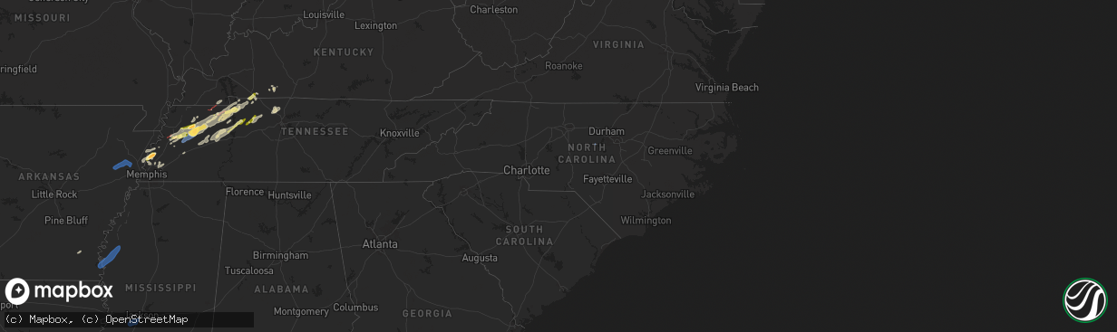
Hail Map in North Carolina on February 15, 2025
The weather event in North Carolina on February 15, 2025 includes Wind, Tornado, and Hail maps. 12 states and 394 cities were impacted and suffered possible damage. The total estimated number of properties impacted is 0.
Want more than just the map?
Turn this storm into a full workflow.
- Owner + property data so you know who to knock
- OnDemand branded weather history reports to win the "did we even have hail?" argument
- RoofTrace estimate so reps stop guessing numbers at the door
Bought this map? Upgrade within 7 days and we'll credit the $230. (10-15 min setup call)
Wind
Tornado
Hail
0
Estimated number of impacted properties by a 1.00" hail or larger0
Estimated number of impacted properties by a 1.75" hail or larger0
Estimated number of impacted properties by a 2.50" hail or largerStorm reports in North Carolina
North Carolina
| Date | Description |
|---|---|
| 02/15/20255:25 AM CST | Power outage attributed to fallen trees or limbs near intersection of bostic sunshine hwy and depriest rd. Time estimated. |
| 02/15/20255:00 AM CST | Power outage attributed to fallen trees or limbs near intersection of erkwood dr and lyndale rd. Time estimated. |
All States Impacted by Hail Map on February 15, 2025
Cities Impacted by Hail Map on February 15, 2025
- Wynne, AR
- Cherry Valley, AR
- Parkin, AR
- Earle, AR
- Pelican, LA
- Ripley, TN
- Halls, TN
- Drummonds, TN
- Burlison, TN
- Millington, TN
- Gates, TN
- Friendship, TN
- Alamo, TN
- Trenton, TN
- Humboldt, TN
- Dyersburg, TN
- Monticello, AR
- Newbern, TN
- Dyer, TN
- Rutherford, TN
- Bradford, TN
- Cottage Grove, TN
- Brighton, TN
- Osceola, AR
- Wilson, AR
- Henning, TN
- Turrell, AR
- Sharon, TN
- Arlington, TN
- Greenfield, TN
- Kenton, TN
- Puryear, TN
- Brownsville, TN
- Gleason, TN
- McKenzie, TN
- Lake Village, AR
- Greenville, MS
- Leland, MS
- Shaw, MS
- Boyle, MS
- Benoit, MS
- Henry, TN
- Paris, TN
- Atwood, TN
- Milan, TN
- Trezevant, TN
- Murray, KY
- Hazel, KY
- Springville, TN
- Buchanan, TN
- Mansfield, TN
- Big Sandy, TN
- Medina, TN
- Jackson, TN
- Hollow Rock, TN
- Stewart, TN
- Dover, TN
- Camden, TN
- Selmer, TN
- Lexington, TN
- Bethel Springs, TN
- Buena Vista, TN
- Adamsville, TN
- Finger, TN
- Bruceton, TN
- Enville, TN
- Westport, TN
- Reagan, TN
- Bells, TN
- Gadsden, TN
- Huntingdon, TN
- Cedar Grove, TN
- Yuma, TN
- Holladay, TN
- Fort Campbell, KY
- Big Rock, TN
- Indian Mound, TN
- Wildersville, TN
- Woodlawn, TN
- Tennessee Ridge, TN
- Cumberland City, TN
- Pembroke, KY
- Hopkinsville, KY
- Clarksville, TN
- Oak Grove, KY
- New Johnsonville, TN
- Waverly, TN
- Eva, TN
- Lavinia, TN
- Oakfield, TN
- Russellville, KY
- Lewisburg, KY
- Olmstead, KY
- Allensville, KY
- McEwen, TN
- Vanleer, TN
- Dickson, TN
- Charlotte, TN
- Cumberland Furnace, TN
- Erin, TN
- Joelton, TN
- Springfield, TN
- Greenbrier, TN
- Ashland City, TN
- Pleasant View, TN
- Crystal Springs, MS
- Byram, MS
- Utica, MS
- Terry, MS
- Raymond, MS
- Goodlettsville, TN
- Pittsboro, NC
- Pittsboro, MS
- Calhoun City, MS
- Vardaman, MS
- Houston, MS
- Randolph, MS
- Houlka, MS
- Cadiz, KY
- Bumpus Mills, TN
- Pontotoc, MS
- Belden, MS
- Okolona, MS
- Shannon, MS
- Tupelo, MS
- Nettleton, MS
- Plantersville, MS
- Fulton, MS
- Pelahatchie, MS
- Morton, MS
- Philadelphia, MS
- Conehatta, MS
- Walnut Grove, MS
- Union, MS
- Sebastopol, MS
- Forest, MS
- Cleveland, MS
- Smithville, MS
- Amory, MS
- Tremont, MS
- Hamilton, AL
- Lyford, TX
- Decatur, AL
- Tanner, AL
- Madison, AL
- Huntsville, AL
- Harvest, AL
- Athens, AL
- Carrollton, AL
- Ethelsville, AL
- Millport, AL
- Reform, AL
- Sulligent, AL
- Vernon, AL
- Winfield, AL
- Kennedy, AL
- Fayette, AL
- Gordo, AL
- Coker, AL
- Northport, AL
- Echola, AL
- Elrod, AL
- Bankston, AL
- Tuscaloosa, AL
- Buhl, AL
- Berry, AL
- Cottondale, AL
- Brookwood, AL
- Fosters, AL
- Ralph, AL
- Eutaw, AL
- Aliceville, AL
- Knoxville, AL
- Adger, AL
- Carbon Hill, AL
- Blacksburg, SC
- Easley, SC
- Riverside, AL
- Lincoln, AL
- Six Mile, SC
- Stanley, NC
- Wake Forest, NC
- Dawsonville, GA
- Cleveland, GA
- Pell City, AL
- Carrboro, NC
- Cowpens, SC
- Ball Ground, GA
- Chesnee, SC
- Dallas, NC
- Cedartown, GA
- Mayo, SC
- Cornelia, GA
- Conway, NC
- Canton, GA
- Boiling Springs, SC
- Richfield, NC
- Ohatchee, AL
- Staley, NC
- Suffolk, VA
- Gainesville, GA
- Enfield, NC
- Aragon, GA
- Taylorsville, GA
- Greer, SC
- Ramseur, NC
- Leeds, AL
- Warrenton, NC
- Hollister, NC
- Louisburg, NC
- Halifax, NC
- Clermont, GA
- Snow Camp, NC
- Demorest, GA
- Anniston, AL
- Virginia Beach, VA
- Rockwell, NC
- Chapel Hill, NC
- Salisbury, NC
- Chesapeake, VA
- Bessemer, AL
- Lula, GA
- Gold Hill, NC
- Acworth, GA
- Littleton, NC
- Toccoa, GA
- Jacksonville, AL
- Siler City, NC
- Seneca, SC
- Cumming, GA
- Bessemer City, NC
- Grover, NC
- Weaver, AL
- McCalla, AL
- Cartersville, GA
- Mount Airy, GA
- Creedmoor, NC
- Graham, NC
- Taylors, SC
- Denton, NC
- Murrayville, GA
- Murfreesboro, NC
- Alexandria, AL
- Liberty, SC
- Central, SC
- Piedmont, AL
- Duncanville, AL
- Kannapolis, NC
- Vance, AL
- Gaffney, SC
- Durham, NC
- Fruithurst, AL
- Como, NC
- Gastonia, NC
- Asheboro, NC
- Youngsville, NC
- Westminster, SC
- Wellford, SC
- Greenville, SC
- Rockmart, GA
- Shelby, NC
- Mount Holly, NC
- Huntersville, NC
- Franklinton, NC
- Emerson, GA
- Jackson, NC
- Lyman, SC
- Gates, NC
- Inman, SC
- Walhalla, SC
- Birmingham, AL
- Concord, NC
- Pendleton, NC
- Franklinville, NC
- Kings Mountain, NC
- San Perlita, TX
- Bruce, MS
- Big Creek, MS
- Sylacauga, AL
- Weogufka, AL
- Selma, AL
- Sardis, AL
- Orrville, AL
- Lowndesboro, AL
- Tyler, AL
- Jones, AL
- Marbury, AL
- Verbena, AL
- Deatsville, AL
- Billingsley, AL
- Autaugaville, AL
- Prattville, AL
- Booth, AL
- Rockford, AL
- Titus, AL
- Elmore, AL
- Coosada, AL
- Millbrook, AL
- Wetumpka, AL
- Equality, AL
- Eclectic, AL
- Montgomery, AL
- Hayneville, AL
- Dadeville, AL
- Shorter, AL
- Tuskegee, AL
- Purvis, MS
- Hattiesburg, MS
- Petal, MS
- Richton, MS
- New Augusta, MS
- Beaumont, MS
- Oakman, AL
- Woodstock, AL
- West Blocton, AL
- Eldridge, AL
- Brierfield, AL
- Helena, AL
- Alabaster, AL
- Montevallo, AL
- Austell, GA
- Mableton, GA
- Atlanta, GA
- Lithia Springs, GA
- Evergreen, AL
- Red Level, AL
- Andalusia, AL
- McKenzie, AL
- Opp, AL
- Jackson, GA
- Monticello, GA
- Covington, GA
- Mansfield, GA
- Shady Dale, GA
- De Soto, GA
- Cobb, GA
- Leslie, GA
- Cordele, GA
- Vienna, GA
- Pitts, GA
- Ponce De Leon, FL
- Inlet Beach, FL
- Vernon, FL
- Ebro, FL
- Panama City Beach, FL
- Panama City, FL
- Lynn Haven, FL
- Collinsville, MS
- Meridian, MS
- Bailey, MS
- Lauderdale, MS
- Daleville, MS
- De Kalb, MS
- Toomsuba, MS
- Porterville, MS
- Cuba, AL
- York, AL
- Livingston, AL
- Boligee, AL
- Auburn, KY
- Sheffield, AL
- Florence, AL
- Tuscumbia, AL
- Muscle Shoals, AL
- Killen, AL
- Leighton, AL
- Town Creek, AL
- Rogersville, AL
- Courtland, AL
- Lexington, AL
- Hillsboro, AL
- Lester, AL
- Elkmont, AL
- Anderson, AL
- Gallion, AL
- Greensboro, AL
- Newbern, AL
- Marion, AL
- Forkland, AL
- Uniontown, AL
- Clanton, AL
- Jemison, AL
- Shelby, AL
- Goodwater, AL
- Ashland, AL
- Talladega, AL
- Alpine, AL
- Millerville, AL
- Alexander City, AL
- Cragford, AL
- Daviston, AL
- Wadley, AL
- Lineville, AL
- Wedowee, AL


