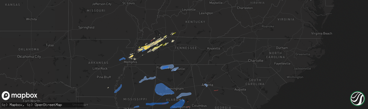
Hail Map in Tennessee on February 15, 2025
The weather event in Tennessee on February 15, 2025 includes Wind, Tornado, and Hail maps. 12 states and 394 cities were impacted and suffered possible damage. The total estimated number of properties impacted is 17,051.
Want more than just the map?
Turn this storm into a full workflow.
- Owner + property data so you know who to knock
- OnDemand branded weather history reports to win the "did we even have hail?" argument
- RoofTrace estimate so reps stop guessing numbers at the door
Bought this map? Upgrade within 7 days and we'll credit the $230. (10-15 min setup call)
Wind
Tornado
Hail
17,051
Estimated number of impacted properties by a 1.00" hail or larger577
Estimated number of impacted properties by a 1.75" hail or larger0
Estimated number of impacted properties by a 2.50" hail or largerStorm reports in Tennessee
Tennessee
| Date | Description |
|---|---|
| 02/15/20252:20 AM CST | Various trees down on roads across the county. No specific locations given. Location approximated based on strongest signals. |
| 02/15/20252:00 AM CST | Tree down across an intersection with old state highway 28. |
| 02/15/20251:40 AM CST | Tree |
| 02/15/20251:35 AM CST | Trees down across various roads in the county. No specific locations to report. |
| 02/15/20251:15 AM CST | Tree |
| 02/15/202512:54 AM CST | Tree fallen on home on east harp street. Time is estimated based on radar data. |
| 02/15/202512:41 AM CST | Trees down on lynchburg highway between lynchburg and tullahoma |
| 02/15/202512:41 AM CST | Trees down on lynchburg highway between lynchburg and tullahoma |
| 02/15/202512:37 AM CST | Tree down on booneville highway |
| 02/15/202512:37 AM CST | Tree down on booneville highway |
| 02/15/202512:25 AM CST | Pole barn under construction blown onto pick up. Several pine trees broken off at 15 ft from ground. |
| 02/14/202511:40 PM CST | Corrects previous tstm wnd dmg report from 8 wsw minor hill. Pole barn under construction blown onto pick up. Several pine trees broken off at 15 ft from ground. Time o |
| 02/14/20259:27 PM CST | A local report indicates 1.00 inch wind near Vanleer |
| 02/14/20258:30 PM CST | A local report indicates 1.00 inch wind near Camden |
| 02/14/20258:25 PM CST | Photo from facebook. |
| 02/14/20257:45 PM CST | Report of quarter size hail near highway 54 and hathaway road. |
| 02/14/20257:43 PM CST | Quarter sized hail was reported in downtown paris. |
| 02/14/20257:43 PM CST | Quarter size hail in downtown paris. |
| 02/14/20257:40 PM CST | Reported tree down on shed and powerlines. |
| 02/14/20257:36 PM CST | Trees snapped and downed. |
| 02/14/20257:35 PM CST | Many trees were knocked down along thetford road. |
| 02/14/20257:25 PM CST | Damaged homes due to downed trees and powerlines on mt. Pisgah rd in bradford. |
| 02/14/20257:21 PM CST | A large tree fell on a house in trenton. |
| 02/14/20257:18 PM CST | Reports of damage in the fruitland and bradford areas. |
| 02/14/20257:15 PM CST | A local report indicates 1.75 inch wind near Trenton |
| 02/14/20257:15 PM CST | At least one home was damaged with several people trapped in a closet. |
| 02/14/20257:13 PM CST | A local report indicates 1.00 inch wind near Greenfield |
| 02/14/20257:02 PM CST | A local report indicates 1.75 inch wind near Dyer |
| 02/14/20257:01 PM CST | Bradford... Tn tornado ef-2. |
| 02/14/20256:59 PM CST | A local report indicates 1.00 inch wind near Dyer |
| 02/14/20256:59 PM CST | Large road sign blown over off i-40 just before the germantown pkwy exit. |
| 02/14/20256:48 PM CST | Tree down in midtown. |
| 02/14/20256:23 PM CST | Golf ball size hail reported on richards landing road. |
| 02/14/20256:00 PM CST | A local report indicates 1.00 inch wind near Dyersburg |
All States Impacted by Hail Map on February 15, 2025
Cities Impacted by Hail Map on February 15, 2025
- Wynne, AR
- Cherry Valley, AR
- Parkin, AR
- Earle, AR
- Pelican, LA
- Ripley, TN
- Halls, TN
- Drummonds, TN
- Burlison, TN
- Millington, TN
- Gates, TN
- Friendship, TN
- Alamo, TN
- Trenton, TN
- Humboldt, TN
- Dyersburg, TN
- Monticello, AR
- Newbern, TN
- Dyer, TN
- Rutherford, TN
- Bradford, TN
- Cottage Grove, TN
- Brighton, TN
- Osceola, AR
- Wilson, AR
- Henning, TN
- Turrell, AR
- Sharon, TN
- Arlington, TN
- Greenfield, TN
- Kenton, TN
- Puryear, TN
- Brownsville, TN
- Gleason, TN
- McKenzie, TN
- Lake Village, AR
- Greenville, MS
- Leland, MS
- Shaw, MS
- Boyle, MS
- Benoit, MS
- Henry, TN
- Paris, TN
- Atwood, TN
- Milan, TN
- Trezevant, TN
- Murray, KY
- Hazel, KY
- Springville, TN
- Buchanan, TN
- Mansfield, TN
- Big Sandy, TN
- Medina, TN
- Jackson, TN
- Hollow Rock, TN
- Stewart, TN
- Dover, TN
- Camden, TN
- Selmer, TN
- Lexington, TN
- Bethel Springs, TN
- Buena Vista, TN
- Adamsville, TN
- Finger, TN
- Bruceton, TN
- Enville, TN
- Westport, TN
- Reagan, TN
- Bells, TN
- Gadsden, TN
- Huntingdon, TN
- Cedar Grove, TN
- Yuma, TN
- Holladay, TN
- Fort Campbell, KY
- Big Rock, TN
- Indian Mound, TN
- Wildersville, TN
- Woodlawn, TN
- Tennessee Ridge, TN
- Cumberland City, TN
- Pembroke, KY
- Hopkinsville, KY
- Clarksville, TN
- Oak Grove, KY
- New Johnsonville, TN
- Waverly, TN
- Eva, TN
- Lavinia, TN
- Oakfield, TN
- Russellville, KY
- Lewisburg, KY
- Olmstead, KY
- Allensville, KY
- McEwen, TN
- Vanleer, TN
- Dickson, TN
- Charlotte, TN
- Cumberland Furnace, TN
- Erin, TN
- Joelton, TN
- Springfield, TN
- Greenbrier, TN
- Ashland City, TN
- Pleasant View, TN
- Crystal Springs, MS
- Byram, MS
- Utica, MS
- Terry, MS
- Raymond, MS
- Goodlettsville, TN
- Pittsboro, NC
- Pittsboro, MS
- Calhoun City, MS
- Vardaman, MS
- Houston, MS
- Randolph, MS
- Houlka, MS
- Cadiz, KY
- Bumpus Mills, TN
- Pontotoc, MS
- Belden, MS
- Okolona, MS
- Shannon, MS
- Tupelo, MS
- Nettleton, MS
- Plantersville, MS
- Fulton, MS
- Pelahatchie, MS
- Morton, MS
- Philadelphia, MS
- Conehatta, MS
- Walnut Grove, MS
- Union, MS
- Sebastopol, MS
- Forest, MS
- Cleveland, MS
- Smithville, MS
- Amory, MS
- Tremont, MS
- Hamilton, AL
- Lyford, TX
- Decatur, AL
- Tanner, AL
- Madison, AL
- Huntsville, AL
- Harvest, AL
- Athens, AL
- Carrollton, AL
- Ethelsville, AL
- Millport, AL
- Reform, AL
- Sulligent, AL
- Vernon, AL
- Winfield, AL
- Kennedy, AL
- Fayette, AL
- Gordo, AL
- Coker, AL
- Northport, AL
- Echola, AL
- Elrod, AL
- Bankston, AL
- Tuscaloosa, AL
- Buhl, AL
- Berry, AL
- Cottondale, AL
- Brookwood, AL
- Fosters, AL
- Ralph, AL
- Eutaw, AL
- Aliceville, AL
- Knoxville, AL
- Adger, AL
- Carbon Hill, AL
- Blacksburg, SC
- Easley, SC
- Riverside, AL
- Lincoln, AL
- Six Mile, SC
- Stanley, NC
- Wake Forest, NC
- Dawsonville, GA
- Cleveland, GA
- Pell City, AL
- Carrboro, NC
- Cowpens, SC
- Ball Ground, GA
- Chesnee, SC
- Dallas, NC
- Cedartown, GA
- Mayo, SC
- Cornelia, GA
- Conway, NC
- Canton, GA
- Boiling Springs, SC
- Richfield, NC
- Ohatchee, AL
- Staley, NC
- Suffolk, VA
- Gainesville, GA
- Enfield, NC
- Aragon, GA
- Taylorsville, GA
- Greer, SC
- Ramseur, NC
- Leeds, AL
- Warrenton, NC
- Hollister, NC
- Louisburg, NC
- Halifax, NC
- Clermont, GA
- Snow Camp, NC
- Demorest, GA
- Anniston, AL
- Virginia Beach, VA
- Rockwell, NC
- Chapel Hill, NC
- Salisbury, NC
- Chesapeake, VA
- Bessemer, AL
- Lula, GA
- Gold Hill, NC
- Acworth, GA
- Littleton, NC
- Toccoa, GA
- Jacksonville, AL
- Siler City, NC
- Seneca, SC
- Cumming, GA
- Bessemer City, NC
- Grover, NC
- Weaver, AL
- McCalla, AL
- Cartersville, GA
- Mount Airy, GA
- Creedmoor, NC
- Graham, NC
- Taylors, SC
- Denton, NC
- Murrayville, GA
- Murfreesboro, NC
- Alexandria, AL
- Liberty, SC
- Central, SC
- Piedmont, AL
- Duncanville, AL
- Kannapolis, NC
- Vance, AL
- Gaffney, SC
- Durham, NC
- Fruithurst, AL
- Como, NC
- Gastonia, NC
- Asheboro, NC
- Youngsville, NC
- Westminster, SC
- Wellford, SC
- Greenville, SC
- Rockmart, GA
- Shelby, NC
- Mount Holly, NC
- Huntersville, NC
- Franklinton, NC
- Emerson, GA
- Jackson, NC
- Lyman, SC
- Gates, NC
- Inman, SC
- Walhalla, SC
- Birmingham, AL
- Concord, NC
- Pendleton, NC
- Franklinville, NC
- Kings Mountain, NC
- San Perlita, TX
- Bruce, MS
- Big Creek, MS
- Sylacauga, AL
- Weogufka, AL
- Selma, AL
- Sardis, AL
- Orrville, AL
- Lowndesboro, AL
- Tyler, AL
- Jones, AL
- Marbury, AL
- Verbena, AL
- Deatsville, AL
- Billingsley, AL
- Autaugaville, AL
- Prattville, AL
- Booth, AL
- Rockford, AL
- Titus, AL
- Elmore, AL
- Coosada, AL
- Millbrook, AL
- Wetumpka, AL
- Equality, AL
- Eclectic, AL
- Montgomery, AL
- Hayneville, AL
- Dadeville, AL
- Shorter, AL
- Tuskegee, AL
- Purvis, MS
- Hattiesburg, MS
- Petal, MS
- Richton, MS
- New Augusta, MS
- Beaumont, MS
- Oakman, AL
- Woodstock, AL
- West Blocton, AL
- Eldridge, AL
- Brierfield, AL
- Helena, AL
- Alabaster, AL
- Montevallo, AL
- Austell, GA
- Mableton, GA
- Atlanta, GA
- Lithia Springs, GA
- Evergreen, AL
- Red Level, AL
- Andalusia, AL
- McKenzie, AL
- Opp, AL
- Jackson, GA
- Monticello, GA
- Covington, GA
- Mansfield, GA
- Shady Dale, GA
- De Soto, GA
- Cobb, GA
- Leslie, GA
- Cordele, GA
- Vienna, GA
- Pitts, GA
- Ponce De Leon, FL
- Inlet Beach, FL
- Vernon, FL
- Ebro, FL
- Panama City Beach, FL
- Panama City, FL
- Lynn Haven, FL
- Collinsville, MS
- Meridian, MS
- Bailey, MS
- Lauderdale, MS
- Daleville, MS
- De Kalb, MS
- Toomsuba, MS
- Porterville, MS
- Cuba, AL
- York, AL
- Livingston, AL
- Boligee, AL
- Auburn, KY
- Sheffield, AL
- Florence, AL
- Tuscumbia, AL
- Muscle Shoals, AL
- Killen, AL
- Leighton, AL
- Town Creek, AL
- Rogersville, AL
- Courtland, AL
- Lexington, AL
- Hillsboro, AL
- Lester, AL
- Elkmont, AL
- Anderson, AL
- Gallion, AL
- Greensboro, AL
- Newbern, AL
- Marion, AL
- Forkland, AL
- Uniontown, AL
- Clanton, AL
- Jemison, AL
- Shelby, AL
- Goodwater, AL
- Ashland, AL
- Talladega, AL
- Alpine, AL
- Millerville, AL
- Alexander City, AL
- Cragford, AL
- Daviston, AL
- Wadley, AL
- Lineville, AL
- Wedowee, AL


