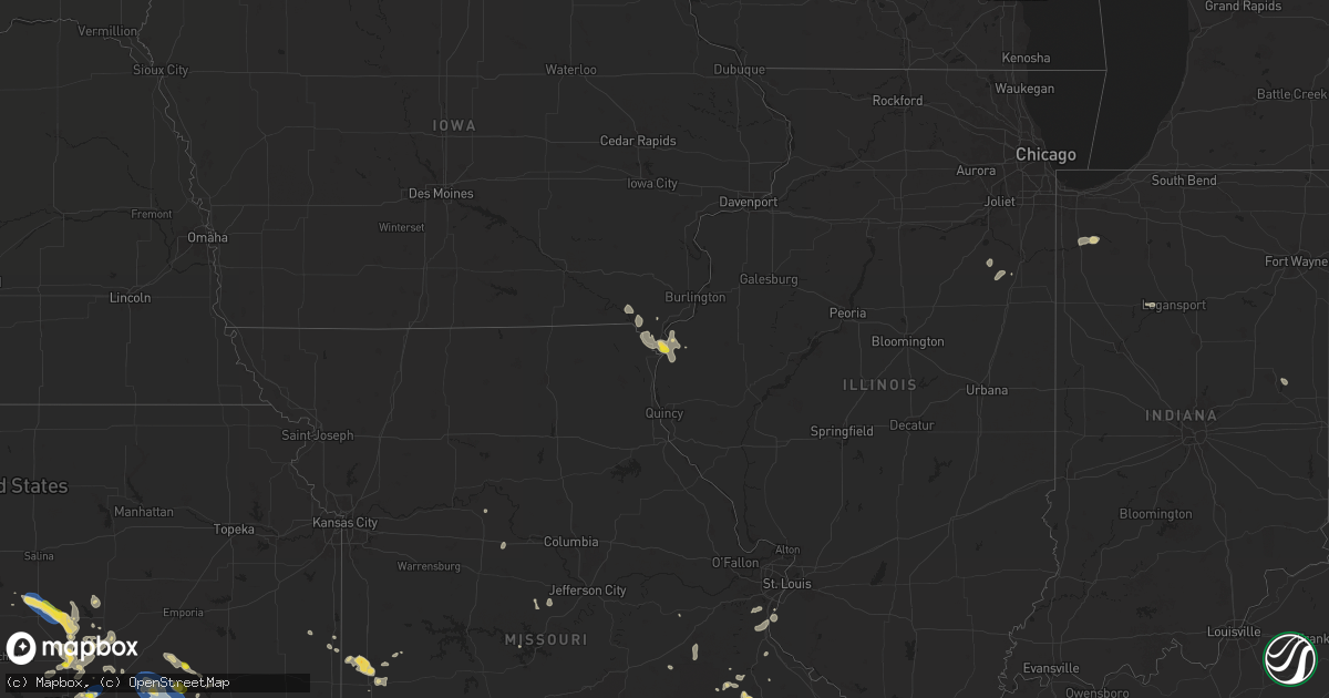
Hail Map on July 30, 2025
Get this storm
July 30 map
$229
one time, instant access
Download today. No call, no setup
Keep the $229
Bought the map and want the full workflow? Apply the entire $229 to a subscription within 7 days. None of it is wasted.
Every map, not just this one
This buys you this map. Subscription and you get every map we run, in the markets you choose from a few cities to whole states to nationwide. Plus real-time alerts the moment a storm fires.
Contact data
Name, contact info, occupancy, even credit band for addresses in the footprint. You go from where it hit to who to call.
Become the source they trust
Unlimited branding weather history reports on demand. You already have the documented answer ready for the property owner, and you are the one who showed up with it.
Property data and RoofTrace estimates
Pull up any address you have got, its value and the exact code rules for that jurisdiction, straight from One Click Code. Then RoofTrace estimates the squares, pitch, and roof value, priced the way you price.
States Impacted by Hail Map on July 30, 2025
Storm reports
New Mexico
| Date | Description |
|---|---|
| 07/30/20255:50 PM CDT | Asos station kgup gallup airport. Likely caused by a virga bomb. |
Colorado
| Date | Description |
|---|---|
| 07/30/20254:10 PM CDT | Spotter sees a tornado on the ground looking east-southeast from her location. |
| 07/30/20254:10 PM CDT | Cu41 called in and could see a tornado on the ground looking ese from her location. |
Missouri
| Date | Description |
|---|---|
| 07/30/20255:45 PM CDT | Hail to the size of half dollars fell north of nevada per social media pictures. Gusty winds also occurred however no damage reported. |
| 07/30/20255:20 PM CDT | Hail to the size of quarters fell in metz per social media report. |
| 07/30/20254:25 PM CDT | Reports of power outages caused by thunderstorm winds in the eminence area late wednesday afternoon. Some power poles were broken. |
| 07/30/20254:10 PM CDT | A lot of tree limbs and tree debris down. |
| 07/30/20253:20 PM CDT | Trees down. |
| 07/29/20257:44 PM CDT | Tree down. |
California
| Date | Description |
|---|---|
| 07/29/20258:29 PM CDT | Report of half inch to quarter sized hail near trinity lake. |
Alabama
| Date | Description |
|---|---|
| 07/30/20254:00 PM CDT | Several trees and power lines down in coffee county... Especially in the elba area. |
| 07/29/20257:40 PM CDT | Tree downed. |
| 07/29/20257:02 PM CDT | Tree down... Blocking both lanes. Time of event estimated from radar. |
Louisiana
| Date | Description |
|---|---|
| 07/30/20256:30 PM CDT | Received photo of large tree limbs and power lines down at this location. |
| 07/30/20255:40 PM CDT | Picture of large trees down across road. |
| 07/30/20255:30 PM CDT | Picture of tress down across highway 71. |
| 07/30/20255:15 PM CDT | Picture of large tree branches down. |
| 07/30/20255:00 PM CDT | Car cover destroyed along with limbs down. |
| 07/30/20254:59 PM CDT | Asos station klch lake charles. |
| 07/30/20254:42 PM CDT | Asos station kaex alexandria. |
| 07/30/20254:37 PM CDT | Tree limbs down and signs blown off. |
| 07/30/20251:56 PM CDT | Powerline knocked over by thunderstorm winds in marrero relayed by broadcast media. |
| 07/29/20258:15 PM CDT | Reports of down trees at the intersection of la hwy 383 and go racca road. |
| 07/29/20257:20 PM CDT | Retired nws employee reported trees blown down. |
| 07/29/20257:15 PM CDT | Corrects previous tstm wnd dmg report from 3 n iowa. Reports of down trees at the intersection of la hwy 383 and go racca road. |
Wyoming
| Date | Description |
|---|---|
| 07/30/20256:40 PM CDT | Asos station kgey greybull airport. |
Mississippi
| Date | Description |
|---|---|
| 07/30/20252:31 PM CDT | Downed tree damaged two homes in centreville. |
Nevada
| Date | Description |
|---|---|
| 07/30/20256:37 PM CDT | Asos station krno reno. |
Iowa
| Date | Description |
|---|---|
| 07/30/20257:56 AM CDT | A local report indicates 1.00 inch wind near 1 SSW Mooar |
Indiana
| Date | Description |
|---|---|
| 07/30/20256:10 PM CDT | Multiple trees down... Damage to school roof... And baseball dugouts. |
| 07/30/20254:01 PM CDT | Emergency manager reports a tree down onto powerlines in the 6700 block of logansport road. Time estimated via radar. |
Connecticut
| Date | Description |
|---|---|
| 07/30/20254:36 PM CDT | Several downed trees across town in naugatuck. |
| 07/30/20254:32 PM CDT | Tree down on wires blocking driveway on hill road in middlebury ct. |
| 07/30/20254:32 PM CDT | Transformer and wires down on christian road in middlebury ct. |
| 07/30/20254:32 PM CDT | Tree down on walkwood road in middlebury ct. |
| 07/30/20254:32 PM CDT | Tree down on wires... Road impassable. |
| 07/30/20254:30 PM CDT | Corrects time of previous tstm wnd dmg report from 2 sw middlebury. Transformer and wires down on christian road in middlebury ct. |
| 07/30/20253:55 PM CDT | Large tree down in roxbury. Social media report. Time estimated from radar. |
| 07/30/20253:45 PM CDT | Numerous reports of downed trees and wires across new milford. Time estimated from radar. |
| 07/30/20253:40 PM CDT | Report of tree down on us 202. Time estimated from radar. |
| 07/30/20253:34 PM CDT | Report of quarter size hail in washington... Ct. |
Arizona
| Date | Description |
|---|---|
| 07/30/20256:00 PM CDT | Personal weather station measured gust of 58 mph. |
Kansas
| Date | Description |
|---|---|
| 07/30/20256:44 PM CDT | Mostly nickel size hail but a few quarters. |
| 07/30/20256:41 PM CDT | Measured via a personal weather station. |
| 07/30/20256:10 PM CDT | A local report indicates 60 MPH wind near 6 S Lindsborg |
| 07/30/20255:40 PM CDT | Road signs were blown down along with 2-to-3-inch diameter limbs broken. |
| 07/30/20255:29 PM CDT | Most hailstones were less than quarter size hail... But a few were quarter sized. |
| 07/30/20254:53 PM CDT | A local report indicates 1.00 inch wind near Hamilton |
| 07/30/20254:24 PM CDT | Delayed report from a personal weather station. |
| 07/29/202511:21 PM CDT | A local report indicates 60 MPH wind near 2 E Caney |
| 07/29/202511:02 PM CDT | Delayed report. Estimated 50 to 60 mph wind gusts along with nickel sized hail. Times estimated by radar. |
| 07/29/202511:02 PM CDT | A local report indicates 60 MPH wind near Chautauqua |
| 07/29/202510:54 PM CDT | Trees down. |
| 07/29/202510:00 PM CDT | Delayed report. Several trees and large tree limbs downs. Corroborates reports from 2 different co-op observers about widespread tree damage across howard. Time estimat |
| 07/29/20259:55 PM CDT | Delayed report. A few tree limbs down in howard. Time estimated by radar. |
| 07/29/20259:24 PM CDT | 50-60 mph wind estimated. |
Florida
| Date | Description |
|---|---|
| 07/30/20255:20 PM CDT | Photo shared from broadcast media of a shed that was picked up and destroyed on saint johns bluff road due to strong winds. Time estimated via radar and measured wind g |
Ohio
| Date | Description |
|---|---|
| 07/29/202511:28 PM CDT | Tree downed in |
| 07/29/202511:28 PM CDT | Tree downed in smithville... With a separate report of downed powerlines in smithville. Time estimated via radar. |
| 07/29/202511:28 PM CDT | Tree downed in smithv |
| 07/29/202511:23 PM CDT | Multiple 58 mph wind gusts at kbjj between 1223 and 1228 am edt. |
| 07/29/20257:23 PM CDT | Delayed report. Tree and powerlines down on to lincoln highway between stewart rd and slabtown rd. Time estimated via radar. |
| 07/29/20257:22 PM CDT | Delayed report. 5 large trees down at a home on lincoln highway between stewart rd and slabtown rd. Home also sustained minor damage to garage... Gutters... And a windo |
| 07/29/20257:20 PM CDT | Delayed report. Photo of large tree down. Reports of multiple trees down in this area. |
| 07/29/20257:19 PM CDT | Delayed report. Large tree down onto lincoln highway near the intersection with oh-115. Time estimated via radar. |
Cities Impacted by Hail Map on July 30, 2025
- Reno, NV
- Bonaparte, IA
- Donnellson, IA
- Farmington, IA
- Argyle, IA
- Wayland, MO
- Montrose, IA
- Kahoka, MO
- Marshall, MO
- Keokuk, IA
- Hamilton, IL
- Nauvoo, IL
- Pilot Grove, MO
- Niota, IL
- Warsaw, IL
- Blackwater, MO
- Carthage, IL
- Pensacola, FL
- Reddick, IL
- Buckingham, IL
- Clifton, IL
- Chebanse, IL
- Herscher, IL
- Hebron, IN
- Demotte, IN
- Wheatfield, IN
- Mccomb, MS
- Magnolia, MS
- Mayhill, NM
- Osyka, MS
- Marrero, LA
- Kentwood, LA
- Mount Hermon, LA
- Bailey, CO
- Westwego, LA
- Olla, LA
- Winnfield, LA
- Oneonta, AL
- Belle Chasse, LA
- Coushatta, LA
- Saint Bernard, LA
- Gibson, LA
- Conway, AR
- Steele, AL
- Amite, LA
- Gretna, LA
- De Queen, AR
- Goldonna, LA
- Oberlin, LA
- Robert, LA
- Franklin, LA
- Greensburg, LA
- Liberty, MS
- Sedalia, CO
- Woodland Park, CO
- Divide, CO
- Roseland, LA
- Ashville, AL
- Braithwaite, LA
- Independence, LA
- Poplarville, MS
- Kinder, LA
- Patterson, LA
- Richland, MO
- Larkspur, CO
- Saline, LA
- Sherwood, AR
- Ponchatoula, LA
- Hammond, LA
- Theriot, LA
- Norwood, LA
- Holden, LA
- Franklinton, LA
- Lebanon, MO
- Folsom, LA
- Clinton, LA
- Colorado Springs, CO
- Burnettsville, IN
- Idaville, IN
- Loranger, LA
- Walker, LA
- Baton Rouge, LA
- Eagletown, OK
- Frisco City, AL
- Atlanta, LA
- Montgomery, LA
- Slaughter, LA
- Greenwell Springs, LA
- Pride, LA
- Potosi, MO
- Portage, ME
- Belgrade, MO
- Logansport, IN
- Ashland, LA
- Castor, LA
- Palmer Lake, CO
- Monument, CO
- Prairieville, LA
- West Point, IA
- Irondale, MO
- Ethel, LA
- Donaldsonville, LA
- Saint Francisville, LA
- Caledonia, MO
- Elba, AL
- New Brockton, AL
- Saint Gabriel, LA
- Gonzales, LA
- Port Allen, LA
- Geismar, LA
- Jackson, LA
- Cuthbert, GA
- Zachary, LA
- Thomasville, AL
- Centerville, KS
- Covington, LA
- Arcadia, MO
- Ironton, MO
- Friona, TX
- White Castle, LA
- Centerville, MO
- Natchitoches, LA
- Parker, KS
- Lesterville, MO
- Robeline, LA
- Eureka, KS
- Bismarck, MO
- Marksville, LA
- Moreauville, LA
- Carville, LA
- Dry Prong, LA
- Park Hills, MO
- Picayune, MS
- Grosse Tete, LA
- Hamilton, KS
- Center Point, LA
- Alamosa, CO
- Donaldson, AR
- Belleview, MO
- Madison, KS
- Pine Hill, AL
- Annapolis, MO
- Grand Chenier, LA
- Creole, LA
- Marthaville, LA
- Doe Run, MO
- Cody, WY
- Clinton, AR
- Saint Martinville, LA
- Black, MO
- Gerald, MO
- Pineville, LA
- Deville, LA
- Mansura, LA
- Pilot Knob, MO
- Farmington, MO
- Benton, KS
- Andover, KS
- Towanda, KS
- Augusta, KS
- Cameron, LA
- Boyce, LA
- Mineral Point, MO
- Bonne Terre, MO
- Abita Springs, LA
- Lecompte, LA
- Alexandria, LA
- House, NM
- Colfax, LA
- Placitas, NM
- Pleasanton, KS
- Abbeville, LA
- Maurice, LA
- Gueydan, LA
- Lake Charles, LA
- Woodworth, LA
- Elmer, LA
- Forest Hill, LA
- Glenmora, LA
- Valley Center, KS
- Thermopolis, WY
- Canon City, CO
- Algodones, NM
- Simmesport, LA
- Hermanville, MS
- Many, LA
- Waynoka, OK
- Pattison, MS
- Bernalillo, NM
- Jena, LA
- Lonsdale, AR
- Cheneyville, LA
- Newton, KS
- Whitewater, KS
- Toronto, KS
- Patten, ME
- Opelousas, LA
- Alva, OK
- Effie, LA
- Happy, TX
- Meeteetse, WY
- El Dorado, KS
- Cadet, MO
- Ellsinore, MO
- Sunset, LA
- Grandin, MO
- Mcpherson, KS
- Galva, KS
- Canton, KS
- Lindsborg, KS
- Sierra Vista, AZ
- Canyon, TX
- Oakdale, LA
- Bunkie, LA
- Church Point, LA
- Carencro, LA
- Deridder, LA
- Bristol, TN
- Washington, LA
- Ville Platte, LA
- Rich Hill, MO
- Richards, MO
- Hume, MO
- Burkeville, TX
- Union Church, MS
- Orange, TX
- Doniphan, MO
- Merryville, LA
- Leslie, MO
- Potwin, KS
- Bridge City, TX
- Virgil, KS
- Eunice, LA
- Mamou, LA
- Elton, LA
- Basile, LA
- Evangeline, LA
- Iota, LA
- Jennings, LA
- Branch, LA
- Crowley, LA
- Welsh, LA
- Iowa, LA
- Roanoke, LA
- Lacassine, LA
- Bell City, LA
- Lake Arthur, LA
- Deer, AR
- Yellville, AR
- Rayne, LA
- Enterprise, LA
- Harrisonburg, LA
- Clarendon, TX
- Claude, TX
- Strong, AR
- Crane, MO
- Russellville, MO
- Ellington, MO
- Lakehead, CA
- Pocahontas, AR
- Myrtle, MO
- Couch, MO
- Lettsworth, LA
- Redford, MO
- Nevada, MO
- Monterey, LA
- Wesson, MS
- Brookhaven, MS
- Walton, KS
- Thayer, MO
- Mammoth Spring, AR
- Walker, MO
- Hillsboro, KS
- Buena Vista, GA
- Albany, GA
- Hardy, AR
- Longville, LA
- Hazlehurst, MS
- Mittie, LA
- Festus, MO
- Shoshoni, WY
- Riverton, WY
- Rawlins, WY
- Casper, WY
- Ragley, LA
- Hesston, KS
- Hillsboro, MO
- Pevely, MO
- Fayette, MS
- Wichita, KS
- Sullivan, MO
- Bourbon, MO
- Peabody, KS
- Ravenden Springs, AR
- De Soto, MO
- Selma, IN
- Verona, MO
- Dubach, LA
- Boulder, WY
- Crowheart, WY
- Parker City, IN
- Elbing, KS
- Barnhart, MO
- Americus, GA
- Singer, LA
- Ravenden, AR
- Rockville, MO
- Trinity Center, CA
- Rayville, LA
- Gatewood, MO
- Halstead, KS
- Reva, SD
- Delhi, LA
- Alta, WY
- Kinnear, WY
- Homer, LA
- Lysite, WY
- Camdenton, MO
- Valmeyer, IL
- Ten Sleep, WY
- Dequincy, LA
- Steelville, MO
- Tularosa, NM
- Jeffrey City, WY
- Belen, NM
- Florence, KS
- North Newton, KS
- Ordway, CO
- Sedgwick, KS
- Bentley, KS
- Delight, AR
- Starks, LA
- Piedmont, KS
- Rosalia, KS
- Leon, KS
- Warm Springs, AR
- Dry Creek, LA
- Aurora, MO
- Marionville, MO
- Box Springs, GA
- Fort Washakie, WY
- Williford, AR
- Bearden, AR
- Fall River, KS
- Severy, KS
- Howard, KS
- Deweyville, TX
- Prescott, KS
- Waterloo, IL
- Schell City, MO
- Springer, NM
- Burns, KS
- Lima, OH
- Cairo, OH
- Clayton, LA
- Lehigh, KS
- Waterproof, LA
- Rebecca, GA
- Natchez, MS
- Fredonia, KS
- Longton, KS
- Elk Falls, KS
- Cedar Vale, KS
- Grenola, KS
- Moline, KS
- Latham, KS
- Dexter, KS
- Winfield, KS
- Rock, KS
- Atlanta, KS
- Cambridge, KS
- Burden, KS
- Clearwater, KS
- Wellington, KS
- Fort Necessity, LA
- Shamrock, TX
- Monett, MO
- Ellaville, GA
- Marion, KS
- Lincolnville, KS
- Laguna, NM
- Goessel, KS
- Red Lodge, MT
- Deer Lodge, MT
- Bearcreek, MT
- Roberts, MT
- Port Clinton, OH
- Reeves, LA
- Sedan, KS
- Elk City, KS
- Niotaze, KS
- Havana, KS
- Peru, KS
- Anaconda, MT
- Bismarck, AR
- Winnsboro, LA
- Buffalo, SD
- Carthage, TX
- Lolo, MT
- Manderson, WY
- Saint Louis, MO
- El Dorado Springs, MO
- San Carlos, AZ
- Missoula, MT
- Pavillion, WY
- High Ridge, MO
- Imperial, MO
- Arnold, MO
- House Springs, MO
- Harwood, MO
- Marquette, KS
- Ozark, AR
- Nashville, AR
- Durham, KS
- Chanute, KS
- Ramona, KS
- North Fairfield, OH
- Greenwich, OH
- New London, OH
- Willard, OH
- Lakeside Marblehead, OH
- Banner, WY
- Clearmont, WY
- Lander, WY
- Vail, AZ
- Oark, AR
- Conway Springs, KS
- Phil Campbell, AL
- Spruce Pine, AL
- Ranchester, WY
- Dayton, WY
- Shelby, OH
- Mansfield, OH
- Sandusky, OH
- Alamogordo, NM
- Weston, WY
- Clarksville, AR
- Hartman, AR
- Sheridan, WY
- Barnett, MO
- Versailles, MO
- Latham, MO
- Floyd, NM
- Newfoundland, PA
- Greentown, PA
- South Sterling, PA
- Canadensis, PA