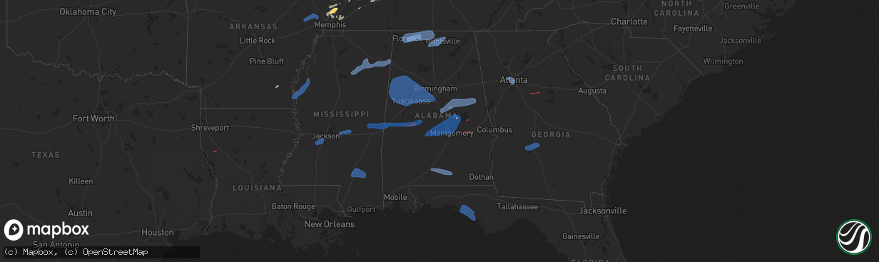
Hail Map in Alabama on February 15, 2025
The weather event in Alabama on February 15, 2025 includes Wind, Tornado, and Hail maps. 12 states and 394 cities were impacted and suffered possible damage. The total estimated number of properties impacted is 0.
Want more than just the map?
Turn this storm into a full workflow.
- Owner + property data so you know who to knock
- OnDemand branded weather history reports to win the "did we even have hail?" argument
- RoofTrace estimate so reps stop guessing numbers at the door
Bought this map? Upgrade within 7 days and we'll credit the $230. (10-15 min setup call)
Wind
Tornado
Hail
0
Estimated number of impacted properties by a 1.00" hail or larger0
Estimated number of impacted properties by a 1.75" hail or larger0
Estimated number of impacted properties by a 2.50" hail or largerStorm reports in Alabama
Alabama
| Date | Description |
|---|---|
| 02/15/20254:43 AM CST | A fallen tree resulted in a power outage via the alabama power website. |
| 02/15/20254:38 AM CST | 1 tree down on hwy 95 at cr 97. |
| 02/15/20254:23 AM CST | Sheriff deputy called in a tree down at hwy 105 and faust ave. |
| 02/15/20254:22 AM CST | Geneva county 911 reports several trees down in geneva. |
| 02/15/20254:21 AM CST | Tree down at cr 41 at cr 36. |
| 02/15/20254:21 AM CST | Tree down at hwy 52 at coffee springs rd. |
| 02/15/20254:06 AM CST | Geneva county 911 reports several trees down in samson. |
| 02/15/20254:05 AM CST | A large pine tree fell in the yard of a resident in ozark. |
| 02/15/20253:48 AM CST | Social media report that a large tree limb fell on a power line and pulled it down into the yard of a resident. |
| 02/15/20253:45 AM CST | Widespread downed trees across coffee county. |
| 02/15/20253:44 AM CST | Trees down in various parts of the county. |
| 02/15/20253:33 AM CST | 58 mph gust measured at k79j. |
| 02/15/20253:26 AM CST | Large tree snapped 6 w crawford. |
| 02/15/20253:25 AM CST | Downed trees blocking both lanes of us hwy 29 near pecan loop. |
| 02/15/20253:20 AM CST | Tree blocking us hwy 331. |
| 02/15/20253:20 AM CST | Trees down on interstate 85 near mile markers 75 and 73. |
| 02/15/20253:18 AM CST | Trees down along highway 51 in beauregard. |
| 02/15/20253:10 AM CST | Multiple trees down... Some on homes and vehicles... In the barrons mobile home park in auburn. |
| 02/15/20253:00 AM CST | A large tree fell on two cars at a residence north of lafayette. |
| 02/15/20252:54 AM CST | Trees down and power poles broken along county rd 13 near hardaway and shorter. Tds on radar. |
| 02/15/20252:53 AM CST | Trees down in various locations across randolph county. |
| 02/15/20252:50 AM CST | A power line was downed along stateline road. |
| 02/15/20252:50 AM CST | A power line was downed along stateline road. |
| 02/15/20252:47 AM CST | Numerous trees were downed and several homes and outbuildings suffered roof damage from an ef1 tornado. |
| 02/15/20252:44 AM CST | Sheet metal peeled off of building at macon east academy. |
| 02/15/20252:42 AM CST | Trees down with damage to a house. |
| 02/15/20252:42 AM CST | An ef1 tornado snapped and uprooted multiple trees along barnesville loop just south of highway 50. |
| 02/15/20252:39 AM CST | Multiple reports of trees down in pike road. |
| 02/15/20252:36 AM CST | Multiple trees down across double bridge ferry rd. |
| 02/15/20252:36 AM CST | Trees down in various parts of the county. |
| 02/15/20252:34 AM CST | Large uprooted tree down on home on red hill rd. |
| 02/15/20252:31 AM CST | Trees down in the willow point area. |
| 02/15/20252:30 AM CST | Trees down in eclectic. |
| 02/15/20252:30 AM CST | A tree was blown down onto a home on andrew jackson road. |
| 02/15/20252:29 AM CST | Trees down in various parts of the county. |
| 02/15/20252:25 AM CST | Social media photo of a large tree down on a shed in ashland. |
| 02/15/20252:25 AM CST | Downed trees on hwy 225 south of i-65. |
| 02/15/20252:24 AM CST | . |
| 02/15/20252:24 AM CST | A local report indicates 70 MPH wind near Dannelly Field |
| 02/15/20252:24 AM CST | Trees and power lines down in the wetumpka area. |
| 02/15/20252:22 AM CST | Trees down in wetumpka. |
| 02/15/20252:20 AM CST | Numerous reports of trees and power lines down in monroe county. |
| 02/15/20252:18 AM CST | A metal roof way blown off of a home on hwy 136. Also... Numerous trees down in the area. |
| 02/15/20252:12 AM CST | Trees down in the titus area. |
| 02/15/20252:12 AM CST | Photo of a large tree down on a home in prattville. |
| 02/15/20252:08 AM CST | Trees down in the deatsville area. |
| 02/15/20252:05 AM CST | A tree was blown down onto a home on knollwood drive in anniston. |
| 02/15/20252:05 AM CST | City of anniston reported multiple roads blocked by trees and powerlines... Including fairway drive... 22nd st... Eglin ave... Castle ave... And raemon ave. |
| 02/15/20252:03 AM CST | Trees and power lines down in sylacauga. |
| 02/15/20252:02 AM CST | A local report indicates 62 MPH wind near Sylacauga Municipal Air |
| 02/15/20252:02 AM CST | . |
| 02/15/20252:01 AM CST | An ef0 downed trees and powerlines in northern coosa county. |
| 02/15/20252:00 AM CST | Social media photo of a tree down on a fence in autaugaville. |
| 02/15/20252:00 AM CST | An ef0 downed trees and powerlines in northern coosa county. |
| 02/15/20252:00 AM CST | Em reports several trees down across roadways in the county. |
| 02/15/20251:58 AM CST | 70mph wind gust on personal weather station. |
| 02/15/20251:45 AM CST | Numerous trees and power lines down across clarke county. |
| 02/15/20251:45 AM CST | Reports of a few trees down across the county. |
| 02/15/20251:39 AM CST | Trees down in the pell city area. |
| 02/15/20251:36 AM CST | Several trees down in the valley grande area. |
| 02/15/20251:33 AM CST | Off-duty nws employee reported numerous large tree limbs down along i-65 beginning about 1 mile north of exit 310 |
| 02/15/20251:33 AM CST | Off-duty nws employee reported numerous large tree limbs down along i-65 beginning about 1 mile north of exit 310 |
| 02/15/20251:30 AM CST | A tree was blown onto a home on cansler ave in gadsden. |
| 02/15/20251:30 AM CST | Trees and power lines down. |
| 02/15/20251:29 AM CST | Tree down blocking roadway near 1400 cty road 174. |
| 02/15/20251:25 AM CST | Trees and powerlines down on scenic dr. |
| 02/15/20251:25 AM CST | Trees down in various locations in shelby county. |
| 02/15/20251:25 AM CST | Trees down in the moody area. |
| 02/15/20251:23 AM CST | Trees down in the ashville area. |
| 02/15/20251:20 AM CST | Multiple trees down on cahaba valley road and northern shelby county. |
| 02/15/20251:15 AM CST | A tree was blown down onto a house on ewell lane. No injuries. |
| 02/15/20251:15 AM CST | Widespread tree damage along highway 168 between albertville and douglas. |
| 02/15/20251:15 AM CST | Widespread tree damage along highway 168 between albertville and douglas. |
| 02/15/20251:13 AM CST | Social media report to the nws account of multiple trees down at the 4300 block of summerville road. Time estimated by radar. |
| 02/15/20251:11 AM CST | A large tree was uprooted on mount hebron road near new home road. Time estimated by radar. |
| 02/15/20251:11 AM CST | A tree was blown onto a house on st. Charles drive in helena. No injuries. |
| 02/15/20251:10 AM CST | Multiple trees down along 4200 block of mount hebron road. |
| 02/15/20251:10 AM CST | Multiple trees down along 4200 block of mount hebron road. |
| 02/15/20251:10 AM CST | Tree on a home on 16th ave s. |
| 02/15/20251:08 AM CST | Trees and power lines down on shades crest road on the shelby county side. |
| 02/15/20251:08 AM CST | Trees down in shades crest... Some involving roadways. |
| 02/15/20251:06 AM CST | Powerlines down in the pleasant grove community. |
| 02/15/20251:06 AM CST | Powerlines down in the pleasant grove community. |
| 02/15/20251:05 AM CST | Corrects previous tornado report from 3 s douglas. An ef-1 tornado with peak wind of 100 mph... Path length of 0.76 miles and maximum path width of 30 yards. |
| 02/15/20251:02 AM CST | Power poles snapped... Pole barn destroyed. Possible tornado. |
| 02/15/20251:01 AM CST | Trees down in various locations in blount county. |
| 02/15/202512:58 AM CST | A tree was knocked down at 1718 alabama highway 91. Time estimated by radar. |
| 02/15/202512:58 AM CST | A tree was knocked down at 1718 alabama highway 91. Time estimated by radar. |
| 02/15/202512:55 AM CST | *** 2 inj *** structures heavily damaged on cr 10 with 2 minor injuries. Possible tornado. |
| 02/15/202512:55 AM CST | Many trees and power lines down in southern hale county affecting crs 10... 69... And 25. Possible tornado. |
| 02/15/202512:52 AM CST | *** 2 inj *** an ef1 tornado downed numerous trees and damaged homes and outbuildings. |
| 02/15/202512:52 AM CST | Multiple trees down in concord... Some involving roadways. |
| 02/15/202512:49 AM CST | Trees reported down in the union grove area. |
| 02/15/202512:49 AM CST | Trees reported down in the union grove area. |
| 02/15/202512:48 AM CST | Multiple trees down in adamsville... Some involving roadways. |
| 02/15/202512:46 AM CST | A tree was blown down onto a house on northridge drive. |
| 02/15/202512:45 AM CST | Trees down in the hayden area. |
| 02/15/202512:43 AM CST | Trees down in various locations in northern hale county. |
| 02/15/202512:37 AM CST | Several trees down on palos circle. |
| 02/15/202512:34 AM CST | A tree was blown down onto a residence with people trapped. Status of injuries... If any... Unknown at this time. |
| 02/15/202512:33 AM CST | Trees down in various parts of east tuscaloosa. |
| 02/15/202512:33 AM CST | An ef0 tornado was confirmed in moundville. Path length 1.62 miles and max winds of 75 mph. |
| 02/15/202512:31 AM CST | A tree and power line down at 707 cross street. Time estimated by radar. Power outages near uah |
| 02/15/202512:31 AM CST | A tree and power line down at 707 cross street. Time estimated by radar. Power outages near uah |
| 02/15/202512:30 AM CST | Trees down in parts of north tuscaloosa. |
| 02/15/202512:26 AM CST | 3 large trees down with live wires and road blockage on davis court. Time estimated by radar. |
| 02/15/202512:25 AM CST | Social media report of trees and powerline down on pineywoods sipsey rd. |
| 02/15/202512:20 AM CST | A local report indicates 75 MPH wind near 4 NW TRIANA |
| 02/15/202512:20 AM CST | A local report indicates 75 MPH wind near 4 NW Triana |
| 02/15/202512:19 AM CST | Trees down in the jones bluff area. |
| 02/15/202512:19 AM CST | A tree trunk was snapped near the palmer road and ray sanderson drive intersection. Time estimated by radar. |
| 02/15/202512:15 AM CST | Report of trees down with loss of power in jasper. |
| 02/15/202512:14 AM CST | Tree and power line down reports in sumter county. |
| 02/15/202512:13 AM CST | Multiple trees were snapped or uprooted along wind mill road between mount hebron road and old jordan road. Time estimated by radar. |
| 02/15/202512:12 AM CST | Measured at county line road and highway 72. |
| 02/15/202512:12 AM CST | Winds up to 88 mph snapped and uprooted several trees along dyar road between mount hebron road and old jordan road. Time estimated by radar. |
| 02/15/202512:12 AM CST | Measured at county line road and highway 72. |
| 02/15/202512:11 AM CST | Trees and power lines were knocked down along mooresville road southwest of ardmore. Time estimated by radar. |
| 02/15/202512:10 AM CST | Winds up to 88 mph snapped trees along new clear creek road north of mount hebron road. Time estimated by radar. |
| 02/15/202512:10 AM CST | Trees reported down in the downtown ardmore area. |
| 02/15/202512:10 AM CST | Trees reported down in the downtown ardmore area. |
| 02/15/202512:09 AM CST | A local report indicates 61 MPH wind near 4 WNW Mooresville |
| 02/15/202512:09 AM CST | A local report indicates 61 MPH wind near 4 WNW MOORESVILLE |
| 02/15/202512:05 AM CST | An ef-1 tornado with peak wind of 100 mph... Path length of 0.76 miles and maximum path width of 30 yards. |
| 02/15/202512:04 AM CST | Trees reported down along fort hampton road and cannon road. |
| 02/15/202512:04 AM CST | Trees reported down along fort hampton road and cannon road. |
| 02/14/202511:58 PM CST | Trees and power lines were knocked down on coffman road. Time estimated by radar. |
| 02/14/202511:52 PM CST | Numerous trees and power lines down across fayette county. |
| 02/14/202511:52 PM CST | Trees and power lines down on cotton belt road. Time estimated by radar. |
| 02/14/202511:52 PM CST | Social media report of trees down on cranal rd and the sipsey recreation area. |
| 02/14/202511:51 PM CST | Trees and power lines down on upper snake road. Time estimated by radar. |
| 02/14/202511:50 PM CST | Trees and power lines down on lentzville road. Time estimated by radar. |
| 02/14/202511:50 PM CST | Trees and power lines down on lovell road. Time estimated by radar. |
| 02/14/202511:50 PM CST | Social media photo of a tree down on a home just west of reform. |
| 02/14/202511:48 PM CST | Trees down... Some damaging two residences on 11th street sw. |
| 02/14/202511:45 PM CST | Siding was blown off the side of a house. |
| 02/14/202511:43 PM CST | A tree was blown down onto a house on 11th street in fayette. |
| 02/14/202511:42 PM CST | A metal roof was blown off a barn or other structure at 1625 lee street in rogersville. Time estimated by radar. |
| 02/14/202511:42 PM CST | Windows blown out of a building or business along highway 72 in rogersville. |
| 02/14/202511:42 PM CST | Windows blown out of a building or business along highway 72 in rogersville. |
| 02/14/202511:39 PM CST | Trees blocking road near college st and lee. Business roof peeled off along 1600 block of lee street. |
| 02/14/202511:39 PM CST | Tree and power lines down. |
| 02/14/202511:39 PM CST | Social media reports of power lines down on 6th avenue in haleyville. |
| 02/14/202511:39 PM CST | 3 large trees blocking county rd 165. |
| 02/14/202511:39 PM CST | Powerlines across road at the intersection of county rd 571 and county rd 53. |
| 02/14/202511:39 PM CST | Large tree limbs were snapped along highway 157 at cr 147 and cr 148. Time estimated by radar. |
| 02/14/202511:38 PM CST | Trees were uprooted and snapped along county road 23 between cr 144 and hatton. Time estimated by radar. |
| 02/14/202511:38 PM CST | Trees and power lines down along county road 87. |
| 02/14/202511:38 PM CST | Trees were knocked down along cr 146. Time estimated by radar. |
| 02/14/202511:38 PM CST | Trees were uprooted and landed on a power pole bending it to the ground along highway 101 between watches creek and hatton. Time estimated by radar. |
| 02/14/202511:37 PM CST | An ef-1 tornado with peak wind of 95 mph... Path length of 0.38 miles... And a maximum path width of 115 yards. |
| 02/14/202511:36 PM CST | Trees were knocked down on cr 236. Time estimated by radar. |
| 02/14/202511:35 PM CST | Pole barn destroyed along county rd 129 and 131... Trees down as well. |
| 02/14/202511:33 PM CST | Metal roofing was torn off of a trailer home along cr 343. Time estimated by radar. |
| 02/14/202511:33 PM CST | An ef-1 tornado with peak wind of 95 mph... Path length of 1.5 miles... And maximum path width of 150 yards. |
| 02/14/202511:32 PM CST | Trees were knocked down on cr 131. Time estimated by radar. |
| 02/14/202511:32 PM CST | Trees were knocked down on cr 129. Time estimated by radar. |
| 02/14/202511:31 PM CST | Trees were knocked down on cr 343. Time estimated by radar. |
| 02/14/202511:29 PM CST | Power line down across roadway on county rd 107. |
| 02/14/202511:29 PM CST | Power lines and power pole down along cr 33. |
| 02/14/202511:27 PM CST | Tree fell and knocked power lines down. |
| 02/14/202511:27 PM CST | Trees down in the bear creek area. |
| 02/14/202511:26 PM CST | Corrects previous tstm wnd dmg report from 1 e tuscumbia. 3 large trees down with live wires and road blockage on davis court. Time estimated by radar. |
| 02/14/202511:26 PM CST | Corrects previous tstm wnd dmg report from 1 e tuscumbia. 3 large trees down with live wires and road blockage on davis court. Time estimated by radar. |
| 02/14/202511:25 PM CST | Several utility poles leaning at 45 degree angle over cnty rd 413. |
| 02/14/202511:25 PM CST | Large tree and power lines down blocking aqua vista dr. |
| 02/14/202511:25 PM CST | Tree in roadway along walnut creek rd. |
| 02/14/202511:25 PM CST | Tree down on powerlines along lingerlost rd and willoughby ln. |
| 02/14/202511:25 PM CST | Tree on house along mimosa cove. |
| 02/14/202511:24 PM CST | A tree was snapped and then fell onto a car along cr 10 near millport. |
| 02/14/202511:23 PM CST | Multiple trees down along the south side of hw 72 near blue water polo. 3 power poles broken and damage to roof along the access road. |
| 02/14/202511:22 PM CST | An ef-1 tornado with peak wind of 94 mph... Path length of 13.42 miles... And a maximum path width of 250 yards. |
| 02/14/202511:22 PM CST | A tree was knocked down on a residence at 104 mimosa cove in killen. Time estimated by radar. |
| 02/14/202511:22 PM CST | A tree was knocked down on a residence at 104 mimosa cove in killen. Time estimated by radar. |
| 02/14/202511:21 PM CST | Measured at the northwest alabama regional airport |
| 02/14/202511:21 PM CST | Measured at the northwest alabama regional airport |
| 02/14/202511:20 PM CST | Trees were uprooted along lincoln avenue. Time estimated by radar. |
| 02/14/202511:20 PM CST | An ef-2 tornado with peak wind of 115 mph... Path length of 3.93 miles... And maximum path width of 170 yards. |
| 02/14/202511:19 PM CST | Tree in road... Partial blockage of bluewater landing rd. |
| 02/14/202511:19 PM CST | Tree and power lines down at intersection of co rd 224 and rocky ford lane. |
| 02/14/202511:18 PM CST | Trees and power lines down in back yd along dowdy dr. |
| 02/14/202511:18 PM CST | Social media report of fencing damage on john r street. Time estimated by radar. |
| 02/14/202511:17 PM CST | A very large tree was knocked down onto the front of a home on chase drive causing considerable damage. Time estimated by radar. |
| 02/14/202511:17 PM CST | Tree on house along randolph street. |
| 02/14/202511:17 PM CST | Transformer and tree on top of house along stovall dr. |
| 02/14/202511:17 PM CST | Social media report. Trees uprooted on west tuxedo street. Time estimated by radar. |
| 02/14/202511:17 PM CST | Social media report of trees down and fencing damage on portage street. Time estimated by radar. |
| 02/14/202511:17 PM CST | Tree across mars hill rd. |
| 02/14/202511:16 PM CST | Two trees were uprooted and minor damage to the roof of a trailer home was identified. Time estimated by radar. |
| 02/14/202511:15 PM CST | Trees down at 110 cr 341. Time estimated by radar. |
| 02/14/202511:15 PM CST | Trees down at 110 cr 341. Time estimated by radar. |
| 02/14/202511:15 PM CST | Tree down on house along williams ave. |
| 02/14/202511:12 PM CST | Reports of multiple trees and powerlines down on east 6th street near n commons and jefferson street. Transformers also blown in the vicinity. Time estimated based on r |
| 02/14/202511:12 PM CST | Reports of multiple trees and powerlines down on east 6th street near n commons and jefferson street. Transformers also blown in the vicinity. Time estimated based on r |
| 02/14/202511:12 PM CST | Update to extend the path. An ef-1 tornado with peak wind of 105 mph... Path length of 4.3 miles... And maximum path width of 215 yards. |
| 02/14/202511:11 PM CST | A church steep was knocked off of westside baptist church. The trees on the property were all knocked down as well. Time estimated by radar. |
| 02/14/202511:10 PM CST | Tree knocked down on a house at 2237 randolph in florence. Time estimated by radar. |
| 02/14/202511:10 PM CST | Tree knocked down on a house at 2237 randolph in florence. Time estimated by radar. |
| 02/14/202511:09 PM CST | Trees down at 728 sherrod avenue. Time estimated by radar. |
| 02/14/202511:09 PM CST | Trees down at cr 457 at cr 57. Time estimated by radar. |
| 02/14/202511:09 PM CST | Trees down at 728 sherrod avenue. Time estimated by radar. |
| 02/14/202511:09 PM CST | Trees down at cr 457 at cr 57. Time estimated by radar. |
| 02/14/202510:58 PM CST | Large trees were uprooted and snapped along highway 172 just west of cedar tree lane. Time estimated by radar. |
| 02/14/202510:57 PM CST | A roof of a home was lifted off and very large trees uprooted along jacksontown road. Time estimated by radar. |
All States Impacted by Hail Map on February 15, 2025
Cities Impacted by Hail Map on February 15, 2025
- Wynne, AR
- Cherry Valley, AR
- Parkin, AR
- Earle, AR
- Pelican, LA
- Ripley, TN
- Halls, TN
- Drummonds, TN
- Burlison, TN
- Millington, TN
- Gates, TN
- Friendship, TN
- Alamo, TN
- Trenton, TN
- Humboldt, TN
- Dyersburg, TN
- Monticello, AR
- Newbern, TN
- Dyer, TN
- Rutherford, TN
- Bradford, TN
- Cottage Grove, TN
- Brighton, TN
- Osceola, AR
- Wilson, AR
- Henning, TN
- Turrell, AR
- Sharon, TN
- Arlington, TN
- Greenfield, TN
- Kenton, TN
- Puryear, TN
- Brownsville, TN
- Gleason, TN
- McKenzie, TN
- Lake Village, AR
- Greenville, MS
- Leland, MS
- Shaw, MS
- Boyle, MS
- Benoit, MS
- Henry, TN
- Paris, TN
- Atwood, TN
- Milan, TN
- Trezevant, TN
- Murray, KY
- Hazel, KY
- Springville, TN
- Buchanan, TN
- Mansfield, TN
- Big Sandy, TN
- Medina, TN
- Jackson, TN
- Hollow Rock, TN
- Stewart, TN
- Dover, TN
- Camden, TN
- Selmer, TN
- Lexington, TN
- Bethel Springs, TN
- Buena Vista, TN
- Adamsville, TN
- Finger, TN
- Bruceton, TN
- Enville, TN
- Westport, TN
- Reagan, TN
- Bells, TN
- Gadsden, TN
- Huntingdon, TN
- Cedar Grove, TN
- Yuma, TN
- Holladay, TN
- Fort Campbell, KY
- Big Rock, TN
- Indian Mound, TN
- Wildersville, TN
- Woodlawn, TN
- Tennessee Ridge, TN
- Cumberland City, TN
- Pembroke, KY
- Hopkinsville, KY
- Clarksville, TN
- Oak Grove, KY
- New Johnsonville, TN
- Waverly, TN
- Eva, TN
- Lavinia, TN
- Oakfield, TN
- Russellville, KY
- Lewisburg, KY
- Olmstead, KY
- Allensville, KY
- McEwen, TN
- Vanleer, TN
- Dickson, TN
- Charlotte, TN
- Cumberland Furnace, TN
- Erin, TN
- Joelton, TN
- Springfield, TN
- Greenbrier, TN
- Ashland City, TN
- Pleasant View, TN
- Crystal Springs, MS
- Byram, MS
- Utica, MS
- Terry, MS
- Raymond, MS
- Goodlettsville, TN
- Pittsboro, NC
- Pittsboro, MS
- Calhoun City, MS
- Vardaman, MS
- Houston, MS
- Randolph, MS
- Houlka, MS
- Cadiz, KY
- Bumpus Mills, TN
- Pontotoc, MS
- Belden, MS
- Okolona, MS
- Shannon, MS
- Tupelo, MS
- Nettleton, MS
- Plantersville, MS
- Fulton, MS
- Pelahatchie, MS
- Morton, MS
- Philadelphia, MS
- Conehatta, MS
- Walnut Grove, MS
- Union, MS
- Sebastopol, MS
- Forest, MS
- Cleveland, MS
- Smithville, MS
- Amory, MS
- Tremont, MS
- Hamilton, AL
- Lyford, TX
- Decatur, AL
- Tanner, AL
- Madison, AL
- Huntsville, AL
- Harvest, AL
- Athens, AL
- Carrollton, AL
- Ethelsville, AL
- Millport, AL
- Reform, AL
- Sulligent, AL
- Vernon, AL
- Winfield, AL
- Kennedy, AL
- Fayette, AL
- Gordo, AL
- Coker, AL
- Northport, AL
- Echola, AL
- Elrod, AL
- Bankston, AL
- Tuscaloosa, AL
- Buhl, AL
- Berry, AL
- Cottondale, AL
- Brookwood, AL
- Fosters, AL
- Ralph, AL
- Eutaw, AL
- Aliceville, AL
- Knoxville, AL
- Adger, AL
- Carbon Hill, AL
- Blacksburg, SC
- Easley, SC
- Riverside, AL
- Lincoln, AL
- Six Mile, SC
- Stanley, NC
- Wake Forest, NC
- Dawsonville, GA
- Cleveland, GA
- Pell City, AL
- Carrboro, NC
- Cowpens, SC
- Ball Ground, GA
- Chesnee, SC
- Dallas, NC
- Cedartown, GA
- Mayo, SC
- Cornelia, GA
- Conway, NC
- Canton, GA
- Boiling Springs, SC
- Richfield, NC
- Ohatchee, AL
- Staley, NC
- Suffolk, VA
- Gainesville, GA
- Enfield, NC
- Aragon, GA
- Taylorsville, GA
- Greer, SC
- Ramseur, NC
- Leeds, AL
- Warrenton, NC
- Hollister, NC
- Louisburg, NC
- Halifax, NC
- Clermont, GA
- Snow Camp, NC
- Demorest, GA
- Anniston, AL
- Virginia Beach, VA
- Rockwell, NC
- Chapel Hill, NC
- Salisbury, NC
- Chesapeake, VA
- Bessemer, AL
- Lula, GA
- Gold Hill, NC
- Acworth, GA
- Littleton, NC
- Toccoa, GA
- Jacksonville, AL
- Siler City, NC
- Seneca, SC
- Cumming, GA
- Bessemer City, NC
- Grover, NC
- Weaver, AL
- McCalla, AL
- Cartersville, GA
- Mount Airy, GA
- Creedmoor, NC
- Graham, NC
- Taylors, SC
- Denton, NC
- Murrayville, GA
- Murfreesboro, NC
- Alexandria, AL
- Liberty, SC
- Central, SC
- Piedmont, AL
- Duncanville, AL
- Kannapolis, NC
- Vance, AL
- Gaffney, SC
- Durham, NC
- Fruithurst, AL
- Como, NC
- Gastonia, NC
- Asheboro, NC
- Youngsville, NC
- Westminster, SC
- Wellford, SC
- Greenville, SC
- Rockmart, GA
- Shelby, NC
- Mount Holly, NC
- Huntersville, NC
- Franklinton, NC
- Emerson, GA
- Jackson, NC
- Lyman, SC
- Gates, NC
- Inman, SC
- Walhalla, SC
- Birmingham, AL
- Concord, NC
- Pendleton, NC
- Franklinville, NC
- Kings Mountain, NC
- San Perlita, TX
- Bruce, MS
- Big Creek, MS
- Sylacauga, AL
- Weogufka, AL
- Selma, AL
- Sardis, AL
- Orrville, AL
- Lowndesboro, AL
- Tyler, AL
- Jones, AL
- Marbury, AL
- Verbena, AL
- Deatsville, AL
- Billingsley, AL
- Autaugaville, AL
- Prattville, AL
- Booth, AL
- Rockford, AL
- Titus, AL
- Elmore, AL
- Coosada, AL
- Millbrook, AL
- Wetumpka, AL
- Equality, AL
- Eclectic, AL
- Montgomery, AL
- Hayneville, AL
- Dadeville, AL
- Shorter, AL
- Tuskegee, AL
- Purvis, MS
- Hattiesburg, MS
- Petal, MS
- Richton, MS
- New Augusta, MS
- Beaumont, MS
- Oakman, AL
- Woodstock, AL
- West Blocton, AL
- Eldridge, AL
- Brierfield, AL
- Helena, AL
- Alabaster, AL
- Montevallo, AL
- Austell, GA
- Mableton, GA
- Atlanta, GA
- Lithia Springs, GA
- Evergreen, AL
- Red Level, AL
- Andalusia, AL
- McKenzie, AL
- Opp, AL
- Jackson, GA
- Monticello, GA
- Covington, GA
- Mansfield, GA
- Shady Dale, GA
- De Soto, GA
- Cobb, GA
- Leslie, GA
- Cordele, GA
- Vienna, GA
- Pitts, GA
- Ponce De Leon, FL
- Inlet Beach, FL
- Vernon, FL
- Ebro, FL
- Panama City Beach, FL
- Panama City, FL
- Lynn Haven, FL
- Collinsville, MS
- Meridian, MS
- Bailey, MS
- Lauderdale, MS
- Daleville, MS
- De Kalb, MS
- Toomsuba, MS
- Porterville, MS
- Cuba, AL
- York, AL
- Livingston, AL
- Boligee, AL
- Auburn, KY
- Sheffield, AL
- Florence, AL
- Tuscumbia, AL
- Muscle Shoals, AL
- Killen, AL
- Leighton, AL
- Town Creek, AL
- Rogersville, AL
- Courtland, AL
- Lexington, AL
- Hillsboro, AL
- Lester, AL
- Elkmont, AL
- Anderson, AL
- Gallion, AL
- Greensboro, AL
- Newbern, AL
- Marion, AL
- Forkland, AL
- Uniontown, AL
- Clanton, AL
- Jemison, AL
- Shelby, AL
- Goodwater, AL
- Ashland, AL
- Talladega, AL
- Alpine, AL
- Millerville, AL
- Alexander City, AL
- Cragford, AL
- Daviston, AL
- Wadley, AL
- Lineville, AL
- Wedowee, AL


