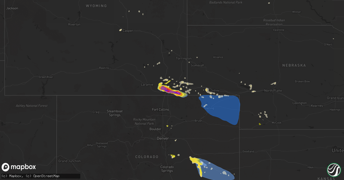
Hail Map on August 1, 2025
Get this storm
August 1 map
$229
one time, instant access
Download today. No call, no setup
Keep the $229
Bought the map and want the full workflow? Apply the entire $229 to a subscription within 7 days. None of it is wasted.
Every map, not just this one
This buys you this map. Subscription and you get every map we run, in the markets you choose from a few cities to whole states to nationwide. Plus real-time alerts the moment a storm fires.
Contact data
Name, contact info, occupancy, even credit band for addresses in the footprint. You go from where it hit to who to call.
Become the source they trust
Unlimited branding weather history reports on demand. You already have the documented answer ready for the property owner, and you are the one who showed up with it.
Property data and RoofTrace estimates
Pull up any address you have got, its value and the exact code rules for that jurisdiction, straight from One Click Code. Then RoofTrace estimates the squares, pitch, and roof value, priced the way you price.
States Impacted by Hail Map on August 1, 2025
Storm reports
South Carolina
| Date | Description |
|---|---|
| 08/01/20256:55 PM CDT | Saluda county dispatch reported a tree on the roadway on john rushton rd. Time estimated by radar. |
| 08/01/20256:52 PM CDT | Scdps reported multiple trees down on i-26 near augusta rd. Time estimated by radar. |
| 08/01/20256:50 PM CDT | Sc highway patrol reported trees down on bruce rd. |
| 08/01/20256:37 PM CDT | Lexington county dispatch reported power lines down along bush river rd at spartan dr. |
| 08/01/20256:35 PM CDT | Scdps reported a tree in the roadway on hollingshed rd. Time estimated by radar. |
| 08/01/20255:40 PM CDT | Lancaster county dispatch reported a tree down on power lines on great falls hwy at douglas rd. Time estimated by radar. |
| 08/01/20254:50 PM CDT | A local report indicates 58 MPH wind near Myrtle Beach |
| 08/01/20254:18 PM CDT | Tree on utility equipment on lake fairfield dr. |
| 08/01/20254:17 PM CDT | Tree down on richbourg rd. Time estimated. |
| 08/01/20254:00 PM CDT | Multiple trees down on lawrence rd. Time estimated. |
| 08/01/20253:40 PM CDT | Tree reported down on a house along hampton ave. |
| 08/01/20252:29 PM CDT | Three power poles broken at flo airport due to the wind gusts. |
| 07/31/20258:46 PM CDT | Schp reported a tree down on wesley chapel ave. |
| 07/31/20257:25 PM CDT | Newberry county dispatch reported multiple trees down on state park rd at state park loop rd. Time estimated by radar. |
North Carolina
| Date | Description |
|---|---|
| 08/01/20256:12 PM CDT | Fallen trees and power lines. |
| 08/01/20255:30 PM CDT | Trees down on ebenezer church |
| 08/01/20255:30 PM CDT | Trees down on ebenezer church rd on power equipment. |
| 08/01/20255:03 PM CDT | Social media picture of a tree down between mineral springs and wesley chapel. |
| 08/01/20254:58 PM CDT | Tree down across the road. |
| 08/01/20254:37 PM CDT | Social media picture of a tree down on a car near selwyn ave. |
| 08/01/20254:30 PM CDT | Corrects previous tstm wnd dmg report from 3 e mount pleasant. 1501 lentz harness shop rd. Trees blocking the road. Time estimated from radar. |
| 08/01/20254:28 PM CDT | Tree down blocking road on thayer rd & cashatt rd in southern trinity. |
| 08/01/20254:27 PM CDT | Social media report of stop lights blown off lines along south boulevard just north of i-485. |
| 08/01/20254:26 PM CDT | Tree down on utility equipment. |
| 08/01/20254:25 PM CDT | A large number of mature... Old trees fell on homes near st matthews church rd and lakeshore dr along south shore of high rock lake. No injuries but several homes appea |
| 08/01/20254:23 PM CDT | Tree down on utility equipment. |
| 08/01/20254:06 PM CDT | Trees down on power equipment along carr store rd and hwy 86. |
| 08/01/20254:05 PM CDT | Trees down on utility equipment. |
| 08/01/20254:04 PM CDT | Tree on a house off of long ferry rd. |
| 08/01/20254:02 PM CDT | Fallen tree damaged utility equipment. |
| 08/01/20254:00 PM CDT | Trees downed off of presbyterian rd. Time estimated from radar. |
| 08/01/20253:55 PM CDT | Cranford road blocked by downed trees. |
| 08/01/20253:54 PM CDT | Trees down at blackwelder farm dr and shearers rd. |
| 08/01/20253:53 PM CDT | Several trees down on powerlines and utility equipment across the north side of gastonia. |
| 08/01/20253:40 PM CDT | Tree downed along otis dellinger rd. |
| 08/01/20253:36 PM CDT | Multiple power outages reported in pleasant grove due to trees down on powerlines and transformers near jeffries cross rd. |
| 08/01/20253:30 PM CDT | Several trees down on powerlines and utility equipment in troutman. |
| 08/01/20253:30 PM CDT | 1501 lentz harness shop rd. Trees blocking the road. Time estimated from radar. |
| 08/01/20253:20 PM CDT | Emergency manager reports numerous downed trees and power line across the city and county... In addition to a tree down on a mobile home. |
| 08/01/20253:18 PM CDT | Tree down on hillcrest dr. Time estimated. |
| 08/01/20253:15 PM CDT | Tree down on hepler dr. Time estimated. |
| 08/01/20253:12 PM CDT | Numerous trees down on the west side of statesville north of the airport and along/south of i-40. |
| 08/01/20253:00 PM CDT | Tree and/or utility line damage causing power outage along underpass rd. |
| 08/01/20252:55 PM CDT | Tree down along us 421 near mile marker 244. |
| 08/01/20252:47 PM CDT | Trees and power lines down. |
| 08/01/20252:44 PM CDT | Thunderstorm winds blew down a power line along the 3200 block of blankenship road. |
| 08/01/20252:22 PM CDT | Trees on utility equipment. |
| 08/01/20251:58 PM CDT | Thunderstorm winds blew down one tree near the 2400 block of rockford road. |
| 08/01/20251:58 PM CDT | Thunderstorm winds blew down one tree near the 2400 block of rockford road. |
| 08/01/202512:51 PM CDT | Tree down on ramp of i-74 near w pine street. |
| 08/01/202512:14 PM CDT | Tree down along ramey creek road. |
| 07/31/20257:00 PM CDT | Thunderstorm damage. |
New Mexico
| Date | Description |
|---|---|
| 08/01/20255:40 PM CDT | Cocorahs observer reported hail of around quarter to half dollar size near ocate. |
| 07/31/202510:19 PM CDT | Santa rosa airport. |
| 07/31/202510:00 PM CDT | Large tree blown over. Time estimated from nearby airport observation. |
| 07/31/20259:59 PM CDT | Santa rosa airport. |
| 07/31/20259:55 PM CDT | Corrects previous tstm wnd gst report from 2 ese santa rosa. Santa rosa airport. |
Texas
| Date | Description |
|---|---|
| 08/01/20256:32 PM CDT | Tree down at fm 1647 near fm 852. |
| 08/01/20256:06 PM CDT | Local police report of trees down in pritchett. |
| 08/01/20255:50 PM CDT | Power lines and trees down on lydia lane. |
| 08/01/20255:05 PM CDT | Photo on x of a large tree branch snapped in north temple. |
| 08/01/20255:05 PM CDT | Corrects previous tstm wnd dmg report from 2 ne temple. Photo on x of a large tree branch snapped in north temple. |
| 08/01/20254:50 PM CDT | Facebook report of several large tree branch |
| 08/01/20254:50 PM CDT | Facebook report of tree down on s 31st st in temple. |
| 08/01/20254:50 PM CDT | Facebook report of several large tree branches down near the baylor hospital on s 31st st in temple. |
| 08/01/20254:40 PM CDT | Corrects previous tstm wnd dmg report from 3 n killeen. Khlr measured a second peak wind gust of 59 mph / 51 knots out of the wnw. |
| 08/01/20254:40 PM CDT | Khlr measured a second peak wind gust of 59 mph / 51 knots out of the wnw. |
| 08/01/20254:27 PM CDT | Corrects previous tstm wnd dmg report from 3 n killeen. Khlr measured a wind gust of 67 mph / 58 knots out of the se. |
| 08/01/20254:27 PM CDT | Khlr measured a wind gust of 67 mph / 58 knots out of the se. |
| 08/01/20254:27 PM CDT | Delayed report from friday august 1st. Part of the roof was blown off an apartment building on north 2nd st. |
| 08/01/20254:25 PM CDT | Facebook photo showed a tree and power line down in killeen. |
| 07/31/20257:40 PM CDT | Power lines down cr 4115 and cr 4117. |
| 07/31/20257:33 PM CDT | Report of a tree down on cr 103. |
| 07/31/20257:33 PM CDT | Report of a tree down on fm 3135 on the east side of h |
| 07/31/20257:33 PM CDT | Report of a tree down on fm 3135 on the east side of henderson. |
Mississippi
| Date | Description |
|---|---|
| 08/01/20254:44 PM CDT | A camper was overturned at the timberlake campground and trees were downed. A private weather station recorded at 58 mph wind gust. Likely microburst. |
Virginia
| Date | Description |
|---|---|
| 08/01/20252:09 PM CDT | Thunderstorm winds blew down one tree near the 1200 block of sandy creek road. |
| 08/01/20251:58 PM CDT | Tree down blocking one lane of old liberty drive. |
| 08/01/20251:56 PM CDT | Tree down blocking both lanes of vista view lane. |
| 08/01/20251:39 PM CDT | Tree down on power lines blocking both lanes along stultz road. |
| 08/01/20251:38 PM CDT | Tree down across sago road. |
| 08/01/20251:30 PM CDT | Thunderstorm winds blew down one tree along the 3200 block of stillmeadow road. |
| 08/01/20251:26 PM CDT | Thunderstorm winds blew down one tree along the 3600 block of spencer-preston road. |
| 08/01/20251:23 PM CDT | Tree down near intersection of oak level road and oakhaven drive. |
| 08/01/20251:20 PM CDT | Tree down blocking both lanes of wilson mill road. |
| 08/01/202512:21 PM CDT | Tree down near intersection of rock ridge and ferrum mountain road. |
Montana
| Date | Description |
|---|---|
| 08/01/20256:21 PM CDT | Mesonet station sdam8 soda springs. |
| 08/01/20256:05 PM CDT | Two separate reports of golf ball to 2 inch hail in buffalo. |
| 07/31/202510:30 PM CDT | Mesonet station mtmal 11.3 |
| 07/31/202510:30 PM CDT | Mesonet station mtmal 11.3 sw phillips |
| 07/31/20258:55 PM CDT | Mt mesonet station loma n. |
Georgia
| Date | Description |
|---|---|
| 08/01/20256:59 PM CDT | A tree reported down on one lane of old poor robin road near the intersection with newington highway. |
| 08/01/20253:54 PM CDT | A tree resulted in a power outage along terrace blvd via the georgia power outage map. |
| 08/01/20253:53 PM CDT | A tree and power line were down along sustella ave. |
| 08/01/20253:40 PM CDT | Social media picture of the top of a large oak tree snapped off. The damage was in the backyard of a home along harris trail road. |
| 08/01/20253:39 PM CDT | Broadcast media shared viewer photos from the piercefield neighborhood of richmond hill... Ga. Photos showed numerous large tree branches down. One flag pole was blown |
| 08/01/20253:30 PM CDT | One tree down along highway 17 near the city limits of richmond hill... Ga. |
| 07/31/202511:02 PM CDT | The tybee south weatherflow observed a 52 kt wind gust. |
Wyoming
| Date | Description |
|---|---|
| 08/01/20256:59 PM CDT | A local report indicates 2.75 inch wind near Cheyenne |
| 08/01/20256:58 PM CDT | Report from mping: ping pong ball |
| 08/01/20256:56 PM CDT | A local report indicates 1.75 inch wind near 2 E Warren Af Base |
| 08/01/20256:55 PM CDT | Report from mping: hen egg |
| 08/01/20256:55 PM CDT | Report from mping: ping pong ball |
| 08/01/20256:52 PM CDT | Report from mping: ping pong ball |
| 08/01/20256:30 PM CDT | A local report indicates 1.25 inch wind near 13 W Cheyenne |
| 08/01/20256:19 PM CDT | A local report indicates 58 MPH wind near 12 SSE Horse Creek |
| 08/01/20256:18 PM CDT | A local report indicates 1.25 inch wind near 18 WNW Cheyenne |
| 08/01/20254:04 PM CDT | Asos station kgey greybull airport. From a strong outflow boundary. |
| 08/01/20254:04 PM CDT | Asos station kgey greybull airport. From a str |
| 08/01/20254:04 PM CDT | Asos station kgey greybull airport. From a strong outflow bo |
| 08/01/20253:08 PM CDT | Asos station kriw riverton airport. Downdraft from weak convection. |
| 07/31/20259:48 PM CDT | A local report indicates 1.50 inch wind near Devils Tower |
| 07/31/20258:04 PM CDT | Trained spotter reported hail sized up to 3 inches via sm with picture evidence. |
| 07/31/20258:04 PM CDT | Trained spotter reported hail sized up to 3 inches via sm wi |
| 07/31/20257:12 PM CDT | Report from mping: hen egg |
| 07/31/20257:12 PM CDT | Report from mping: tennis ball |
| 07/31/20257:03 PM CDT | Report from mping: ping pong ball |
South Dakota
| Date | Description |
|---|---|
| 08/01/20256:49 PM CDT | Marble to quarter size hail. |
| 08/01/20254:38 PM CDT | A local report indicates 1.75 inch wind near 16 E Redig |
| 08/01/20254:05 PM CDT | A local report indicates 1.75 inch wind near 11 ENE Redig |
| 07/31/20258:25 PM CDT | A local report indicates 1.00 inch wind near 3 ESE Cheyenne Crossing |
| 07/31/20257:10 PM CDT | A local report indicates 64 MPH wind near 8 SE Mud Butte |
| 07/31/20257:05 PM CDT | A local report indicates 1.75 inch wind near 3 S Mud Butte |
Colorado
| Date | Description |
|---|---|
| 08/01/20256:54 PM CDT | A local report indicates 60 MPH wind near 6 S Hugo |
| 08/01/20256:45 PM CDT | A local report indicates 74 MPH wind near 7 SSW Hugo |
| 08/01/20255:47 PM CDT | Report from mping: quarter |
| 07/31/202510:26 PM CDT | Mesonet station co034 i-76 julesburg. |
| 07/31/202510:20 PM CDT | A local report indicates 60 MPH wind near 6 NNW Sixteen-Mile Corn |
| 07/31/202510:15 PM CDT | Awos station kheq holyoke airport. |
| 07/31/202510:15 PM CDT | Mesonet station aw276 holyoke. |
| 07/31/202510:15 PM CDT | Mesonet station co048 us 385 holyoke. |
| 07/31/202510:11 PM CDT | Home weather station measured a 70 mph wind gust at 9:11 pm mdt. |
| 07/31/202510:09 PM CDT | A local report indicates 70 MPH wind near Holyoke |
| 07/31/202510:04 PM CDT | Weatherlink station wl-paoli3.34w. |
| 07/31/20259:51 PM CDT | Home weather station measured a 59 mph wind gust at 8:51 pm mdt. |
| 07/31/20259:50 PM CDT | A local report indicates 70 MPH wind near 2 NNE Highland Center |
| 07/31/20259:49 PM CDT | A local report indicates 74 MPH wind near 4 W Highland Center |
| 07/31/20259:48 PM CDT | A local report indicates 58 MPH wind near 4 ESE Haxtun |
| 07/31/20259:45 PM CDT | A local report indicates 71 MPH wind near 3 SW Fleming |
| 07/31/20259:40 PM CDT | A local report indicates 67 MPH wind near 6 W Fairfield |
| 07/31/20259:05 PM CDT | A local report indicates 68 MPH wind near 6 NNW Proctor |
| 07/31/20259:04 PM CDT | Mesonet station co035 i-76 sterling. |
| 07/31/20258:56 PM CDT | A local report indicates 71 MPH wind near 4 NNW Iliff |
| 07/31/20258:55 PM CDT | Awos station k1mw sterling 15 wnw. |
| 07/31/20258:55 PM CDT | Awos station k1jw peetz. |
| 07/31/20258:45 PM CDT | Upr site ktcrsn in kit carson reported a 63 mph wind gust at 7:45 pm mdt. Wind direction from the nne. |
| 07/31/20258:45 PM CDT | Mesonet station tt562 north sterling. |
| 07/31/20258:40 PM CDT | A local report indicates 64 MPH wind near 3 NNW Peetz |
| 07/31/20258:37 PM CDT | A local report indicates 66 MPH wind near 5 WNW Peetz |
| 07/31/20258:00 PM CDT | Upr site up695 in aroya measured a 58 mph wind gust at 7:00 pm mdt. Temperature dropped from the 70s to the upper 50s... Consistent with outflow... Though.. Wind direct |
| 07/31/20257:56 PM CDT | Report from mping: half dollar |
Cities Impacted by Hail Map on August 1, 2025
- Dodson, MT
- Harlem, MT
- Hays, MT
- Lake City, CO
- Dawson, GA
- Parrott, GA
- Henrietta, TX
- Ellenboro, NC
- Casar, NC
- Munford, AL
- Lawndale, NC
- Talladega, AL
- Tobaccoville, NC
- Pfafftown, NC
- Winston Salem, NC
- Rural Hall, NC
- Patrick, SC
- West, MS
- Tow, TX
- Burnet, TX
- Yadkinville, NC
- Lewisville, NC
- Maben, MS
- Lampasas, TX
- Shelby, NC
- Mathiston, MS
- Harmony, NC
- Mocksville, NC
- Eros, LA
- Newnan, GA
- La Jara, CO
- Abbeville, AL
- Loring, MT
- Sharpsburg, GA
- Camp Hill, AL
- Tallassee, AL
- Boncarbo, CO
- Hobson, MT
- Killeen, TX
- Corsicana, TX
- Sanford, CO
- Antonito, CO
- Maiden, NC
- Lincolnton, NC
- Notasulga, AL
- Statesville, NC
- Buffalo, SD
- Stanford, MT
- Capulin, CO
- Briggs, TX
- Kempner, TX
- Trinidad, CO
- Weston, CO
- Kerens, TX
- Troutman, NC
- Conway, SC
- Lubbock, TX
- Hampton, GA
- Griffin, GA
- Brownfield, TX
- Havelock, NC
- Reva, SD
- Mason, TX
- Locust Grove, GA
- Longs, SC
- Mooresville, NC
- Brady, TX
- Wheatland, WY
- Morganton, NC
- Dallas, NC
- Wetmore, CO
- Gastonia, NC
- McAdenville, NC
- Belmont, NC
- Cramerton, NC
- Lowell, NC
- Fleming, GA
- Richmond Hill, GA
- Midway, GA
- Penrose, CO
- Pueblo, CO
- Prairie City, SD
- Sherrills Ford, NC
- Salisbury, NC
- Linwood, NC
- Kellyton, AL
- Alexander City, AL
- Stanley, NC
- Cubero, NM
- Lexington, NC
- Elizabeth, CO
- Elbert, CO
- Franktown, CO
- Big Timber, MT
- Mount Holly, NC
- Groesbeck, TX
- Charlotte, NC
- Columbus, MT
- Lodge Grass, MT
- Bessemer City, NC
- Absarokee, MT
- Newell, SD
- Model, CO
- Moccasin, MT
- Seagraves, TX
- Walsenburg, CO
- Bennett, CO
- Junction, TX
- Zebulon, GA
- Fowler, CO
- Augusta, MT
- Greensboro, GA
- Cheyenne, WY
- Lamesa, TX
- Mud Butte, SD
- Fort Hood, TX
- Guernsey, WY
- Thornton, TX
- Fort Lupton, CO
- Casper, WY
- Eldorado, TX
- Ocate, NM
- Datil, NM
- Bison, SD
- Miami, NM
- Meadow, SD
- Guadalupita, NM
- Albin, WY
- Pine Bluffs, WY
- Burns, WY
- White Plains, GA
- Matheson, CO
- Immokalee, FL
- Clinton, SC
- Sparta, GA
- Belton, TX
- Temple, TX
- Whitmire, SC
- Limon, CO
- Magdalena, NM
- Skipperville, AL
- Ozark, AL
- Hudson, CO
- Orofino, ID
- Glenrock, WY
- Morrill, NE
- Crow Agency, MT
- Saint Xavier, MT
- Mitchell, GA
- Lemmon, SD
- Lodgepole, SD
- Hugo, CO
- Fe Warren Afb, WY
- Buffalo, MT
- Rocky Ford, CO
- Overton, TX
- Kilgore, TX
- Faith, SD
- Shawmut, MT
- Saluda, SC
- Bushnell, NE
- Somes Bar, CA
- Garryowen, MT
- Warthen, GA
- Pachuta, MS
- Harrison, NE
- Troup, TX
- Midwest, WY
- Rosebud, TX
- Wagon Mound, NM
- Reagan, TX
- Lott, TX
- Jacksonville, TX
- Fort Jones, CA
- Grand Saline, TX
- Valmora, NM
- Custer, MT
- Carpenter, WY
- Karval, CO
- Ramah, CO
- Haswell, CO
- Arlington, CO
- Kit Carson, CO
- Dupree, SD
- Moore, MT
- Union Center, SD
- Sand Coulee, MT
- Great Falls, MT
- Trementina, NM
- Saint George, SC
- Grover, CO
- Lewistown, MT
- Las Vegas, NM
- Klamath River, CA
- Hilger, MT
- Gillette, WY
- Mims, FL
- Harleyville, SC
- Henderson, TX
- Hereford, CO
- Eads, CO
- Deadwood, SD
- Rusk, TX
- Pickton, TX
- Lead, SD
- Murchison, TX
- White Owl, SD
- Howes, SD
- Hill City, SD
- Leroy, AL
- Happy Camp, CA
- Cross Plains, TX
- Brownsboro, TX
- McGregor, TX
- Huntington, TX
- Winnsboro, TX
- Saint Stephens, AL
- Bruneau, ID
- Quitman, TX
- Scroggins, TX
- Padroni, CO
- Sterling, CO
- Peetz, CO
- Iliff, CO
- Fleming, CO
- Crook, CO
- Birney, MT
- Pittsburg, TX
- Leesburg, TX
- Gilmer, TX
- Cherry Creek, SD
- Atwood, CO
- Sedgwick, CO
- Haxtun, CO
- Wild Horse, CO
- Grove Hill, AL
- La Junta, CO
- Jackson, AL
- Two Dot, MT
- Weston, WY
- Akron, CO
- Cheyenne Wells, CO
- Sheridan Lake, CO
- Las Animas, CO
- Otis, CO
- Cameron, TX
- Milesville, SD
- Sundance, WY
- Yuma, CO
- Ovid, CO
- Julesburg, CO
- Devils Tower, WY
- Dix, NE
- Potter, NE
- Burkett, TX
- Sidney, NE
- Kimball, NE
- Winnett, MT
- Como, TX
- Cleveland, TN
- Holyoke, CO
- Eckley, CO
- Paoli, CO
- Wray, CO
- Venango, NE
- Amherst, CO
- Colorado City, TX
- Hermleigh, TX
- Geyser, MT
- Vaughn, NM
- Sturgis, SD
- Champion, NE
- Zortman, MT
- Lloyd, MT
- Snyder, TX
- Kim, CO
- Powderly, TX
- Arthur City, TX
- Santa Rosa, NM
- Klondike, TX
- Ogallala, NE
- Beulah, WY
- Raynesford, MT
- Chinook, MT
- Spearfish, SD
- Alzada, MT
- Grand View, ID
- Cumby, TX
- Lemoyne, NE
- Blossom, TX
- Detroit, TX
- Hammond, MT
- Springfield, CO
- Keystone, NE
- Commerce, TX
- Whitewood, SD
- Big Sandy, MT
- Geraldine, MT
- Paris, TX
- Terrell, TX
- Stapleton, NE
- Hugo, OK
- Yeso, NM
- Kaufman, TX
- Wall, SD
- Paxton, NE
- Belle Fourche, SD
- Nemo, SD
- Lincoln, NM
- Hayes Center, NE
- Zavalla, TX
- Ekalaka, MT
- Sulphur Springs, TX
- Brashear, TX
- Palisade, NE
- Newcastle, WY
- Merkel, TX
- Philip, SD
- Culbertson, NE
- Hawley, TX
- Oneill, NE
- Chappell, NE
- North Platte, NE
- Brady, NE
- Loma, MT
- Fort Benton, MT
- Malta, MT
- Billings, MT
- Cuervo, NM