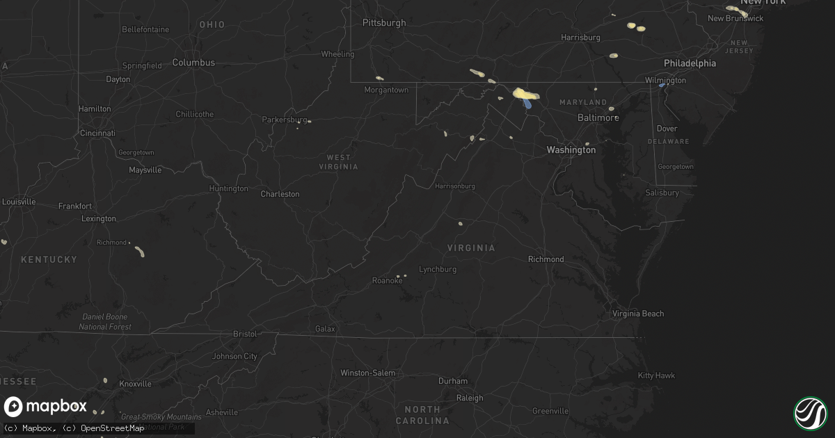
Hail Map in Virginia on July 31, 2025
Get this storm
July 31 map
$229
one time, instant access
Download today. No call, no setup
Keep the $229
Bought the map and want the full workflow? Apply the entire $229 to a subscription within 7 days. None of it is wasted.
Every map, not just this one
This buys you this map. Subscription and you get every map we run, in the markets you choose from a few cities to whole states to nationwide. Plus real-time alerts the moment a storm fires.
Contact data
Name, contact info, occupancy, even credit band for addresses in the footprint. You go from where it hit to who to call.
Become the source they trust
Unlimited branding weather history reports on demand. You already have the documented answer ready for the property owner, and you are the one who showed up with it.
Property data and RoofTrace estimates
Pull up any address you have got, its value and the exact code rules for that jurisdiction, straight from One Click Code. Then RoofTrace estimates the squares, pitch, and roof value, priced the way you price.
Storm reports in Virginia
Virginia
| Date | Description |
|---|---|
| 07/31/20256:00 PM CDT | Tree down in moneta area of bedford county. |
| 07/31/20255:08 PM CDT | Vdot reported a tree a |
| 07/31/20255:08 PM CDT | Vdot reported a tree across the roadway on us-15 in the vicinity of oak hill drive and whitetail road. All north and south lanes were closed. Time estimated from radar. |
| 07/31/20254:32 PM CDT | Power line down reported in the alta vista area. |
| 07/31/20254:15 PM CDT | Vdot reported a tree down across the roadway on route 635 in the vicinity of gallion town road. All north and south lanes were closed. Time estimated from radar. |
| 07/31/20254:07 PM CDT | Vdot reported a tree down across the roadway on route 670 in the vicinity of couches creek road. All north and south lanes were closed. Time estimated from radar. |
| 07/31/20253:56 PM CDT | Tree down along u.s. 50 just east of the clarke county and fauquier county line. |
| 07/31/20253:44 PM CDT | A couple of trees down on craigs store rd. Near the intersection with castle rock rd. |
| 07/31/20253:35 PM CDT | Corrects previous tstm wnd dmg report from 1 e moneta. Tree down in moneta area of bedford county. |
| 07/31/20253:26 PM CDT | Tree down near the intersection of elvan rd. And mountain rd. |
| 07/31/20253:21 PM CDT | Thunderstorm winds blew down one tree near the intersection of joppa mill road and stewartsville road. |
| 07/31/20253:07 PM CDT | Tree down near the intersection of back road and chicory lane. |
| 07/31/20253:03 PM CDT | Tree down near the intersection of crooked run road and senedo rd. |
| 07/31/20252:50 PM CDT | Large tree limb snapped. |
| 07/31/20252:44 PM CDT | A couple of trees down on craigs store rd. Near the intersection with castle rock rd. |
| 07/31/20252:25 PM CDT | Numerous trees down near the intersection of wolfridge rd. And grindstone rd. |
| 07/31/20252:25 PM CDT | Numerous trees down near the intersection of wolfridge rd. And grindstone rd. |
| 07/31/20252:23 PM CDT | Thunderstorm winds blew down one tree along east back street between the intersections of north roanoke street and north church street. |
| 07/31/20252:20 PM CDT | Tree down in the 200 block of dalhousie rd. |
| 07/31/20252:10 PM CDT | Thunderstorm winds blew down one tree near the intersection with dog creek road and moore lane. |
| 07/31/20252:05 PM CDT | Powerline down at rainbow forest drive of timberlake of campbell county. |
| 07/31/20251:56 PM CDT | A few reports of downed trees in the city of staunton. |
| 07/31/20251:05 PM CDT | Multiple reports of trees and powerlines down in the city of lynchburg. |
| 07/31/202512:45 PM CDT | Numerous trees down near the intersection of wolfridge rd. And grindstone rd. |
| 07/30/20257:49 PM CDT | Tree on a home shared via social media. |
All States Impacted by Hail Map on July 31, 2025
Cities Impacted by Hail Map on July 31, 2025
- Riverton, WY
- Shoshoni, WY
- Timbo, AR
- Prim, AR
- Drasco, AR
- Higden, AR
- Atkins, AR
- Heber Springs, AR
- Center Ridge, AR
- Clinton, AR
- Bee Branch, AR
- Lancaster, PA
- Mountville, PA
- Pine Grove, PA
- Robesonia, PA
- Bernville, PA
- Millersville, PA
- Cairo, WV
- Mohrsville, PA
- Wernersville, PA
- Reading, PA
- Walker, WV
- Leesport, PA
- Temple, PA
- Waynesburg, PA
- Mount Morris, PA
- Spraggs, PA
- Vine Grove, KY
- Rineyville, KY
- Elizabethtown, KY
- Dilliner, PA
- Kingsville, MD
- White Marsh, MD
- Perry Hall, MD
- Nottingham, MD
- Hot Springs Village, AR
- Hot Springs National Park, AR
- Malvern, AR
- Joppa, MD
- Bridgewater, NJ
- Warren, NJ
- Martinsville, NJ
- Basking Ridge, NJ
- Bedford, PA
- Oliver Springs, TN
- Bay, AR
- Jonesboro, AR
- Middle River, MD
- Spring City, TN
- Grandview, TN
- Chattanooga, TN
- Dunellen, NJ
- Watchung, NJ
- Everett, PA
- Trumann, AR
- Harriman, TN
- Plainfield, NJ
- Clearville, PA
- Pearcy, AR
- Piscataway, NJ
- South Plainfield, NJ
- Beaver Dam, KY
- Morgantown, KY
- Leola, AR
- Lynn, AL
- Haleyville, AL
- Arkadelphia, AR
- Edison, NJ
- Bowie, MD
- Glenn Dale, MD
- Bismarck, AR
- La Fayette, GA
- Rock Spring, GA
- Artemas, PA
- Warfordsburg, PA
- Iselin, NJ
- Metuchen, NJ
- Cromwell, KY
- Woodbridge, NJ
- Fords, NJ
- Mount Ida, AR
- Sparkman, AR
- Annapolis, MD
- Weir, MS
- Ackerman, MS
- Oneonta, AL
- Okolona, AR
- Gurdon, AR
- Nashville, AR
- Perth Amboy, NJ
- Sweetwater, TN
- Niota, TN
- Murfreesboro, AR
- Ozark, AR
- Cleveland, TN
- Hancock, MD
- Sewaren, NJ
- Keasbey, NJ
- Newark, DE
- New Castle, DE
- Oark, AR
- Bearden, AR
- Bowling Green, KY
- Rochester, KY
- Carthage, AR
- Kosciusko, MS
- Caddo Gap, AR
- Norman, AR
- Parkton, MD
- White Hall, MD
- Bluff City, AR
- Prescott, AR
- Chidester, AR
- Penns Grove, NJ
- Cohutta, GA
- Crandall, GA
- Old Fort, TN
- Fayetteville, TN
- Mulberry, AR
- Jasper, AL
- Arley, AL
- Camden, AR
- Carthage, MS
- Alma, AR
- Dyer, AR
- Chatsworth, GA
- Dalton, GA
- Berkeley Springs, WV
- Smiths Grove, KY
- Oakland, KY
- Hazel Green, AL
- Alvaton, KY
- Charleston, AR
- Bishopville, SC
- Magnolia, AR
- Gateway, CO
- Rosston, AR
- Benton, TN
- Ocoee, TN
- Fisher, WV
- Moorefield, WV
- Scottsville, KY
- Bremen, AL
- Cecil, AR
- Rudy, AR
- Falling Waters, WV
- Williamsport, MD
- Fairplay, MD
- Boonsboro, MD
- Shepherdstown, WV
- Sharpsburg, MD
- Keedysville, MD
- Rohrersville, MD
- Whitewater, CO
- Wardensville, WV
- Aberdeen, MS
- Thaxton, VA
- Afton, VA
- Hagerstown, MD
- Enoree, SC
- Hayden, AL
- Warrior, AL
- Vinton, VA
- Blue Ridge, VA
- Martinsburg, WV
- Hedgesville, WV
- Clear Spring, MD
- Tallahassee, FL
- Knoxville, MD
- Magazine, AR
- Booneville, AR
- Preston, MS
- Lavaca, AR
- Emmet, AR
- Waldron, AR
- Bedford, VA
- Van Buren, AR
- Reliance, TN
- Emerson, AR
- Maryville, TN
- Empire, AL
- Myersville, MD
- Hampton, AR
- Hope, AR
- Ashdown, AR
- Grants, NM
- De Queen, AR
- Blountsville, AL
- Washington, AR
- Star Tannery, VA
- Garland City, AR
- Texarkana, AR
- Haynesville, LA
- Ogden, AR
- Horatio, AR
- Grand View, ID
- Macdoel, CA
- Lockesburg, AR
- Lewisville, AR
- Adairsville, GA
- Fort Smith, AR
- Strasburg, VA
- Roland, OK
- Piedmont, AL
- Rattan, OK
- Eagletown, OK
- Texarkana, TX
- Parks, AR
- Fort Towson, OK
- Arkoma, OK
- Scottsboro, AL
- Snow, OK
- Foreman, AR
- Groveoak, AL
- Spiro, OK
- Irvine, KY
- Paris, VA
- Boyce, VA
- Ravenna, KY
- Springhill, LA
- Clayton, OK
- Cambridge, MD
- Fyffe, AL
- Pocola, OK
- Cameron, OK
- Beattyville, KY
- Heavener, OK
- Bienville, LA
- Parsons, TN
- Cubero, NM
- Sarepta, LA
- Gordo, AL
- Reform, AL
- Madison, MD
- Church Creek, MD
- Woolford, MD
- Klamath Falls, OR
- Athens, LA
- Homer, LA
- Minden, LA
- Hodgen, OK
- Laramie, WY
- Bells, TN
- Gibsland, LA
- Cheyenne, WY
- Haskell, TX
- Pine, CO
- Bailey, CO
- Fe Warren Afb, WY
- Weinert, TX
- Smithville, OK
- Dairy, OR
- Arcadia, LA
- Guntersville, AL
- Arab, AL
- Farmington, NM
- Simsboro, LA
- Tremont, MS
- Fulton, MS
- Story, AR
- Shannon, NC
- Red Springs, NC
- Dalzell, SC
- Camden, SC
- Rembert, SC
- Brownsville, TN
- Fort Garland, CO
- Mentone, AL
- Hope Mills, NC
- Moyers, OK
- Dubberly, LA
- Godwin, NC
- Wade, NC
- Hanna, WY
- Ringgold, LA
- Watson, OK
- Jamestown, LA
- Antlers, OK
- Bethel, OK
- La Salle, CO
- Kersey, CO
- Windthorst, TX
- Archer City, TX
- Fayetteville, NC
- Humboldt, TN
- Trenton, TN
- Mason, TN
- Parkton, NC
- Eagle Point, OR
- White City, OR
- Ault, CO
- Grover, CO
- Scotland, TX
- Nunn, CO
- Kingston, ID
- White Sulphur Springs, MT
- Nogales, AZ
- Medicine Bow, WY
- Byhalia, MS
- Red Banks, MS
- Tuskahoma, OK
- Upperville, VA
- Saint Pauls, NC
- Stanton, TN
- Oakland, TN
- Ringling, MT
- Holly Springs, MS
- Rossville, TN
- Crossett, AR
- Livermore, CO
- Toston, MT
- Townsend, MT
- Greenville, MS
- Garrett, WY
- Hayden, ID
- Lamar, MS
- Hartshorne, OK
- Greeley, CO
- Gill, CO
- Pierce, CO
- Briggsdale, CO
- Orchard, CO
- Weldona, CO
- Nespelem, WA
- Riverside, WA
- Wilburton, OK
- Rathdrum, ID
- Athol, ID
- Roggen, CO
- Holliday, TX
- Johnstown, CO
- Milliken, CO
- Mansfield, LA
- Glenrock, WY
- Lawrenceville, GA
- Loganville, GA
- Unity, OR
- Colville, WA
- Mullan, ID
- Kettle Falls, WA
- Evans, CO
- De Kalb, TX
- Walnut, MS
- Falkner, MS
- Priest River, ID
- Fort Jones, CA
- Usk, WA
- Dixon, WY
- Converse, LA
- Fort Morgan, CO
- New Raymer, CO
- Snyder, CO
- Cave Junction, OR
- Elk, WA
- Newport, WA
- Hillsdale, WY
- Burns, WY
- Coffee Creek, MT
- Buffalo, WY
- Ashland, MS
- Geyser, MT
- East Helena, MT
- Winston, MT
- Selma, OR
- Newport News, VA
- Damascus, AR
- Seymour, TX
- Lysite, WY
- Geraldine, MT
- Otter, MT
- Platteville, CO
- Clearmont, WY
- Keenesburg, CO
- Carter, MT
- Floweree, MT
- Myrtle Beach, SC
- Drummond, MT
- Boyle, MS
- Shaw, MS
- Anna, TX
- Van Alstyne, TX
- Cleveland, NM
- Helena, MT
- Turrell, AR
- Tyronza, AR
- Valley View, TX
- Gainesville, TX
- Mora, NM
- Muenster, TX
- Lindsay, TX
- Weiner, AR
- Celina, TX
- Power, MT
- La Grande, OR
- Yoder, WY
- Fort Laramie, WY
- Carr, CO
- Arvada, WY
- Gilmore, AR
- Earle, AR
- Florence, MT
- Missoula, MT
- Lolo, MT
- Taft, TN
- Gunter, TX
- Howe, TX
- Fort Benton, MT
- Byers, CO
- Jordan, MT
- Belgrade, MT
- Carpenter, WY
- Loma, MT
- Crawfordsville, AR
- Jacksonville, OR
- Sherman, TX
- Wolf Creek, MT
- Gildford, MT
- Great Falls, MT
- Lingle, WY
- Jay Em, WY
- Whitesboro, TX
- Lakehead, CA
- Hopkins, SC
- Monette, AR
- Black Oak, AR
- Black Eagle, MT
- Big Sandy, MT
- Caraway, AR
- Huntsville, TN
- Ten Sleep, WY
- Olla, LA
- Rye, CO
- Clancy, MT
- Lyman, NE
- Jacksboro, TX
- Elmo, MT
- Big Arm, MT
- Polson, MT
- Mccall, ID
- Ashland, MT
- Lame Deer, MT
- Kaycee, WY
- Decker, MT
- Amagon, AR
- Bowie, TX
- McCrory, AR
- Hickory Ridge, AR
- Pioneer, TN
- Oneida, TN
- Box Elder, MT
- Walsenburg, CO
- Torrington, WY
- Forsyth, MT
- Bellevue, TX
- Lodge Grass, MT
- Batesville, AR
- Pueblo, CO
- Colorado City, CO
- Marked Tree, AR
- Lepanto, AR
- Scottsbluff, NE
- Stanford, MT
- Garrison, MT
- Merino, CO
- Ashton, ID
- Fountain, CO
- Penrose, CO
- Roy, NM
- Colorado Springs, CO
- Council, ID
- Alliance, NE
- Vaughn, MT
- Cotopaxi, CO
- Canon City, CO
- Marsland, NE
- Wiggins, CO
- Fairfield, MT
- Choteau, MT
- Belle Fourche, SD
- Deer Trail, CO
- Wallowa, OR
- Hemingford, NE
- Chester, MT
- Lloyd, MT
- Ekalaka, MT
- Wasta, SD
- Howes, SD
- Kinsey, MT
- Quinn, SD
- Ismay, MT
- Miles City, MT
- Camp Crook, SD
- Booneville, KY
- Kadoka, SD
- Wanblee, SD
- Zortman, MT
- Chinook, MT
- Philip, SD
- Manchester, KY
- Hays, MT
- Jackson, KY
- Malta, MT
- Harlem, MT
- Dodson, MT
- Longview, TX
- Dutton, MT
- Spirit Lake, ID


