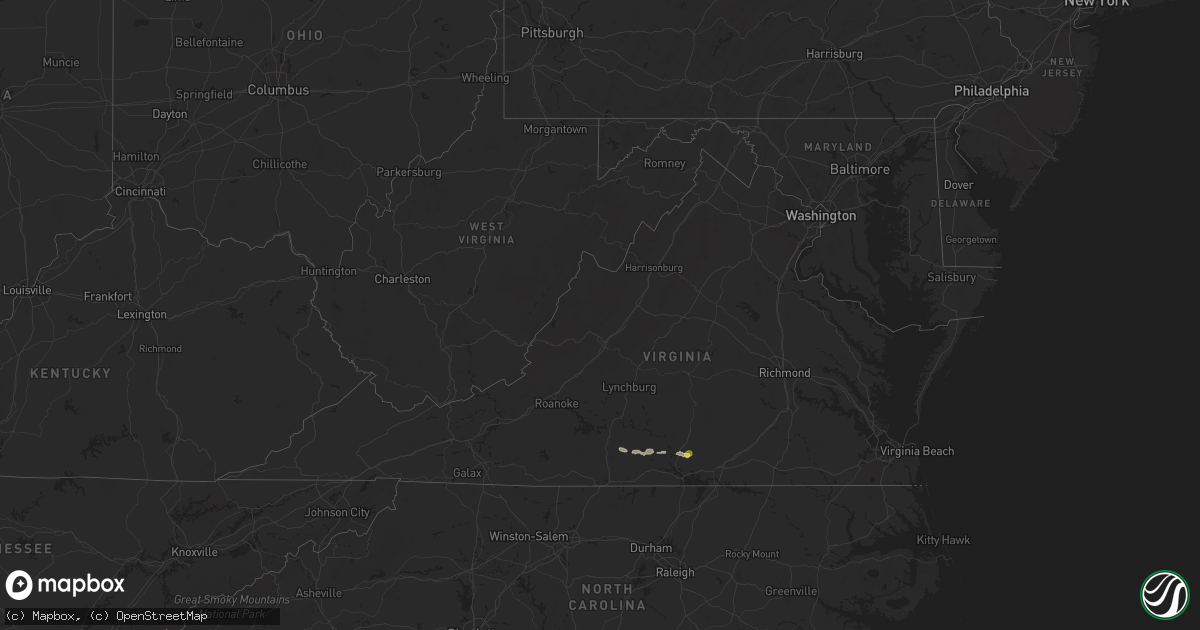
Hail Map in Virginia on July 24, 2024
Get this storm
July 24 map
$229
one time, instant access
Download today. No call, no setup
Keep the $229
Bought the map and want the full workflow? Apply the entire $229 to a subscription within 7 days. None of it is wasted.
Every map, not just this one
This buys you this map. Subscription and you get every map we run, in the markets you choose from a few cities to whole states to nationwide. Plus real-time alerts the moment a storm fires.
Contact data
Name, contact info, occupancy, even credit band for addresses in the footprint. You go from where it hit to who to call.
Become the source they trust
Unlimited branding weather history reports on demand. You already have the documented answer ready for the property owner, and you are the one who showed up with it.
Property data and RoofTrace estimates
Pull up any address you have got, its value and the exact code rules for that jurisdiction, straight from One Click Code. Then RoofTrace estimates the squares, pitch, and roof value, priced the way you price.
Storm reports in Virginia
Virginia
| Date | Description |
|---|---|
| 07/24/20246:21 PM CDT | Tree knocked down in the vicinity of drew street. Time estimated from radar. |
| 07/24/20246:16 PM CDT | Tree downed by thunderstorm winds on preston road... Completely blocking one lane. |
| 07/24/20245:53 PM CDT | Tree downed by thunderstorm winds on sunnybrook circle. |
| 07/24/20245:44 PM CDT | Several trees down along bethel road. |
| 07/24/20245:41 PM CDT | Tree downed by thunderstorm winds on sandy creek church road. |
| 07/24/20245:34 PM CDT | Tree downed by thunderstorm winds on oakland drive. |
| 07/24/20245:30 PM CDT | At least a dozen trees down along lp bailey memorial highway... Near intersection with murphy grove road. There are some lane closures. |
| 07/24/20245:21 PM CDT | 7 trees down across driveway. Time estimated from radar. |
| 07/24/20245:18 PM CDT | Large tree uprooted and fell onto a home. Minor damage to roof and windows. |
| 07/24/20245:10 PM CDT | Numerous trees and power lines down across halifax county. |
| 07/24/20245:02 PM CDT | Trees down on road. Time estimated from radar. |
| 07/24/20245:02 PM CDT | A few trees were downed by thunderstorm winds on county line road. |
| 07/24/20245:02 PM CDT | Tree down across road. |
| 07/24/20244:16 PM CDT | Corrects time from previous tstm wnd dmg report from 3 nne martinsville airport. Tree downed by thunderstorm winds on preston road... Completely blocking one lane. |
| 07/24/20244:09 PM CDT | Large tree down on highway. Time estimated from radar. |
| 07/24/20243:53 PM CDT | Corrects time from previous tstm wnd dmg report from 1 nne sanville. Tree downed by thunderstorm winds on sunnybrook circle. |
| 07/23/20247:17 PM CDT | Tree knocked down along i-85 at mile marker 34. Time estimated from radar. |
All States Impacted by Hail Map on July 24, 2024
Cities Impacted by Hail Map on July 24, 2024
- Gouverneur, NY
- De Kalb Junction, NY
- Richville, NY
- Canton, NY
- Potsdam, NY
- Norwood, NY
- Massena, NY
- Norfolk, NY
- Saint George, SC
- Groton, NY
- Cortland, NY
- Homer, NY
- McGraw, NY
- Cincinnatus, NY
- North Bloomfield, OH
- Orwell, OH
- Bristolville, OH
- Redfield, NY
- Lacona, NY
- Lowville, NY
- Constableville, NY
- Richland, NY
- Cubero, NM
- Abingdon, IL
- Maquon, IL
- Saint Augustine, IL
- London Mills, IL
- Avon, IL
- Floris, IA
- Washington, GA
- Browning, IL
- Plymouth, NC
- Milton, IA
- Douds, IA
- Bloomfield, IA
- Fairview, IL
- Java, VA
- Gretna, VA
- Linden, IA
- Cantril, IA
- Sells, AZ
- Memphis, MO
- Otley, IA
- Pella, IA
- Nathalie, VA
- Vernon Hill, VA
- Chase City, VA
- Arbela, MO
- Redfield, IA
- Brooksville, FL
- Dade City, FL
- Albia, IA
- Hamilton, IA
- Floral City, FL
- Inverness, FL
- Halifax, VA
- Ashland, IL
- Alexander, IL
- Lovilia, IA
- Wisdom, MT
- Blakesburg, IA
- Drakesville, IA
- West Des Moines, IA
- Cumming, IA
- Waukee, IA
- Norwalk, IA
- Prairie City, OR
- Bates, OR
- Unity, OR
- John Day, OR
- Hereford, OR
- Sumpter, OR
- Baker City, OR
- Lloyd, MT
- Hays, MT
- Zortman, MT
- Dodson, MT
- Haines, OR
- Union, OR
- Boise, ID
- Garden City, ID
- Red Oak, VA
- Wylliesburg, VA
- Clover, VA
- Scottsburg, VA
- Crystal Hill, VA
- Mount Lemmon, AZ
- Tucson, AZ
- Indianola, IA
- Prole, IA
- Ellisville, IL
- Martensdale, IA
- Dallas City, IL
- Carthage, IL
- Elkhart, IL
- Mount Pulaski, IL
- Williamsville, IL
- Safford, AZ
- Twentynine Palms, CA
- Buffalo, IL
- Lucile, ID
- Imnaha, OR
- White Bird, ID
- Cottonwood, ID
- La Harpe, IL
- Manilla, IA
- Defiance, IA
- Newcastle, UT
- Blandinsville, IL
- Knoxville, IA
- Dunnellon, FL
- Gorin, MO
- Coolidge, AZ
- Denio, NV
- Winnemucca, NV
- Golconda, NV
- Gibbonsville, ID
- Conner, MT
- North Fork, ID
- Jackson, MT
- Superior, MT
- Alberton, MT
- Elk City, ID
- Lolo, MT
- Orofino, ID
- Victor, MT
- Darby, MT
- Pinesdale, MT
- Stevensville, MT
- Hamilton, MT
- Florence, MT
- Corvallis, MT
- Frenchtown, MT
- Huson, MT
- Missoula, MT
- Arlee, MT
- Bonner, MT
- Milltown, MT
- Clinton, MT
- Wyaconda, MO
- Dixon, MT
- Saint Ignatius, MT
- Charlo, MT
- Ravalli, MT
- Polson, MT
- Ronan, MT
- Seeley Lake, MT
- Ovando, MT
- Maricopa, AZ
- Bigfork, MT
- Condon, MT
- Kalispell, MT
- Lincoln, MT
- Phoenix, AZ
- Casa Grande, AZ
- Rutledge, MO
- Laveen, AZ
- Stanfield, AZ
- Augusta, MT
- Tolleson, AZ
- Wallowa, OR
- North Powder, OR
- Mesa, AZ
- Cortland, OH
- Buckeye, AZ
- West Point, IA
- Glendale, AZ
- Avondale, AZ
- Goodyear, AZ


