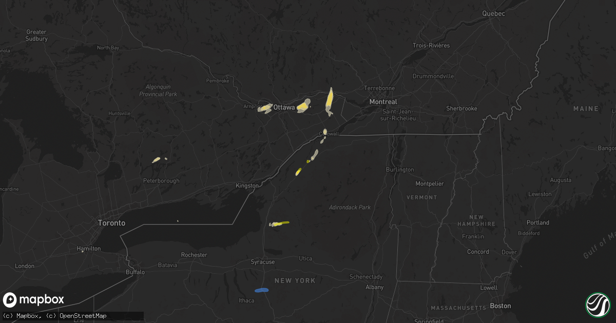
Hail Map on July 24, 2024
Get this storm
July 24 map
$229
one time, instant access
Download today. No call, no setup
Keep the $229
Bought the map and want the full workflow? Apply the entire $229 to a subscription within 7 days. None of it is wasted.
Every map, not just this one
This buys you this map. Subscription and you get every map we run, in the markets you choose from a few cities to whole states to nationwide. Plus real-time alerts the moment a storm fires.
Contact data
Name, contact info, occupancy, even credit band for addresses in the footprint. You go from where it hit to who to call.
Become the source they trust
Unlimited branding weather history reports on demand. You already have the documented answer ready for the property owner, and you are the one who showed up with it.
Property data and RoofTrace estimates
Pull up any address you have got, its value and the exact code rules for that jurisdiction, straight from One Click Code. Then RoofTrace estimates the squares, pitch, and roof value, priced the way you price.
States Impacted by Hail Map on July 24, 2024
Storm reports
Florida
| Date | Description |
|---|---|
| 07/24/20245:40 PM CDT | Social media showing scattered damage across brooksville due to medium to large tree branches. Estimated winds around 50 mph. |
Arizona
| Date | Description |
|---|---|
| 07/24/20246:19 PM CDT | Private weather station. |
| 07/24/202412:00 AM CDT | Mesonet station gw3424 phoenix raceway infield. |
| 07/24/202412:00 AM CDT | Large warehouse facility collapsed with multiple walls and portion of roof missing. Time of damage estimated by radar. |
| 07/23/202411:10 PM CDT | Mesonet station srp32 4.8 w phoenix |
| 07/23/202411:00 PM CDT | Multiple commercial buildings had most of their solar panels ripped off their roofs and pieces of the buildings are scattered around. Trees 60-80 feet tall have been kn |
| 07/23/202410:50 PM CDT | Awos station ka39 ak-chin. |
| 07/23/202410:40 PM CDT | Palm tree fell over on powerlines. |
| 07/23/20248:01 PM CDT | Asos station ksad safford regional airport. |
Pennsylvania
| Date | Description |
|---|---|
| 07/24/20243:54 PM CDT | Tree down on buxton road. |
| 07/24/20243:17 PM CDT | Tree down on wires at cassady road and robertson road. |
| 07/24/20243:15 PM CDT | Tree down on power lines on holly lane. |
| 07/24/20243:13 PM CDT | Tree down on pennsy road. |
| 07/24/20243:04 PM CDT | Tree down at south good hope road and orangeville road. |
| 07/24/20242:12 PM CDT | Trees and wires down on falls ridge rd. |
| 07/24/20242:07 PM CDT | Tree down near glen road. |
| 07/24/20242:04 PM CDT | Trees and wires down on valley ridge road. |
| 07/24/202411:33 AM CDT | Tree limbs down on wires on dynes ave. Time estimated via radar. |
| 07/23/20247:19 PM CDT | Several reports of trees down in jersey shore. |
| 07/23/20247:08 PM CDT | Corrects previous tstm wnd dmg report from 2 n carroll. Report of several trees down near the intersection of rt 880 and rockey rd. |
| 07/23/20247:08 PM CDT | Tree on wires near the intersection of rt 880 and rockey rd. |
Idaho
| Date | Description |
|---|---|
| 07/24/20246:33 PM CDT | Tree down blocking northbound traffic. |
| 07/24/20246:30 PM CDT | Damaged roof and downed tree. Time estimated from radar. |
| 07/24/20246:30 PM CDT | Tree down blocking southbound traffic. Time estimated from radar. |
| 07/24/20246:28 PM CDT | Measured gust at crestline trail. |
| 07/24/20246:12 PM CDT | Metal roof blown off home. |
| 07/24/20245:52 PM CDT | Mesonet station hbfi1 horse butte. |
| 07/24/20245:45 PM CDT | Rwis itd99 kettle butte us-20. |
| 07/24/20244:39 PM CDT | Mesonet station mofi1 moburg canyon. |
| 07/23/20249:10 PM CDT | Idaho department of transportation reports downed trees on us 12... Both directions from road 564 to beaver ridge road 369. |
| 07/23/20249:00 PM CDT | Idaho department of transportation reports multiple trees and rocks on us highway 12 from milepost 158 to the idaho montana border. Time estimated via radar. |
| 07/23/20249:00 PM CDT | Multiple trees with diameters of up to 2 feet fell due to high winds at the wendover campground... Located west of powell idaho along us-12. One tree crushed a 5th whee |
| 07/23/20248:30 PM CDT | Avista reported approximately 600 without power in the kamiah area due to thunderstorm wind gusts. Nearby observations show wind speeds around 45 to 55 mph. |
| 07/23/20248:23 PM CDT | Pittsburg landing raws report. |
| 07/23/20248:20 PM CDT | Idaho county sheriff office reports downed trees blocking selway road. Time estimated via radar. |
| 07/23/20248:15 PM CDT | Avista utilities reports 775 customers without power associated with thunderstorm wind damage in elk city. Time estimated via radar. |
| 07/23/20248:05 PM CDT | Idaho county sheriff office reports closure of us highway 12 near kooskia to the montana border due to rock slides and fallen trees. |
| 07/23/20247:35 PM CDT | Avista utilities reports 700 customers without power associated with thunderstorm wind damage. |
Utah
| Date | Description |
|---|---|
| 07/24/20246:40 AM CDT | Mesonet station pc476 mineral mountains. |
| 07/24/20245:04 AM CDT | Mesonet station wrru1 white reef. |
| 07/24/20244:45 AM CDT | Mesonet station hdp central wasatch peaks - west. |
Ohio
| Date | Description |
|---|---|
| 07/24/20243:09 PM CDT | 1 tree down on house. Time estimated from radar. |
| 07/24/20242:47 PM CDT | Tree down. |
| 07/24/20242:45 PM CDT | Tree down. |
| 07/24/20242:29 PM CDT | Multiple trees down on route 87 between n. Park street and route 46. Time estimated via radar. |
| 07/24/20241:58 PM CDT | Tree down near the intersection of pioneer trail and peck road. Time estimated via radar. |
| 07/24/20241:57 PM CDT | Tree reported down near route 82 and frost road. Time estimated via radar. |
| 07/24/20241:51 PM CDT | Large tree limb reported down near the intersection of riverside drive and duncan drive. Time estimated via radar. |
| 07/24/20241:49 PM CDT | Large tree snapped at base at denver dr and youngstown-pittsburgh rd. |
California
| Date | Description |
|---|---|
| 07/24/20245:57 PM CDT | Pubic reports about 3 large trees down and trailers knocked over due to strong winds near mile marker 55 on sr 62. |
| 07/24/20245:55 PM CDT | California highway patrol reports power pole down at the sr 62 and godwin rd intersection. |
| 07/24/20245:31 PM CDT | Semi-truck was flipped by strong wind gusts and was blocking most of the eb lanes causing traffic to back up. |
Iowa
| Date | Description |
|---|---|
| 07/23/20247:25 PM CDT | A local report indicates 1.00 inch wind near 1 S Cumming |
Oregon
| Date | Description |
|---|---|
| 07/24/20246:41 PM CDT | Several downed trees. Power outages. Time estimated from radar. |
| 07/24/20246:40 PM CDT | Downed juniper trees and 0.27 inches rain in less than one hour. Time estimated from radar. |
| 07/24/20245:55 PM CDT | Mesonet station fafo3 flagstaff hill. |
| 07/24/20245:55 PM CDT | Mesonet station byfo3 blue canyon. |
| 07/24/20245:24 PM CDT | Large tree branches down in the city. |
| 07/24/20245:00 PM CDT | Mesonet station pcyo 4.3 e prairie city |
| 07/24/20244:53 PM CDT | Mesonet station od137 unity |
| 07/23/20248:22 PM CDT | Time estimated from radar. Social media report. |
| 07/23/20247:15 PM CDT | Large tree downed in imnaha. Power outages. Social media report. |
| 07/23/20247:00 PM CDT | Huge pine trees uprooted. Marble size hail. Time estimated from radar. Social media report. |
Virginia
| Date | Description |
|---|---|
| 07/24/20246:21 PM CDT | Tree knocked down in the vicinity of drew street. Time estimated from radar. |
| 07/24/20246:16 PM CDT | Tree downed by thunderstorm winds on preston road... Completely blocking one lane. |
| 07/24/20245:53 PM CDT | Tree downed by thunderstorm winds on sunnybrook circle. |
| 07/24/20245:44 PM CDT | Several trees down along bethel road. |
| 07/24/20245:41 PM CDT | Tree downed by thunderstorm winds on sandy creek church road. |
| 07/24/20245:34 PM CDT | Tree downed by thunderstorm winds on oakland drive. |
| 07/24/20245:30 PM CDT | At least a dozen trees down along lp bailey memorial highway... Near intersection with murphy grove road. There are some lane closures. |
| 07/24/20245:21 PM CDT | 7 trees down across driveway. Time estimated from radar. |
| 07/24/20245:18 PM CDT | Large tree uprooted and fell onto a home. Minor damage to roof and windows. |
| 07/24/20245:10 PM CDT | Numerous trees and power lines down across halifax county. |
| 07/24/20245:02 PM CDT | Trees down on road. Time estimated from radar. |
| 07/24/20245:02 PM CDT | Tree down across road. |
| 07/24/20245:02 PM CDT | A few trees were downed by thunderstorm winds on county line road. |
| 07/24/20244:16 PM CDT | Corrects time from previous tstm wnd dmg report from 3 nne martinsville airport. Tree downed by thunderstorm winds on preston road... Completely blocking one lane. |
| 07/24/20244:09 PM CDT | Large tree down on highway. Time estimated from radar. |
| 07/24/20243:53 PM CDT | Corrects time from previous tstm wnd dmg report from 1 nne sanville. Tree downed by thunderstorm winds on sunnybrook circle. |
| 07/23/20247:17 PM CDT | Tree knocked down along i-85 at mile marker 34. Time estimated from radar. |
New York
| Date | Description |
|---|---|
| 07/24/20245:15 PM CDT | Several uprooted trees and tops of trees down. Estimated 15 trees down. |
| 07/24/20245:15 PM CDT | Video of trees down along reservoir rd outside of gilbertsville sent to us via slack. |
| 07/24/20244:39 PM CDT | Tree downed and blocking route 209 |
| 07/24/20244:39 PM CDT | Tree downed on wires at eastern correctional facility |
| 07/24/20244:38 PM CDT | Tree downed on a home on hugenot street in napanoch |
| 07/24/20243:45 PM CDT | Multiple trees down... Trees uprooted... Limbs and debris scattered in the area. |
| 07/24/20243:41 PM CDT | Storm survey confirmed a weak ef0 tornado occurred along route 29 just east of broadalbin... Ny. |
| 07/24/20243:18 PM CDT | Downed tree on ny 17 eastbound before exit 102- county road 174. |
| 07/24/20243:18 PM CDT | Tree down on wires. |
| 07/24/20243:18 PM CDT | Tree down on stanton corners road. |
| 07/24/20243:15 PM CDT | Trees and wires down on topaz lane. |
| 07/24/20242:25 PM CDT | Nws aerial storm survey found broken hardwood tree damage and uprooted trees in a convergent damage pattern along an upper tributary of the pennock brook. Preliminary r |
| 07/24/20242:10 PM CDT | Trees and wires down on stella road. |
| 07/24/20242:07 PM CDT | Large tree snapped on cortland waterways property. |
| 07/24/20242:07 PM CDT | Tree down blocking roadway. |
| 07/24/20242:07 PM CDT | Tree and wires down on house. |
| 07/24/20242:07 PM CDT | Tree down. |
| 07/24/20242:07 PM CDT | Tree down on west main street. |
| 07/24/20242:04 PM CDT | Tree down on melvin road. |
| 07/24/20242:04 PM CDT | Tree down completely blocking tompkins road. |
| 07/24/20242:04 PM CDT | Tree down on star road. |
| 07/24/20242:04 PM CDT | Tree down on louise road. |
| 07/24/20241:45 PM CDT | Tree down. |
| 07/24/20241:24 PM CDT | Delayed report. Reports of trees snapped and branches down in penfield. |
| 07/24/20241:12 PM CDT | Tree down next to new york 56 in norfolk village. |
| 07/24/20241:05 PM CDT | Several trees down with one down on a powerline on austin ridge rd west of norwood. |
| 07/24/20241:00 PM CDT | Trees down on powerlines along wright and finnegan rd. |
| 07/24/202412:50 PM CDT | Tree reported down on judson st. |
| 07/24/202412:34 PM CDT | Trees down along chautauqua lake. Time estimated by radar. |
| 07/23/20248:21 PM CDT | Trees down on wires along coolidge rd. |
| 07/23/20248:21 PM CDT | Tree and wires down along lake shore dr near loomis lane. Time estimated from radar. |
| 07/23/20248:21 PM CDT | Tree down on wires blocking the road along lake shore dr. Time estimated from radar. |
| 07/23/20248:14 PM CDT | Tree down on wires blocking the road along diamond point rd. Time estimated from radar. |
| 07/23/20248:12 PM CDT | Tree down blocking the road along e. Schroon river rd. Time estimated from radar. |
| 07/23/20247:43 PM CDT | Couple of trees down. |
Nevada
| Date | Description |
|---|---|
| 07/23/20249:05 PM CDT | Giants grave raws |
| 07/23/20248:05 PM CDT | Station: ggrn2... Elevation: 4789 ft. |
North Carolina
| Date | Description |
|---|---|
| 07/23/20247:18 PM CDT | Tree down. Time estimated from radar. |
| 07/23/20247:07 PM CDT | Power line down. Time estimated from radar. |
South Carolina
| Date | Description |
|---|---|
| 07/23/202411:46 PM CDT | Colleton county emergency management reported a tree down at ace basin parkway and charleston highway. |
| 07/23/202411:40 PM CDT | Colleton county emergency management reported a tree down at jefferies highway and cougar nation drive. |
| 07/23/202411:06 PM CDT | Colleton county emergency management reported a tree down at the 8700 block of augusta highway. |
Montana
| Date | Description |
|---|---|
| 07/24/20246:45 PM CDT | Mesonet station mthay 6.1 sw hays |
| 07/24/20241:00 AM CDT | A few 6-8 inch tree branches broken. |
| 07/24/202412:00 AM CDT | A local report indicates 64 MPH wind near 4 SSE Bynum |
| 07/23/202410:40 PM CDT | Missoula electric coop reports damaged power lines in ovando area. 181 customers still without power as of 1400 july 26. |
| 07/23/202410:35 PM CDT | Missoula electric coop reports damaged power lines in woodworth. 300 plus customers still without power as of 1400 july 26. |
| 07/23/202410:30 PM CDT | Missoula electric coop reports over 3000 customers without power along montana highway 83 between seeley lake and condon associated with wind damage. |
| 07/23/202410:15 PM CDT | Missoula electric coop reports broken power poles along montana highway 200 from blackfoot to potomac area. |
| 07/23/202410:05 PM CDT | Weather underground station at 5026 feet on mt. Sentinel...nearly 2000 feet above the missoula valley floor. |
| 07/23/202410:05 PM CDT | Power out. |
| 07/23/202410:01 PM CDT | Gusts to 60+ mph has been occurring for ~20 minutes. |
| 07/23/202410:00 PM CDT | Toppled 70 year old maple tree... Along with other tree damage. Power and cell service out. |
| 07/23/20249:55 PM CDT | Missoula electric coop reports the most severe damage to the system along mulan road... With 42 broken power poles. |
| 07/23/20249:55 PM CDT | Nws employees estimate wind gusts of 90-100 mph... Based on damage. Large fir trees uprooted and snapped in half. Metal high voltage transmission lines bent over. Wides |
| 07/23/20249:55 PM CDT | Missoula county sheriff reports downed power lines across the bitterroot river. Advised citizens to stay away from the river. |
| 07/23/20249:45 PM CDT | Missoula electric coop reports damage to power lines from lolo to florence. |
| 07/23/20249:40 PM CDT | Missoula electric coop reports broken power poles along us highway 12. |
| 07/23/20249:20 PM CDT | Ravalli county sheriff office reports downed tree leading to closure of logan lane. Time estimated via radar. |
| 07/23/20249:05 PM CDT | Ravalli county sheriff office reports downed power lines on red crow rd and bumpy lane. Time estimated via radar. |
| 07/23/20249:05 PM CDT | Ravalli county sheriff office reports downed power lines on sweathouse creek rd and 5th avenue. Time estimated via radar. |
Cities Impacted by Hail Map on July 24, 2024
- Gouverneur, NY
- De Kalb Junction, NY
- Richville, NY
- Canton, NY
- Potsdam, NY
- Norwood, NY
- Massena, NY
- Norfolk, NY
- Saint George, SC
- Groton, NY
- Cortland, NY
- Homer, NY
- McGraw, NY
- Cincinnatus, NY
- North Bloomfield, OH
- Orwell, OH
- Bristolville, OH
- Redfield, NY
- Lacona, NY
- Lowville, NY
- Constableville, NY
- Richland, NY
- Cubero, NM
- Abingdon, IL
- Maquon, IL
- Saint Augustine, IL
- London Mills, IL
- Avon, IL
- Floris, IA
- Washington, GA
- Browning, IL
- Plymouth, NC
- Milton, IA
- Douds, IA
- Bloomfield, IA
- Fairview, IL
- Java, VA
- Gretna, VA
- Linden, IA
- Cantril, IA
- Sells, AZ
- Memphis, MO
- Otley, IA
- Pella, IA
- Nathalie, VA
- Vernon Hill, VA
- Chase City, VA
- Arbela, MO
- Redfield, IA
- Brooksville, FL
- Dade City, FL
- Albia, IA
- Hamilton, IA
- Floral City, FL
- Inverness, FL
- Halifax, VA
- Ashland, IL
- Alexander, IL
- Lovilia, IA
- Wisdom, MT
- Blakesburg, IA
- Drakesville, IA
- West Des Moines, IA
- Cumming, IA
- Waukee, IA
- Norwalk, IA
- Prairie City, OR
- Bates, OR
- Unity, OR
- John Day, OR
- Hereford, OR
- Sumpter, OR
- Baker City, OR
- Lloyd, MT
- Hays, MT
- Zortman, MT
- Dodson, MT
- Haines, OR
- Union, OR
- Boise, ID
- Garden City, ID
- Red Oak, VA
- Wylliesburg, VA
- Clover, VA
- Scottsburg, VA
- Crystal Hill, VA
- Mount Lemmon, AZ
- Tucson, AZ
- Indianola, IA
- Prole, IA
- Ellisville, IL
- Martensdale, IA
- Dallas City, IL
- Carthage, IL
- Elkhart, IL
- Mount Pulaski, IL
- Williamsville, IL
- Safford, AZ
- Twentynine Palms, CA
- Buffalo, IL
- Lucile, ID
- Imnaha, OR
- White Bird, ID
- Cottonwood, ID
- La Harpe, IL
- Manilla, IA
- Defiance, IA
- Newcastle, UT
- Blandinsville, IL
- Knoxville, IA
- Dunnellon, FL
- Gorin, MO
- Coolidge, AZ
- Denio, NV
- Winnemucca, NV
- Golconda, NV
- Gibbonsville, ID
- Conner, MT
- North Fork, ID
- Jackson, MT
- Superior, MT
- Alberton, MT
- Elk City, ID
- Lolo, MT
- Orofino, ID
- Victor, MT
- Darby, MT
- Pinesdale, MT
- Stevensville, MT
- Hamilton, MT
- Florence, MT
- Corvallis, MT
- Frenchtown, MT
- Huson, MT
- Missoula, MT
- Arlee, MT
- Bonner, MT
- Milltown, MT
- Clinton, MT
- Wyaconda, MO
- Dixon, MT
- Saint Ignatius, MT
- Charlo, MT
- Ravalli, MT
- Polson, MT
- Ronan, MT
- Seeley Lake, MT
- Ovando, MT
- Maricopa, AZ
- Bigfork, MT
- Condon, MT
- Kalispell, MT
- Lincoln, MT
- Phoenix, AZ
- Casa Grande, AZ
- Rutledge, MO
- Laveen, AZ
- Stanfield, AZ
- Augusta, MT
- Tolleson, AZ
- Wallowa, OR
- North Powder, OR
- Mesa, AZ
- Cortland, OH
- Buckeye, AZ
- West Point, IA
- Glendale, AZ
- Avondale, AZ
- Goodyear, AZ